|

|
|
|
|
|
gazetteer links
places may or may not be labelled
on the map
|
|
|

|
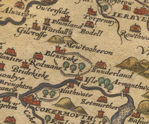
-- -- "Mewtoobecon"
|
|
|

|
-- Blindcrake -- "Blencrake"
|
|
|

|
-- Bothel -- "Bodell"
|
|
|

|
-- Bridekirk -- "Bridekirke"
|
|
|

|
--
|
|
|

|
-- Cocker Bridge
|
|
|

|
-- Cocker, River -- "Coker flu:"
|
|
|

|
-- Cockermouth -- "COKERMOUTH"
|
|
|

|
-- Derwent, River -- "Darwen flu:"
|
|
|

|
-- Gilcrux -- "Gilcrosse"
|
|
|

|
-- Hewthwaite Hall -- "Huthwate"
|
|
|

|
-- Isel Park
|
|
|

|
-- Isel -- "Isle"
|
|
|

|
-- Moota Hill -- "Mewtoobecon"
|
|
|

|
--
|
|
|

|
-- Plumbland -- "plumland"
|
|
|

|
-- Redmain -- "Redmane"
|
|
|

|
-- Setmurthy -- "Setmurther"
|
|
|

|
-- Sunderland -- "Sunderland"
|
|
|

|
-- Torpenhow -- "Torpenny"
|
|
|

|
-- Wardhall Guards -- "Wardall"
|
|
|
|
civil parishes
The area roughly includes parts of parishes:-
Blindcrake
Bridekirk
Setmurthy
Plumbland
Cockermouth
Oughterside and Allerby
Bewaldeth and Snittlegarth
Wythop
Papcastle
Embleton
Brigham
Blennerhasset and Torpenhow
Gilcrux
Bothel and Threapland
|
|
|
|
|
|

|
Lakes Guides menu.
|
 Saxton 1576 NY13

