 Saxton 1576 NY23


|

|
|
|
gazetteer links places may or may not be labelled on the map |
||

|
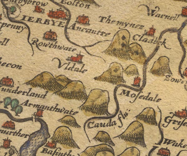
-- Armathwaite Hall -- "Armanthwate" |
|
|
|
-- Aughertree -- "Ancautre" |
|
|
|
-- Caldbeck -- "Cladbek" |
|
|
|
-- Caldew, River -- "Cauda flu:" |
|
|
|
-- Mosedale -- "Mosedale" |
|
|
|
-- Roughtongill Mines -- "The mynes" |
|
|
|
-- Ruthwaite -- "Rowthwate" |
|
|
|
-- Uldale -- "Uldale" |
|
|
civil parishes The area roughly includes parts of parishes:- Setmurthy Blindcrake Blennerhasset and Torpenhow Boltons Bewaldeth and Snittlegarth Underskiddaw Bassenthwaite Ireby Mungrisdale Caldbeck Wythop |
||
|
|
||
|
|
Lakes Guides menu. | |