Old Cumbria Gazetteer
 |
 |
|
||
| Caldew, River | ||||
| runs into:- |  Eden, River Eden, River |
|||
|
|
||||
| civil parish:- | Underskiddaw (formerly Cumberland) | |||
| civil parish:- | Dalston (formerly Cumberland) | |||
| civil parish:- | St Cuthbert Without (formerly Cumberland) | |||
| civil parish:- | Cummersdale (formerly Cumberland) | |||
| civil parish:- | Sebergham (formerly Cumberland) | |||
| civil parish:- | Castle Sowerby (formerly Cumberland) | |||
| civil parish:- | Mungrisdale (formerly Cumberland) | |||
| county:- | Cumbria | |||
| locality type:- | river | |||
| locality type:- | boundary | |||
| locality type:- | parish boundary | |||
| 1Km square:- | NY3851 (etc) | |||
| 1Km square:- | NY3642 (etc) | |||
| 1Km square:- | NY3332 (etc) | |||
| 10Km square:- | NY35 | |||
| 10Km square:- | NY34 | |||
| 10Km square:- | NY33 | |||
|
|
||||
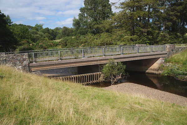
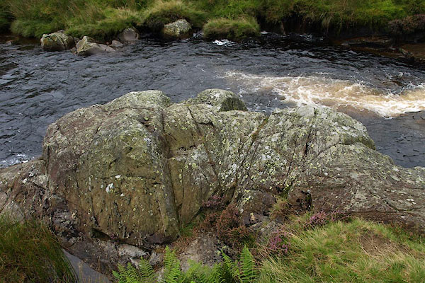
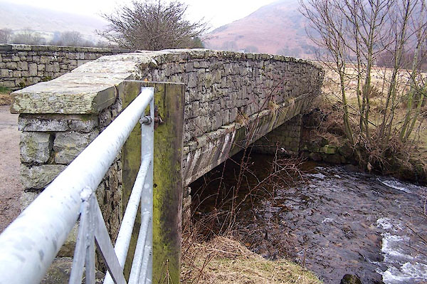
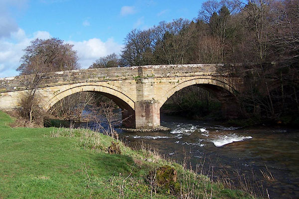
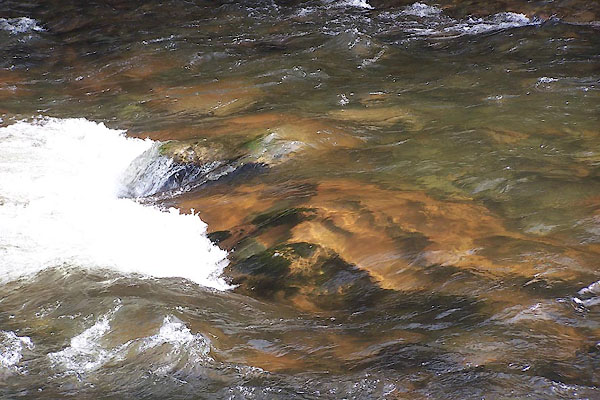
 BVD03.jpg (taken 3.8.2011) 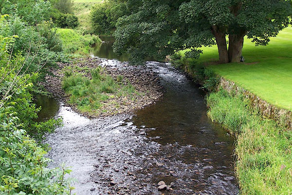 BNX31.jpg At Millhouse Bridge, Castle Sowerby. (taken 3.8.2007) |
||||
|
|
||||
| evidence:- | old map:- OS County Series (Cmd 23 11) placename:- Caldew, River |
|||
| source data:- | Maps, County Series maps of Great Britain, scales 6 and 25
inches to 1 mile, published by the Ordnance Survey, Southampton,
Hampshire, from about 1863 to 1948. OS County Series (Cmd 23 15) OS County Series (Cmd 30 6) OS County Series (Cmd 30 14) OS County Series (Cmd 38 10) OS County Series (Cmd 48 6) OS County Series (Cmd 48 13) OS County Series (Cmd 56 7) |
|||
|
|
||||
| evidence:- | old map:- Gough 1350s-60s placename:- Caldew |
|||
| source data:- | Map, colour photozincograph copy, reduced size facsimile, Gough
Map of Britain, scale about 28.5 miles to 1 inch, published by
the Ordnance Survey, Southampton, Hampshire, 1875.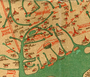 click to enlarge click to enlargeGgh1Cm.jpg "fl caldew" Tributary to the Eden. item:- JandMN : 33 Image © see bottom of page |
|||
|
|
||||
| evidence:- | old map:- Gough 1350s-60s placename:- Caldew |
|||
| source data:- | Map, lithograph facsimile, Gough Map of Britain, 20 miles to 1
inch? published by the Ordnance Survey, Southampton, Hampshire,
1935.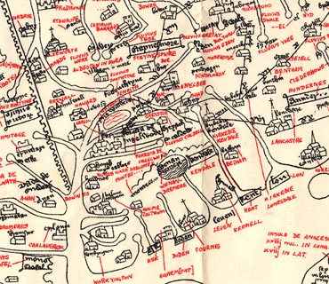 click to enlarge click to enlargeGgh2Cm.jpg "fl caldew" Tributary to the Eden. item:- JandMN : 34 Image © see bottom of page |
|||
|
|
||||
| evidence:- | perhaps old map:- Ptolemy 1540 |
|||
| source data:- | Map, copy, uncoloured lithograph? Anglia II Nova Tabula, New Map
of England, scale about 50 miles to 1 inch, data in the
Geographia by Claudius Ptolemy, engraved by Sebastian Munster,
Basle, Switzerland, 1540.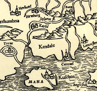 click to enlarge click to enlargePTY4Cm.jpg tapering wiggly double line; river item:- private collection : 131 Image © see bottom of page |
|||
|
|
||||
| evidence:- | probably old map:- Lloyd 1573 |
|||
| source data:- | Map, hand coloured copper plate engraving, Angliae Regni,
Kingdom of England, with Wales, scale about 24 miles to 1 inch, authored by Humphrey
Lloyd, Denbigh, Clwyd, drawn and engraved
by Abraham Ortelius, Netherlands, 1573.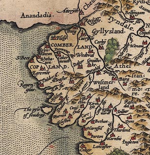 click to enlarge click to enlargeLld1Cm.jpg item:- Hampshire Museums : FA1998.69 Image © see bottom of page |
|||
|
|
||||
| evidence:- | old map:- Saxton 1579 placename:- Cauda Flu. |
|||
| source data:- | Map, hand coloured engraving, Westmorlandiae et Cumberlandiae Comitatus ie Westmorland
and Cumberland, scale about 5 miles to 1 inch, by Christopher Saxton, London, engraved
by Augustinus Ryther, 1576, published 1579-1645. Sax9NY35.jpg  Sax9NY34.jpg 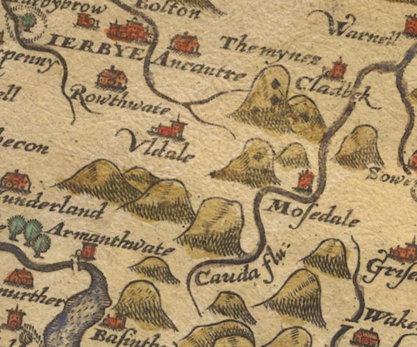 Sax9NY23.jpg "Cauda flu:" item:- private collection : 2 Image © see bottom of page |
|||
|
|
||||
| evidence:- | old map:- Mercator 1595 (edn?) placename:- Cauda flu. |
|||
| source data:- | Map, hand coloured engraving, Northumbria, Cumberlandia, et
Dunelmensis Episcopatus, ie Northumberland, Cumberland and
Durham etc, scale about 6.5 miles to 1 inch, by Gerard Mercator,
Duisberg, Germany, about 1595.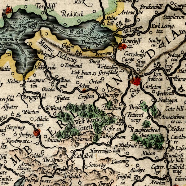 MER8CumC.jpg "Cauda flu." double line with stream lines; river, running into the Eden item:- JandMN : 169 Image © see bottom of page |
|||
|
|
||||
| evidence:- | old map:- Keer 1605 |
|||
| source data:- | Map, hand coloured engraving, Westmorland and Cumberland, scale
about 16 miles to 1 inch, probably by Pieter van den Keere, or
Peter Keer, about 1605 edition perhaps 1676. click to enlarge click to enlargeKER8.jpg "" double wiggly line, tapering to single; river item:- Dove Cottage : 2007.38.110 Image © see bottom of page |
|||
|
|
||||
| evidence:- | probably old map:- Speed 1611 (Cum/EW) |
|||
| source data:- | Map, hand coloured engraving, Kingdome of Great Britaine and
Ireland, scale about 36 miles to 1 inch, by John Speed, about
1610-11, published by Thomas Bassett, Fleet Street and Richard
Chiswell, St Paul's Churchyard, London, 1676? click to enlarge click to enlargeSPD6Cm.jpg tapering wiggly line item:- private collection : 85 Image © see bottom of page |
|||
|
|
||||
| evidence:- | old map:- Speed 1611 (Cmd) placename:- Cauda flud |
|||
| source data:- | Map, hand coloured engraving, Cumberland and the Ancient Citie
Carlile Described, scale about 4 miles to 1 inch, by John Speed,
1610, published by J Sudbury and George Humble, Popes Head
Alley, London, 1611-12. SP11NY35.jpg double line, runs into the Eden 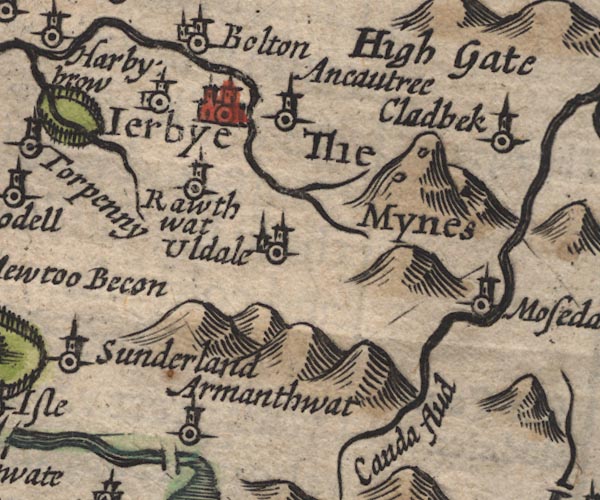 SP11NY23.jpg "Cauda flud" wiggly line item:- private collection : 16 Image © see bottom of page |
|||
|
|
||||
| evidence:- | poem:- Drayton 1612/1622 text placename:- Cauda |
|||
| source data:- | Poem, Poly Olbion, by Michael Drayton, published by published by
John Marriott, John Grismand and Thomas Dewe, and others?
London, part 1 1612, part 2 1622. goto source page 167:- "... From Skidow her tall Sire, first Cauda cleerely brings In Eden all her wealth; ..." |
|||
|
|
||||
| evidence:- | old map:- Drayton 1612/1622 placename:- Canda Flu. |
|||
| source data:- | Map, hand coloured engraving, Cumberlande and Westmorlande, by
Michael Drayton, probably engraved by William Hole, scale about
4 or 5 miles to 1 inch, published by John Mariott, John
Grismand, and Thomas Dewe, London, 1622.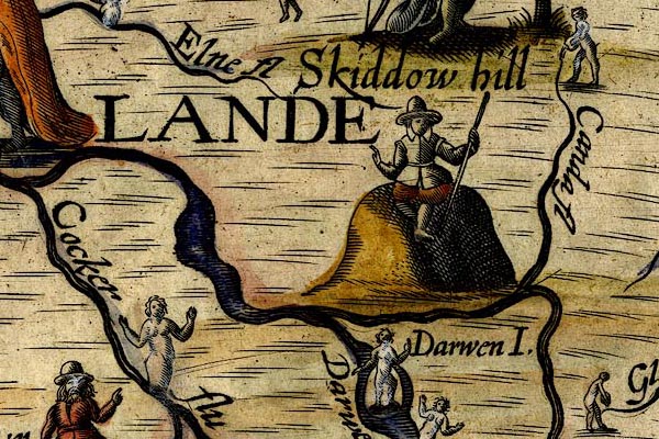 DRY509.jpg "Canda fl" River, naiad? pouring out water. item:- JandMN : 168 Image © see bottom of page |
|||
|
|
||||
| evidence:- | probably table of distances:- Simons 1635 |
|||
| source data:- | Table of distances, uncoloured engraving, Cumberland, with a
thumbnail map, scale about 41 miles to 1 inch, by Mathew Simons,
published in A Direction for the English Traviller, 1635.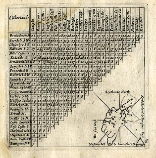 click to enlarge click to enlargeSIM4.jpg on thumbnail map item:- private collection : 50.11 Image © see bottom of page |
|||
|
|
||||
| evidence:- | old map:- Jenner 1643 |
|||
| source data:- | Tables of distances with a maps, Westmerland, scale about 16
miles to 1 inch, and Cumberland, scale about 21 miles to 1 inch,
published by Thomas Jenner, London, 1643; published 1643-80.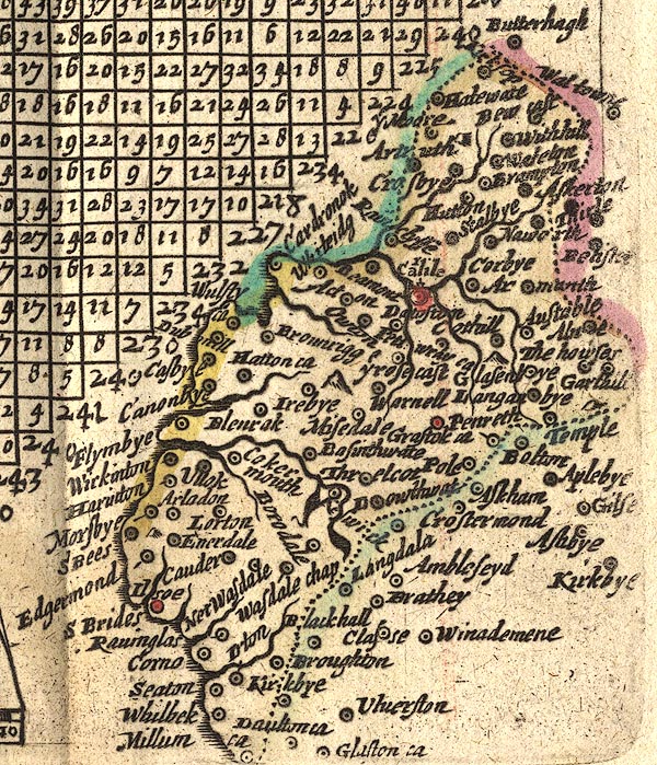 JEN4Sq.jpg wiggly line |
|||
|
|
||||
| evidence:- | old map:- Jansson 1646 |
|||
| source data:- | Map, hand coloured engraving, Cumbria and Westmoria, ie
Cumberland and Westmorland, scale about 3.5 miles to 1 inch, by
John Jansson, Amsterdam, Netherlands, 1646. JAN3NY45.jpg  JAN3NY34.jpg  JAN3NY33.jpg  JAN3NY23.jpg "Canda fl." Double wiggly line, tapering to single. item:- JandMN : 88 Image © see bottom of page |
|||
|
|
||||
| evidence:- | old map:- Ogilby 1675 (plate 86) |
|||
| source data:- | Road strip map, uncoloured engraving, the Road from Tinmouth ...
to Carlisle, scale about 1 inch to 1 mile, by John Ogilby,
London, 1675.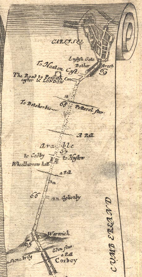 OG86m065.jpg In mile 69, Cumberland. River on the left (west) of Carlisle. item:- JandMN : 73 Image © see bottom of page |
|||
|
|
||||
| evidence:- | old map:- Ogilby 1675 (plate 96) |
|||
| source data:- | Road strip map, hand coloured engraving, the Road from Kendal to
Cockermouth, and the Road from Egremond to Carlisle, scale about
1 inch to 1 mile, by John Ogilby, London, 1675.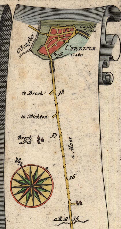 OG96Bm35.jpg In mile 38, Cumberland. River crossed by the road, no bridge drawn, tributary to the River Eden. item:- JandMN : 22 Image © see bottom of page |
|||
|
|
||||
| evidence:- | old map:- Ogilby 1675 (plate 38) |
|||
| source data:- | Road strip map, hand coloured engraving, continuation of the
Road from London to Carlisle, scale about 1 inch to 1 mile, by
John Ogilby, London, 1675.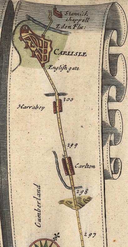 OG38m297.jpg In mile 301, Cumberland. River drawn on the left (west) of the town. item:- JandMN : 21 Image © see bottom of page |
|||
|
|
||||
| evidence:- | old map:- Sanson 1679 |
|||
| source data:- | Map, hand coloured engraving, Ancien Royaume de Northumberland
aujourdhuy Provinces de Nort, ie the Ancient Kingdom of
Northumberland or the Northern Provinces, scale about 9.5 miles
to 1 inch, by Nicholas Sanson, Paris, France, 1679. click to enlarge click to enlargeSAN2Cm.jpg tapering wiggly line; river item:- Dove Cottage : 2007.38.15 Image © see bottom of page |
|||
|
|
||||
| evidence:- | old map:- Seller 1694 (Cmd) |
|||
| source data:- | Map, uncoloured engraving, Cumberland, scale about 12 miles to 1
inch, by John Seller, 1694. click to enlarge click to enlargeSEL9.jpg tapering wiggly line; river item:- Dove Cottage : 2007.38.89 Image © see bottom of page |
|||
|
|
||||
| evidence:- | old map:- Morden 1695 (EW) |
|||
| source data:- | Map, hand coloured engraving, England, including Wales, scale
about 27 miles to 1 inch, by Robert Morden, published by Abel
Swale Awnsham and John Churchil, London, about 1695. click to enlarge click to enlargeMRD3Cm.jpg tapering wiggly line item:- JandMN : 339 Image © see bottom of page |
|||
|
|
||||
| evidence:- | old map:- Morden 1695 (Cmd) |
|||
| source data:- | Map, uncoloured engraving, Cumberland, scale about 4 miles to 1
inch, by Robert Morden, 1695, published by Abel Swale, the
Unicorn, St Paul's Churchyard, Awnsham, and John Churchill, the
Black Swan, Paternoster Row, London, 1695-1715.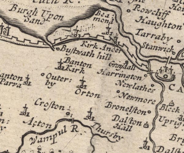 MD12NY35.jpg 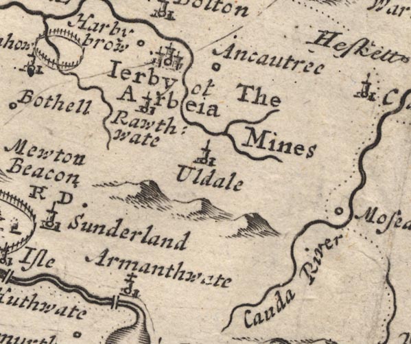 MD12NY23.jpg "Cauda River" Running into the Eden. item:- JandMN : 90 Image © see bottom of page |
|||
|
|
||||
| evidence:- | old map:- Stukeley 1723 |
|||
| source data:- | Road map, uncoloured engraving, the Antonine Itineraries through
Britain, scale about 55 miles to 1 inch, plotted by William
Stukeley, 1723, published London, 1724.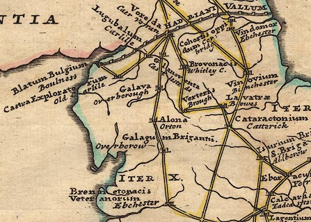 click to enlarge click to enlargeStu1Cm.jpg item:- Hampshire Museums : FA2001.171 Image © see bottom of page |
|||
|
|
||||
| evidence:- | descriptive text:- Defoe 1724-26 placename:- Cande, River placename:- Canda, River placename:- Calda, River |
|||
| source data:- | Tour through England and Wales, by Daniel Defoe, published in
parts, London, 1724-26. "... Carlisle is strong by situation, being almost surrounded with rivers. ... on the south the Cande, or Canda, or Calda, ..." |
|||
|
|
||||
| evidence:- | old map:- Badeslade 1742 placename:- Caude River |
|||
| source data:- | Map, uncoloured engraving, A Map of Cumberland North from
London, scale about 11 miles to 1 inch, with descriptive text,
by Thomas Badeslade, London, engraved and published by William
Henry Toms, Union Court, Holborn, London, 1742. click to enlarge click to enlargeBD10.jpg "Caude R" tapering wiggly line item:- JandMN : 115 Image © see bottom of page |
|||
|
|
||||
| evidence:- | descriptive text:- Simpson 1746 placename:- Caude, River |
|||
| source data:- | Atlas, three volumes of maps and descriptive text published as
'The Agreeable Historian, or the Compleat English Traveller
...', by Samuel Simpson, 1746. goto source "..." "The Eden now drawing near the AEstuary receives two little Rivers almost at the same Place, viz. the Peterell and the Caude, which coming from the S. keep all along at almost equal Distance, ..." |
|||
|
|
||||
| evidence:- | old text:- Gents Mag placename:- Cauda, River |
|||
| source data:- | Magazine, The Gentleman's Magazine or Monthly Intelligencer or
Historical Chronicle, published by Edward Cave under the
pseudonym Sylvanus Urban, and by other publishers, London,
monthly from 1731 to 1922. goto source Gentleman's Magazine 1747 p.523 "[on a journey to Caldbeck Fells] ..." "Under mount Skiddow is the head of the river Cauda; it issues thro' a narrow trough, and takes its winding course with great rapidity to Mosedale, where it turns northward for Carlisle. Near two miles above that village (Mosedale) it receives a small rivulet from Bouscale-tarn, ..." |
|||
|
|
||||
| evidence:- | old map:- Gents Mag 1747 placename:- Cauda River |
|||
| source data:- | Map, uncoloured engraving, perspective view, Caudbeck Fells ie
Caldbeck Fells, scale about 1+ miles to 1 inch, published in the
Gentleman's Magazine, 1747.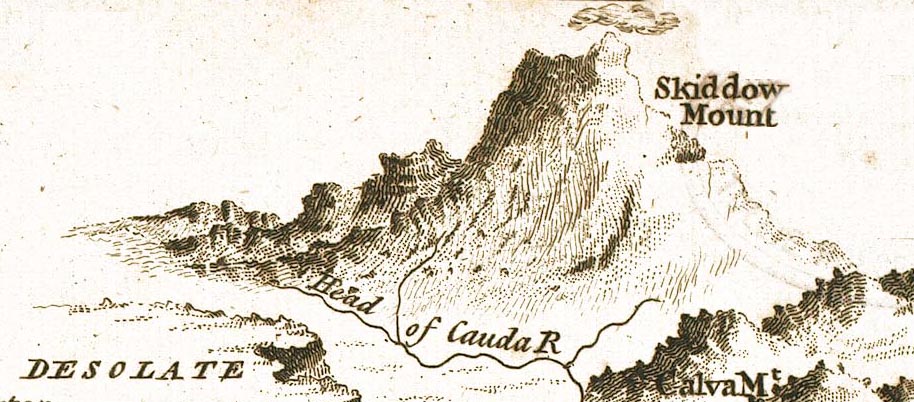 GM1408.jpg 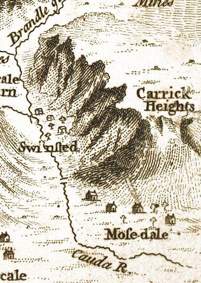 GM1406.jpg "Head of Cauda R / Cauda R." tapering wiggly line item:- Carlisle Library : Map 43 Images © Carlisle Library |
|||
|
|
||||
| evidence:- | old text:- Gents Mag 1747 placename:- Cauda River |
|||
| source data:- | Map, perspective view, Caudbeck Fells ie Caldbeck Fells, scale about 1+ miles to 1
inch, and descriptive text, published in the Gentleman's Magazine, November 1747. goto source Page 523:- "Under mount Skiddow is the head of the river Cauda; it issues thro' a narrow trough, and takes its winding course with great rapidity to Mosedale, where it turns northward for Carlisle. Near two miles above that village (Mosedale) it receives a small rivulet from Bouscale-tarn, ..." |
|||
|
|
||||
| evidence:- | old map:- Gents Mag 1751 placename:- Cauda |
|||
| source data:- | Map, uncoloured engraving, Map of the Black Lead Mines in
Cumberland, and area, scale about 2 miles to 1 inch, by George
Smith, published in the Gentleman's Magazine, 1751.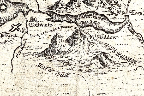 GM1314.jpg "Head of Cauda" tapering wiggly line; river item:- JandMN : 114 Image © see bottom of page |
|||
|
|
||||
| evidence:- | old map:- Bowen and Kitchin 1760 placename:- Caude River |
|||
| source data:- | Map, hand coloured engraving, A New Map of the Counties of
Cumberland and Westmoreland Divided into their Respective Wards,
scale about 4 miles to 1 inch, by Emanuel Bowen and Thomas
Kitchin et al, published by T Bowles, Robert Sayer, and John
Bowles, London, 1760. BO18NY35.jpg double line with stream lines, into the Eden  BO18NY34.jpg 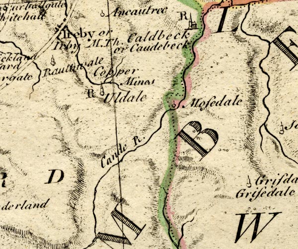 BO18NY23.jpg "Caude R." wiggly line item:- Armitt Library : 2008.14.10 Image © see bottom of page |
|||
|
|
||||
| evidence:- | old map:- Donald 1774 (Cmd) placename:- Caldew River |
|||
| source data:- | Map, hand coloured engraving, 3x2 sheets, The County of Cumberland, scale about 1
inch to 1 mile, by Thomas Donald, engraved and published by Joseph Hodskinson, 29
Arundel Street, Strand, London, 1774. D4NY35NE.jpg  D4NY35SE.jpg "Caldew River"  D4NY34NE.jpg 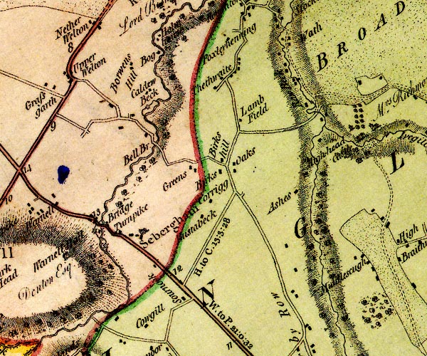 D4NY34SE.jpg 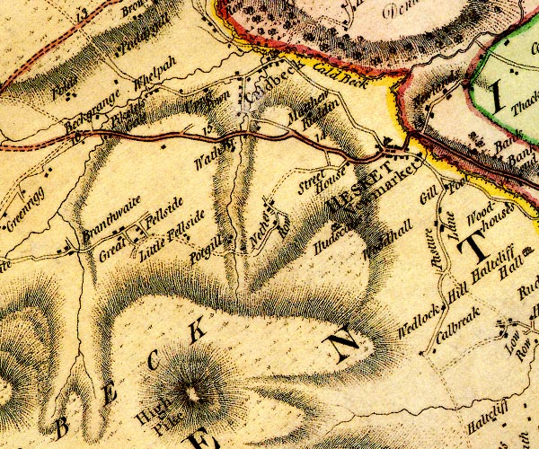 D4NY33NW.jpg 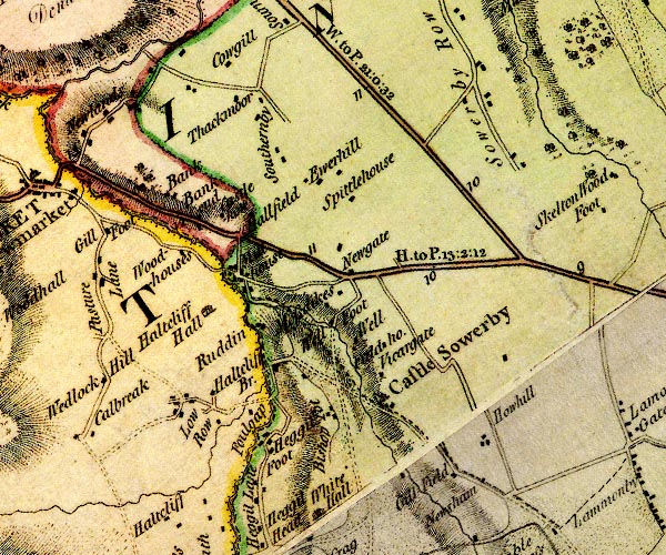 D4NY33NE.jpg 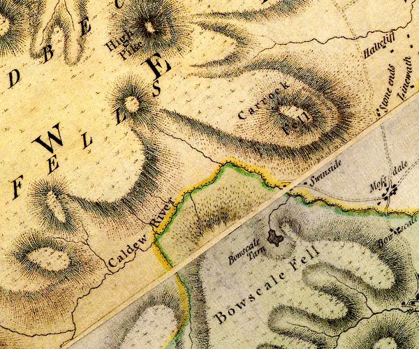 D4NY33SW.jpg "Caldew River" 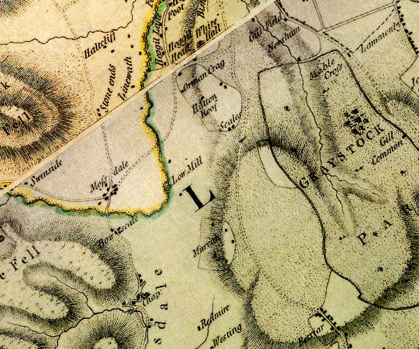 D4NY33SE.jpg single or double wiggly line; a river into the Eden item:- Carlisle Library : Map 2 Images © Carlisle Library |
|||
|
|
||||
| evidence:- | old map:- Donald 1774 (Cmd) placename:- Caldew, River |
|||
| source data:- | Map, hand coloured engraving, 3x2 sheets, The County of Cumberland, scale about 1
inch to 1 mile, by Thomas Donald, engraved and published by Joseph Hodskinson, 29
Arundel Street, Strand, London, 1774. D43956K.jpg 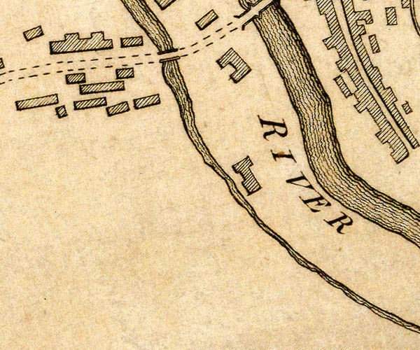 D43955P.jpg "CALDEW RIVER"  D43955U.jpg  D43955T.jpg river item:- Carlisle Library : Map 2 Images © Carlisle Library |
|||
|
|
||||
| evidence:- | old map:- West 1784 map placename:- Caldew River |
|||
| source data:- | Map, hand coloured engraving, A Map of the Lakes in Cumberland,
Westmorland and Lancashire, scale about 3.5 miles to 1 inch,
engraved by Paas, 53 Holborn, London, about 1784.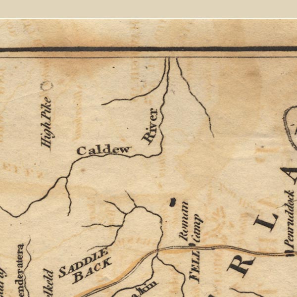 Ws02NY33.jpg item:- Armitt Library : A1221.1 Image © see bottom of page |
|||
|
|
||||
| evidence:- | old text:- Camden 1789 placename:- Caude, River placename:- Gavata item:- placename, Caldew |
|||
| source data:- | Book, Britannia, or A Chorographical Description of the Flourishing Kingdoms of England,
Scotland, and Ireland, by William Camden, 1586, translated from the 1607 Latin edition
by Richard Gough, published London, 1789. goto source Page 174:- "..." "... Congavata signifies in British the valley on the Gavata, now contracted into Caude. But the" |
|||
|
|
||||
| evidence:- | road book:- Cary 1798 (2nd edn 1802) placename:- Caldew, River |
|||
| source data:- | Road book, itineraries, Cary's New Itinerary, by John Cary, 181
Strand, London, 2nd edn 1802. goto source click to enlarge click to enlargeC38319.jpg page 319-320 "Cross the Caldew River ..." item:- JandMN : 228.1 Image © see bottom of page |
|||
|
|
||||
| evidence:- | road book:- Cary 1798 (2nd edn 1802) placename:- Caldew, River |
|||
| source data:- | Road book, itineraries, Cary's New Itinerary, by John Cary, 181
Strand, London, 2nd edn 1802. goto source click to enlarge click to enlargeC38557.jpg page 557-558 "Cross the Caldew River" item:- JandMN : 228.2 Image © see bottom of page |
|||
|
|
||||
| evidence:- | old map:- Skrine 1801 placename:- Caldew River |
|||
| source data:- | Map, uncoloured engraving, rivers in Cumberland, Westmorland,
Lancashire and Cheshire, scale about 23 miles to 1 inch, by
Henry Skrine, published by P Elmsly, London, 1801.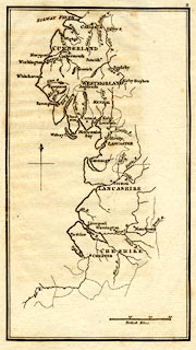 click to enlarge click to enlargeM076.jpg "Caldew R." river item:- JandMN : 421 Image © see bottom of page |
|||
|
|
||||
| evidence:- | old map:- Cooke 1802 placename:- Caldew River |
|||
| source data:- | Map, Cumberland, scale about 15.5 miles to 1 inch, by George
Cooke, 1802, bound in Gray's New Book of Roads, 1824, published
by Sherwood, Jones and Co, Paternoster Road, London, 1824. click to enlarge click to enlargeGRA1Cd.jpg "Caldew R." tapering wiggly line; river item:- Hampshire Museums : FA2000.62.2 Image © see bottom of page |
|||
|
|
||||
| evidence:- | old map:- Cooke 1802 placename:- Caldew, River placename:- Caldew River |
|||
| source data:- | Map, The Lakes, Westmorland and Cumberland, scale about 8.5
miles to 1 inch, engravedby Neele and Son, published by
Sherwood, Jones and Co, Paternoster Road, London, 1824. click to enlarge click to enlargeGRA1Lk.jpg "R. Caldew / Caldew R." tapering wiggly line; river item:- Hampshire Museums : FA2000.62.5 Image © see bottom of page |
|||
|
|
||||
| evidence:- | old map:- Cooper 1808 placename:- Caldew River |
|||
| source data:- | Map, uncoloured engraving, Cumberland, scale about 10.5 miles to
1 inch, drawn and engraved by Cooper, published by R Phillips,
Bridge Street, Blackfriars, London, 1808. click to enlarge click to enlargeCOP3.jpg "Caldew R." tapering wiggly line; river, ward boundary item:- JandMN : 86 Image © see bottom of page |
|||
|
|
||||
| evidence:- | old map:- Otley 1818 placename:- Caldew River |
|||
| source data:- | Map, uncoloured engraving, The District of the Lakes,
Cumberland, Westmorland, and Lancashire, scale about 4 miles to
1 inch, by Jonathan Otley, 1818, engraved by J and G Menzies,
Edinburgh, Scotland, published by Jonathan Otley, Keswick,
Cumberland, et al, 1833.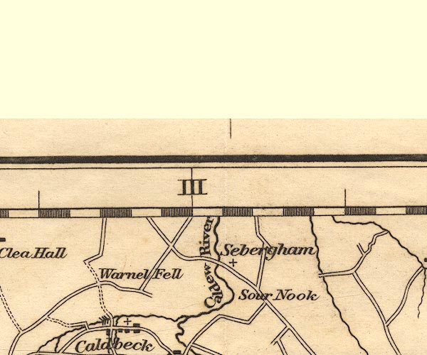 OT02NY34.jpg "Caldew R." item:- JandMN : 48.1 Image © see bottom of page |
|||
|
|
||||
| evidence:- | old map:- Hall 1820 (Cmd) |
|||
| source data:- | Map, hand coloured engraving, Cumberland, scale about 21 miles
to 1 inch, engraved by Sidney Hall, published by S Leigh, 18
Strand, London, 1820-31. click to enlarge click to enlargeHA14.jpg tapering wiggly line; river item:- JandMN : 91 Image © see bottom of page |
|||
|
|
||||
| evidence:- | descriptive text:- Otley 1823 (5th edn 1834) |
|||
| source data:- | Guide book, A Concise Description of the English Lakes, the
mountains in their vicinity, and the roads by which they may be
visited, with remarks on the mineralogy and geology of the
district, by Jonathan Otley, published by the author, Keswick,
Cumberland now Cumbria, by J Richardson, London, and by Arthur
Foster, Kirkby Lonsdale, Cumbria, 1823; published 1823-49,
latterly as the Descriptive Guide to the English Lakes. goto source Page 40:- "... the Caldew, from the east side of Skiddaw." "..." goto sourcePage 149:- "That rock of granite which seems best entitled to the distinction of primitive, may be seen denudated in the bed of the river Caldew, near the north-east side of Skiddaw; and in a branch of the river Greta, between Skiddaw and Saddleback, about 1400 feet above the level of the sea. This granite is of a grey kind, composed of quartz, white felspar, and black mica. It is traversed in various directions by veins of quartz; in some of which, molybdena, apatite, tungsten, wolfram, and other minerals have been found." |
|||
|
|
||||
| evidence:- | descriptive text:- Ford 1839 (3rd edn 1843) placename:- Caldew |
|||
| source data:- | Guide book, A Description of Scenery in the Lake District, by
Rev William Ford, published by Charles Thurnam, Carlisle, by W
Edwards, 12 Ave Maria Lane, Charles Tilt, Fleet Street, William
Smith, 113 Fleet Street, London, by Currie and Bowman,
Newcastle, by Bancks and Co, Manchester, by Oliver and Boyd,
Edinburgh, and by Sinclair, Dumfries, 1839. goto source Page 95:- "... At Bowscale, in the gorge of another opening, the road crosses the Caldew, where it issues out from its birth-place in the wild and solitary regions of Skiddaw Forest, solitary in all but its abundance of grouse, ..." |
|||
|
|
||||
| evidence:- | old map:- Ford 1839 map placename:- Caldew River |
|||
| source data:- | Map, uncoloured engraving, Map of the Lake District of
Cumberland, Westmoreland and Lancashire, scale about 3.5 miles
to 1 inch, published by Charles Thurnam, Carlisle, and by R
Groombridge, 5 Paternoster Row, London, 3rd edn 1843.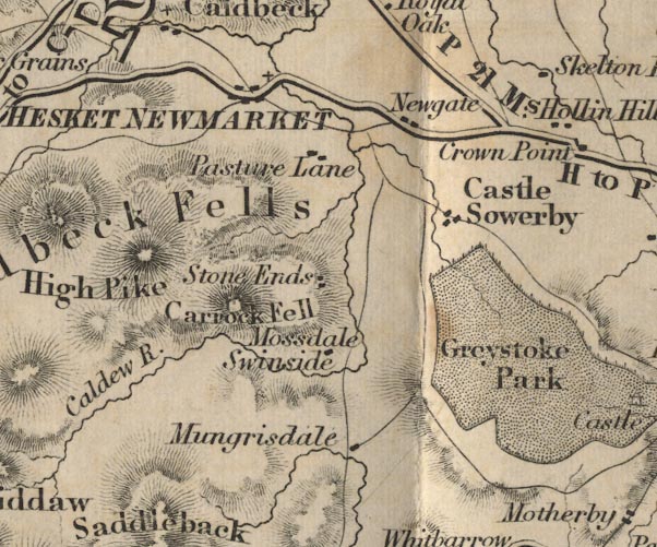 FD02NY33.jpg "Caldew R." item:- JandMN : 100.1 Image © see bottom of page |
|||
|
|
||||
| evidence:- | old map:- Garnett 1850s-60s H placename:- Caldew, River |
|||
| source data:- | Map of the English Lakes, in Cumberland, Westmorland and
Lancashire, scale about 3.5 miles to 1 inch, published by John
Garnett, Windermere, Westmorland, 1850s-60s.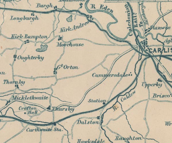 GAR2NY35.jpg "R. Caldew" wiggly line, river 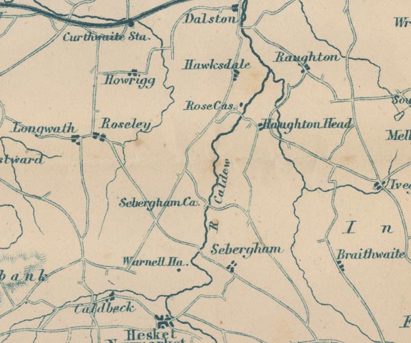 GAR2NY34.jpg "R. Caldew" 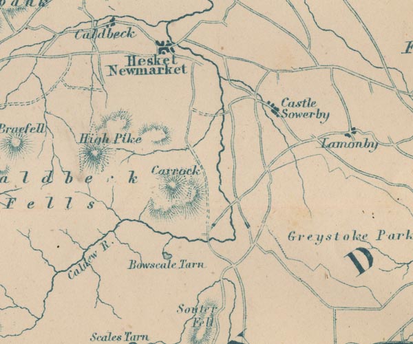 GAR2NY33.jpg "Caldew R." item:- JandMN : 82.1 Image © see bottom of page |
|||
|
|
||||
| evidence:- | old map:- Postlethwaite 1877 (3rd edn 1913) placename:- Caldew, River |
|||
| source data:- | Map, uncoloured engraving, Map of the Lake District Mining Field, Westmorland, Cumberland,
Lancashire, scale about 5 miles to 1 inch, by John Postlethwaite, published by W H
Moss and Sons, 13 Lowther Street, Whitehaven, Cumberland, 1877 edn 1913.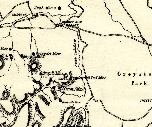 PST2NY33.jpg "River Caldew" wiggly line item:- JandMN : 162.2 Image © see bottom of page |
|||
|
|
||||
| evidence:- | old print:- Thurnam 1835 |
|||
| source data:- | Print, uncoloured lithograph, Carlisle from Primrose Bank, Cumberland, drawn by M
E Nutter, lithographed by P Gauci, published by Charles Thurnam, Carlisle, Cumberland,
by Ackermann and Co, by Hodgson, Boys, and Graves, and by Charles Tilt, London, 1835.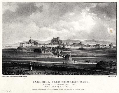 click to enlarge click to enlargeTHM102.jpg Included in Carlisle in the Olden Time. printed at bottom:- "Drawn by M. E. Nutter from the original sketch. / P. Gauci lith. / CARLISLE FROM PRIMROSE BANK. / UPWARDS OF ONE HUNDRED YEARS AGO. / Carlisle, Published by Charles Thurnam. / London. Ackermann & Co. - Hodgson, Boys, and Graves & Charles Tilt. / Printed by Graf &Soret." item:- Dove Cottage : 2008.123.2 Image © see bottom of page |
|||
|
|
||||
| evidence:- | old print:- Green 1819 placename:- Caldew, River |
|||
| source data:- | Print, soft ground etching, Carlisle from the River Caldew, Cumberland, by William
Green, 1820, published by R Lough and Co, Chronicle Office, Finkle Street, Kendal,
and others, 1820.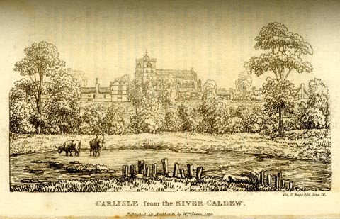 click to enlarge click to enlargeGN0132.jpg Tipped in opposite vol.2 p.398 of The Tourist's New Guide, by William Green. printed at bottom right, centre:- "Vol.2, page 398, line 16. / CARLISLE from the RIVER CALDEW. / Published at Ambleside, by Wm. Green, 1820." item:- Armitt Library : A1141.33 Image © see bottom of page |
|||
|
|
||||
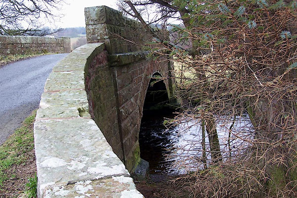
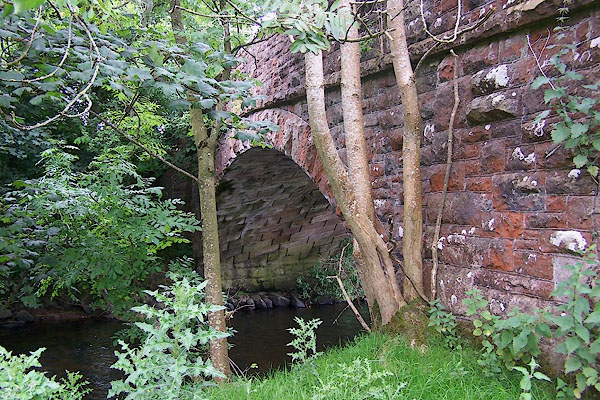
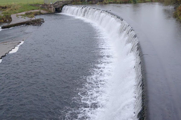
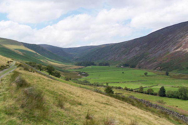
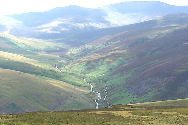
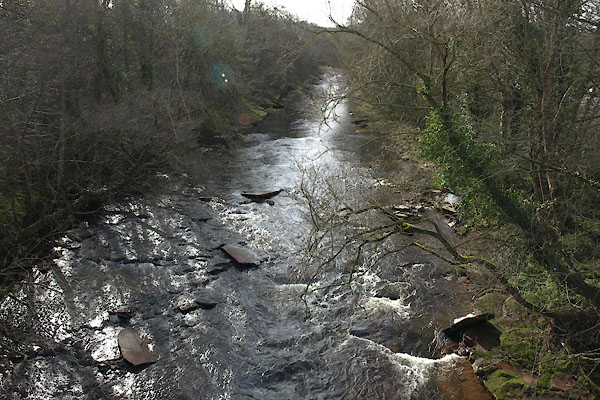
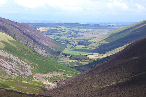 BNZ09.jpg Looking down at the top of the headwater valley, towards Mosedale. (taken 15.8.2007) 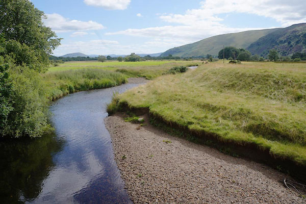 CDQ63.jpg At a bridge, Notice the embankment on the right. (taken 12.8.2015) 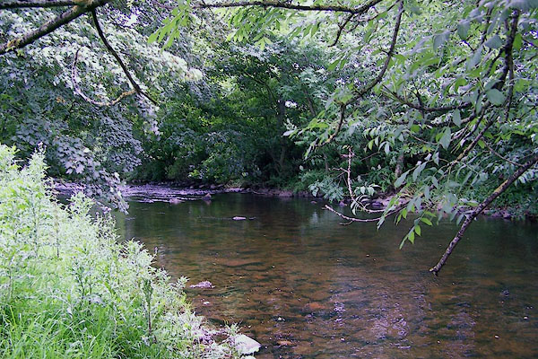 BNX29.jpg At Millhouse Bridge, Castle Sowerby. (taken 3.8.2007) 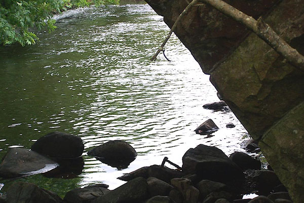 BNX30.jpg At Millhouse Bridge, Castle Sowerby. (taken 3.8.2007)  BOI06.jpg At Bell Bridge, Sebergham. (taken 30.10.2007)  Click to enlarge BVE70.jpg (taken 8.8.2011)  BVE55.jpg (taken 8.8.2011)  CFQ69.jpg Denton Holme, (taken 4.11.2016) |
||||
|
|
||||
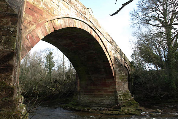
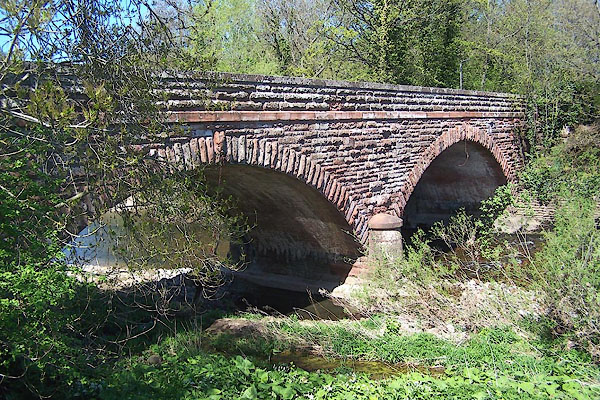
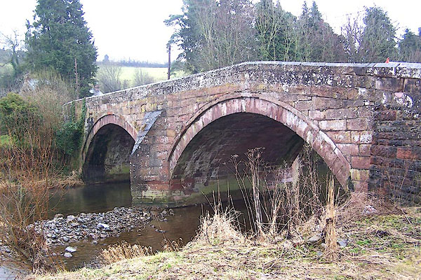
 BNI04.jpg At Rose Bridge. (taken 9.3.2007) 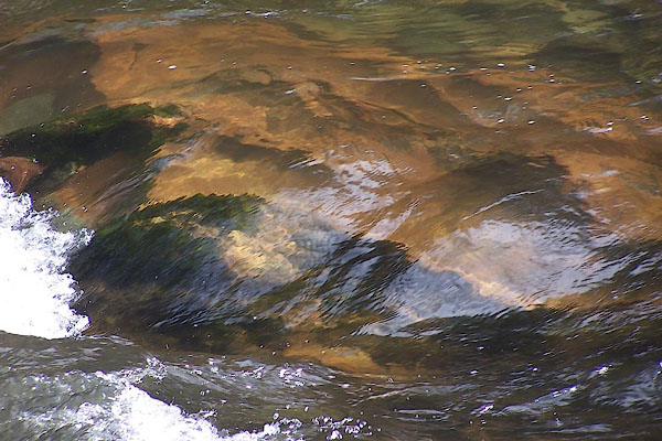 BNI05.jpg At Rose Bridge. (taken 9.3.2007) 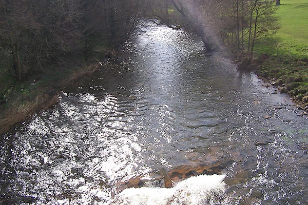 BNI06.jpg At Rose Bridge. (taken 9.3.2007) |
||||
|
|
||||
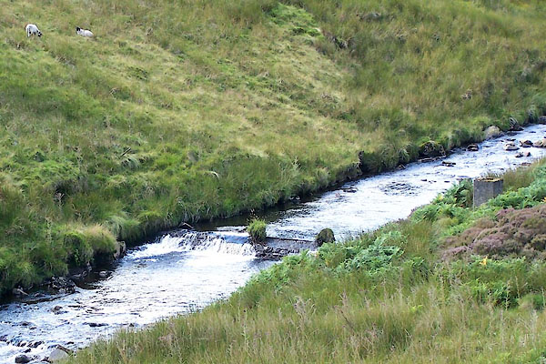
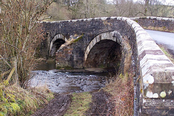
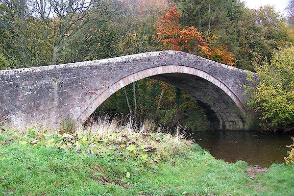
 BRC82.jpg From Carrock Fell (taken 20.7.2009) 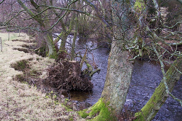 BLR21.jpg Down stream from Haltcliff Bridge. (taken 9.3.2006) 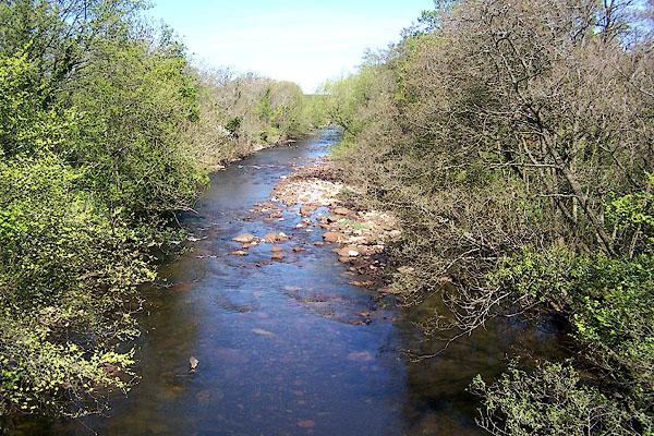 BMA58.jpg (taken 5.5.2006) |
||||
|
|
||||
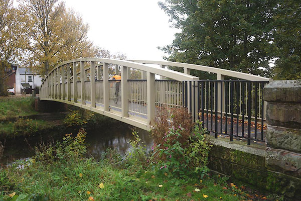
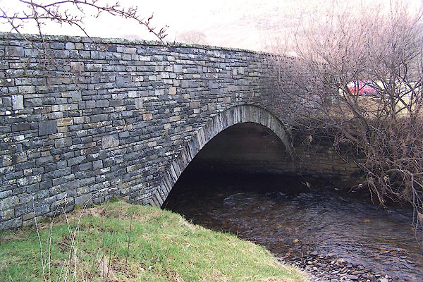
 BUE75.jpg At Dalston Bridge (taken 11.3.2011)  BUE76.jpg At Dalston Bridge (taken 11.3.2011) |
||||
|
|
||||
| places:- |
|
|||
|
||||
|
||||
|
||||
|
||||
|
||||
|
||||
|
||||
|
||||
|
||||
|
||||
|
||||
|
||||
|
||||
|
||||
|
||||
|
||||
|
||||
|
||||
|
||||
|
||||
|
||||
|
||||
|
||||
|
||||
|
||||
|
||||
|
||||
|
||||
|
||||
|
||||
|
||||
|
||||
|
||||
|
||||
|
||||
|
||||
|
||||
|
||||
|
||||
|
||||
|
||||
|
||||
|
||||
|
||||
Lakes Guides menu.