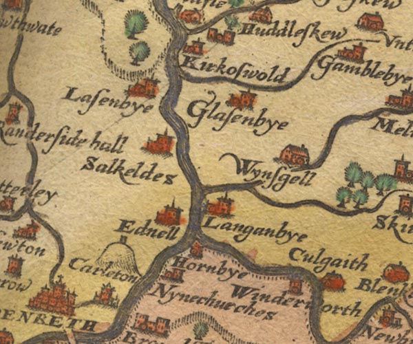
 Saxton 1576 NY53


|

|
|
|
gazetteer links places may or may not be labelled on the map |
||

|
-- Beacon Hill |
|
|
|
-- Briggle Beck |
|
|
|
-- Carleton -- "Carleton" |
|
|
|
-- Culgaith -- "Culgaith" |
|
|
|
-- Eamont, River |
|
|
|
-- Eden, River -- "Eden flu:" -- "Eden flu:"
-- "Eden flu:" -- "Eden flu:" |
|
|
|
-- Edenhall -- "Ednell" |
|
|
|
-- Glassonby -- "Glasenbye" |
|
|
|
-- Great Salkeld -- "Salkeldes" |
|
|
|
-- Hazelrigg Beck |
|
|
|
-- Hornby Hall -- "Hornbye" |
|
|
|
-- Kirkoswald -- "Kirkoswold" |
|
|
|
-- Langwathby -- "Langanbye" |
|
|
|
-- Lazonby -- "Lasenbye" |
|
|
|
-- Penrith Beacon |
|
|
|
-- Robberby Water |
|
|
|
-- St Ninian's Church -- "Nynechurches" |
|
|
|
-- Winderwath -- "Winderworth" |
|
|
|
-- Winskill -- "Wynsgell" |
|
|
civil parishes The area roughly includes parts of parishes:- Culgaith Penrith Great Salkeld Glassonby Lazonby Hesket Hunsonby Ousby Kirkoswald Langwathby Brougham |
||
|
|
||
|
|
Lakes Guides menu. | |