 Saxton 1576 NY70


|

|
|
|
gazetteer links places may or may not be labelled on the map |
||

|
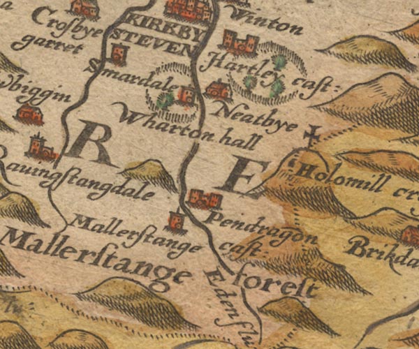
-- Eden, River -- "Eden flu:" -- "Eden flu:"
-- "Eden flu:" -- "Eden flu:" |
|
|
|
-- Hartley Castle -- "Hartley cast:" |
|
|
|
-- Hollow Mill Cross -- "Holomill crosse" |
|
|
|
-- Mallerstang -- "mallerstange" |
|
|
|
-- Mallerstang Forest -- "Mallestange forest" |
|
|
|
-- Nateby -- "Neatbye" |
|
|
|
-- Pendragon Castle -- "Pendragon cast:" |
|
|
|
-- Smardale -- "Smardale" |
|
|
|
-- Wharton Hall -- "Wharton hall" |
|
|
civil parishes The area roughly includes parts of parishes:- Kirkby Stephen Ravenstonedale Mallerstang Wharton Nateby Waitby Hartley Soulby Kaber Asby Winton Crosby Garrett |
||
|
|
||
|
|
Lakes Guides menu. | |