 West 1784 map NY41


|

|
|
|
gazetteer links places may or may not be labelled on the map |
||

|
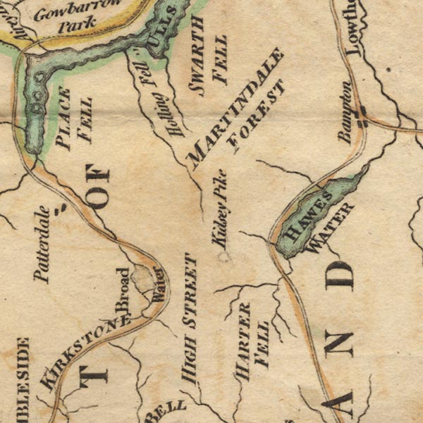
-- Brothers Water |
|
|
|
-- Goldrill Beck |
|
|
|
-- Hallin Fell |
|
|
|
-- Harter Fell -- "HARTER FELL" |
|
|
|
-- Hawes Water -- "HAWES WATER" |
|
|
|
-- High Street -- "HIGH STREET" |
|
|
|
-- Kidsty Pike |
|
|
|
-- Kirkstone Pass -- "KIRKSTONE" |
|
|
|
-- Martindale Common -- "MARTINDALE FOREST" |
|
|
civil parishes The area roughly includes parts of parishes:- Kentmere Shap Rural Longsleddale Patterdale Martindale Lakes Bampton Barton Matterdale |
||
|
|
||
|
|
Lakes Guides menu. | |