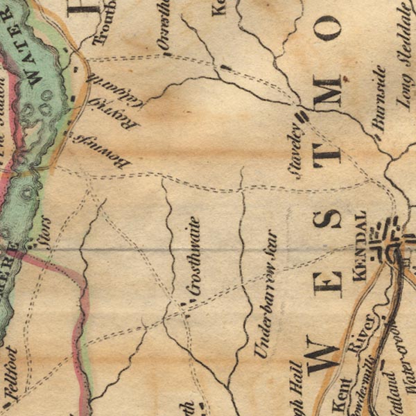
 West 1784 map SD49


|

|
|
|
gazetteer links places may or may not be labelled on the map |
||

|
-- Bowness-on-Windermere |
|
|
|
-- Calgarth Hall |
|
|
|
-- Crosthwaite |
|
|
|
-- Gilpin, River |
|
|
|
-- Gowan, River |
|
|
|
-- Kent, River -- "Kent River" |
|
|
|
-- Orrest Head |
|
|
|
-- Pool, River |
|
|
|
-- Rayrigg Hall |
|
|
|
-- Scout Scar |
|
|
|
-- Staveley |
|
|
|
-- Winster, River |
|
|
civil parishes The area roughly includes parts of parishes:- Crosthwaite and Lyth Cartmel Fell Helsington Strickland Ketel Windermere Underbarrow and Bradleyfield Hugill Strickland Roger Over Staveley Nether Staveley Crook |
||
|
|
||
|
|
Lakes Guides menu. | |