 Ford 1839 map SD37


|

|
|
|
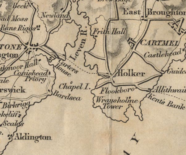
gazetteer links places may or may not be labelled on the map |
||

|
-- Allithwaite -- "Allithwaite" |
|
|
|
-- Bardsea -- "Bardsea" |
|
|
|
-- Carter House (?) -- "Carters House" |
|
|
|
-- Cartmel -- "CARTMEL" |
|
|
|
-- Chapel Island -- "Chapel I." |
|
|
|
-- Conishead Priory -- "Conishead Priory" |
|
|
|
-- Field Broughton -- "East Broughton" |
|
|
|
-- Flookburgh -- "Flookboro" |
|
|
|
-- Frith Hall -- "Frith Hall" |
|
|
|
-- Holker -- "Holker" |
|
|
|
-- Kent's Bank -- "Kent's Bank" |
|
|
|
-- Leven, River -- "Leven R." |
|
|
|
-- Mansriggs -- "Rans Riggs" |
|
|
|
-- Morecambe Bay -- "MORECAMBE BAY" |
|
|
|
-- Newby Bridge to Ulverston |
|
|
|
-- Swarthmoor Hall -- "Swarthmoor Hall" |
|
|
|
-- Ulverston Canal |
|
|
|
-- Wraysholme Tower -- "Wraysholme Tower" |
|
|
civil parishes The area roughly includes parts of parishes:- Urswick Aldingham Lower Holker Lower Allithwaite Egton with Newland Ulverston Broughton East Grange-over-Sands |
||
|
|
||
|
|
Lakes Guides menu. | |