 Old Cumbria Gazetteer
 |
 |
|
| High Sadgill, Longsleddale | ||
| High Sadgill | ||
| locality:- | Sadgill | |
| civil parish:- | Longsleddale (formerly Westmorland) | |
| county:- | Cumbria | |
| locality type:- | buildings | |
| coordinates:- | NY48260581 | |
| 1Km square:- | NY4805 | |
| 10Km square:- | NY40 | |
|
|
||
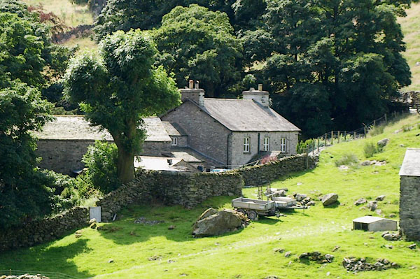
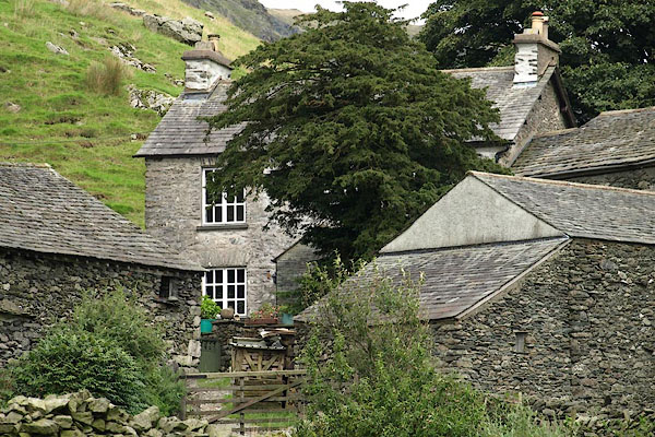 BRI20.jpg (taken 27.8.2009) 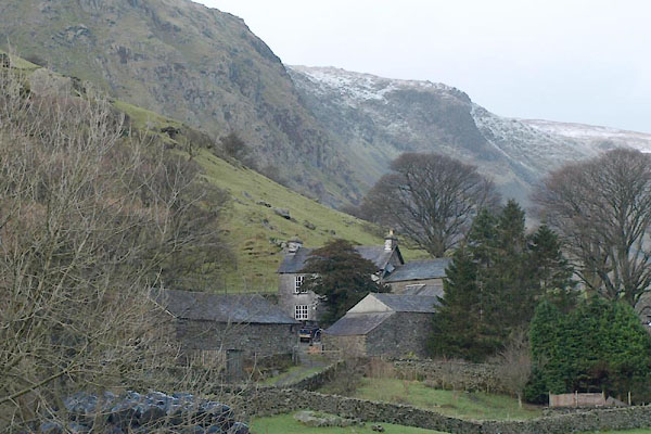 BVT73.jpg (taken 3.1.2012) |
||
|
|
||
| evidence:- | old map:- OS County Series (Wmd 27 6) |
|
| source data:- | Maps, County Series maps of Great Britain, scales 6 and 25
inches to 1 mile, published by the Ordnance Survey, Southampton,
Hampshire, from about 1863 to 1948. OS County Series (Wmd 27 7) 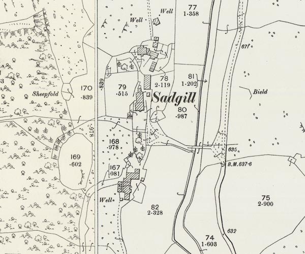 C5E001.jpg "Sadgill" |
|
|
|
||
| evidence:- | census returns:- placename:- High Sadgill placename:- High Sadghyll placename:- High Sad Gill |
|
|
|
||
| evidence:- | old map:- Kendal Corn Rent Act 1836 |
|
| source data:- | Tithe map, Plan of part of the Township of Longsleddale, Westmorland, made regarding
the Kendal Corn Rent Act, ie a tithe award map, scale about 20 inches to 1 mile, Kendal,
Westmorland, 1836.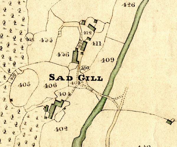 KCR201.jpg courtesy of Mark Cropper Plan of part of the Township of Longsleddale, Westmorland, made regarding the Kendal Corn Rent Act, ie a tithe award map, scale about 20 inches to 1 mile, Kendal, Westmorland, 1836. item:- private collection : 370 Image © see bottom of page |
|
|
|
||
 Kendal Corn Rent Act 1836 Kendal Corn Rent Act 1836 |
||
|
|
||
| evidence:- | old map:- Fields 1875 |
|
| source data:- | 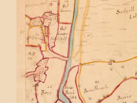 LFld0217.jpg courtesy of Ruth Fishwick |
|
|
|
||
| evidence:- | old postcard:- |
|
| source data:- | Postcard, sepia toned, photograph of Middle and High Sadgill in the Si-Ko series,
1920s-30s?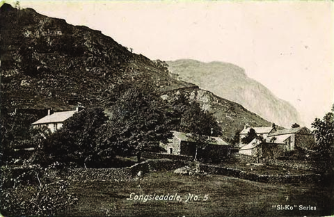 click to enlarge click to enlargePH0044.jpg "Longsleddale, No. 5" "Si-Ko Series" courtesy of Michael Wooldridge item:- private collection : 146 Image © see bottom of page |
|
|
|
||
| census records |
||
|
|
||
| directory entries |
||
|
|
||
| evidence:- | map:- OS Six Inch (1956) |
|
| source data:- | Map series, various editions with the national grid, scale about
6 inches to 1 mile, published by the Ordnance Survey,
Southampton, Hampshire, scale 1 to 10560 from 1950s to 1960s,
then 1 to 10000 from 1960s to 2000s, superseded by print on
demand from digital data.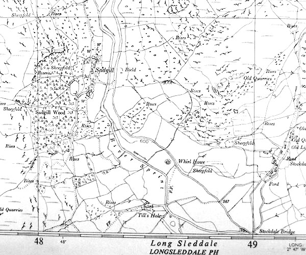 SINY4805.jpg |
|
|
|
||
| evidence:- | shepherds guide:- Wilson 1913 placename:- High Sadgill |
|
| source data:- | Book, New Shepherd's Guide for Cumberland, Westmorland, and
Lancashire, by Thomas Wilson, 1913.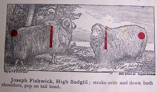 WL1p367b.jpg "Joseph Fishwick, High Sadgill; stroke over and down both shoulders, pop on tail head." item:- private collection : 329 Image © see bottom of page |
|
|
|
||
| evidence:- | shepherds guide:- Gate 1879 placename:- High Sadgill |
|
| source data:- | Book, New Shepherd's Guide for Cumberland, Westmoreland, and
Lancashire, published by Daniel Gate, Keswick, Cumberland, 1879. GT1p384b.jpg "GEORGE ARMISTEAD, High Sadgill; stroke over and down both shoulders, pop on tail head." item:- Kendal Library : 38 Image © see bottom of page |
|
|
|
||
| evidence:- | shepherds guide:- Lamb 1937 placename:- High Sadgill |
|
| source data:- | Book, Lamb's Shepherds' Guide for Cumberland, Westmorland and
Lancashire, by R H Lamb, published by the Herald Printing Co,
Penrith, Cumberland, 1937.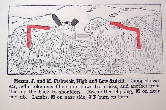 LM1p317c.jpg "Messrs. J.and M. Fishwick, High and Low Sadgill. Cropped near ear, red stroke over fillets and down both lisks, and another from that up the back to shoulders. Ewes after clipping, M on near mid rib. Lambs, M on near side, J F burn on horn." item:- Kendal Library : 40 Image © see bottom of page |
|
|
|
||
 BRB83.jpg (taken 19.7.2009) 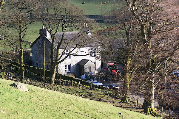 BNJ90.jpg (taken 19.3.2007) |
||
|
|
||
| see:- |  Sadgill, Longsleddale Sadgill, Longsleddale |
|
|
|
||
Lakes Guides menu.