 Old Cumbria Gazetteer
 |
 |
|
| Mealsgate Station, Mealsgate | ||
| Mealsgate Station | ||
| site name:- | Maryport and Carlisle Railway | |
| locality:- | Mealsgate | |
| civil parish:- | Boltons (formerly Cumberland) | |
| county:- | Cumbria | |
| locality type:- | railway station | |
| coordinates:- | NY20824250 | |
| 1Km square:- | NY2042 | |
| 10Km square:- | NY24 | |
| SummaryText:- | Opened 1866; closed 1930. | |
|
|
||
 BNY34.jpg (taken 15.8.2007) |
||
|
|
||
| evidence:- | old map:- OS County Series (Cmd 36 7) placename:- Mealsgate Station item:- weighing machine; crane; railway bridge |
|
| source data:- | Maps, County Series maps of Great Britain, scales 6 and 25
inches to 1 mile, published by the Ordnance Survey, Southampton,
Hampshire, from about 1863 to 1948.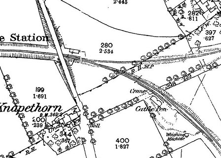 click to enlarge click to enlargeCSRY0049.jpg OS County Series (Cmd 36 8) "Mealsgate Station" "Crane / Cattle Pens / Weighing Machine" |
|
|
|
||
| evidence:- | old map:- Postlethwaite 1877 (3rd edn 1913) |
|
| source data:- | Map, uncoloured engraving, Map of the Lake District Mining Field, Westmorland, Cumberland,
Lancashire, scale about 5 miles to 1 inch, by John Postlethwaite, published by W H
Moss and Sons, 13 Lowther Street, Whitehaven, Cumberland, 1877 edn 1913.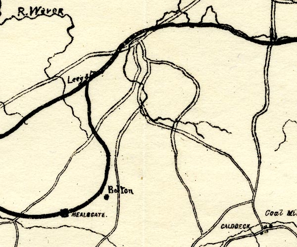 PST2NY24.jpg station on railway item:- JandMN : 162.2 Image © see bottom of page |
|
|
|
||
| evidence:- | probably old map:- Post Office 1850s-1900s placename:- Mealsgate |
|
| source data:- | Post road maps, General Post Office Circulation Map for England
and Wales, for the General Post Office, London, 1850s-1900s. click to enlarge click to enlargePOF7Cm.jpg "Mealsgate" map date 1909 |
|
|
|
||
| evidence:- | probably old map:- Post Office 1850s-1900s placename:- Mealsgate |
|
| source data:- | Post road maps, General Post Office Circulation Map for England
and Wales, for the General Post Office, London, 1850s-1900s.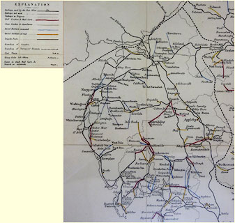 click to enlarge click to enlargePF10Cm.jpg "Mealsgate" map date 1892 |
|
|
|
||
| evidence:- | old map:- Post Office 1850s-1900s placename:- Mealsgate Station |
|
| source data:- | Post road maps, General Post Office Circulation Map for England
and Wales, for the General Post Office, London, 1850s-1900s.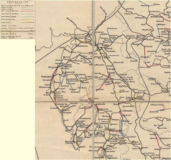 click to enlarge click to enlargePOF2Cm.jpg "Mealsgate Sta." map date 1890 |
|
|
|
||
| :- |
images courtesy of the British Postal Museum and Hampshire CC Museums |
|
|
|
||
 Lakes Guides menu.