 Old Cumbria Gazetteer
 |
 |
|
| boundary stone, Longsleddale/Kentmere/etc | ||
| site name:- | Harter Fell | |
| civil parish:- | Longsleddale (formerly Westmorland) | |
| civil parish:- | Kentmere (formerly Westmorland) | |
| civil parish:- | Shap Rural (formerly Westmorland) | |
| county:- | Cumbria | |
| locality type:- | boundary stone | |
| locality type:- | parish boundary mark | |
| coordinates:- | NY4623309562 | |
| 1Km square:- | NY4609 | |
| 10Km square:- | NY40 | |
|
|
||
 BJE15.jpg South face letter 'L', about 6 inches high. L for Lowther, landowner in Shap Rural parish to the north; the stone has been replaced the wrong way round. (taken 7.9.2004) 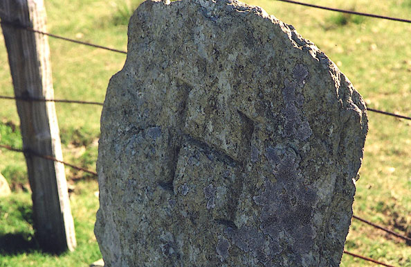 BJE16.jpg North face letter 'H' about 6 inches high. H for Harrison, the landowner in Longsleddale parish, to the south; the stone has been replaced the wrong way round. (taken 7.9.2004) |
||
|
|
||
| evidence:- | map:- OS Six Inch (1956) |
|
| source data:- | Map series, various editions with the national grid, scale about
6 inches to 1 mile, published by the Ordnance Survey,
Southampton, Hampshire, scale 1 to 10560 from 1950s to 1960s,
then 1 to 10000 from 1960s to 2000s, superseded by print on
demand from digital data.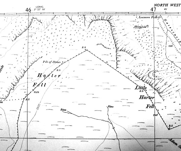 SINY4609.jpg "B.S." |
|
|
|
||
| :- |
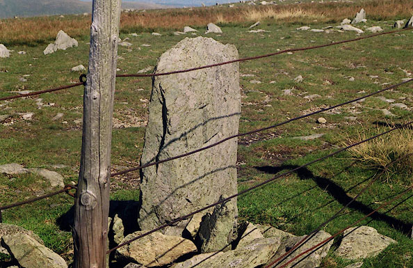
The boundary stone is by the fence. The north/south faces of the stone are marked:- |
|
| "H / L" |
||
| in neatly serifed letters about 6 inches high. H for Harrison, L for Lowther, landowners. |
||
| The stone is at the meet of Longsleddale, Kentmere, and Shap; on the parish boundary. |
||
|
|
||
 Lakes Guides menu.