 Old Cumbria Gazetteer
 |
 |
|
| Chapel House, Longsleddale | ||
| Chapel House | ||
| Outbarn | ||
| civil parish:- | Longsleddale (formerly Westmorland) | |
| county:- | Cumbria | |
| locality type:- | buildings (site of) | |
| locality type:- | vicarage (ex) | |
| coordinates:- | NY49980303 | |
| 1Km square:- | NY4903 | |
| 10Km square:- | NY40 | |
| SummaryText:- | barn, Longsleddale (5) now on this site | |
|
|
||
| evidence:- | old map:- OS County Series (Wmd 27 15) placename:- Chapel House |
|
| source data:- | Maps, County Series maps of Great Britain, scales 6 and 25
inches to 1 mile, published by the Ordnance Survey, Southampton,
Hampshire, from about 1863 to 1948. |
|
|
|
||
| evidence:- | census returns:- placename:- Chapel House |
|
|
|
||
| evidence:- | old map:- Jefferys 1770 (Wmd) placename:- Chapel House |
|
| source data:- | Map, 4 sheets, The County of Westmoreland, scale 1 inch to 1
mile, surveyed 1768, and engraved and published by Thomas
Jefferys, London, 1770.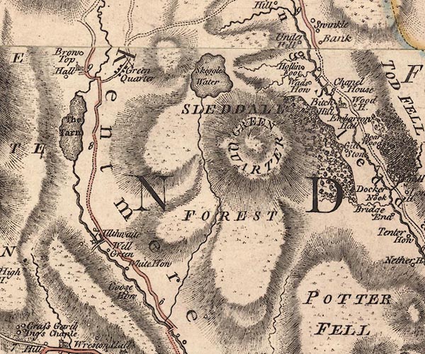 J5NY40SE.jpg "Chapel House" circle, labelled in italic lowercase text; settlement, farm, house, or hamlet? item:- National Library of Scotland : EME.s.47 Image © National Library of Scotland |
|
|
|
||
| evidence:- | old map:- Cary 1789 (edn 1805) placename:- Chapel House |
|
| source data:- | Map, uncoloured engraving, Westmoreland, scale about 2.5 miles
to 1 inch, by John Cary, London, 1789; edition 1805.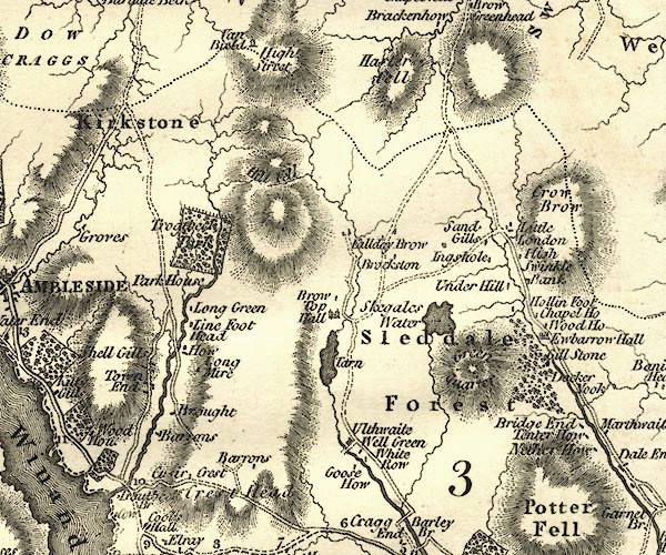 CY24NY40.jpg "Chapel Ho" block/s, labelled in italic lowercase; house, or hamlet item:- JandMN : 129 Image © see bottom of page |
|
|
|
||
 Kendal Corn Rent Act 1836 Kendal Corn Rent Act 1836 |
||
|
|
||
| evidence:- | old map:- Kendal Corn Rent Act 1836 placename:- Chapel House |
|
| source data:- | Tithe map, Plan of part of the Township of Longsleddale, Westmorland, made regarding
the Kendal Corn Rent Act, ie a tithe award map, scale about 20 inches to 1 mile, Kendal,
Westmorland, 1836.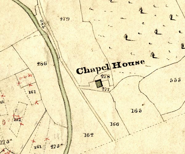 KCR215.jpg courtesy of Mark Cropper Plan of part of the Township of Longsleddale, Westmorland, made regarding the Kendal Corn Rent Act, ie a tithe award map, scale about 20 inches to 1 mile, Kendal, Westmorland, 1836. "Chapel House" item:- private collection : 370 Image © see bottom of page |
|
|
|
||
| census records |
||
|
|
||
| directory entries |
||
|
|
||
| old parish registers (formerly ) |
||
|
|
||
| see:- |  barn, Longsleddale (5) barn, Longsleddale (5) |
|
|
|
||
Lakes Guides menu.