Old Cumbria Gazetteer
 |
 |
|
||
| Bela, River | ||||
| runs into:- |  Kent Estuary Kent Estuary |
|||
|
|
||||
| civil parish:- | Beetham (formerly Westmorland) | |||
| county:- | Cumbria | |||
| locality type:- | river | |||
| 1Km square:- | SD5079 (etc) | |||
| 10Km square:- | SD57 | |||
| 10Km square:- | SD57 | |||
|
|
||||
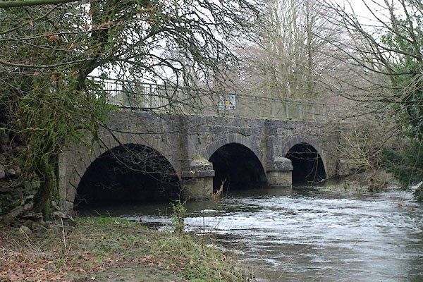
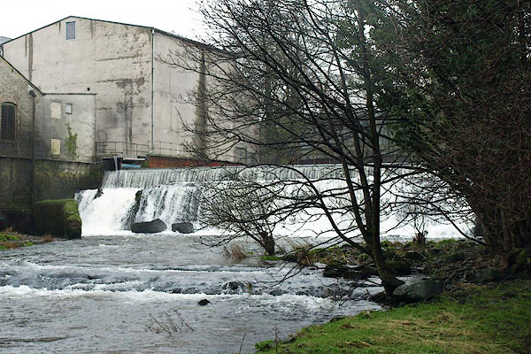
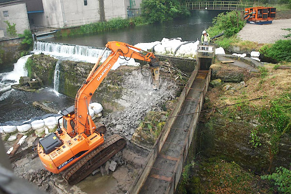
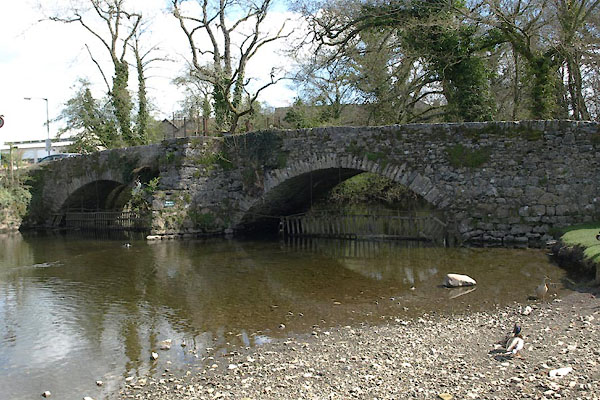
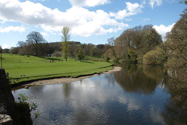
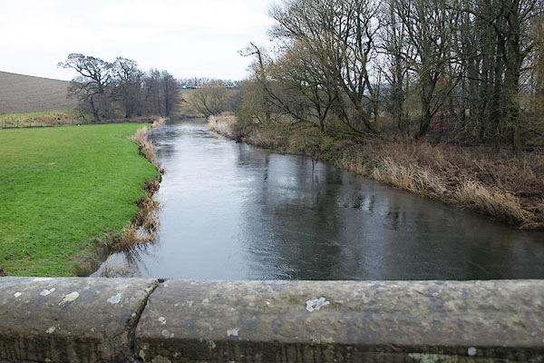 BPY96.jpg Downstream of Hang Bridge. (taken 30.1.2008) 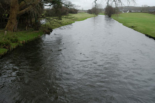 BVT89.jpg At Beetham, after a few wet days. (taken 6.1.2012) |
||||
|
|
||||
| evidence:- | old map:- OS County Series (Wmd 46 3) placename:- Beetha, River placename:- Belah, River |
|||
| source data:- | Maps, County Series maps of Great Britain, scales 6 and 25
inches to 1 mile, published by the Ordnance Survey, Southampton,
Hampshire, from about 1863 to 1948. "River Belah / Ordinary Spring Tides flow to this point" |
|||
| source data:- | Maps, County Series maps of Great Britain, scales 6 and 25
inches to 1 mile, published by the Ordnance Survey, Southampton,
Hampshire, from about 1863 to 1948. "River Beetha" |
|||
| source data:- | Maps, County Series maps of Great Britain, scales 6 and 25
inches to 1 mile, published by the Ordnance Survey, Southampton,
Hampshire, from about 1863 to 1948. "River Beetha" |
|||
|
|
||||
| evidence:- | old map:- Bowen and Kitchin 1760 |
|||
| source data:- | Map, hand coloured engraving, A New Map of the Counties of
Cumberland and Westmoreland Divided into their Respective Wards,
scale about 4 miles to 1 inch, by Emanuel Bowen and Thomas
Kitchin et al, published by T Bowles, Robert Sayer, and John
Bowles, London, 1760.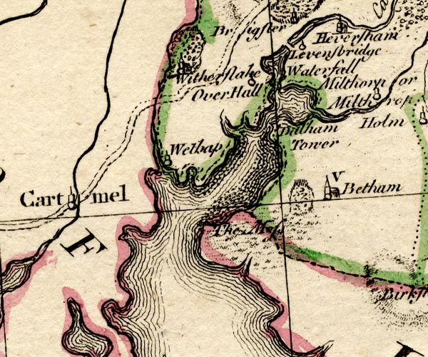 BO18SD37.jpg double line with stream lines, river mouth, into the Kent Estuary item:- Armitt Library : 2008.14.10 Image © see bottom of page |
|||
|
|
||||
| evidence:- | old map:- Jefferys 1770 (Wmd) placename:- Beelo River |
|||
| source data:- | Map, 4 sheets, The County of Westmoreland, scale 1 inch to 1
mile, surveyed 1768, and engraved and published by Thomas
Jefferys, London, 1770. J5SD58NW.jpg 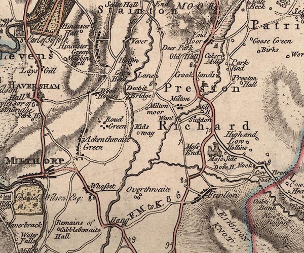 J5SD58SW.jpg  J5SD57NW.jpg "Beelo River" 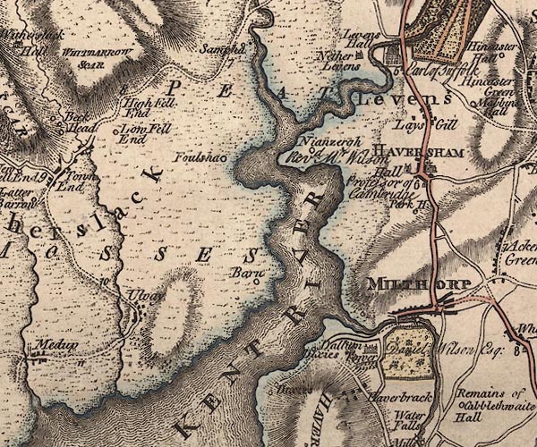 J5SD48SE.jpg single or double wiggly line; river item:- National Library of Scotland : EME.s.47 Images © National Library of Scotland |
|||
|
|
||||
| evidence:- | old map:- West 1784 map placename:- Beela River |
|||
| source data:- | Map, hand coloured engraving, A Map of the Lakes in Cumberland,
Westmorland and Lancashire, scale about 3.5 miles to 1 inch,
engraved by Paas, 53 Holborn, London, about 1784.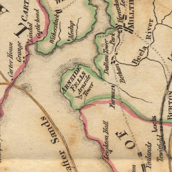 Ws02SD47.jpg 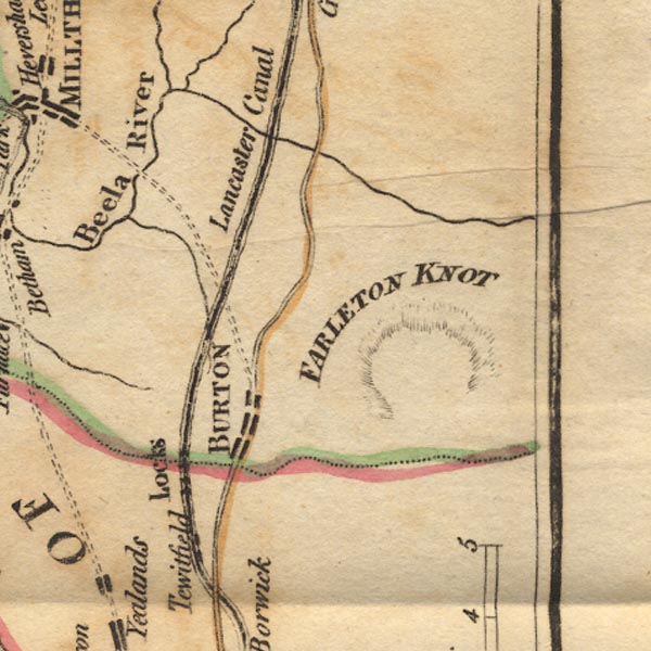 Ws02SD57.jpg item:- Armitt Library : A1221.1 Image © see bottom of page |
|||
|
|
||||
| evidence:- | old text:- Camden 1789 (Gough Additions) placename:- Byth Water placename:- Betham, River |
|||
| source data:- | Book, Britannia, or A Chorographical Description of the Flourishing Kingdoms of England,
Scotland, and Ireland, by William Camden, 1586, translated from the 1607 Latin edition
by Richard Gough, published London, 1789. goto source Page 153:- "..." "... "... By Bytham runneth Byth water, a pretty river." Below at the mouth of the river Betham is Milthorp, ..." |
|||
|
|
||||
| evidence:- | old map:- Cary 1789 (edn 1805) |
|||
| source data:- | Map, uncoloured engraving, Westmoreland, scale about 2.5 miles
to 1 inch, by John Cary, London, 1789; edition 1805.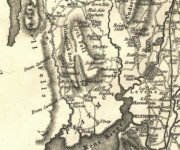 CY24SD48.jpg river running into the Kent Estuary item:- JandMN : 129 Image © see bottom of page |
|||
|
|
||||
| evidence:- | road book:- Cary 1798 (2nd edn 1802) placename:- Beloo, River |
|||
| source data:- | Road book, itineraries, Cary's New Itinerary, by John Cary, 181
Strand, London, 2nd edn 1802. goto source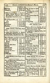 click to enlarge click to enlargeC38315.jpg page 315-316 "Cross the Beloo River." item:- JandMN : 228.1 Image © see bottom of page |
|||
|
|
||||
| evidence:- | old text:- Capper 1808 placename:- Betha, River |
|||
| source data:- | Gazetteer, A Topographical Dictionary of the United Kingdom,
compiled by Benjamin Pitts Capper, published by Richard
Phillips, Bridge Street, Blackfriars, London, 1808; published
1808-29. goto source "[Milnthorpe] ... on the river Betha, which soon after joins the Ker near its mouth, and over which is a handsome stone bridge. In the neighbourhood are 2 paper mills. ..." |
|||
|
|
||||
| evidence:- | old map:- Cooper 1808 |
|||
| source data:- | Map, hand coloured engraving, Westmoreland ie Westmorland, scale
about 9 miles to 1 inch, by H Cooper, 1808, published by R
Phillips, Bridge Street, Blackfriars, London, 1808. click to enlarge click to enlargeCOP4.jpg tapering wiggly line; river; county boundary item:- Dove Cottage : 2007.38.53 Image © see bottom of page |
|||
|
|
||||
| evidence:- | descriptive text:- Otley 1823 (5th edn 1834) placename:- Belo, River |
|||
| source data:- | Guide book, A Concise Description of the English Lakes, the
mountains in their vicinity, and the roads by which they may be
visited, with remarks on the mineralogy and geology of the
district, by Jonathan Otley, published by the author, Keswick,
Cumberland now Cumbria, by J Richardson, London, and by Arthur
Foster, Kirkby Lonsdale, Cumbria, 1823; published 1823-49,
latterly as the Descriptive Guide to the English Lakes. goto source Page 41:- "The Kent ... enters the sea near Milnthorp, where it is joined by the Belo." |
|||
|
|
||||
| evidence:- | old map:- Garnett 1850s-60s H placename:- Beetha, River |
|||
| source data:- | Map of the English Lakes, in Cumberland, Westmorland and
Lancashire, scale about 3.5 miles to 1 inch, published by John
Garnett, Windermere, Westmorland, 1850s-60s.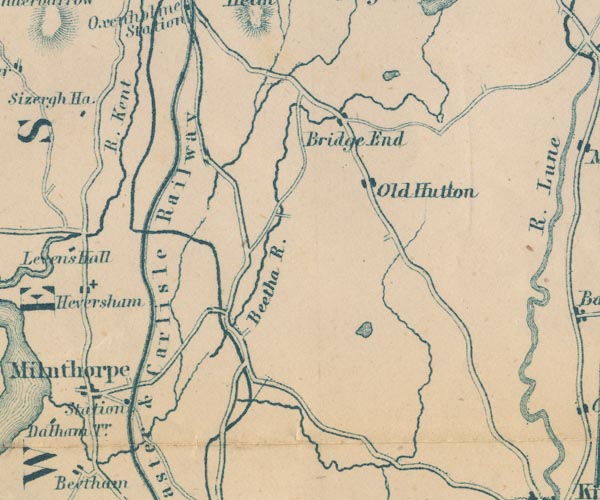 GAR2SD58.jpg "Beetha R." wiggly line, river item:- JandMN : 82.1 Image © see bottom of page |
|||
|
|
||||
| evidence:- | old map:- Postlethwaite 1877 (3rd edn 1913) placename:- Peetha, River |
|||
| source data:- | Map, uncoloured engraving, Map of the Lake District Mining Field, Westmorland, Cumberland,
Lancashire, scale about 5 miles to 1 inch, by John Postlethwaite, published by W H
Moss and Sons, 13 Lowther Street, Whitehaven, Cumberland, 1877 edn 1913.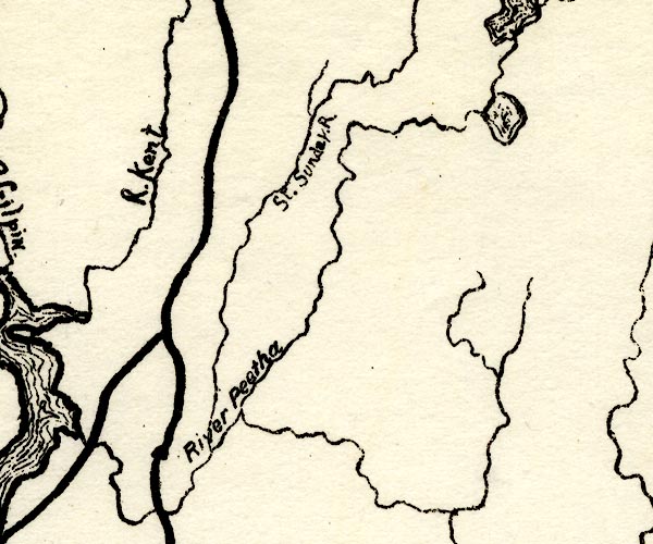 PST2SD58.jpg "River Peetha" wiggly line, running into Kent Estuary item:- JandMN : 162.2 Image © see bottom of page |
|||
|
|
||||
| evidence:- | old map:- LMS 1920s maps placename:- Beela, River |
|||
| source data:- | Railway map, lithograph, 23 pages of strip maps, The Journey in
Brief, the Route London to Carlisle, published by the London
Midland and Scottish Railway, LMS, 1920s.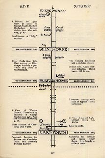 click to enlarge click to enlargeLS3p25.jpg "R. Beela" item:- JandMN : 95.2 Image © see bottom of page |
|||
|
|
||||
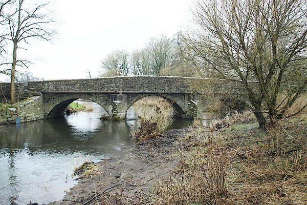
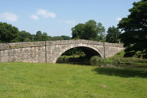
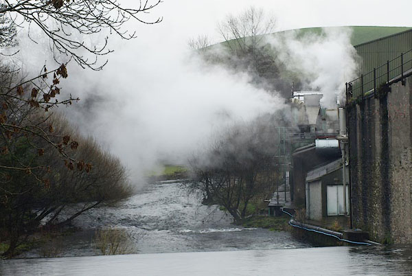
 BYG99.jpg At Milnthorpe, (taken 30.4.2013) 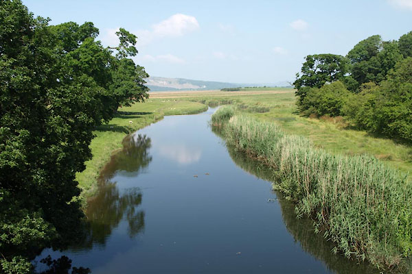 BYU22.jpg Down from Milnthorpe Bridge, (taken 11.7.2013) 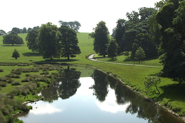 BYU23.jpg Up from Milnthorpe Bridge, (taken 11.7.2013) |
||||
|
|
||||
| places:- |
|
|||
|
||||
|
||||
|
||||
|
||||
|
||||
|
||||
|
||||
|
||||
|
||||
|
||||
|
||||
|
||||
|
||||
|
||||
|
||||
Lakes Guides menu.