 Old Cumbria Gazetteer
 |
 |
|
||||||||||||||||||||||||
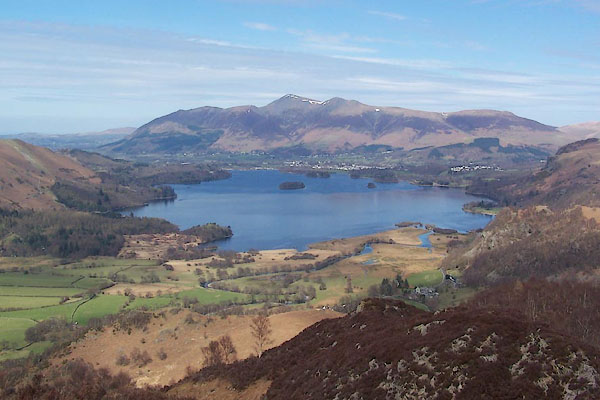
| Derwent Water | ||||||||||||||||||||||||||
| Daran Water | ||||||||||||||||||||||||||
| Keswick Water | ||||||||||||||||||||||||||
| site name:- | Derwent, River | |||||||||||||||||||||||||
| civil parish:- | Keswick (formerly Cumberland) | |||||||||||||||||||||||||
| civil parish:- | Above Derwent (formerly Cumberland) | |||||||||||||||||||||||||
| civil parish:- | Borrowdale (formerly Cumberland) | |||||||||||||||||||||||||
| county:- | Cumbria | |||||||||||||||||||||||||
| locality type:- | lake | |||||||||||||||||||||||||
| coordinates:- | NY26272113 (etc) | |||||||||||||||||||||||||
| 1Km square:- | NY2621 | |||||||||||||||||||||||||
| 10Km square:- | NY22 | |||||||||||||||||||||||||
| 10Km square:- | NY21 | |||||||||||||||||||||||||
| altitude:- | 249 feet (winter 1972) | |||||||||||||||||||||||||
| altitude:- | 76m (winter 1972) | |||||||||||||||||||||||||
|
|
||||||||||||||||||||||||||
 BSM46.jpg (taken 12.4.2010) 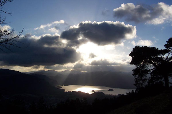 BXT29.jpg (taken 5.12.2012) |
||||||||||||||||||||||||||
|
|
||||||||||||||||||||||||||
| evidence:- | old map:- OS County Series (Cmd 64 10) placename:- Derwent Water |
|||||||||||||||||||||||||
| source data:- | Maps, County Series maps of Great Britain, scales 6 and 25
inches to 1 mile, published by the Ordnance Survey, Southampton,
Hampshire, from about 1863 to 1948. |
|||||||||||||||||||||||||
|
|
||||||||||||||||||||||||||
| evidence:- | old map:- OS County Series (Cmd 64) |
|||||||||||||||||||||||||
| source data:- | Maps, County Series maps of Great Britain, scales 6 and 25
inches to 1 mile, published by the Ordnance Survey, Southampton,
Hampshire, from about 1863 to 1948. "Lowest point of bed of lake 172 feet above O.S. datum" elsewhere:- "Sur. of Water 238.3" |
|||||||||||||||||||||||||
|
|
||||||||||||||||||||||||||
| evidence:- | old map:- Saxton 1579 placename:- Darwen Flu. |
|||||||||||||||||||||||||
| source data:- | Map, hand coloured engraving, Westmorlandiae et Cumberlandiae Comitatus ie Westmorland
and Cumberland, scale about 5 miles to 1 inch, by Christopher Saxton, London, engraved
by Augustinus Ryther, 1576, published 1579-1645. Sax9NY22.jpg "Darwen flu:" Lake and islands. item:- private collection : 2 Image © see bottom of page |
|||||||||||||||||||||||||
|
|
||||||||||||||||||||||||||
| evidence:- | old map:- Mercator 1595 (edn?) placename:- |
|||||||||||||||||||||||||
| source data:- | Map, hand coloured engraving, Northumbria, Cumberlandia, et
Dunelmensis Episcopatus, ie Northumberland, Cumberland and
Durham etc, scale about 6.5 miles to 1 inch, by Gerard Mercator,
Duisberg, Germany, about 1595. MER8CumF.jpg "" outline, coast shaded, tinted blue; lake item:- JandMN : 169 Image © see bottom of page |
|||||||||||||||||||||||||
|
|
||||||||||||||||||||||||||
| evidence:- | old map:- Keer 1605 |
|||||||||||||||||||||||||
| source data:- | Map, hand coloured engraving, Westmorland and Cumberland, scale
about 16 miles to 1 inch, probably by Pieter van den Keere, or
Peter Keer, about 1605 edition perhaps 1676. click to enlarge click to enlargeKER8.jpg "" outline, shaded; lake item:- Dove Cottage : 2007.38.110 Image © see bottom of page |
|||||||||||||||||||||||||
|
|
||||||||||||||||||||||||||
| evidence:- | old map:- Speed 1611 (Cmd) |
|||||||||||||||||||||||||
| source data:- | Map, hand coloured engraving, Cumberland and the Ancient Citie
Carlile Described, scale about 4 miles to 1 inch, by John Speed,
1610, published by J Sudbury and George Humble, Popes Head
Alley, London, 1611-12.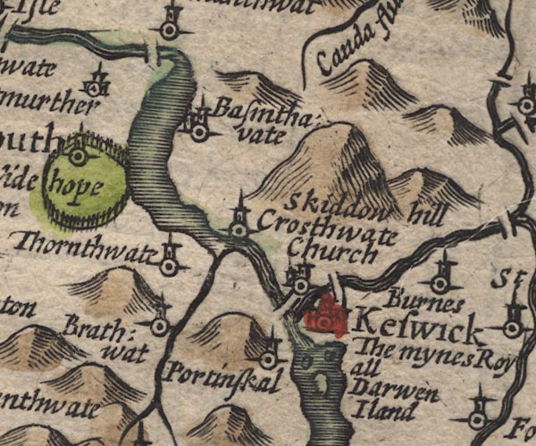 SP11NY22.jpg 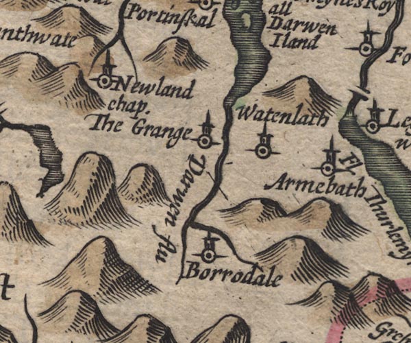 SP11NY21.jpg outline, shaded, with 3 islands item:- private collection : 16 Image © see bottom of page |
|||||||||||||||||||||||||
|
|
||||||||||||||||||||||||||
| evidence:- | old map:- Drayton 1612/1622 placename:- Darwen Fl. |
|||||||||||||||||||||||||
| source data:- | Map, hand coloured engraving, Cumberlande and Westmorlande, by
Michael Drayton, probably engraved by William Hole, scale about
4 or 5 miles to 1 inch, published by John Mariott, John
Grismand, and Thomas Dewe, London, 1622.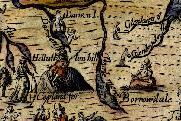 DRY514.jpg "Darwen fl" Lake and perhaps river, naiad. item:- JandMN : 168 Image © see bottom of page |
|||||||||||||||||||||||||
|
|
||||||||||||||||||||||||||
| evidence:- | perhaps table of distances:- Simons 1635 |
|||||||||||||||||||||||||
| source data:- | Table of distances, uncoloured engraving, Cumberland, with a
thumbnail map, scale about 41 miles to 1 inch, by Mathew Simons,
published in A Direction for the English Traviller, 1635.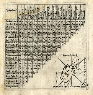 click to enlarge click to enlargeSIM4.jpg outline on thumbnail map item:- private collection : 50.11 Image © see bottom of page |
|||||||||||||||||||||||||
|
|
||||||||||||||||||||||||||
| evidence:- | old map:- Jenner 1643 |
|||||||||||||||||||||||||
| source data:- | Tables of distances with a maps, Westmerland, scale about 16
miles to 1 inch, and Cumberland, scale about 21 miles to 1 inch,
published by Thomas Jenner, London, 1643; published 1643-80.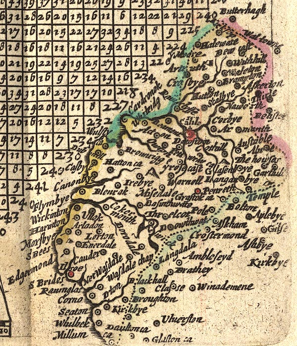 JEN4Sq.jpg outline, shaded |
|||||||||||||||||||||||||
|
|
||||||||||||||||||||||||||
| evidence:- | old map:- Ogilby 1675 (plate 96) |
|||||||||||||||||||||||||
| source data:- | Road strip map, hand coloured engraving, the Road from Kendal to
Cockermouth, and the Road from Egremond to Carlisle, scale about
1 inch to 1 mile, by John Ogilby, London, 1675.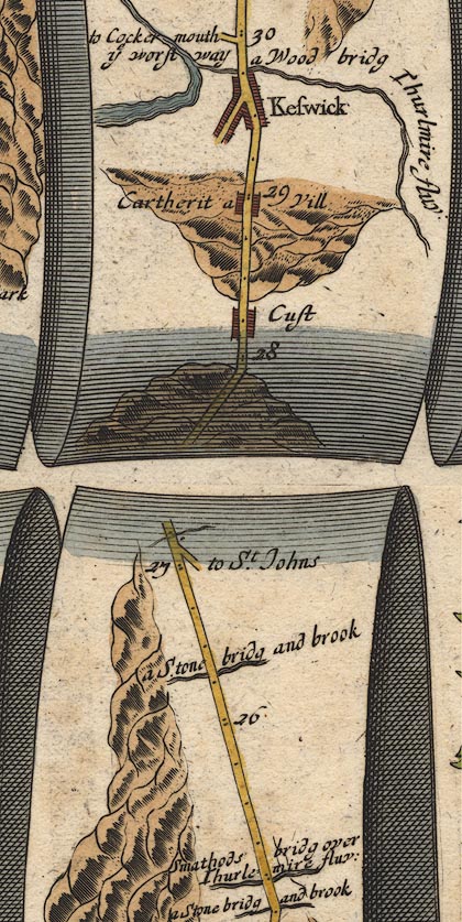 OG96m025.jpg In mile 29, Cumberland. Drawn as a wide river, narrowing to a river on the left of the road. item:- JandMN : 22 Image © see bottom of page |
|||||||||||||||||||||||||
|
|
||||||||||||||||||||||||||
| evidence:- | old map:- Sanson 1679 |
|||||||||||||||||||||||||
| source data:- | Map, hand coloured engraving, Ancien Royaume de Northumberland
aujourdhuy Provinces de Nort, ie the Ancient Kingdom of
Northumberland or the Northern Provinces, scale about 9.5 miles
to 1 inch, by Nicholas Sanson, Paris, France, 1679. click to enlarge click to enlargeSAN2Cm.jpg outline, shore shaded; lake item:- Dove Cottage : 2007.38.15 Image © see bottom of page |
|||||||||||||||||||||||||
|
|
||||||||||||||||||||||||||
| evidence:- | old map:- Seller 1694 (Cmd) |
|||||||||||||||||||||||||
| source data:- | Map, uncoloured engraving, Cumberland, scale about 12 miles to 1
inch, by John Seller, 1694. click to enlarge click to enlargeSEL9.jpg outline with shaded shore; lake item:- Dove Cottage : 2007.38.89 Image © see bottom of page |
|||||||||||||||||||||||||
|
|
||||||||||||||||||||||||||
| evidence:- | old map:- Morden 1695 (EW) |
|||||||||||||||||||||||||
| source data:- | Map, hand coloured engraving, England, including Wales, scale
about 27 miles to 1 inch, by Robert Morden, published by Abel
Swale Awnsham and John Churchil, London, about 1695. click to enlarge click to enlargeMRD3Cm.jpg outline, shaded; lake item:- JandMN : 339 Image © see bottom of page |
|||||||||||||||||||||||||
|
|
||||||||||||||||||||||||||
| evidence:- | old map:- Morden 1695 (Cmd) |
|||||||||||||||||||||||||
| source data:- | Map, uncoloured engraving, Cumberland, scale about 4 miles to 1
inch, by Robert Morden, 1695, published by Abel Swale, the
Unicorn, St Paul's Churchyard, Awnsham, and John Churchill, the
Black Swan, Paternoster Row, London, 1695-1715. MD12NY22.jpg 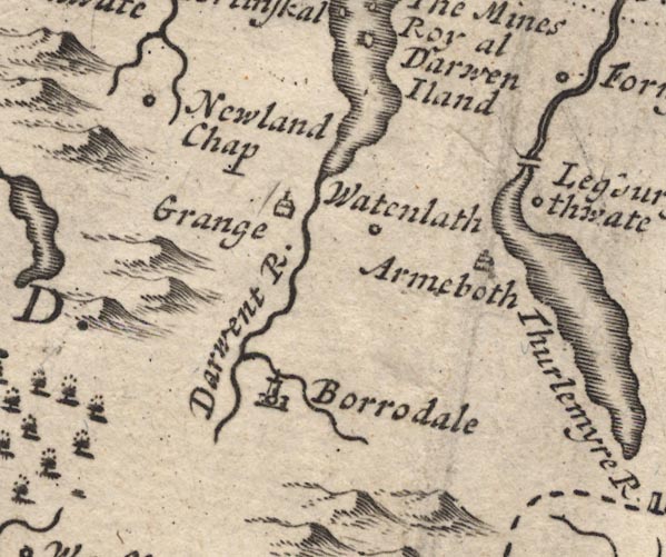 MD12NY21.jpg Outline with shore shading. item:- JandMN : 90 Image © see bottom of page |
|||||||||||||||||||||||||
|
|
||||||||||||||||||||||||||
| evidence:- | perhaps old map:- Stukeley 1723 |
|||||||||||||||||||||||||
| source data:- | Road map, uncoloured engraving, the Antonine Itineraries through
Britain, scale about 55 miles to 1 inch, plotted by William
Stukeley, 1723, published London, 1724. click to enlarge click to enlargeStu1Cm.jpg item:- Hampshire Museums : FA2001.171 Image © see bottom of page |
|||||||||||||||||||||||||
|
|
||||||||||||||||||||||||||
| evidence:- | old map:- Badeslade 1742 placename:- |
|||||||||||||||||||||||||
| source data:- | Map, uncoloured engraving, A Map of Cumberland North from
London, scale about 11 miles to 1 inch, with descriptive text,
by Thomas Badeslade, London, engraved and published by William
Henry Toms, Union Court, Holborn, London, 1742. click to enlarge click to enlargeBD10.jpg "" outline with form lines item:- JandMN : 115 Image © see bottom of page |
|||||||||||||||||||||||||
|
|
||||||||||||||||||||||||||
| evidence:- | descriptive text:- Simpson 1746 placename:- Praegrande Stragnum |
|||||||||||||||||||||||||
| source data:- | Atlas, three volumes of maps and descriptive text published as
'The Agreeable Historian, or the Compleat English Traveller
...', by Samuel Simpson, 1746. goto source goto source"..." "The River Derwent, ... runs among the Mountains, call'd Derwent Fells, which having pass'd, it spreads itself into a spacious Lake, three Mile long, call'd by Bede, Praegrande Stragnum, i.e. a vast Pool, in which there are three Islands, one of them inhabited by German Miners; another is suppos'd by Bede to be the Place where St. Herbert lead an Hermit's Life; and the third has of late Years, had the Honour to be the Seat of the famous Family of Radcliffs, ..." |
|||||||||||||||||||||||||
|
|
||||||||||||||||||||||||||
| evidence:- | old map:- Simpson 1746 map (Wmd) |
|||||||||||||||||||||||||
| source data:- | Map, uncoloured engraving, Westmorland, scale about 8 miles to 1
inch, printed by R Walker, Fleet Lane, London, 1746. SMP2NYG.jpg Outline with form lines. item:- Dove Cottage : 2007.38.59 Image © see bottom of page |
|||||||||||||||||||||||||
|
|
||||||||||||||||||||||||||
| evidence:- | old text:- Gents Mag |
|||||||||||||||||||||||||
| source data:- | Magazine, The Gentleman's Magazine or Monthly Intelligencer or
Historical Chronicle, published by Edward Cave under the
pseudonym Sylvanus Urban, and by other publishers, London,
monthly from 1731 to 1922. goto source Gentleman's Magazine 1751 p.52 "..." "Near Keswic is also another lake about two miles broad, and 4 miles long, in which several beautiful islands are interspersed, but not inhabited by German miners, as was asserted by a worthy brother of yours lately defunct [2]. When I saw them they were so many Ortygias, or islands of Calypso, covered with beautiful woods, which were then felling." "..." "The writer means the Universal, or London Magazine; for both have given descriptions of this country, so void of truth, that they are, as to those parts, felo de se.- They have not the right number of churches in Carlisle, and both make large and fair towns, where there are not three houses together." |
|||||||||||||||||||||||||
|
|
||||||||||||||||||||||||||
| evidence:- | old map:- Gents Mag 1751 placename:- Keswick Water |
|||||||||||||||||||||||||
| source data:- | Map, uncoloured engraving, Map of the Black Lead Mines in
Cumberland, and area, scale about 2 miles to 1 inch, by George
Smith, published in the Gentleman's Magazine, 1751. GM1311.jpg "KESWICK WATER" outline with form lines; lake, with islands item:- JandMN : 114 Image © see bottom of page |
|||||||||||||||||||||||||
|
|
||||||||||||||||||||||||||
| evidence:- | old text:- Morgan 1759 placename:- Keswick Lake placename:- Derwentwater |
|||||||||||||||||||||||||
| source data:- | MG02q013.txt ".... Keswick lake, though inferior in size to Uls-water, affords many delightful scenes. The waters, which still bear the name of Derwentwater, though embodied in so great a lake, said to be ten miles in circumference, is transparent as crystal, over whose surface five fine islands are dispersed; some are covered with corn, others clothed in wood, and the hills are lofty, arising on every side from the margin of the lake. Here the mountains are in some parts covered with grass, in others with heath; there the rocks are covered with shrubs and brushwood, which hang in their apertures and creeks. Little valleys of cultivated land present themselves in the openings and windings of the mountains, and small enclosures, and groves of oak, stretch up the precipitate ascents of several hills from the brink of the water. At the head of the bason, the mountains are more rugged and romantic. In some parts waterfalls strike the ear from every side with agreeable solemnity. Here (says Mr. Pennant) all the possible variety of alpine scenery is exhibited, with all the horrour of precipice, broken crag, or overhanging rock; or insulated piramidal hills, contrasted with others whose smooth and verdant sides swel-" "ling" MG02q014.txt "[swel]ling into immense aerial heights, at once please and surprise the eye. The two extremes of the lake afford most delightful prospects: The southern is a composition of all that is horrible. An immense chasm opens in the midst, whose entrance is divided by a rude conic hill, once topped with a castle, the habitation of the tyrant of the rocks; beyond, a series of broken mountainous crags soar one above the other, overshadowing the dark winding deeps of Burrowdale. But the opposite, or northern view, is in all respects a strong and beautiful contrast. Skiddow shows its vast base, and, bounding all that part of the vale, rises gently to a height that sinks the neighbouring hills, opens a pleasing front smooth and verdant, smiling over the country like a gentle generous lord, while the fells of Burrowdale frown on it like a hardened tyrant. The water of this lake is subject to violent agitations, even when little or no wind is stirring, and boats are frequently tossed about with great violence by what is called a bottom wind, which raises the waves to a great height." |
|||||||||||||||||||||||||
|
|
||||||||||||||||||||||||||
| evidence:- | old map:- Bowen and Kitchin 1760 |
|||||||||||||||||||||||||
| source data:- | Map, hand coloured engraving, A New Map of the Counties of
Cumberland and Westmoreland Divided into their Respective Wards,
scale about 4 miles to 1 inch, by Emanuel Bowen and Thomas
Kitchin et al, published by T Bowles, Robert Sayer, and John
Bowles, London, 1760.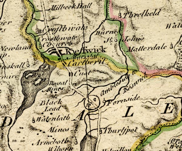 BO18NY21.jpg outline with form lines item:- Armitt Library : 2008.14.10 Image © see bottom of page |
|||||||||||||||||||||||||
|
|
||||||||||||||||||||||||||
| evidence:- | old map:- Donald 1774 (Cmd) placename:- Derwent Water |
|||||||||||||||||||||||||
| source data:- | Map, hand coloured engraving, 3x2 sheets, The County of Cumberland, scale about 1
inch to 1 mile, by Thomas Donald, engraved and published by Joseph Hodskinson, 29
Arundel Street, Strand, London, 1774.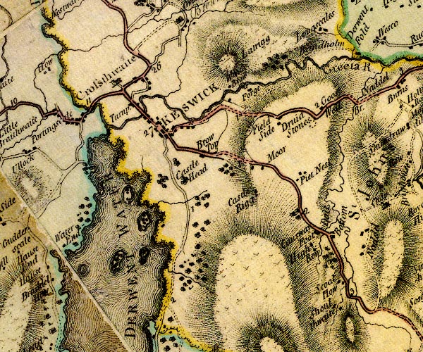 D4NY22SE.jpg  D4NY21NE.jpg "DERWENT WATER" lake item:- Carlisle Library : Map 2 Images © Carlisle Library |
|||||||||||||||||||||||||
|
|
||||||||||||||||||||||||||
| evidence:- | descriptive text:- West 1778 (11th edn 1821) placename:- Lake of Keswick item:- ice; newspaper; Cumberland Pacquet; fish; trout; perch; pike; eel, Derwent Water |
|||||||||||||||||||||||||
| source data:- | Guide book, A Guide to the Lakes, by Thomas West, published by
William Pennington, Kendal, Cumbria once Westmorland, and in
London, 1778 to 1821. goto source Page 86:- "... This small neat town [Keswick] is at present renowned for nothing so much as the lake it stands near, and which is sometimes called, from the town," goto sourcePage 87:- "the lake of KESWICK, but more properly the lake of DERWENT; and I am inclined to think, and hope to make it appear, that the ancient name of KESWICK is the DERWENT-TOWN, or the town of DERWENT-WATER. But first of the lake itself [1]." "The whole extent of the lake is about three miles, from north to south; the form is irregular, and its greatest breadth exceeds not a mile and a half. The best method of viewing this enchanting water, is in a boat, and from the banks. Mr. Gray viewed it from the banks only, and Mr. Mason, after trying both, prefers Mr. Gray's choice; and, where the pleasure of rowing and sailing is out of the question, it will, in general, be found the best, on account of the fore-ground, which the boat does not furnish. Every dimension of the lake, however, appears more extended from its bosom, than from its banks. I shall, therefore, point out the favourite stations round the lake, that have often been verified." "[1] Some agreeable lines descriptive of this Lake, by Dr. Dalton, may be seen in the Addenda, Article II." "..." West 1778 (11th edn 1821) goto sourcePage 96:- "... The water of all the lakes in these parts is clear; but the Derwent only is pelucid. In it the smallest pebble is seen at a great depth, nearly as in the open air." "..." goto sourcePage 113:- "[The transparent] beauty of the lake is only seen in the boat, and it is very surprising. The bottom resembles a mosaic pavement of party-coloured stone. The fragments of spar at the depth of seven yards either shine like diamonds, or glitter in diversity of colour; and such is the purity of the water, that no mud or ooze defiles its bottom. ..." "..." goto sourcePage 115:- "[Mr Pennant's report] '... The water of Derwent-water is subject to violent agitations, and often without any apparent cause, as was the case this day; the weather was calm, yet the waves ran a great height, and the boat was tossed violently, with what is called bottom wind.'" "..." goto sourcePage 117:- "The characteristic of this lake is, that it retains its form viewed from any point, and never assumes the appearance of a river [2]." "[2] The following sketch of the appearance of this amphitheatre, in a hard frost, appeared in the Cumberland Pacquet, February 10, 1784." "Derwent lake has been frozen over for several days, and quantities of timber have been drawn across it by horses. The appearance of this celebrated piece of water and the surrounding mountains is described by numbers who have seen it, as the most delightful of any prospect that can be conceived. The four islands have been visited by crowds of people, who agree that the whole scene is at present more awfully grand and enchanting than in the height of summer. The summits and sides of the mountains, at present clad with snow, the icicles hanging from the different cliffs, and the glassy surface of the lake, all these glittering in the sun, fill the eye with such an assemblage of natural magnificence and beauty as beggars all description.'" "The following passage may be worth reading here, taken from a description of the curiosities in the Peak of Derbyshire, in the London Magazine, for October, 1778." "'Long has been the contention between gentlemen of Derbyshire and Cumberland, respecting Dovedale and Keswick, each claiming the superiority of natural beauties, and Dr. Brown has been thought by many to carry the dispute in favour of Keswick. I have carefully surveyed both, without being a native of either country; and if I might presume to be any judge of the matter, I should compare Dovedale to the soft and delicate maiden, and Keswick to the bold and sturdy Briton.'" goto sourcePage 118:- "The fish here are trout, perch, pike, and eel." "..." goto sourcePage 190:- "A TABLE OF THE Height of Mountains and Lakes SEEN IN THIS TOUR, ... TAKEN FROM THE LEVEL OF THE SEA. ... by Mr. John Dalton." "Derwent-water ... 76 [yards]" |
|||||||||||||||||||||||||
|
|
||||||||||||||||||||||||||
| evidence:- | old map:- Crosthwaite 1783-94 (Der) placename:- Lake of Derwent |
|||||||||||||||||||||||||
| source data:- | Map, uncoloured engraving, An Accurate Map of the Matchless Lake
of Derwent, ie Derwent Water, scale about 3 inches to 1 mile, by
Peter Crosthwaite, Keswick, Cumberland, 1783, version published
1800.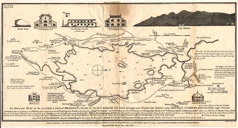 click to enlarge click to enlargeCT02.jpg "An Accurate MAP of the matcheless LAKE of DERWENT, (situate in the most delightful Vale which perhaps ever Human Eye beheld) near KESWICK, CUMBERLAND; ..." item:- Armitt Library : 1959.191.3 Image © see bottom of page |
|||||||||||||||||||||||||
|
|
||||||||||||||||||||||||||
| evidence:- | old map:- West 1784 map placename:- Derwent Water |
|||||||||||||||||||||||||
| source data:- | Map, hand coloured engraving, A Map of the Lakes in Cumberland,
Westmorland and Lancashire, scale about 3.5 miles to 1 inch,
engraved by Paas, 53 Holborn, London, about 1784. Ws02NY22.jpg "DERWENT WATER" item:- Armitt Library : A1221.1 Image © see bottom of page |
|||||||||||||||||||||||||
|
|
||||||||||||||||||||||||||
| evidence:- | old print:- Middiman 1784-92 placename:- Keswick Lake |
|||||||||||||||||||||||||
| source data:- | Print, uncoloured engraving, Keswick Lake, Cumberland, drawn by T Smith, engraved
and published by Samuel Middiman, 3 Grafton Street, Tottenham Court Road, London,
1784.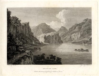 click to enlarge click to enlargeMM0102.jpg "Painted by T. Smith. / Engrav'd by S. Middiman. / KESWICK-LAKE. / Publish'd as the Act directs, Jany. 1st. 1784, by S. Middiman, London." Accompanying text:- "PLATE II." "KESWICK - LAKE," "CUMBERLAND." "THE picturesque Scenery surrounding the celebrated Lake of Keswick, posesses a Diversity that must astonish every Admirer of the Romantic. This View, near Lady's Rake, a large Opening iin the Rocks between Wallow and Barrow-Crags, exhibits an Assemblage of the most stupendous Objects near the Lake." "Lowdore Water-Fall, on the Left, a formidable Mass, towers over its Base, bulging out in horrid Shapes, pendent and threatening; near the Path, and in the Lake, lie dispersed the huge Fragments of Rocks that have tumbled from its Summit. At the Extremity, Castle-Crag appears a pyramidal Form; apparently blocking up the Pass to Borrowdale, from whence a grotesque Scene of Rocks opens to the View, of the most singular and opposite Forms, rising in cumbrous Piles, or starting into conical irregular Shapes, with trees vegetating from their numerous Fissures. Strange Masses are upheld by Fragments, apparently unequal to the Weight they sustain, and appear as if suspended by Magic, forming an awful Precipice from the Base to the Summit: the Changes in their Disposition are infinite, alternately assuming the most fantastical Shapes; and every Step produces a Combination of Objects magnificently great." "On the opposite Shore is seen a Range of Mountains, arising immediately from the Lake, whose Declivities are covered with Vegetation; Cawseypike and Thornthwaite are the principal Boundaries; those that form the Out Line to the South, lie in fine Order of perspective, are much broken, and highly picturesque." "On the Lord's Island, the Ratcliff Family had some Time its residence; and from this Lake took the Title of Derwentwater. The last ill-fated Earl lost his Life and Fortune by the Rebellion of 1715; and his Estate, now amounting to 20,000l. per Annum, (the Mines included) is vested in Trustees for the Support of Greenwich Hospital." item:- Armitt Library : A6858.2 Image © see bottom of page |
|||||||||||||||||||||||||
|
|
||||||||||||||||||||||||||
| evidence:- | old sketch map:- Gilpin 1786 placename:- Keswick Lake |
|||||||||||||||||||||||||
| source data:- | Sketch map, Keswick Lake ie Derwent Water, Cumberland, by William Gilpin, 1772-74 goto source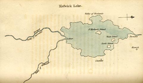 click to enlarge click to enlargeGLP312.jpg Plate vol 1 opposite p.179 in Observations on Picturesque Beauty published by T Cadell and W Davies, Strand, London, 1808. caption from the list of plates:- "This plan of Keswick-lake means only to express the general shape of it; and the relative situation of it's several parts." item:- Armitt Library : A918.12 Image © see bottom of page |
|||||||||||||||||||||||||
|
|
||||||||||||||||||||||||||
| evidence:- | old text:- goto source placename:- Keswick Lake placename:- Lake of Derwent |
|||||||||||||||||||||||||
| source data:- | goto source vol.1 p.180 "The lake of Derwent, or Keswick-lake, as it is generally called, is contained within a circumference of about ten miles; presenting itself in a circular form, tho in fact it is rather oblong. It's area is interspersed with four or five islands; three of which only are of consequence, Lord's island, Vicar's island, and St. Herbert's island: but none of them is comparable to the island on Windermere, in point either of size, or beauty." "If a painter were desirous of studying the circumference of the lake from one station, St. Herbert's island is the spot he should choose; from whence, as from a centre, he might see it in rotation. I have seen a set of drawings taken from this stand; which were hung round a circular room, and intended to give a general idea of the boundaries of the lake. But as no representation could be given of the lake itself; the idea was lost, and the drawings made but an awkward appearance." goto sourcevol.1 p.181 "..." "As the boundaries of this lake are more mountainous than those of Windermere; they, of course, afford more romantic scenery. But tho the whole shore, except the spot where we stood, is incircled with mountains; they rarely fall abruptly into the water; which is girt almost round by a margin of meadow - on the western shores especially. On the eastern, the mountains approach nearer the water; and in some parts fall perpendicularly into it. But as we stood viewing the lake from it's northern shores, all these marginal parts were lost; and" goto sourcevol.1 p.182 "the mountains (tho in fact they describe a circle of twenty miles, which is double the circumference of the lake) appeared universally to rise from the water's edge." "Along it's western shores on the right, they rise smooth and uniform; and are therefore rather lumpish. The more removed part of this mountain-line is elegant: but, in some parts, it is disagreeably broken." "On the eastern side, the mountains are both grander, and more picturesque. The line is pleasing; and is filled with that variety of objects, broken-ground,- rocks,- and wood, which being well combined, take from the heaviness of a mountain; and give it an airy lightness." "The front-screen (if we may so call a portion of a circular form,) is more formidable, than either of the sides. But it's line is less elegant, than that of the eastern-screen. ..." goto sourcevol.1 p.183 "Of all the lakes in these romantic regions, the lake we are now examining, seems to be most generally admired. It was once admirably characterized by an ingenious person, * who, on his first seeing it, cried out, Here is beauty indeed - Beauty lying in the lap of Horrour! We do not often find a happier illustration. Nothing conveys an idea of beauty more strongly, than the lake; nor of horrour, than the mountains; and the former lying in the lap of the latter, expresses in a strong manner the mode of their combination. The late Dr. Brown, who was a man of taste, and had seen every part of this country, singled out the scenery of this lake for it's peculiar beauty †. And unquestionably it is, in many places, both beautiful, and romantic; particularly along it's eastern, and southern shores: but to give it pre-eminence may be paying it perhaps as much too high a compliment; as it would be too" "[1.183.*] The late Mr. Avilon, organist of St. Nicholas at Newcastle upon Tyne." "[1.183.†] In a letter to Lord Lyttelton, quoted above." goto sourcevol.1 p.184 "rigourous to make any but a few comparative objections" "In the first place, it's form, which in appearance is circular, is less interesting, I think, than the winding sweep of Windermere, and some other lakes; which losing themselves in vast reaches, behind some cape or promontory, add to their other beauties, the varieties of distance, and perspective. Some people object to this, as touching rather on the character of the river. But does that injure ir's beauty? And yet I believe there are very few rivers, which form such reaches, as the lake of Windermere." "To the formality of it's shores may be added the formality of it's islands. They are round, regular, and similar spots, as they appear from most points of view; formal in their situation, as well as in their shape; and of little advantage to the scene. The islands of Windermere are in themselves better shaped; more varied; and uniting together, add a beauty, and contrast to the whole." "But among the greatest objections to this lake is the abrupt, and broken line in several of the mountains, which compose it's screens, (especially on the western, and on part of" goto sourcevol.1 p.185 "the southern shore) which is more remarkable, than on any of the other lakes. We have little of the easy sweep of a mountain-line: at least the eye is hurt with too many tops of mountains, which injure the ideas of simplicity, and grandeur. Great care therefore should be taken in selecting views of this lake. If there is a littleness even among the grand ideas of the original, what can we expect from representations on paper, or canvas? I have seen some views of this lake, injudiciously chosen, or taken on too extensive a scale, in which the mountains appear like hay-cocks.- I would be understood however to speak chiefly of the appearance, which the lines of these mountains occasionally make. When we change our point of view, the mountain-line changes also, and may be beautiful in one point, tho it is displeasing in another." "Having thus taken a view of the whole lake together from it's northern point, we proceeded on our rout to Borrodale, skirting the eastern coast along the edge of the water. The grandest side-screen, on the left, hung over us; and we found it as beautifully romantic," goto sourcevol.1 p.186 "and pleasing to the imagination, when it's rocks, precipices, and woods became a fore-ground; as it appeared from the northern point of the lake, when we examined it in a more removed point of view." "Nor do these rocky shores recommend themselves to us only as fore-grounds. We found them every where the happiest situations for obtaining the most picturesque views of the lake. The inexperienced conductor, shewing you the lake, carries you to some garish stand, where the eye may range far and wide. And such a view indeed is well calculated, as we have just seen, to obtain a general idea of the whole. But he, who is in quest of the picturesque scenes of the lake, must travel along the rough side-screens that adorn it; and catch it's beauties, as they arise in smaller portions - it's little bays, and winding shores - it's deep recesses, and hanging promontories - it's garnished rock, and distant mountains. These are, in general, the picturesque scenes, which it affords." |
|||||||||||||||||||||||||
|
|
||||||||||||||||||||||||||
| evidence:- | old text:- Clarke 1787 placename:- Derwentwater placename:- Daran Water item:- bottom wind; wind |
|||||||||||||||||||||||||
| source data:- | Guide book, A Survey of the Lakes of Cumberland, Westmorland,
and Lancashire, written and published by James Clarke, Penrith,
Cumberland, and in London etc, 1787; published 1787-93. goto source Page 69:- "This Lake of Derwentwater contains 1295 acres at low water, the islands included; and deducting for islands 13 acres, 1282 remain for the area of the water: my survey was very exact, in which the lowness of the water assisted me very much; when I took the soundings, the water was very high." "..." "Since so many of the curious have visited these lakes, our native rustics have pretended to imitate them. Within these few years, not half a dozen persons in Keswick knew what the word Lake meant; it was either called Daran (that is Derwent,) or Keswick water, and had only two or three fishing boats upon it: now every cottager attempts to be polite, and to speak better language; and the name of Daran is not known, but the Lake only. Permit the following genuine illustration of my assertions, which I flatter myself will not be less valuable for its being literally true." "..." goto sourcePage 84:- "..." "Before we leave the Lake, I must beg my reader's patience for a few words concerning that extraordinary phaenomenon, the Bottom-Wind: This, so far as I know, is not observed in any other of our English Lakes, and is attended with many singular and inexplicable circumstances. In a perfectly calm day, the surface of the Lake will be agitated in a violent manner; the swell is quite regular, and always in the same direction, viz. from West to East; yet I have been at the very entrance of Borrowdale when one of these bottom-winds began, and felt not so much wind as would have extinguished a candle: sometimes they scarcely continue an hour, at other times almost a whole day, and are often, (tho' not always) the forerunners of a storm. These phaenomena I have elsewhere declared myself unable to explain: Should, however, any of my readers be able to accomplish the task, he will confer a singular favour upon me by communicating his solution." |
|||||||||||||||||||||||||
|
|
||||||||||||||||||||||||||
| evidence:- | old map:- Clarke 1787 map (Der) placename:- Derwentwater |
|||||||||||||||||||||||||
| source data:- | Map, uncoloured engraving, Map of Derwentwater and its Environs,
scale about 13 ins to 1 mile, by James Clarke, engraved by S J
Neele, published by James Clarke, Penrith, Cumberland and in
London etc, 1787.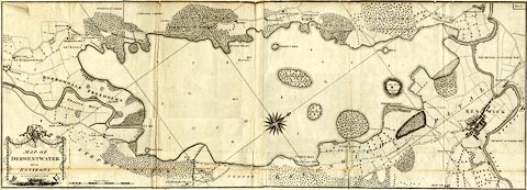 click to enlarge click to enlargeCL15.jpg "Map of Derwentwater and its Environs" item:- private collection : 169 Image © see bottom of page |
|||||||||||||||||||||||||
|
|
||||||||||||||||||||||||||
| evidence:- | old text:- Camden 1789 |
|||||||||||||||||||||||||
| source data:- | Book, Britannia, or A Chorographical Description of the Flourishing Kingdoms of England,
Scotland, and Ireland, by William Camden, 1586, translated from the 1607 Latin edition
by Richard Gough, published London, 1789. goto source Page 170:- "..." "... The Derwent running among these hills [Derwent Fells] spreads itself in a spacious lake, or as Bede calls it a very large pool, in which are three islands: one of them has the seat of the knightly family of Ratcliffe, another was inhabited by German miners, and the third is supposed to have been that in which Bede relates that St. Herbert led a solitary life. On the edges of this lake in very rich" |
|||||||||||||||||||||||||
|
|
||||||||||||||||||||||||||
| evidence:- | old text:- Camden 1789 (Gough Additions) item:- depth, Derwent Water; placename, Derwent Water; bottom wind |
|||||||||||||||||||||||||
| source data:- | Book, Britannia, or A Chorographical Description of the Flourishing Kingdoms of England,
Scotland, and Ireland, by William Camden, 1586, translated from the 1607 Latin edition
by Richard Gough, published London, 1789. goto source Page 182:- "..." "[at Keswick] ... The form of the lake is irregular, extending about three miles and an half from north to south and about one mile and an half broad; its greatest depth 20 feet. The river Derwent passes through and gives name to it. ..." "... Each boundary of the lake partakes of the extremities. The southern varies in rocks of different forms from the tremendous precipices of the Lady's leap and broken front of the Falcon's nest, and the more distant concave curve of Lowdore, a length of precipices intermixed with trees and cataracts. On the north side is a salt spring, once belonging to the monks of Furness, sheep-pastures on the sides of the lofty hills, and woods running down to the water's edge: But most of the antient woods have been cut down by the commissioners for Greenwich hospital. The three islands on this circular lake are finely disposed. The principal is the Lord's island about five acres, where St. Herbert's hermitage was. The late sir Wilfrid Lawson 1761 cut down the old wood and planted new. The water is subject to violent agitation, and, in the calmest weather, the waves will run high and the vessels be tost by what is called a bottom wind. ..." |
|||||||||||||||||||||||||
|
|
||||||||||||||||||||||||||
| evidence:- | old print:- Farington 1789 placename:- Derwentwater |
|||||||||||||||||||||||||
| source data:- | Print, uncoloured engraving, Derwentwater and Skiddaw, from Brandelow Woods, Cumberland,
drawn by Joseph Farington, engraved by B T Pouncy, published by William Byrne, 79
Titchfield Street, London, 1785.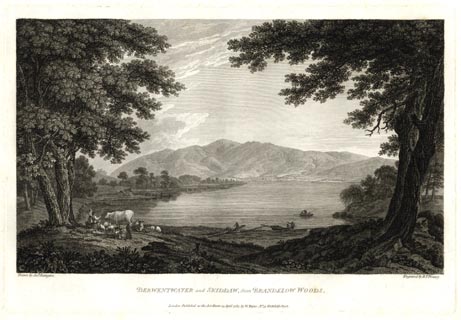 click to enlarge click to enlargeFA0303.jpg printed, bottom left, right, centre "Drawn by Josh. Farington / Engraved by B. T. Pouncy. / DERWENTWATER and SKIDDAW, from BRANDELOW WOODS. / London Published as the Act directs, 15 April 1785, by W. Byrne, No.79, Titchfield Street." item:- Armitt Library : A6668.3 Image © see bottom of page |
|||||||||||||||||||||||||
|
|
||||||||||||||||||||||||||
| evidence:- | old print:- Farington 1789 placename:- Derwentwater |
|||||||||||||||||||||||||
| source data:- | Print, uncoloured engraving, Derwentwater and the Vale of Keswick from Ashness, Borrowdale,
Cumberland, drawn by Joseph Farington, engraved by W Byrne and T Medland, published
by William Byrne, 79 Titchfield Street, London, 1784.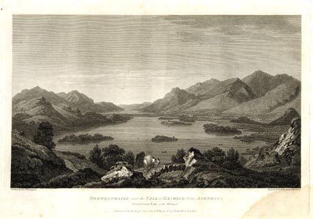 click to enlarge click to enlargeFA0301.jpg printed, bottom left, right, centre "Drawn by Josh. Farington / Engraved by W. Byrne &T. Medland / DERWENTWATER and the VALE of KESWICK from ASHNESS; Bassenthwaite Lake in the distance. / Published as the Act directs, 1 Decr. 1784, by W. Byrne, No.79, Titchfield Str. London." item:- Armitt Library : A6668.1 Image © see bottom of page |
|||||||||||||||||||||||||
|
|
||||||||||||||||||||||||||
| evidence:- | old print with text:- Farington 1789 (plate 3) |
|||||||||||||||||||||||||
| source data:- | Print, engraving, View of Skiddaw and Derwentwater, painted by Joseph Farington, engraved
by B T Pouncy, published by W Byrne, 79 Titchfield Street, London, 1785.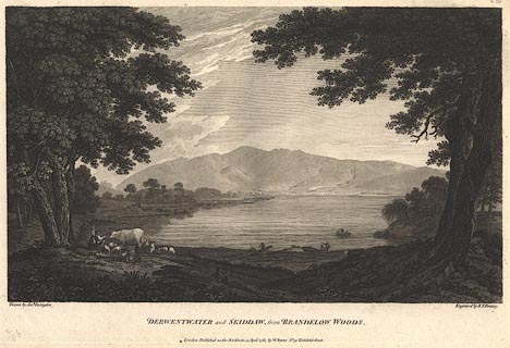 click to enlarge click to enlargeBMZ89.jpg Taken from the lake margin in Brandlehow Park. Plate 3 from Views of the Lakes, &c, in Cumberland and Westmorland, published 1789; with descriptive text:- "A VIEW of SKIDDAW and DERWENTWATER." "THIS Plate exhibits a View of the Mountain of Skiddaw, and the Lake of Derwentwater, as seen from Brandelow-Woods on its Western Shore. The Town of Keswick appears on its opposite Side, a little to the Right. ... The Lake of Derwentwater is about three Miles in Length, from North to South; its Breadth about a Mile and a Half. It derives much Beauty from the Islands which are interspersed in it; the principal of these is Lord's Island. about five Acres in Extent, where the unfortunate family of RATCLIFF had once its Residence, taking the Title of Derwentwater from the Lake itself. The Breadth of this Lake bearing so considerable a Proportion to its Length, it nearly retains its Form from whatever Point it is viewed, never assuming the Appearance of a river, which is a Distinction peculiar to itself." item:- Dove Cottage : Lowther.53 Image © see bottom of page |
|||||||||||||||||||||||||
|
|
||||||||||||||||||||||||||
| evidence:- | old print with text:- Farington 1789 (plate 1) placename:- Derwentwater |
|||||||||||||||||||||||||
| source data:- | Print, engraving, General View of Derwentwater, painted by Joseph Farington, engraved
by W Byrne and T Medland, published by W Byrne, 79 Titchfield Street, London, 1784.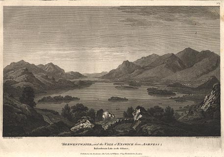 click to enlarge click to enlargeBMZ87.jpg A packhorse on Ashness Bridge in the foreground, Derwent Water with many islands. Plate 1 from Views of the Lakes, &c, in Cumberland and Westmorland, published 1789; with descriptive text:- "GENERAL VIEW OF DERWENTWATER." "THIS View is intended to convey a general Idea of the Valley of Keswick. Ashness, from whence it is taken, is on the Summit of the Rocks which hang over the Road leading to Lowdore, distant from Keswick about two Miles and a Half. No other Point can perhaps be fixed upon where the several Features which distinguish this romantic Vale will appear to be so strongly marked. The Elevation is sufficient to command an extensive Prospect, without so far reducing its component parts as materially to affect their Importance. A great Part of Derwentwater, including its four principal Islands, is in Front, and the Lake of Bassenthwaite in the Distance. The Stream which forms the Communication between them is only to be traced by the Flatness and Luxuriance of the adjacent Meadows. The Foot of Bassenthwaite is distant about ten Miles from Ashness. From the Margin of this Lake on the Right rises Skiddaw, on whose Skirts appear a part of the Town of Keswick; the rest is concealed from the View by Cockshut-Hill. On the Left of Derwentwater are Newlands and Thornthwaite-Fells. Beyond these are the Woods of Wythop hanging over the more distant Lake. The whole View is terminated by Caer-Mote, a Hill remarkable for still retaining the evident Traces of a Roman Encampment." item:- Dove Cottage : Lowther.51 Image © see bottom of page |
|||||||||||||||||||||||||
|
|
||||||||||||||||||||||||||
| evidence:- | old print:- Farington 1789 placename:- Derwentwater |
|||||||||||||||||||||||||
| source data:- | Print, uncoloured engraving, Derwentwater and Skiddaw, from Brandelow Woods, Cumberland,
drawn by Joseph Farington, engraved by B T Pouncy, published by William Byrne, 79
Titchfield Street, London, 1785. click to enlarge FA0303.jpg printed, bottom left, right, centre "Drawn by Josh. Farington / Engraved by B. T. Pouncy. / DERWENTWATER and SKIDDAW, from BRANDELOW WOODS. / London Published as the Act directs, 15 April 1785, by W. Byrne, No.79, Titchfield Street." item:- Armitt Library : A6668.3 Image © see bottom of page |
|||||||||||||||||||||||||
|
|
||||||||||||||||||||||||||
| evidence:- | old print:- Farington 1789 placename:- Derwentwater |
|||||||||||||||||||||||||
| source data:- | Print, uncoloured engraving, Derwentwater and the Vale of Keswick from Ashness, Borrowdale,
Cumberland, drawn by Joseph Farington, engraved by W Byrne and T Medland, published
by William Byrne, 79 Titchfield Street, London, 1784. click to enlarge FA0301.jpg printed, bottom left, right, centre "Drawn by Josh. Farington / Engraved by W. Byrne &T. Medland / DERWENTWATER and the VALE of KESWICK from ASHNESS; Bassenthwaite Lake in the distance. / Published as the Act directs, 1 Decr. 1784, by W. Byrne, No.79, Titchfield Str. London." item:- Armitt Library : A6668.1 Image © see bottom of page |
|||||||||||||||||||||||||
|
|
||||||||||||||||||||||||||
| evidence:- | old print with text:- Farington 1789 (plate 3) |
|||||||||||||||||||||||||
| source data:- | Print, engraving, View of Skiddaw and Derwentwater, painted by Joseph Farington, engraved
by B T Pouncy, published by W Byrne, 79 Titchfield Street, London, 1785. click to enlarge BMZ89.jpg Taken from the lake margin in Brandlehow Park. Plate 3 from Views of the Lakes, &c, in Cumberland and Westmorland, published 1789; with descriptive text:- "A VIEW of SKIDDAW and DERWENTWATER." "THIS Plate exhibits a View of the Mountain of Skiddaw, and the Lake of Derwentwater, as seen from Brandelow-Woods on its Western Shore. The Town of Keswick appears on its opposite Side, a little to the Right. ... The Lake of Derwentwater is about three Miles in Length, from North to South; its Breadth about a Mile and a Half. It derives much Beauty from the Islands which are interspersed in it; the principal of these is Lord's Island. about five Acres in Extent, where the unfortunate family of RATCLIFF had once its Residence, taking the Title of Derwentwater from the Lake itself. The Breadth of this Lake bearing so considerable a Proportion to its Length, it nearly retains its Form from whatever Point it is viewed, never assuming the Appearance of a river, which is a Distinction peculiar to itself." item:- Dove Cottage : Lowther.53 Image © see bottom of page |
|||||||||||||||||||||||||
|
|
||||||||||||||||||||||||||
| evidence:- | old print with text:- Farington 1789 (plate 1) placename:- Derwentwater |
|||||||||||||||||||||||||
| source data:- | Print, engraving, General View of Derwentwater, painted by Joseph Farington, engraved
by W Byrne and T Medland, published by W Byrne, 79 Titchfield Street, London, 1784. click to enlarge BMZ87.jpg A packhorse on Ashness Bridge in the foreground, Derwent Water with many islands. Plate 1 from Views of the Lakes, &c, in Cumberland and Westmorland, published 1789; with descriptive text:- "GENERAL VIEW OF DERWENTWATER." "THIS View is intended to convey a general Idea of the Valley of Keswick. Ashness, from whence it is taken, is on the Summit of the Rocks which hang over the Road leading to Lowdore, distant from Keswick about two Miles and a Half. No other Point can perhaps be fixed upon where the several Features which distinguish this romantic Vale will appear to be so strongly marked. The Elevation is sufficient to command an extensive Prospect, without so far reducing its component parts as materially to affect their Importance. A great Part of Derwentwater, including its four principal Islands, is in Front, and the Lake of Bassenthwaite in the Distance. The Stream which forms the Communication between them is only to be traced by the Flatness and Luxuriance of the adjacent Meadows. The Foot of Bassenthwaite is distant about ten Miles from Ashness. From the Margin of this Lake on the Right rises Skiddaw, on whose Skirts appear a part of the Town of Keswick; the rest is concealed from the View by Cockshut-Hill. On the Left of Derwentwater are Newlands and Thornthwaite-Fells. Beyond these are the Woods of Wythop hanging over the more distant Lake. The whole View is terminated by Caer-Mote, a Hill remarkable for still retaining the evident Traces of a Roman Encampment." item:- Dove Cottage : Lowther.51 Image © see bottom of page |
|||||||||||||||||||||||||
|
|
||||||||||||||||||||||||||
| evidence:- | old map:- Aikin 1790 (Cmd) placename:- Derwent Water |
|||||||||||||||||||||||||
| source data:- | Map, uncoloured engraving, Cumberland, by John Aikin, London,
1790. click to enlarge click to enlargeAIK3.jpg "Derwent Water" outline with form lines; lake item:- JandMN : 145 Image © see bottom of page |
|||||||||||||||||||||||||
|
|
||||||||||||||||||||||||||
| evidence:- | old text:- Gents Mag item:- road, Borrowdale and Buttermere; tree felling |
|||||||||||||||||||||||||
| source data:- | Magazine, The Gentleman's Magazine or Monthly Intelligencer or
Historical Chronicle, published by Edward Cave under the
pseudonym Sylvanus Urban, and by other publishers, London,
monthly from 1731 to 1922. goto source Gentleman's Magazine 1790 p.930 "Review of New Publications" "... Observations Relative Chiefly to Picturesque Beauty ... William Gilpin ..." "..." "Mr. G. considers Keswick lake as an inexhaustible fund of beauty; yet thinks it capable of improvement, by clearing the road about it, and by planting. The rules for the latter are not so easily practised. "Man cannot put a twig into the ground without formality; and if he put in a dozen together, let him put them in with what art he please, his awkward handywork will hardly ever be effaced. Nature will be ashamed to own his work, at least till it had been matured by a long course of years. The best mode of planting is to plant profusely, and thus to afford scope for the felling-axe, which is the instrument that gives the finishing touch of picturesque effect." II. 165. Mr. G. forgets that man can plant only twigs. If he could plant the oak of" |
|||||||||||||||||||||||||
|
|
||||||||||||||||||||||||||
| evidence:- | old text:- Gents Mag 1790 item:- ruins |
|||||||||||||||||||||||||
| source data:- | goto source Gentleman's Magazine 1790 p.930 "centuries, he might perhaps improve Nature, or at least concur with her in her improvements. The felling-axe is not to be trusted in every hand. We do not mean every hand that wants its aid to recruit its profusion or necessities, but that which attempts what is commonly called improvement; witness the devastations of Brown at Roche abbey, censured by Mr. G. In the building line of improvement at Keswick Mr. G. prefers bridges to mansions, or the "bringing a few loads of bricks or stone, and puting them together in some odd shape, whitening them over, and calling them a ruin."" |
|||||||||||||||||||||||||
|
|
||||||||||||||||||||||||||
| evidence:- | old drawing:- Green 1790s-1820s (1814) |
|||||||||||||||||||||||||
| source data:- | Drawing, pencil, Derwentwater from Lodore, Borrowdale, Cumberland, by William Green,
Ambleside, Westmorland, about 1814. click to enlarge click to enlargePR1735.jpg item:- Dove Cottage : 1994.118.1 Image © see bottom of page |
|||||||||||||||||||||||||
|
|
||||||||||||||||||||||||||
| evidence:- | old drawing:- Green 1790s-1820s placename:- Derwentwater |
|||||||||||||||||||||||||
| source data:- | Drawing, pencil, Head of Derwentwater, Borrowdale, Cumberland by William Green, Ambleside,
Westmorland, 1800s-10s? click to enlarge click to enlargePR1737.jpg item:- Dove Cottage : 1994.118.3 Image © see bottom of page |
|||||||||||||||||||||||||
|
|
||||||||||||||||||||||||||
| evidence:- | old map:- Bailey 1797 placename:- Derwent Lake |
|||||||||||||||||||||||||
| source data:- | Map, soil etc, uncoloured engraving, Cumberland, scale about 21
miles to 1 inch, by J Bailey, engraved by Neele, Strand,
published by Messrs Robinson, Paternoster Row and G Nicol, Pall
Mall, London, 1797. click to enlarge click to enlargeBY04.jpg "Derwent Lake" outline with form lines; lake item:- Armitt Library : A680.2 Image © see bottom of page |
|||||||||||||||||||||||||
|
|
||||||||||||||||||||||||||
| evidence:- | old map:- Housman 1800 map 3 placename:- Derwentwater |
|||||||||||||||||||||||||
| source data:- | Maps, hand coloured engraving, Lakes in Cumberland, 9 lakes on one sheet, engraved
by James Lowes, published by F Jollie, Carlisle, Cumberland, and C Law, Ave Maria
Lane, London, 1800.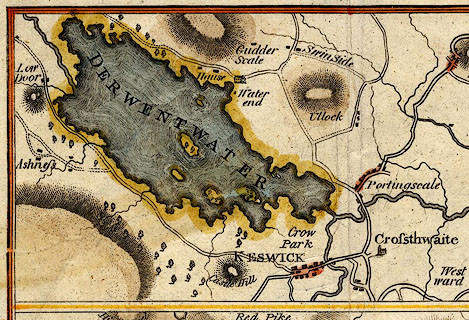 click to enlarge click to enlargeHM01Der.jpg "DERWENTWATER" item:- Dove Cottage : 2007.38.96 Image © see bottom of page |
|||||||||||||||||||||||||
|
|
||||||||||||||||||||||||||
| evidence:- | old map:- Cooke 1802 placename:- Derwent Water |
|||||||||||||||||||||||||
| source data:- | Map, The Lakes, Westmorland and Cumberland, scale about 8.5
miles to 1 inch, engravedby Neele and Son, published by
Sherwood, Jones and Co, Paternoster Road, London, 1824. click to enlarge click to enlargeGRA1Lk.jpg "Derwent W." outline with form lines; lake or tarn item:- Hampshire Museums : FA2000.62.5 Image © see bottom of page |
|||||||||||||||||||||||||
|
|
||||||||||||||||||||||||||
| evidence:- | old map:- Cooke 1802 placename:- Derwent Water |
|||||||||||||||||||||||||
| source data:- | Map, Cumberland, scale about 15.5 miles to 1 inch, by George
Cooke, 1802, bound in Gray's New Book of Roads, 1824, published
by Sherwood, Jones and Co, Paternoster Road, London, 1824. click to enlarge click to enlargeGRA1Cd.jpg "Derwent Water" outline with form lines; lake or tarn item:- Hampshire Museums : FA2000.62.2 Image © see bottom of page |
|||||||||||||||||||||||||
|
|
||||||||||||||||||||||||||
| evidence:- | old diary:- Green 1802-21 |
|||||||||||||||||||||||||
| source data:- | Diaries kept by William Green, Ambleside, Westmorland, 1802-21. goto source Diary, 6 November 1817:- "1817" "Nov 6 This book opens with an account of the pleasantest day I ever witnessed at this season of the year - I went in a boat round the water with Mr Hutton the morning was sunny, and so serene that the lake was at times so perfect a [mirour] as to reflect in the highest perfection all the surrounding objects - I must not forget to describe the [arch] in the guide which [MrH] pointed out which is made by the reflection of the rocks at Lowdore. --- afternoon drawing went with Jane to Lowdore" |
|||||||||||||||||||||||||
|
|
||||||||||||||||||||||||||
| evidence:- | old print:- Green 1804 (plate 15) placename:- Derwent Water |
|||||||||||||||||||||||||
| source data:- | Print, uncoloured aquatint, Head of Derwent Water, from Barrow Common, Borrowdale,
Cumberland, by William Green, Ambleside, Westmorland, 1804.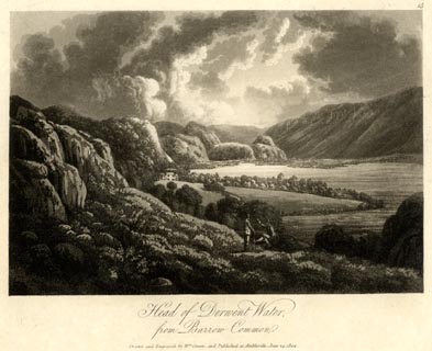 click to enlarge click to enlargeGN1615.jpg Plate 15 from a series. printed at bottom:- "Head of Derwent Water, / from Barrow Common. / Drawn and Engraved by Wm. Green, and Published at Ambleside, June 24, 1804." printed at top right:- "15" item:- Armitt Library : 2014.160 Image © see bottom of page |
|||||||||||||||||||||||||
|
|
||||||||||||||||||||||||||
| evidence:- | old text:- Gents Mag |
|||||||||||||||||||||||||
| source data:- | Magazine, The Gentleman's Magazine or Monthly Intelligencer or
Historical Chronicle, published by Edward Cave under the
pseudonym Sylvanus Urban, and by other publishers, London,
monthly from 1731 to 1922. goto source Gentleman's Magazine 1805 p.1121 "[Keswick] ... the Lake, three miles in extent, and of a shape irregularly circular, derives its principle nourishment from the rivers of Derwent and Lodore; it is profusely sprinkled with islands arrayed in rich liveries of green. ... Of the water scenery, if we consider it abstractly, much cannot be said; but the elevation of its side and front screens is without parallel in grandeur. The tour of the Lake, affording a most interesting walk of nine miles, presents every variety of which the gradual change of situation, and the unceasing interposition of new objects, are anywhere susceptible. It is a secret among the best-informed guides, and one of admirable importance, to keep as nearly as possible to the margin of the water for the purpose of a view; for, in proportion as we receded, we diminish the extent of the foreground; points of great elevation, as they render the objects beneath them scanty and diminutive, are for a similar reason not generally preferred. This lake and its environs demand more than any an attention to these rules; for it must be evident to the meanest observer, that Nature has" |
|||||||||||||||||||||||||
|
|
||||||||||||||||||||||||||
| evidence:- | old text:- Gents Mag 1805 |
|||||||||||||||||||||||||
| source data:- | goto source Gentleman's Magazine 1805 p.1122 "not here distributed her favours with an equal hand, scattering those ornaments with a fastidious frugality, around which she wantons in the most luxuriant profusion. When I first beheld the Lakes of Derwent and Bassenthwaite, I could not easily divest my mind of a persuasion that thay had once been united, and that the intervening plain had originally formed the bed of the water. Such an alteration, taken as a whole, might powerfully contribute to the scenic consistency of the valley; but perhaps an expanse so equally extensive would rather degenerate into tameness, than raise the landscape in the scale of grandeur. The character of the Mountain scenery is here happily diversified; we have the undulating velvet slope, the mouldering earth crag, the sullen grey cliff, and the rock of silvery whiteness, sparkling like agate in the interstices of the shrubby mantle with which it is overspread. The water of Derwent, which is of the clearest crystal, is sometimes curled into little eddies, and presents a surface as much agitated as that of boiling water,owing to what is technically denominated a bottom wind, the infallible omen of an approaching tempest. This ruffled face of the Lake, from whatever cause, is by no means unfrequent, and gives an interesting vivacity to the scene; it is moreover an appearance which has not escaped observation in the glownig (sic) catalogue of Virgil's beauties:" "Speluncae, vivique lacus, - mugitisque boum, Non absunt." "..." |
|||||||||||||||||||||||||
|
|
||||||||||||||||||||||||||
| evidence:- | old text:- Gents Mag 1805 |
|||||||||||||||||||||||||
| source data:- | goto source Gentleman's Magazine 1805 p.1123 "Of the lake-spread plain, prettily illuminated by the last floating beams of the Sun, we commended the whole extent: the double-coned Skiddaw frowned awfully in the distance; while the rocks of Borradaile and Lodore advanced boldly to the very borders of the Lake. The vale of Newlands, an abyss of Elysian beauty, the fanciful meanders of the Derwent and Greeta in the bottom, and the roads to Cockermouth and Penrith intersecting the mountains, contributed to variegate and soften the rougher features of this glorious landscape." "..." |
|||||||||||||||||||||||||
|
|
||||||||||||||||||||||||||
| evidence:- | old map:- Laurie and Whittle 1806 placename:- Derwent Water |
|||||||||||||||||||||||||
| source data:- | Road map, Completion of the Roads to the Lakes, scale about 10
miles to 1 inch, by Nathaniel Coltman? 1806, published by Robert
H Laurie, 53 Fleet Street, London, 1834. click to enlarge click to enlargeLw18.jpg "Derwent W." lake item:- private collection : 18.18 Image © see bottom of page |
|||||||||||||||||||||||||
|
|
||||||||||||||||||||||||||
| evidence:- | old text:- Capper 1808 placename:- Lake of Keswick placename:- Derwent Water |
|||||||||||||||||||||||||
| source data:- | Gazetteer, A Topographical Dictionary of the United Kingdom,
compiled by Benjamin Pitts Capper, published by Richard
Phillips, Bridge Street, Blackfriars, London, 1808; published
1808-29. goto source "... The lake of Keswick, or as it is more generally called, Derwent water, is a most romantic piece of scenery; ... The lake is subject to violent agitations, and often without any apparent cause. It has five islands, which being covered with verdure, add greatly to its beauty. On one is an elegant modern house. Its extent is about 3 miles by 1½broad. It abounds with excellent trout, pike, eels, and perch. ..." |
|||||||||||||||||||||||||
|
|
||||||||||||||||||||||||||
| evidence:- | old map:- Cooper 1808 placename:- Derwent Water |
|||||||||||||||||||||||||
| source data:- | Map, uncoloured engraving, Cumberland, scale about 10.5 miles to
1 inch, drawn and engraved by Cooper, published by R Phillips,
Bridge Street, Blackfriars, London, 1808. click to enlarge click to enlargeCOP3.jpg "Derwent W." outline, shaded; lake item:- JandMN : 86 Image © see bottom of page |
|||||||||||||||||||||||||
|
|
||||||||||||||||||||||||||
| evidence:- | old text:- Green 1810 placename:- Derwent Water |
|||||||||||||||||||||||||
| source data:- | Set of prints, soft ground etchings, Sixty Studies from Nature,
by William Green, Ambleside, Westmorland, drawn 1808-10,
published 1810. goto source page 57:- "..." "Derwent Water, as has been before observed, is a fine lake, and its beauties will be obvious to all who may" goto sourcepage 58:- "ride round it, or see the circumjacent country from the water, or go to Castlerigg, which is a divine situation; for whether we look towards Borrowdale or Newlands, Bassenthwaite or Skiddaw, from Castlerigg, the eye will not fail of being abundantly gratified." |
|||||||||||||||||||||||||
|
|
||||||||||||||||||||||||||
| evidence:- | old print:- Green 1810 (plate 30) placename:- Derwent Water |
|||||||||||||||||||||||||
| source data:- | Print, soft ground etching, Derwent Water from Castlerigg, St John's Castlerigg and
Wythburn, Cumberland, by William Green, Ambleside, Westmorland, 1809.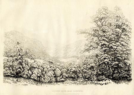 click to enlarge click to enlargeGN1230.jpg Walla Crag on the left. Plate 30 in Sixty Studies from Nature, 1810. printed at top right:- "[30]" printed at bottom:- "DERWENT WATER FROM CASTLERIGG. / Drawn &Engraved by William Green, and Published at Ambleside, Augst. 1st. 1809." watermark:- "J WHATMAN / 1813" item:- Armitt Library : A6641.30 Image © see bottom of page |
|||||||||||||||||||||||||
|
|
||||||||||||||||||||||||||
| evidence:- | old print:- Green 1810 (plate 31) placename:- Derwent Water item:- drumlin |
|||||||||||||||||||||||||
| source data:- | Print, soft ground etching, Islands on Derwent Water from Castlerigg, Keswick, Cumberland,
by William Green, Ambleside, Westmorland, 1810.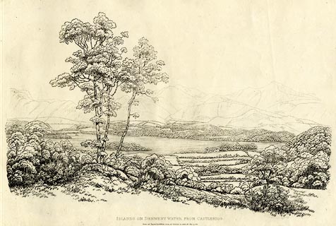 click to enlarge click to enlargeGN1231.jpg From near right to far - Derwent Isle, Lord's Island, St Herbert's Island? Plate 31 in Sixty Studies from Nature, 1810. printed at top right:- "31" printed at bottom:- "ISLANDS ON DERWENT WATER FROM CASTLERIGG. / Drawn and Engraved by William Green, and Published at Ambleside, June 24, 1810." watermark:- "J WHATMAN / 1813" item:- Armitt Library : A6641.31 Image © see bottom of page |
|||||||||||||||||||||||||
|
|
||||||||||||||||||||||||||
| evidence:- | old print:- Green 1810 (plate 32) placename:- Derwent Water item:- boat; rowing boat |
|||||||||||||||||||||||||
| source data:- | Print, soft ground etching, Derwent Water from Crow Park, Keswick, Cumberland, by
William Green, Ambleside, Westmorland, 1810.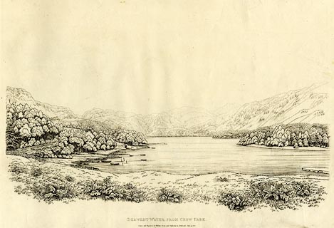 click to enlarge click to enlargeGN1232.jpg Plate 32 in Sixty Studies from Nature, 1810. printed at bottom:- "DERWENT WATER FROM CROW PARK. / Drawn and Engraved by William Green and Published at Ambleside, June 24, 1810." watermark:- "J WHATMAN / 1813" item:- Armitt Library : A6641.32 Image © see bottom of page |
|||||||||||||||||||||||||
|
|
||||||||||||||||||||||||||
| evidence:- | old print:- Green 1810 (plate 33) placename:- Derwent Water |
|||||||||||||||||||||||||
| source data:- | Print, soft ground etching, Derwent Water from Isthmus, Keswick, Cumberland, by William
Green, Ambleside, Westmorland, 1809.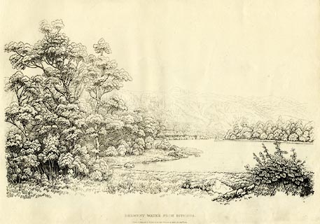 click to enlarge click to enlargeGN1233.jpg Plate 33 in Sixty Studies from Nature, 1810. printed at bottom:- "DERWENT WATER FROM ISTHMUS. / Drawn &Engraved by William Green, and Published at Ambleside, Augst. 1, 1809." watermark:- "J WHATMAN / 1813" item:- Armitt Library : A6641.33 Image © see bottom of page |
|||||||||||||||||||||||||
|
|
||||||||||||||||||||||||||
| evidence:- | old map:- Wallis 1810 (Cmd) placename:- Derwent Water |
|||||||||||||||||||||||||
| source data:- | Road map, hand coloured engraving, Cumberland, scale about 16
miles to 1 inch, by James Wallis, 77 Berwick Stree, Soho,
London, 1810. click to enlarge click to enlargeWL13.jpg "Derwent Water" outline, shaded; lake item:- Dove Cottage : 2009.81.10 Image © see bottom of page |
|||||||||||||||||||||||||
|
|
||||||||||||||||||||||||||
| evidence:- | old print:- Wilkinson 1810 (plate 40) placename:- Derwent Water item:- cattle |
|||||||||||||||||||||||||
| source data:- | Print, uncoloured soft ground etching, Derwent Water, from Applethwaite, Cumberland,
by Joseph Wilkinson, engraved by William Frederick Wells, published by R Ackermann,
Repository of Arts, 101 Strand, London, 1810.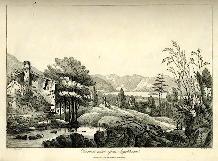 click to enlarge click to enlargeWKN122.jpg Plate 22 in Select Views in Cumberland, Westmoreland, and Lancashire. printed at bottom left, right, centre:- "The Revd. Jos. Wilkinson delt. / W. F. Wells Sculpt. / Derwent-water, from Applethwaite. / Publish'd Jany. 1. 1810. by R. Ackerman. 101. Strand. London." item:- Fell and Rock Climbing Club : MN4.22 Image © see bottom of page |
|||||||||||||||||||||||||
|
|
||||||||||||||||||||||||||
| evidence:- | poem:- Syntax 1812 |
|||||||||||||||||||||||||
| source data:- | Set of aquatints with a poem making an illustrated book, The
Tour of Dr Syntax in Search of the Picturesque, verses by
William Combe to accompany the set of prints by Thomas
Rowlandson, issued as a book published by R Ackermann, 101
Strand, London, 1812-19. Plate 16 "DOCTOR SYNTAX SKETCHING THE LAKE." relevant text:- "..." "The town of Keswick reach'd at last," "Where he his famous work prepar'd," "Of all his toil the hop'd reward." "Soon as the morn began to break," "Old Grizzle bore him to the lake," "Along its banks he gravely pac'd" "And all its various beauties trac'd;" "When, lo, a threatening storm appear'd" "Phoebus the scene no longer cheer'd:" "The dark clouds sink on ev'ry hill;" "The floating mists the valleys fill:" "Nature, transform'd, began to lour," "And threaten'd a tremendous show'r." "'I love,' he cry'd, 'to hear the rattle" "'When elements contend to battle;" "'For I insist, tho' some may flout it," "'Who write about it and about it," "'That we the picturesque may find" "'In thunder loud, or whistling wind;" "'And often, as I fully ween," "'It may be heard as well as seen;" "'For, tho' a pencil cannot trace" "'A sound as it can paint a place," "'The pen, in its poetic rage," "'Can make it figure on the page.'" |
|||||||||||||||||||||||||
|
|
||||||||||||||||||||||||||
| evidence:- | old print:- Green 1814 (plate 31) placename:- Derwent Water |
|||||||||||||||||||||||||
| source data:- | Print, tinted soft ground etching, Derwent Water and Bassenthwaite, Keswick, Cumberland,
by William Green, Ambleside, Westmorland, 1814.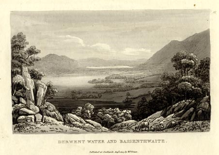 click to enlarge click to enlargeGN1031.jpg Plate 31 in Sixty Small Prints. printed at top right:- "31" printed at bottom:- "DERWENT WATER AND BASSENTHWAITE. / Published at Ambleside Augst. 1, 1814, by Wm. Green." item:- Armitt Library : A6653.31 Image © see bottom of page |
|||||||||||||||||||||||||
|
|
||||||||||||||||||||||||||
| evidence:- | old print:- Green 1814 (plate 31) placename:- Derwent Water |
|||||||||||||||||||||||||
| source data:- | Print, uncoloured soft ground etching, Derwent Water and Bassenthwaite, Keswick, Cumberland,
by William Green, Ambleside, Westmorland, 1814.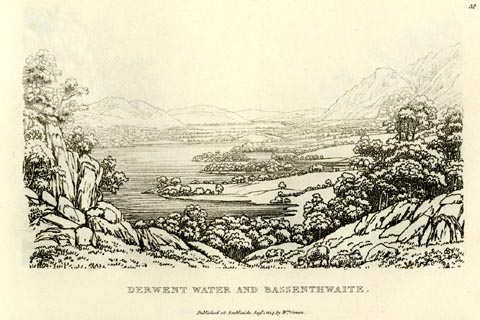 click to enlarge click to enlargeGN0931.jpg Plate 31 in Sixty Small Prints. printed at top right:- "31" printed at bottom:- "DERWENT WATER AND BASSENTHWAITE. / Published at Ambleside Augst. 1, 1814, by Wm. Green." item:- Armitt Library : A6656.31 Image © see bottom of page |
|||||||||||||||||||||||||
|
|
||||||||||||||||||||||||||
| evidence:- | old print:- Green 1814 (plate 29) placename:- Derwent Water |
|||||||||||||||||||||||||
| source data:- | Print, tinted soft ground etching, Derwent Water from Castlerigg, St John's Castlerigg
and Wythburn, Cumberland, by William Green, Ambleside, Westmorland, 1814.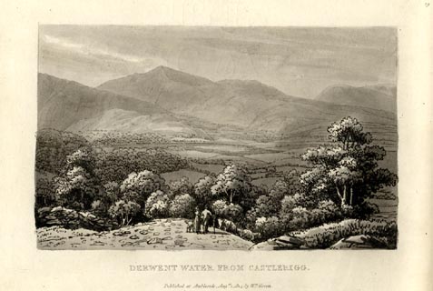 click to enlarge click to enlargeGN1029.jpg Plate 29 in Sixty Small Prints. printed at top right:- "29" printed at bottom:- "DERWENT WATER FROM CASTLERIGG. / Published at Ambleside Augst. 1, 1814, by Wm. Green." item:- Armitt Library : A6653.29 Image © see bottom of page |
|||||||||||||||||||||||||
|
|
||||||||||||||||||||||||||
| evidence:- | old print:- Green 1814 (plate 29) placename:- Derwent Water |
|||||||||||||||||||||||||
| source data:- | Print, uncoloured soft ground etching, Derwent Water from Castlerigg, St John's Castlerigg
and Wythburn, Cumberland, by William Green, Ambleside, Westmorland, 1814.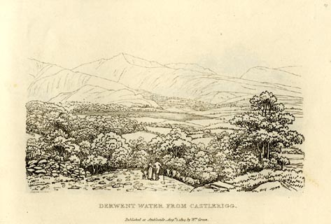 click to enlarge click to enlargeGN0929.jpg Plate 29 in Sixty Small Prints. printed at top right:- "29" printed at bottom:- "DERWENT WATER FROM CASTLERIGG. / Published at Ambleside Augst. 1, 1814, by Wm. Green." item:- Armitt Library : A6656.29 Image © see bottom of page |
|||||||||||||||||||||||||
|
|
||||||||||||||||||||||||||
| evidence:- | old print:- Green 1814 (plate 32) placename:- Derwent Water |
|||||||||||||||||||||||||
| source data:- | Print, tinted soft ground etching, Derwent Water from Lowdore, Borrowdale, Cumberland,
by William Green, Ambleside, Westmorland, 1814.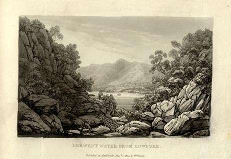 click to enlarge click to enlargeGN1032.jpg Plate 32 in Sixty Small Prints. printed at top right:- "32" printed at bottom:- "DERWENT WATER FROM LOWDORE. / Published at Ambleside Augst. 1, 1814, by Wm. Green." item:- Armitt Library : A6653.32 Image © see bottom of page |
|||||||||||||||||||||||||
|
|
||||||||||||||||||||||||||
| evidence:- | old print:- Green 1814 (plate 32) placename:- Derwent Water |
|||||||||||||||||||||||||
| source data:- | Print, uncoloured soft ground etching, Derwent Water from Lowdore, Borrowdale, Cumberland,
by William Green, Ambleside, Westmorland, 1814.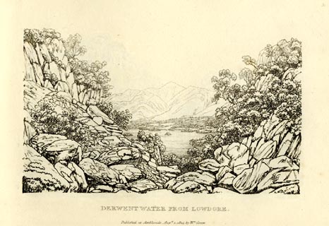 click to enlarge click to enlargeGN0932.jpg Plate 32 in Sixty Small Prints. printed at top right:- "32" printed at bottom:- "DERWENT WATER FROM LOWDORE. / Published at Ambleside Augst. 1, 1814, by Wm. Green." item:- Armitt Library : A6656.32 Image © see bottom of page |
|||||||||||||||||||||||||
|
|
||||||||||||||||||||||||||
| evidence:- | old print:- Green 1814 (plate 30) placename:- Derwent Water |
|||||||||||||||||||||||||
| source data:- | Print, tinted soft ground etching, Head of Derwent Water, Keswick, Cumberland, by
William Green, Ambleside, Westmorland, 1814.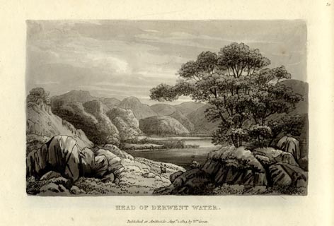 click to enlarge click to enlargeGN1030.jpg Plate 30 in Sixty Small Prints. printed at top right:- "30" printed at bottom:- "HEAD OF DERWENT WATER. / Published at Ambleside Augst. 1, 1814, by Wm. Green." item:- Armitt Library : A6653.30 Image © see bottom of page |
|||||||||||||||||||||||||
|
|
||||||||||||||||||||||||||
| evidence:- | old print:- Green 1814 (plate 30) placename:- Derwent Water |
|||||||||||||||||||||||||
| source data:- | Print, uncoloured soft ground etching, Head of Derwent Water, Keswick, Cumberland,
by William Green, Ambleside, Westmorland, 1814.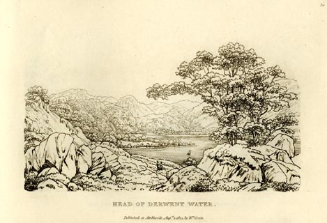 click to enlarge click to enlargeGN0930.jpg Plate 30 in Sixty Small Prints. printed at top right:- "30" printed at bottom:- "HEAD OF DERWENT WATER. / Published at Ambleside Augst. 1, 1814, by Wm. Green." item:- Armitt Library : A6656.30 Image © see bottom of page |
|||||||||||||||||||||||||
|
|
||||||||||||||||||||||||||
| evidence:- | old text:- Green 1814 placename:- Derwent Water |
|||||||||||||||||||||||||
| source data:- | Set of prints, soft ground etchings, Sixty Small Prints, with
text, A Description of a Series of Sixty Small Prints, by
William Green, Ambleside, Westmorland, 1814. goto source page 16:- "KESWICK." "..." "Derwent Water is about three miles long, and its greatest breadth not more than a mile and a half; its promontories, which stretch far into the water, are sometimes bold and rugged: a give-and-take line would make this lake nearly elliptical." "More than one half of the immediate boundary of the lake is rich meadow and pasture ground, profusely decorated with massy groups and scatterings of trees." "The Fells above Barrow common rise with magnificent grandeur from the water. Falcon Crag and Eve Crag are prodigious masses of rock, and reach nearly the summit of the mountain." "From this place, all the way to Grange, which lies at the head of the lake, the scenery is chiefly of that bold character already described at Barrow." "..." goto sourcepage 18:- "..." "Those who wish to see Derwent Water with Skiddaw for its back-ground, through a magnificent vista of rocks, will ascend to the top of Lowdore Waterfall; and the safest way is to proceed from the public-house at Lowdore to the foot-road leading to Watenlath, which leaves the Grange road a little short of the farm-house called High Lowdore; the road zig-zags the mountain's side, which pursue, till Skiddaw from it is seen through the chasm, and afterwards Derwent Water and Bassenthwaite; descend from this part of the road to the angle of the river, and follow its course a short distance, and the view here given will present itself in nature. ..." |
|||||||||||||||||||||||||
|
|
||||||||||||||||||||||||||
| evidence:- | old print:- Green 1815 placename:- Derwent Water item:- sailing boat; boat |
|||||||||||||||||||||||||
| source data:- | Print, coloured aquatint, Derwent Water from Isthmus, Keswick, Cumberland, by William
Green, Ambleside, Westmorland, 1815.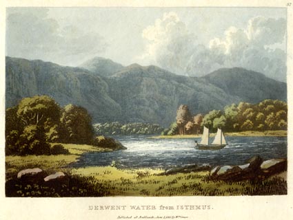 click to enlarge click to enlargeGN0534.jpg Plate 37 in Lake Scenery. printed at upper right:- "37" printed at bottom:- "DERWENT WATER from ISTHMUS. / Published at Ambleside, June 1, 1815, by Wm. Green." item:- Armitt Library : A6646.34 Image © see bottom of page |
|||||||||||||||||||||||||
|
|
||||||||||||||||||||||||||
| evidence:- | old print:- Green 1815 placename:- Derwent Water |
|||||||||||||||||||||||||
| source data:- | Print, coloured aquatint, Derwent Water from Barrow Common, Borrowdale, Cumberland,
by William Green, Ambleside, Westmorland, 1815.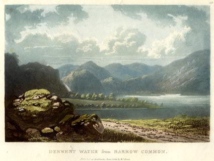 click to enlarge click to enlargeGN0535.jpg Plate 38 in Lake Scenery. printed at upper right:- "38" printed at bottom:- "DERWENT WATER from BARROW COMMON. / Published at Ambleside, June 1, 1815, by Wm. Green." item:- Armitt Library : A6646.35 Image © see bottom of page |
|||||||||||||||||||||||||
|
|
||||||||||||||||||||||||||
| evidence:- | old print:- Green 1815 placename:- Derwent Water |
|||||||||||||||||||||||||
| source data:- | Print, coloured aquatint, Saddleback from Derwent Water, Cumberland, by William Green,
Ambleside, Westmorland, 1815.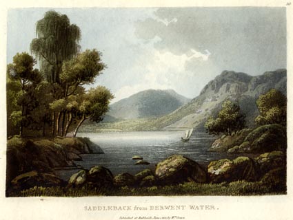 click to enlarge click to enlargeGN0536.jpg Plate 39 in Lake Scenery. printed at upper right:- "39" printed at bottom:- "SADDLEBACK from DERWENT WATER. / Published at Ambleside, June 1, 1815, by Wm. Green." item:- Armitt Library : A6646.36 Image © see bottom of page |
|||||||||||||||||||||||||
|
|
||||||||||||||||||||||||||
| evidence:- | old print:- Green 1815 placename:- Derwent Water |
|||||||||||||||||||||||||
| source data:- | Print, coloured aquatint, Derwent Water from Castle Crag, Borrowdale, Cumberland,
by William Green, Ambleside, Westmorland, 1815.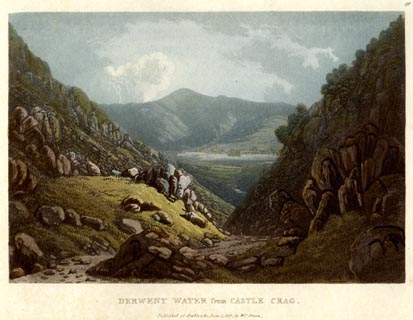 click to enlarge click to enlargeGN0537.jpg Plate 40 in Lake Scenery. printed at upper right:- "40" printed at bottom:- "DERWENT WATER from CASTLE CRAG. / Published at Ambleside, June 1, 1815, by Wm. Green." item:- Armitt Library : A6646.37 Image © see bottom of page |
|||||||||||||||||||||||||
|
|
||||||||||||||||||||||||||
| evidence:- | old print with text:- Farington 1816 placename:- Derwentwater placename:- Keswick Lake |
|||||||||||||||||||||||||
| source data:- | Print, uncoloured engraving and descriptive text, Derwentwater, from Brough Top, Cumberland,
drawn by Joseph Farington, engraved by F R Hay, published by T Cadell and W Davies,
Strand, London, 1815.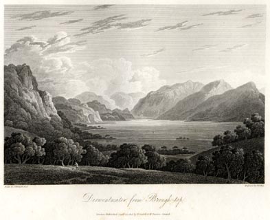 click to enlarge click to enlargeFA0410.jpg printed, bottom left, right, centre "Drawn by J. Farington R.A. / Engraved by F. R. Hay. / Derwentwater, from Brough Top. / London Published Septr. 15, 1815, by T. Cadell &W. Davies, Strand." Descriptive text:- "DERWENTWATER FROM BROUGH TOP" "DERWENT-WATER, or KESWICK LAKE, as it is frequently termed from its vicinity to the town of Keswick, is of an irregular form, somewhat approaching an oval, and about three miles in length, by one and a half in width. By many tourists, this Lake has been supposed to be the finest in the North of England; but for grandeur and sublimity Ulswater is now allowed to claim the pre-eminence. Derwentwater, however, has this decided advantage over the other Lakes, viz. that it immediately appears to be what it is. The dark frowning Skiddaw "forms its northern boundary, and seems to rise almost immediately from its shore, though it is at the nearest point half a league distant, and the town of Keswick intervenes. One long mountain, along which the road forms a fine terrace, reaches nearly along the whole of its western side: and through the space between this and the next mountain, which in many points of view appears like a lower segment of a prodigious circle, a lovely vale is seen which runs up among the hills." But the pride of Derwentwater is the head, where the mountains of Borrowdale bound the prospect in a manner singularly wild and grand. Our view, which is taken from Brough Top (an eminence on the left of the road to Keswick from Ambleside,) will convey an accurate idea of its general features. "The whole" says Mrs. Radcliffe, "is seen at one glance, expanding within an amphitheatre of mountains, rocky but not vast; broken into many fantastic shapes, peaked, splintered, impending, and sometimes pyramidal, opening by narrow vallies to the view of rocks that rise immediately byeond (sic), and are again overlooked by others. The precipices seldom overhang the water, but are arranged at some distance; and the shores swell with woody eminences, or sink into green pastoral margins. Masses of wood also appear among the cliffs feathering them to their summits" (as may be seen in the foreground on the left of our engraving;) "and a white cottage sometimes peeps from out their skirts, seated on the smooth knoll of a pasture, and looking so exquisitely picturesque, as to seem placed there purposely to adorn it. The Lake in turn faithfully reflects the whole picture; and so even and brilliantly pellucid is its surface, that it rather heightens than obscures the colouring."" item:- Armitt Library : A6666.10 Image © see bottom of page |
|||||||||||||||||||||||||
|
|
||||||||||||||||||||||||||
| evidence:- | old print with text:- Farington 1816 |
|||||||||||||||||||||||||
| source data:- | Print, uncoloured engraving and descriptive text, View on the Road from Keswick to
Borrowdale, Cumberland, drawn by Joseph Farington, engraved by F R Hay, published
by T Cadell and W Davies, Strand, London, 1815.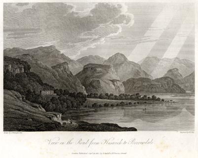 click to enlarge click to enlargeFA0411.jpg printed, bottom left, right, centre "Drawn by J. Farington R.A. / Engraved by F. R. Hay. / View on the Road from Keswick to Borrowdale. / London Published Septr. 15, 1815, by T. Cadell &W. Davies, Strand." Descriptive text:- "... The peaceful Lake of Derwentwater touches the shore, above which runs the terrace road. ... The glassy smoothness of the Lake is finely contrasted by rugged crags, and the lofty mountains of Borrowdale, which form a sublime back-ground to the scene represented in our plate." item:- Armitt Library : A6666.11 Image © see bottom of page |
|||||||||||||||||||||||||
|
|
||||||||||||||||||||||||||
| evidence:- | old print with text:- Farington 1816 placename:- Derwentwater |
|||||||||||||||||||||||||
| source data:- | Print, uncoloured engraving and descriptive text, East Side of Derwentwater, looking
towards Lowdore Waterfall, Borrowdale, Cumberland, drawn by Joseph Farington, engraved
by F R Hay, published by T Cadell and W Davies, Strand, London, 1815.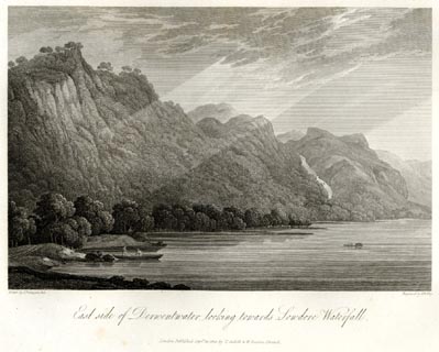 click to enlarge click to enlargeFA0414.jpg printed, bottom left, right, centre "Drawn by J. Farington R.A. / Engraved by F. R. Hay. / East side of Derwentwater, looking towards Lowdore Waterfall. / London Published Septr. 15, 1815, by T. Cadell &W. Davies, Strand." Descriptive text:- "EAST SIDE OF DERWENTWATER LOOKING TOWARDS LOWDORE WATERFALL." "THE prominent features of this Lake, as described in the view of "Derwentwater from Brough Top," are here seen to considerable advantage. The view of Derwentwater on the east side, looking up towards Lowdore Waterfall, is one of the most beautiful in the whole Lake. the most favourable time to ride on this side is about ten o'clock." item:- Armitt Library : A6666.14 Image © see bottom of page |
|||||||||||||||||||||||||
|
|
||||||||||||||||||||||||||
| evidence:- | old print with text:- Farington 1816 placename:- Derwentwater placename:- Lake of Keswick item:- bottom wind |
|||||||||||||||||||||||||
| source data:- | Print, uncoloured engraving and descriptive text, Skiddaw and Derwentwater from Lowdore
Waterfall, Borrowdale, Cumberland, drawn by Joseph Farington, engraved by J Scott,
published by T Cadell and W Davies, Strand, London, 1815.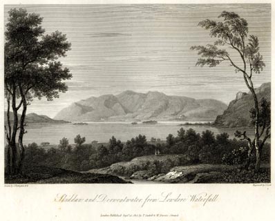 click to enlarge click to enlargeFA0415.jpg printed, bottom left, right, centre "Drawn by J. Farington R.A. / Engraved by J. Scott. / Skiddaw and Derwentwater from Lowdore Waterfall. / London Published Septr. 15, 1815, by T. Cadell &W. Davies, Strand." Descriptive text:- "SKIDDAW AND DERWENTWATER, FROM LOWDORE WATERFALL." "THIS plate offers a view of the mountain of Skiddaw, and the lake of Keswick, or Derwentwater, as seen from the cataract of Lowdore. ..." "Much of the beauty of this Lake is derived from the islands, four or five in number, which are interspersed in it: the principal of these are, Lord's Island and that of St. Herbert. ..." "..." "But however smooth the surface of this beautiful Lake generally appears, its waters are sometimes ag[ ]tated in an extraordinary manner, though without any apparent cause; and, on a perfectly calm day, are seen to swell in high waves, moving from west to east. This singular phenomenon, for which no rational account has hitherto been given, is denominated a Bottom-Wind. The time of its duration is various: sometimes the swell continues for an hour or two only; at others it will last for nearly a whole day, though scarcely a breath of air is felt in the vicinity of the Lake. The bottom-wind usually prevails a day or two previous to a storm: and during its continuance it is that the floating island rises to the surface. One feature peculiar to Derwentwater is, that, from its breadth being so considerable a proportion to its length, it nearly retains its form, from whatever point it may be viewed, never assuming the appearance of a river." item:- Armitt Library : A6666.15 Image © see bottom of page |
|||||||||||||||||||||||||
|
|
||||||||||||||||||||||||||
| evidence:- | old map:- Otley 1818 placename:- Derwent |
|||||||||||||||||||||||||
| source data:- | Map, uncoloured engraving, The District of the Lakes,
Cumberland, Westmorland, and Lancashire, scale about 4 miles to
1 inch, by Jonathan Otley, 1818, engraved by J and G Menzies,
Edinburgh, Scotland, published by Jonathan Otley, Keswick,
Cumberland, et al, 1833.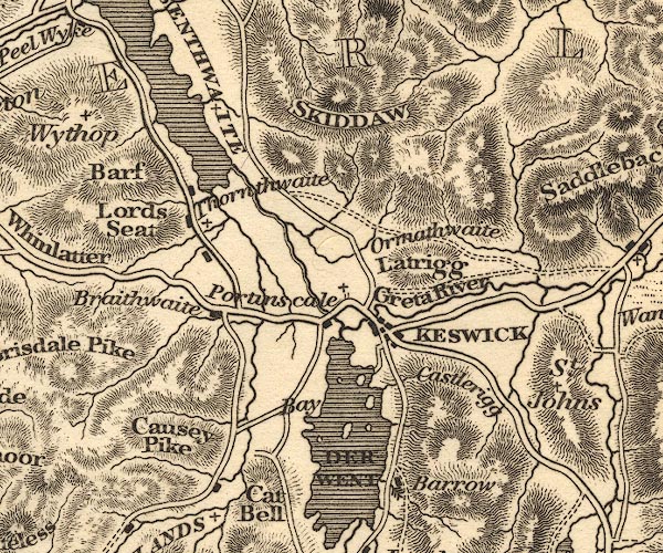 OT02NY22.jpg item:- JandMN : 48.1 Image © see bottom of page |
|||||||||||||||||||||||||
|
|
||||||||||||||||||||||||||
| evidence:- | old map:- Hall 1820 (Cmd) placename:- Derwent Water |
|||||||||||||||||||||||||
| source data:- | Map, hand coloured engraving, Cumberland, scale about 21 miles
to 1 inch, engraved by Sidney Hall, published by S Leigh, 18
Strand, London, 1820-31. click to enlarge click to enlargeHA14.jpg "Derwent Wr." outline, shaded; lake item:- JandMN : 91 Image © see bottom of page |
|||||||||||||||||||||||||
|
|
||||||||||||||||||||||||||
| evidence:- | old print:- Westall 1820 placename:- Keswick Lake |
|||||||||||||||||||||||||
| source data:- | Print, uncoloured mezzotint, Keswick Lake, from Applethwaite, Cumberland, drawn and
engraved by William Westall, published by Rodwell and Martin, New Bond Street, London,
1820.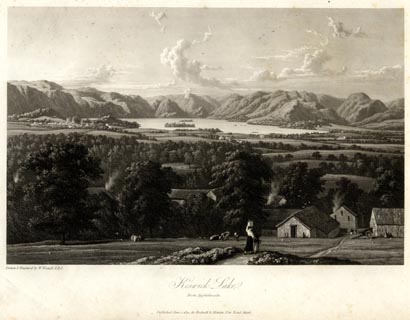 click to enlarge click to enlargeWTL101.jpg printed, bottom left, centre "Drawn & Engraved by W. Westall A.R.A. / Keswick Lake. / From Applethwaite. / Published June 1, 1820, by Rodwell &Martin, New Bond Street." item:- Armitt Library : A6671.1 Image © see bottom of page |
|||||||||||||||||||||||||
|
|
||||||||||||||||||||||||||
| evidence:- | old print:- Westall 1820 placename:- Keswick Lake |
|||||||||||||||||||||||||
| source data:- | Print, uncoloured mezzotint, Keswick Lake, from Saddleback, Cumberland, drawn and
engraved by William Westall, published by Rodwell and Martin, New Bond Street, London,
1820.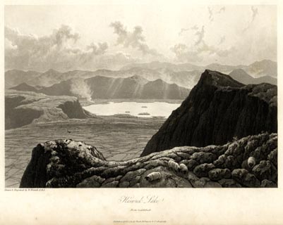 click to enlarge click to enlargeWTL103.jpg printed, bottom left, centre "Drawn & Engraved by W. Westall A.R.A. / Keswick Lake. / From Saddleback. / Published April 1, 1820, by Hurst, Robinson &Co. Cheapside." item:- Armitt Library : A6671.3 Image © see bottom of page |
|||||||||||||||||||||||||
|
|
||||||||||||||||||||||||||
| evidence:- | old print:- Westall 1820 placename:- Keswick Lake |
|||||||||||||||||||||||||
| source data:- | Print, uncoloured mezzotint, Keswick Lake, from the North Side of Castlelet, ie from
Castle Head, Cumberland, drawn and engraved by William Westall, published by Rodwell
and Martin, New Bond Street, London, 1820.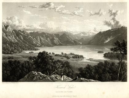 click to enlarge click to enlargeWTL105.jpg printed, bottom left, centre "Drawn & Engraved by W. Westall A.R.A. / Keswick Lake, / from the North side of Castlelet. / Published July 1, 1819, by Hurst, Robinson &Co. Cheapside." item:- Armitt Library : A6671.5 Image © see bottom of page |
|||||||||||||||||||||||||
|
|
||||||||||||||||||||||||||
| evidence:- | old print:- Westall 1820 placename:- Keswick Lake |
|||||||||||||||||||||||||
| source data:- | Print, uncoloured mezzotint, Keswick Lake, from Barrow Common, Cumberland, drawn and
engraved by William Westall, published by Rodwell and Martin, New Bond Street, London,
1820.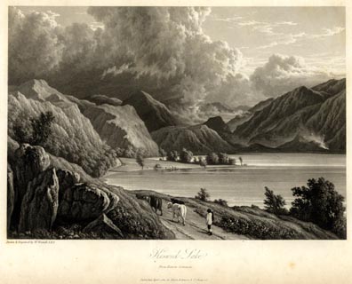 click to enlarge click to enlargeWTL106.jpg printed, bottom left, centre "Drawn & Engraved by W. Westall A.R.A. / Keswick Lake, / from Barrow Common. / Published April 1, 1820, by Hurst, Robinson &Co. Cheapside." item:- Armitt Library : A6671.6 Image © see bottom of page |
|||||||||||||||||||||||||
|
|
||||||||||||||||||||||||||
| evidence:- | old print:- Westall 1820 placename:- Keswick Lake |
|||||||||||||||||||||||||
| source data:- | Print, uncoloured mezzotint, Keswick Lake, seen from above Lowdore, Borrowdale, Cumberland,
drawn and engraved by William Westall, published by Rodwell and Martin, New Bond Street,
London, 1820.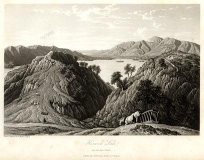 click to enlarge click to enlargeWTL108.jpg printed, bottom left, centre "Drawn & Engraved by W. Westall A.R.A. / Keswick Lake, / seen from above Lowdore / Published July 1, 1819, by Hurst, Robinson &Co. Cheapside." item:- Armitt Library : A6671.8 Image © see bottom of page |
|||||||||||||||||||||||||
|
|
||||||||||||||||||||||||||
| evidence:- | old print:- Westall 1820 placename:- Keswick Lake |
|||||||||||||||||||||||||
| source data:- | Print, uncoloured mezzotint, Keswick Lake, near Waterend, Cumberland, drawn and engraved
by William Westall, published by Rodwell and Martin, New Bond Street, London, 1820.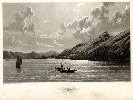 click to enlarge click to enlargeWTL109.jpg printed, bottom left, centre "Drawn & Engraved by W. Westall A.R.A. / Keswick Lake, / [ ] / Published June 1, 1820, by Hurst, Robinson &Co. Cheapside." item:- Armitt Library : A6671.9 Image © see bottom of page |
|||||||||||||||||||||||||
|
|
||||||||||||||||||||||||||
| evidence:- | old print:- Westall 1820 placename:- Keswick Lake |
|||||||||||||||||||||||||
| source data:- | Print, uncoloured mezzotint, Keswick Lake, from the East Side, Cumberland, twilight,
drawn and engraved by William Westall, published by Rodwell and Martin, New Bond Street,
London, 1820.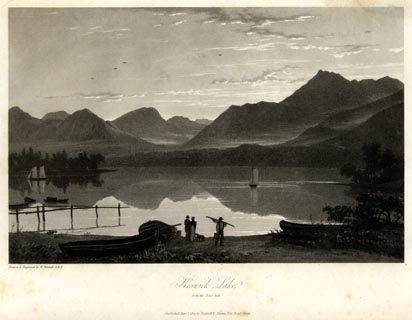 click to enlarge click to enlargeWTL111.jpg printed, bottom left, centre "Drawn & Engraved by W. Westall A.R.A. / Keswick Lake, / from the East side. / Published June 1, 1820, by Hurst, Robinson &Co. Cheapside." item:- Armitt Library : A6671.11 Image © see bottom of page |
|||||||||||||||||||||||||
|
|
||||||||||||||||||||||||||
| evidence:- | outline view:- Otley 1823 (8th edn 1849) placename:- Derwent Water |
|||||||||||||||||||||||||
| source data:- | Engraving, outline view of mountains, Derwent Water from Crow Park, drawn by T Binns,
engraved by O Jewitt, opposite p.10 of A Descriptive Guide of the English Lakes, by
Jonathan Otley, 8th edition, 1849.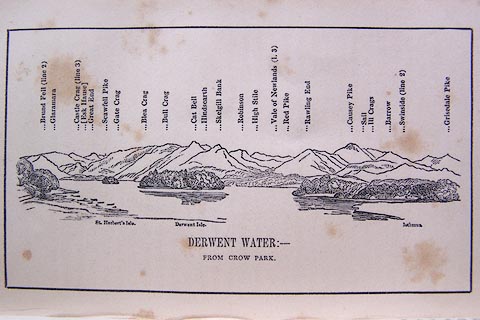 click to enlarge click to enlargeO80E06.jpg item:- Armitt Library : A1180.7 Image © see bottom of page |
|||||||||||||||||||||||||
|
|
||||||||||||||||||||||||||
| evidence:- | descriptive text:- Otley 1823 (5th edn 1834) placename:- Derwent Lake item:- floating island; bottom wind; wind; earthquake; fishing; trout; pike; perch; eel; ice; skating; depth, Derwent Water; echoes; flood; geology; painting; horse; viewpoint |
|||||||||||||||||||||||||
| source data:- | Guide book, A Concise Description of the English Lakes, the
mountains in their vicinity, and the roads by which they may be
visited, with remarks on the mineralogy and geology of the
district, by Jonathan Otley, published by the author, Keswick,
Cumberland now Cumbria, by J Richardson, London, and by Arthur
Foster, Kirkby Lonsdale, Cumbria, 1823; published 1823-49,
latterly as the Descriptive Guide to the English Lakes. goto source Page 17:- "DERWENT LAKE," "Near Keswick, is of the most agreeable proportions. In breadth it exceeds any of the neighbouring lakes, being nearly a mile and a half; although its whole length is little more than three miles. Lakes of greater length generally extend too far from that mountain scenery, which is so conducive to their importance; but Derwent Lake appears entirely encircled; and visiters (sic) are at a loss which to admire most, the broken rocky mountains of Borrowdale on the one hand, or the smooth flowing lines of Newlands on the other; while the majestic Skiddaw closes up the view to the north." "The islands are of a more proportionate size, and disposed at better distances, than those in any of the neighbouring lakes. The largest, called Lord's Isle, ... This, and the smaller island called Rampsholm, form part of the late Earl of Derwentwater's sequestrated estate, ..." "The Vicar's Isle, ..." goto sourcePage 18:- "... For some years it was called Pocklington's Island, ... and is sometimes by way of pre-eminence called Derwent Isle." "One, nearer the middle of the lake, is called St. Herbert's Isle, ..." "There are other small islets; as, Otter Isle, situated in a bay near the head of the lake, the views from which have been much admired; a piece of rock called Tripetholm, and two others known by the name of Lingholms." "Besides these permanent islands, an occasional one is sometimes observed, called the Floating Island: ..." goto sourcePage 19:- "..." "Another peculiarity has been attributed to this lake in what is called the Bottom Wind: which has been described as an agitation of the water occurring when no wind can be felt on any part of the lake. It has been supposed to originate at the bottom of the water; and some, associating this with the last mentioned phenomenon, have ascribed both to those subterranean convulsions by which earthquakes are produced. Although it be admitted, that the waves are sometimes greater than could be reasonably expected, from any wind perceivable at the time; yet, it may be doubted whether they are ever formed when no wind is stirring: and if such a term as 'Bottom wind' must still be retained, I think it ought to be referred to the bottom of the atmosphere, rather than the bottom of the lake." "The depth of Derwent Lake does not in any part exceed fourteen fathoms: a great portion of it scarcely one fourth of that measure. It is supplied chiefly from Borrowdale, and forms a reservoir for the water, which in heavy rains pours down the steep mountains on every side; by which means its surface is often raised six or seven feet; and in an extraordinary case has been known to rise a perpendicular height of eight feet, above its lowest water" goto sourcePage 20:- "mark. At such times the meadows are overflowed, all the way between this lake and Bassenthwaite. Its surface being large in proportion to its depth, causes it to be sooner cooled down to the freezing point; and it frequently affords a fine field for the skaiter (sic). In January 1814, the ice attained the thickness of ten inches." "The fish of this lake are trout, pike, perch, and eels. The trout, which are very good, are taken by angling, in the months of April and May; the pike and perch during the whole summer." "It would be superfluous to enter into a description or enumeration of the different views on this lake: many attempts have been made to describe them - but they must be seen to be duly appreciated." "Parties navigating the lake may be landed upon the different islands, and also to view the cascades at Barrow and Lowdore: at the latter place is a public-house where a cannon is kept for the echo, which on a favourable opportunity is very fine; the sound being reverberated from the rocks, encompassing the valley, at intervals proportioned to their respective distances. ..." goto sourcePage 42:- "Winding round Shepherd's Crag towards the top of the fall [Lowdore Cascade], and looking between two finely wooded side screens, through the chasm in which the water is precipitated, a part of Derwent lake with its islands, beyond it the vale of Keswick, ornamented with white buildings, and the whole surmounted by the lofty Skiddaw - forms a picture in its kind scarcely to be equalled." "..." goto sourcePage 122:- "ROUND DERWENT LAKE." "A delightful excursion may be made round Derwent lake, either on horseback or in a carriage. The road lies at the foot of the wooded park of Derwentwater, with the lake on the right, and the lofty rocks of Wallow Crag and Falcon Crag on the left; and in many places it commands excellent views. One, much admired, is on emerging from the woods to the more open common, where the road lies just above the margin of the lake. Two miles from Keswick, a road on the left leads to Watendleth, and we pass Barrow House, the beautiful summer residence of Joseph Pocklington, Esq. A fine cascade behind the house may be seen by strangers on application at the lodge. Another mile brings us to Lowdore,- famous for its waterfall. Here is a neat public-house, where a cannon is kept for the echo which is very fine, especially in a still evening. Rather more than four miles from Keswick, we have the hamlet called the Grange, upon the opposite bank of the river." "About Lowdore and Grange, the draftsman will find employment for his pencil; and the geologist" goto sourcePage 123:- "will observe the transition, from the blackish clay slate upon which he treads, to the more variously aggregated and paler-coloured rocks on his left hand and before him." "The bridge at Grange might be crossed, as the shortest route; but it may be recommended to proceed forwards another mile to the Bowder Stone - a fragment of rock above twenty yards in length, and half as much in height,- remarkable for being curiously poised upon one of its angles, with a little more support towards one end. But it is not merely for the sight of this stone, that travellers are advised to advance so far. It is chiefly for the prospect here obtained into the interior of Borrowdale, which expands itself as far as Rosthwaite; beyond which the vale is divided into two parts; the one branching off towards Grasmere and Langdale, the other towards Wasdale and Buttermere." "Returning to Grange, the road then crosses the river, and is carried along a pleasant elevation above the woods of Lady William Gordon, the house, formerly called Water End, now Derwentwater Bay, standing sweetly sheltered on the margin of the lake. From this elevation, the lake, with its islands, bays, and promontories, is seen to great advantage. The road then crossing the pleasant vale of Newlands, joins the Cockermouth road at Portinscale, and reaches Keswick in a circuit of 12 miles."
|
|||||||||||||||||||||||||
|
|
||||||||||||||||||||||||||
| evidence:- | :- Hullmandel 1826 placename:- Derwent Water |
|||||||||||||||||||||||||
| source data:- | 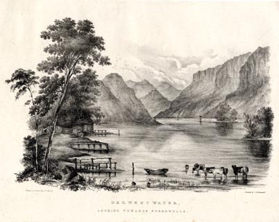 click to enlarge click to enlargeHUL101.jpg Print, uncoloured lithograph, Derwent Water, looking towards Borrowdale, Cumberland, drawn by Miss I Cropper and Miss S Atkins, published by Charles Hullmandel, London, 1826. "Drawn on Stone by I.C & S.A. / Printed by C. Hullmandel. / DERWENT WATER, / LOOKING TOWARDS BORROWDALE." item:- Armitt Library : ALMA370.1 Image © see bottom of page |
|||||||||||||||||||||||||
|
|
||||||||||||||||||||||||||
| evidence:- | old map:- Leigh 1830 map placename:- |
|||||||||||||||||||||||||
| source data:- | Map, Derwent Water and Borrowdale, scale about 1.5 miles to 1
inch, engraved by Josiah Neele, 352 Strand, published by Leigh
and Son, 421 Strand, London, about 1830.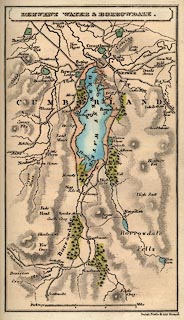 click to enlarge click to enlargeLE05.jpg item:- JandMN : 1.4 Image © see bottom of page |
|||||||||||||||||||||||||
|
|
||||||||||||||||||||||||||
| evidence:- | old print:- Rose 1832-35 placename:- Derwentwater |
|||||||||||||||||||||||||
| source data:- | Print, engraving, Derwentwater and Village of Grange, from the Entrance to Borrowdale,
by Thomas Allom, engraved by W le Petit, 1833.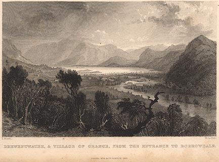 click to enlarge click to enlargeR208.jpg "Derwentwater and the Village of Grange, from the Entrance to Borrowdale" item:- JandMN : 96.5 Image © see bottom of page |
|||||||||||||||||||||||||
|
|
||||||||||||||||||||||||||
| evidence:- | descriptive text:- Ford 1839 (3rd edn 1843) placename:- Derwent Water item:- depth, Derwent Water |
|||||||||||||||||||||||||
| source data:- | Map, uncoloured engraving, Derwent Water and Vale of Keswick,
engraved by W H Lizars, published by Charles Thurnam, Carlisle,
and by R Groombridge, 5 Paternoster Row, London, 3rd edn 1843. goto source plate:- 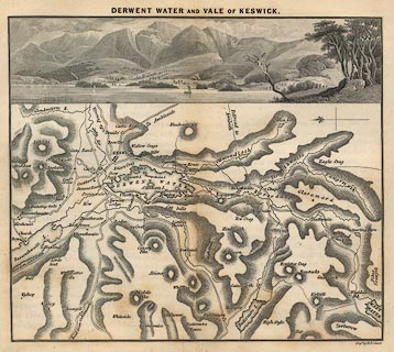 click to enlarge click to enlargeFD04.jpg Map and print, uncoloured engraving, Derwent Water and Vale of Keswick, engraved by W H Lizars, published by Charles Thurnham, Carlisle, and by R Groombridge, 5 Paternoster Row, London, 1843. "DERWENT WATER AND VALE OF KESWICK." goto sourcePage 53:- "..." "We shall now hasten to describe the lake, which is the chief object of attraction, ..." "DERWENT WATER" "Is of an oval shape, three miles long, and one mile and a half broad. Its waters abound with trout, pike, perch, and eels; and are separated from Bassenthwaite by low, flat, marshy, meadow lands. This lake is surrounded by magnificence. On the south, rise the fantastic mountains of Borrowdale; to the north, the solitary majesty of Skiddaw uprears his lordly head; on the east, the steeps of Wallow Crag, Lowdore, and the Gowdar Crag; and on the west, Cat Bells and the clustering mountains of Newlands. It has been said to partake of the majesty of Ulles Water, and the lovely scenery of Windermere. The near views of this lake are from Crow Park, Friar's Crag, Stable Field, and the Vicarage; the more distant are from Latrigg, Ormathwaite, Applethwaite, and along the foot of Skiddaw towards Bassenthwaite. Good bird's-eye views are presented from Castle Hill, Ashness, and Lowdore." "The islands rather take from, than add to the attractions of the water. Their uniform roundness and thickness of foliage, with the manner of" goto sourcePage 54:- "their disposition, when viewed with any of the grander features about the lake, are deformities. ..." "In riding round the lake, numberless are the views of beauty, magnificence, and sublimity, which will strike the traveller of taste and discernment. Leaving Keswick and proceeding southwards along the eastern side, you have the grandest side-screens" goto sourcePage 55:- "and foregrounds in Wallow Crag and the several precipices in that range, which sometimes come magnificently forward, sometimes retire and lean to the east, their grey fronts often enlivened by green woods, and combining with the water - the small meadowy promontories and tree-clad eminences - with Glaramara and his azure compeers in Borrowdale. The first we shall particularise is one of the lake, as seen over Lord's Island, Castle Head being on the left and Friar Crag on the right of that island, and beyond, Causey Pike with Newlands lying between Grizedale and Cat Bells. ... Gowdar" goto sourcePage 56:- "Crag upon the left, broad, bold, and finely marked, rearing its aged head to an enormous height, overlooks the embattled projection of Shepherd's Crag on the right. These rocks, exhibiting surfaces of grandeur, are finely contrasted and beautifully enriched with oak, ash, and birch, of which some are large and stately, others picturesque and wild, fantastically expanding over, and impending from, and partially obscuring rocks where vegetation could scarcely be expected. ... Along the western side of the lake are two terrace-roads, the lower one of which is commonly used, and commands a succession of scenes replete with gratification. The retrospective views are into Borrowdale, but in front are the islands studding the glassy mirror of the lake, the finely-embayed coast about Water End and Brandelow, with the deeply-indented shores of the rich country beyond, and the town of Keswick overlooked by Lonscale Fell, Skiddaw, and Blencathra. Passing by Derwent Bank and Lodge with Foe Park, you come to Portinscale, a small village on the gentle swell of a hill, which rises from the lake and river. From" goto sourcePage 57:- "the neighbouring grounds that are higher than the houses, may be viewed the lakes of Derwent Water and the Bassenthwaite, with all the finely-wooded and fertile country reaching from Swineside to Skiddaw, a scene which for extent, beauty, and sublimity, can rarely be equalled. Hence you cross the Long Bridge over the Derwent, and passing the church by the high-road or through the meadows of Howray, arrive again at Keswick." "The boating on the lake presents the same grand objects from a different surface and point of view. ... We should, therefore, recommend the excursion to be left to the discretion of the boatmen, who are also guides. If it could be made by moonlight, the gratification would be intense." goto sourcePage 177:- "A TABLE" "OF THE LENGTH, BREADTH, &c. OF THE LAKES," "COLLECTED FROM DIFFERENT AUTHORITIES."
Image © see bottom of page |
|||||||||||||||||||||||||
|
|
||||||||||||||||||||||||||
| evidence:- | old map:- Ford 1839 map placename:- Derwent Water |
|||||||||||||||||||||||||
| source data:- | Map, uncoloured engraving, Derwent Water and Vale of Keswick,
engraved by W H Lizars, published by Charles Thurnam, Carlisle,
and by R Groombridge, 5 Paternoster Row, London, 3rd edn 1843. click to enlarge FD04.jpg "DERWENT WATER AND VALE OF KESWICK" item:- JandMN : 100.3 Image © see bottom of page |
|||||||||||||||||||||||||
|
|
||||||||||||||||||||||||||
| evidence:- | old map:- Ford 1839 map placename:- Derwent Water |
|||||||||||||||||||||||||
| source data:- | Map, uncoloured engraving, Map of the Lake District of
Cumberland, Westmoreland and Lancashire, scale about 3.5 miles
to 1 inch, published by Charles Thurnam, Carlisle, and by R
Groombridge, 5 Paternoster Row, London, 3rd edn 1843.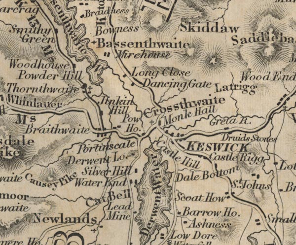 FD02NY22.jpg "Derwent Water" Outline with form lines. item:- JandMN : 100.1 Image © see bottom of page |
|||||||||||||||||||||||||
|
|
||||||||||||||||||||||||||
| evidence:- | old drawing:- Aspland 1840s-60s placename:- Derwent Water |
|||||||||||||||||||||||||
| source data:- | Drawing, pencil, yachts and a crag, Derwent Water, Cumberland, by Theophilus Lindsey
Aspland, 30 August 1845. click to enlarge click to enlargeAS0216.jpg "Aug 30. 1845 / Derwent Water" page number "11" item:- Armitt Library : 1958.488.16 Image © see bottom of page |
|||||||||||||||||||||||||
|
|
||||||||||||||||||||||||||
| evidence:- | old drawing:- Aspland 1840s-60s placename:- Derwent Water |
|||||||||||||||||||||||||
| source data:- | Drawing, pencil, Derwent Water, Borrowdale, Cumbria, by Theophilus Lindsey Aspland,
5 September 1845.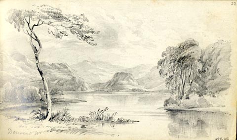 click to enlarge click to enlargeAS0225.jpg "Derwent Wr" page number "22" item:- Armitt Library : 1958.488.25 Image © see bottom of page |
|||||||||||||||||||||||||
|
|
||||||||||||||||||||||||||
| evidence:- | old drawing:- Aspland 1840s-60s |
|||||||||||||||||||||||||
| source data:- | Drawing, pencil, Derwent Water, Borrowdale, Cumberland, by Theophilus Lindsey Aspland,
27 July 1846.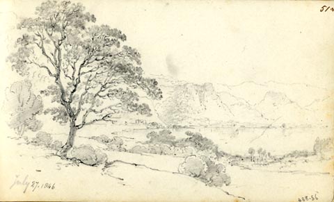 click to enlarge click to enlargeAS0256.jpg page number "51+" "July 27. 1846" item:- Armitt Library : 1958.488.56 Image © see bottom of page |
|||||||||||||||||||||||||
|
|
||||||||||||||||||||||||||
| evidence:- | old map:- Hudson 1842 (4th edn 1853) |
|||||||||||||||||||||||||
| source data:- | Map, uncoloured engraving, The Vicinity of Keswick, engraved by
W Banks, Edinburgh, published by John Hudson, Kendal,
Westmorland, 1853.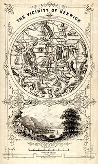 click to enlarge click to enlargeHUD1M2.jpg Circular map, with a vignette view of Derwent Water below. Tipped in opp p.68 in A Complete Guide to the Lakes, edited John Hudson. printed at top:- "THE VICINITY OF KESWICK." printed at bottom:- "W. Banks, sc. Edinr." item:- JandMN : 327.5 Image © see bottom of page |
|||||||||||||||||||||||||
|
|
||||||||||||||||||||||||||
| evidence:- | old map:- Wyld 1847 placename:- Derwentwater |
|||||||||||||||||||||||||
| source data:- | Map, uncoloured engraving, Thirlmere, Derwentwater, and
Bassenthwaite Lakes, scale about 3.5 miles to 1 inch, by James
Wyld, published by John Johnstone, Paternoster Row, London, et
al, 1847.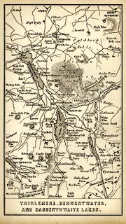 click to enlarge click to enlargeWLD3M2.jpg printed at bottom:- "THIRLMERE, DERWENTWATER, / AND BASSENTHWAITE LAKES." item:- Armitt Library : A1201.65 Image © see bottom of page |
|||||||||||||||||||||||||
|
|
||||||||||||||||||||||||||
| evidence:- | old text:- Gents Mag item:- tree felling |
|||||||||||||||||||||||||
| source data:- | Magazine, The Gentleman's Magazine or Monthly Intelligencer or
Historical Chronicle, published by Edward Cave under the
pseudonym Sylvanus Urban, and by other publishers, London,
monthly from 1731 to 1922. goto source Gentleman's Magazine 1849 part 2 p.138 "..." "... The woods which clothed all the shores and islands of Derwentwater with the sylvan nobility of centuries, and which, according to the record furnished by an eye-witness, exhibited, not a century ago, a picture of wide-spread leafy splendour, succumbed beneath the same relentless fate some twenty years before [about 1760]. ..." |
|||||||||||||||||||||||||
|
|
||||||||||||||||||||||||||
| evidence:- | old print:- Garnett 1850s-60s F placename:- Derwent Water |
|||||||||||||||||||||||||
| source data:- | Print, uncoloured lithograph, Derwent Water, from behind Barrow House, Borrowdale,
Cumberland, drawn by A Pettit, engraved by William Banks, Edinburgh, published by
John Garnett, Post Office, Windermere, Westmorland, 1850s-60s?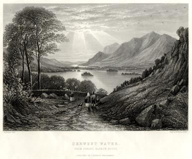 click to enlarge click to enlargeGA1305.jpg printed, bottom left, right, centre "A. Pettitt, Delt. / Engd. by W. Banks, Edinr. / DERWENT WATER. / FROM BEHIND BARROW HOUSE. / PUBLISHED BY J. GARNETT, WINDERMERE." item:- Armitt Library : ALMA335.5 Image © see bottom of page |
|||||||||||||||||||||||||
|
|
||||||||||||||||||||||||||
| evidence:- | old map:- Garnett 1850s-60s H placename:- Derwent Water |
|||||||||||||||||||||||||
| source data:- | Map of the English Lakes, in Cumberland, Westmorland and
Lancashire, scale about 3.5 miles to 1 inch, published by John
Garnett, Windermere, Westmorland, 1850s-60s.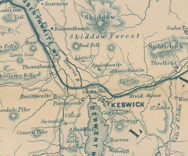 GAR2NY22.jpg "DERWENT WR." outline with shore form lines, lake or tarn 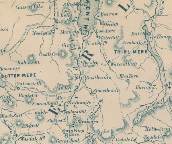 GAR2NY21.jpg item:- JandMN : 82.1 Image © see bottom of page |
|||||||||||||||||||||||||
|
|
||||||||||||||||||||||||||
| evidence:- | old print:- Pyne 1853 placename:- Derwent Water |
|||||||||||||||||||||||||
| source data:- | Print, tinted lithograph, Derwent Water, by Keswick, Cumberland, by James Baker Pyne,
engraved by W Gauci, published by Thomas Agnew and Sons, Manchester, Lancashire, 1853.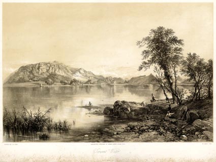 click to enlarge click to enlargePYN210.jpg "PAINTED BY J. B. PYNE. / W. GAUCI LITH. / MANCHESTER, PUBLISHED BY THOMAS AGNEW & SONS, 1853. / Derwent Water / M & N HANHART IMPT." item:- Armitt Library : A6678.11 Image © see bottom of page |
|||||||||||||||||||||||||
|
|
||||||||||||||||||||||||||
| evidence:- | old print:- Pyne 1853 placename:- Derwent Water |
|||||||||||||||||||||||||
| source data:- | Print, coloured lithograph, Derwent Water, by Keswick, Cumberland, by James Baker
Pyne, engraved by W Gauci, published by Thomas Agnew and Sons, Manchester, Lancashire,
1853.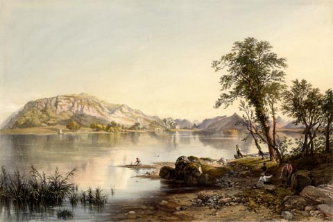 click to enlarge click to enlargePYN410.jpg item:- Armitt Library : A6677.11 Image © see bottom of page |
|||||||||||||||||||||||||
|
|
||||||||||||||||||||||||||
| evidence:- | outline view, old text:- Martineau 1855 |
|||||||||||||||||||||||||
| source data:- | Plate, opposite p.74:- goto source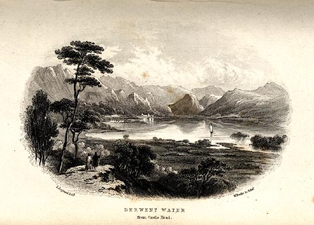 click to enlarge click to enlargeMNU112.jpg Print, engraving, Derwent Water from Castle Head, drawn by L Aspland, engraved by W Banks, Edinburgh, published by John Garnett, Windermere, Westmorland, and by Whittaker and Co, London, 1855. "L Aspland Delt. / W Banks Sc Edinr. / DERWENT WATER / from Castle Head" item:- Armitt Library : A1159.12 Image © see bottom of page |
|||||||||||||||||||||||||
|
|
||||||||||||||||||||||||||
| evidence:- | old text:- Martineau 1855 |
|||||||||||||||||||||||||
| source data:- | Guide book, A Complete Guide to the English Lakes, by Harriet
Martineau, published by John Garnett, Windermere, Westmorland,
and by Whittaker and Co, London, 1855; published 1855-76. goto source Page 74:- "EXCURSIONS FROM KESWICK." "DERWENT WATER." "The first object of attention will be the lake itself; and it will probably be viewed by boat. The uppermost thought at all points about the foot of the lake is of the Derwentwater family. They had once a castle on the hill called Castlehead, where they built upon the site of a Druidical circle. This hill should be visited for the view. The Ratcliffes also possessed Lord's Island, the largest on the lake, ... Ramps Holme, another of the islands, was their's also; and the hermit, the dear friend of St. Cuthbert, who lived in St. Herbert's Isle in the seventh century, is somehow mixed up in legends, in local imaginations which are careless of dates, with the same family. ... Vicar's, or" goto sourcePage 75:- "Derwent Isle, is the other of the four larger islands. Lord's Isle was once a part of the mainland. The Ratcliffes cut a fosse, in the feudal times, and set up a drawbridge. ..." "The lake is about three miles long, and, at its broadest part, about a mile and a half wide. Its waters are singularly clear, and its surface often unruffled as a mirror. Then it reflects the surrounding shores with marvellous beauty of effect,- from the bare crest of the crag and peak of the mountain to the grassy knoll and overhanging birch. Pike, trout, and perch abound in the lake; but not char, which requires deeper water. The Floating Island, whose appearance is announced in the newspapers at intervals of a few years, has obtained more celebrity than it deserves. ..." |
|||||||||||||||||||||||||
|
|
||||||||||||||||||||||||||
| evidence:- | old text:- Martineau 1855 placename:- Derwentwater item:- depth, Derwent Water |
|||||||||||||||||||||||||
| source data:- | Guide book, A Complete Guide to the English Lakes, by Harriet
Martineau, published by John Garnett, Windermere, Westmorland,
and by Whittaker and Co, London, 1855; published 1855-76. goto source Page 180:- "A TABLE OF THE LENGTH, BREADTH, AND DEPTH OF THE LAKES." "No. : Names of Lakes. : Counties : Length in Miles. : Extreme breadth in Miles : Extreme depth in Feet : Height above the Sea" "11 : Derwentwater : Cumberland : 3 : 1½: 72 : 228" |
|||||||||||||||||||||||||
|
|
||||||||||||||||||||||||||
| evidence:- | outline view, old text:- Martineau 1855 |
|||||||||||||||||||||||||
| source data:- | Plate, opposite p.74:- goto source click to enlarge MNU112.jpg Print, engraving, Derwent Water from Castle Head, drawn by L Aspland, engraved by W Banks, Edinburgh, published by John Garnett, Windermere, Westmorland, and by Whittaker and Co, London, 1855. "L Aspland Delt. / W Banks Sc Edinr. / DERWENT WATER / from Castle Head" item:- Armitt Library : A1159.12 Image © see bottom of page |
|||||||||||||||||||||||||
|
|
||||||||||||||||||||||||||
| evidence:- | old text:- Martineau 1855 |
|||||||||||||||||||||||||
| source data:- | Guide book, A Complete Guide to the English Lakes, by Harriet
Martineau, published by John Garnett, Windermere, Westmorland,
and by Whittaker and Co, London, 1855; published 1855-76. goto source Page 74:- "EXCURSIONS FROM KESWICK." "DERWENT WATER." "The first object of attention will be the lake itself; and it will probably be viewed by boat. The uppermost thought at all points about the foot of the lake is of the Derwentwater family. They had once a castle on the hill called Castlehead, where they built upon the site of a Druidical circle. This hill should be visited for the view. The Ratcliffes also possessed Lord's Island, the largest on the lake, ... Ramps Holme, another of the islands, was their's also; and the hermit, the dear friend of St. Cuthbert, who lived in St. Herbert's Isle in the seventh century, is somehow mixed up in legends, in local imaginations which are careless of dates, with the same family. ... Vicar's, or" goto sourcePage 75:- "Derwent Isle, is the other of the four larger islands. Lord's Isle was once a part of the mainland. The Ratcliffes cut a fosse, in the feudal times, and set up a drawbridge. ..." "The lake is about three miles long, and, at its broadest part, about a mile and a half wide. Its waters are singularly clear, and its surface often unruffled as a mirror. Then it reflects the surrounding shores with marvellous beauty of effect,- from the bare crest of the crag and peak of the mountain to the grassy knoll and overhanging birch. Pike, trout, and perch abound in the lake; but not char, which requires deeper water. The Floating Island, whose appearance is announced in the newspapers at intervals of a few years, has obtained more celebrity than it deserves. ..." |
|||||||||||||||||||||||||
|
|
||||||||||||||||||||||||||
| evidence:- | old text:- Martineau 1855 placename:- Derwentwater item:- depth, Derwent Water |
|||||||||||||||||||||||||
| source data:- | Guide book, A Complete Guide to the English Lakes, by Harriet
Martineau, published by John Garnett, Windermere, Westmorland,
and by Whittaker and Co, London, 1855; published 1855-76. goto source Page 180:- "A TABLE OF THE LENGTH, BREADTH, AND DEPTH OF THE LAKES." "No. : Names of Lakes. : Counties : Length in Miles. : Extreme breadth in Miles : Extreme depth in Feet : Height above the Sea" "11 : Derwentwater : Cumberland : 3 : 1½: 72 : 228" |
|||||||||||||||||||||||||
|
|
||||||||||||||||||||||||||
| evidence:- | old map:- Jenkinson 1875 map1 placename:- |
|||||||||||||||||||||||||
| source data:- | Map, Keswick Section, Westmorland, ?colour lithograph, scale
about 1 mile to 1 inch, by Stanford's Geographical
Establishment, published by Edward Stanford, 55 Charing Cross,
London, 1875.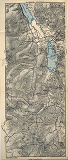 click to enlarge click to enlargeJK07.jpg item:- JandMN : 28.7 Image © see bottom of page |
|||||||||||||||||||||||||
|
|
||||||||||||||||||||||||||
| evidence:- | old print:- Walton 1876 placename:- Derwentwater |
|||||||||||||||||||||||||
| source data:- | Print, colour lithograph, Derwentwater and Skiddaw, Cumberland, from a painting by
Elijah Walton, published by W M Thompson, 20 Cockspur Street, Pall Mall, and Burlington
Gallery, Piccadilly, London, 1876.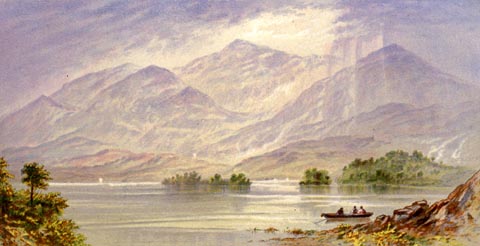 click to enlarge click to enlargeWLT317.jpg Plate 17 in English Lake Scenery, with a description by T G Bonney. item:- JandMN : 469.17 Image © see bottom of page |
|||||||||||||||||||||||||
|
|
||||||||||||||||||||||||||
| evidence:- | old print:- Nelson 1853 (edn 1880s) placename:- Derwent Water |
|||||||||||||||||||||||||
| source data:- | Print, chromolithograph, Derwent Water, Borrowdale, Cumberland, published by Thomas
Nelson and Sons, London, 1880s?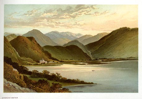 click to enlarge click to enlargeNS0330.jpg At the end of Views of the English Lakes, and Tourists Guide to the English Lakes. printed at bottom:- "DERWENT WATER" item:- JandMN : 474.31 Image © see bottom of page |
|||||||||||||||||||||||||
|
|
||||||||||||||||||||||||||
| evidence:- | old photograph:- Bell 1880s-1940s item:- waves |
|||||||||||||||||||||||||
| source data:- | Photograph, black and white, Derwentwater in a Storm, Keswick, Cumberland, by Herbert
Bell, photographer, Ambleside, Westmorland, 1890s?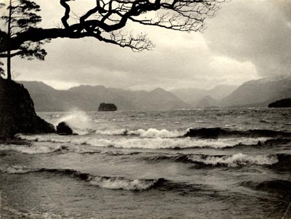 click to enlarge click to enlargeHB0960.jpg item:- Armitt Library : 1958.4275 Image © see bottom of page |
|||||||||||||||||||||||||
|
|
||||||||||||||||||||||||||
| evidence:- | old photograph:- Bell 1880s-1940s item:- boat; rowing boat; costume |
|||||||||||||||||||||||||
| source data:- | Photograph, black and white, Lodore Hotel by Derwent Water, Borrowdale, Cumberland,
by Herbert Bell, photographer, Ambleside, Westmorland, 1890s.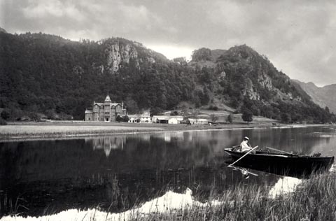 click to enlarge click to enlargeHB0933.jpg internegative at lower right:- "H. Bell" item:- Armitt Library : ALPS610 Image © see bottom of page |
|||||||||||||||||||||||||
|
|
||||||||||||||||||||||||||
| evidence:- | old photograph:- Bell 1880s-1940s |
|||||||||||||||||||||||||
| source data:- | Photograph, black and white, Derwent Water and Derwent Fells, Above Derwent, Cumberland,
by Herbert Bell, photographer, Ambleside, Westmorland, 1890s.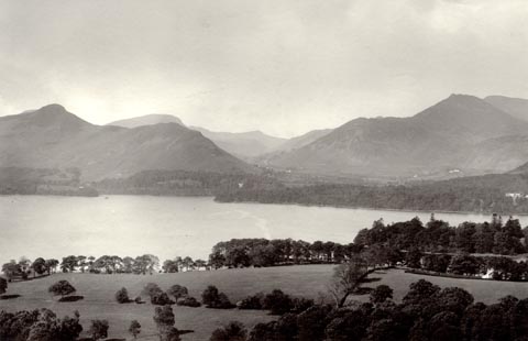 click to enlarge click to enlargeHB0932.jpg item:- Armitt Library : ALPS609 Image © see bottom of page |
|||||||||||||||||||||||||
|
|
||||||||||||||||||||||||||
| evidence:- | old photograph:- Bell 1880s-1940s |
|||||||||||||||||||||||||
| source data:- | Photograph, black and white, Derwent Water and Derwent Fells, Above Derwent, Cumberland,
by Herbert Bell, photographer, Ambleside, Westmorland, 1890s.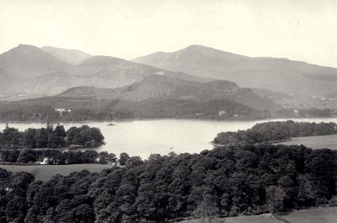 click to enlarge click to enlargeHB0931.jpg internegative at lower left:- "H. Bell" item:- Armitt Library : ALPS608 Image © see bottom of page |
|||||||||||||||||||||||||
|
|
||||||||||||||||||||||||||
| evidence:- | old photograph:- Bell 1880s-1940s |
|||||||||||||||||||||||||
| source data:- | Photograph, black and white, Derwent Water looking into Borrowdale, Cumberland, by
Herbert Bell, photographer, Ambleside, Westmorland, 1890s.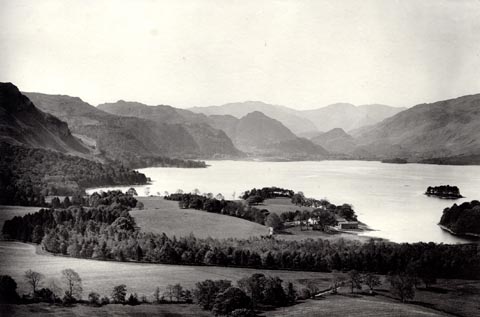 click to enlarge click to enlargeHB0930.jpg item:- Armitt Library : ALPS607 Image © see bottom of page |
|||||||||||||||||||||||||
|
|
||||||||||||||||||||||||||
| evidence:- | old photograph:- Bell 1880s-1940s |
|||||||||||||||||||||||||
| source data:- | Photograph, black and white, Derwent Water and Newlands, Above Derwent, Cumberland,
by Herbert Bell, photographer, Ambleside, Westmorland, 1890s.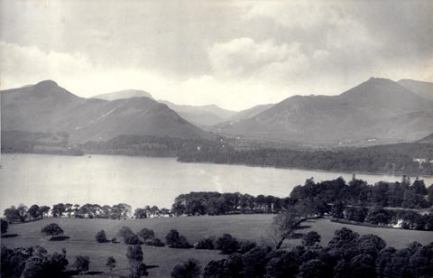 click to enlarge click to enlargeHB0863.jpg internegative at lower left:- "H. Bell" stamped at reverse:- "HERBERT BELL / Photographer / AMBLESIDE" item:- Armitt Library : ALPS534 Image © see bottom of page |
|||||||||||||||||||||||||
|
|
||||||||||||||||||||||||||
| evidence:- | old photograph:- Bell 1880s-1940s |
|||||||||||||||||||||||||
| source data:- | Photograph, black and white, upper Derwent Water, Borrowdale, Cumberland, by Herbert
Bell, photographer, Ambleside, Westmorland, 1890s.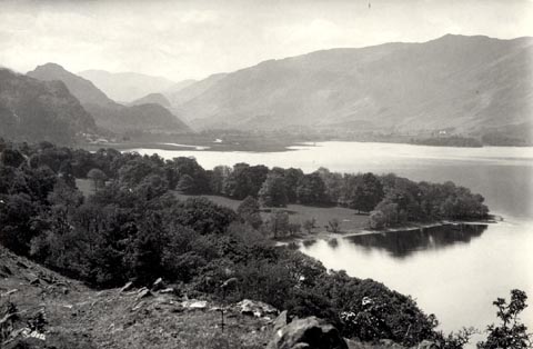 click to enlarge click to enlargeHB0853.jpg internegative at lower left:- "H. Bell" item:- Armitt Library : ALPS524 Image © see bottom of page |
|||||||||||||||||||||||||
|
|
||||||||||||||||||||||||||
| evidence:- | old photograph:- Bell 1880s-1940s item:- rowing boat; boat |
|||||||||||||||||||||||||
| source data:- | Photograph, sepia, rowing boats at the landing stages on Derwent Water, Keswick, Cumberland,
by Herbert Bell, Ambleside, Westmorland, 1890s.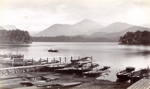 click to enlarge click to enlargeHB0480.jpg There is a sign for Sparks, boat hirer. item:- Armitt Library : ALPS139 Image © see bottom of page |
|||||||||||||||||||||||||
|
|
||||||||||||||||||||||||||
| evidence:- | old photograph:- Bell 1880s-1940s |
|||||||||||||||||||||||||
| source data:- | Photograph, sepia, Derwent Water from Barrow House, Borrowdale, Cumberland, by Herbert
Bell, Ambleside, Westmorland, 1890s.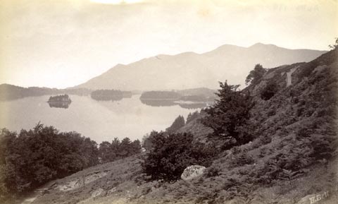 click to enlarge click to enlargeHB0479.jpg internegative at lower right:- "H. Bell" item:- Armitt Library : ALPS138 Image © see bottom of page |
|||||||||||||||||||||||||
|
|
||||||||||||||||||||||||||
| evidence:- | old photograph:- Bell 1880s-1940s |
|||||||||||||||||||||||||
| source data:- | Photograph, black and white, Derwent Water and Causey Pike, Above Derwent, Cumberland,
by Herbert Bell, Ambleside, Westmorland, 1890s.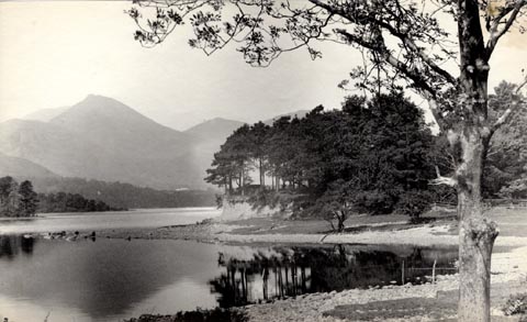 click to enlarge click to enlargeHB0478.jpg stamped at reverse:- "HERBERT BELL / Photographer / AMBLESIDE" item:- Armitt Library : ALPS137 Image © see bottom of page |
|||||||||||||||||||||||||
|
|
||||||||||||||||||||||||||
| evidence:- | old photograph:- Bell 1880s-1940s |
|||||||||||||||||||||||||
| source data:- | Photograph, black and white, Derwent Water and Borrowdale, from Castle Head, Keswick,
Cumberland, by Herbert Bell, Ambleside, Westmorland, 1890s.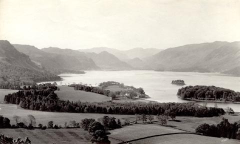 click to enlarge click to enlargeHB0477.jpg internegative at lower right:- "H. Bell" stamped at reverse:- "HERBERT BELL / Photographer / AMBLESIDE" item:- Armitt Library : ALPS136 Image © see bottom of page |
|||||||||||||||||||||||||
|
|
||||||||||||||||||||||||||
| evidence:- | old photograph:- Bell 1880s-1940s |
|||||||||||||||||||||||||
| source data:- | Photograph, black and white, Derwent Water and Newlands Valley, Above Derwent, Cumberland,
by Herbert Bell, Ambleside, Westmorland, 1890s.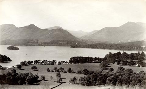 click to enlarge click to enlargeHB0476.jpg stamped at reverse:- "HERBERT BELL / Photographer / AMBLESIDE" item:- Armitt Library : ALPS135 Image © see bottom of page |
|||||||||||||||||||||||||
|
|
||||||||||||||||||||||||||
| evidence:- | old photograph:- Bell 1880s-1940s |
|||||||||||||||||||||||||
| source data:- | Photograph, black and white, Derwent Water and Lodore, Borrowdale, Cumberland, by
Herbert Bell, Ambleside, Westmorland, 1890s. click to enlarge click to enlargeHB0475.jpg internegative at lower left:- "H. Bell" stamped at reverse:- "HERBERT BELL / Photographer / AMBLESIDE" item:- Armitt Library : ALPS134 Image © see bottom of page |
|||||||||||||||||||||||||
|
|
||||||||||||||||||||||||||
| evidence:- | old photograph:- Bell 1880s-1940s |
|||||||||||||||||||||||||
| source data:- | Photograph, black and white, Derwent Water and Grisedale Pike, Cumberland, by Herbert
Bell, Ambleside, Westmorland, 1890s.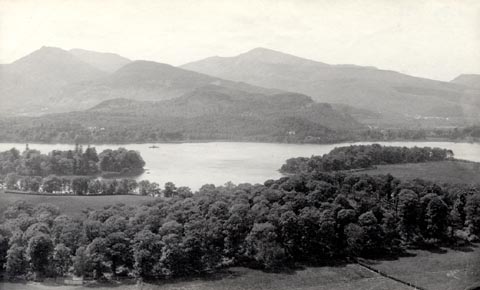 click to enlarge click to enlargeHB0474.jpg internegative at lower right:- "H. Bell" item:- Armitt Library : ALPS133 Image © see bottom of page |
|||||||||||||||||||||||||
|
|
||||||||||||||||||||||||||
| evidence:- | old photograph:- Bell 1880s-1940s |
|||||||||||||||||||||||||
| source data:- | Photograph, black and white, Derwent Water and Borrowdale, Cumberland, by Herbert
Bell, Ambleside, Westmorland, 1890s.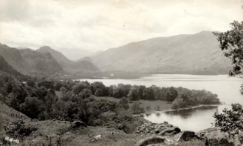 click to enlarge click to enlargeHB0473.jpg internegative at lower left:- "H. Bell" stamped at reverse:- "HERBERT BELL / Photographer / AMBLESIDE" item:- Armitt Library : ALPS132 Image © see bottom of page |
|||||||||||||||||||||||||
|
|
||||||||||||||||||||||||||
| evidence:- | old photograph:- Bell 1880s-1940s |
|||||||||||||||||||||||||
| source data:- | Photograph, b/w, Derwent Water and Causey Pike, Cumberland, by Herbert Bell, Ambleside,
Westmorland, 1890s?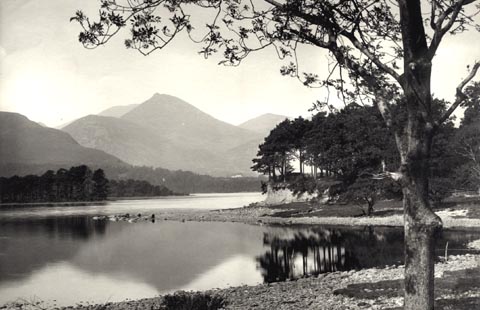 click to enlarge click to enlargeHB0282.jpg item:- Armitt Library : ALPS639 Image © see bottom of page |
|||||||||||||||||||||||||
|
|
||||||||||||||||||||||||||
| evidence:- | old photograph:- Bell 1880s-1940s |
|||||||||||||||||||||||||
| source data:- | Photograph, sepia, Derwent Water and Skiddaw, Keswick, Cumberland, by Herbert Bell,
Ambleside, Westmorland, 1881.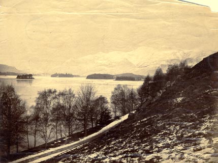 click to enlarge click to enlargeHB0285.jpg item:- Armitt Library : ALPS642 Image © see bottom of page |
|||||||||||||||||||||||||
|
|
||||||||||||||||||||||||||
| evidence:- | old photograph:- Bell 1880s-1940s |
|||||||||||||||||||||||||
| source data:- | Photograph, b/w, Derwent Water and Lodore, Borrowdale, Cumberland, by Herbert Bell,
Ambleside, Westmorland, 1890s?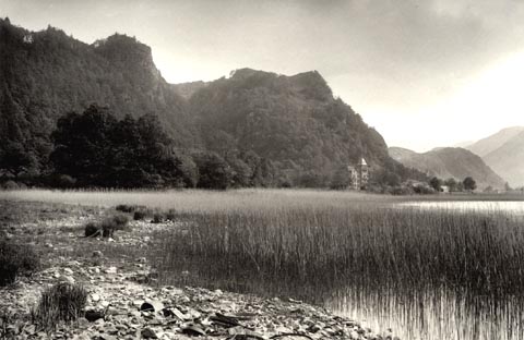 click to enlarge click to enlargeHB0288.jpg item:- Armitt Library : ALPS645 Image © see bottom of page |
|||||||||||||||||||||||||
|
|
||||||||||||||||||||||||||
| evidence:- | old map:- Mill and Heawood 1895 placename:- Derwent Water |
|||||||||||||||||||||||||
| source data:- | Map, Derwentwater, scale 2 inches to 1 mile, with soundings by
Hugh Robert Mill and Edward Heawood, by Bartholomew, Edinburgh,
Scotland, published by George Philip and Son, 32 Fleet Street,
London, etc, 1895.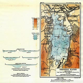 click to enlarge click to enlargeMIL3.jpg - with soundings and sections item:- Kendal Library : 7.2 Image © see bottom of page |
|||||||||||||||||||||||||
|
|
||||||||||||||||||||||||||
| evidence:- | old map:- Pearson 1900s map (Der) placename:- Derwent Water |
|||||||||||||||||||||||||
| source data:- | Map, lithograph, Round Derwent Water, Cumberland, published by C
Arthur Pearson, Henrietta Street, London, 1900s.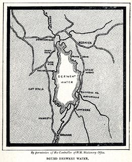 click to enlarge click to enlargePSN1M5.jpg On p.xxxvii of Pearson's Gossipy Guide to the English Lakes and Neighbouring Districts. printed at bottom:- "By permission of the Controller of H.M. Stationery Office. / ROUND DERWENT WATER." item:- Armitt Library : A1188.7 Image © see bottom of page |
|||||||||||||||||||||||||
|
|
||||||||||||||||||||||||||
| evidence:- | old print:- Bradley 1901 placename:- Derwentwater |
|||||||||||||||||||||||||
| source data:- | Print, uncoloured lithograph, Derwentwater, Cumberland, by Joseph Pennell, published
by Macmillan and Co, London, 1901.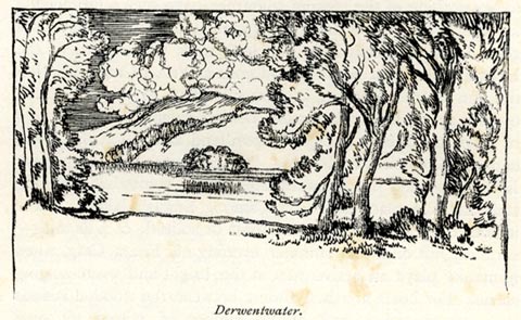 click to enlarge click to enlargeBRL123.jpg On page 110 of Highways and Byways in the Lake District, by A G Bradley. printed at bottom:- "Derwentwater." item:- JandMN : 464.23 Image © see bottom of page |
|||||||||||||||||||||||||
|
|
||||||||||||||||||||||||||
| evidence:- | old print:- Brabant 1902 placename:- Derwentwater |
|||||||||||||||||||||||||
| source data:- | Print, uncoloured lithograph, Derwentwater, from Castle Head, Keswick, Cumberland,
by Edmund H New, published by Methuen and Co, 36 Essex Street, Strand, London, 1902.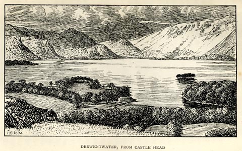 click to enlarge click to enlargeBBT110.jpg Tipped in opposite p.224 of The English Lakes, by F G Brabant. printed at bottom left:- "E. H. N." printed at bottom:- "DERWENTWATER, FROM CASTLE HEAD" item:- JandMN : 502.18 Image © see bottom of page |
|||||||||||||||||||||||||
|
|
||||||||||||||||||||||||||
| evidence:- | old print:- Heaton Cooper 1905 (edn 1908) placename:- Derwentwater |
|||||||||||||||||||||||||
| source data:- | Print, colour halftone, Lodore and Derwentwater, a summer's morn, Borrowdale, Cumberland,
from a watercolour painting by Alfred Heaton Cooper, published by Adam and Charles
Black, London, 2nd edn 1908.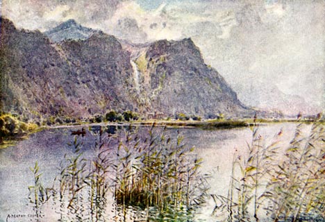 click to enlarge click to enlargeHC0146.jpg Opposite p.136 of The English Lakes, painted by Alfred Heaton Cooper, described by William T Palmer. printed at tissue opposite the print:- "LODORE AND DERWENTWATER / A summer's morn" printed at signed lower left:- "A HEATON COOPER" item:- JandMN : 468.46 Image © see bottom of page |
|||||||||||||||||||||||||
|
|
||||||||||||||||||||||||||
| evidence:- | old print:- Heaton Cooper 1905 (edn 1908) placename:- Derwentwater item:- tree; Scots pine; Pinus sylvestris |
|||||||||||||||||||||||||
| source data:- | Print, colour halftone, Derwentwater, from Castle Head, a bright morning, Keswick,
Cumberland, from a watercolour painting by Alfred Heaton Cooper, published by Adam
and Charles Black, London, 2nd edn 1908.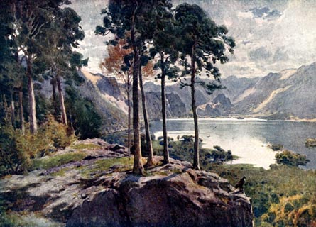 click to enlarge click to enlargeHC0147.jpg Opposite p.138 of The English Lakes, painted by Alfred Heaton Cooper, described by William T Palmer. printed at tissue opposite the print:- "DERWENTWATER, FROM CASTLE HEAD / A bright morning" printed at signed lower right:- "[A HEATON COOPER]" item:- JandMN : 468.47 Image © see bottom of page |
|||||||||||||||||||||||||
|
|
||||||||||||||||||||||||||
| evidence:- | old print:- Heaton Cooper 1905 (edn 1908) placename:- Derwentwater item:- swimming |
|||||||||||||||||||||||||
| source data:- | Print, colour halftone, By the Shores of Derwentwater, Cumberland, from a watercolour
painting by Alfred Heaton Cooper, published by Adam and Charles Black, London, 2nd
edn 1908.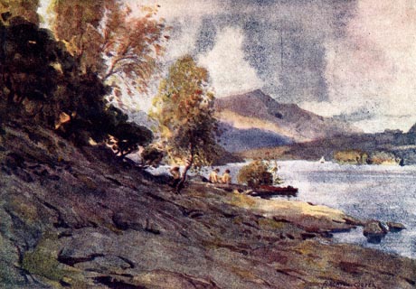 click to enlarge click to enlargeHC0148.jpg Opposite p.142 of The English Lakes, painted by Alfred Heaton Cooper, described by William T Palmer. printed at tissue opposite the print:- "BY THE SHORES OF DERWENTWATER" printed at signed lower right:- "[A HEATON COOPER]" item:- JandMN : 468.48 Image © see bottom of page |
|||||||||||||||||||||||||
|
|
||||||||||||||||||||||||||
| evidence:- | old print:- Heaton Cooper 1905 (edn 1908) placename:- Derwentwater |
|||||||||||||||||||||||||
| source data:- | Print, colour halftone, Derwentwater and Bassenthwaite Lake, from High Lodore, Borrowdale,
Cumberland, from a watercolour painting by Alfred Heaton Cooper, published by Adam
and Charles Black, London, 2nd edn 1908.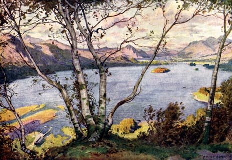 click to enlarge click to enlargeHC0154.jpg Opposite p.156 of The English Lakes, painted by Alfred Heaton Cooper, described by William T Palmer. printed at tissue opposite the print:- "DERWENTWATER AND BASSENTHWAITE LAKE, / FROM HIGH LODORE" printed at signed lower right:- "[A HEATON COOPER]" item:- JandMN : 468.54 Image © see bottom of page |
|||||||||||||||||||||||||
|
|
||||||||||||||||||||||||||
| evidence:- | text:- Mason 1907 (edn 1930) |
|||||||||||||||||||||||||
| source data:- | Text book, The Ambleside Geography Books bk.III, The Counties of
England, by Charlotte M Mason, published by Kegan Paul, Trench,
Trubner and Co, Broadway House, 68-74 Carter Lane, and the
Parents' Educational Union Office, 26 Victoria Street, London,
edn 1930. MSN1P021.txt Page 21:- "..." "Beautiful Derwent Water! - the fairest of all the lakes, many people think - with its green shores and" MSN1P022.txt Page 22:- "fringing trees, its islets and its mountain background; but perhaps Ullswater, on the other side of Helvellyn, has a wilder beauty." |
|||||||||||||||||||||||||
|
|
||||||||||||||||||||||||||
| evidence:- | old map:- Watson 1912 placename:- Derwentwater |
|||||||||||||||||||||||||
| source data:- | Map, black and white halftone, Derwentwater, Keswick area,
Cumberland, scale about 1.5 inches to 1 mile, published by
George Watson, after 1912.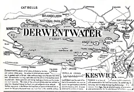 click to enlarge click to enlargeWT4M3.jpg Map, black and white halftone, Derwentwater, Keswick area, Cumberland, scale about 1.5 inches to 1 mile, published by George Watson, after 1912. In a guide book, Keswick on Derwentwater. item:- Keswick Museum : 2145.6 Image © see bottom of page |
|||||||||||||||||||||||||
|
|
||||||||||||||||||||||||||
| evidence:- | old map:- Postlethwaite 1877 (3rd edn 1913) placename:- Derwent Water placename:- Derwentwater |
|||||||||||||||||||||||||
| source data:- | Map, uncoloured engraving, Map of the Lake District Mining Field, Westmorland, Cumberland,
Lancashire, scale about 5 miles to 1 inch, by John Postlethwaite, published by W H
Moss and Sons, 13 Lowther Street, Whitehaven, Cumberland, 1877 edn 1913.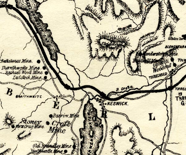 PST2NY22.jpg 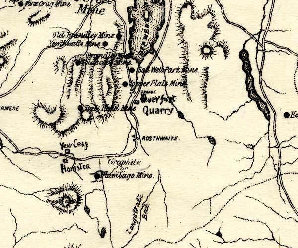 PST2NY21.jpg "DERWENT[ ]WATER" lake, islands item:- JandMN : 162.2 Image © see bottom of page |
|||||||||||||||||||||||||
|
|
||||||||||||||||||||||||||
| evidence:- | old print:- Reynolds 1915 placename:- Derwent Water |
|||||||||||||||||||||||||
| source data:- | Print, colour halftone, Derwent Water from Castle Head, Keswick, Cumberland, from
a painting by Alfred Heaton Cooper, published by Adam and Charles Black, London, 1915.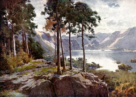 click to enlarge click to enlargeREY612.jpg "A HEATON COOPER" "DERWENT WATER FROM CASTLE HEAD." item:- JandMN : 1071.12 Image © see bottom of page |
|||||||||||||||||||||||||
|
|
||||||||||||||||||||||||||
| evidence:- | old print:- Reynolds 1915 placename:- Derwent Water ??? |
|||||||||||||||||||||||||
| source data:- | Print, colour halftone, Lodore and Derwentwater, Borrowdale, Cumberland, from a painting
by Alfred Heaton Cooper, published by Adam and Charles Black, London, 1915.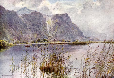 click to enlarge click to enlargeREY613.jpg "A HEATON COOPER" "LODORE AND DERWENTWATER." item:- JandMN : 1071.13 Image © see bottom of page |
|||||||||||||||||||||||||
|
|
||||||||||||||||||||||||||
| evidence:- | old print:- Reynolds 1915 placename:- Derwentwater |
|||||||||||||||||||||||||
| source data:- | Print, colour halftone, Derwentwater and Bassenthwaite Lake, Cumberland, from a painting
by Alfred Heaton Cooper, published by Adam and Charles Black, London, 1915.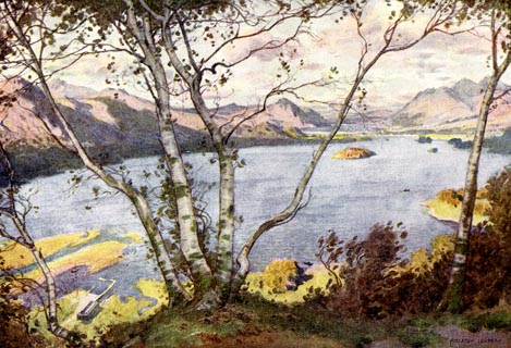 click to enlarge click to enlargeREY614.jpg "A HEATON COOPER" "DERWENTWATER AND BASSENTHWAITE LAKE." item:- JandMN : 1071.14 Image © see bottom of page |
|||||||||||||||||||||||||
|
|
||||||||||||||||||||||||||
| evidence:- | old photograph:- Marr 1916 placename:- Derwentwater |
|||||||||||||||||||||||||
| source data:- | Photograph, halftone print, Derwentwater, Bassenthwaite and Skiddaw, Cumberland, 1916.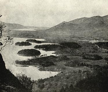 click to enlarge click to enlargeMA1206.jpg item:- JandMN : 173.14 Image © see bottom of page |
|||||||||||||||||||||||||
|
|
||||||||||||||||||||||||||
| evidence:- | old text:- Burrow 1920s placename:- |
|||||||||||||||||||||||||
| source data:- | Road book, strip maps with parts in Westmorland, Cumberland etc,
irregular scales about 1.5 miles to 1 inch, by E J Burrow and
Co, Cheltenham, Gloucestershire, 1920s. "... Keswick, where lovely Derwentwater is close at hand on the left. This is one of the broader lakes and its wooded shores and pretty islands give it a distinctive beauty of its own. ..." |
|||||||||||||||||||||||||
|
|
||||||||||||||||||||||||||
| evidence:- | old photograph:- Photochrom 1930s placename:- Derwentwater |
|||||||||||||||||||||||||
| source data:- | Photograph, black and white halftone print, Keswick and Derwentwater, Cumberland,
published by Photochrom Co, Tunbridge Wells, Kent, 1930s?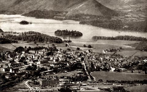 click to enlarge click to enlargePCH106.jpg printed, "Keswick and Derwentwater. / ..." item:- JandMN : 1015.6 Image © see bottom of page |
|||||||||||||||||||||||||
|
|
||||||||||||||||||||||||||
| evidence:- | old photograph:- Photochrom 1930s placename:- Derwentwater |
|||||||||||||||||||||||||
| source data:- | Photograph, black and white halftone print, Friars Crag, Derwentwater, Keswick, Cumberland,
published by Photochrom Co, Tunbridge Wells, Kent, 1930s?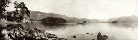 click to enlarge click to enlargePCH116.jpg printed, "Friars Crag, Derwentwater. / ..." item:- JandMN : 1015.16 Image © see bottom of page |
|||||||||||||||||||||||||
|
|
||||||||||||||||||||||||||
| evidence:- | old photograph:- Photochrom 1930s placename:- Derwentwater |
|||||||||||||||||||||||||
| source data:- | Photograph, black and white halftone print, Sunset on Derwentwater, Keswick, Cumberland,
published by Photochrom Co, Tunbridge Wells, Kent, 1930s?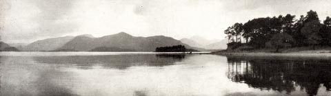 click to enlarge click to enlargePCH117.jpg printed, "Sunset on Derwentwater. / ..." item:- JandMN : 1015.17 Image © see bottom of page |
|||||||||||||||||||||||||
|
|
||||||||||||||||||||||||||
| evidence:- | old map:- Dunlop 1950s placename:- Derwent Water |
|||||||||||||||||||||||||
| source data:- | Pictorial map, colour lithograph, A Dunlop Map of the Lake
District, scale about 4 miles to 1 inch, by J R Hart, published
by Dunlop Rubber Co, about 1950?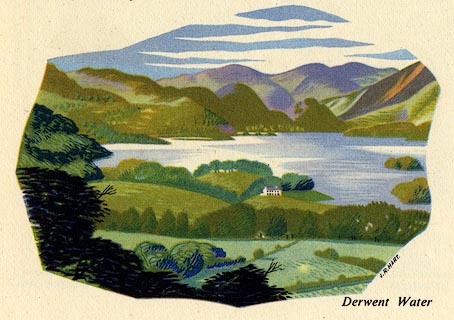 click to enlarge click to enlargeDP01E2.jpg item:- JandMN : 188 Image © see bottom of page |
|||||||||||||||||||||||||
|
|
||||||||||||||||||||||||||
| evidence:- | old print:- placename:- Derwent Water |
|||||||||||||||||||||||||
| source data:- | Print, halftone photograph, Keswick and Derwent Water, by Mayson's, Keswick, published
by Cumberland Motor Services, Tangier Street, Whitehaven, Cumberland, about 1926.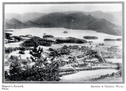 click to enlarge click to enlargeCS101.jpg On p.11 of Cumberland its Lakes and Mountains. lower right "WP" printed, bottom, left right "Mayson's, Keswick, Photo. / KESWICK &DERWENT WATER." item:- JandMN : 1022.1 Image © see bottom of page |
|||||||||||||||||||||||||
|
|
||||||||||||||||||||||||||
| evidence:- | old postcard:- placename:- Derwentwater |
|||||||||||||||||||||||||
| source data:- | Postcard, colour printed photograph, Derwent Water from Broom Point, Keswick, Cumberland,
published mid 20th century?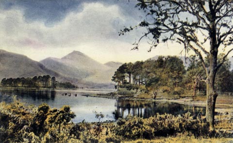 click to enlarge click to enlargePH0091.jpg Perhaps Broomhill Point? printed at bottom:- "DERWENTWATER FROM BROOM POINT, KESWICK" item:- JandMN : 959 Image © see bottom of page |
|||||||||||||||||||||||||
|
|
||||||||||||||||||||||||||
| evidence:- | old postcard:- placename:- Derwentwater |
|||||||||||||||||||||||||
| source data:- | Postcard, colour printed photograph, Derwent Water from Castle Head, Keswick, Cumberland,
published mid 20th century?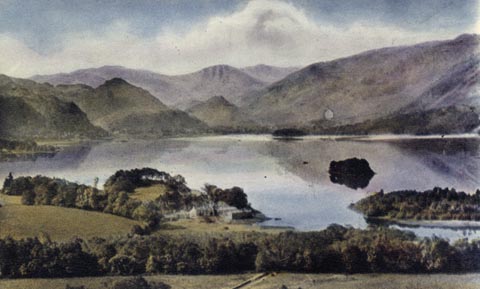 click to enlarge click to enlargePH0092.jpg printed at bottom:- "DERWENTWATER FROM CASTLE HEAD, KESWICK" item:- JandMN : 960 Image © see bottom of page |
|||||||||||||||||||||||||
|
|
||||||||||||||||||||||||||
| evidence:- | old postcard:- placename:- Derwentwater |
|||||||||||||||||||||||||
| source data:- | Postcard, Nature Colour Series, colour printed photograph, Derwent Water from Castle
Head, Keswick, published by G P Abraham, Keswick, Cumberland, mid 20th century.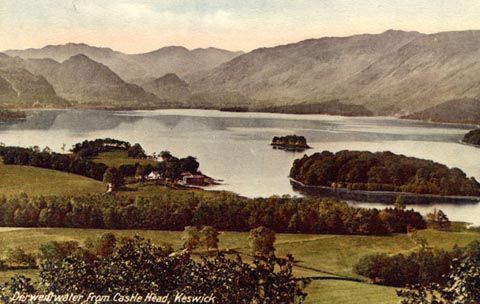 click to enlarge click to enlargePH0093.jpg , copyrightprinted at bottom:- "Derwentwater from Castle Head, Keswick" printed at rev:- "Nature-Colour Series. G. P. ABRAHAM Ltd. (Copyright) Keswick." item:- JandMN : 961 Image © see bottom of page |
|||||||||||||||||||||||||
|
|
||||||||||||||||||||||||||
| evidence:- | old postcard:- placename:- Derwentwater |
|||||||||||||||||||||||||
| source data:- | Postcard, sepia coloured photograph, A Peaceful Prospect, Derwent Water from Castle
Head, Keswick, published by G P Abraham, Keswick, Cumberland, mid 20th century.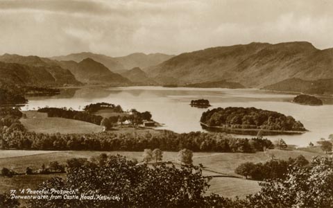 click to enlarge click to enlargePH0096.jpg , copyrightprinted at bottom:- "77. "A Peaceful Prospect," / Derwentwater from Castle Head, Keswick" printed at rev:- "Photographed and Published by G. P. Abraham Ltd., Keswick." item:- JandMN : 964 Image © see bottom of page |
|||||||||||||||||||||||||
|
|
||||||||||||||||||||||||||
| evidence:- | old postcard:- placename:- Derwentwater |
|||||||||||||||||||||||||
| source data:- | Postcard, black and white photograph, Derwent Water from Castle Hill, Keswick, published
by Valentine's, mid 20th century.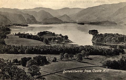 click to enlarge click to enlargePH0097.jpg , copyrightprinted at bottom:- "Derwentwater from Castle Hill 19390 J.V." printed at rev:- "Valentine's Series" item:- JandMN : 965 Image © see bottom of page |
|||||||||||||||||||||||||
|
|
||||||||||||||||||||||||||
| evidence:- | old print:- CKPR 1916 |
|||||||||||||||||||||||||
| source data:- | Colour lithograph, Cockermouth, Keswick and Penrith Railway, published by the general
manager, J Clark, Keswick Station, Keswick, Cumberland, 1 October 1916.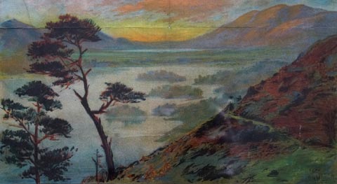 click to enlarge click to enlargeCP01E1.jpg Railway timetable with a map of the railway, and pictures of Derwent Water and Bassenthwaite Lake, and of the Keswick Hotel. item:- Keswick Museum : no id no 2 Image © see bottom of page |
|||||||||||||||||||||||||
|
|
||||||||||||||||||||||||||
| evidence:- | old painting:- |
|||||||||||||||||||||||||
| source data:- | Painting, watercolour, Derwent Water, Cumberland, by Robert Maris, early 19th century?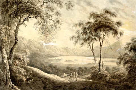 click to enlarge click to enlargePR1903.jpg item:- Armitt Library : 2001.153 Image © see bottom of page |
|||||||||||||||||||||||||
|
|
||||||||||||||||||||||||||
| evidence:- | old print:- placename:- Derwentwater |
|||||||||||||||||||||||||
| source data:- | Print, colour halftone, By the Shores of Derwentwater, from a painting by A Heaton
Cooper, 1925.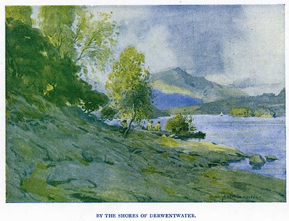 click to enlarge click to enlargePR0399.jpg The bathers appear to be nude. painted at lower right:- "A. HEATON COOPER -" printed at bottom:- "BY THE SHORES OF DERWENTWATER.:" item:- Dove Cottage : 2008.107.392 Image © see bottom of page |
|||||||||||||||||||||||||
|
|
||||||||||||||||||||||||||
| evidence:- | old print:- placename:- Derwentwater |
|||||||||||||||||||||||||
| source data:- | Print, uncoloured engraving, Derwentwater, Cumberland, drawn by W H J Bool, published
1920s-30s?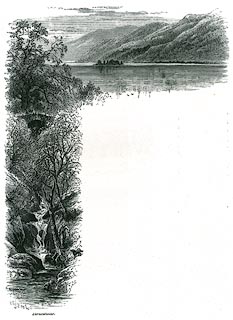 click to enlarge click to enlargePR0350.jpg On page 215 of Picturesque Europe, The Lake Country. printed at lower left:- "WHJBoo[l]" printed at bottom:- "Derwentwater." item:- Dove Cottage : 2008.107.350 Image © see bottom of page |
|||||||||||||||||||||||||
|
|
||||||||||||||||||||||||||
| evidence:- | old photograph:- Bogg 1898 placename:- Derwentwater item:- snow |
|||||||||||||||||||||||||
| source data:- | Photograph, halftone print, Derwentwater - Winter, Cumberland, by Abrahams, published
by Edmund Bogg, 3 Woodhouse Lane, and James Miles, Guildford Street, Leeds, Yorkshire,
1898.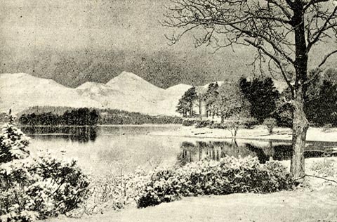 click to enlarge click to enlargeBGG149.jpg Included on p.157 of Lakeland and Ribblesdale, by Edmund Bogg. item:- JandMN : 231.49 Image © see bottom of page |
|||||||||||||||||||||||||
|
|
||||||||||||||||||||||||||
| evidence:- | outline view:- Jenkinson 1875 placename:- Derwent Water |
|||||||||||||||||||||||||
| source data:- | Print, lithograph, outline view, Panoramic Sketches from Skiddaw, Cumberland, by Edwin
A Pettitt, London, published by Edward Stanford, 55 Charing Cross, London, 1875.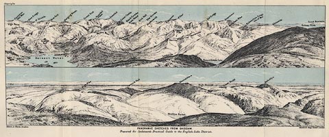 click to enlarge click to enlargeJk01E2.jpg "... Derwent Water ..." item:- JandMN : 28.8 Image © see bottom of page |
|||||||||||||||||||||||||
|
|
||||||||||||||||||||||||||
| evidence:- | outline view:- placename:- Derwent Water |
|||||||||||||||||||||||||
| source data:- | Print, lithograph, outline view, Panoramic Sketches from Scawfell Pike, Cumberland,
by Edwin A Pettitt, London, published by Edward Stanford, 55 Charing Cross, London,
1875.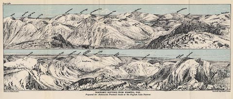 click to enlarge click to enlargeJk01E3.jpg "... Derwent Water ..." item:- JandMN : 28.9 Image © see bottom of page |
|||||||||||||||||||||||||
|
|
||||||||||||||||||||||||||
| evidence:- | old print:- placename:- Derwentwater |
|||||||||||||||||||||||||
| source data:- | Scott's Lodore Hotel, Derwentwater, published by J Scott, Lodore Hotel, Cumberland
with advertisement on reverse side.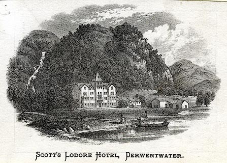 click to enlarge click to enlargePR0413.jpg Print, uncoloured engraving, Lodore Hotel, viewed from the lake side. printed at bottom:- "Scott's Lodore Hotel, Derwentwater" 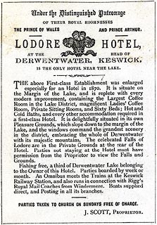 click to enlarge click to enlargePR0460.jpg Advertisement on the reverse side of the print of Scott's Lodore Hotel:- "Under the Distinguished Patronage OF THEIR ROYAL HIGHNESSES THE PRINCE OF WALES AND PRINCE ARTHUR. / LODORE HOTEL, AT THE HEAD OF DERWENTWATER, KESWICK, IS THE ONLY HOTEL NEAR THE LAKE. / THE above First-Class Establishment was enlarged especially for an Hotel in 1870. It is situate on the Margin of the Lake, and is replete with every modern improvement, containing the Largest Coffee Room in the Lake District, magnificent Ladies' Coffee Room, Private Sitting Rooms, and Sixty Beds; Hot and Cold Baths, and every other accommodation required in a first-class Hotel. It is delightfully situated in its own Pleasure Grounds, which slope down to the margin of the Lake, and the windows command the grandest scenery in the district, embracing the whole of Derwentwater with its majestic mountains. The celebrated Falls of Lodore are in the Private Grounds at the rear of the Hotel. Parties not staying at the Hotel must have permission from the Proprietor to view the Falls and Grounds. / Fishing free, a third of Derwentwater Lake belonging to the Owner of this Hotel. Parties boarded by week or month. An Omnibus meets the Trains at the Keswick Railway Station, and also runs in connection with Rigg's Royal Mail Coaches from Windermere. Boats supplied direct, and Posting in all its branches. / PARTIES TAKEN TO CHURCH ON SUNDAYS FREE OF CHARGE. / J. SCOTT, PROPRIETOR." item:- Dove Cottage : 2008.107.406 Image © see bottom of page |
|||||||||||||||||||||||||
|
|
||||||||||||||||||||||||||
| evidence:- | old print:- Garnett 1850s-60s F placename:- Derwent Water |
|||||||||||||||||||||||||
| source data:- | Print, uncoloured engraving, Derwent Water, Westmorland, engraved by William Banks
and Son, Edinburgh, probably published by John Garnett, Windermere, Westmorland, 1850s-60s?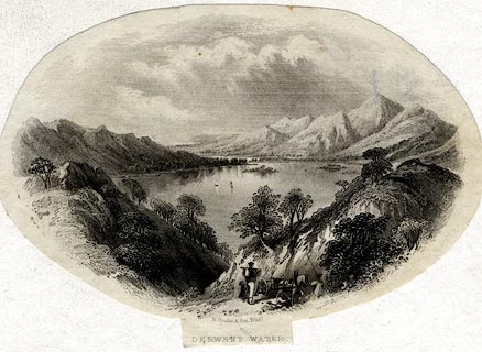 click to enlarge click to enlargeGAR729.jpg Found with Views of the English Lakes. printed at bottom:- "W. Banks &Son, Edinr. / DERWENT WATER." item:- JandMN : 165.29 Image © see bottom of page |
|||||||||||||||||||||||||
|
|
||||||||||||||||||||||||||
| evidence:- | old print:- Farington 1816 (plate 19) |
|||||||||||||||||||||||||
| source data:- | Print, uncoloured engraving, View on the Road from Keswick to Borrowdale, drawn by
Joseph Farington, engraved by F R Hay, published by T Cadell and W Davies, Strand,
London, 1815.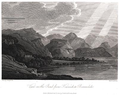 click to enlarge click to enlargePR0447.jpg Barrow House? and Lodore Falls, etc etc. Plate 20 in The Lakes of Lancashire, Westmorland, and Cumberland. printed at bottom left, right, centre:- "Drawn by J. Farington. / Engraved by F. R. Hay. / View on the Road from Keswick to Borrowdale. / London, Published Septr. 15, 1815, by T. Cadell &W. Davies, Strand." item:- private collection : 111 Image © see bottom of page |
|||||||||||||||||||||||||
|
|
||||||||||||||||||||||||||
| evidence:- | old print:- Farington 1816 (plate 20) placename:- Derwentwater |
|||||||||||||||||||||||||
| source data:- | Print, uncoloured engraving, East Side of Derwentwater looking towards Lowdore Waterfall,
Cumberland, drawn by Joseph Farington, engraved by F R Hay, published by T Cadell
and W Davies, Strand, London, 1815.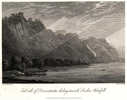 click to enlarge click to enlargePR0449.jpg Plate 20 in The Lakes of Lancashire, Westmorland, and Cumberland. The accompanying text is by Thomas Hartwell Horne:- "EAST SIDE OF DERWENTWATER LOOKING TOWARDS LOWDORE WATERFALL" "THE prominent features of this Lake, as described in the view of 'Derwentwater from Brough Top,' are here seen to considerable advantage. The view of Derwentwater on the east side, looking up towards Lowdore Waterfall, is one of the most beautiful in the whole Lake. The most favourable time to ride on this side is about ten o'clock." printed at bottom left, right, centre:- "Drawn by J. Farington. / Engraved by F. R. Hay. / East side of Derwentwater looking towards Lowdore Waterfall. / London, Published Septr. 15, 1815, by T. Cadell &W. Davies, Strand." item:- private collection : 113 Image © see bottom of page |
|||||||||||||||||||||||||
|
|
||||||||||||||||||||||||||
| evidence:- | old print:- Farington 1816 (plate 17) placename:- Derwentwater placename:- Keswick Lake |
|||||||||||||||||||||||||
| source data:- | Print, uncoloured engraving, Derwentwater from Brough Top, Cumberland, drawn by Joseph
Farington, engraved by F R Hay, published by T Cadell and W Davies, Strand, London,
1815.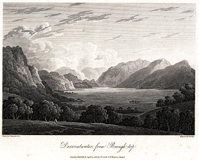 click to enlarge click to enlargePR0450.jpg Plate 17 in The Lakes of Lancashire, Westmorland, and Cumberland. printed at bottom left, right, centre:- "Drawn by J. Farington. / Engraved by F. R. Hay. / Derwentwater from Brough-top. / London, Published Septr. 15, 1815, by T. Cadell &W. Davies, Strand." The accompanying text is by Thomas Hartwell Horne:- "DERWENTWATER FROM BROUGH TOP." "DERWENT-WATER, or KESWICK LAKE, as it is frequently termed from its vicinity to the town of Keswick, is of an irregular form, somewhat approaching to the oval, and about three miles in length, by one and a half in width. By many tourists, this Lake has been supposed to be the finest in the North of England; but for grandeur and sublimity Ulswater is now allowed to claim the pre-eminence. Derwentwater, however, has this decided advantage over the other Lakes, viz. that it immediately appears to be what it is. The dark frowning Skiddaw 'forms its northern boundary, and seems to rise almost immediately from its shore, though it is at its nearest point half a league distant, and the town of Keswick intervenes. One long mountain, along which the road forms a fine terrace, reaches nearly along the whole of its western side: and through the space between this and the next mountain, which in many points of view appears like the lower segment of a prodigious circle, a lovely vale is seen which runs up amomg the hills.' But the pride of Derwentwater is the head, where the mountains of Borrowdale bound the prospect in a manner singularly wild and grand. Our view, which is taken from Brough Top (an eminence on the left of the road to Keswick from Ambleside,) will convey an accurate idea of its general features. 'The whole,' says Mrs. Radcliffe, 'is seen at one glance, expanding within an amphitheatre of mountains, rocky but not vast; broken into many fantastic shapes, peaked, splintered, impending, and sometimes pyramidal, opening by narrow vallies to the view of rocks that rise immediately byeond (sic), and are again overlooked by others. The precipices seldom hang over the water, but are arranged at some distance; and the shores swell with woody eminences, or sink into green pastural margins. Masses of wood also appear among the cliffs feathering them to their summits' (as may be seen in the foreground on the left of our engraving;) 'and a white cottage sometimes peeps from out their skirts, seated on the smooth knoll of a pasture, and looking so exquisitely picturesque, as to seem placed there purposely to adorn it. The Lake in return faithfully reflects the whole picture; and so even and brilliantly pellucid is its surface, that it rather heightens than obscures the colouring.'" item:- private collection : 114 Image © see bottom of page |
|||||||||||||||||||||||||
|
|
||||||||||||||||||||||||||
| evidence:- | old print:- |
|||||||||||||||||||||||||
| source data:- | Print, uncoloured engraving, Skiddaw, drawn by J M W Turner, engraved by W Miller,
1800s?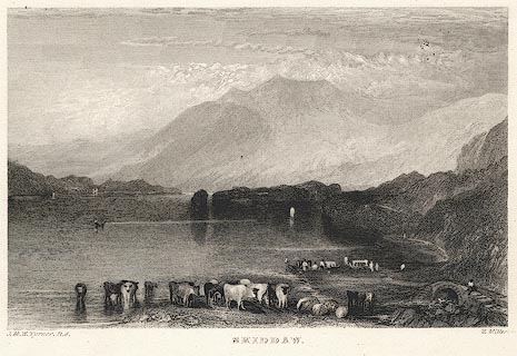 click to enlarge click to enlargePR0379.jpg printed at bottom left, right, centre:- "J. M. W. Turner R.A. / W. Miller. / SKIDDAW." item:- Dove Cottage : 2008.107.379 Image © see bottom of page |
|||||||||||||||||||||||||
|
|
||||||||||||||||||||||||||
| evidence:- | old print:- Middiman 1784-92 (pl.2) placename:- Keswick Lake |
|||||||||||||||||||||||||
| source data:- | Print, uncoloured engraving, Keswick Lake, Cumberland, drawn by J Smith, engraved
and published by Samuel Middiman, London, 1784.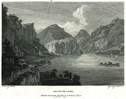 click to enlarge click to enlargePR0194.jpg Plate 2 from the set of prints, Select Views in Great Britain? printed at bottom left, right, centre:- "Drawn by J. Smith. / Engrav'd by S. Middiman. / KESWICK - LAKE. / Published as the Act directs, Jany. 1st. 1784, by S. Middiman, London." item:- Dove Cottage : 2008.107.194 Image © see bottom of page |
|||||||||||||||||||||||||
|
|
||||||||||||||||||||||||||
| evidence:- | old print:- Black 1856 placename:- Derwentwater |
|||||||||||||||||||||||||
| source data:- | Print, engraving, Derwentwater, Cumberland, by Montague Stanley,
engraved by W Miller, about 1846?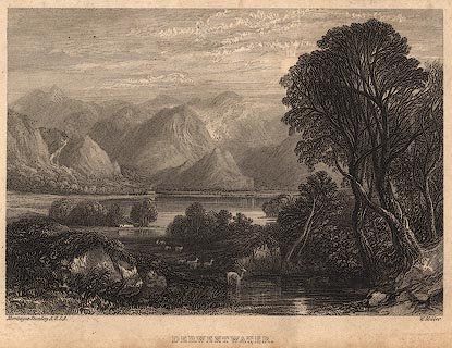 click to enlarge click to enlargeBC02E5.jpg Tipped in opposite p.78 of Black's Picturesque Guide to the English Lakes, published by Adam and Charles Black, North Bridge, Edinburgh, 3rd edn 1846. bottom, left, centre, right:- "Montague Stanley A.R.S.A. / W. Miller" item:- JandMN : 32.8 Image © see bottom of page |
|||||||||||||||||||||||||
|
|
||||||||||||||||||||||||||
| evidence:- | old print:- Gresham Publishing 1900s placename:- Derwentwater |
|||||||||||||||||||||||||
| source data:- | Print, colour halftone, Derwentwater from Friars Crag, Cumberland, by Ernest W Haslehurst,
published by The Gresham Publishing Co, 66 Chandos Street, London, 1900s?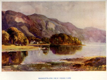 click to enlarge click to enlargePR1567.jpg Tipped in opposite p.40 of The English Lakes section of a volume of Our Beautiful Homeland. printed at bottom:- "DERWENTWATER FROM FRIARS CRAG" printed at lower left:- "E. W. HASLEHURST" item:- JandMN : 381.9 Image © see bottom of page |
|||||||||||||||||||||||||
|
|
||||||||||||||||||||||||||
| evidence:- | old print:- Rumney 1899 placename:- Derwentwater item:- sunset |
|||||||||||||||||||||||||
| source data:- | Print, halftone photograph, Sunset on Derwentwater, Cumberland, published by George
Philip and Son, 32 Fleet Street, London, and Liverpool, 1899.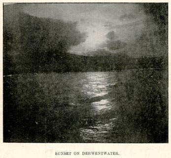 click to enlarge click to enlargeRUM115.jpg On p.47 of the Cyclist's Guide to the English Lake District, by A W Rumney. printed at bottom:- "SUNSET ON DERWENTWATER." item:- JandMN : 147.16 Image © see bottom of page |
|||||||||||||||||||||||||
|
|
||||||||||||||||||||||||||
| evidence:- | old print:- Goodwin 1887 (edn 1890) placename:- Derwentwater |
|||||||||||||||||||||||||
| source data:- | Print, etching? Derwentwater, Cumberland, by Harry Goodwin, published by Swan Sonnenschein
and Co, Paternoster Square, London, 1890.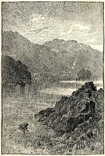 click to enlarge click to enlargePR1617.jpg Tipped in opposite p.226 of Through the Wordsworth Country, by William Knight. printed at lower right:- "HG" item:- JandMN : 382.47 Image © see bottom of page |
|||||||||||||||||||||||||
|
|
||||||||||||||||||||||||||
| evidence:- | old print:- Ritter 1849 placename:- Derwentwater |
|||||||||||||||||||||||||
| source data:- | Print, uncoloured engraving, Derwentwater, Borrowdale, Cumberland, published by the
Religious Tract Society, The Depository, 56 Paternoster Row, and 65 St Paul's Churchyard,
London, 1849?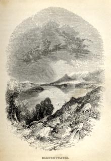 click to enlarge click to enlargeRT0104.jpg Tipped opposite p.116 of Loitering among the Lakes of Cumberland and Westmoreland, by Paul Ritter? printed at bottom:- "DERWENTWATER." printed at lower left of centre:- "[J] Gill[ick]" item:- Fell and Rock Climbing Club : 2.5 Image © see bottom of page |
|||||||||||||||||||||||||
|
|
||||||||||||||||||||||||||
| evidence:- | old print:- Ritter 1849 placename:- Derwent Water |
|||||||||||||||||||||||||
| source data:- | Print, Baxter print, colour, Derwent Water, Cumberland, by Baxter, 11 Northampton
Square, London, published by the Religious Tract Society, The Depository, 56 Paternoster
Row, and 65 St Paul's Churchyard, London, 1849?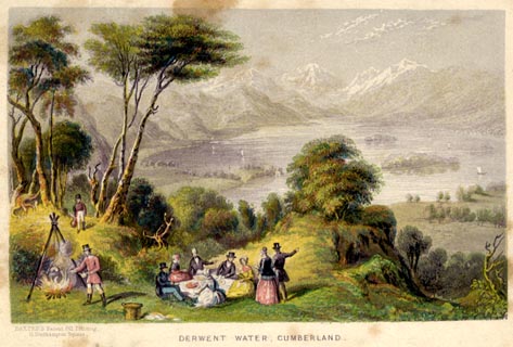 click to enlarge click to enlargeRT01F.jpg The view is from Ashness. Tipped in as frontispiece to Loitering among the Lakes of Cumberland and Westmoreland, by Paul Ritter? printed at bottom left:- "BAXTER'S Patent Oil Printing, / 11, Northampton Square." printed at bottom:- "DERWENT WATER, CUMBERLAND." item:- Fell and Rock Climbing Club : 2.1 Image © see bottom of page |
|||||||||||||||||||||||||
|
|
||||||||||||||||||||||||||
| evidence:- | old drawing:- |
|||||||||||||||||||||||||
| source data:- | Drawing, Keswick Lake and residence of Mackenzie Esq, Derwent Water, Cumberland, by
William Havell, 1817.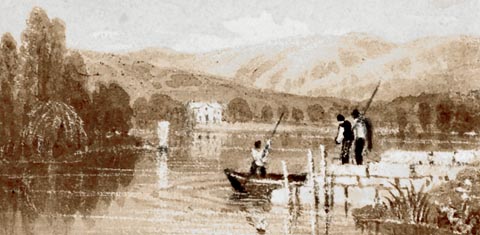 click to enlarge click to enlargePR1411.jpg Derwent Water with jetty in foreground on which stand two fisherman, a third fisherman can be seen in a boat on the lake beside the jetty. On the far distant shore stands a country house, residence of Mackenzie Esq. Lakeland hills in background. One of a set of eight 'Drawings for a Pocket Book' intended to be engraved, executed on the spot by the artist. Eight drawings pasted to one piece of paper all executed in pencil, brown wash and white gouache. at bottom right:- "September 1817" item:- Tullie House Museum : 2009.89.59 Image © Tullie House Museum |
|||||||||||||||||||||||||
|
|
||||||||||||||||||||||||||
| evidence:- | old drawing:- placename:- Derwentwater |
|||||||||||||||||||||||||
| source data:- | Drawing, Derwentwater from Crow Park, Keswick, Cumberland, by William Havell, 1800s-10s.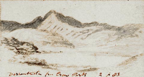 click to enlarge click to enlargePR1406.jpg View of Derwent Water from Crow Park with large hills in background. One of a set of twenty views of the lake district executed by the artist on one sheet of paper. at bottom:- "Derwentwater from Crow Park 2 p23" item:- Tullie House Museum : 2009.89.50 Image © Tullie House Museum |
|||||||||||||||||||||||||
|
|
||||||||||||||||||||||||||
| evidence:- | old drawing:- placename:- Derwentwater |
|||||||||||||||||||||||||
| source data:- | Drawing, Derwentwater and Skiddaw, Cumberland, by William Havell, 1800s-10s.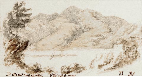 click to enlarge click to enlargePR1408.jpg View of Derwent Water from above with Skiddaw in the background. One of a set of twenty views of the lake district executed by the artist on one sheet of paper. at bottom:- "Derwentwater Skiddaw II 31" item:- Tullie House Museum : 2009.89.52 Image © Tullie House Museum |
|||||||||||||||||||||||||
|
|
||||||||||||||||||||||||||
| evidence:- | old painting:- item:- sheep |
|||||||||||||||||||||||||
| source data:- | Painting, watercolour, Early Morning, Derwentwater, Cumberland, by Frederick Clive
Newcome, 1870-94. click to enlarge click to enlargePR0866.jpg A shepherd with his sheep advances along path winding between large boulders. Behind him, to left, lies Derwentwater; to right of composition a wooded hillside rises. signed at bottom right:- "Newcome" item:- Tullie House Museum : 1915.18.1 Image © Tullie House Museum |
|||||||||||||||||||||||||
|
|
||||||||||||||||||||||||||
| evidence:- | old painting:- placename:- Derwentwater |
|||||||||||||||||||||||||
| source data:- | Painting, oil on canvas, Catbells and Causey Pike, Derwentwater, Cumberland, by William
James Blacklock, 1854.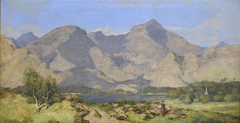 click to enlarge click to enlargePR0918.jpg This is a view of Catbells and Causey Pike beyond Derwent Water in the Lake District on a fine summer's day. Bright sunshine throws the shadows of the fells beyond the lake into sharp relief. In the middle distance to right of composition the church spire of St John's Church, Keswick can be seen rising from thick woodland in front of which sheep are grazing. In the foreground a sandy track leads towards the lake in the centre of the composition. A woman stands amongst clumps of flowering heather, her back towards the viewer, looking towards the church spire. This painting was exhibited at the Royal Academy in 1854. Blacklock is one of Cumbria's most important landscape painters. He painted the scenery of Cumbria, the Lake District and the Borders and particularly favoured remote areas. He painted these landscapes in his own uniquely precise style. The composition shows considerable artistic licence. Blacklock has altered components of the picture by bringing St John's Church in Keswick into view to make a more pleasing composition. Blacklock's unique painting style is very precise and has an almost three dimensional effect. Exhibited at the Royal Academy, London, 1854. labelled at reverse on stretcher:- "Cat Bells and Causey Pike, Derwentwater W J Blacklock Cumwhitton No 3 Carlisle" item:- Tullie House Museum : 1935.91.1 Image © Tullie House Museum |
|||||||||||||||||||||||||
|
|
||||||||||||||||||||||||||
| evidence:- | old painting:- placename:- Derwentwater item:- picnic |
|||||||||||||||||||||||||
| source data:- | Painting, oil painting, On the Banks of Derwentwater, Silver Birch, Cumberland, by
William James Blacklock, about 1843.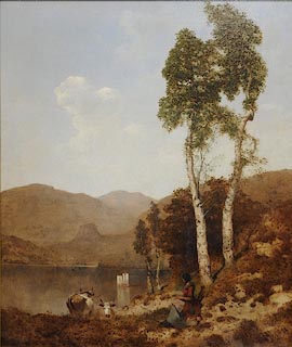 click to enlarge click to enlargePR0938.jpg In foreground a young woman sits beside the lake in the shade of two tall birch trees, eating a solitary meal; she has a cloth spread over her lap and a flagon and basket standing beside her. Two long horned cows graze on the foreshore of the lake upon which two small boats sail. Distant fells rise beyond. labelled at reverse:- "No 1 On the banks of Derwentwater W J Blacklock 40 London St Fitzroy Square Worcester Exhibition" item:- Tullie House Museum : 1946.67.2 Image © Tullie House Museum |
|||||||||||||||||||||||||
|
|
||||||||||||||||||||||||||
| evidence:- | old drawing:- placename:- Derwent Water |
|||||||||||||||||||||||||
| source data:- | Drawing, Derwentwater and Bassenthwaite, Cumberland, by John Harper, 1840.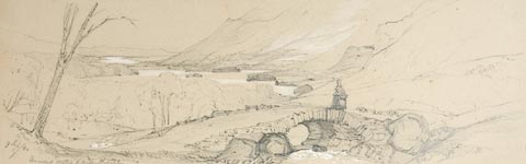 click to enlarge click to enlargePR1369.jpg View of Derwentwater and Bassenthwaite from Ashness Bridge, framed by hills and woods on both sides. A female figure walks across the bridge in the foreground. Executed in pencil with touches of white gouache on buff coloured paper. Preparatory sketch drawn on the spot by the artist. at bottom left:- "9 Sep/40 Derwent Water &Bassenthwaite" item:- Tullie House Museum : 2009.89.13 Image © Tullie House Museum |
|||||||||||||||||||||||||
|
|
||||||||||||||||||||||||||
| evidence:- | old painting:- placename:- Keswick Lake item:- fishing |
|||||||||||||||||||||||||
| source data:- | Painting, watercolour, Keswick Lake, ie Derwent Water, Cumberland, copied from Kineyle,
1829?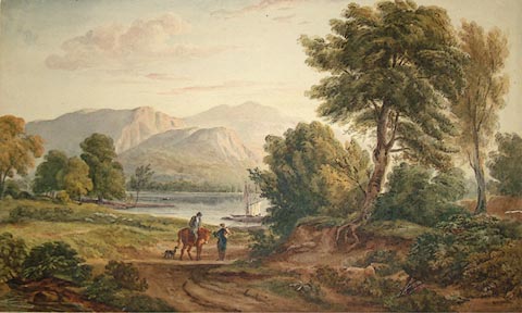 click to enlarge click to enlargePR1053.jpg A pathway, to right side of which grow tall trees, leads from foreground towards lake; a man on horseback converses with a fisherman who has a basket on his back. A small dog waits beside them. On the lake a boat prepares to leave the shore. Rugged fells rise beyond. inscribed &dated at reverse:- "Keswick Lake Copied from Kineyle - 1829 Mrs Cresswell with her nieces love and duty" item:- Tullie House Museum : 1970.33.40 Image © Tullie House Museum |
|||||||||||||||||||||||||
|
|
||||||||||||||||||||||||||
| evidence:- | old print:- placename:- Derwentwater item:- cattle |
|||||||||||||||||||||||||
| source data:- | Print, Derwentwater, Cumberland, drawn by Philippe Jacques de Loutherbourg, engraved
by John Hassell, 1790-1809?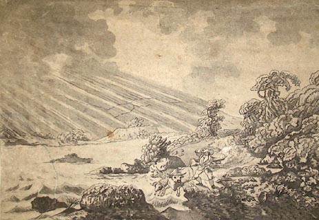 click to enlarge click to enlargePR1030.jpg Windy day; in centre of composition, having come along the lakeside path beside which stands a small house, a cowherd drives a bull, a cow and a ram across the shallow water at the edge of the choppy lake. He holds onto his hat as his cloak swirls about him. Slanting rays of sunshine break through the clouds overshadowing the fells rising to left of composition. inscribed at bottom left on print:- "Drawn by Loutherbourg." printed at bottom centre:- "DERWENTWATER" inscribed at bottom right on print:- "Etch'd and Aqua.t by I Hassell." item:- Tullie House Museum : 1970.33.3 Image © Tullie House Museum |
|||||||||||||||||||||||||
|
|
||||||||||||||||||||||||||
| evidence:- | illustration:- OS 1925 |
|||||||||||||||||||||||||
| source data:- | Map, Tourist Map of The Lake District, Westmorland, Cumberland,
Lancashire, scale 1 inch to 1 mile, published by the Ordnance
Survey, Southampton, Hampshire, about 1925.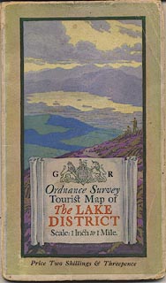 click to enlarge click to enlargeOS22C.jpg "DERWENTWATER from SKIDDAW ... ELLIS MARTIN" 1925 - Martin, Ellis, 1925item:- JandMN : 62 Image © see bottom of page |
|||||||||||||||||||||||||
|
|
||||||||||||||||||||||||||
| evidence:- | illustration:- LNWR 1910 |
|||||||||||||||||||||||||
| source data:- | Print, colour lithograph? Head of Derwent Water, from Castle
Crag, from a painting by R T Roussel, published by the London
and North Western Railway, LNWR, about 1910.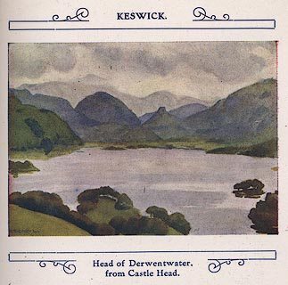 click to enlarge click to enlargeNW01E7.jpg Included in the guide book, The English Lakes, published by the London and North Western Railway about 1910. Roussel, R T, 1910item:- JandMN : 49.8 Image © see bottom of page |
|||||||||||||||||||||||||
|
|
||||||||||||||||||||||||||
| evidence:- | old print:- Pyne 1853 placename:- Derwentwater |
|||||||||||||||||||||||||
| source data:- | Drawn by James Barker Pyne, 1848-1853, lithographed by T Picken, 1859.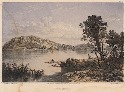 click to enlarge click to enlargePY21.jpg "Derwentwater" item:- JandMN : 97.19 Image © see bottom of page |
|||||||||||||||||||||||||
|
|
||||||||||||||||||||||||||
| evidence:- | old print:- Garnett 1850s-60s F |
|||||||||||||||||||||||||
| source data:- | Print, uncoloured engraving, Derwent Water, looking towards Lodore, Cumberland, engraved
by William Banks, Edinburgh, published by John Garnett, Windermere, Westmorland, 1850s-60s?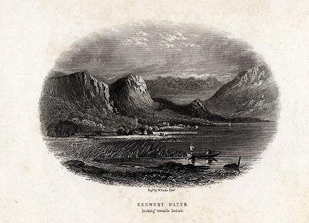 click to enlarge click to enlargeGAR716.jpg Found with Views of the English Lakes. printed at bottom:- "Engd. by W. Banks, Edinr. / DERWENT WATER / looking towards Lodore." item:- JandMN : 165.16 Image © see bottom of page |
|||||||||||||||||||||||||
|
|
||||||||||||||||||||||||||
| evidence:- | old print:- Harwood 1842 placename:- Derwentwater |
|||||||||||||||||||||||||
| source data:- | Print, uncoloured engraving, Derwentwater and Keswick from Skiddaw, Cumberland, engraved
and published by John and Frederick Harwood, 26 Fenchurch Street, London, about 1842. click to enlarge click to enlargeHRW212.jpg printed at bottom left, centre:- "London, J &F. Harwood. / Derwentwater and Keswick from Skiddaw." item:- JandMN : 166.12 Image © see bottom of page |
|||||||||||||||||||||||||
|
|
||||||||||||||||||||||||||
| evidence:- | old print:- Fielding 1822 (plate 5) |
|||||||||||||||||||||||||
| source data:- | Print, coloured aquatint, Skiddaw over Derwent Water, drawn by Theodore Fielding,
published by Thomas McLean, 26 Haymarket, and by Howlett and Brimmer, Columbian Press,
10 Frith Street, London, 1822.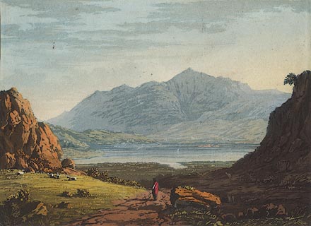 click to enlarge click to enlargeBNV39.jpg Plate 5 in Cumberland, Westmorland, and Lancashire Illustrated ... item:- private collection : 78 Image © see bottom of page |
|||||||||||||||||||||||||
|
|
||||||||||||||||||||||||||
| evidence:- | old print:- Housman 1800 placename:- Derwentwater placename:- Keswick Lake |
|||||||||||||||||||||||||
| source data:- | Print, uncoloured engraving, Derwentwater or Keswick Lake from Ormathwaite, drawn
by IW, engraved by R Scott, published by F Jollie, Carlisle, Cumberland, 1800.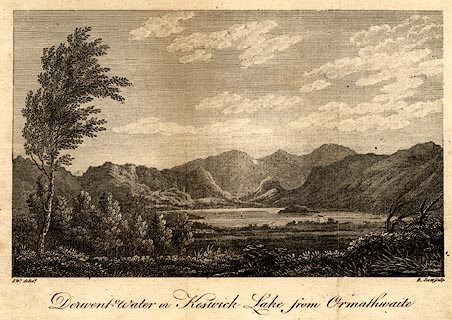 click to enlarge click to enlargePR0478.jpg Taken from a guide book, A Descriptive Tour, and Guide to the Lakes, Caves and Mountains, by John Housman, 1800, 5th edn 1812. printed at bottom left, right, centre:- "I.W. delint. / R. Scott sculpt. / Derwentwater or Keswick Lake from Ormathwaite" item:- JandMN : 233.7 Image © see bottom of page |
|||||||||||||||||||||||||
|
|
||||||||||||||||||||||||||
| evidence:- | old print:- placename:- Derwentwater |
|||||||||||||||||||||||||
| source data:- | Print, 3 engravings, A View of Derwentwater ie Derwent Water, A
View of Broadwater perhaps Brothers Water, and A View of
Winander Mere ie Windermere, Westmorland and Cumberland,
engraved by Lodge, published by Alexander Hogg, The Kings Arms,
16 Paternoster Row, London, about 1794.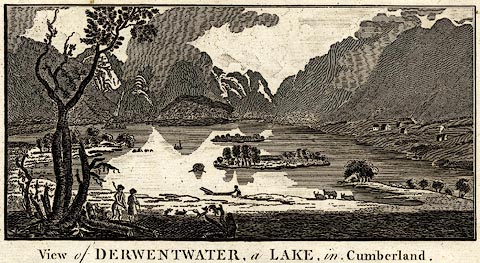 click to enlarge click to enlargeBNF23A.jpg "View of DERWENTWATER, a LAKE, in Cumberland" item:- Dove Cottage : 2007.38.6 Image © see bottom of page |
|||||||||||||||||||||||||
|
|
||||||||||||||||||||||||||
| evidence:- | old postcard:- placename:- Derwentwater |
|||||||||||||||||||||||||
| source data:- | Postcard, colour photogravure, Derwentwater and Skiddaw from Ashness Bridge, by G
P Abrahams, Keswick, Cumberland, purchased about 1954.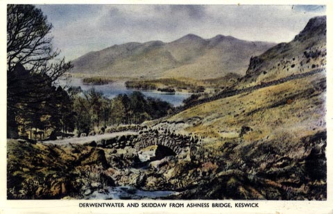 click to enlarge click to enlargePH0060.jpg printed at reverse:- "Photogravure Series by G. P. ABRAHAM, LTD. (Copyright) KESWICK" item:- JandMN : 342 Image © see bottom of page |
|||||||||||||||||||||||||
|
|
||||||||||||||||||||||||||
| evidence:- | old print:- Heywood 1906 placename:- Derwentwater |
|||||||||||||||||||||||||
| source data:- | Print, halftone, Keswick and Derwentwater, Cumberland, from a photograph by A Pettitt,
Keswick, published by Abel Heywood and Son, 56-58 Oldham Street, Manchester, and by
Simpkin, Marshall, Hamilton, Kent and Co, Ave Maria Lane, Paternoster Row, London,
1906.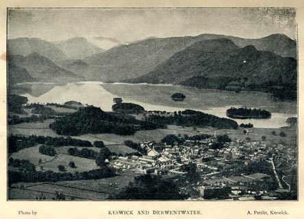 click to enlarge click to enlargeHW1E09.jpg In a Guide to Keswick and its Vicinity in the Penny Guide Books series. printed at bottom:- "Photo by / KESWICK AND DERWENTWATER. / A. Pettitt, Keswick." item:- JandMN : 348.9 Image © see bottom of page |
|||||||||||||||||||||||||
|
|
||||||||||||||||||||||||||
| evidence:- | old print:- Heywood 1906 placename:- Derwentwater |
|||||||||||||||||||||||||
| source data:- | Print, halftone, Derwentwater, Keswick, Cumberland, from a photograph by H Bell, Ambleside,
published by Abel Heywood and Son, 56-58 Oldham Street, Manchester, and by Simpkin,
Marshall, Hamilton, Kent and Co, Ave Maria Lane, Paternoster Row, London, 1906.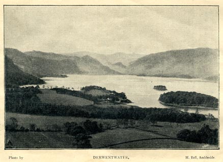 click to enlarge click to enlargeHW1E03.jpg In a Guide to Keswick and its Vicinity in the Penny Guide Books series. printed at bottom:- "Photo by / DERWENTWATER. / H. Bell, Ambleside" inter neg at lower right:- "[H. BELL]" item:- JandMN : 348.3 Image © see bottom of page |
|||||||||||||||||||||||||
|
|
||||||||||||||||||||||||||
| evidence:- | old print:- Pearson 1900s placename:- Derwentwater |
|||||||||||||||||||||||||
| source data:- | Print, halftone photograph, Derwentwater from Ashness Bridge, Borrowdale, Cumberland,
published by C Arthur Pearson, Henrietta Street, London, 1900s.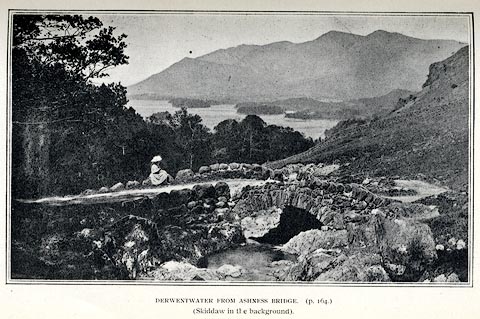 click to enlarge click to enlargePS1E59.jpg On p.161 of Pearson's Gossipy Guide to the English Lakes and Neighbouring Districts. printed at bottom:- "DERWENTWATER FROM ASHNESS BRIDGE. (p.164). / (Skiddaw in the background)." item:- Armitt Library : A1188.66 Image © see bottom of page |
|||||||||||||||||||||||||
|
|
||||||||||||||||||||||||||
| evidence:- | old print:- Pearson 1900s placename:- Derwentwater |
|||||||||||||||||||||||||
| source data:- | Print, halftone photograph, Derwentwater, from the East, Keswick, Cumberland, published
by C Arthur Pearson, Henrietta Street, London, 1900s.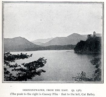 click to enlarge click to enlargePS1E58.jpg On p.159 of Pearson's Gossipy Guide to the English Lakes and Neighbouring Districts. printed at bottom:- "DERWENTWATER, FROM THE EAST. (p.158). / (The peak to the right is Causey Pike, the to the left Cat Bells)." item:- Armitt Library : A1188.65 Image © see bottom of page |
|||||||||||||||||||||||||
|
|
||||||||||||||||||||||||||
| evidence:- | old print:- placename:- Derwent Water |
|||||||||||||||||||||||||
| source data:- | Print, chromolithograph, Derwent Water, Cumberland, published by T Nelson and Sons,
London, 1900s?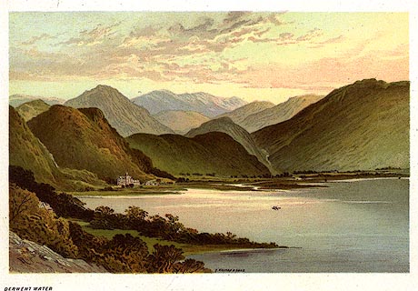 click to enlarge click to enlargePR0166.jpg From a set of prints, The Scenery of the English Lakes printed at lower centre:- "T. NELSON &SONS" printed at bottom left:- "DERWENT WATER" item:- Dove Cottage : 2008.107.166 Image © see bottom of page |
|||||||||||||||||||||||||
|
|
||||||||||||||||||||||||||
| evidence:- | old print:- placename:- Derwentwater |
|||||||||||||||||||||||||
| source data:- | Print, uncoloured engraving, Derwentwater, Cumberland, engraved by Butterworth and
Heath, published late 19th century?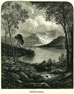 click to enlarge click to enlargePR0327.jpg Frontispiece to The English Lakes. printed at lower right:- "Butterworth &Heath Sc" printed at bottom:- "DERWENTWATER. / DEEP stillness lies upon this lovely lake, /The air is calm, the forest trees are still; / The river windeth without noise, and here / The fall of fountains comes not, nor the sound / Of the white cataract Lodore: the voice - / The mighty mountain voice - itself is dumb. / B. W. PROCTOR." item:- Dove Cottage : 2008.107.327 Image © see bottom of page |
|||||||||||||||||||||||||
|
|
||||||||||||||||||||||||||
| evidence:- | old print:- Rowbotham 1875 |
|||||||||||||||||||||||||
| source data:- | Print, chromograph, Derwent Water, Cumberland, by T L Rowbotham, published by Marcus
Ward and Co, 67-68 Chandos Street, Covent Garden, London, and Belfast, 1875.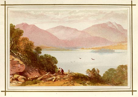 click to enlarge click to enlargeLF1E01.jpg Frontispiece to English Lake Scenery, by W J Loftie. printed at lower right:- "T L Rowbotham" printed at lower left:- "MARCUS WARD &CO CHROMO" item:- Armitt Library : A963.1 Image © see bottom of page |
|||||||||||||||||||||||||
|
|
||||||||||||||||||||||||||
| evidence:- | old print:- Rowbotham 1875 |
|||||||||||||||||||||||||
| source data:- | Print, colour lithograph? Derwent Water, Cumberland, by T L Rowbotham, published by
Marcus Ward and Co, London? 1875?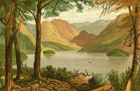 click to enlarge click to enlargePR0130.jpg Included in the set of prints, Views in the English Lake District. item:- Dove Cottage : 2008.107.130 Image © see bottom of page |
|||||||||||||||||||||||||
|
|
||||||||||||||||||||||||||
| evidence:- | old print:- placename:- Derwentwater |
|||||||||||||||||||||||||
| source data:- | Print, uncoloured engraving, Derwentwater, Cumberland, published late 19th century?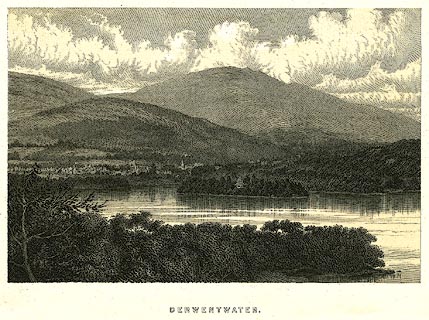 click to enlarge click to enlargePR0274.jpg Derwent Isle and its house in the midground. printed at bottom:- "DERWENTWATER." item:- Dove Cottage : 2008.107.274 Image © see bottom of page |
|||||||||||||||||||||||||
|
|
||||||||||||||||||||||||||
| evidence:- | outline view:- Matthew 1866 placename:- Derwent Water |
|||||||||||||||||||||||||
| source data:- | Print, engraving, outline view, View from Watendlath Road of Derwent Water and Bassenthwaite,
Cumberland, published by J Richardson, Highgate, Kendal, Westmorland, 1866.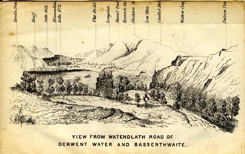 click to enlarge click to enlargeMW1E05.jpg Tipped in before p.1 of The English Lakes, Peaks and Passes, from Kendal to Keswick, by George King Matthew. printed at bottom:- "VIEW FROM WATENDLATH ROAD OF / DERWENT WATER AND BASSENTHWAITE." item:- Armitt Library : A1168.5 Image © see bottom of page |
|||||||||||||||||||||||||
|
|
||||||||||||||||||||||||||
| evidence:- | old print:- Payn 1860s-70s placename:- Derwent Water |
|||||||||||||||||||||||||
| source data:- | Print, colour printed, Derwent Water, Keswick, Cumberland, published by John Garnett,
Windermere, Westmorland, and by Simpkin, Marshall and Co, London, 1860s-70s?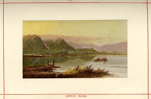 click to enlarge click to enlargePN0113.jpg Tipped in opposite p.56 of England's Lakeland, a Tour Therein, by James Payn. printed at bottom:- "DERWENT WATER." item:- Armitt Library : A1183.13 Image © see bottom of page |
|||||||||||||||||||||||||
|
|
||||||||||||||||||||||||||
| evidence:- | old print:- Payn 1860s-70s placename:- Derwent Water |
|||||||||||||||||||||||||
| source data:- | Print, uncoloured woodcut, Derwent Water, Keswick, Cumberland, published by John Garnett,
Windermere, Westmorland, and by Simpkin, Marshall and Co, London, 1860s-70s?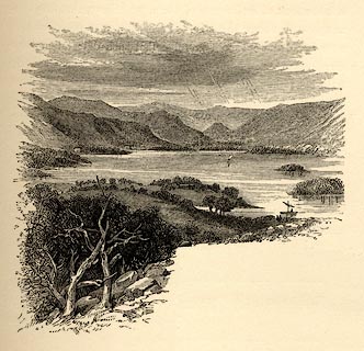 click to enlarge click to enlargePN0112.jpg On p.55 of England's Lakeland, a Tour Therein, by James Payn. item:- Armitt Library : A1183.12 Image © see bottom of page |
|||||||||||||||||||||||||
|
|
||||||||||||||||||||||||||
| evidence:- | old print:- Religious Tract Society 1860s placename:- Derwentwater |
|||||||||||||||||||||||||
| source data:- | Print, engraving, Derwentwater, Cumberland, published by the Religious Tract Society,
London, 1860s?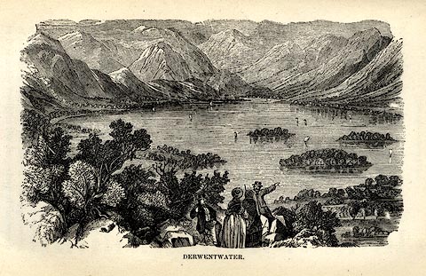 click to enlarge click to enlargeRL01E6.jpg Tipped in opp.p.74 in How To See the English Lakes. printed at bottom:- "DERWENTWATER." item:- Armitt Library : A1150.7 Image © see bottom of page |
|||||||||||||||||||||||||
|
|
||||||||||||||||||||||||||
| evidence:- | old print:- placename:- Derwent Water |
|||||||||||||||||||||||||
| source data:- | Print, uncoloured engraving, Derwent Water and Skiddaw, Cumberland, engraved by M
Jackson, published late 19th century?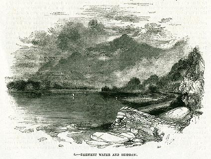 click to enlarge click to enlargePR0343.jpg On page 241 of The Land We Live In. printed at lower centre:- "M. JACKSON. SC" printed at bottom:- "6.- DERWENT WATER AND SKIDDAW." item:- Dove Cottage : 2008.107.343 Image © see bottom of page |
|||||||||||||||||||||||||
|
|
||||||||||||||||||||||||||
| evidence:- | old print:- Nelson 1859 placename:- Derwentwater |
|||||||||||||||||||||||||
| source data:- | Print, engraving, Derwentwater from Castle Head, drawn by Keeley Halswelle, Edinburgh,
published by T Nelson and Sons, Paternoster Row, London, and Edinburgh and New York,
United States, 1859.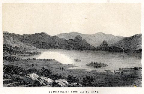 click to enlarge click to enlargeNS0104.jpg Tipped in oppposite p.96 of a guide book, The English Lakes. printed at bottom:- "DERWENTWATER FROM CASTLE HEAD." item:- JandMN : 336.5 Image © see bottom of page |
|||||||||||||||||||||||||
|
|
||||||||||||||||||||||||||
| evidence:- | old print:- Adams 1852 placename:- Keswick Lake |
|||||||||||||||||||||||||
| source data:- | Print, engraving, Keswick Lake and Lowdore Fall, by F G Delamotte, published by W
J Adams, 59 Fleet Street, London, 1852.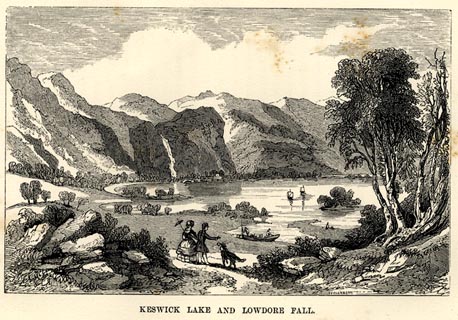 click to enlarge click to enlargeAD03E4.jpg Tipped in opp.p.59 in Adams's Pocket Descriptive Guide to the Lake District. printed at lower right:- "F DELAMOTTE" printed at bottom:- "KESWICK LAKE AND LOWDORE FALL." item:- Armitt Library : A1117.5 Image © see bottom of page |
|||||||||||||||||||||||||
|
|
||||||||||||||||||||||||||
| evidence:- | old print:- Sylvan 1847 placename:- Derwent Water item:- moonlight |
|||||||||||||||||||||||||
| source data:- | Print, engraving, Derwent Water by Moonlight, near Keswick, Cumberland, published
by John Johnstone, Paternoster Row, London, et al, 1847.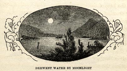 click to enlarge click to enlargeSYL148.jpg On p.196 of Sylvan's Pictorial Guide to the English Lakes. printed at bottom:- "DERWENT WATER BY MOONLIGHT." item:- Armitt Library : A1201.48 Image © see bottom of page |
|||||||||||||||||||||||||
|
|
||||||||||||||||||||||||||
| evidence:- | old print:- Sylvan 1847 placename:- Derwent Water |
|||||||||||||||||||||||||
| source data:- | Print, engraving, Derwent Water, near Keswick, Cumberland, published by John Johnstone,
Paternoster Row, London, et al, 1847.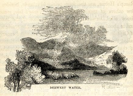 click to enlarge click to enlargeSYL146.jpg On p.192 of Sylvan's Pictorial Guide to the English Lakes. printed at bottom:- "DERWENT WATER." item:- Armitt Library : A1201.46 Image © see bottom of page |
|||||||||||||||||||||||||
|
|
||||||||||||||||||||||||||
| evidence:- | outline view:- Tattersall 1836 (version 1869) placename:- Derwentwater Lake |
|||||||||||||||||||||||||
| source data:- | Print, hand coloured, Derwentwater and Bassenthwaite Lakes, from the road to Watendlath,
Cumberland, drawn by George Tattersall, 1836, engraved by W F Topham, published by
T J Allman, 463 Oxford Street, London, 1869.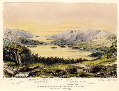 click to enlarge click to enlargeTAT212.jpg Included in The Lakes of England, by W F Topham. printed at bottom:- "DERWENTWATER and BASSENTHWAITE LAKES, / from the road to Watendlath." printed at bottom:- "Swinside. / Lord's Seat. / Barff. / St. Herbert's I. / Bassenthwaite L. / Ramps I. / Vicar's I. / Lord's I. / Skiddaw Dodd. / Castle Hill. / Keswick. / Skiddaw. / Latrigg. / Falcon Crag." item:- Armitt Library : A1067.12 Image © see bottom of page |
|||||||||||||||||||||||||
|
|
||||||||||||||||||||||||||
| evidence:- | old print:- Green 1819 placename:- Derwent Water |
|||||||||||||||||||||||||
| source data:- | Print, aquatint, Derwent Water from Strands Hagg, Keswick, Cumberland, by William
Green, 1819, published by R Lough and Co, Chronicle Office, Finkle Street, Kendal,
and others, 1820.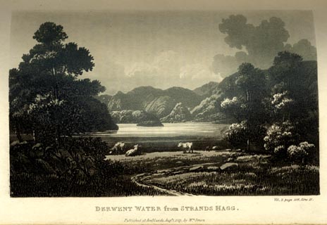 click to enlarge click to enlargeGN0120.jpg Tipped in opposite vol.2 p.106 of The Tourist's New Guide, by William Green. printed at bottom right, centre:- "Vol.2, page 106, line 11. / DERWENT WATER from STRANDS HAGG. / Published at Ambleside, Augt. 1. 1819, by Wm. Green." item:- Armitt Library : A1141.21 Image © see bottom of page |
|||||||||||||||||||||||||
|
|
||||||||||||||||||||||||||
| evidence:- | old print:- Green 1819 placename:- Derwent Water |
|||||||||||||||||||||||||
| source data:- | Print, aquatint, Derwent Water from Crow Park, Keswick, Cumberland, by William Green,
1819, published by R Lough and Co, Chronicle Office, Finkle Street, Kendal, and others,
1820.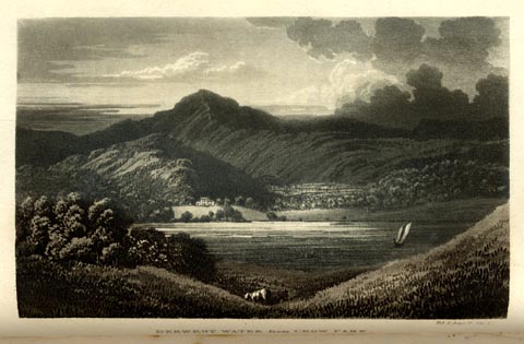 click to enlarge click to enlargeGN0119.jpg Tipped in opposite vol.2 p.83 of The Tourist's New Guide, by William Green. printed at bottom right, centre:- "Vol.2, page 83, line 1. / DERWENT WATER from CROW PARK. / Published at Ambleside, Augt. 1. 1819, by Wm. Green." item:- Armitt Library : A1141.20 Image © see bottom of page |
|||||||||||||||||||||||||
|
|
||||||||||||||||||||||||||
| evidence:- | old print:- Green 1819 placename:- Derwent Water |
|||||||||||||||||||||||||
| source data:- | Print, aquatint, Derwent Water distance Skiddaw, Cumberland, by William Green, 1819,
published by R Lough and Co, Chronicle Office, Finkle Street, Kendal, and others,
1820.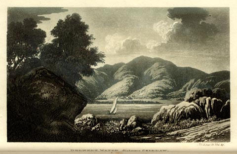 click to enlarge click to enlargeGN0118.jpg Tipped in opposite vol.2 p.31 of The Tourist's New Guide, by William Green. printed at bottom right, centre:- "Vol.2, page 31, line 29. / DERWENT WATER distance SKIDDAW. / Published at Ambleside, Augt. 1. 1819, by Wm. Green." item:- Armitt Library : A1141.19 Image © see bottom of page |
|||||||||||||||||||||||||
|
|
||||||||||||||||||||||||||
| evidence:- | old print:- Green 1819 placename:- Derwent Water |
|||||||||||||||||||||||||
| source data:- | Print, aquatint, Derwent Water near Barrow Beck, Borrowdale, Cumberland, by William
Green, 1819, published by R Lough and Co, Chronicle Office, Finkle Street, Kendal,
and others, 1820.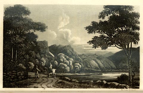 click to enlarge click to enlargeGN0117.jpg Tipped in opposite vol.2 p.23 of The Tourist's New Guide, by William Green. printed at bottom right, centre:- "Vol.2, page 23, line 10. / DERWENT WATER near BARROW BECK. / Published at Ambleside, Augt. 1. 1819, by Wm. Green." item:- Armitt Library : A1141.18 Image © see bottom of page |
|||||||||||||||||||||||||
|
|
||||||||||||||||||||||||||
| evidence:- | old print:- Britton and Brayley 1802 placename:- Derwentwater |
|||||||||||||||||||||||||
| source data:- | Print, uncoloured engraving, Derwentwater, Cumberland, drawn by W M Craig, engraved
by B Compte, published by Vernor and Hood, Poultry, London, 1801.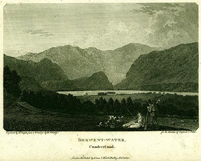 click to enlarge click to enlargePR0139.jpg Included in the Beauties of England and Wales, by John Britton and Edward W Brayley. printed at bottom left, right, centre:- "Engraved by B. Compte from a Drawing by W. M. Craig. / for the Beauties of England & Wales. / DERWENT-WATER, / Cumberland. / London. Publish'd by Vernor &Hood. Poultry, Octr. 1. 1801." item:- Dove Cottage : 2008.107.139 Image © see bottom of page |
|||||||||||||||||||||||||
|
|
||||||||||||||||||||||||||
| evidence:- | old print:- placename:- Derwent Water |
|||||||||||||||||||||||||
| source data:- | Print, aquatint, Derwent Water, Cumberland, drawn by Becker, published by R Crutterell,
Bath, Somerset, 1802.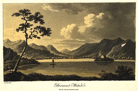 click to enlarge click to enlargePR0438.jpg Derwent Isle and its house in the midground. A companion print has the publisher as Cruttwell. printed at bottom left, centre:- "Becker del. / Derwent-Water. / Pub. Jan. 1 1802, by R. Crutterell, Bath." item:- private collection : 102 Image © see bottom of page |
|||||||||||||||||||||||||
|
|
||||||||||||||||||||||||||
| evidence:- | old print:- placename:- Derwentwater |
|||||||||||||||||||||||||
| source data:- | Print, uncoloured engraving, Derwentwater, Cumberland, published early 19th century?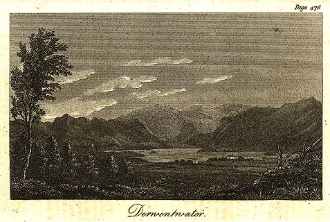 click to enlarge click to enlargePR0273.jpg printed at top right:- "Page 476" printed at bottom:- "Derwentwater" item:- Dove Cottage : 2008.107.273 Image © see bottom of page |
|||||||||||||||||||||||||
|
|
||||||||||||||||||||||||||
| evidence:- | old print:- placename:- Derwentwater |
|||||||||||||||||||||||||
| source data:- | Print, uncoloured engraving, Derwentwater from Lodore, Cumberland, drawn by Powell,
engraved by C Pye, early 19th century.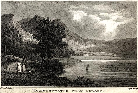 click to enlarge click to enlargePR0442.jpg printed at bottom left, right, centre:- "Powell delin. / C. Pye sculp. / DERWENTWATER FROM LODORE." item:- private collection : 106 Image © see bottom of page |
|||||||||||||||||||||||||
|
|
||||||||||||||||||||||||||
| evidence:- | old print:- placename:- Derwentwater |
|||||||||||||||||||||||||
| source data:- | Print, uncoloured engraving, A View of Derwentwater, Cumberland, engraved by Lodge,
published by Alexander Hogg, The Kings Arms, 16 Paternoster Row, London, about 1794.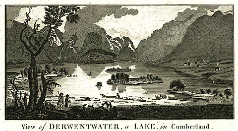 click to enlarge click to enlargePR0221.jpg It has been suggested that this is from Walpoole's Guide to the Lakes. printed at top:- "Publish'd as the Act directs, by Alexr. Hogg, at the Kings Arms, No16 Paternoster Row, London." printed at caption:- "View of DERWENTWATER, a LAKE, in Cumberland." item:- Dove Cottage : 2008.107.221 Image © see bottom of page |
|||||||||||||||||||||||||
|
|
||||||||||||||||||||||||||
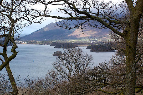 BLT85.jpg From Lowcrag Wood by Ashness Bridge. (taken 3.4.2006) 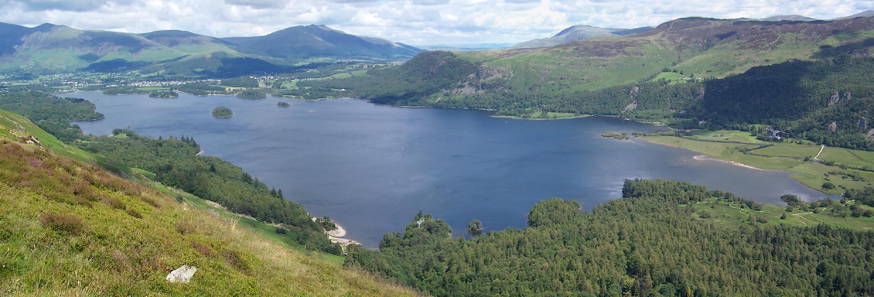 Click to enlarge BUW31.jpg (taken 29.6.2011) 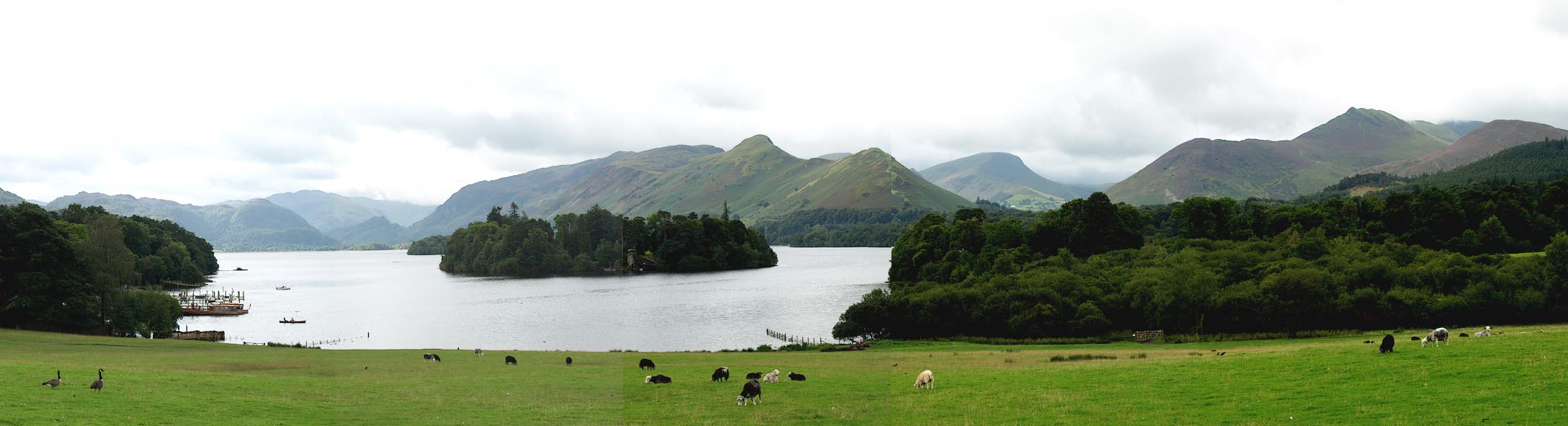 Click to enlarge BPP95.jpg From the top of the Crow Park drumlin. (taken 24.8.2008) 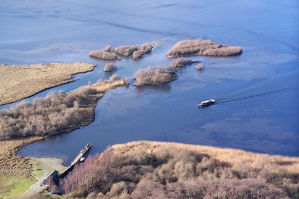 BNE37.jpg Delta formation where the River Derwent enters the lake, consolidated into grassland grazed by sheep, multiple channels, new deposits colonised by trees etc. Landing stage near Lowdore. (taken 17.2.2007) 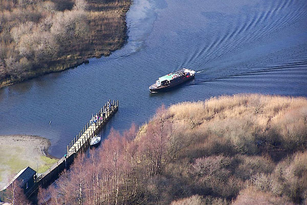 BNE38.jpg Landing stage near Lowdore. (taken 17.2.2007) 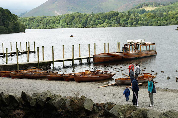 BPP96.jpg Landing stage at Keswick. (taken 24.8.2008) 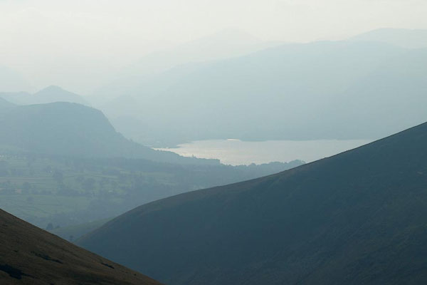 BPR47.jpg From Blease Fell. (taken 26.9.2008) 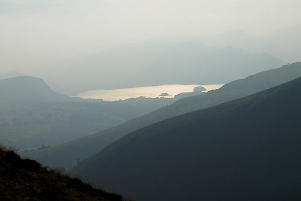 BPR68.jpg From Blease Fell. (taken 26.9.2008) 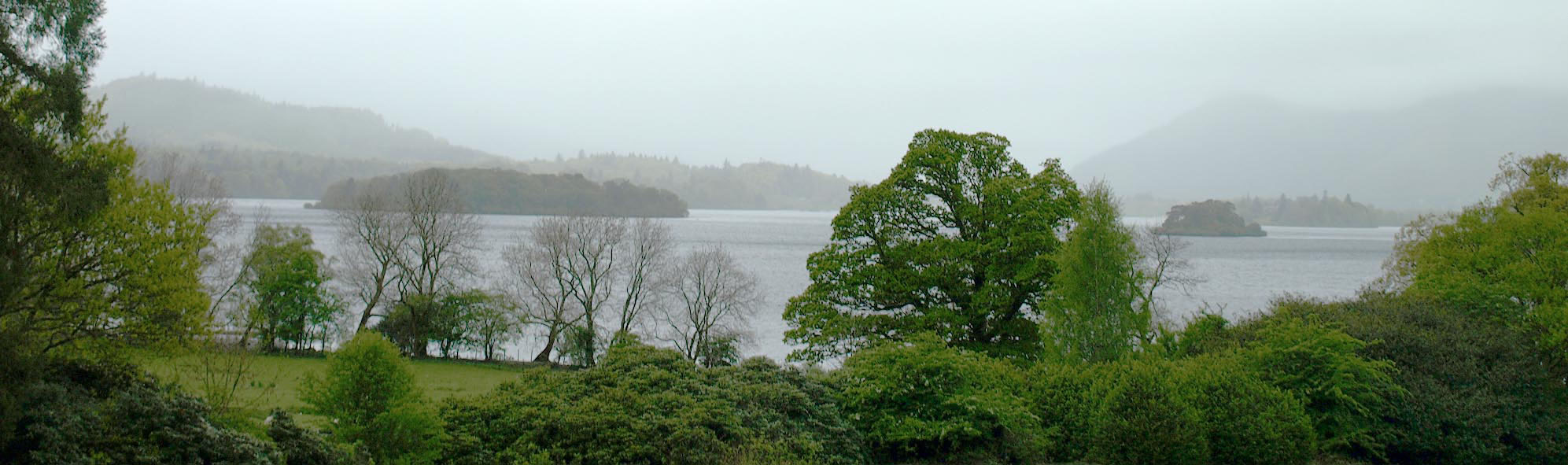 Click to enlarge BQM01.jpg From Barrow House. (taken 4.5.2009) 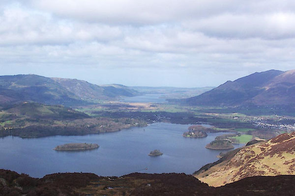 BUI46.jpg (taken 7.4.2011) 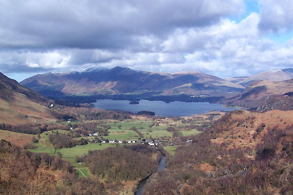 BWB12.jpg From Castle Crag. (taken 6.3.2012) |
||||||||||||||||||||||||||
|
|
||||||||||||||||||||||||||
 BUM25.jpg Launch, Annie Mellor. (taken 3.5.2011)  BUM26.jpg Launch, Annie Mellor. (taken 3.5.2011) 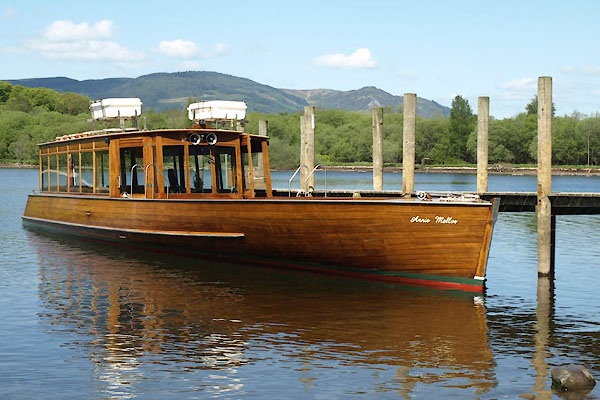 BUM27.jpg Launch, Annie Mellor. (taken 3.5.2011) 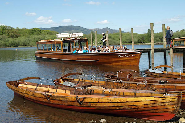 BUM28.jpg Launch, Princess Margaret Rose. (taken 3.5.2011) |
||||||||||||||||||||||||||
|
|
||||||||||||||||||||||||||
 BNP83.jpg Watercolour by Samuel Brough. Courtesy of the Kirkstone Pass Inn. |
||||||||||||||||||||||||||
|
|
||||||||||||||||||||||||||
| see:- | viewpoint, Cockshot Wood Thomas West I viewpoint, Crow Park Thomas West II viewpoint, Walla Crag Thomas West III viewpoint, Castle Crag Thomas West IV viewpoint, Swinside Thomas West V viewpoint, Fawe Park Thomas West VI viewpoint, Latrigg Thomas West VII viewpoint, Crosthwaite Vicarage Thomas West VIII viewpoint, Castlerigg Thomas West / Mr Gray viewpoint, Derwent Water by boat Thomas West / Thomas Pennant viewpoint, Derwent Water by moonlight Thomas West / Dr Brown viewpoint, Latrigg side Peter Crosthwaite 1 viewpoint, Low Howray Peter Crosthwaite 2 |
|||||||||||||||||||||||||
|
|
||||||||||||||||||||||||||
Lakes Guides menu.