Old Cumbria Gazetteer
 |
 |
|
||
| Loweswater | ||||
| civil parish:- | Loweswater (formerly Cumberland) | |||
| county:- | Cumbria | |||
| locality type:- | locality | |||
| locality type:- | buildings | |||
| coordinates:- | NY14152090 (etc) | |||
| 1Km square:- | NY1420 | |||
| 10Km square:- | NY12 | |||
|
|
||||
| evidence:- | old map:- Saxton 1579 placename:- Loweswater |
|||
| source data:- | Map, hand coloured engraving, Westmorlandiae et Cumberlandiae Comitatus ie Westmorland
and Cumberland, scale about 5 miles to 1 inch, by Christopher Saxton, London, engraved
by Augustinus Ryther, 1576, published 1579-1645.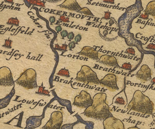 Sax9NY12.jpg Church, symbol for a parish or village, with a parish church. "Loweswater" Settlement. item:- private collection : 2 Image © see bottom of page |
|||
|
|
||||
| evidence:- | old map:- Mercator 1595 (edn?) placename:- Loweswater |
|||
| source data:- | Map, hand coloured engraving, Northumbria, Cumberlandia, et
Dunelmensis Episcopatus, ie Northumberland, Cumberland and
Durham etc, scale about 6.5 miles to 1 inch, by Gerard Mercator,
Duisberg, Germany, about 1595. MER8CumE.jpg "Loweswater" circle item:- JandMN : 169 Image © see bottom of page |
|||
|
|
||||
| evidence:- | old map:- Speed 1611 (Cmd) placename:- Loweswater |
|||
| source data:- | Map, hand coloured engraving, Cumberland and the Ancient Citie
Carlile Described, scale about 4 miles to 1 inch, by John Speed,
1610, published by J Sudbury and George Humble, Popes Head
Alley, London, 1611-12. SP11NY11.jpg "Loweswater" circle, building, tower item:- private collection : 16 Image © see bottom of page |
|||
|
|
||||
| evidence:- | old map:- Jansson 1646 placename:- Loweswater |
|||
| source data:- | Map, hand coloured engraving, Cumbria and Westmoria, ie
Cumberland and Westmorland, scale about 3.5 miles to 1 inch, by
John Jansson, Amsterdam, Netherlands, 1646.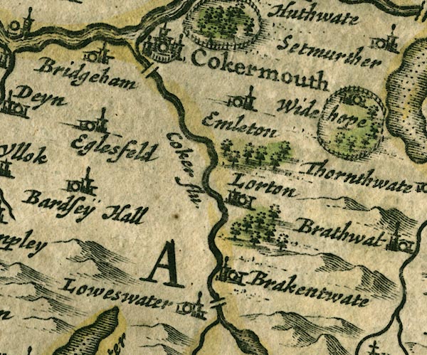 JAN3NY12.jpg "Loweswater" Buildings and tower. item:- JandMN : 88 Image © see bottom of page |
|||
|
|
||||
| evidence:- | old map:- Morden 1695 (Cmd) placename:- Lowswater |
|||
| source data:- | Map, uncoloured engraving, Cumberland, scale about 4 miles to 1
inch, by Robert Morden, 1695, published by Abel Swale, the
Unicorn, St Paul's Churchyard, Awnsham, and John Churchill, the
Black Swan, Paternoster Row, London, 1695-1715.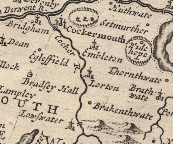 MD12NY12.jpg "Lowswater" Circle, building and tower. item:- JandMN : 90 Image © see bottom of page |
|||
|
|
||||
| evidence:- | old map:- Bowen and Kitchin 1760 placename:- Lowswater |
|||
| source data:- | Map, hand coloured engraving, A New Map of the Counties of
Cumberland and Westmoreland Divided into their Respective Wards,
scale about 4 miles to 1 inch, by Emanuel Bowen and Thomas
Kitchin et al, published by T Bowles, Robert Sayer, and John
Bowles, London, 1760.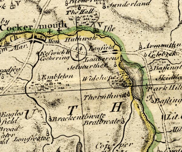 BO18NY12.jpg "Lowswater" circle, tower item:- Armitt Library : 2008.14.10 Image © see bottom of page |
|||
|
|
||||
| evidence:- | old map:- Donald 1774 (Cmd) placename:- Loweswater |
|||
| source data:- | Map, hand coloured engraving, 3x2 sheets, The County of Cumberland, scale about 1
inch to 1 mile, by Thomas Donald, engraved and published by Joseph Hodskinson, 29
Arundel Street, Strand, London, 1774.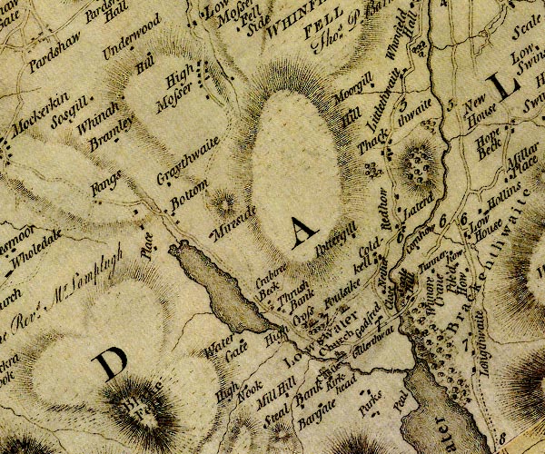 D4NY12SW.jpg "Loweswater" area item:- Carlisle Library : Map 2 Image © Carlisle Library |
|||
|
|
||||
| evidence:- | old map:- Crosthwaite 1783-94 (But/Cru/Low) placename:- Lowes Water |
|||
| source data:- | Map, uncoloured engraving, An Accurate Map of Buttermere,
Crummock and Loweswater Lakes, scale about 3 inches to 1 mile,
by Peter Crosthwaite, Keswick, Cumberland, 1794, version
published 1800.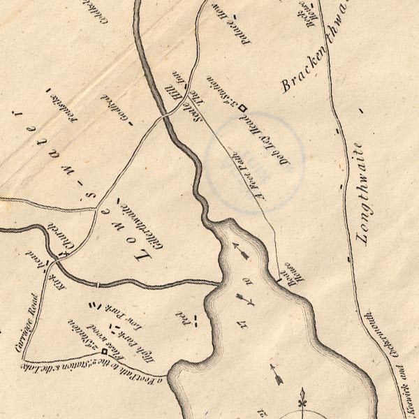 CT8NY12K.jpg "Lowes-water" item:- Armitt Library : 1959.191.2 Image © see bottom of page |
|||
|
|
||||
| evidence:- | old text:- Camden 1789 (Gough Additions) placename:- Loweswater item:- placename, Loweswater |
|||
| source data:- | Book, Britannia, or A Chorographical Description of the Flourishing Kingdoms of England,
Scotland, and Ireland, by William Camden, 1586, translated from the 1607 Latin edition
by Richard Gough, published London, 1789. goto source goto sourcePage 181:- "..." "Loweswater, a chapelry in St. Bee's parish, has its name from a lake in a deep vale surrounded by mountains two miles broad abounding with pike, perch, and, as some say, char." |
|||
|
|
||||
| evidence:- | old map:- Cooper 1808 placename:- Loweswater |
|||
| source data:- | Map, uncoloured engraving, Cumberland, scale about 10.5 miles to
1 inch, drawn and engraved by Cooper, published by R Phillips,
Bridge Street, Blackfriars, London, 1808. click to enlarge click to enlargeCOP3.jpg "Loweswater" circle; village or hamlet item:- JandMN : 86 Image © see bottom of page |
|||
|
|
||||
| evidence:- | old print with text:- Farington 1816 (plate 29) placename:- Loweswater |
|||
| source data:- | Print, uncoloured engraving, The Village of Lowswater, Loweswater, Cumberland, drawn
by Joseph Farington, engraved by J Scott, published by T Cadell and W Davies, Strand,
London, 1815.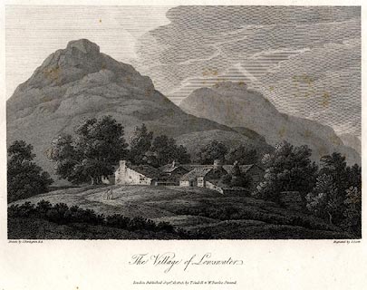 click to enlarge click to enlargePR0521.jpg Plate 29 in The Lakes of Lancashire, Westmorland and Cumberland. printed at bottom left, right, centre:- "Drawn by J. Farinton R.A. / Engraved by J. Scott / The Village of Lowswater. / London Published Septr. 15, 1815, by T. Cadell &W. Davies, Strand." The accompanying text:- "THE VILLAGE OF LOWESWATER," "IS beautifully situated close to the Lake of the same name, near the north-western extremity of the mountains above Mellbreak. The beauty of the landscape is considerably increased by the mixture of wood-lands and cultivated fields, interspersed with small farms, which, with their waving inclosures, are most delightfully situated. The Lake of Loweswater is about a mile in length, and a quarter of a mile in breadth; and, unlike all the other Lakes, discharges its waters at the southern end. It may be here remarked, that the purest taste will be gratified on seeing the beautiful and romantic character of this most interesting country preserved in all its simplicity by every village, every cottage, being both in form and colour in perfect unison with the scenery in which they are placed. The sentiment excited while contemplating the savage rock or the mgnificent mountain, or admiring the beautiful vale, is never disturbed by the introduction of objects at variance with the impression made by the fine works of nature." item:- Dove Cottage : 2008.107.470 Image © see bottom of page |
|||
|
|
||||
| evidence:- | descriptive text:- Otley 1823 (5th edn 1834) |
|||
| source data:- | Guide book, A Concise Description of the English Lakes, the
mountains in their vicinity, and the roads by which they may be
visited, with remarks on the mineralogy and geology of the
district, by Jonathan Otley, published by the author, Keswick,
Cumberland now Cumbria, by J Richardson, London, and by Arthur
Foster, Kirkby Lonsdale, Cumbria, 1823; published 1823-49,
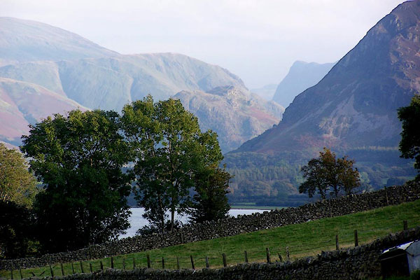
latterly as the Descriptive Guide to the English Lakes. goto source Page 23:- "..." "A small lake [Lowes Water] of about a mile in length, has given name to the parish or chapelry in which it is situated. ..." goto sourcePage 24:- "... Lowes Water, viewed from the end of Melbreak, exhibits a sweet rural landscape, the cultivated slopes being ornamented with neat farm houses and trees: ..." |
|||
|
|
||||
| evidence:- | old map:- Ford 1839 map placename:- Lowes Water |
|||
| source data:- | Map, uncoloured engraving, Map of the Lake District of
Cumberland, Westmoreland and Lancashire, scale about 3.5 miles
to 1 inch, published by Charles Thurnam, Carlisle, and by R
Groombridge, 5 Paternoster Row, London, 3rd edn 1843.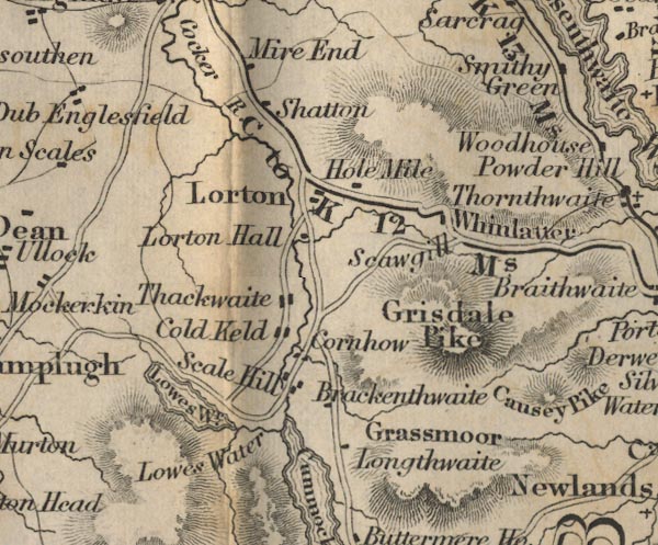 FD02NY12.jpg "Lowes Water" item:- JandMN : 100.1 Image © see bottom of page |
|||
|
|
||||
 Martineau Directory Martineau Directory |
||||
|
|
||||
| evidence:- | old map:- Garnett 1850s-60s H placename:- Loweswater |
|||
| source data:- | Map of the English Lakes, in Cumberland, Westmorland and
Lancashire, scale about 3.5 miles to 1 inch, published by John
Garnett, Windermere, Westmorland, 1850s-60s.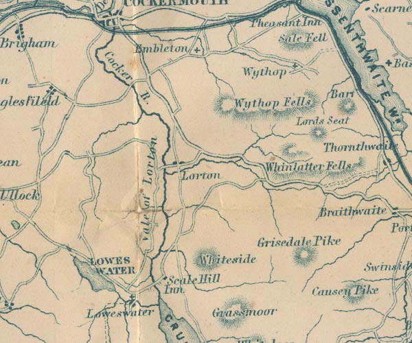 GAR2NY12.jpg "Loweswater" blocks, settlement, and cross, a church item:- JandMN : 82.1 Image © see bottom of page |
|||
|
|
||||
| evidence:- | old map:- Post Office 1850s-1900s placename:- Loweswater |
|||
| source data:- | Post road maps, General Post Office Circulation Map for England
and Wales, for the General Post Office, London, 1850s-1900s. click to enlarge click to enlargePOF7Cm.jpg "Loweswater" map date 1909 |
|||
|
|
||||
| evidence:- | old map:- Post Office 1850s-1900s placename:- Loweswater |
|||
| source data:- | Post road maps, General Post Office Circulation Map for England
and Wales, for the General Post Office, London, 1850s-1900s.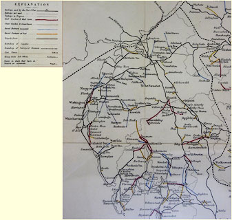 click to enlarge click to enlargePF10Cm.jpg "Loweswater" map date 1892 |
|||
|
|
||||
| evidence:- | old map:- Post Office 1850s-1900s placename:- Loweswater |
|||
| source data:- | Post road maps, General Post Office Circulation Map for England
and Wales, for the General Post Office, London, 1850s-1900s.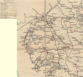 click to enlarge click to enlargePOF2Cm.jpg "Loweswater" map date 1890 |
|||
|
|
||||
| :- |
images courtesy of the British Postal Museum and Hampshire CC Museums |
|||
|
|
||||
| places:- |
|
|||
|
||||
|
||||
|
||||
|
||||
|
||||
|
||||
|
||||
|
||||
|
||||
|
||||
|
||||
|
||||
|
||||
|
||||
|
||||
|
||||
|
||||
|
||||
|
||||
|
||||
|
||||
|
||||
|
||||
|
||||
|
||||
|
||||
|
||||
|
||||
|
||||
|
||||
|
||||
Lakes Guides menu.