 Old Cumbria Gazetteer
 |
 |
|
||||||||||||||||||||||||
| Loweswater lake | ||||||||||||||||||||||||||
| runs into:- |  Dub Beck (2) Dub Beck (2) |
|||||||||||||||||||||||||
|
|
||||||||||||||||||||||||||
| Loweswater | ||||||||||||||||||||||||||
| locality:- | Loweswater | |||||||||||||||||||||||||
| civil parish:- | Loweswater (formerly Cumberland) | |||||||||||||||||||||||||
| county:- | Cumbria | |||||||||||||||||||||||||
| locality type:- | lake | |||||||||||||||||||||||||
| coordinates:- | NY12502170 (etc) | |||||||||||||||||||||||||
| 1Km square:- | NY1221 | |||||||||||||||||||||||||
| 10Km square:- | NY12 | |||||||||||||||||||||||||
|
|
||||||||||||||||||||||||||
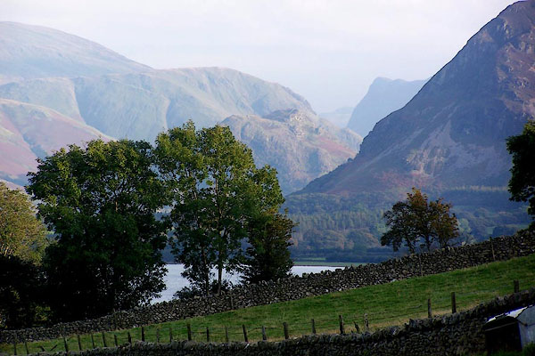 BJY13.jpg From Fangs Brow. (taken 14.10.2005) 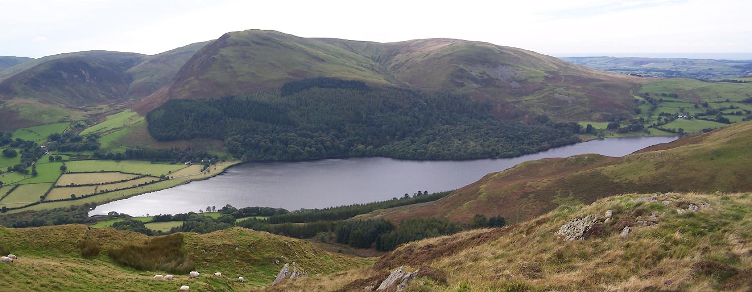 Click to enlarge BXK22.jpg Carling Knott and Burnbank Fell behind. (taken 23.9.2012) |
||||||||||||||||||||||||||
|
|
||||||||||||||||||||||||||
| evidence:- | old map:- OS County Series (Cmd 62 12) placename:- Loweswater |
|||||||||||||||||||||||||
| source data:- | Maps, County Series maps of Great Britain, scales 6 and 25
inches to 1 mile, published by the Ordnance Survey, Southampton,
Hampshire, from about 1863 to 1948. |
|||||||||||||||||||||||||
|
|
||||||||||||||||||||||||||
| evidence:- | old map:- Saxton 1579 |
|||||||||||||||||||||||||
| source data:- | Map, hand coloured engraving, Westmorlandiae et Cumberlandiae Comitatus ie Westmorland
and Cumberland, scale about 5 miles to 1 inch, by Christopher Saxton, London, engraved
by Augustinus Ryther, 1576, published 1579-1645.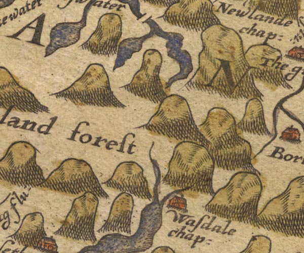 Sax9NY11.jpg item:- private collection : 2 Image © see bottom of page |
|||||||||||||||||||||||||
|
|
||||||||||||||||||||||||||
| evidence:- | old map:- Mercator 1595 (edn?) placename:- |
|||||||||||||||||||||||||
| source data:- | Map, hand coloured engraving, Northumbria, Cumberlandia, et
Dunelmensis Episcopatus, ie Northumberland, Cumberland and
Durham etc, scale about 6.5 miles to 1 inch, by Gerard Mercator,
Duisberg, Germany, about 1595. MER8CumE.jpg "" outline, coast shaded, tinted blue; lake item:- JandMN : 169 Image © see bottom of page |
|||||||||||||||||||||||||
|
|
||||||||||||||||||||||||||
| evidence:- | old map:- Speed 1611 (Cmd) |
|||||||||||||||||||||||||
| source data:- | Map, hand coloured engraving, Cumberland and the Ancient Citie
Carlile Described, scale about 4 miles to 1 inch, by John Speed,
1610, published by J Sudbury and George Humble, Popes Head
Alley, London, 1611-12.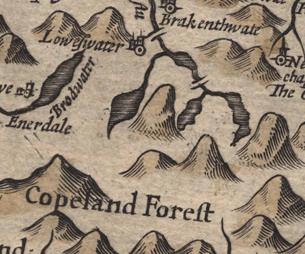 SP11NY11.jpg outline, shaded item:- private collection : 16 Image © see bottom of page |
|||||||||||||||||||||||||
|
|
||||||||||||||||||||||||||
| evidence:- | old map:- Drayton 1612/1622 |
|||||||||||||||||||||||||
| source data:- | Map, hand coloured engraving, Cumberlande and Westmorlande, by
Michael Drayton, probably engraved by William Hole, scale about
4 or 5 miles to 1 inch, published by John Mariott, John
Grismand, and Thomas Dewe, London, 1622.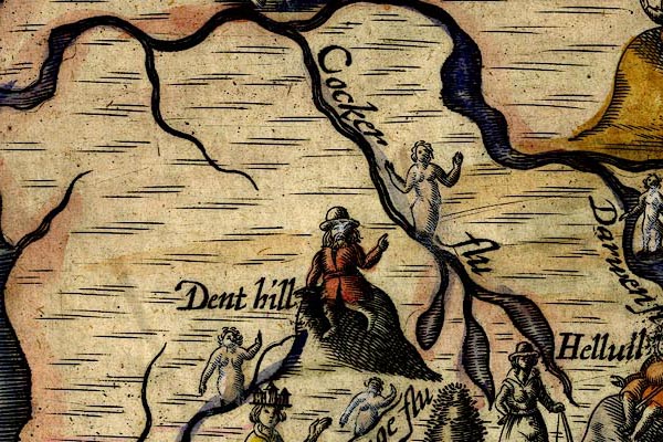 DRY513.jpg Lake. item:- JandMN : 168 Image © see bottom of page |
|||||||||||||||||||||||||
|
|
||||||||||||||||||||||||||
| evidence:- | old map:- Jansson 1646 |
|||||||||||||||||||||||||
| source data:- | Map, hand coloured engraving, Cumbria and Westmoria, ie
Cumberland and Westmorland, scale about 3.5 miles to 1 inch, by
John Jansson, Amsterdam, Netherlands, 1646.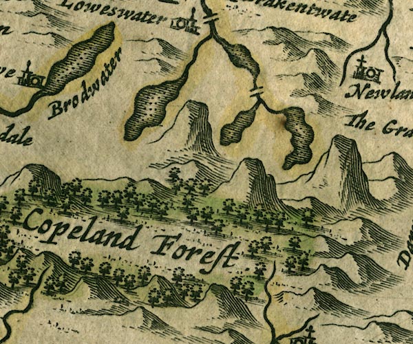 JAN3NY11.jpg Outline with shore shaded, dotted area. item:- JandMN : 88 Image © see bottom of page |
|||||||||||||||||||||||||
|
|
||||||||||||||||||||||||||
| evidence:- | old map:- Sanson 1679 |
|||||||||||||||||||||||||
| source data:- | Map, hand coloured engraving, Ancien Royaume de Northumberland
aujourdhuy Provinces de Nort, ie the Ancient Kingdom of
Northumberland or the Northern Provinces, scale about 9.5 miles
to 1 inch, by Nicholas Sanson, Paris, France, 1679. click to enlarge click to enlargeSAN2Cm.jpg outline, shore shaded; lake item:- Dove Cottage : 2007.38.15 Image © see bottom of page |
|||||||||||||||||||||||||
|
|
||||||||||||||||||||||||||
| evidence:- | probably old map:- Seller 1694 (Cmd) |
|||||||||||||||||||||||||
| source data:- | Map, uncoloured engraving, Cumberland, scale about 12 miles to 1
inch, by John Seller, 1694. click to enlarge click to enlargeSEL9.jpg outline with shaded shore; lake item:- Dove Cottage : 2007.38.89 Image © see bottom of page |
|||||||||||||||||||||||||
|
|
||||||||||||||||||||||||||
| evidence:- | old map:- Morden 1695 (Cmd) |
|||||||||||||||||||||||||
| source data:- | Map, uncoloured engraving, Cumberland, scale about 4 miles to 1
inch, by Robert Morden, 1695, published by Abel Swale, the
Unicorn, St Paul's Churchyard, Awnsham, and John Churchill, the
Black Swan, Paternoster Row, London, 1695-1715.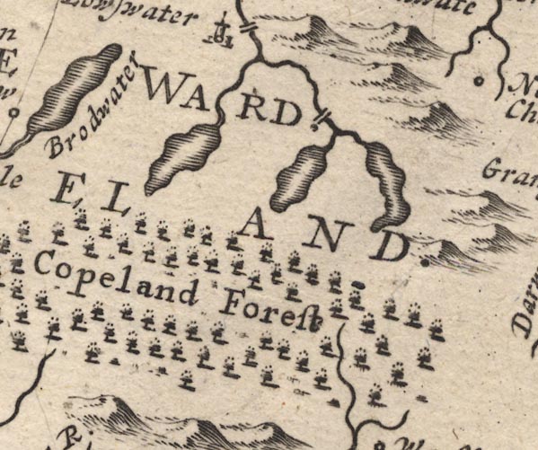 MD12NY11.jpg Outline with shore shading. item:- JandMN : 90 Image © see bottom of page |
|||||||||||||||||||||||||
|
|
||||||||||||||||||||||||||
| evidence:- | possibly old map:- Badeslade 1742 placename:- |
|||||||||||||||||||||||||
| source data:- | Map, uncoloured engraving, A Map of Cumberland North from
London, scale about 11 miles to 1 inch, with descriptive text,
by Thomas Badeslade, London, engraved and published by William
Henry Toms, Union Court, Holborn, London, 1742. click to enlarge click to enlargeBD10.jpg "" outline with form lines item:- JandMN : 115 Image © see bottom of page |
|||||||||||||||||||||||||
|
|
||||||||||||||||||||||||||
| evidence:- | old map:- Gents Mag 1751 placename:- Lows Water |
|||||||||||||||||||||||||
| source data:- | Map, uncoloured engraving, Map of the Black Lead Mines in
Cumberland, and area, scale about 2 miles to 1 inch, by George
Smith, published in the Gentleman's Magazine, 1751. GM1303.jpg "LOWS WATER" outline with form lines; lake item:- JandMN : 114 Image © see bottom of page |
|||||||||||||||||||||||||
|
|
||||||||||||||||||||||||||
| evidence:- | old map:- Bowen and Kitchin 1760 |
|||||||||||||||||||||||||
| source data:- | Map, hand coloured engraving, A New Map of the Counties of
Cumberland and Westmoreland Divided into their Respective Wards,
scale about 4 miles to 1 inch, by Emanuel Bowen and Thomas
Kitchin et al, published by T Bowles, Robert Sayer, and John
Bowles, London, 1760.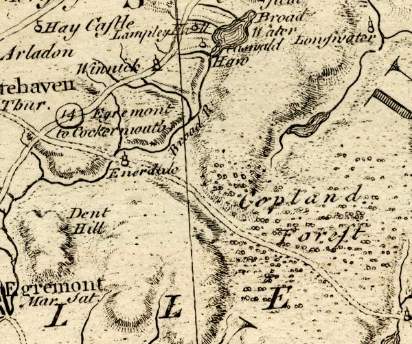 BO18NY01.jpg outline with form lines item:- Armitt Library : 2008.14.10 Image © see bottom of page |
|||||||||||||||||||||||||
|
|
||||||||||||||||||||||||||
| evidence:- | old map:- Donald 1774 (Cmd) |
|||||||||||||||||||||||||
| source data:- | Map, hand coloured engraving, 3x2 sheets, The County of Cumberland, scale about 1
inch to 1 mile, by Thomas Donald, engraved and published by Joseph Hodskinson, 29
Arundel Street, Strand, London, 1774.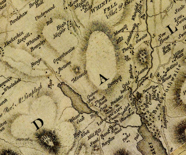 D4NY12SW.jpg lake item:- Carlisle Library : Map 2 Image © Carlisle Library |
|||||||||||||||||||||||||
|
|
||||||||||||||||||||||||||
| evidence:- | descriptive text:- West 1778 (11th edn 1821) placename:- Lowes Water item:- fish, Loweswater lake; char (none); pike; perch; trout |
|||||||||||||||||||||||||
| source data:- | Guide book, A Guide to the Lakes, by Thomas West, published by
William Pennington, Kendal, Cumbria once Westmorland, and in
London, 1778 to 1821. goto source Page 140:- "LOWES-WATER." "... the lake spreads out before you, a mile in length, and of an equal breadth of about a quarter of a mile. The extremities are rivals in beauty of hanging woods, little groves, and waving inclosures, with farms seated in the sweetest points of view. The south end is overlooked by lofty Mellbreak, ... The eastern shore is open, and indented with small bays; but the opposite side is more pleasing. Carling knot presents a broad pyramidal front, of swift ascent, covered with soft vegetation, and spotted with many aged solitary thorns. On each side the outlines wave upwards in the finest manner, terminating in a cone of grey rocks, patched with verdure." "This lake, in opposition to all the others, has its course from north to south, and under Mellbreak falls into Cromack-water. It is of no great depth, and without char; but it abounds with pike and perch, and has some trout." goto sourceAccount of Ennerdale, late 18th century Page 295:- "Within these few years, several visitors of the lakes extend their tour, by taking in Whitehaven, and proceeding from thence, ... to Ennerdale Broad-water; and, if they choose, from thence to Lowes-water, Buttermere, &c.- This part of the journey (without which the tour is incomplete) cannot, however, be performed in a carriage; but a ride on horseback will amply recompence the trouble, for the scenery is delightful, ..." "Certain it is, the approach to the lake of Ennerdale, to Lowes-water, and to Buttermere, is from no other quarter so magnificent and captivating. ..." |
|||||||||||||||||||||||||
|
|
||||||||||||||||||||||||||
| evidence:- | old map:- Crosthwaite 1783-94 (But/Cru/Low) placename:- Lowes Water lake |
|||||||||||||||||||||||||
| source data:- | Map, uncoloured engraving, An Accurate Map of Buttermere,
Crummock and Loweswater Lakes, scale about 3 inches to 1 mile,
by Peter Crosthwaite, Keswick, Cumberland, 1794, version
published 1800. click to enlarge click to enlargeCT08.jpg "LOWES-WATER LAKE" item:- Armitt Library : 1959.191.2 Image © see bottom of page |
|||||||||||||||||||||||||
|
|
||||||||||||||||||||||||||
| evidence:- | old map:- West 1784 map placename:- Lowes Water |
|||||||||||||||||||||||||
| source data:- | Map, hand coloured engraving, A Map of the Lakes in Cumberland,
Westmorland and Lancashire, scale about 3.5 miles to 1 inch,
engraved by Paas, 53 Holborn, London, about 1784. Ws02NY12.jpg "LOWES WATER" item:- Armitt Library : A1221.1 Image © see bottom of page |
|||||||||||||||||||||||||
|
|
||||||||||||||||||||||||||
| evidence:- | old text:- Camden 1789 (Gough Additions) item:- fish, Loweswater lake; pike; perch; char |
|||||||||||||||||||||||||
| source data:- | Book, Britannia, or A Chorographical Description of the Flourishing Kingdoms of England,
Scotland, and Ireland, by William Camden, 1586, translated from the 1607 Latin edition
by Richard Gough, published London, 1789. goto source Page 181:- "..." "[Loweswater] ... a lake in a deep vale surrounded by mountains two miles broad abounding with pike, perch, and, as some say, char." |
|||||||||||||||||||||||||
|
|
||||||||||||||||||||||||||
| evidence:- | old map:- Housman 1800 map 3 placename:- Lowes Water |
|||||||||||||||||||||||||
| source data:- | Maps, hand coloured engraving, Lakes in Cumberland, 9 lakes on one sheet, engraved
by James Lowes, published by F Jollie, Carlisle, Cumberland, and C Law, Ave Maria
Lane, London, 1800. click to enlarge click to enlargeHM01Low.jpg "LOWES WATER" item:- Dove Cottage : 2007.38.96 Image © see bottom of page |
|||||||||||||||||||||||||
|
|
||||||||||||||||||||||||||
| evidence:- | old map:- Cooke 1802 placename:- Lows Water |
|||||||||||||||||||||||||
| source data:- | Map, The Lakes, Westmorland and Cumberland, scale about 8.5
miles to 1 inch, engravedby Neele and Son, published by
Sherwood, Jones and Co, Paternoster Road, London, 1824. click to enlarge click to enlargeGRA1Lk.jpg "Lows W." outline with form lines; lake or tarn item:- Hampshire Museums : FA2000.62.5 Image © see bottom of page |
|||||||||||||||||||||||||
|
|
||||||||||||||||||||||||||
| evidence:- | old map:- Cooke 1802 |
|||||||||||||||||||||||||
| source data:- | Map, Cumberland, scale about 15.5 miles to 1 inch, by George
Cooke, 1802, bound in Gray's New Book of Roads, 1824, published
by Sherwood, Jones and Co, Paternoster Road, London, 1824. click to enlarge click to enlargeGRA1Cd.jpg outline with form lines; lake or tarn item:- Hampshire Museums : FA2000.62.2 Image © see bottom of page |
|||||||||||||||||||||||||
|
|
||||||||||||||||||||||||||
| evidence:- | old print:- Green 1804 (plate 20) placename:- Lowes Water |
|||||||||||||||||||||||||
| source data:- | Print, uncoloured aquatint, Lowes Water, distance Grasmire, Loweswater, Cumberland,
by William Green, Ambleside, Westmorland, 1804.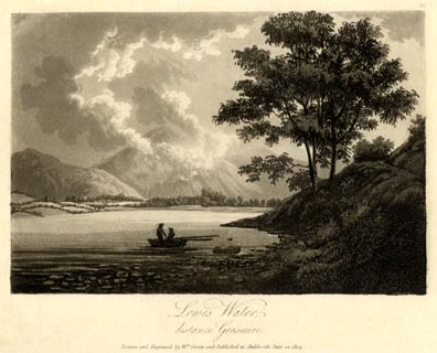 click to enlarge click to enlargeGN1620.jpg Plate 20 from a series. printed at bottom:- "Lowes Water, / distance Grasmire. / Drawn and Engraved by Wm. Green, and Published at Ambleside, June 24, 1804." printed at top right:- "20" at :- "W ELGAR / 1802" item:- Armitt Library : 2014.168 Image © see bottom of page |
|||||||||||||||||||||||||
|
|
||||||||||||||||||||||||||
| evidence:- | old map:- Laurie and Whittle 1806 placename:- Lowes Water |
|||||||||||||||||||||||||
| source data:- | Road map, Completion of the Roads to the Lakes, scale about 10
miles to 1 inch, by Nathaniel Coltman? 1806, published by Robert
H Laurie, 53 Fleet Street, London, 1834. click to enlarge click to enlargeLw18.jpg "Lowes Water" lake item:- private collection : 18.18 Image © see bottom of page |
|||||||||||||||||||||||||
|
|
||||||||||||||||||||||||||
| evidence:- | old map:- Cooper 1808 placename:- Lows Water |
|||||||||||||||||||||||||
| source data:- | Map, uncoloured engraving, Cumberland, scale about 10.5 miles to
1 inch, drawn and engraved by Cooper, published by R Phillips,
Bridge Street, Blackfriars, London, 1808. click to enlarge click to enlargeCOP3.jpg "Lows W." outline, shaded; lake item:- JandMN : 86 Image © see bottom of page |
|||||||||||||||||||||||||
|
|
||||||||||||||||||||||||||
| evidence:- | old text:- Green 1810 placename:- Lows Water |
|||||||||||||||||||||||||
| source data:- | Set of prints, soft ground etchings, Sixty Studies from Nature,
by William Green, Ambleside, Westmorland, drawn 1808-10,
published 1810. goto source page 69:- "Lows Water is the smallest of the three lakes, and must be gone round by such as have time and can conveniently walk three or four miles: there is a pretty sylvan scene between the lake and the eye, from the edge of the common under Melbreak - the hills on the east, west, and north sides, rise gently from the water. The low grounds are pleasantly ornamented with meadows, out of which groups of wood and single trees, alone and in the hedge-rows. - Melbreak, Whiteside, Grasmire, Rannerdale Knott, and Honister Crag, are fine objects, when seen from the head of Lows Water. - The foot of Lows Water is about a mile from the foot of Crummock Water, and not a mile from the inn at Scale Hill." |
|||||||||||||||||||||||||
|
|
||||||||||||||||||||||||||
| evidence:- | old print:- Green 1814 (plate 41) placename:- Lows Water |
|||||||||||||||||||||||||
| source data:- | Print, tinted soft ground etching, Lows Water, Loweswater, Cumberland, by William
Green, Ambleside, Westmorland, 1814.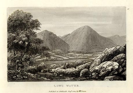 click to enlarge click to enlargeGN1041.jpg Plate 41 in Sixty Small Prints. printed at top right:- "41" printed at bottom:- "LOWS WATER. / Published at Ambleside Augst. 1, 1814, by Wm. Green." item:- Armitt Library : A6653.41 Image © see bottom of page |
|||||||||||||||||||||||||
|
|
||||||||||||||||||||||||||
| evidence:- | old print:- Green 1814 (plate 41) placename:- Lows Water |
|||||||||||||||||||||||||
| source data:- | Print, uncoloured soft ground etching, Lows Water, Loweswater, Cumberland, by William
Green, Ambleside, Westmorland, 1814.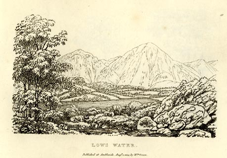 click to enlarge click to enlargeGN0941.jpg Plate 41 in Sixty Small Prints. printed at top right:- "41" printed at bottom:- "LOWS WATER. / Published at Ambleside Augst. 1, 1814, by Wm. Green." item:- Armitt Library : A6656.41 Image © see bottom of page |
|||||||||||||||||||||||||
|
|
||||||||||||||||||||||||||
| evidence:- | old text:- Green 1814 placename:- Low's Water |
|||||||||||||||||||||||||
| source data:- | Set of prints, soft ground etchings, Sixty Small Prints, with
text, A Description of a Series of Sixty Small Prints, by
William Green, Ambleside, Westmorland, 1814. goto source page 22:- "..." "Low's Water is the smallest of the three lakes of Buttermere, Crummock and Low's Water." "The hills on the east, west, and north sides of Low's Water rise gently from it. The low grounds are pleasantly ornamented with meadows, out of which groupes (sic) of woods and single trees, alone and in the hedge-rows." "Melbreak, Whiteside, Grasmire, Rannerdale Knott, and Honister Crag are fine objects when seen from the head of Low's Water. The foot of Low's Water is about half a mile from the foot of Crummock Water, and not a mile from the Inn at Scale Hill. ..." |
|||||||||||||||||||||||||
|
|
||||||||||||||||||||||||||
| evidence:- | old print:- Green 1815 placename:- Lows Water item:- cattle |
|||||||||||||||||||||||||
| source data:- | Print, coloured aquatint, Lows Water, Loweswater, Cumberland, by William Green, Ambleside,
Westmorland, 1815. click to enlarge click to enlargeGN0538.jpg Plate 54 in Lake Scenery. printed at upper right:- "[54]" printed at bottom:- "LOWS WATER. / Published at Ambleside, June 1, 1815, by Wm. Green." item:- Armitt Library : A6646.38 Image © see bottom of page |
|||||||||||||||||||||||||
|
|
||||||||||||||||||||||||||
| evidence:- | old text:- Farington 1816 placename:- Lowswater |
|||||||||||||||||||||||||
| source data:- | The Village of Lowswater, Cumberland - the print is missing from the set - published
by T Cadell and W Davies, Strand, London, 1815. Descriptive text:- "... The Lake of Lowswater is about a mile in length, and a quarter of a mile in breadth; and, unlike all the other Lakes, discharges its waters at the southern end. ..." item:- Armitt Library : A6666.21 Image © see bottom of page |
|||||||||||||||||||||||||
|
|
||||||||||||||||||||||||||
| evidence:- | old map:- Otley 1818 placename:- Loweswater |
|||||||||||||||||||||||||
| source data:- | Map, uncoloured engraving, The District of the Lakes,
Cumberland, Westmorland, and Lancashire, scale about 4 miles to
1 inch, by Jonathan Otley, 1818, engraved by J and G Menzies,
Edinburgh, Scotland, published by Jonathan Otley, Keswick,
Cumberland, et al, 1833.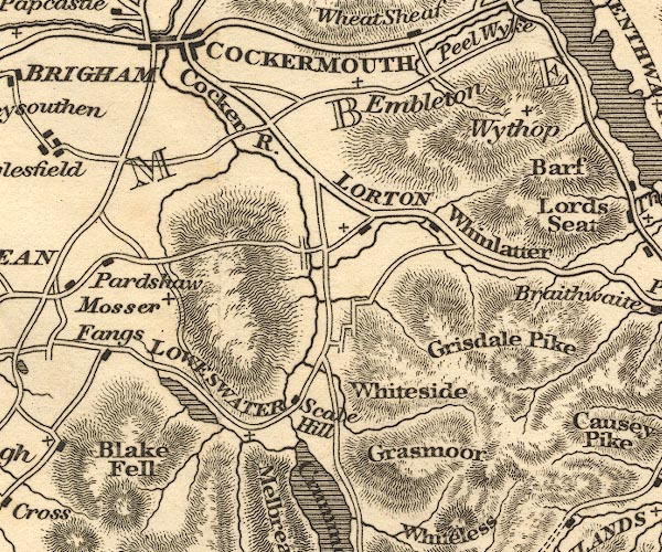 OT02NY12.jpg "LOWESWATWER" item:- JandMN : 48.1 Image © see bottom of page |
|||||||||||||||||||||||||
|
|
||||||||||||||||||||||||||
| evidence:- | old print:- Fielding and Walton 1821 (plate 32) placename:- Lowes Water |
|||||||||||||||||||||||||
| source data:- | Print, coloured aquatint, Lowes Water, Cumberland, drawn by Theodore H A Fielding,
published by R Ackermann, 101 Strand, London, 1821.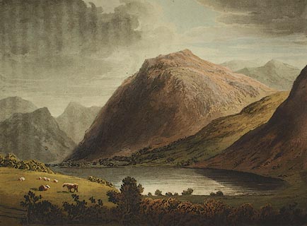 click to enlarge click to enlargeFW0132.jpg Mellbreak dominating the lake. Tipped in opposite p.215 in A Picturesque Tour of the English Lakes. item:- Dove Cottage : 1993.R566.32 Image © see bottom of page |
|||||||||||||||||||||||||
|
|
||||||||||||||||||||||||||
| evidence:- | descriptive text:- Otley 1823 (5th edn 1834) placename:- Lowes Water |
|||||||||||||||||||||||||
| source data:- | Guide book, A Concise Description of the English Lakes, the
mountains in their vicinity, and the roads by which they may be
visited, with remarks on the mineralogy and geology of the
district, by Jonathan Otley, published by the author, Keswick,
Cumberland now Cumbria, by J Richardson, London, and by Arthur
Foster, Kirkby Lonsdale, Cumbria, 1823; published 1823-49,
latterly as the Descriptive Guide to the English Lakes. goto source Page 23:- "LOWES WATER," "A small lake of about a mile in length, has given name to the parish or chapelry in which it is situated. It differs from all the other lakes, in that, they" goto sourcePage 24:- "generally exhibit the most interesting mountain scenery, in looking towards the head of the lake; this, on the contrary, is more tame towards its head, while at its foot the mountains appear of bolder forms. It is not the difference between one piece of water and another, but the endless variety of scenery with which they are associated, that gives to every lake its peculiar character. Lowes Water, viewed from the end of Melbreak, exhibits a sweet rural landscape, the cultivated slopes being ornamented with neat farm houses and trees: but, taking the view in an opposite direction, the lake makes a middle distance to a combination of mountains scarcely to be equalled." "The best approach to Lowes Water is from Lamplugh, or Pardshaw, by the farm house at Fangs; below which, on descending the hill, we first come in sight of the lake. On the left, beyond Low Fell, we have the lofty precipitous front of Grasmoor, succeeded by Witeless Pike, Robinson, and Rannerdale Knot, beyond Crummock Lake. On the right lie Burnbank, and Carling Knot; in front Melbreak rises in an aspiring cone, flanked by High Stile and Red Pike on one hand, and the peaked perpendicular front of Honister Crag on the other: between the last and Rannerdale Knot, is just seen a part of the mountain called Hay Stacks, near Stonethwaite in Borrowdale. At a gate opening to the Common, the top of the Pillar may be seen to the right of Red Pike." |
|||||||||||||||||||||||||
|
|
||||||||||||||||||||||||||
| evidence:- | descriptive text:- Ford 1839 (3rd edn 1843) placename:- Lowes Water item:- depth, Loweswater lake |
|||||||||||||||||||||||||
| source data:- | Guide book, A Description of Scenery in the Lake District, by
Rev William Ford, published by Charles Thurnam, Carlisle, by W
Edwards, 12 Ave Maria Lane, Charles Tilt, Fleet Street, William
Smith, 113 Fleet Street, London, by Currie and Bowman,
Newcastle, by Bancks and Co, Manchester, by Oliver and Boyd,
Edinburgh, and by Sinclair, Dumfries, 1839. goto source Page 91:- "..." "LOWES WATER" "Is a narrow lake, extending more than a mile in length, and from five to ten fathoms in depth. It is tame at its head, the water being bordered with little cultivated estates, the dwelling-houses in the centre, and the green enclosures lying around; but when viewed in the contrary direction, it presents a magnificent assemblage of mountains at its outlet," goto sourcePage 92:- "where its waters flow out, passing the Hamlet into Crummock Water. The mountains that lie around are high and rocky, rising abruptly from their bases, and assuming conical forms. The declivities are covered with brushwood and scattered trees, adding greatly to the romantic and diversified scenery of the country." goto sourcePage 170:- "..." "Lowes Water is surrounded by noble mountains, and pours its waters into Crummock Lake." goto sourcePage 177:- "A TABLE" "OF THE LENGTH, BREADTH, &c. OF THE LAKES," "COLLECTED FROM DIFFERENT AUTHORITIES."
|
|||||||||||||||||||||||||
|
|
||||||||||||||||||||||||||
| evidence:- | old map:- Ford 1839 map placename:- Lowes Water |
|||||||||||||||||||||||||
| source data:- | Map, uncoloured engraving, Map of the Lake District of
Cumberland, Westmoreland and Lancashire, scale about 3.5 miles
to 1 inch, published by Charles Thurnam, Carlisle, and by R
Groombridge, 5 Paternoster Row, London, 3rd edn 1843. FD02NY12.jpg "Lowes Wr." Outline with form lines. item:- JandMN : 100.1 Image © see bottom of page |
|||||||||||||||||||||||||
|
|
||||||||||||||||||||||||||
| evidence:- | old map:- Wyld 1847 placename:- Loweswater |
|||||||||||||||||||||||||
| source data:- | Map, uncoloured engraving, Loweswater, Crummock, Buttermere,
Ennerdale and Wastwaters, Cumberland, scale about 3.5 miles to 1
inch, by James Wyld, published by John Johnstone, Paternoster
Row, London, et al, 1847.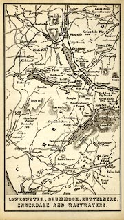 click to enlarge click to enlargeWLD3M3.jpg printed at bottom:- "LOWESWATER, CRUMMOCK, BUTTERMERE, / ENNERDALE AND WASTWATERS." item:- Armitt Library : A1201.66 Image © see bottom of page |
|||||||||||||||||||||||||
|
|
||||||||||||||||||||||||||
| evidence:- | old map:- Garnett 1850s-60s H placename:- Lowes Water |
|||||||||||||||||||||||||
| source data:- | Map of the English Lakes, in Cumberland, Westmorland and
Lancashire, scale about 3.5 miles to 1 inch, published by John
Garnett, Windermere, Westmorland, 1850s-60s.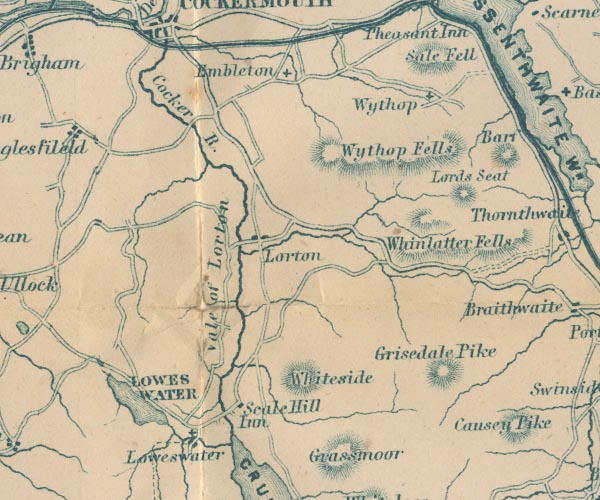 GAR2NY12.jpg "LOWES WATER" outline with shore form lines, lake or tarn item:- JandMN : 82.1 Image © see bottom of page |
|||||||||||||||||||||||||
|
|
||||||||||||||||||||||||||
| evidence:- | old print with text:- Pyne 1853 placename:- Lowes Water |
|||||||||||||||||||||||||
| source data:- | Print, tinted lithograph, Lowes Water, Cumberland, by James Baker Pyne, engraved by
W Gauci, published by Thomas Agnew and Sons, Manchester, Lancashire, 1853.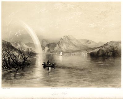 click to enlarge click to enlargePYN222.jpg "PAINTED BY J. B. PYNE. / W. GAUCI LITH. / MANCHESTER, PUBLISHED BY THOMAS AGNEW & SONS, 1853. / Lowes Water / [M & N HANHART IMPT.]" From the descriptive text:- "... The tranquil lake gives back mountain forms in all their massive outline and richly-coloured truth. The fragmental bow across the heavens indicates a retiring shower. The rude boat floats as if magically suspended in mid air, so perfectly transparanet is the water. ..." item:- Armitt Library : A6678.23 Image © see bottom of page |
|||||||||||||||||||||||||
|
|
||||||||||||||||||||||||||
| evidence:- | old print:- Pyne 1853 placename:- Lowes Water |
|||||||||||||||||||||||||
| source data:- | Print, coloured lithograph, Lowes Water, Cumberland, by James Baker Pyne, engraved
by W Gauci, published by Thomas Agnew and Sons, Manchester, Lancashire, 1853.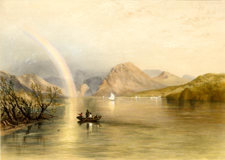 click to enlarge click to enlargePYN422.jpg item:- Armitt Library : A6677.23 Image © see bottom of page |
|||||||||||||||||||||||||
|
|
||||||||||||||||||||||||||
| evidence:- | old text:- Martineau 1855 |
|||||||||||||||||||||||||
| source data:- | Guide book, A Complete Guide to the English Lakes, by Harriet
Martineau, published by John Garnett, Windermere, Westmorland,
and by Whittaker and Co, London, 1855; published 1855-76. goto source Page 130:- "... Lowes Water is one of the out-lying lakes, and its lower end is tame accordingly: but it is only a mile long; and the peaks congregate finely about its head. The circuit of Lowes Water, (seven miles) is a charming morning's walk. There is a prosperous look about the homesteads there, and a richness about the meadows which smacks of the level country, ..." |
|||||||||||||||||||||||||
|
|
||||||||||||||||||||||||||
| evidence:- | old text:- Martineau 1855 item:- depth, Loweswater lake |
|||||||||||||||||||||||||
| source data:- | Guide book, A Complete Guide to the English Lakes, by Harriet
Martineau, published by John Garnett, Windermere, Westmorland,
and by Whittaker and Co, London, 1855; published 1855-76. goto source Page 180:- "A TABLE OF THE LENGTH, BREADTH, AND DEPTH OF THE LAKES." "No. : Names of Lakes. : Counties : Length in Miles. : Extreme breadth in Miles : Extreme depth in Feet : Height above the Sea" "14 : Loweswater : Cumberland : 1 : ½: 60 : -" |
|||||||||||||||||||||||||
|
|
||||||||||||||||||||||||||
| evidence:- | old photograph:- Bell 1880s-1940s |
|||||||||||||||||||||||||
| source data:- | Photograph, black and white, foot of Loweswater lake, Loweswater, Cumberland, by Herbert
Bell, Ambleside, Westmorland, 1890s.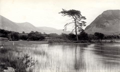 click to enlarge click to enlargeHB0469.jpg internegative at lower left:- "H. Bell" item:- Armitt Library : ALPS128 Image © see bottom of page |
|||||||||||||||||||||||||
|
|
||||||||||||||||||||||||||
| evidence:- | old map:- Pearson 1900s map (But/Cru/Low) placename:- Loweswater |
|||||||||||||||||||||||||
| source data:- | Map, lithograph, Buttermere, Crummock Water and Loweswater,
Cumberland, published by C Arthur Pearson, Henrietta Street,
London, 1900s.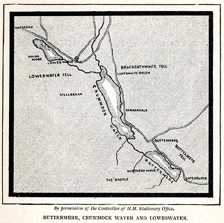 click to enlarge click to enlargePSN1M1.jpg On p.xxv of Pearson's Gossipy Guide to the English Lakes and Neighbouring Districts. printed at bottom:- "By permission of the Controller of H.M. Stationery Office. / BUTTERMERE, CRUMMOCK WATER AND LOWESWATER." item:- Armitt Library : A1188.3 Image © see bottom of page |
|||||||||||||||||||||||||
|
|
||||||||||||||||||||||||||
| evidence:- | old print:- Heaton Cooper 1905 (edn 1908) placename:- Loweswater |
|||||||||||||||||||||||||
| source data:- | Print, colour halftone, Loweswater lake, Cumberland, from a watercolour by Alfred
Heaton Cooper, published by Adam and Charles Black, London, 2nd edn 1908.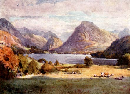 click to enlarge click to enlargeHC0139.jpg Opposite p.106 of The English Lakes, painted by Alfred Heaton Cooper, described by William T Palmer. printed at tissue opposite the print:- "LOWESWATER" item:- JandMN : 468.39 Image © see bottom of page |
|||||||||||||||||||||||||
|
|
||||||||||||||||||||||||||
| evidence:- | old map:- Postlethwaite 1877 (3rd edn 1913) placename:- Loweswater |
|||||||||||||||||||||||||
| source data:- | Map, uncoloured engraving, Map of the Lake District Mining Field, Westmorland, Cumberland,
Lancashire, scale about 5 miles to 1 inch, by John Postlethwaite, published by W H
Moss and Sons, 13 Lowther Street, Whitehaven, Cumberland, 1877 edn 1913.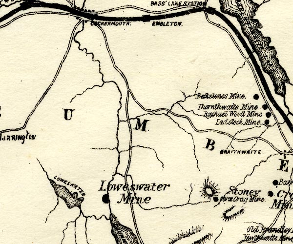 PST2NY12.jpg "LOWESWATER" lake item:- JandMN : 162.2 Image © see bottom of page |
|||||||||||||||||||||||||
|
|
||||||||||||||||||||||||||
| evidence:- | old photograph:- Marr 1916 placename:- Loweswater |
|||||||||||||||||||||||||
| source data:- | Photograph, halftone print, Melbreak and Loweswater, Loweswater, Cumberland, 1916.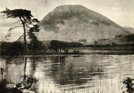 click to enlarge click to enlargeMA1201.jpg item:- JandMN : 173.9 Image © see bottom of page |
|||||||||||||||||||||||||
|
|
||||||||||||||||||||||||||
| evidence:- | outline view:- Black 1856 placename:- Loweswater |
|||||||||||||||||||||||||
| source data:- | Print, lithograph, Outline Views, Buttermere - Mountains as seen from the Knots near
the Hotel at Buttermere, and Mountains as seen at the Seat in Lanthwaite Wood, Scale
Hill, by J Flintoft, Keswick, Cumberland, engraved by R Mason, Edinburgh, Lothian,
about 1900.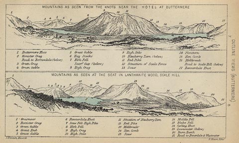 click to enlarge click to enlargeBC08E5.jpg "... 19 Loweswater ..." item:- JandMN : 37.19 Image © see bottom of page |
|||||||||||||||||||||||||
|
|
||||||||||||||||||||||||||
| evidence:- | old print:- Pyne 1853 placename:- Lowes Water |
|||||||||||||||||||||||||
| source data:- | Loweswater drawn by James Barker Pyne, 1848-1853, lithographed by T Picken, 1859.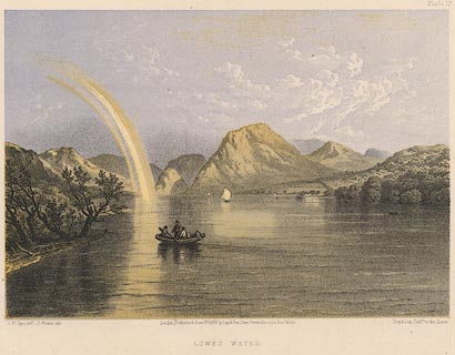 click to enlarge click to enlargePY19.jpg "Lowes Water" item:- JandMN : 97.18 Image © see bottom of page |
|||||||||||||||||||||||||
|
|
||||||||||||||||||||||||||
| evidence:- | old print:- Harwood 1842 placename:- Loweswater |
|||||||||||||||||||||||||
| source data:- | Print, uncoloured engraving, Loweswater and Buttermere, Cumberland, engraved and published
by John and Frederick Harwood, 26 Fenchurch Street, London, 1842.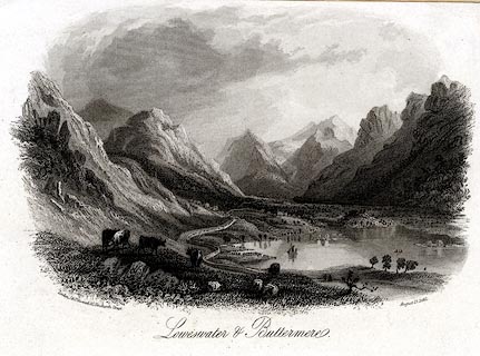 click to enlarge click to enlargeHRW223.jpg Just what is the view? Included in Harwoods Illustrations of the Lakes. printed at bottom left, right, centre:- "London, J & F. Harwood. / August 17, 1842. / Loweswater &Buttermere." item:- JandMN : 166.23 Image © see bottom of page |
|||||||||||||||||||||||||
|
|
||||||||||||||||||||||||||
| evidence:- | outline view:- Black 1841 (3rd edn 1846) placename:- Loweswater |
|||||||||||||||||||||||||
| source data:- | Print, engraving, outline view, Mountains as seen from The Knots near the Victoria
at Buttermere, and Mountains as seen at the Seat in Lanthwaite Wood, Scale Hill, by
J Flintoft, Keswick, Cumberland, engraved by R Mason, Edinburgh, Lothian, about 1846.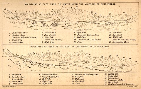 click to enlarge click to enlargeBC02E7.jpg "... 19 Loweswater ..." item:- JandMN : 32.11 Image © see bottom of page |
|||||||||||||||||||||||||
|
|
||||||||||||||||||||||||||
| evidence:- | outline view:- Tattersall 1836 (version 1869) placename:- Loweswater |
|||||||||||||||||||||||||
| source data:- | Print, hand coloured, Loweswater, from the North West, Cumberland, drawn by George
Tattersall, 1836, engraved by W F Topham, published by T J Allman, 463 Oxford Street,
London, 1869.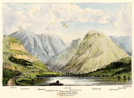 click to enlarge click to enlargeTAT216.jpg Included in The Lakes of England, by W F Topham. printed at bottom:- "LOWESWATER, / from the North West." printed at bottom:- "Bottom. / Grasmoor. / Whiteless. / Buttermere Moss. / Hindscarth. / Low Fell. / Glaramara. / Honister Crag. / Melbreak. / High Style. / Red Pike. / Blake Fell." item:- Armitt Library : A1067.16 Image © see bottom of page |
|||||||||||||||||||||||||
|
|
||||||||||||||||||||||||||
| evidence:- | perhaps outline view:- Rose 1832-35 (vol.2 no.13) |
|||||||||||||||||||||||||
| source data:- | Print, engraving, Loweswater, from Water End, Cumberland, by Thomas Allom, engraved
by W Floyd, 1833.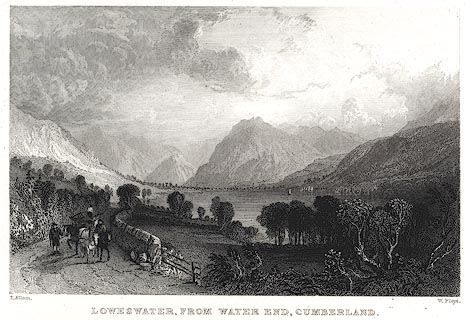 click to enlarge click to enlargePR0402.jpg The text description of the view it 'includes the mountains of Blake Fell, Mellbreak, and Red Pike.' Vol.2 no.13 in Westmorland, Cumberland, Durham and Northumberland Illustrated, with descriptions by Thomas Rose, published by H Fisher, R Fisher, and P Jackson, Newgate, London, about 1835. item:- Dove Cottage : 2008.107.395 Image © see bottom of page |
|||||||||||||||||||||||||
|
|
||||||||||||||||||||||||||
| evidence:- | old print:- Smith and Emes 1794-95 (plate 14) placename:- Lowes Water |
|||||||||||||||||||||||||
| source data:- | Print, aquatint, Lowes Water, Cumberland, drawn by John 'Warwick' Smith, engraved
by Samuel Alken, published by W Clarke, New Bond Street, London, 1794-95.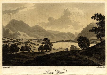 click to enlarge click to enlargePR0432.jpg Plate 14 in Views of the Lakes. printed at bottom, left, right, centre:- "J. Smith delt. / S. Alken fecit / Lowes Water" item:- private collection : 96 Image © see bottom of page |
|||||||||||||||||||||||||
|
|
||||||||||||||||||||||||||
 BJY14.jpg Loweswater, Mellbreak, etc. (taken 14.10.2005) 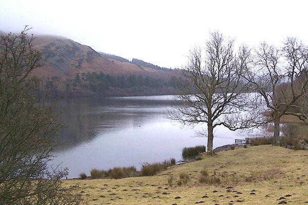 BQD60.jpg From WNW. (taken 17.2.2009) 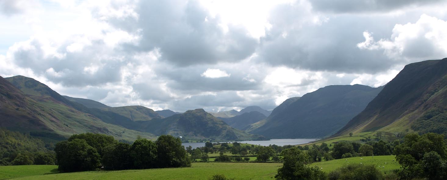 Click to enlarge BVF20.jpg (taken 17.8.2011) 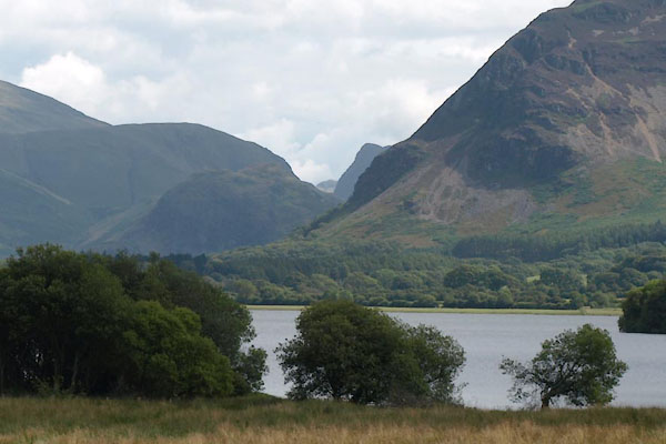 BVF39.jpg (taken 17.8.2011) 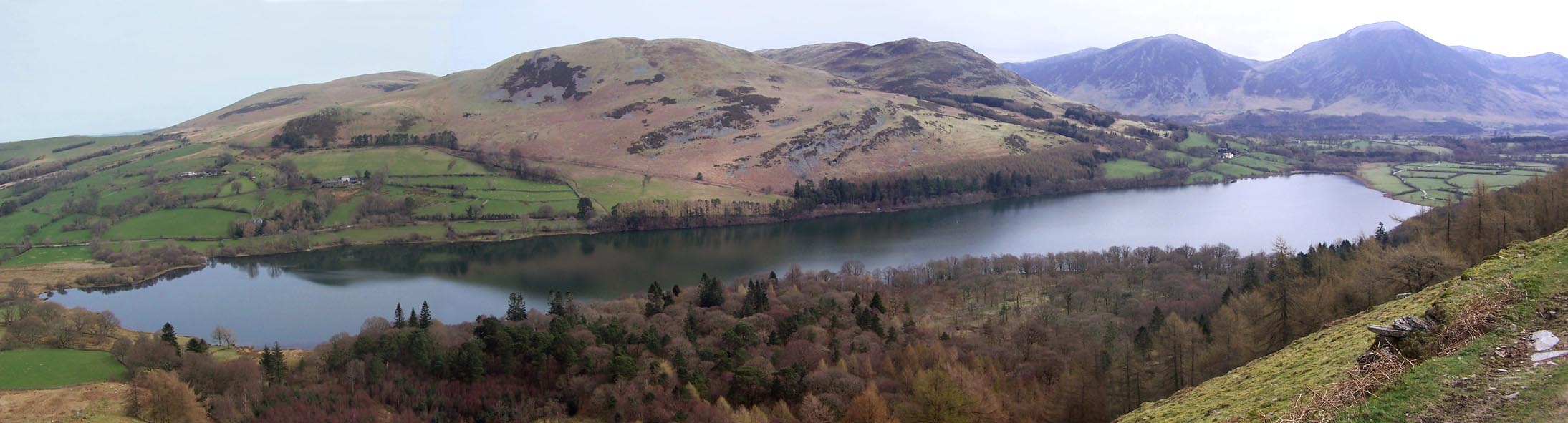 Click to enlarge BQJ17.jpg From S. (taken 1.4.2009) |
||||||||||||||||||||||||||
|
|
||||||||||||||||||||||||||
| see:- | viewpoint, Flass Wood Thomas West / Peter Crosthwaite 2 viewpoint, Highgap Yeat Thomas West / Peter Crosthwaite 1 |
|||||||||||||||||||||||||
|
|
||||||||||||||||||||||||||
Lakes Guides menu.