 Old Cumbria Gazetteer
 |
 |
|
| Millom Castle, Millom | ||
| Millom Castle | ||
| civil parish:- | Millom (formerly Cumberland) | |
| county:- | Cumbria | |
| locality type:- | castle | |
| coordinates:- | SD17128133 | |
| 1Km square:- | SD1781 | |
| 10Km square:- | SD18 | |
|
|
||
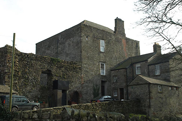 BXX98.jpg (taken 4.3.2103) 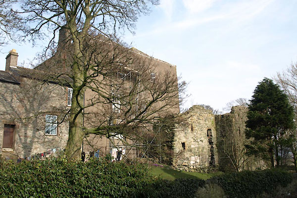 BXX99.jpg (taken 4.3.2103) |
||
|
|
||
| evidence:- | old map:- OS County Series (Cmd 88 14) placename:- Millom Castle |
|
| source data:- | Maps, County Series maps of Great Britain, scales 6 and 25
inches to 1 mile, published by the Ordnance Survey, Southampton,
Hampshire, from about 1863 to 1948. |
|
|
|
||
| evidence:- | old map:- Saxton 1579 placename:- Millum Castle |
|
| source data:- | Map, hand coloured engraving, Westmorlandiae et Cumberlandiae Comitatus ie Westmorland
and Cumberland, scale about 5 miles to 1 inch, by Christopher Saxton, London, engraved
by Augustinus Ryther, 1576, published 1579-1645.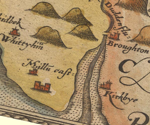 Sax9SD18.jpg Building with two towers, symbol for a castle. "Millu~ cast:" item:- private collection : 2 Image © see bottom of page |
|
|
|
||
| evidence:- | old map:- Mercator 1595 (edn?) placename:- Millum Castle |
|
| source data:- | Map, hand coloured engraving, Westmorlandia, Lancastria, Cestria
etc, ie Westmorland, Lancashire, Cheshire etc, scale about 10.5
miles to 1 inch, by Gerard Mercator, Duisberg, Germany, 1595,
edition 1613-16.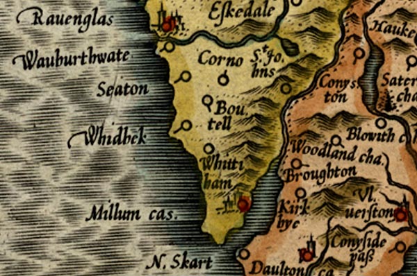 MER5CumG.jpg "Millum ca." circle, building and tower item:- Armitt Library : 2008.14.3 Image © see bottom of page |
|
|
|
||
| evidence:- | old map:- Keer 1605 placename:- Millum Castle |
|
| source data:- | Map, hand coloured engraving, Westmorland and Cumberland, scale
about 16 miles to 1 inch, probably by Pieter van den Keere, or
Peter Keer, about 1605 edition perhaps 1676. click to enlarge click to enlargeKER8.jpg "Millu~ cast" dot, circle and tower; village, tinted red item:- Dove Cottage : 2007.38.110 Image © see bottom of page |
|
|
|
||
| evidence:- | old map:- Speed 1611 (Cum/EW) placename:- Millum Castle |
|
| source data:- | Map, hand coloured engraving, Kingdome of Great Britaine and
Ireland, scale about 36 miles to 1 inch, by John Speed, about
1610-11, published by Thomas Bassett, Fleet Street and Richard
Chiswell, St Paul's Churchyard, London, 1676?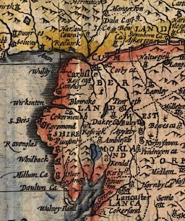 click to enlarge click to enlargeSPD6Cm.jpg "Millum Ca" dot, circle, and tower item:- private collection : 85 Image © see bottom of page |
|
|
|
||
| evidence:- | old map:- Speed 1611 (Cmd) placename:- Millum Castle |
|
| source data:- | Map, hand coloured engraving, Cumberland and the Ancient Citie
Carlile Described, scale about 4 miles to 1 inch, by John Speed,
1610, published by J Sudbury and George Humble, Popes Head
Alley, London, 1611-12.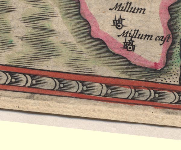 SP11SD17.jpg "Millum cast" circle, building, tower item:- private collection : 16 Image © see bottom of page |
|
|
|
||
| evidence:- | table of distances:- Simons 1635 placename:- Millum Castle |
|
| source data:- | Table of distances, uncoloured engraving, Cumberland, with a
thumbnail map, scale about 41 miles to 1 inch, by Mathew Simons,
published in A Direction for the English Traviller, 1635.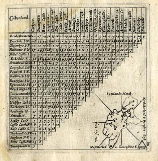 click to enlarge click to enlargeSIM4.jpg "Millu~ Castle S" and tabulated distances; M on thumbnail map item:- private collection : 50.11 Image © see bottom of page |
|
|
|
||
| evidence:- | old map:- Jenner 1643 placename:- Millum Castle |
|
| source data:- | Tables of distances with a maps, Westmerland, scale about 16
miles to 1 inch, and Cumberland, scale about 21 miles to 1 inch,
published by Thomas Jenner, London, 1643; published 1643-80.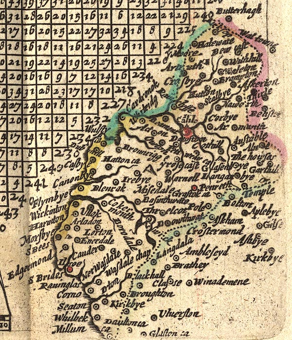 JEN4Sq.jpg "Millum ca" circle |
|
|
|
||
| evidence:- | old map:- Jansson 1646 placename:- Millum Castle |
|
| source data:- | Map, hand coloured engraving, Cumbria and Westmoria, ie
Cumberland and Westmorland, scale about 3.5 miles to 1 inch, by
John Jansson, Amsterdam, Netherlands, 1646.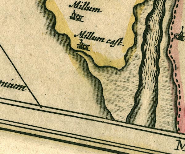 JAN3SD17.jpg "Millum cast." Buildings and tower with flag. item:- JandMN : 88 Image © see bottom of page |
|
|
|
||
| evidence:- | old map:- Morden 1695 (EW) placename:- Millum Castle |
|
| source data:- | Map, hand coloured engraving, England, including Wales, scale
about 27 miles to 1 inch, by Robert Morden, published by Abel
Swale Awnsham and John Churchil, London, about 1695.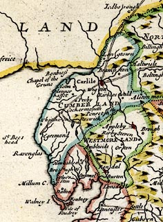 click to enlarge click to enlargeMRD3Cm.jpg "Millum C." buildings and tower; castle item:- JandMN : 339 Image © see bottom of page |
|
|
|
||
| evidence:- | old map:- Morden 1695 (Cmd) placename:- Millum Castle |
|
| source data:- | Map, uncoloured engraving, Cumberland, scale about 4 miles to 1
inch, by Robert Morden, 1695, published by Abel Swale, the
Unicorn, St Paul's Churchyard, Awnsham, and John Churchill, the
Black Swan, Paternoster Row, London, 1695-1715.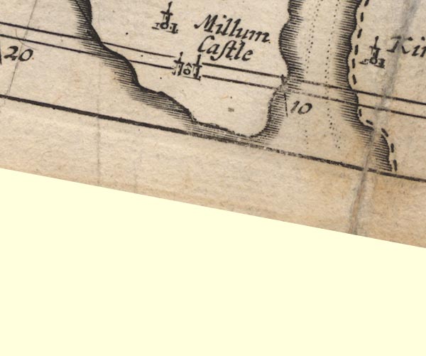 MD12SD17.jpg "Millum Castle" Circle, building with two towers. item:- JandMN : 90 Image © see bottom of page |
|
|
|
||
| evidence:- | old print:- Buck 1739 placename:- Millum Castle |
|
| source data:- | Print, uncoloured engraving, The North East View of Millum Castle, in the County of
Cumberland, drawn and engraved by Samuel and Nathaniel Buck, published 1739. click to enlarge click to enlargeBU0212.jpg printed, top "THE NORTH-EAST VIEW OF MILLUM-CASTLE, IN THE COUNTY OF CUMBERLAND." printed, bottom "THIS Castle was built by Godard de Boyvill, who first possess'd the Manor of Millum. His Posterity Arthur, surnam'd de Millum, Henry, William, & Adam, successively enjoy'd it after him: But the last leaving only one Daughter nam'd Joan, who was in ye Reign of K. H. III. married to John Hudleston, it was then transferr'd to that family, in which it has continued till the present Time. / Saml. &Nathl. Buck Delin. et Sculpt. Publish'd according to Act of Parliamt. March 26th. 1739." item:- Armitt Library : 1959.67.12 Image © see bottom of page |
|
|
|
||
| evidence:- | probably old map:- Badeslade 1742 placename:- Millum |
|
| source data:- | Map, uncoloured engraving, A Map of Cumberland North from
London, scale about 11 miles to 1 inch, with descriptive text,
by Thomas Badeslade, London, engraved and published by William
Henry Toms, Union Court, Holborn, London, 1742. click to enlarge click to enlargeBD10.jpg "Millum" circle, italic lowercase text item:- JandMN : 115 Image © see bottom of page |
|
|
|
||
| evidence:- | old map:- Bowen and Kitchin 1760 placename:- Millum Castle |
|
| source data:- | Map, hand coloured engraving, A New Map of the Counties of
Cumberland and Westmoreland Divided into their Respective Wards,
scale about 4 miles to 1 inch, by Emanuel Bowen and Thomas
Kitchin et al, published by T Bowles, Robert Sayer, and John
Bowles, London, 1760.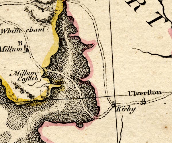 BO18SD17.jpg "Millum Castle" circle and line item:- Armitt Library : 2008.14.10 Image © see bottom of page |
|
|
|
||
| evidence:- | old map:- Donald 1774 (Cmd) placename:- Castle |
|
| source data:- | Map, hand coloured engraving, 3x2 sheets, The County of Cumberland, scale about 1
inch to 1 mile, by Thomas Donald, engraved and published by Joseph Hodskinson, 29
Arundel Street, Strand, London, 1774.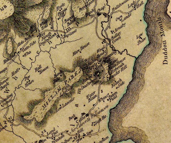 D4SD18SE.jpg "Castle / Sir Edworth Williamson" house item:- Carlisle Library : Map 2 Image © Carlisle Library |
|
|
|
||
| evidence:- | old map:- West 1784 map placename:- Millom Castle |
|
| source data:- | Map, hand coloured engraving, A Map of the Lakes in Cumberland,
Westmorland and Lancashire, scale about 3.5 miles to 1 inch,
engraved by Paas, 53 Holborn, London, about 1784.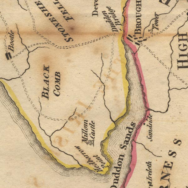 Ws02SD18.jpg item:- Armitt Library : A1221.1 Image © see bottom of page |
|
|
|
||
| evidence:- | old text:- Clarke 1787 placename:- Millum Castle |
|
| source data:- | Guide book, A Survey of the Lakes of Cumberland, Westmorland,
and Lancashire, written and published by James Clarke, Penrith,
Cumberland, and in London etc, 1787; published 1787-93. goto source goto sourcePage 105:- "..." "I do not find any ancient authors mention a castle here [Castlerigg], Speed, who speaks of twenty-five in Cumberland, hath found out every one I ever heard or knew of, except Kirkoswald; how that has escaped him I cannot tell. I shall here put down their names, and, as well as I can, their most ancient owners, and supposed founders." "..." goto sourcePage 106:- "..." "25. MILLUM. Godartus Dapifer." "..." |
|
|
|
||
| evidence:- | old text:- Camden 1789 placename:- Millum Castle |
|
| source data:- | Book, Britannia, or A Chorographical Description of the Flourishing Kingdoms of England,
Scotland, and Ireland, by William Camden, 1586, translated from the 1607 Latin edition
by Richard Gough, published London, 1789. goto source Page 169:- "..." "... In this [Copeland] at the sandy mouth of the Duden, which separates it from Lancashire, is Millum, a castle of the antient family of the Hodlestons; ..." |
|
|
|
||
| evidence:- | old text:- Camden 1789 (Gough Additions) placename:- Millum Castel |
|
| source data:- | Book, Britannia, or A Chorographical Description of the Flourishing Kingdoms of England,
Scotland, and Ireland, by William Camden, 1586, translated from the 1607 Latin edition
by Richard Gough, published London, 1789. Page 179:- "..." ""Between Eske and Doden is set Millum, a castel longing to sir John Hudestan, on the right of Dudden river or Dudden sands." The first lords William and Henry, about the time of Henry II. took their name from it, but t. Henry III. the heiress of Adam de Millum transferred it by marriage to John Hudlestone." |
|
|
|
||
| evidence:- | probably old map:- Laurie and Whittle 1806 placename:- Millam |
|
| source data:- | Road map, Completion of the Roads to the Lakes, scale about 10
miles to 1 inch, by Nathaniel Coltman? 1806, published by Robert
H Laurie, 53 Fleet Street, London, 1834. click to enlarge click to enlargeLw18.jpg "Millam 281" village or other place; distance from London item:- private collection : 18.18 Image © see bottom of page |
|
|
|
||
| evidence:- | old text:- Capper 1808 |
|
| source data:- | Gazetteer, A Topographical Dictionary of the United Kingdom,
compiled by Benjamin Pitts Capper, published by Richard
Phillips, Bridge Street, Blackfriars, London, 1808; published
1808-29. goto source "[Millom] ... The ruins of an ancient mansion, the seat of the Hudlestons, are to be seen with an extensive park, beyond which rises Blackcomb mountain; ..." |
|
|
|
||
| evidence:- | old map:- Ford 1839 map |
|
| source data:- | Map, uncoloured engraving, Map of the Lake District of
Cumberland, Westmoreland and Lancashire, scale about 3.5 miles
to 1 inch, published by Charles Thurnam, Carlisle, and by R
Groombridge, 5 Paternoster Row, London, 3rd edn 1843.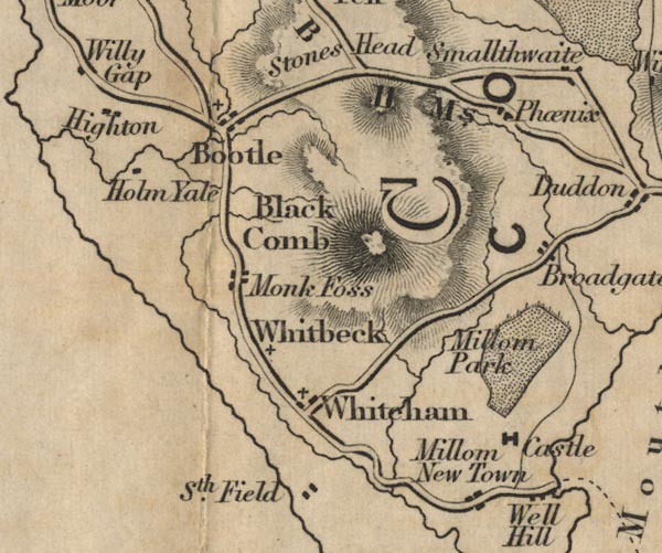 FD02SD18.jpg "Castle" item:- JandMN : 100.1 Image © see bottom of page |
|
|
|
||
| evidence:- | probably old map:- Garnett 1850s-60s H placename:- Millom |
|
| source data:- | Map of the English Lakes, in Cumberland, Westmorland and
Lancashire, scale about 3.5 miles to 1 inch, published by John
Garnett, Windermere, Westmorland, 1850s-60s.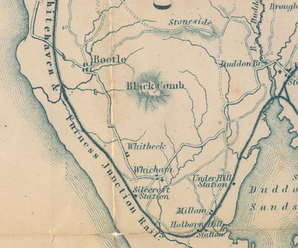 GAR2SD18.jpg "Millom" blocks, settlement item:- JandMN : 82.1 Image © see bottom of page |
|
|
|
||
| evidence:- | probably old text:- Gents Mag placename:- Millum |
|
| source data:- | Magazine, The Gentleman's Magazine or Monthly Intelligencer or
Historical Chronicle, published by Edward Cave under the
pseudonym Sylvanus Urban, and by other publishers, London,
monthly from 1731 to 1922. goto source Gentleman's Magazine 1856 part 2 pp.323-330 "..." "LICENCES TO CRENELLATE, FROM THE PATENT ROLLS IN THE TOWER OF LONDON." "..." "EDWARD III. A.D. 1327. Jan. 25. 1377. June 21." "..." "9. Johannes de Hodleston mansum Millumi ... Cumbr." "..." "i Millum. There are some remains of this house." |
|
|
|
||
| evidence:- | text:- Curwen 1913 placename:- item:- licence to crenellate |
|
| source data:- | Book, The Castles and Fortified Towers of Cumberland,
Westmorland, and Lancashire North of the Sands, by John F
Curwen, published for the Cumberland and Westmorland Antiquarian
and Archaeological Society by Titus Wilson, Kendal, Westmorland,
1913. Licence to crenellate granted by Edward III; 24 August 1335:- "Johannes de Hodleston ... mansum suum ... Millum, Cumberland." |
|
|
|
||
| evidence:- | database:- Listed Buildings 2010 placename:- Millom Castle |
|
| source data:- | courtesy of English Heritage "MILLOM CASTLE / / A 5093 / MILLOM / COPELAND / CUMBRIA / I / 76333 / SD1712781333" |
|
| source data:- | courtesy of English Heritage "Ruins of castle or moated manor house incorporating present farmhouse. Licence to crenellate 1335, east range later C14, great tower, now farmhouse C16 or Cl7 with later alterations. Stone rubble with ashlar dressings, house partly roughcast with parallel hipped slate roofs. House has hall to north; east range has central gatehouse, kitchen range to north, solar range to south. Windows with pointed heads. East elevation has projecting gatehouse up C17 steps, front wall collapsed, small projection to south. Straight-headed 1st floor window to south return. South elevation of house has varied windows with label moulds, mostly tall 12-pane sashes, later 2-storey wing to west. Cross-axial stack and return lateral stacks. Entrance to wing. West elevation has pointed entrance and window opening to hall, entrance with overlight and 2 sashed windows to house, gabled out-house to wing which has sashed windows. North elevation has later barns abutting. Solar range has 1st floor with larger windows and ogee-headed entrance, probably to garderobe, to south-west angle; ground floor fireplace has smoke hole to outer hall with finial. Gatehouse has signs of 1st floor, small courtyard to west has jamb of entrance with portcullis groove. Kitchen range has segmental-headed fireplace with smoke hole to outer wall. 2 pointed entrances to hall lwhich has signs of east dais and 2 formerly Y tracery north windows. House north elevation has 2 pointed entrances to vaulted cellars; sashed windows, one with bull's eye pane. East elevation has wide-boarded studded door. Moat to west and north. Scheduled Ancient Monument. See T Clare: 'Guide to Archaeological Sites of Cumbria'." |
|
|
|
||
| evidence:- | database:- Listed Buildings 2010 |
|
| source data:- | courtesy of English Heritage "GATEPIERS TO NORTH EAST OF MILLOM CASTLE / / A 5093 / MILLOM / COPELAND / CUMBRIA / II / 76335 / SD1717481380" |
|
| source data:- | courtesy of English Heritage "Gatepiers to road. Probably Cl7 or C18. Ashlar. Rusticated square piers with cornices and ball finials." |
|
|
|
||
| evidence:- | database:- Listed Buildings 2010 |
|
| source data:- | courtesy of English Heritage "GATEPIERS TO EAST OF MILLOM CASTLE / / A 5093 / MILLOM / COPELAND / CUMBRIA / II / 76334 / SD1716481323" |
|
| source data:- | courtesy of English Heritage "Gatepiers. Probably Cl7 or C18. Ashlar. Rusticated piers with cornices and ball finials." |
|
|
|
||
| evidence:- | old print:- Buck 1739/1837 (edn 1877) placename:- Millum Castle |
|
| source data:- | Print, uncoloured engraving, The North East View of Millum Castle, in the County of
Cumberland, drawn and engraved by Samuel and Nathaniel Buck, 1739, reprinted by Hudson
Scott and Sons, Carlisle, Cumberland, 1877.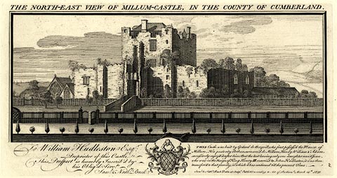 click to enlarge click to enlargeBU0114.jpg With descriptive text of 1837. No.14 in The Castles, Abbeys, and Priories of the County of Cumberland, 1877. printed at top:- "THE NORTH-EAST VIEW OF MILLUM-CASTLE, IN THE COUNTY OF CUMBERLAND." printed at lower left:- "To William Hudleston Esqr: Propprietor of this Castle, This Prospect is humbly Inscrib'd by his Oblig'd Servts: Saml. &Nathl. Buck." printed at lower right:- "THIS castle was built by Godard de Boyvill, who first possess'd the Manor of Millum. His posterity Arthur, surnam'd de Millum, Henry, William, & Adam, successivley enjoy'd it after him: But the last leaving only one daughter nam'd Joan, who was in ye Reign of King Henry III. married to John Hudleston, it was then transferr'd to that family, in which it has continued 'till the present Time. Saml. &Nathl. Buck delin: et sculp: Publish'd according to Act of Parliament March 26. 1739." item:- JandMN : 178.14 Image © see bottom of page |
|
|
|
||
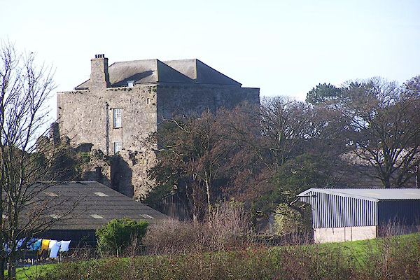 BOI28.jpg (taken 6.11.2007) |
||
|
|
||
| hearsay:- |
Pele and hall, from 1335; obscured within the farm buildings. |
|
|
|
||
| notes:- |
keep, gateway, curtain wall, moat, all in ruins |
|
| Perriam, D R &Robinson, J: 1998: Medieval Fortified Buildings of Cumbria: CWAAS::
ISBN 1 873124 23 6; plan and illustrations |
||
|
|
||
Lakes Guides menu.