Old Cumbria Gazetteer
 |
 |
|
||
| included in:- |
 road, Lancaster to Carlisle road, Lancaster to Carlisle |
|||
| road, Kendal to Shap | ||||
| Kendal to Shap | ||||
| Shap to Kendal | ||||
| A6 | ||||
| civil parish:- | Kendal (formerly Westmorland) | |||
| civil parish:- | Skelsmergh (formerly Westmorland) | |||
| civil parish:- | Whitwell and Selside (formerly Westmorland) | |||
| civil parish:- | Fawcett Forest (formerly Westmorland) | |||
| civil parish:- | Orton S (formerly Westmorland) | |||
| civil parish:- | Shap Rural (formerly Westmorland) | |||
| civil parish:- | Shap (formerly Westmorland) | |||
| county:- | Cumbria | |||
| locality type:- | road route | |||
| 10Km square:- | SD59 | |||
| 10Km square:- | NY50 | |||
| 10Km square:- | NY51 | |||
|
|
||||
 accident 18410801 accident 18410801 |
||||
|
|
||||
| evidence:- | old map:- Speed 1611 placename:- |
|||
| source data:- | Map, hand coloured engraving, The Countie Westmorland and
Kendale the Cheif Towne, scale about 2.5 miles to 1 inch, by
John Speed, 1610, published by George Humble, Popes Head Alley,
London, 1611-12.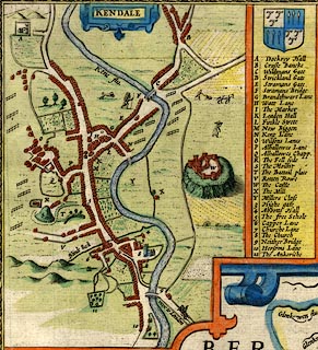 click to enlarge click to enlargeSP14Mk.jpg road N from Cross Bank ie Longpool item:- Armitt Library : 2008.14.5 Image © see bottom of page |
|||
|
|
||||
| evidence:- | old map:- Ogilby 1675 |
|||
| source data:- | Road strip map, hand coloured engraving, continuation of the
Road from London to Carlisle, scale about 1 inch to 1 mile, by
John Ogilby, London, 1675.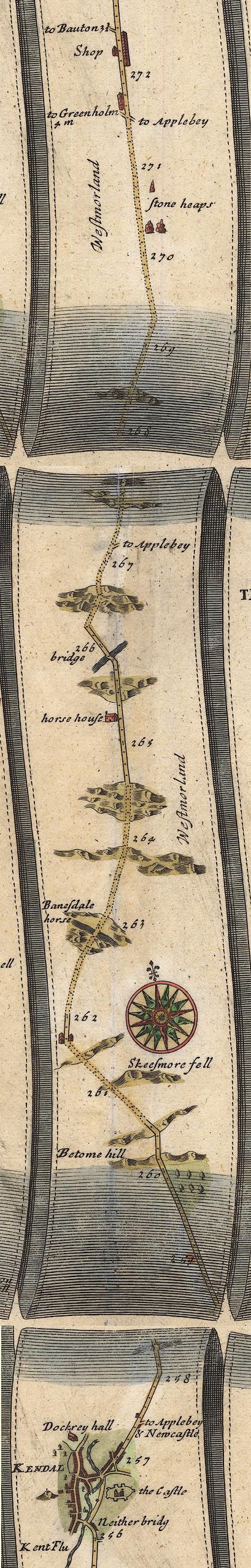 OG38KtoS.jpg item:- JandMN : 21 Image © see bottom of page |
|||
|
|
||||
| evidence:- | old map:- Morden 1695 (Wmd) |
|||
| source data:- | Map, hand coloured engraving, Westmorland, scale about 2.5 miles to 1 inch, by Robert
Morden, published by Abel Swale, the Unicorn, St Paul's Churchyard, Awnsham, and John
Churchill, the Black Swan, Paternoster Row, London, 1695.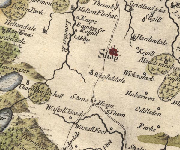 MD10NY51.jpg  MD10NY50.jpg 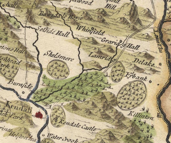 MD10SD59.jpg The westerly route between Kendal and Shap relates to the present A6. The other route follows the Appleby road as far as Tebay. item:- JandMN : 24 Image © see bottom of page |
|||
|
|
||||
| evidence:- | old map:- Bowen 1720 (plates 93 and 94) |
|||
| source data:- | Strip maps, uncoloured engravings, road maps, The Road from
London to Carlisle, scale about 2 miles to 1 inch, with sections
in Lancashire and Westmorland, published by Emanuel Bowen, St
Katherines, London, 1720.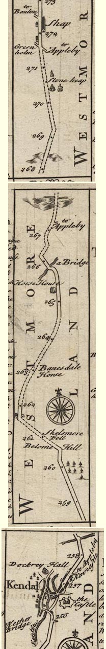 B094KtoS.jpg item:- Dove Cottage : 2007.38.100 Image © see bottom of page |
|||
|
|
||||
| evidence:- | old map:- Badeslade 1742 |
|||
| source data:- | Map, uncoloured engraving, A Map of Westmorland North from
London, scale about 10 miles to 1 inch, with descriptive text,
by Thomas Badeslade, London, engraved and published by William
Henry Toms, Union Court, Holborn, London, 1742. click to enlarge click to enlargeBD12.jpg double line item:- Dove Cottage : 2007.38.62 Image © see bottom of page |
|||
|
|
||||
| evidence:- | descriptive text:- |
|||
| source data:- | : 1745 (?): : : vol.1: p.389 "... On the 16th [December 1745] the Main Body of the Army marched for Shap, but Rear-guards
were obliged to stop at a farm [Forest Hall] four miles from Kendal, by Reason that
a great many of the carriages and particularly the four-wheeled waggons, in which
was Part of the Ammunition, could not be forwarded because of the steepness of the
Hill, and the Badness of the Road. But small carriages being got next Day, and the
Ammunition being shifted from the broken waggons, they came that night to Shap, being
the 17th; the main Body having gone to Penrith that day. ..." |
|||
|
|
||||
| evidence:- | old text:- Gents Mag item:- rebellion, 1745; 1745 Rebellion |
|||
| source data:- | Magazine, The Gentleman's Magazine or Monthly Intelligencer or
Historical Chronicle, published by Edward Cave under the
pseudonym Sylvanus Urban, and by other publishers, London,
monthly from 1731 to 1922. goto source Gentleman's Magazine 1745 p.625 "... ..." "... that from their [rebels, 1745] first entering England, till they came to Derby, they seem's resolv'd upon marching directly to London; but that at Derby, having heard how the D. of Cumberland's army was posted, a council of war was call'd, in which it was resolv'd to return by Carlisle into Scotland; ..." "Appleby, Dec. 14. In obedience to a letter sent to the deputy-lieutenants of Westmorland and Cumberland, by his R.H. the D. of Cumberland, requiring them, by all means, to retard and obstruct the march of the rebels thro' thos two counties, a resolution had just been taken to raise part of the county to demolish Wastal bridge, to make the road from Kendal to Shap impassable for the artillery of the rebels, or any wheel-carriages; and for the same reason to break up the road down Graridge Hawse; whereby it is hoped their march may be so far retarded, as to give time to his R.H.'s army to come up with them, before they can get clear of these counties. ..." |
|||
|
|
||||
| evidence:- | old map:- Simpson 1746 map (Wmd) |
|||
| source data:- | Map, uncoloured engraving, Westmorland, scale about 8 miles to 1
inch, printed by R Walker, Fleet Lane, London, 1746.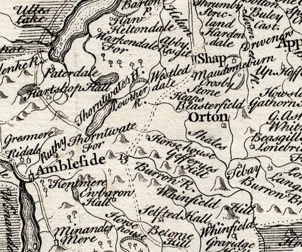 SMP2NYK.jpg Double dotted line; distance number 13. 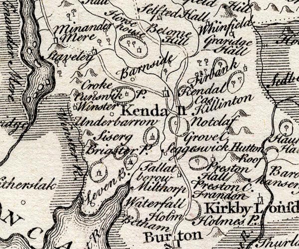 SMP2SDP.jpg Double line. item:- Dove Cottage : 2007.38.59 Image © see bottom of page |
|||
|
|
||||
| evidence:- | old map:- Bowen and Kitchin 1760 |
|||
| source data:- | Map, hand coloured engraving, A New Map of the Counties of
Cumberland and Westmoreland Divided into their Respective Wards,
scale about 4 miles to 1 inch, by Emanuel Bowen and Thomas
Kitchin et al, published by T Bowles, Robert Sayer, and John
Bowles, London, 1760.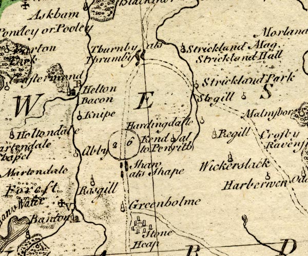 BO18NY41.jpg double line, dotted 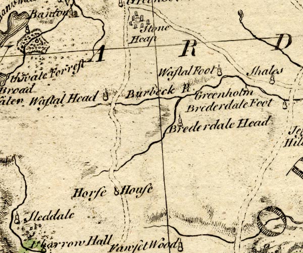 BO18NY40.jpg double line, dotted 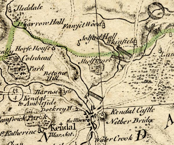 BO18SD49.jpg double line, dotted item:- Armitt Library : 2008.14.10 Image © see bottom of page |
|||
|
|
||||
| evidence:- | old map:- Kitchin 1767 (plate 40) |
|||
| source data:- | Road strip map, uncoloured engraving, The Road from London to
Carlisle, in Kitchin's Post Chaise Companion, by Thomas Kitchin,
published by Robert Sayer, 53 Fleet Street, John Bowles,
Cornhill, and Carington Bowles, St Paul's Church Yard, London,
1767.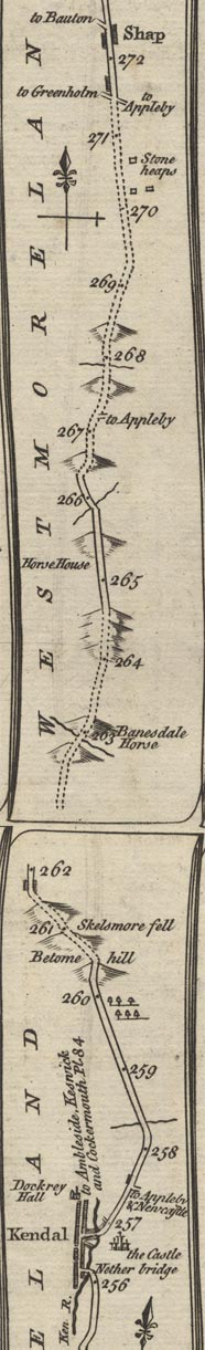 K040KtoS.jpg item:- Hampshire Museums : FA1999.138.40 Image © see bottom of page |
|||
|
|
||||
| evidence:- | old map:- Jefferys 1770 |
|||
| source data:- | Map, 4 sheets, The County of Westmoreland, scale 1 inch to 1
mile, surveyed 1768, and engraved and published by Thomas
Jefferys, London, 1770.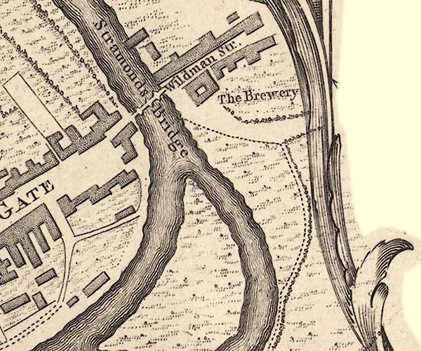 J55192Z.jpg road item:- National Library of Scotland : EME.s.47 Image © National Library of Scotland |
|||
|
|
||||
| evidence:- | old map:- Jefferys 1770 (Wmd) |
|||
| source data:- | Map, 4 sheets, The County of Westmoreland, scale 1 inch to 1
mile, surveyed 1768, and engraved and published by Thomas
Jefferys, London, 1770. J5NY51SE.jpg  J5NY50NE.jpg  J5NY50SW.jpg 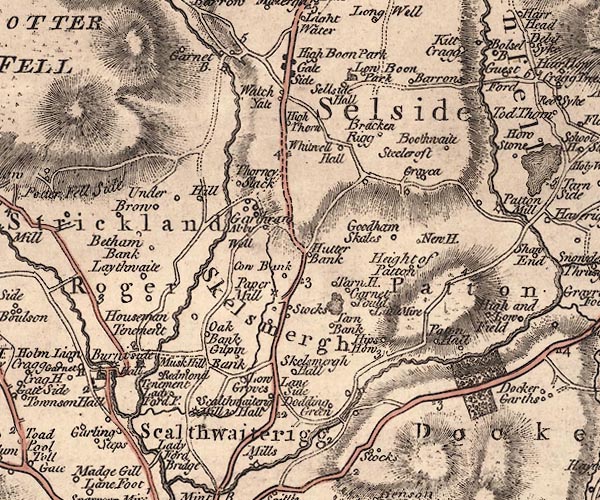 J5SD59NW.jpg 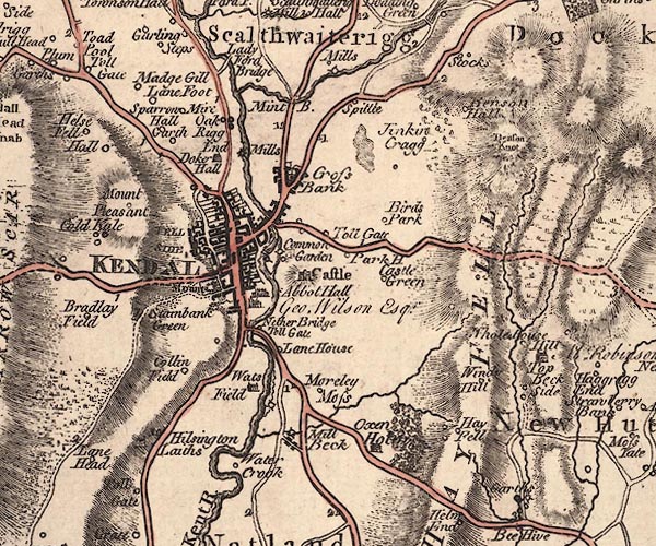 J5SD59SW.jpg double line; road, bold, main road, with mile numbers item:- National Library of Scotland : EME.s.47 Images © National Library of Scotland |
|||
|
|
||||
| evidence:- | old text:- Pennant 1773 |
|||
| source data:- | Book, A Tour from Downing to Alston Moor, 1773, by Thomas
Pennant, published by Edward Harding, 98 Pall Mall, London, 1801. goto source Pennant's Tour 1773, page 121 "I left Kendal, and not far from thence passed by the Spittle, once an hospital for lepers, ... A little beyond I began to ascend the mountains: on the left is the narrow deep valley of Long Sladale, ... for a long space the road lies in the midst of black and dreary mountains. I rode very near to Shap, [and turned off to Orton] ..." |
|||
|
|
||||
| evidence:- | descriptive text:- West 1778 (11th edn 1821) |
|||
| source data:- | Guide book, A Guide to the Lakes, by Thomas West, published by
William Pennington, Kendal, Cumbria once Westmorland, and in
London, 1778 to 1821. goto source Page 173:- "..." "... to the village of Shap, a proper place for refreshment, before you face Shap-fells, ... [Shap to Kendal]" goto sourcePage 174:- "a dreary, melancholy tract of twelve miles. On the east side of the road, soon after you leave the village, observe a double range of" goto sourcePage 175:- "huge granites, ... They are supposed to have run quite through the village, and terminated in a point. ..." "There is at a small distance to the east from these stones a spring, called Shap-spaw, in smell and taste like that of Harrowgate, and much frequented by the people of the country for scorbutic complaints, and eruptions of the skin. Leaving this gloomy region of black moors and shapeless mountains behind you, you approach a charming vale, which Mr. Young, in his elegant manner, describes thus:" "'After crossing this dreary tract, the first appearance of a good country is most exquisitely fine; about three miles from Kendal, you" goto sourcePage 176:- "at once look down from off this desolate country upon one of the finest landscapes in the world; ..." |
|||
|
|
||||
| evidence:- | old map:- Cary 1789 (edn 1805) |
|||
| source data:- | Map, uncoloured engraving, Westmoreland, scale about 2.5 miles
to 1 inch, by John Cary, London, 1789; edition 1805.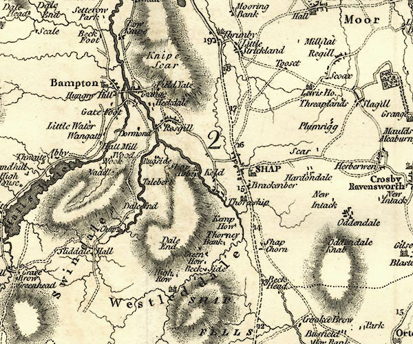 CY24NY51.jpg 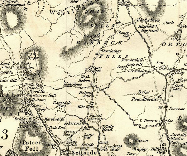 CY24NY50.jpg 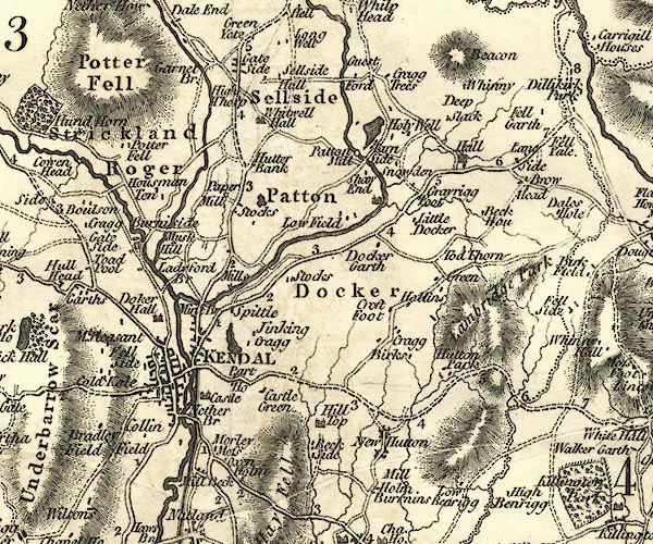 CY24SD59.jpg double line, bold light, numbered miles; main road item:- JandMN : 129 Image © see bottom of page |
|||
|
|
||||
| evidence:- | road map:- Cary 1790 (Wmd/edn 1792) |
|||
| source data:- | Road map, hand coloured engraving, Westmoreland, scale about
11.5 miles to 1 inch, by John Cary, 181 Strand, London, 1790,
edn 1792.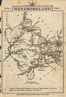 click to enlarge click to enlargeCY16.jpg double line, with road distances from Kendal item:- JandMN : 44 Image © see bottom of page |
|||
|
|
||||
| evidence:- | road book:- Cary 1798 (2nd edn 1802) |
|||
| source data:- | Road book, itineraries, Cary's New Itinerary, by John Cary, 181
Strand, London, 2nd edn 1802. goto source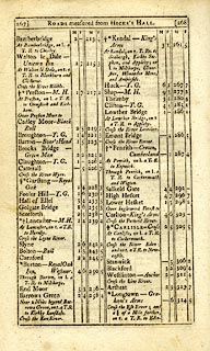 click to enlarge click to enlargeC38267.jpg page 267-268 "LONDON, through Manchester and Carlisle, to Port Patrick" part of goto source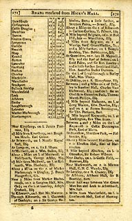 click to enlarge click to enlargeC38271.jpg page 271-272 "[PORT PATRICK to Northampton.]" in the reverse route item:- JandMN : 228.1 Image © see bottom of page |
|||
|
|
||||
| evidence:- | descriptive text:- Baker 1802 |
|||
| source data:- | Perspective road map with sections in Lancashire, Westmorland,
and Cumberland, by J Baker, London 1802. pp.25-26:- "[Kendal] ... another [street] leads by similar distance [half a mile] to cross the river Kent on the eastward, and by means of this latter the post road is continued to Shap. ..." "..." "The road from Kendal to Shap, after passing the fertile vale of the river Ken, shews a vast succession of wide wastes, mountains, and moors, long vales, and broad hollows, that yield the traveller little amusement after the novelty of the first impression. Seats of the Wakefield's and the Blount's adorn the first part of this track." |
|||
|
|
||||
| evidence:- | old map:- Cooke 1802 |
|||
| source data:- | Map, Westmoreland ie Westmorland, scale about 12 miles to 1
inch, by George Cooke, 1802, published by Sherwood, Jones and
Co, Paternoster Road, London, 1824. click to enlarge click to enlargeGRA1Wd.jpg double line, feathered edges; post road? item:- Hampshire Museums : FA2000.62.4 Image © see bottom of page |
|||
|
|
||||
| evidence:- | old map:- Laurie and Whittle 1806 |
|||
| source data:- | Road map, Completion of the Roads to the Lakes, scale about 10
miles to 1 inch, by Nathaniel Coltman? 1806, published by Robert
H Laurie, 53 Fleet Street, London, 1834. click to enlarge click to enlargeLw18.jpg double line, light bold; 'Mail-Coach Roads (Direct)' item:- private collection : 18.18 Image © see bottom of page |
|||
|
|
||||
| evidence:- | old map:- Cooper 1808 |
|||
| source data:- | Map, hand coloured engraving, Westmoreland ie Westmorland, scale
about 9 miles to 1 inch, by H Cooper, 1808, published by R
Phillips, Bridge Street, Blackfriars, London, 1808. click to enlarge click to enlargeCOP4.jpg double line; road item:- Dove Cottage : 2007.38.53 Image © see bottom of page |
|||
|
|
||||
| evidence:- | old map:- Wallis 1810 (Wmd) |
|||
| source data:- | Road map, Westmoreland, scale about 19 miles to 1 inch, by James
Wallis, 77 Berwick Street, Soho, 1810, published by W Lewis,
Finch Lane, London, 1835? click to enlarge click to enlargeWAL5.jpg double line, hatched; 'Mail Coach Road' item:- JandMN : 63 Image © see bottom of page |
|||
|
|
||||
| evidence:- | old map:- Otley 1818 placename:- Hause |
|||
| source data:- | Map, uncoloured engraving, The District of the Lakes,
Cumberland, Westmorland, and Lancashire, scale about 4 miles to
1 inch, by Jonathan Otley, 1818, engraved by J and G Menzies,
Edinburgh, Scotland, published by Jonathan Otley, Keswick,
Cumberland, et al, 1833.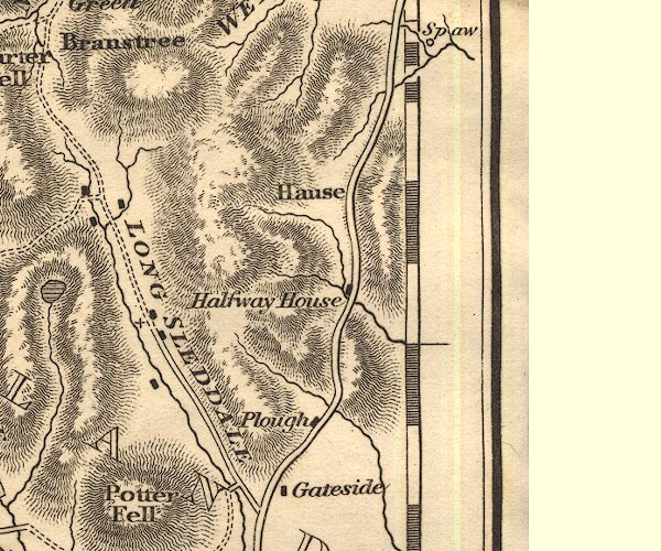 OT02NY50.jpg item:- JandMN : 48.1 Image © see bottom of page |
|||
|
|
||||
| evidence:- | old map:- Hall 1820 (Wmd) |
|||
| source data:- | Map, hand coloured engraving, Westmoreland ie Westmorland, scale
about 14.5 miles to 1 inch, by Sidney Hall, London, 1820,
published by Samuel Leigh, 18 Strand, London, 1820-31. click to enlarge click to enlargeHA18.jpg double line, solid; main road; Kendal, Spittle, Selside, Kitts How, Hause Foot, Demmings, Shap item:- Armitt Library : 2008.14.58 Image © see bottom of page |
|||
|
|
||||
| evidence:- | old text:- Gents Mag item:- roman finds; coin, roman |
|||
| source data:- | Magazine, The Gentleman's Magazine or Monthly Intelligencer or
Historical Chronicle, published by Edward Cave under the
pseudonym Sylvanus Urban, and by other publishers, London,
monthly from 1731 to 1922. goto source Gentleman's Magazine 1833 part 1 p.5 "... about three years since, when the workmen were employed in improving the road from Shap to Kendal, they had a great many of them [Shap granite boulders] to remove just on the north side of Wastdale beck; and under some, found considerable quantities of Roman coins, all belonging to emperors, prior, as I understood my informant, to the reign of Trajan, but principally of Vespasian and Domitian. There were 19 of gold, and about 580 of silver, and all in fine preservation. Several of them found there way into the cabinet of Sir Christopher Musgrave, Bart. of Eden Hall, in Cumberland. This discovery is highly interesting, inasmuch as it serves to show that the route of Agricola's army from Wales, was by that way into Caledonia. I hope this notice may be the means of procuring you some further and more particular account of the coins themselves, and of the circumstances under which they were found." |
|||
|
|
||||
| evidence:- | old map:- Ford 1839 map |
|||
| source data:- | Map, uncoloured engraving, Map of the Lake District of
Cumberland, Westmoreland and Lancashire, scale about 3.5 miles
to 1 inch, published by Charles Thurnam, Carlisle, and by R
Groombridge, 5 Paternoster Row, London, 3rd edn 1843. FD02SD59.jpg 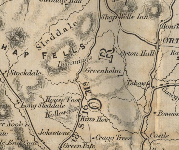 FD02NY50.jpg "K to S 16 Ms."  FD02NY51.jpg item:- JandMN : 100.1 Image © see bottom of page |
|||
|
|
||||
| evidence:- | old map:- Garnett 1850s-60s H |
|||
| source data:- | Map of the English Lakes, in Cumberland, Westmorland and
Lancashire, scale about 3.5 miles to 1 inch, published by John
Garnett, Windermere, Westmorland, 1850s-60s.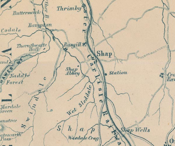 GAR2NY51.jpg double line, bold light, major road 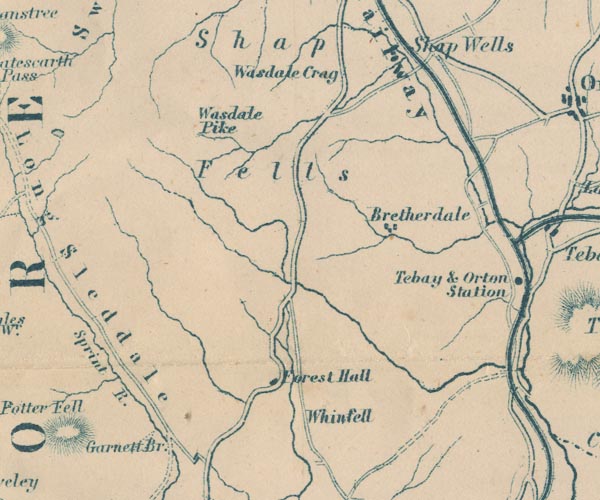 GAR2NY50.jpg  GAR2SD59.jpg item:- JandMN : 82.1 Image © see bottom of page |
|||
|
|
||||
| evidence:- | gradient diagram:- Gall and Inglis 1890s-1900s (Roads) |
|||
| source data:- | Contour Road Book of England, Northern Division, by Harry R G Inglis, published by
Gall and Inglis, 25 Paternoster Square, London and Edinburgh, 1898.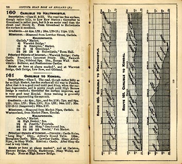 click to enlarge click to enlargeIG5160.jpg Itinerary, with gradient diagram, route 160, Carlisle to Haltwhistle, and route 161, Carlisle to Kendal, Westmorland, Cumberland and Northumberland, 1898. item:- JandMN : 763.8 Image © see bottom of page |
|||
|
|
||||
| evidence:- | old print:- Bradley 1901 |
|||
| source data:- | Print, uncoloured lithograph, The Road over Shap Fell, Westmorland, by Joseph Pennell,
published by Macmillan and Co, London, 1901.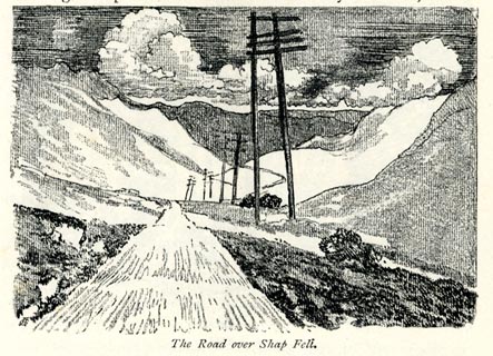 click to enlarge click to enlargeBRL179.jpg On page 302 of Highways and Byways in the Lake District, by A G Bradley. printed at bottom:- "The Road over Shap Fell." item:- JandMN : 464.79 Image © see bottom of page |
|||
|
|
||||
| evidence:- | old text:- Harper 1907 |
|||
| source data:- | Guidebook, The Manchester and Glasgow Road, by Charles G Harper,
published by Chapman and Hall Ltd, London, 1907. HP01p106.txt Page 106:- "..." "BETWEEN Kendal and Penrith, a distance of twenty-six miles, is situated the bleakest and most trying stretch of country in all the distance from London and Glasgow. It is the district of that high-perched table-land, 1,400 feet above sea-level, dreaded by the old coachmen, and the passengers too, as "Shap fell." All the weather of Westmoreland is brewed amid the inhospitable altitudes of Stainmoor and Shap Fell ..." "The ascent of this not very promising region begins by a gentle rise at Mint Bridge, one mile from Kendal. It continues, with increasingly steep gradients, but with two short intervals of down gradient, for nine and a half miles, when the summit is reached. Although Shap Fell has so ugly a" HP01p107.txt Page 107:- "name, the rise at no point exceeds 1 in 10. It is rather the long-continued character of the ascent to the exposed summit that makes the road remarkable." "..." HP01p111.txt Page 111:- "..." "... Hucks Brow, the end of the first stage out of Kendal, and Forest Hall, which, with the Abbey Farm at Shap, forms one of the two largest sheep-farms in Westmoreland. Another rise of a mile and a half, and a steep descent leads to Boroughbridge, a hamlet where an ancient bridge spans a mountain stream and is neighboured by a few cottages and the "Bay Horse" inn. From this point the final and most trying ascent is made. An old road goes winding away in the valley below, past Hausefoot Farm, but it has long ceased to be of any but strictly local use." HP01p112.txt Page 112:- "The road across Shap summit is built upon peat bogs, and needs constant repair. The boggy nature of the foundation is not apparent to the casual wayfarer, but may readily be discovered by standing beside it at the passing of a motor-car, when it very perceptibly shakes." "At the descent from the summit towards Shap village, the old road crosses to the right hand, and away to the right, half a mile across the moors, the hotel of Shap Wells, is seen, rising from its wooded hollow." |
|||
|
|
||||
| evidence:- | old strip map:- CTC 1911 (Roads) |
|||
| source data:- | Page 16 of Cyclists' Touring Club British Road Book new series vol.6, edited by F
B Sandford, published by Thomas Nelson and Sons, London etc, 1911.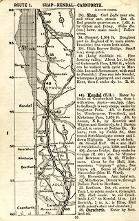 click to enlarge click to enlargeCTC216.jpg Strip road map, route 1, Shap Kendal Carnforth, part of Carlisle to Tarporley, scale about 5 miles to 1 inch. Together with an itinerary and gradient diagram. item:- JandMN : 491.16 Image © see bottom of page |
|||
|
|
||||
| evidence:- | old map:- Burrow 1920s |
|||
| source data:- | Road book, On the Road, Dunlop Pictorial Road Plans, volume V,
strip maps with parts in Westmorland, Cumberland etc, irregular
scale about 1.5 miles to 1 inch, by E J Burrow and Co,
Cheltenham, Gloucestershire, 1920s.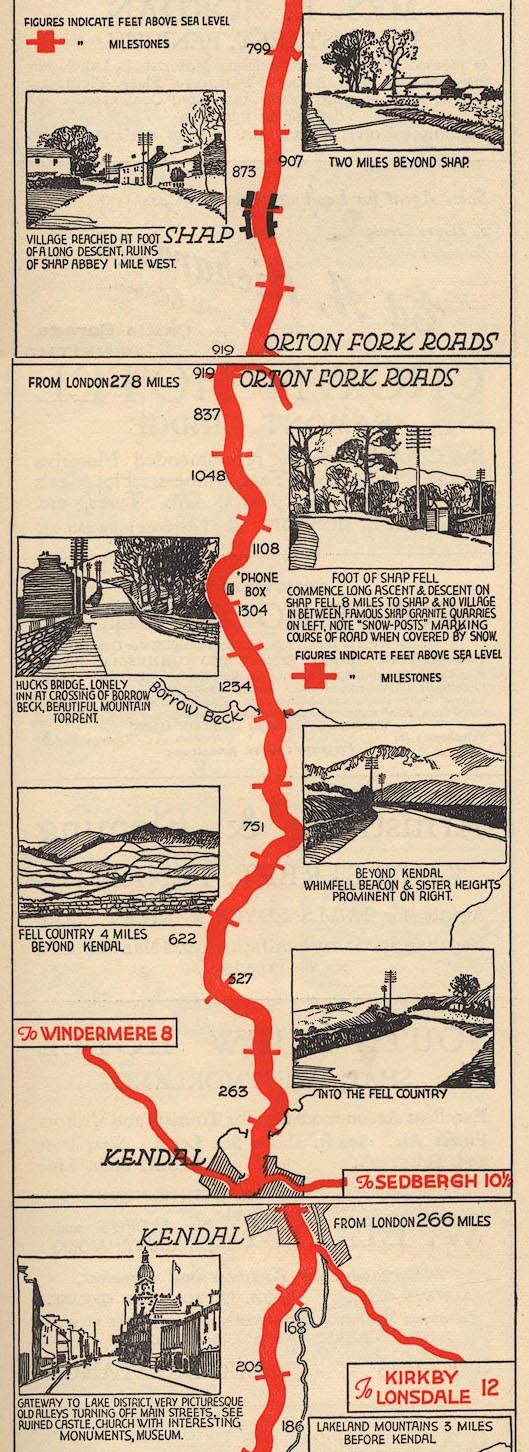 EJB3KtoS.jpg item:- private collection : 17 Image © see bottom of page |
|||
|
|
||||
| evidence:- | old text:- Burrow 1920s |
|||
| source data:- | Road book, strip maps with parts in Westmorland, Cumberland etc,
irregular scales about 1.5 miles to 1 inch, by E J Burrow and
Co, Cheltenham, Gloucestershire, 1920s. "The eastern route from Kendal to Carlisle calls for less detailed description; the scenery is grand but without the lakes to punctuate the long succession of mountains. This is some of the loneliest country in England, a rare place for deep snowdrifts even in winters that are mild elsewhere. The road climbs Shap Fell to a height of 1,400 feet, with a bog at the top and then a descent to Shap village. ..." |
|||
|
|
||||
| Act of Parliament |
||||
|
|
||||
| hearsay:- |
A snow storm that began on13 March 1947 caused havoc on Shap Fell, ... |
|||
| "the biggests road transport hold-up ever known." |
||||
| "... The worst section of the England to Scotland main road has a seven mile succession
of the biggest drifts of the century and is likely to remain blocked for several days.
..." |
||||
| Some lorry drivers, after sitting in a cold draughty cab, have staggered knee-deep
down the road to the well known Jungle Cafe for relief. |
||||
|
|
||||
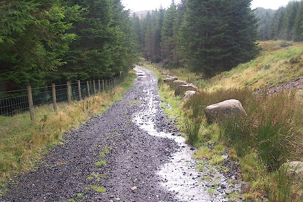
| MN photo:- |
Views N on old road. |
|||
 BNK12.jpg (taken 23.3.2007) 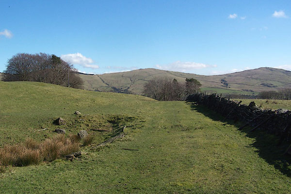 BNK13.jpg (taken 23.3.2007) 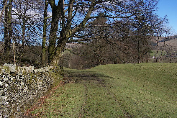 BNK15.jpg (taken 23.3.2007) 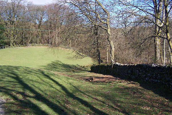 BNK18.jpg (taken 23.3.2007) 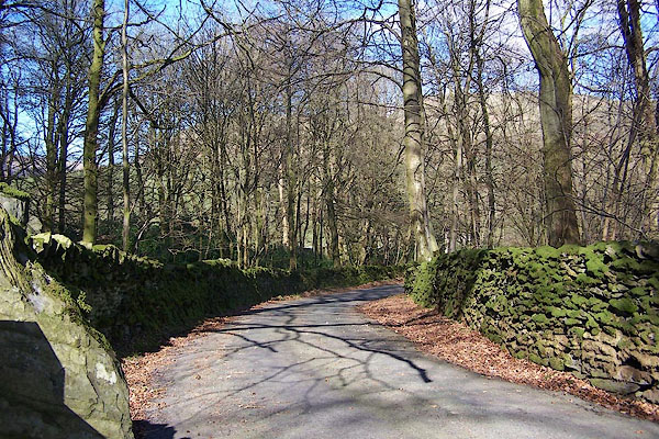 BNK19.jpg (taken 23.3.2007) 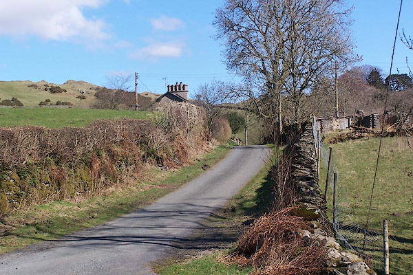 BNK22.jpg (taken 23.3.2007) 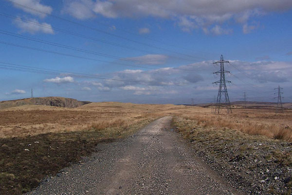 BNK25.jpg (taken 23.3.2007) 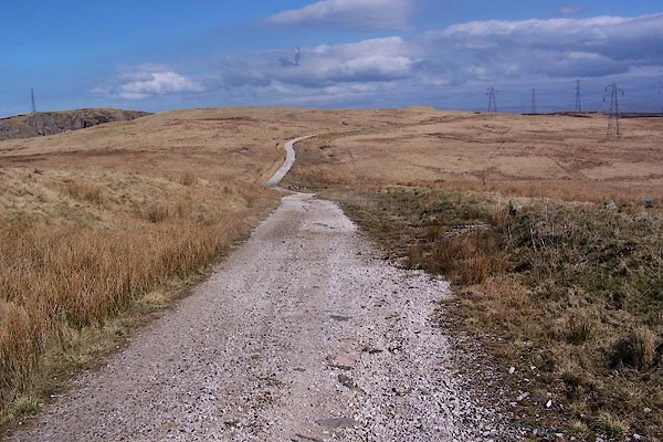 BNK29.jpg (taken 23.3.2007) 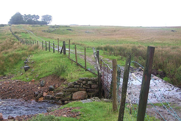 BMT21.jpg (taken 6.10.2006) |
||||
|
|
||||
| MN photo:- |
Views S on old road. |
|||
 BMT17.jpg (taken 6.10.2006) 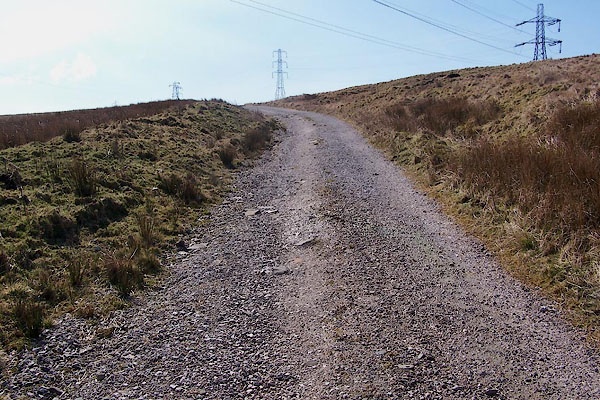 BNK30.jpg (taken 23.3.2007) 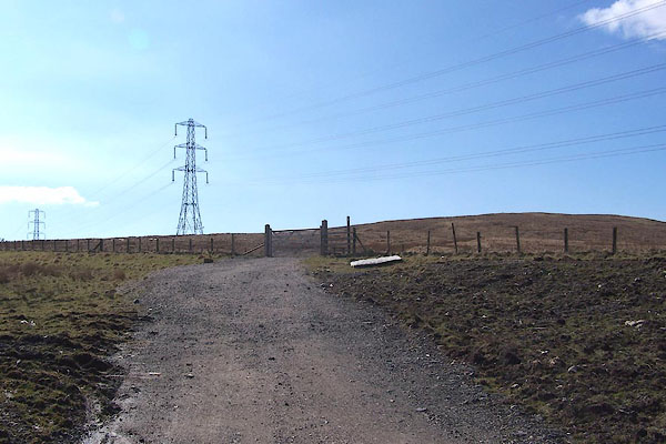 BNK26.jpg (taken 23.3.2007) 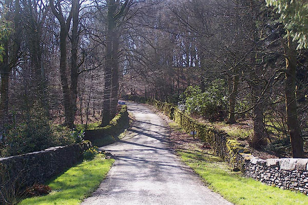 BNK23.jpg (taken 23.3.2007) 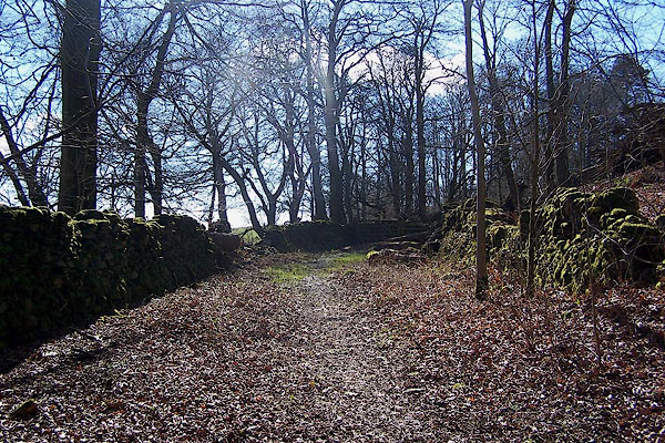 BNK20.jpg (taken 23.3.2007) 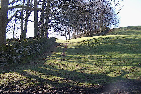 BNK17.jpg (taken 23.3.2007) 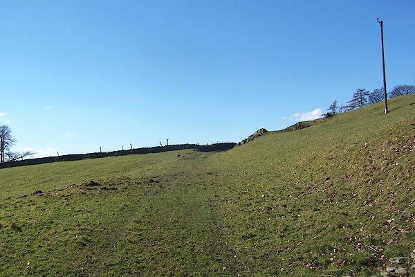 BNK16.jpg (taken 23.3.2007) 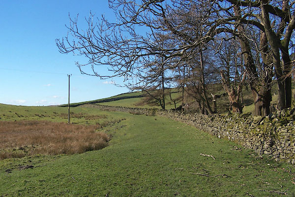 BNK14.jpg (taken 23.3.2007) 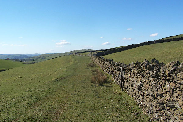 BNK11.jpg (taken 23.3.2007) |
||||
|
|
||||
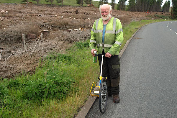 BPJ13.jpg Waywiser being used to measure along the road. (taken 23.6.2008) 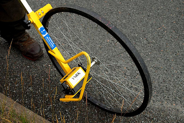 BPJ14.jpg Waywiser. (taken 23.6.2008) 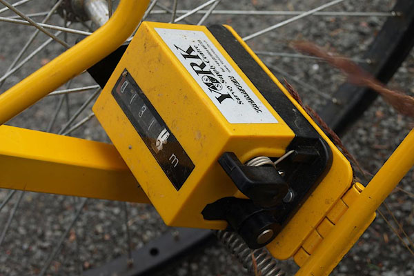 BPJ15.jpg Waywiser. (taken 23.6.2008) 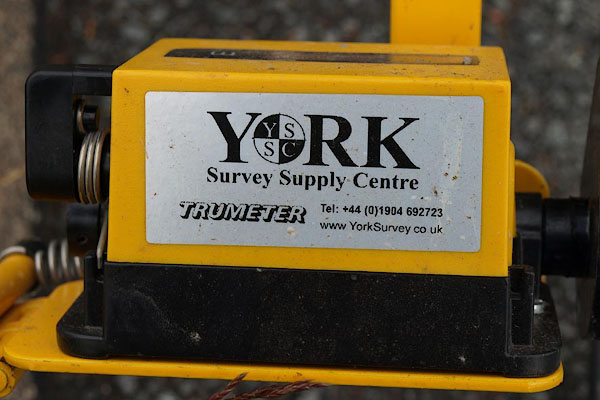 BPJ16.jpg Waywiser, TRUMETER from York Survey Supply Centre. (taken 23.6.2008) |
||||
|
|
||||
| hearsay:- |
John Dodd, a saddler with a shop in Market Square, Penrith, was driving his cart on
the Shap Fells in mist, in 1820. His dog Rolla, suddenly ran in front of the pony
to stop it, and refused to get out of the way. When he looked to see what was up,
Mr Dodd found himself on the edge of a steep drop. John Dodd engraved on a snuff box,
a silver mounted cowrie shell, his pointer, its name, and his name and the date, to
record the rescue:- |
|||
| "ROLLA / [portrait of the pointer] /18 JOHN DODD PENRITH 20" |
||||
|
|
||||
| notes:- |
It is said that on the old road, where it climbs a hill a quarter of a mile eat of
Forest Hall (guess about NY54340140) a lot of cannon balls were dropped by Bonnie
Prince Charlie's army when retreating north. And, that there is still a 'brass cannon'
buried there. |
|||
| Somervell, John: 1930: Water Power Mills of South Westmorland |
||||
|
|
||||
| places:- | Kendal Watchgate, Whitwell and Selside Forest Hall, Fawcett Forest Hucks Bridge, Fawcett Forest Shap |
|||
|
|
||||
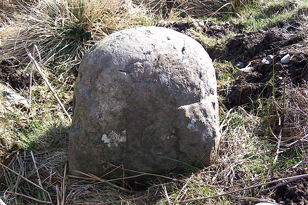
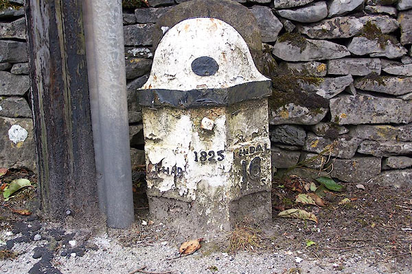
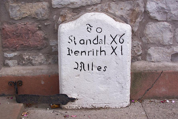
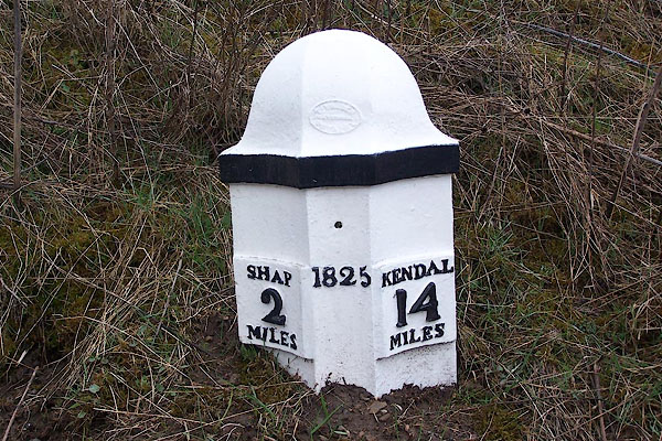
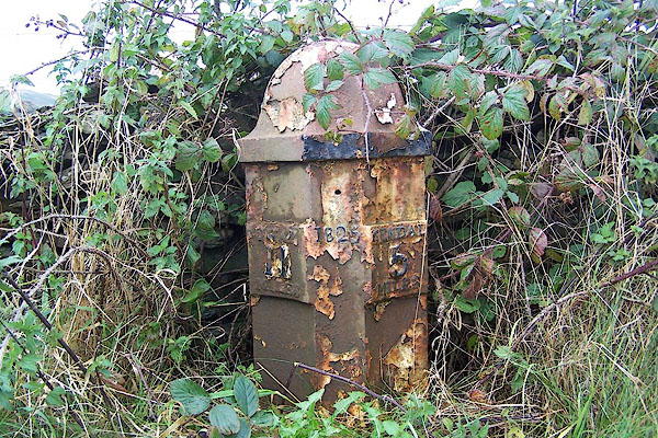
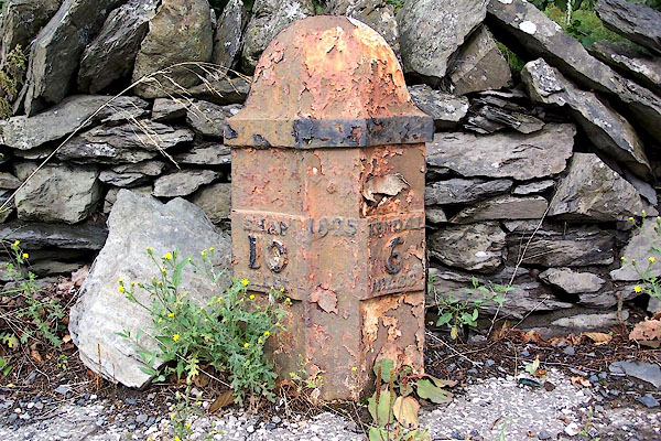
| milestones:- | Milestones in sequence in sequence, some on A6 milestone, Kendal (7) milestone, Skelsmergh (6) milestone, Skelsmergh (5) milestone, Skelsmergh (4) milestone, Skelsmergh (7) on old road [milestone, Gateside] [milestone, Selside (2)] on old road [milestone, Selside] [milestone, Selside (3)] on old road milestone, Fawcett Forest (2) milestone, Fawcett Forest (5) milestone, Fawcett Forest milestone, Fawcett Forest (6) on old road milestone, Fawcett Forest (3) milestone, Fawcett Forest (4) on old road milestone, Orton S (6) milestone, Orton S on old road, not in same sequence milestone, Shap Rural (4) milestone, Orton S (5) on old road, not in same sequence milestone, Shap Rural (3) milestone, Shap Rural (6) milestone, Shap Rural (7) milestone, Shap (9) milestone, Shap (8) milestone, Shap (5) milestone, Shap (4) not in same sequence milestone, Shap (2) |
|||
|
|
||||
| places:- |
|
|||
|
||||
|
||||
|
||||
|
||||
|
||||
|
||||
|
||||
|
||||
|
||||
|
||||
|
||||
|
||||
|
||||
|
||||
|
||||
|
||||
|
||||
|
||||
|
||||
|
||||
|
||||
|
||||
|
||||
|
||||
|
||||
|
||||
|
||||
|
||||
|
||||
|
||||
|
||||
|
||||
|
||||
|
||||
Lakes Guides menu.