 Old Cumbria Gazetteer
 |
 |
|
| Skeggles Water | ||
| runs into:- |  Skeggleswater Dike Skeggleswater Dike |
|
|
|
||
| civil parish:- | Longsleddale (formerly Westmorland) | |
| civil parish:- | Kentmere (formerly Westmorland) | |
| county:- | Cumbria | |
| locality type:- | tarn | |
| locality type:- | boundary feature | |
| locality type:- | parish boundary feature | |
| coordinates:- | NY479034 | |
| 1Km square:- | NY4703 | |
| 10Km square:- | NY40 | |
| altitude:- | 1000 feet | |
| altitude:- | 305m | |
|
|
||
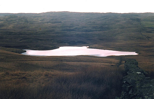
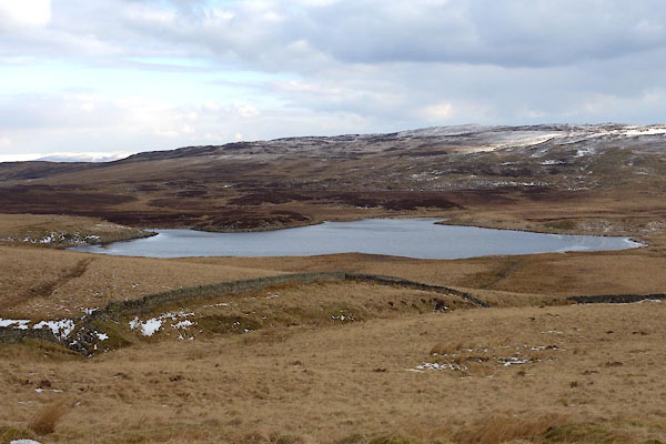 BYA68.jpg (taken 29.3.2013) 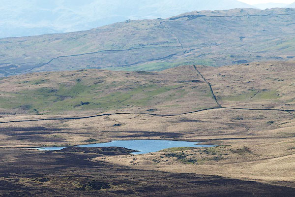 BSM24.jpg From across the valley. (taken 11.4.2010) |
||
|
|
||
| evidence:- | old map:- OS County Series (Wmd 27 10) placename:- Skeggles Water |
|
| source data:- | Maps, County Series maps of Great Britain, scales 6 and 25
inches to 1 mile, published by the Ordnance Survey, Southampton,
Hampshire, from about 1863 to 1948.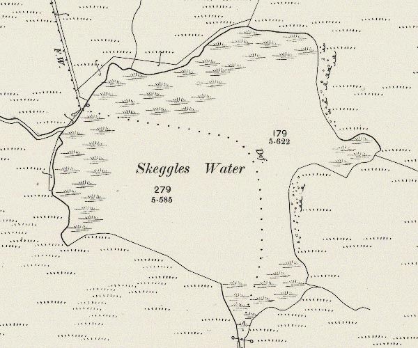 C5E008.jpg "Skeggles Water" |
|
|
|
||
| evidence:- | old map:- Jefferys 1770 (Wmd) placename:- Skeggles Water |
|
| source data:- | Map, 4 sheets, The County of Westmoreland, scale 1 inch to 1
mile, surveyed 1768, and engraved and published by Thomas
Jefferys, London, 1770.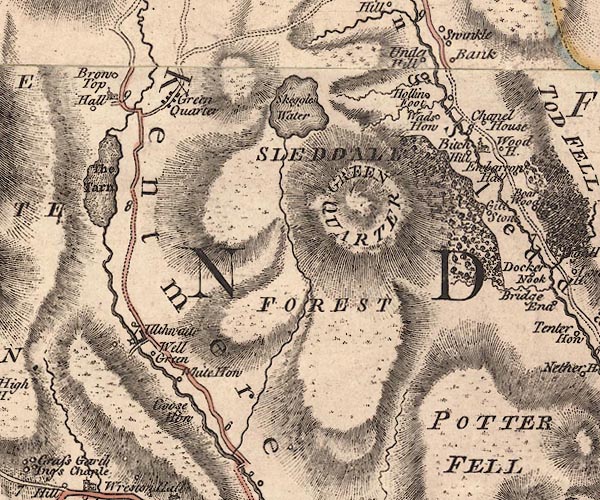 J5NY40SE.jpg "Skeggles Water" outline with form lines; lake or tarn item:- National Library of Scotland : EME.s.47 Image © National Library of Scotland |
|
|
|
||
| evidence:- | old map:- West 1784 map placename:- Skeggles Water |
|
| source data:- | Map, hand coloured engraving, A Map of the Lakes in Cumberland,
Westmorland and Lancashire, scale about 3.5 miles to 1 inch,
engraved by Paas, 53 Holborn, London, about 1784.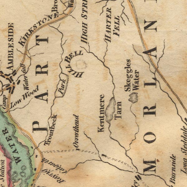 Ws02NY40.jpg item:- Armitt Library : A1221.1 Image © see bottom of page |
|
|
|
||
| evidence:- | old map:- Cary 1789 (edn 1805) placename:- Skegales Water |
|
| source data:- | Map, uncoloured engraving, Westmoreland, scale about 2.5 miles
to 1 inch, by John Cary, London, 1789; edition 1805.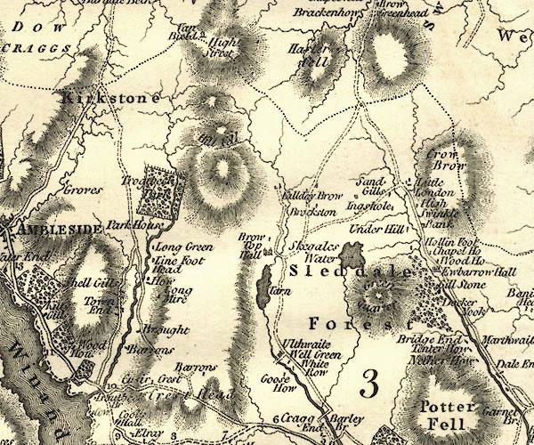 CY24NY40.jpg "Skegales Water" outline with shore form lines; lake or tarn item:- JandMN : 129 Image © see bottom of page |
|
|
|
||
| evidence:- | old map:- Cooke 1802 placename:- Skeggles Water |
|
| source data:- | Map, The Lakes, Westmorland and Cumberland, scale about 8.5
miles to 1 inch, engravedby Neele and Son, published by
Sherwood, Jones and Co, Paternoster Road, London, 1824. click to enlarge click to enlargeGRA1Lk.jpg "Skeggles W." outline with form lines; lake or tarn item:- Hampshire Museums : FA2000.62.5 Image © see bottom of page |
|
|
|
||
| evidence:- | old map:- Laurie and Whittle 1806 placename:- Skeggles Water |
|
| source data:- | Road map, Completion of the Roads to the Lakes, scale about 10
miles to 1 inch, by Nathaniel Coltman? 1806, published by Robert
H Laurie, 53 Fleet Street, London, 1834. click to enlarge click to enlargeLw18.jpg "Skeggles Water" lake item:- private collection : 18.18 Image © see bottom of page |
|
|
|
||
| evidence:- | old map:- Cooper 1808 placename:- Skeggles Water |
|
| source data:- | Map, hand coloured engraving, Westmoreland ie Westmorland, scale
about 9 miles to 1 inch, by H Cooper, 1808, published by R
Phillips, Bridge Street, Blackfriars, London, 1808. click to enlarge click to enlargeCOP4.jpg "Skeggles Water" outline, shaded; lake item:- Dove Cottage : 2007.38.53 Image © see bottom of page |
|
|
|
||
| evidence:- | old map:- Otley 1818 |
|
| source data:- | Map, uncoloured engraving, The District of the Lakes,
Cumberland, Westmorland, and Lancashire, scale about 4 miles to
1 inch, by Jonathan Otley, 1818, engraved by J and G Menzies,
Edinburgh, Scotland, published by Jonathan Otley, Keswick,
Cumberland, et al, 1833.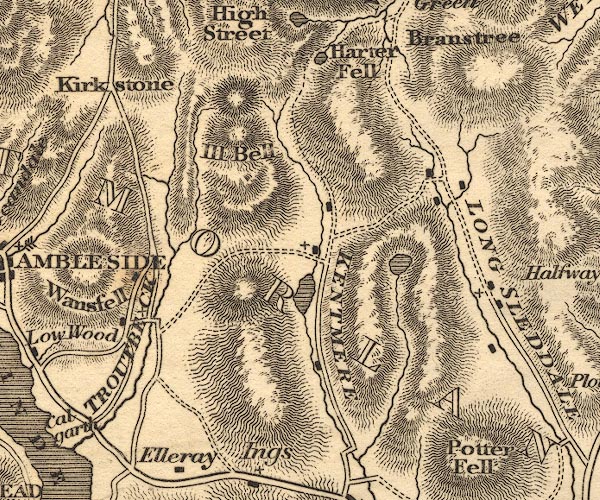 OT02NY40.jpg item:- JandMN : 48.1 Image © see bottom of page |
|
|
|
||
| evidence:- | descriptive text:- Otley 1823 (5th edn 1834) |
|
| source data:- | Guide book, A Concise Description of the English Lakes, the
mountains in their vicinity, and the roads by which they may be
visited, with remarks on the mineralogy and geology of the
district, by Jonathan Otley, published by the author, Keswick,
Cumberland now Cumbria, by J Richardson, London, and by Arthur
Foster, Kirkby Lonsdale, Cumbria, 1823; published 1823-49,
latterly as the Descriptive Guide to the English Lakes. goto source Page 36:- "Kentmere Tarn, ... and Skeggles Water on the heath-clad mountain between that and Long-Sleddale, are neither of them possessed of any striking features." |
|
|
|
||
| evidence:- | old map:- Hodgson 1828 placename:- Skeggles Water |
|
| source data:- | Map, hand coloured engraving, 4 sheets mounted together on linen and rolled, Plan
of the County of Westmorland, scale about 1.25 inches to 1 mile, by Thomas Hodgson,
engraved by W R Gardner, Harpur Street, London, published by Thomas Hodgson, Lancaster,
and perhaps by C Smith, 172 Strand, London,1828.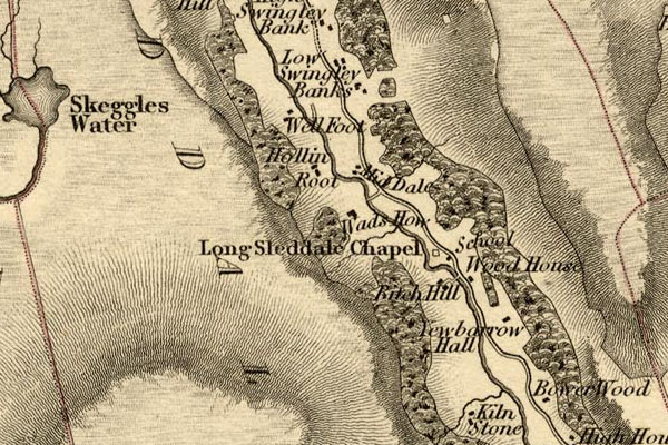 HDG6lsl2.jpg map courtesy of Mark Cropper "Skeggles Water" item:- private collection : 371 Image © see bottom of page |
|
|
|
||
| evidence:- | old map:- Kendal Corn Rent Act 1836 placename:- Skeggles Water |
|
| source data:- | Tithe map, Plan of part of the Township of Longsleddale, Westmorland, made regarding
the Kendal Corn Rent Act, ie a tithe award map, scale about 20 inches to 1 mile, Kendal,
Westmorland, 1836.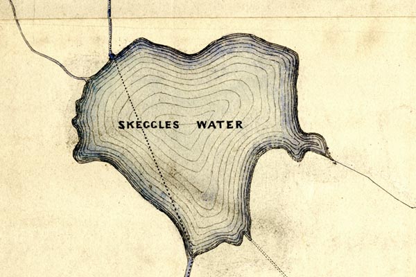 KCR216.jpg courtesy of Mark Cropper Plan of part of the Township of Longsleddale, Westmorland, made regarding the Kendal Corn Rent Act, ie a tithe award map, scale about 20 inches to 1 mile, Kendal, Westmorland, 1836. "SKEGGLES WATER" item:- private collection : 370 Image © see bottom of page |
|
|
|
||
| evidence:- | old map:- Garnett 1850s-60s H placename:- Skeggles Water |
|
| source data:- | Map of the English Lakes, in Cumberland, Westmorland and
Lancashire, scale about 3.5 miles to 1 inch, published by John
Garnett, Windermere, Westmorland, 1850s-60s.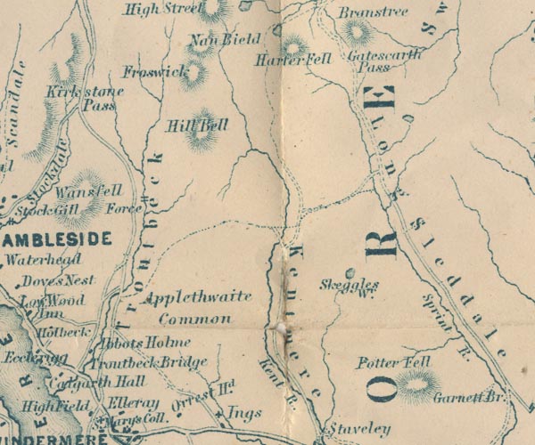 GAR2NY40.jpg "Skeggles Wr." outline with shore form lines, lake or tarn item:- JandMN : 82.1 Image © see bottom of page |
|
|
|
||
| evidence:- | old text:- Prior 1865 placename:- Skeggles Water |
|
| source data:- | Guide book, Ascents and Passes in the Lake District of England,
by Herman Prior, published by John Garnett, Windermere,
Westmorland, and by Simpkin, Marshall and Co, London, 1865. Page 109:- "... Skeggles-Water is quite uninteresting. ..." |
|
|
|
||
| evidence:- | old map:- OS 1881-82 New Series (outline edition) placename:- Skeggles Water |
|
| source data:- | Map, engraving, area north of Kendal, Westmorland, New Series
one inch map, outline edition, sheet 39, scale 1 inch to 1 mile,
published by the Ordnance Survey, Southampton, Hampshire,
1881-82.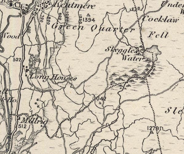 O21NY40R.jpg "Skeggles Water" item:- JandMN : 61 Image © see bottom of page |
|
|
|
||
| evidence:- | descriptive text:- Wilson 1912 |
|
| source data:- | Guide book, Longsleddale, by F M Wilson, published by T Wilson,
Kendal, Westmorland, 1912. WILSON1.txt "... and Sleddale Forest, north of which, at a height of 1017 ft. is Skeggles Water, a small tarn near the head of the dale. ..." |
|
|
|
||
| evidence:- | map:- OS Six Inch (1956) placename:- Skeggles Water |
|
| source data:- | Map series, various editions with the national grid, scale about
6 inches to 1 mile, published by the Ordnance Survey,
Southampton, Hampshire, scale 1 to 10560 from 1950s to 1960s,
then 1 to 10000 from 1960s to 2000s, superseded by print on
demand from digital data.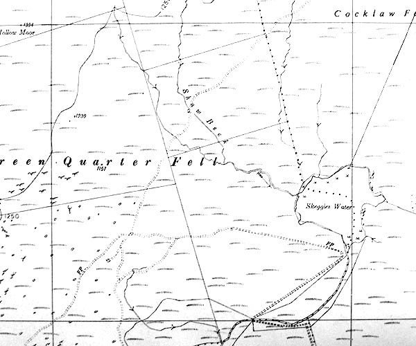 SINY4703.jpg "Skeggles Water" |
|
|
|
||
 BIK31.jpg From N. (taken 15.2.2004) 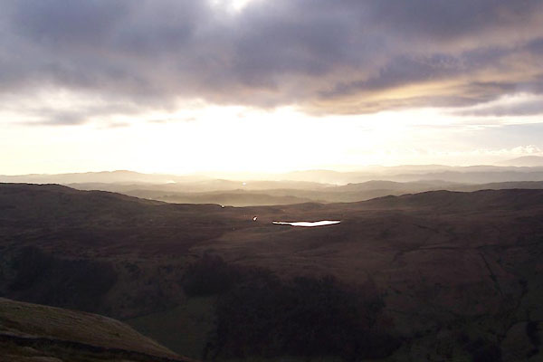 BXS63.jpg (taken 29.11.2012) |
||
|
|
||
| notes:- |
Kendal Reservoir Commissioners had plans to build four embankmemts to make this twenty
times as big, to be a dry weather supply for water mills on the River Kent. |
|
|
|
||
Lakes Guides menu.