Old Cumbria Gazetteer
 |
 |
|
||||||||||||
| Sour Milk Gill | ||||||||||||||
| runs into:- |  Buttermere lake Buttermere lake |
|||||||||||||
|
|
||||||||||||||
| civil parish:- | Loweswater (formerly Cumberland) | |||||||||||||
| civil parish:- | Buttermere (formerly Cumberland) | |||||||||||||
| county:- | Cumbria | |||||||||||||
| locality type:- | river | |||||||||||||
| locality type:- | boundary | |||||||||||||
| locality type:- | parish boundary | |||||||||||||
| 1Km square:- | NY1615 (etc) | |||||||||||||
| 10Km square:- | NY11 | |||||||||||||
|
|
||||||||||||||
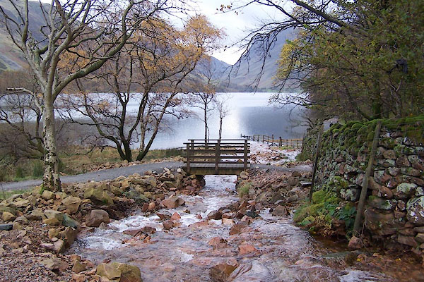
 BVP97.jpg (taken 1.1.2011) 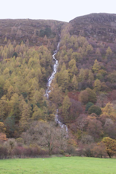 BVP99.jpg From below. (taken 1.1.2011) |
||||||||||||||
|
|
||||||||||||||
| evidence:- | old map:- Bowen and Kitchin 1760 |
|||||||||||||
| source data:- | Map, hand coloured engraving, A New Map of the Counties of
Cumberland and Westmoreland Divided into their Respective Wards,
scale about 4 miles to 1 inch, by Emanuel Bowen and Thomas
Kitchin et al, published by T Bowles, Robert Sayer, and John
Bowles, London, 1760.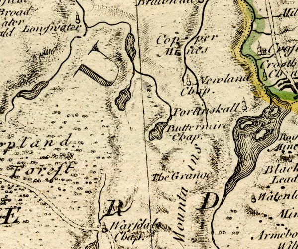 BO18NY11.jpg wiggly line from Bleaberry Tarn item:- Armitt Library : 2008.14.10 Image © see bottom of page |
|||||||||||||
|
|
||||||||||||||
| evidence:- | old map:- Jefferys 1770 (Wmd) |
|||||||||||||
| source data:- | Map, 4 sheets, The County of Westmoreland, scale 1 inch to 1
mile, surveyed 1768, and engraved and published by Thomas
Jefferys, London, 1770.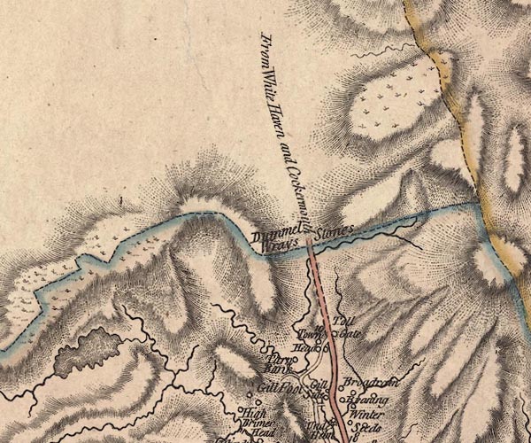 J5NY31SW.jpg single or double wiggly line; river item:- National Library of Scotland : EME.s.47 Image © National Library of Scotland |
|||||||||||||
|
|
||||||||||||||
| evidence:- | old map:- Donald 1774 (Cmd) |
|||||||||||||
| source data:- | Map, hand coloured engraving, 3x2 sheets, The County of Cumberland, scale about 1
inch to 1 mile, by Thomas Donald, engraved and published by Joseph Hodskinson, 29
Arundel Street, Strand, London, 1774.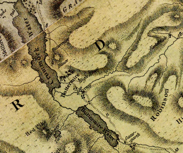 D4NY11NE.jpg single or double wiggly line; a river from Bleaberry Tarn item:- Carlisle Library : Map 2 Image © Carlisle Library |
|||||||||||||
|
|
||||||||||||||
| evidence:- | descriptive text:- West 1778 (11th edn 1821) |
|||||||||||||
| source data:- | Guide book, A Guide to the Lakes, by Thomas West, published by
William Pennington, Kendal, Cumbria once Westmorland, and in
London, 1778 to 1821. goto source Page 131:- "... large hollow craters scooped in their bosoms, once the seeming seats of raging liquid fire, though at present overflowing with the purest water, that foams down the craggy brows; ..." goto sourcePage 135:- "in whose bosom it is formed, appears to have been the focus of a volcano, in some distant period of time, when the cones were produced by explosion. At present it is the reservoir of water, that feeds the roaring cataract you see in the descent to Buttermere. Here all is barrenness, solitude, and silence, only interrupted by the murmurs of a rill, that runs unseen in the bottom of a deep dell. ..." |
|||||||||||||
|
|
||||||||||||||
| evidence:- | old map:- Crosthwaite 1783-94 (But/Cru/Low) placename:- Sour Milk Gill |
|||||||||||||
| source data:- | Map, uncoloured engraving, An Accurate Map of Buttermere,
Crummock and Loweswater Lakes, scale about 3 inches to 1 mile,
by Peter Crosthwaite, Keswick, Cumberland, 1794, version
published 1800.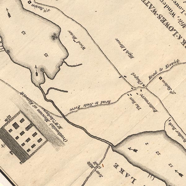 CT8NY11T.jpg "Sour Milk Gill" item:- Armitt Library : 1959.191.2 Image © see bottom of page |
|||||||||||||
|
|
||||||||||||||
| evidence:- | old map:- West 1784 map |
|||||||||||||
| source data:- | Map, hand coloured engraving, A Map of the Lakes in Cumberland,
Westmorland and Lancashire, scale about 3.5 miles to 1 inch,
engraved by Paas, 53 Holborn, London, about 1784.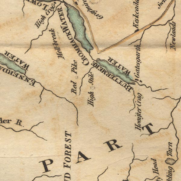 Ws02NY11.jpg item:- Armitt Library : A1221.1 Image © see bottom of page |
|||||||||||||
|
|
||||||||||||||
| evidence:- | descriptive text:- Otley 1823 (5th edn 1834) |
|||||||||||||
| source data:- | Guide book, A Concise Description of the English Lakes, the
mountains in their vicinity, and the roads by which they may be
visited, with remarks on the mineralogy and geology of the
district, by Jonathan Otley, published by the author, Keswick,
Cumberland now Cumbria, by J Richardson, London, and by Arthur
Foster, Kirkby Lonsdale, Cumbria, 1823; published 1823-49,
latterly as the Descriptive Guide to the English Lakes. goto source Page 46:- "SOUR-MILK GILL is a name applied to some mountain torrents, on account of their frothy whiteness resembling Butter-milk from the churn. We have Sour-milk Gill near Buttermere, Sour-milk Gill in Grasmere, and Sour-milk Gill near the Black-lead Mine in Borrowdale." |
|||||||||||||
|
|
||||||||||||||
| evidence:- | descriptive text:- Ford 1839 (3rd edn 1843) placename:- Sour Milk Force |
|||||||||||||
| source data:- | Guide book, A Description of Scenery in the Lake District, by
Rev William Ford, published by Charles Thurnam, Carlisle, by W
Edwards, 12 Ave Maria Lane, Charles Tilt, Fleet Street, William
Smith, 113 Fleet Street, London, by Currie and Bowman,
Newcastle, by Bancks and Co, Manchester, by Oliver and Boyd,
Edinburgh, and by Sinclair, Dumfries, 1839. goto source Page 179:- "WATERFALLS."
|
|||||||||||||
|
|
||||||||||||||
| evidence:- | old map:- Garnett 1850s-60s H placename:- Sourmilk Force |
|||||||||||||
| source data:- | Map of the English Lakes, in Cumberland, Westmorland and
Lancashire, scale about 3.5 miles to 1 inch, published by John
Garnett, Windermere, Westmorland, 1850s-60s.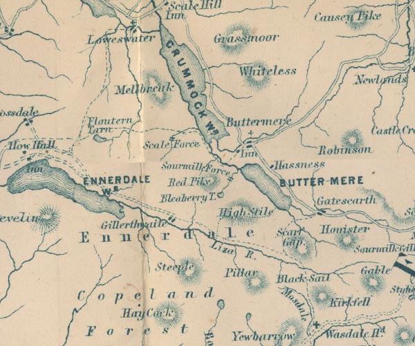 GAR2NY11.jpg "Sourmilk Force" two lines across a stream, waterfall item:- JandMN : 82.1 Image © see bottom of page |
|||||||||||||
|
|
||||||||||||||
| evidence:- | old text:- Martineau 1855 placename:- Sourmilk Ghyll |
|||||||||||||
| source data:- | Guide book, A Complete Guide to the English Lakes, by Harriet
Martineau, published by John Garnett, Windermere, Westmorland,
and by Whittaker and Co, London, 1855; published 1855-76. goto source Page 133:- "[the torrent] flowing down the steep into the lake [Buttermere] is called (as others in the district are) Sourmilk Ghyll; and it issues from Bleaberry, or Burtness Tarn, on the side of Red Pike. ..." |
|||||||||||||
|
|
||||||||||||||
| evidence:- | old print:- Nelson 1859 |
|||||||||||||
| source data:- | Print, engraving, Buttermere from near the Fish Inn, drawn by Keeley Halswelle, Edinburgh,
published by T Nelson and Sons, Paternoster Row, London, and Edinburgh and New York,
United States, 1859.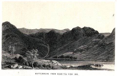 click to enlarge click to enlargeNS01F.jpg Frontispiece to a guide book, The English Lakes. printed at bottom:- "BUTTERMERE FROM NEAR THE FISH INN." item:- JandMN : 336.1 Image © see bottom of page |
|||||||||||||
|
|
||||||||||||||
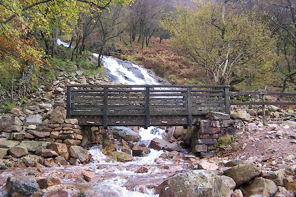
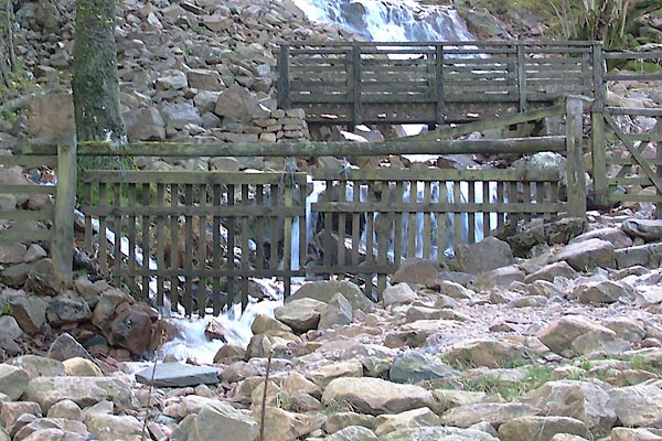
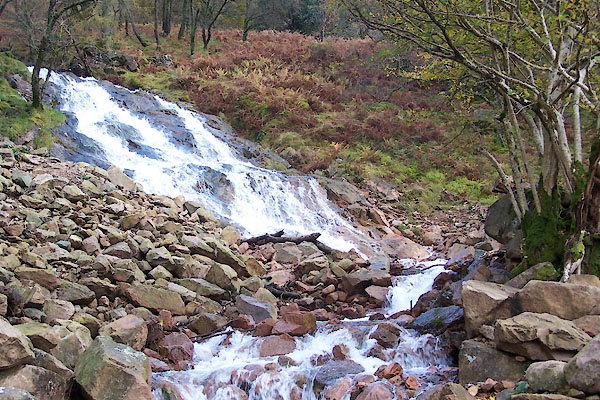
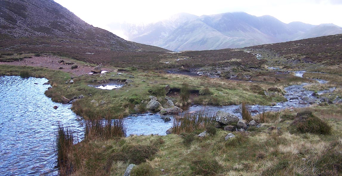 Click to enlarge BVQ03.jpg Running out of Bleaberry Tarn, (taken 1.1.2011) 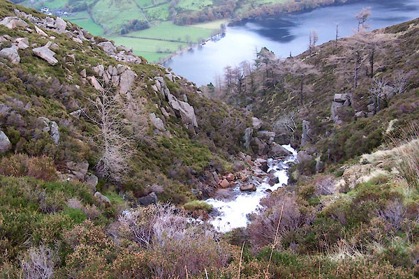 BVQ01.jpg (taken 1.1.2011) 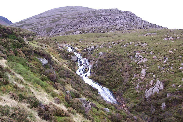 BVQ02.jpg (taken 1.1.2011) 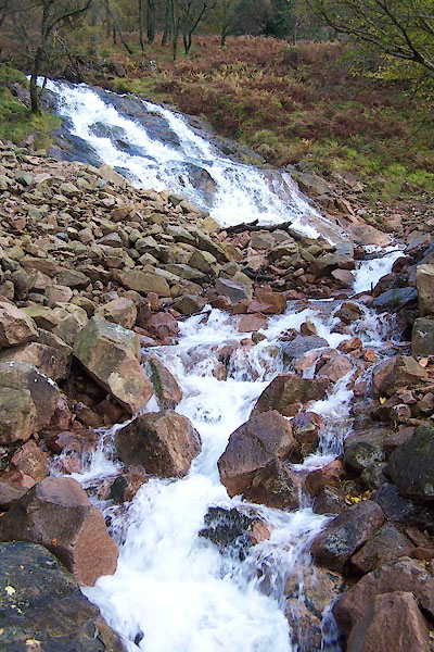 BVP98.jpg (taken 1.1.2011) 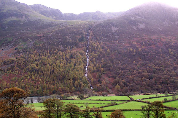 BJZ32.jpg From across the lake. (taken 7.11.2005) |
||||||||||||||
|
|
||||||||||||||
| places:- |
|
|||||||||||||
|
||||||||||||||
|
||||||||||||||
Lakes Guides menu.