 Old Cumbria Gazetteer
 |
 |
|
| Tills Hole, Longsleddale | ||
| Tills Hole | ||
| Till's Hole | ||
| civil parish:- | Longsleddale (formerly Westmorland) | |
| county:- | Cumbria | |
| locality type:- | buildings | |
| coordinates:- | NY48500512 | |
| 1Km square:- | NY4805 | |
| 10Km square:- | NY40 | |
|
|
||
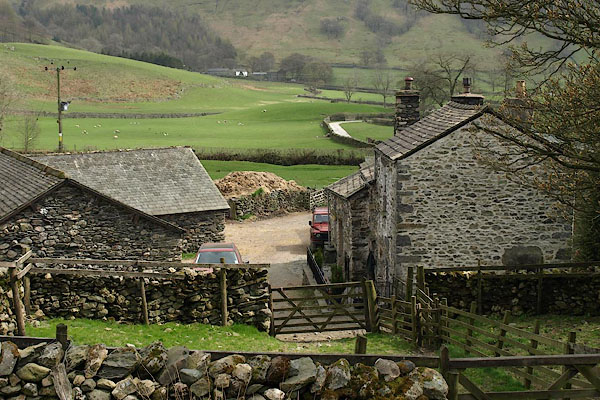 BSN86.jpg (taken 16.4.2010) 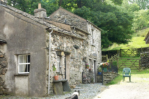 BQX78.jpg (taken 28.6.2009) |
||
|
|
||
| evidence:- | old map:- OS County Series (Wmd 27 7) placename:- Tills Hole |
|
| source data:- | Maps, County Series maps of Great Britain, scales 6 and 25
inches to 1 mile, published by the Ordnance Survey, Southampton,
Hampshire, from about 1863 to 1948. |
|
|
|
||
| evidence:- | old map:- OS County Series (Wmd 27 7) placename:- Till's Hole |
|
| source data:- | Maps, County Series maps of Great Britain, scales 6 and 25
inches to 1 mile, published by the Ordnance Survey, Southampton,
Hampshire, from about 1863 to 1948.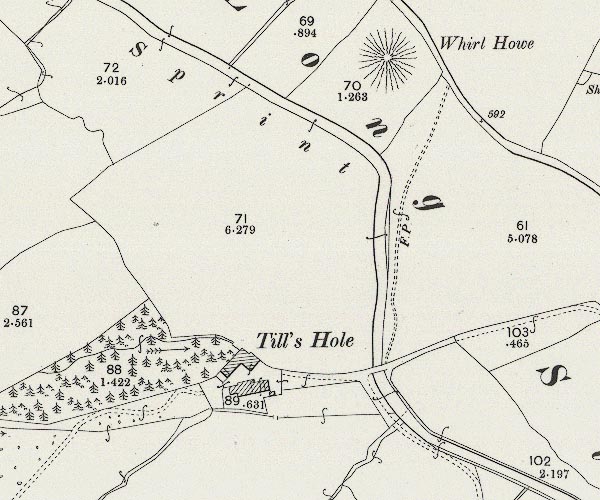 C5E003.jpg "Till's Hole" |
|
|
|
||
| evidence:- | census returns:- placename:- Tilshole placename:- Tillshole placename:- Tills Hole placename:- Tills Hall |
|
|
|
||
 old parish register (formerly ) old parish register (formerly ) |
||
|
|
||
| evidence:- | old map:- Jefferys 1770 (Wmd) placename:- Ingshole |
|
| source data:- | Map, 4 sheets, The County of Westmoreland, scale 1 inch to 1
mile, surveyed 1768, and engraved and published by Thomas
Jefferys, London, 1770.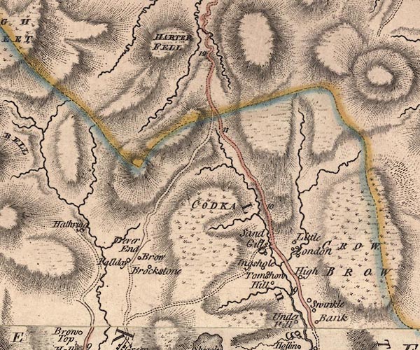 J5NY40NE.jpg "Ingshole" circle, labelled in italic lowercase text; settlement, farm, house, or hamlet? item:- National Library of Scotland : EME.s.47 Image © National Library of Scotland |
|
|
|
||
| evidence:- | old map:- Cary 1789 (edn 1805) placename:- Ingshole |
|
| source data:- | Map, uncoloured engraving, Westmoreland, scale about 2.5 miles
to 1 inch, by John Cary, London, 1789; edition 1805.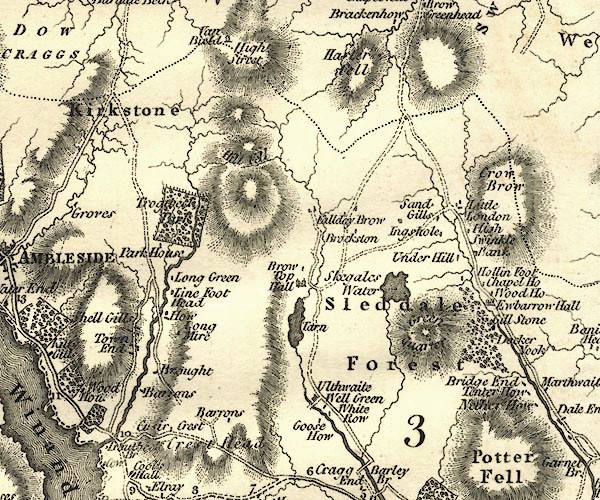 CY24NY40.jpg "Ingshole" block/s, labelled in italic lowercase; house, or hamlet item:- JandMN : 129 Image © see bottom of page |
|
|
|
||
| evidence:- | old map:- Hodgson 1828 placename:- Hole |
|
| source data:- | Map, hand coloured engraving, 4 sheets mounted together on linen and rolled, Plan
of the County of Westmorland, scale about 1.25 inches to 1 mile, by Thomas Hodgson,
engraved by W R Gardner, Harpur Street, London, published by Thomas Hodgson, Lancaster,
and perhaps by C Smith, 172 Strand, London,1828.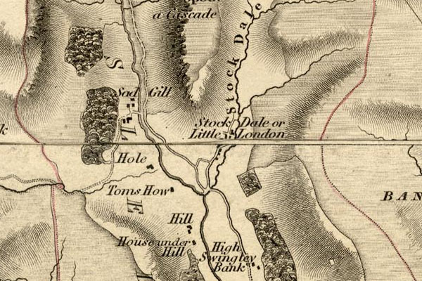 HDG6lsl3.jpg map courtesy of Mark Cropper "Hole" item:- private collection : 371 Image © see bottom of page |
|
|
|
||
| evidence:- | old map:- Kendal Corn Rent Act 1836 placename:- Tills Hole |
|
| source data:- | Tithe map, Plan of part of the Township of Longsleddale, Westmorland, made regarding
the Kendal Corn Rent Act, ie a tithe award map, scale about 20 inches to 1 mile, Kendal,
Westmorland, 1836.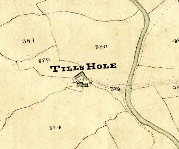 KCR203.jpg courtesy of Mark Cropper Plan of part of the Township of Longsleddale, Westmorland, made regarding the Kendal Corn Rent Act, ie a tithe award map, scale about 20 inches to 1 mile, Kendal, Westmorland, 1836. "TILLS HOLE" item:- private collection : 370 Image © see bottom of page |
|
|
|
||
| Kendal Corn Rent Act 1836 |
||
|
|
||
| evidence:- | old map:- Fields 1875 |
|
| source data:- | 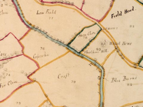 LFld0225.jpg courtesy of Ruth Fishwick |
|
|
|
||
| evidence:- | descriptive text:- |
|
| source data:- | Royal Commission on Historical Monuments in England: 1936: Inventory of the Historical
Monuments in Westmorland: HMSO "[17th century, 2 storey, rubble walls, slate roofs] ... contains a three-stage cupboard
of the local type, with one carved panel, pendants and fascia with the date 1691." |
|
|
|
||
| evidence:- | textbook:- EPNS Westmorland 1967 placename:- Tillzhole placename:- Tilshole |
|
| source data:- | Book, The Place Names of Westmorland, two volumes, by A H Smith,
published for the English Place Name Society by Cambridge
University Press, Cambridgeshire, 1967 |
|
|
|
||
| census records |
||
|
|
||
| directory entries |
||
|
|
||
| evidence:- | map:- OS Six Inch (1956) placename:- Tills Hole |
|
| source data:- | Map series, various editions with the national grid, scale about
6 inches to 1 mile, published by the Ordnance Survey,
Southampton, Hampshire, scale 1 to 10560 from 1950s to 1960s,
then 1 to 10000 from 1960s to 2000s, superseded by print on
demand from digital data. SINY4805.jpg "Tills Hole" |
|
|
|
||
| evidence:- | shepherds guide:- Wilson 1913 placename:- Till's Hole |
|
| source data:- | Book, New Shepherd's Guide for Cumberland, Westmorland, and
Lancashire, by Thomas Wilson, 1913.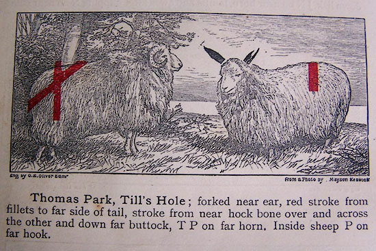 WL1p368b.jpg "Thomas Park, Till's Hole; forked near ear, red stroke from fillets to far side of tail, stroke up from near hock bone over and across the other and down far buttock, T P on far horn. Inside sheep P on far hook." item:- private collection : 329 Image © see bottom of page |
|
|
|
||
| evidence:- | shepherds guide:- Gate 1879 placename:- Till's Hole |
|
| source data:- | Book, New Shepherd's Guide for Cumberland, Westmoreland, and
Lancashire, published by Daniel Gate, Keswick, Cumberland, 1879.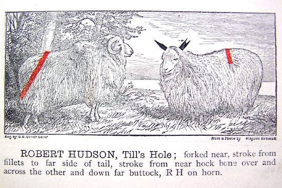 GT1p385b.jpg "ROBERT HUDSON, Till's Hole; forked near, stroke from fillets to far side of tail, stroke from near hock bone over and across the other and down far buttock, RH on horn." item:- Kendal Library : 38 Image © see bottom of page |
|
|
|
||
| evidence:- | shepherds guide:- Walker 1817 placename:- Tilshole |
|
| source data:- | Shepherds guide, The Shepherd's Guides or a Delineation of the
Wool and Ear Marks on the Different Stocks of Sheep ..., in
Westmorland, by Joseph Walker, printed by W Stephen, Penrith,
Cumberland, 1817.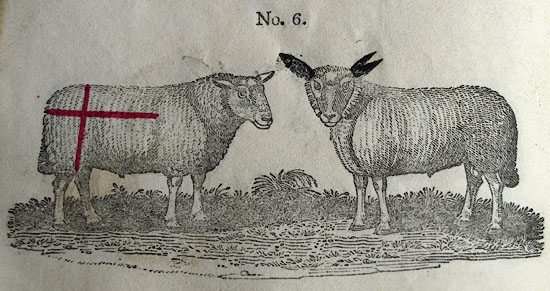 WK13L06.jpg courtesy of George Akrigg "No.6 - THOMAS HUDSON, Tilshole:" "Sharp bottomed fork near ear, a red cross on the far huck bone, TH on the horns." item:- private collection : 91 Image © see bottom of page |
|
|
|
||
| evidence:- | shepherds guide:- Lamb 1937 placename:- Tills Hole |
|
| source data:- | Book, Lamb's Shepherds' Guide for Cumberland, Westmorland and
Lancashire, by R H Lamb, published by the Herald Printing Co,
Penrith, Cumberland, 1937. LM1p317b.jpg "Messrs. J.and M. Fishwick, Tills Hole. Forked near ear, red stroke from fillets to far side of tail, another from near hook bone over and across the other and down far buttock." item:- Kendal Library : 40 Image © see bottom of page |
|
|
|
||
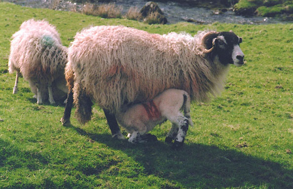 BIQ28.jpg Swaledale sheep and lamb with the Sadghyll mark. Red M on nearside rib. The M stands for Mattinson, earlier owners of the farm, it gets very indistinct as the sheep grows older. (taken 22.4.2004) |
||
|
|
||
 BQX79.jpg (taken 28.6.2009) 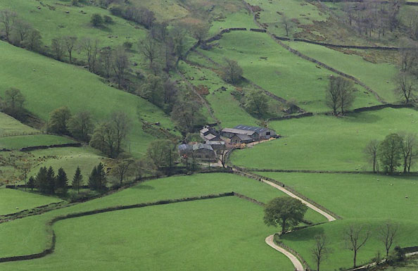 BJK16.jpg (taken 2.5.2005) 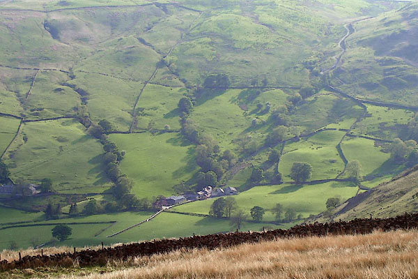 BPF82.jpg (taken 24.5.2008) 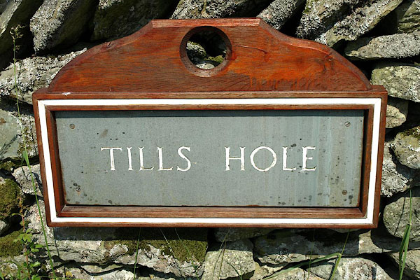 BQY24.jpg (taken 29.6.2009) 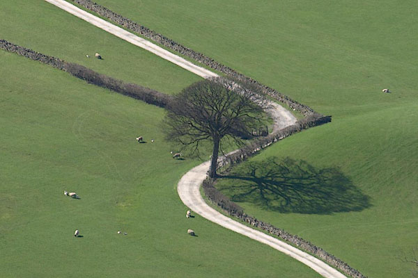 BSM35.jpg A tree by the lane to Tills Hole. (taken 29.6.2009) 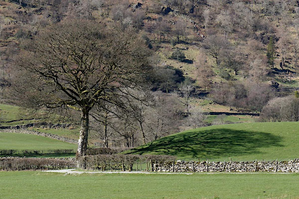 CAB24.jpg A tree by the lane to Tills Hole. (taken 10.3.2014) |
||
|
|
||
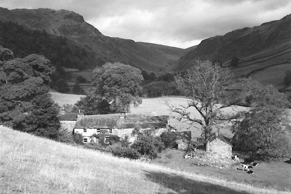 CDQ02.jpg 1950s? courtesy of Nial Barnes |
||
|
|
||
 Lakes Guides menu.