 Old Cumbria Gazetteer
 |
 |
|
|
| included in:- |
 road, Kendal to Kirkby Stephen road, Kendal to Kirkby Stephen |
||
| road, Kirkby Stephen to Brough | |||
| Kirkby Stephen to Brough | |||
| Brough to Kirkby Stephen | |||
| A685 | |||
| civil parish:- | Kirkby Stephen (formerly Westmorland) | ||
| civil parish:- | Hartley (formerly Westmorland) | ||
| civil parish:- | Winton (formerly Westmorland) | ||
| civil parish:- | Kaber (formerly Westmorland) | ||
| civil parish:- | Brough Sowerby (formerly Westmorland) | ||
| civil parish:- | Brough (formerly Westmorland) | ||
| county:- | Cumbria | ||
| locality type:- | road route | ||
| 10Km square:- | NY70 | ||
| 10Km square:- | NY71 | ||
|
|
|||
| evidence:- | old map:- Jefferys 1770 (Wmd) |
||
| source data:- | Map, 4 sheets, The County of Westmoreland, scale 1 inch to 1
mile, surveyed 1768, and engraved and published by Thomas
Jefferys, London, 1770.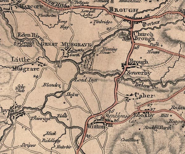 J5NY71SE.jpg 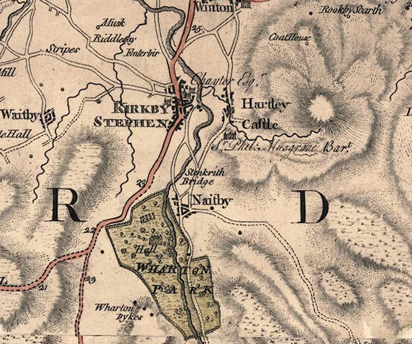 J5NY70NE.jpg double line; road, bold, main road, with mile numbers item:- National Library of Scotland : EME.s.47 Images © National Library of Scotland |
||
|
|
|||
| evidence:- | old map:- Cary 1789 (edn 1805) |
||
| source data:- | Map, uncoloured engraving, Westmoreland, scale about 2.5 miles
to 1 inch, by John Cary, London, 1789; edition 1805.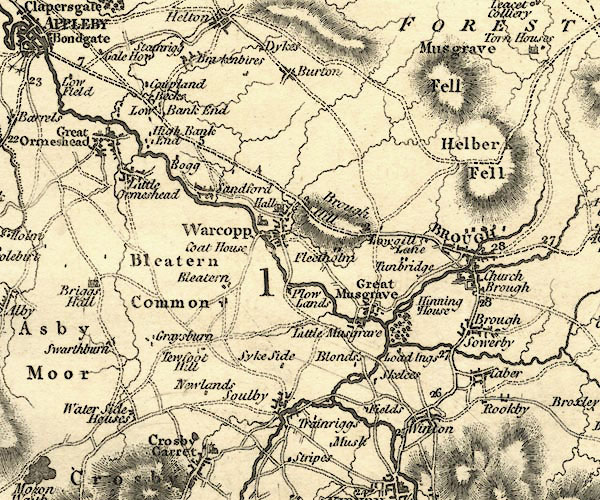 CY24NY71.jpg 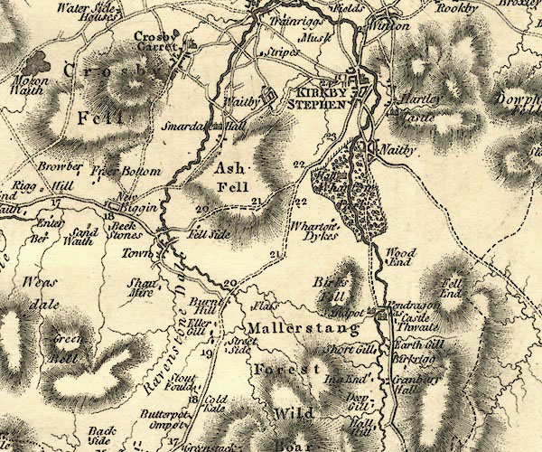 CY24NY70.jpg double line, bold light, numbered miles; main road item:- JandMN : 129 Image © see bottom of page |
||
|
|
|||
| evidence:- | road map:- Cary 1790 (Wmd/edn 1792) |
||
| source data:- | Road map, hand coloured engraving, Westmoreland, scale about
11.5 miles to 1 inch, by John Cary, 181 Strand, London, 1790,
edn 1792.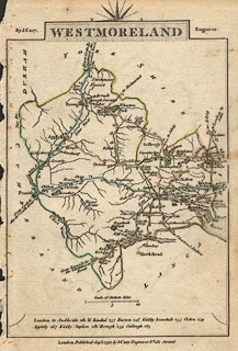 click to enlarge click to enlargeCY16.jpg double line, with road distances from Kirkby Lonsdale item:- JandMN : 44 Image © see bottom of page |
||
|
|
|||
| evidence:- | road book:- Cary 1798 (2nd edn 1802) |
||
| source data:- | Road book, itineraries, Cary's New Itinerary, by John Cary, 181
Strand, London, 2nd edn 1802. goto source page 315-316 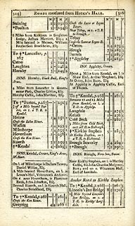 click to enlarge click to enlargeC38315.jpg "Near Tebay, on r. a T.R. to Brough." item:- JandMN : 228.1 Image © see bottom of page |
||
|
|
|||
| evidence:- | old map:- Cooke 1802 |
||
| source data:- | Map, Westmoreland ie Westmorland, scale about 12 miles to 1
inch, by George Cooke, 1802, published by Sherwood, Jones and
Co, Paternoster Road, London, 1824. click to enlarge click to enlargeGRA1Wd.jpg double line, light dark solid; road item:- Hampshire Museums : FA2000.62.4 Image © see bottom of page |
||
|
|
|||
| evidence:- | old map:- Laurie and Whittle 1806 |
||
| source data:- | Road map, Continuation of the Roads to Glasgow and Edinburgh,
scale about 10 miles to 1 inch, by Nathaniel Coltman? 1806,
published by Robert H Laurie, 53 Fleet Street, London, 1834. click to enlarge click to enlargeLw21.jpg bold line; 'Principal Travelling Roads' item:- private collection : 18.21 Image © see bottom of page |
||
|
|
|||
| evidence:- | old map:- Cooper 1808 |
||
| source data:- | Map, hand coloured engraving, Westmoreland ie Westmorland, scale
about 9 miles to 1 inch, by H Cooper, 1808, published by R
Phillips, Bridge Street, Blackfriars, London, 1808. click to enlarge click to enlargeCOP4.jpg double line; road item:- Dove Cottage : 2007.38.53 Image © see bottom of page |
||
|
|
|||
| evidence:- | old map:- Wallis 1810 (Wmd) |
||
| source data:- | Road map, Westmoreland, scale about 19 miles to 1 inch, by James
Wallis, 77 Berwick Street, Soho, 1810, published by W Lewis,
Finch Lane, London, 1835? click to enlarge click to enlargeWAL5.jpg double line, light bold; 'Turnpike Road' item:- JandMN : 63 Image © see bottom of page |
||
|
|
|||
| evidence:- | old map:- Hall 1820 (Wmd) |
||
| source data:- | Map, hand coloured engraving, Westmoreland ie Westmorland, scale
about 14.5 miles to 1 inch, by Sidney Hall, London, 1820,
published by Samuel Leigh, 18 Strand, London, 1820-31. click to enlarge click to enlargeHA18.jpg single line, solid; minor road; Kirkby Stephen, Brough Sowerby, Brough item:- Armitt Library : 2008.14.58 Image © see bottom of page |
||
|
|
|||
| evidence:- | gradient diagram:- Gall and Inglis 1890s-1900s (Roads) |
||
| source data:- | Contour Road Book of England, Northern Division, by Harry R G Inglis, published by
Gall and Inglis, 25 Paternoster Square, London and Edinburgh, 1898.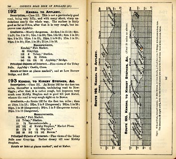 click to enlarge click to enlargeIG5192.jpg Itinerary, with gradient diagram, route 192, Kendal to Appleby and route 193, Kendal to Kirkby Stephen, etc, Westmorland and Durham, 1898. item:- JandMN : 763.20 Image © see bottom of page |
||
|
|
|||
| evidence:- | old strip map:- CTC 1911 (Roads) |
||
| source data:- | Page 101 of Cyclists' Touring Club British Road Book new series vol.6, edited by F
B Sandford, published by Thomas Nelson and Sons, London etc, 1911.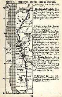 click to enlarge click to enlargeCTC2A1.jpg Strip road map, route 48, Middleton Brough Kirkby Stephen, part of Middleton to Lancaster, scale roughly 5 miles to 1 inch. Together with an itinerary and gradient diagram. item:- JandMN : 491.101 Image © see bottom of page |
||
|
|
|||
 Act of Parliament Act of Parliament |
|||
|
|
|||
| places:- | Kirkby Stephen Church Brough, Brough Brough Sowerby Brough |
||
|
|
|||
Lakes Guides menu.