 Morden 1695 (Wmd) SD49


|

|
|
|
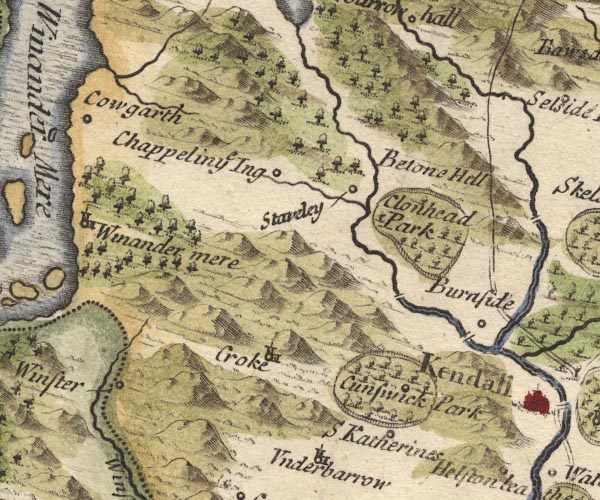
gazetteer links places may or may not be labelled on the map |
||

|
-- Bowston Bridge |
|
|
|
-- |
|
|
|
-- Burneside -- "Burnside" |
|
|
|
-- Crook -- "Croke" |
|
|
|
-- Cunswick Hall -- "Cunswick Park" |
|
|
|
-- Gowan, River |
|
|
|
-- Height of Patton -- "Betone Hill" |
|
|
|
-- Ings -- "Chappel in ye Ing" |
|
|
|
-- Kent, River -- "Can Flu." |
|
|
|
-- -- "Clonhead Park" |
|
|
|
-- Kendal to Shap |
|
|
|
-- St Catherine's Church -- "S Katherines" |
|
|
|
-- Staveley -- "Staveley" |
|
|
|
-- Trout Beck |
|
|
|
-- Winster -- "Winster" |
|
|
civil parishes The area roughly includes parts of parishes:- Crosthwaite and Lyth Cartmel Fell Helsington Strickland Ketel Windermere Underbarrow and Bradleyfield Hugill Strickland Roger Over Staveley Nether Staveley Crook |
||
|
|
||
|
|
Lakes Guides menu. | |