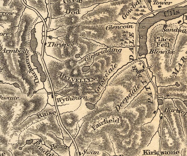
 Otley 1818 NY31


|

|
|
|
gazetteer links places may or may not be labelled on the map |
||

|
-- Blowick |
|
|
|
-- Deepdale |
|
|
|
-- Dunmail Raise |
|
|
|
-- Fairfield |
|
|
|
-- Fisherplace Gill |
|
|
|
-- Glencoyne |
|
|
|
-- Grisedale Tarn |
|
|
|
-- Grisedale |
|
|
|
-- Helvellyn -- "HELVELLYN" |
|
|
|
-- Keppelcove Tarn |
|
|
|
-- Patterdale Hotel -- "Inn" |
|
|
|
-- Patterdale -- "PATTERDALE" |
|
|
|
-- Raise Beck |
|
|
|
-- Red Tarn |
|
|
|
-- station, Helvellyn -- "HELVELLYN" |
|
|
|
-- Thirlmere |
|
|
|
-- Thirlspot |
|
|
|
-- Ullswater |
|
|
|
-- waterfall, Fisher Gill |
|
|
|
-- Wythburn |
|
|
civil parishes The area roughly includes parts of parishes:- Lakes Matterdale Martindale St John's Castlerigg and Wythburn Patterdale |
||
|
|
||
|
|
Lakes Guides menu. | |