 Saxton 1576 NY41


|

|
|
|
gazetteer links places may or may not be labelled on the map |
||

|
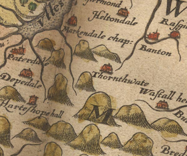
-- Bampton Grange -- "Banton" |
|
|
|
-- Goldrill Beck |
|
|
|
-- Haweswater Beck |
|
|
|
-- Heltondale -- "Heltondale" |
|
|
|
-- Howegrain Beck |
|
|
|
-- Martindale -- "Markendale chap:" |
|
|
|
-- St Martin's Church -- "Markendale chap:" |
|
|
|
-- Thornthwaite Hall -- "Thornthwate" |
|
|
|
-- Ullswater -- "Ulles flu" |
|
|
civil parishes The area roughly includes parts of parishes:- Kentmere Shap Rural Longsleddale Patterdale Martindale Lakes Bampton Barton Matterdale |
||
|
|
||
|
|
Lakes Guides menu. | |