 Saxton 1576 NY43


|

|
|
|
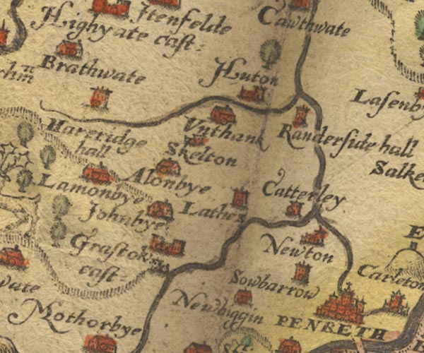
gazetteer links places may or may not be labelled on the map |
||

|
-- Catterlen -- "Catterley" |
|
|
|
-- Ellonby -- "Alonbye" |
|
|
|
-- Gillcambon Beck |
|
|
|
-- Greystoke Castle -- "Grastok cast:" |
|
|
|
-- Greystoke Forest |
|
|
|
-- Hardrigg Hall -- "Hareridge hall" |
|
|
|
-- Hutton-in-the-Forest -- "Huton" |
|
|
|
-- Johnby -- "Johnbye" |
|
|
|
-- Laithes -- "Lathes" |
|
|
|
-- Lamonby -- "Lamonbye" |
|
|
|
-- Newbiggin -- "Newbiggin" |
|
|
|
-- Newton Reigny -- "Newton" |
|
|
|
-- Old Petterill |
|
|
|
-- Penrith -- "PENRETH" |
|
|
|
-- Randerside Hall (?) -- "Randerside hall" |
|
|
|
-- Sewborwens -- "Sowbarrow" |
|
|
|
-- Skelton -- "Skelton" |
|
|
|
-- Thacka Beck |
|
|
|
-- Unthank -- "Unthank" |
|
|
civil parishes The area roughly includes parts of parishes:- Greystoke Mungrisdale Dacre Catterlen Skelton Penrith Castle Sowerby Hesket |
||
|
|
||
|
|
Lakes Guides menu. | |