 Saxton 1576 SD59


|

|
|
|
gazetteer links places may or may not be labelled on the map |
||

|
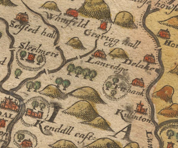
-- Dillicar -- "Delake[n]" |
|
|
|
-- Docker Bridge |
|
|
|
-- Firbank -- "Firbank" |
|
|
|
-- |
|
|
|
-- Grayrigg Hall -- "Grarigg hall" |
|
|
|
-- Kendal Castle -- "Kendall cast:" |
|
|
|
-- Killington -- "Killinton" |
|
|
|
-- Lambrigg -- "Lanridge" |
|
|
|
-- Lambrigg Beck (?) |
|
|
|
-- Lambrigg Park |
|
|
|
-- Laverock Bridge |
|
|
|
-- Old Park |
|
|
|
-- Patton Bridge bridge |
|
|
civil parishes The area roughly includes parts of parishes:- Skelsmergh Scalthwaiterigg Longsleddale Firbank Lambrigg Strickland Roger Docker Kendal Old Hutton and Holmescales Grayrigg Helsington Underbarrow and Bradleyfield Whitwell and Selside Killington Natland New Hutton Strickland Ketel Whinfell |
||
|
|
||
|
|
Lakes Guides menu. | |