 Saxton 1576 NY31


|

|
|
|
gazetteer links places may or may not be labelled on the map |
||

|
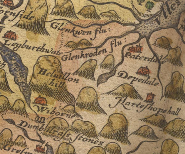
-- Deepdale Hall -- "Depedale" |
|
|
|
-- Glencoyne Beck -- "Glenkwen flu:" |
|
|
|
-- Glenridding Beck -- "Glenkroden flu:" |
|
|
|
-- Grisedale Beck |
|
|
|
-- Grisedale Tarn |
|
|
|
-- Hartsop Hall (?) -- "Harteshope hall" |
|
|
|
-- Helvellyn -- "Helvillon hill" |
|
|
|
-- Patterdale -- "Paterdale" |
|
|
|
-- Raise Beck |
|
|
|
-- Wythburn -- "Wiborne" |
|
|
civil parishes The area roughly includes parts of parishes:- Lakes Matterdale Martindale St John's Castlerigg and Wythburn Patterdale |
||
|
|
||
|
|
Lakes Guides menu. | |