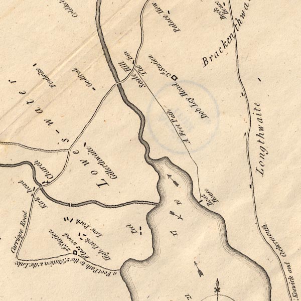
 Crosthwaite 1783-94, tetrad NY12K

|

|
|
|
gazetteer links
|
||

|
-- (boat house, Crummock Water)
|
|
|
|
-- "Brackenthwaite" -- Brackenthwaite
|
|
|
|
-- "Cocker River" -- Cocker, River
|
|
|
|
-- "Crummock Lake" -- Crummock Water
|
|
|
|
-- "Flass wood" -- Flass Wood
|
|
|
|
-- "Foulsike" -- Foulsyke
|
|
|
|
-- "Gillerthwaite" -- Gillerthwaite
|
|
|
|
-- "Godfred" -- Godferhead
|
|
|
|
-- "High Park" -- High Park
|
|
|
|
-- "Inn, The" -- (inn, Scale Hill)
|
|
|
|
-- "Kirk Head" -- Kirkhead
|
|
|
|
-- "Longthwaite" -- Lanthwaite
|
|
|
|
-- "Low Park" -- Low Park
|
|
|
|
-- "Lowes Water" -- Loweswater
|
|
|
|
-- Park Beck
|
|
|
|
-- Park Bridge
|
|
|
|
-- "Peel" -- Peel
|
|
|
|
-- Cockermouth to Buttermere
|
|
|
|
-- Cockermouth to Whitehaven
|
|
|
|
-- "Scale Hill" -- Scale Hill
|
|
|
|
-- St Bartholomew's Church
|
|
|
|
-- station, Dob Ley Head
|
|
|
|
-- station, Flass Wood
|
|
|
civil parishes The area roughly includes parts of parishes:- Loweswater Buttermere |
||
|
|
||
|
|
Lakes Guides menu. | |