Old Cumbria Gazetteer
 |
 |
|
|||||||||||||||||||||||||||
| included in:- |
 road, Carlisle to Whitehaven road, Carlisle to Whitehaven |
||||||||||||||||||||||||||||
| road, Cockermouth to Whitehaven | |||||||||||||||||||||||||||||
| Cockermouth to Whitehaven | |||||||||||||||||||||||||||||
| Whitehaven to Cockermouth | |||||||||||||||||||||||||||||
| A595 | |||||||||||||||||||||||||||||
| civil parish:- | Cockermouth (formerly Cumberland) | ||||||||||||||||||||||||||||
| civil parish:- | Brigham (formerly Cumberland) | ||||||||||||||||||||||||||||
| civil parish:- | Greysouthen (formerly Cumberland) | ||||||||||||||||||||||||||||
| civil parish:- | Little Clifton (formerly Cumberland) | ||||||||||||||||||||||||||||
| civil parish:- | Great Clifton (formerly Cumberland) | ||||||||||||||||||||||||||||
| civil parish:- | Winscales (formerly Cumberland) | ||||||||||||||||||||||||||||
| civil parish:- | Distington (formerly Cumberland) | ||||||||||||||||||||||||||||
| civil parish:- | Moresby (formerly Cumberland) | ||||||||||||||||||||||||||||
| civil parish:- | Parton (formerly Cumberland) | ||||||||||||||||||||||||||||
| civil parish:- | Whitehaven (formerly Cumberland) | ||||||||||||||||||||||||||||
| county:- | Cumbria | ||||||||||||||||||||||||||||
| locality type:- | road route | ||||||||||||||||||||||||||||
| 10Km square:- | NY13 | ||||||||||||||||||||||||||||
| 10Km square:- | NY03 | ||||||||||||||||||||||||||||
| 10Km square:- | NY02 | ||||||||||||||||||||||||||||
| 10Km square:- | NX92 | ||||||||||||||||||||||||||||
| 10Km square:- | NX91 | ||||||||||||||||||||||||||||
|
|
|||||||||||||||||||||||||||||
| evidence:- | old map:- Morden 1695 (Cmd) |
||||||||||||||||||||||||||||
| source data:- | Map, uncoloured engraving, Cumberland, scale about 4 miles to 1
inch, by Robert Morden, 1695, published by Abel Swale, the
Unicorn, St Paul's Churchyard, Awnsham, and John Churchill, the
Black Swan, Paternoster Row, London, 1695-1715.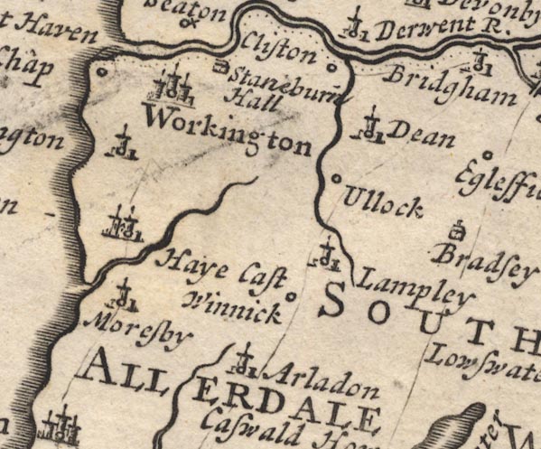 MD12NY02.jpg 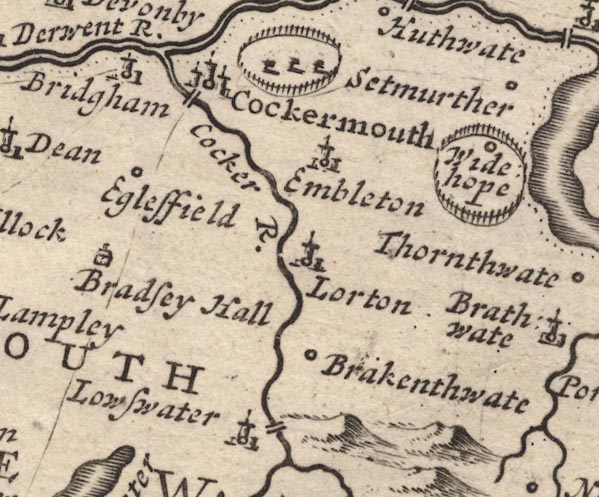 MD12NY12.jpg 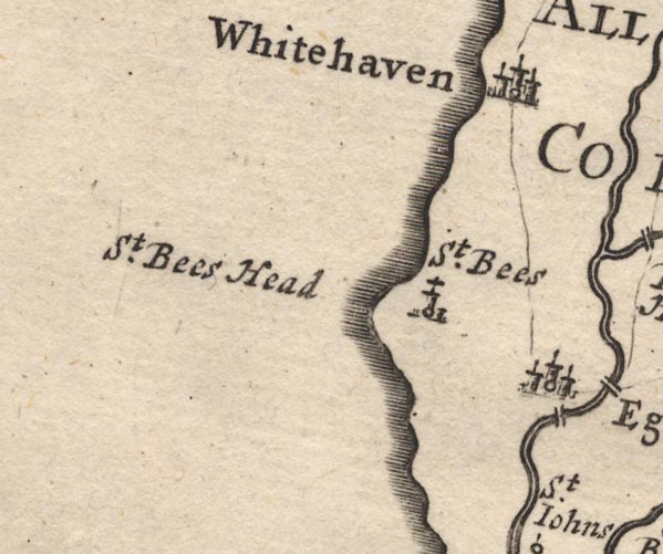 MD12NX91.jpg Single line. item:- JandMN : 90 Image © see bottom of page |
||||||||||||||||||||||||||||
|
|
|||||||||||||||||||||||||||||
| evidence:- | old map:- Bowen and Kitchin 1760 |
||||||||||||||||||||||||||||
| source data:- | Map, hand coloured engraving, A New Map of the Counties of
Cumberland and Westmoreland Divided into their Respective Wards,
scale about 4 miles to 1 inch, by Emanuel Bowen and Thomas
Kitchin et al, published by T Bowles, Robert Sayer, and John
Bowles, London, 1760.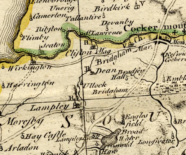 BO18NY02.jpg double line, solid 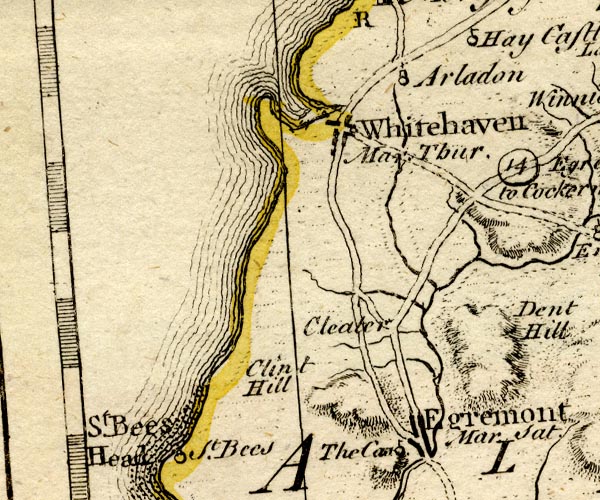 BO18NX91.jpg double line, dotted and solid item:- Armitt Library : 2008.14.10 Image © see bottom of page |
||||||||||||||||||||||||||||
|
|
|||||||||||||||||||||||||||||
| evidence:- | old map:- Donald 1774 (Cmd) |
||||||||||||||||||||||||||||
| source data:- | Map, hand coloured engraving, 3x2 sheets, The County of Cumberland, scale about 1
inch to 1 mile, by Thomas Donald, engraved and published by Joseph Hodskinson, 29
Arundel Street, Strand, London, 1774. double line, solid or dotted, with a dot or milestone and number at 1 mile intervals, tinted red; turnpike road 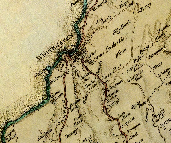 D4NX91NE.jpg 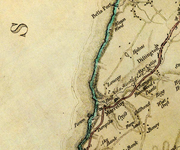 D4NX92SE.jpg 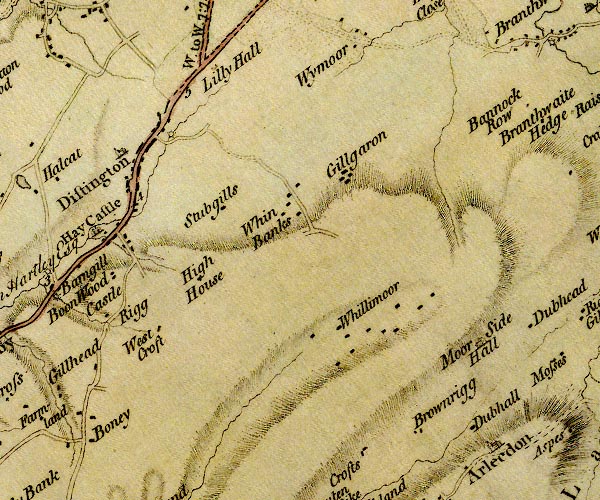 D4NY02SW.jpg 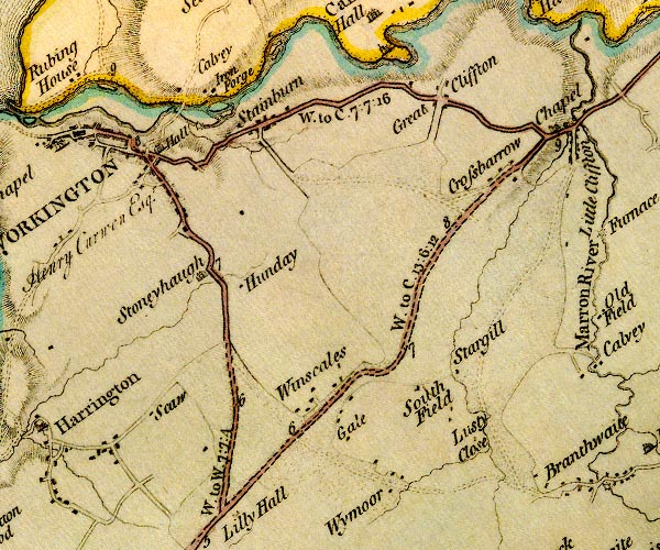 D4NY02NW.jpg "W. to C. 13:6:12" miles.furlongs.poles; Whitehaven to Cockermouth 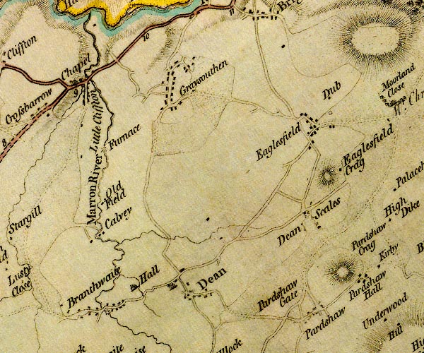 D4NY02NE.jpg 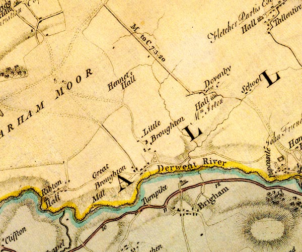 D4NY03SE.jpg 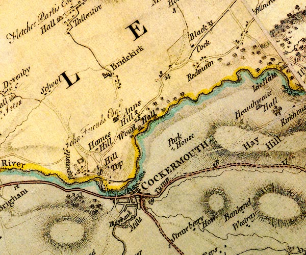 D4NY13SW.jpg item:- Carlisle Library : Map 2 Images © Carlisle Library |
||||||||||||||||||||||||||||
|
|
|||||||||||||||||||||||||||||
| evidence:- | old map:- Donald 1774 (Cmd) |
||||||||||||||||||||||||||||
| source data:- | Map, hand coloured engraving, 3x2 sheets, The County of Cumberland, scale about 1
inch to 1 mile, by Thomas Donald, engraved and published by Joseph Hodskinson, 29
Arundel Street, Strand, London, 1774.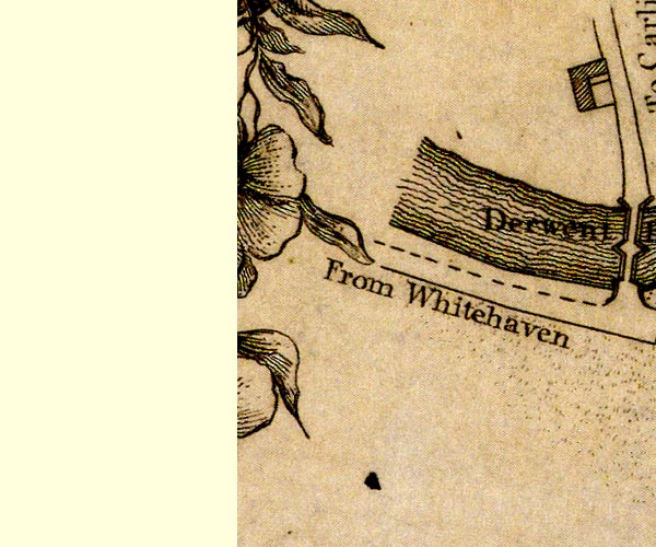 D41130N.jpg "From Whitehaven" road out of town item:- Carlisle Library : Map 2 Image © Carlisle Library |
||||||||||||||||||||||||||||
|
|
|||||||||||||||||||||||||||||
| evidence:- | old map:- Donald 1774 (Cmd) |
||||||||||||||||||||||||||||
| source data:- | Map, hand coloured engraving, 3x2 sheets, The County of Cumberland, scale about 1
inch to 1 mile, by Thomas Donald, engraved and published by Joseph Hodskinson, 29
Arundel Street, Strand, London, 1774.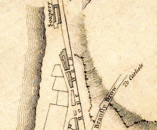 D49718N.jpg "To Carlisle" road out of town item:- Carlisle Library : Map 2 Image © Carlisle Library |
||||||||||||||||||||||||||||
|
|
|||||||||||||||||||||||||||||
| evidence:- | old map:- Crosthwaite 1783-94 (But/Cru/Low) |
||||||||||||||||||||||||||||
| source data:- | Map, uncoloured engraving, An Accurate Map of Buttermere,
Crummock and Loweswater Lakes, scale about 3 inches to 1 mile,
by Peter Crosthwaite, Keswick, Cumberland, 1794, version
published 1800. CT8NY12G.jpg "Road to Whitehaven"  CT8NY12F.jpg 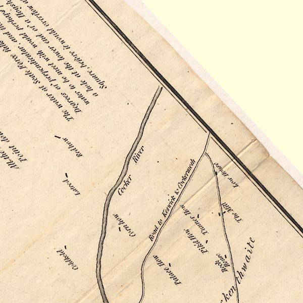 CT8NY12L.jpg "Road to Keswick &Cockermoth" 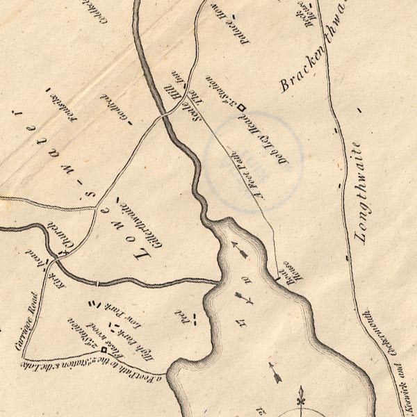 CT8NY12K.jpg item:- Armitt Library : 1959.191.2 Image © see bottom of page |
||||||||||||||||||||||||||||
|
|
|||||||||||||||||||||||||||||
| evidence:- | road map:- Cary 1790 (Cmd/edn 1789) |
||||||||||||||||||||||||||||
| source data:- | Road map, hand coloured engraving, Cumberland, scale about 15
miles to 1 inch, by John Cary, 181 Strand, London, 1790, edn
1789.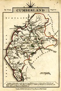 click to enlarge click to enlargeCY47.jpg double line, with road distances from Whitehaven item:- JandMN : 419 Image © see bottom of page |
||||||||||||||||||||||||||||
|
|
|||||||||||||||||||||||||||||
| evidence:- | road book:- Cary 1798 (2nd edn 1802) |
||||||||||||||||||||||||||||
| source data:- | Road book, itineraries, Cary's New Itinerary, by John Cary, 181
Strand, London, 2nd edn 1802. goto source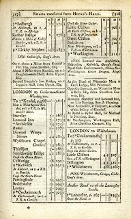 click to enlarge click to enlargeC38317.jpg page 317-318 "At Little Clifton, on l. a T.R. to Whitehaven." "LONDON to Whitehaven." part of item:- JandMN : 228.1 Image © see bottom of page |
||||||||||||||||||||||||||||
|
|
|||||||||||||||||||||||||||||
| evidence:- | road book:- Cary 1798 (2nd edn 1802) |
||||||||||||||||||||||||||||
| source data:- | Road book, itineraries, Cary's New Itinerary, by John Cary, 181
Strand, London, 2nd edn 1802. goto source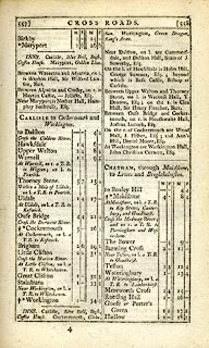 click to enlarge click to enlargeC38557.jpg page 557-558 "At Little Clifton, on l. a T.R. to Whitehaven" item:- JandMN : 228.2 Image © see bottom of page |
||||||||||||||||||||||||||||
|
|
|||||||||||||||||||||||||||||
| evidence:- | old map:- Laurie and Whittle 1806 |
||||||||||||||||||||||||||||
| source data:- | Road map, Completion of the Roads to the Lakes, scale about 10
miles to 1 inch, by Nathaniel Coltman? 1806, published by Robert
H Laurie, 53 Fleet Street, London, 1834. click to enlarge click to enlargeLw18.jpg bold line; 'Principal Travelling Roads' item:- private collection : 18.18 Image © see bottom of page |
||||||||||||||||||||||||||||
|
|
|||||||||||||||||||||||||||||
| evidence:- | old map:- Cooper 1808 |
||||||||||||||||||||||||||||
| source data:- | Map, uncoloured engraving, Cumberland, scale about 10.5 miles to
1 inch, drawn and engraved by Cooper, published by R Phillips,
Bridge Street, Blackfriars, London, 1808. click to enlarge click to enlargeCOP3.jpg double line; road item:- JandMN : 86 Image © see bottom of page |
||||||||||||||||||||||||||||
|
|
|||||||||||||||||||||||||||||
| evidence:- | old map:- Wallis 1810 (Cmd) |
||||||||||||||||||||||||||||
| source data:- | Road map, hand coloured engraving, Cumberland, scale about 16
miles to 1 inch, by James Wallis, 77 Berwick Stree, Soho,
London, 1810. click to enlarge click to enlargeWL13.jpg double line, light bold; 'Turnpike Road' item:- Dove Cottage : 2009.81.10 Image © see bottom of page |
||||||||||||||||||||||||||||
|
|
|||||||||||||||||||||||||||||
| evidence:- | descriptive text:- Ford 1839 (3rd edn 1843) |
||||||||||||||||||||||||||||
| source data:- | Guide book, A Description of Scenery in the Lake District, by
Rev William Ford, published by Charles Thurnam, Carlisle, by W
Edwards, 12 Ave Maria Lane, Charles Tilt, Fleet Street, William
Smith, 113 Fleet Street, London, by Currie and Bowman,
Newcastle, by Bancks and Co, Manchester, by Oliver and Boyd,
Edinburgh, and by Sinclair, Dumfries, 1839. goto source Page 172:- "..." "XV. WHITEHAVEN TO KESWICK. - 27 M."
|
||||||||||||||||||||||||||||
|
|
|||||||||||||||||||||||||||||
| evidence:- | old map:- Ford 1839 map |
||||||||||||||||||||||||||||
| source data:- | Map, uncoloured engraving, Map of the Lake District of
Cumberland, Westmoreland and Lancashire, scale about 3.5 miles
to 1 inch, published by Charles Thurnam, Carlisle, and by R
Groombridge, 5 Paternoster Row, London, 3rd edn 1843.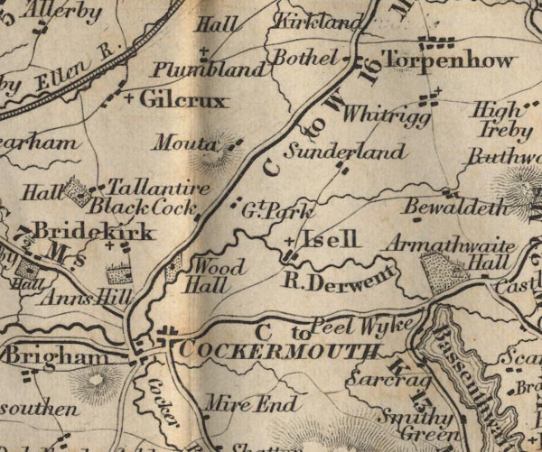 FD02NY13.jpg 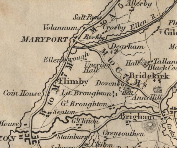 FD02NY03.jpg 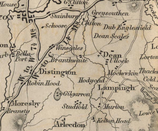 FD02NY02.jpg "W to C 14 Ms." 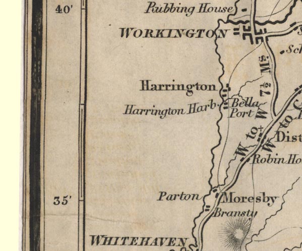 FD02NX92.jpg 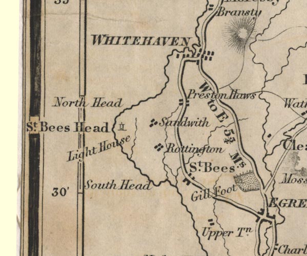 FD02NX91.jpg item:- JandMN : 100.1 Image © see bottom of page |
||||||||||||||||||||||||||||
|
|
|||||||||||||||||||||||||||||
| evidence:- | old itinerary:- Tinsley 1877 (Roads/Cum) |
||||||||||||||||||||||||||||
| source data:- | Itinerary, route 7, London to Whitehaven via the Lake Districts, including from Settle,
Lancashire; through Kirkby Lonsdale, Kendal, Ambleside, Westmorland; then Keswick,
Cockermouth to Whitehaven, Cumberland, published by Tinsley Bros, 8 Catherine Street,
Strand, London, 1877.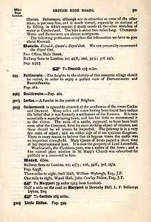 click to enlarge click to enlargeTLY190.jpg pp.71-91 in British High Roads, North and North Eastern Routes; pp.84-91. printed at p.71:- "... / ROUTE VII. - LONDON to WHTEHAVEN via THE LAKE / DISTRICTS. (See Maps 65 to 80.) / Hitchin (as per Route I.) 34, Shefford 41, Bedford 50, Higham-Ferrers, / 64¾, Kettering 74½, Rockingham 83¼, Uppingham 88¾, Oakham, / 94¾, Melton Mowbray 104¾, Nottingham 123¼, Rotherham 159¼, / Barnsley 171¾, Huddersfield 188¾, Halifax 196¾, Keighley 208¾, / Skipton 218¾, Settle 234¾, Kirkby Lonsdale 252½, Kendal 264½, / Ambleside 278½, Keswick 293½, Cockermouth 305½, Whitehaven / 319½. / ..." 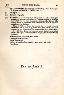 click to enlarge click to enlargeTLY191.jpg item:- private collection : 270.2 Image © see bottom of page |
||||||||||||||||||||||||||||
|
|
|||||||||||||||||||||||||||||
| evidence:- | old strip map:- Tinsley 1877 (Roads/Cum) |
||||||||||||||||||||||||||||
| source data:- | Strip map, road map, part of London to Whitehaven, including from before Keswick through
Cockermouth to Whitehaven, Cumberland, published by Tinsley Bros, 8 Catherine Street,
Strand, London, 1877.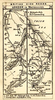 click to enlarge click to enlargeTLY1M5.jpg Map pp.79-80 in British High Roads, North and North Eastern Routes. printed at top:- "BRITISH HIGH ROADS / 79 LONDON TO WHITEHAVEN. 80" item:- private collection : 270.7 Image © see bottom of page |
||||||||||||||||||||||||||||
|
|
|||||||||||||||||||||||||||||
| evidence:- | old map:- Bell 1892 |
||||||||||||||||||||||||||||
| source data:- | Map, colour lithograph, Road Map of Cumberland, by George Joseph
Bell, scale about 2.5 miles to 1 inch, printed by Charles
Thurnam and Sons, Carlisle, Cumberland, 1892.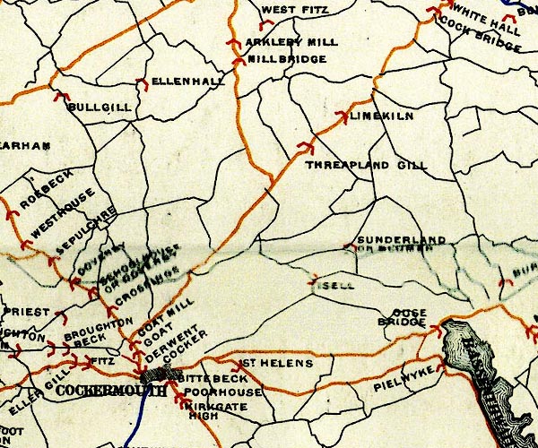 BEL9NY13.jpg 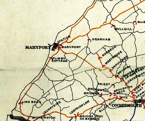 BEL9NY03.jpg 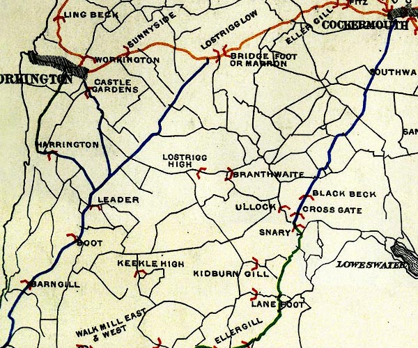 BEL9NY02.jpg 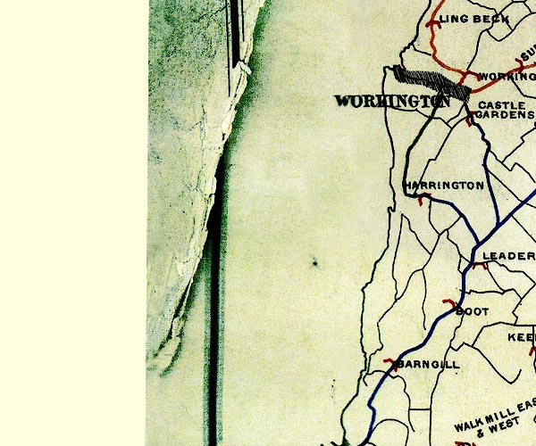 BEL9NX92.jpg 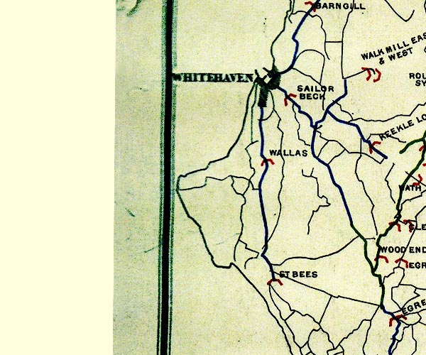 BEL9NX91.jpg orange - disturnpiked 'main road' under section 13 of the Highways Act 1878 since 1 September 1883; blue - declared 'main road' by magistrates, as the county authority, since 1878, under section 15 of the Highways Act 1878 Road map of Cumberland showing County Bridges item:- Carlisle Library : Map 38 Images © Carlisle Library |
||||||||||||||||||||||||||||
|
|
|||||||||||||||||||||||||||||
| evidence:- | old strip map:- CTC 1911 (Roads) |
||||||||||||||||||||||||||||
| source data:- | Page 108 of Cyclists' Touring Club British Road Book new series vol.6, edited by F
B Sandford, published by Thomas Nelson and Sons, London etc, 1911.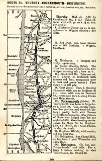 click to enlarge click to enlargeCTC2A8.jpg Strip road map, route 54, Thursby Cockermouth Distington, scale roughly 5 miles to 1 inch. Together with an itinerary and gradient diagram. item:- JandMN : 491.108 Image © see bottom of page |
||||||||||||||||||||||||||||
|
|
|||||||||||||||||||||||||||||
| places:- | Cockermouth Brigham Little Clifton Winscales Distington Moresby Whitehaven |
||||||||||||||||||||||||||||
|
|
|||||||||||||||||||||||||||||
| places:- |
|
||||||||||||||||||||||||||||
|
|||||||||||||||||||||||||||||
|
|||||||||||||||||||||||||||||
|
|||||||||||||||||||||||||||||
|
|||||||||||||||||||||||||||||
|
|||||||||||||||||||||||||||||
|
|||||||||||||||||||||||||||||
|
|||||||||||||||||||||||||||||
|
|||||||||||||||||||||||||||||
|
|||||||||||||||||||||||||||||
|
|||||||||||||||||||||||||||||
|
|||||||||||||||||||||||||||||
|
|||||||||||||||||||||||||||||
|
|||||||||||||||||||||||||||||
|
|||||||||||||||||||||||||||||
Lakes Guides menu.