 Morden 1695 (Wmd) SD48


|

|
|
|
gazetteer links places may or may not be labelled on the map |
||

|
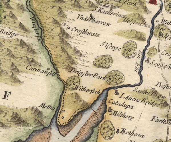
-- Brigsteer Park -- "Brigster Park" |
|
|
|
-- Cartmel Fell -- "Carmanfell" |
|
|
|
-- Crosthwaite -- "Crosthwate" |
|
|
|
-- Helsington Laithes -- "Helston lea" |
|
|
|
-- Kent, River -- "Can Flu." |
|
|
|
-- Levens Bridge -- "Levens Bridge" |
|
|
|
-- Levens Force -- "Catadupa" |
|
|
|
-- Levens Park -- "Brigsteer Park" |
|
|
|
-- Meathop -- "Methap" |
|
|
|
-- Milnthorpe -- "Milthorp" |
|
|
|
-- Sizergh Castle -- "Siserge" |
|
|
|
-- Underbarrow -- "Underbarrow" |
|
|
|
-- Winster, River -- "Winster flu" |
|
|
|
-- Witherslack -- "Witherslak" |
|
|
|
-- Witherslack Hall |
|
|
civil parishes The area roughly includes parts of parishes:- Broughton East Staveley-in-Cartmel Underbarrow and Bradleyfield Heversham Witherslack Beetham Meathop and Ulpha Milnthorpe Cartmel Fell Crosthwaite and Lyth Levens Helsington Upper Allithwaite Grange-over-Sands |
||
|
|
||
|
|
Lakes Guides menu. | |