 Saxton 1576 NY30


|

|
|
|
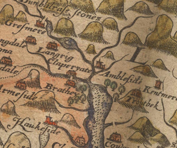
gazetteer links places may or may not be labelled on the map |
||

|
-- Ambleside -- "Ambleside" |
|
|
|
-- Blelham Beck |
|
|
|
-- Brathay Garths |
|
|
|
-- Brathay, River |
|
|
|
-- Church Bridge |
|
|
|
-- Clappersgate -- "Claperyate" |
|
|
|
-- Dovenest Wood |
|
|
|
-- Easedale Beck |
|
|
|
-- Grasmere -- "Gresmere" |
|
|
|
-- Grasmere |
|
|
|
-- Great Langdale Beck |
|
|
|
-- Hawkshead -- "Haukeside" |
|
|
|
-- Heron Island |
|
|
|
-- Loughrigg -- "Langrig" |
|
|
|
-- Old Brathay -- "Brathey" |
|
|
|
-- Rothay, River |
|
|
|
-- Rydal Water |
|
|
|
-- Scandale Beck |
|
|
|
-- Skelghyll Wood |
|
|
|
-- Skelwith Bridge bridge |
|
|
|
-- Stock Ghyll |
|
|
|
-- Strawberry Wood |
|
|
|
-- Trout Beck |
|
|
|
-- Troutbeck Bridge |
|
|
|
-- Troutbeck -- "Troutbek" |
|
|
|
-- Windermere lake -- "Wynandermere flu:" |
|
|
civil parishes The area roughly includes parts of parishes:- Claife Lakes Windermere Skelwith Coniston Patterdale |
||
|
|
||
|
|
Lakes Guides menu. | |