Old Cumbria Gazetteer
 |
 |
|
|||||||||||||||||||||||||||
| Ambleside | |||||||||||||||||||||||||||||
| Amelsed | |||||||||||||||||||||||||||||
| civil parish:- | Lakes (formerly Westmorland) | ||||||||||||||||||||||||||||
| county:- | Cumbria | ||||||||||||||||||||||||||||
| locality type:- | locality | ||||||||||||||||||||||||||||
| locality type:- | buildings | ||||||||||||||||||||||||||||
| locality type:- | market town | ||||||||||||||||||||||||||||
| locality type:- | selected place | ||||||||||||||||||||||||||||
| coordinates:- | NY37670451 (etc) | ||||||||||||||||||||||||||||
| 1Km square:- | NY3704 | ||||||||||||||||||||||||||||
| 10Km square:- | NY30 | ||||||||||||||||||||||||||||
| latitude; longitude:- | 2d 57.6m W; 54d 25.9m N | ||||||||||||||||||||||||||||
|
|
|||||||||||||||||||||||||||||
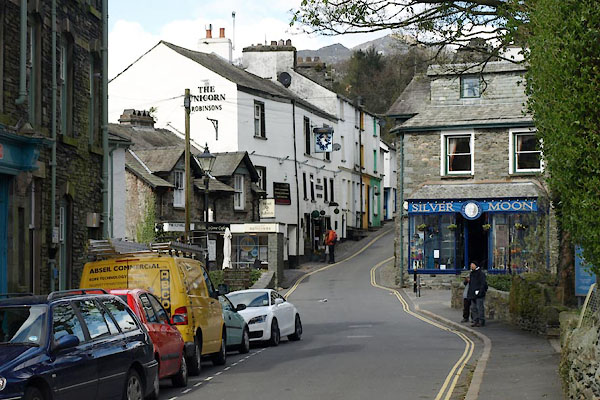
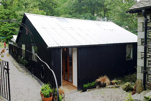
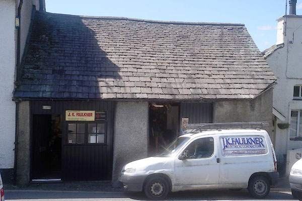
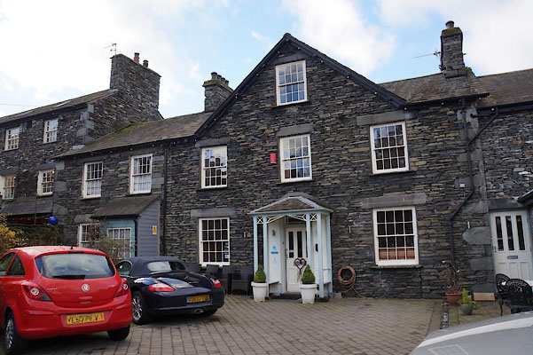
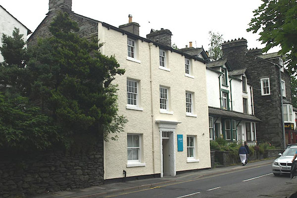
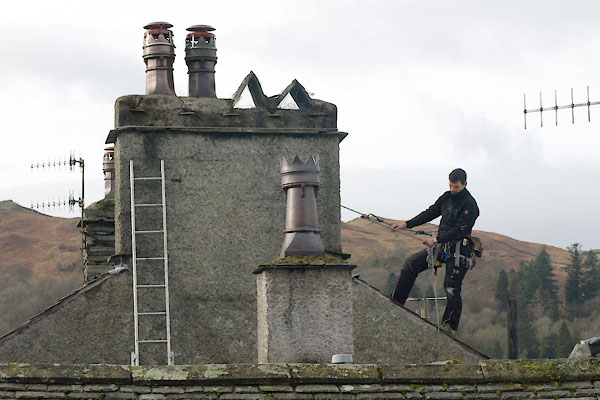
 BVX72.jpg (taken 17.2.2012) 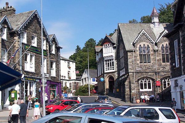 BJT01.jpg (taken 17.8.2005) |
|||||||||||||||||||||||||||||
|
|
|||||||||||||||||||||||||||||
| evidence:- | old map:- OS County Series (Wmd 26 2) placename:- Ambleside Urban District |
||||||||||||||||||||||||||||
| source data:- | Maps, County Series maps of Great Britain, scales 6 and 25
inches to 1 mile, published by the Ordnance Survey, Southampton,
Hampshire, from about 1863 to 1948. OS County Series (Wmd 26 3) |
||||||||||||||||||||||||||||
|
|
|||||||||||||||||||||||||||||
| evidence:- | old map:- OS County Series (Wmd 26 6) placename:- Ambleside |
||||||||||||||||||||||||||||
| source data:- | Maps, County Series maps of Great Britain, scales 6 and 25
inches to 1 mile, published by the Ordnance Survey, Southampton,
Hampshire, from about 1863 to 1948. OS County Series (Wmd 26 10) |
||||||||||||||||||||||||||||
|
|
|||||||||||||||||||||||||||||
| evidence:- | old map:- Saxton 1579 placename:- Ambleside |
||||||||||||||||||||||||||||
| source data:- | Map, hand coloured engraving, Westmorlandiae et Cumberlandiae Comitatus ie Westmorland
and Cumberland, scale about 5 miles to 1 inch, by Christopher Saxton, London, engraved
by Augustinus Ryther, 1576, published 1579-1645.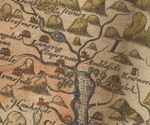 Sax9NY30.jpg Church, symbol for a parish or village, with a parish church. "Ambleside" item:- private collection : 2 Image © see bottom of page |
||||||||||||||||||||||||||||
|
|
|||||||||||||||||||||||||||||
| evidence:- | old map:- Mercator 1595 (edn?) placename:- Ambleside |
||||||||||||||||||||||||||||
| source data:- | Map, hand coloured engraving, Westmorlandia, Lancastria, Cestria
etc, ie Westmorland, Lancashire, Cheshire etc, scale about 10.5
miles to 1 inch, by Gerard Mercator, Duisberg, Germany, 1595,
edition 1613-16. MER5WmdA.jpg "Ambleside" circle item:- Armitt Library : 2008.14.3 Image © see bottom of page |
||||||||||||||||||||||||||||
|
|
|||||||||||||||||||||||||||||
| evidence:- | old map:- Keer 1605 placename:- Ambleside |
||||||||||||||||||||||||||||
| source data:- | Map, hand coloured engraving, Westmorland and Cumberland, scale
about 16 miles to 1 inch, probably by Pieter van den Keere, or
Peter Keer, about 1605 edition perhaps 1676. click to enlarge click to enlargeKER8.jpg "Ambleside" dot, circle and tower; village item:- Dove Cottage : 2007.38.110 Image © see bottom of page |
||||||||||||||||||||||||||||
|
|
|||||||||||||||||||||||||||||
| evidence:- | old map:- Speed 1611 (Cum/EW) placename:- Ambleside |
||||||||||||||||||||||||||||
| source data:- | Map, hand coloured engraving, Kingdome of Great Britaine and
Ireland, scale about 36 miles to 1 inch, by John Speed, about
1610-11, published by Thomas Bassett, Fleet Street and Richard
Chiswell, St Paul's Churchyard, London, 1676?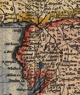 click to enlarge click to enlargeSPD6Cm.jpg "Ambleside" dot, circle, and tower item:- private collection : 85 Image © see bottom of page |
||||||||||||||||||||||||||||
|
|
|||||||||||||||||||||||||||||
| evidence:- | old map:- Speed 1611 (Wmd) placename:- Ambleside placename:- Amboglan |
||||||||||||||||||||||||||||
| source data:- | Map, hand coloured engraving, The Countie Westmorland and
Kendale the Cheif Towne, scale about 2.5 miles to 1 inch, by
John Speed, 1610, published by George Humble, Popes Head Alley,
London, 1611-12. SP14NY30.jpg "Ambleside / AMBOGLAN" circle, building and tower item:- Armitt Library : 2008.14.5 Image © see bottom of page |
||||||||||||||||||||||||||||
|
|
|||||||||||||||||||||||||||||
| evidence:- | table of distances:- Simons 1635 placename:- Ambleside |
||||||||||||||||||||||||||||
| source data:- | Table of distances, uncoloured engraving, Westmerland ie
Westmorland, with a thumbnail map, scale about 42 miles to 1
inch, by Mathew Simons, published in A Direction for the English
Traviller, 1635. click to enlarge click to enlargeSIM3.jpg "Ambleside N.W." and tabulated distances item:- private collection : 50.39 Image © see bottom of page |
||||||||||||||||||||||||||||
|
|
|||||||||||||||||||||||||||||
| evidence:- | perhaps old map:- Jenner 1643 placename:- Ambleside |
||||||||||||||||||||||||||||
| source data:- | Table of distances, with map, hand coloured engraving,
Westmerland ie Westmorland, scale about 16 miles to 1 inch,
engraved by Jacob van Langeren, published by Thomas Jenner,
Cornhill, London, 1643. JEN3Sq.jpg "Ambleside" dot, circle, tower item:- private collection : 52.Wmd Image © see bottom of page |
||||||||||||||||||||||||||||
|
|
|||||||||||||||||||||||||||||
| evidence:- | old map:- Jansson 1646 placename:- Ambleside |
||||||||||||||||||||||||||||
| source data:- | Map, hand coloured engraving, Cumbria and Westmoria, ie
Cumberland and Westmorland, scale about 3.5 miles to 1 inch, by
John Jansson, Amsterdam, Netherlands, 1646.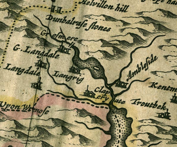 JAN3NY30.jpg "Ambleside" Buildings and tower. item:- JandMN : 88 Image © see bottom of page |
||||||||||||||||||||||||||||
|
|
|||||||||||||||||||||||||||||
| evidence:- | hearth tax returns:- Hearth Tax 1675 placename:- Ambleside |
||||||||||||||||||||||||||||
| source data:- | Records, hearth tax survey returns, Westmorland, 1674/75. "Ambleside" |
||||||||||||||||||||||||||||
|
|
|||||||||||||||||||||||||||||
| evidence:- | hearth tax returns:- Hearth Tax 1670 placename:- Amblesyde |
||||||||||||||||||||||||||||
| source data:- | Records, hearth tax returns, exchequer duplicates, Westmorland,
1670. "Amblesyde" |
||||||||||||||||||||||||||||
|
|
|||||||||||||||||||||||||||||
| evidence:- | old road book:- Ogilby 1675 (edn 1698) placename:- Ambleside |
||||||||||||||||||||||||||||
| source data:- | page 45; describing plate 96 "The Road from" "KENDAL to COCKERMOUTH," "... come at 13'2 to Ambleside of 4 F. seated near the said Lake, and having a Mt. on Wednesd. indifferently well stored with Provisions." item:- private collection : 367 Image © see bottom of page |
||||||||||||||||||||||||||||
|
|
|||||||||||||||||||||||||||||
| evidence:- | old map:- Ogilby 1675 (plate 96) placename:- Ambleside |
||||||||||||||||||||||||||||
| source data:- | Road strip map, hand coloured engraving, the Road from Kendal to
Cockermouth, and the Road from Egremond to Carlisle, scale about
1 inch to 1 mile, by John Ogilby, London, 1675.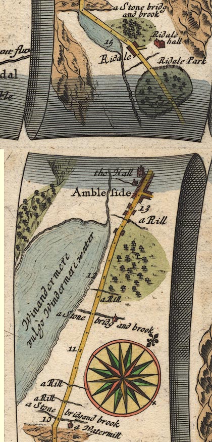 OG96m010.jpg In mile 13, Westmoreland. "Ambleside" houses each side of the road and a side street. item:- JandMN : 22 Image © see bottom of page |
||||||||||||||||||||||||||||
|
|
|||||||||||||||||||||||||||||
| evidence:- | old map:- Berry 1679 placename:- Ambleside |
||||||||||||||||||||||||||||
| source data:- | Road map, diagram, The Grand Roads of England, engraved by John
Rich, made and published by William Berry, at the Sign of the
Globe, London, 1679. "Ambleside" market Wednesday |
||||||||||||||||||||||||||||
|
|
|||||||||||||||||||||||||||||
| evidence:- | old map:- Seller 1694 (Wmd) placename:- Ambleside |
||||||||||||||||||||||||||||
| source data:- | Map, hand coloured engraving, Westmorland, scale about 8 miles
to 1 inch, by John Seller, 1694. click to enlarge click to enlargeSEL7.jpg "Ambleside" circle, italic lowercase text; settlement or house item:- Dove Cottage : 2007.38.87 Image © see bottom of page |
||||||||||||||||||||||||||||
|
|
|||||||||||||||||||||||||||||
| evidence:- | old map:- Morden 1695 (EW) placename:- Ambleside |
||||||||||||||||||||||||||||
| source data:- | Map, hand coloured engraving, England, including Wales, scale
about 27 miles to 1 inch, by Robert Morden, published by Abel
Swale Awnsham and John Churchil, London, about 1695. click to enlarge click to enlargeMRD3Cm.jpg "Ambleside" circle; village or town item:- JandMN : 339 Image © see bottom of page |
||||||||||||||||||||||||||||
|
|
|||||||||||||||||||||||||||||
| evidence:- | old map:- Morden 1695 (Cmd) placename:- Amble Side |
||||||||||||||||||||||||||||
| source data:- | Map, uncoloured engraving, Cumberland, scale about 4 miles to 1
inch, by Robert Morden, 1695, published by Abel Swale, the
Unicorn, St Paul's Churchyard, Awnsham, and John Churchill, the
Black Swan, Paternoster Row, London, 1695-1715.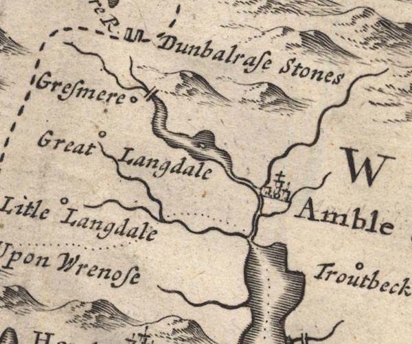 MD12NY30.jpg "Amble Side" Circle, buildings, towers, with a cross. item:- JandMN : 90 Image © see bottom of page |
||||||||||||||||||||||||||||
|
|
|||||||||||||||||||||||||||||
| evidence:- | old map:- Morden 1695 (Wmd) placename:- Ambleside placename:- Amboglana |
||||||||||||||||||||||||||||
| source data:- | Map, hand coloured engraving, Westmorland, scale about 2.5 miles to 1 inch, by Robert
Morden, published by Abel Swale, the Unicorn, St Paul's Churchyard, Awnsham, and John
Churchill, the Black Swan, Paternoster Row, London, 1695.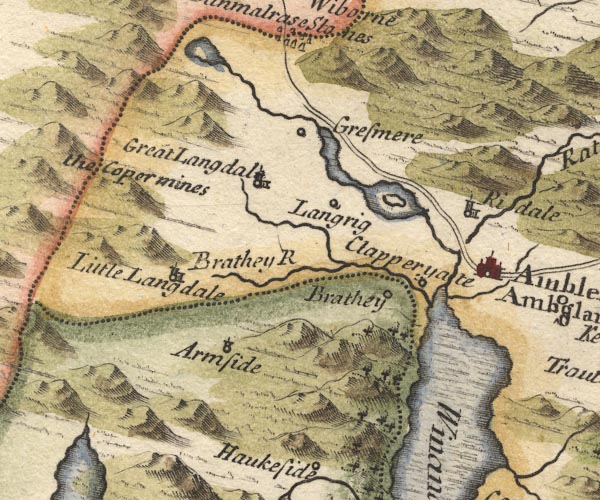 MD10NY30.jpg "Ambleside / Amboglana" Circle, buildings, towers. item:- JandMN : 24 Image © see bottom of page |
||||||||||||||||||||||||||||
|
|
|||||||||||||||||||||||||||||
| evidence:- | old map, descriptive text:- Bowen 1720 (plate 260) placename:- Ambleside placename:- Amblogand item:- roman coin; coin, roman; market |
||||||||||||||||||||||||||||
| source data:- | Road strip map, uncoloured engraving, pl.260, The Road from
Kendal to Cockermouth, scale about 2 miles to 1 inch, with
sections in Westmorland and Cumberland, published by Emanuel
Bowen, St Katherines, London, 1720.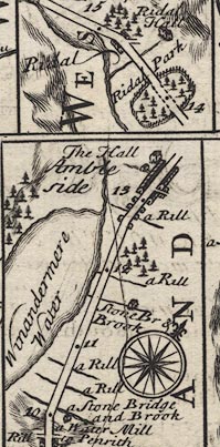 B260m10.jpg "Ambleside (at 13) Conjectured by some to be ye Amblogand of ye Romans, from ye Ruins of an old Roman Fortification & Coyns &c. has a Mt. on Wedn. well stored wth. Provisions." item:- private collection : 1.260 Image © see bottom of page |
||||||||||||||||||||||||||||
|
|
|||||||||||||||||||||||||||||
| evidence:- | old map:- Badeslade 1742 placename:- Ambleside |
||||||||||||||||||||||||||||
| source data:- | Maps, Westmorland North from London, scale about 10 miles to 1
inch, and Cumberland North from London, scale about 11 miles to
1 inch, with descriptive text, by Thomas Badeslade, London,
engraved and published by William Henry Toms, Union Court,
Holborn, London, 1742; published 1742-49. "Ambleside Market Wednesday." |
||||||||||||||||||||||||||||
|
|
|||||||||||||||||||||||||||||
| evidence:- | old map:- Badeslade 1742 placename:- Ambleside |
||||||||||||||||||||||||||||
| source data:- | Map, uncoloured engraving, A Map of Westmorland North from
London, scale about 10 miles to 1 inch, with descriptive text,
by Thomas Badeslade, London, engraved and published by William
Henry Toms, Union Court, Holborn, London, 1742. click to enlarge click to enlargeBD12.jpg "Ambleside" circle, tower/s, upright lowercase text; town item:- Dove Cottage : 2007.38.62 Image © see bottom of page |
||||||||||||||||||||||||||||
|
|
|||||||||||||||||||||||||||||
| evidence:- | descriptive text:- Simpson 1746 placename:- Ambleside placename:- Amboglana item:- market |
||||||||||||||||||||||||||||
| source data:- | Atlas, three volumes of maps and descriptive text published as
'The Agreeable Historian, or the Compleat English Traveller
...', by Samuel Simpson, 1746. goto source goto sourcePage 1024:- "..." "Ambleside, is another Town noted for a Manufacture of Cloth, on the upper Corner of Winander Mere. Its Market is well stored with Provisions, which is kept on Wednesday." goto sourcePage 1025:- "..." "Amboglana, which if we regard the Analogy of Names, can be placed no where more conveniently than at Ambleside upon Winander Mere, and the rather, because it shews the Ruins of an old City, and other Marks of Aniquity, and several Medals of Gold. Silver, and Copper, have been found here, some of which were in that Collection which Mr. Brathwate of Ambleside gave in 1674 to the University Library at Oxford." |
||||||||||||||||||||||||||||
|
|
|||||||||||||||||||||||||||||
| evidence:- | old map:- Simpson 1746 map (Wmd) placename:- Ambleside |
||||||||||||||||||||||||||||
| source data:- | Map, uncoloured engraving, Westmorland, scale about 8 miles to 1
inch, printed by R Walker, Fleet Lane, London, 1746.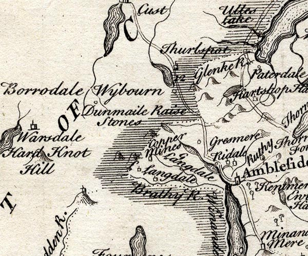 SMP2NYF.jpg "Ambleside" Building; labelled as a town. item:- Dove Cottage : 2007.38.59 Image © see bottom of page |
||||||||||||||||||||||||||||
|
|
|||||||||||||||||||||||||||||
| evidence:- | old map:- Bickham 1753-54 (Wmd) placename:- Ambleside |
||||||||||||||||||||||||||||
| source data:- | Map, uncoloured engraving, perspective view, A Map of
Westmorland, North from London, by George Bickham, James Street,
Bunhill Fields, London, 1753.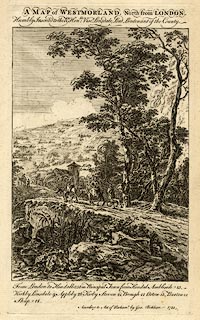 click to enlarge click to enlargeBCK3.jpg "Ambleside" view (sort of) item:- Armitt Library : 2008.14.71 Image © see bottom of page |
||||||||||||||||||||||||||||
|
|
|||||||||||||||||||||||||||||
| evidence:- | old map:- Bowen and Kitchin 1760 placename:- Ambleside |
||||||||||||||||||||||||||||
| source data:- | Map, hand coloured engraving, A New Map of the Counties of
Cumberland and Westmoreland Divided into their Respective Wards,
scale about 4 miles to 1 inch, by Emanuel Bowen and Thomas
Kitchin et al, published by T Bowles, Robert Sayer, and John
Bowles, London, 1760.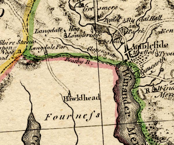 BO18SD29.jpg "Ambleside Mar. Wed." blocks, on road, street plan, town, market item:- Armitt Library : 2008.14.10 Image © see bottom of page |
||||||||||||||||||||||||||||
|
|
|||||||||||||||||||||||||||||
| evidence:- | old map:- Jefferys 1770 (Wmd) placename:- Ambleside placename:- Amboglana |
||||||||||||||||||||||||||||
| source data:- | Map, 4 sheets, The County of Westmoreland, scale 1 inch to 1
mile, surveyed 1768, and engraved and published by Thomas
Jefferys, London, 1770.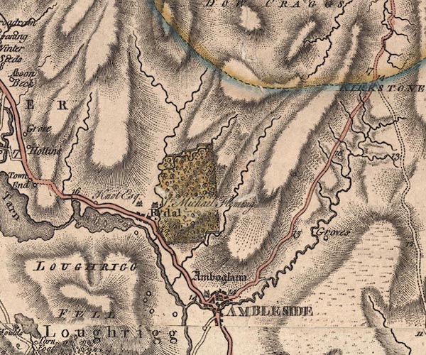 J5NY30NE.jpg "AMBLESIDE" blocks on a street plan, labelled in block caps; settlement, market town?, streets; and "Amboglana" antiquity item:- National Library of Scotland : EME.s.47 Image © National Library of Scotland |
||||||||||||||||||||||||||||
|
|
|||||||||||||||||||||||||||||
| evidence:- | old map:- Jefferys 1770 placename:- Ambleside placename:- Amboglana |
||||||||||||||||||||||||||||
| source data:- | Map, 4 sheets, The County of Westmoreland, scale 1 inch to 1
mile, surveyed 1768, and engraved and published by Thomas
Jefferys, London, 1770.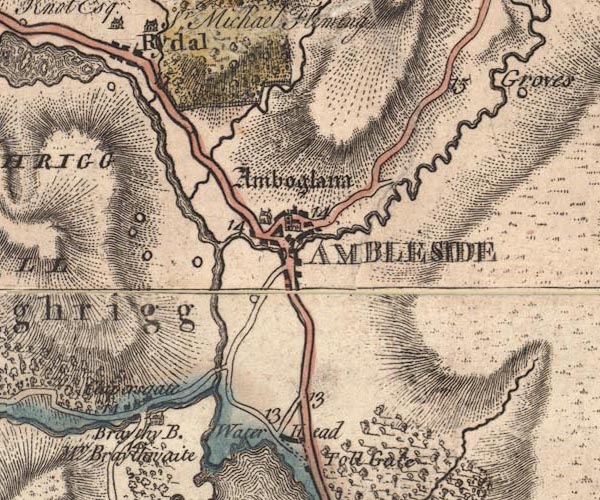 JEF5Ambl.jpg "AMBLESIDE / Amboglana" blocks on a street plan, church, large house item:- National Library of Scotland : EME.s.47 Image © National Library of Scotland |
||||||||||||||||||||||||||||
|
|
|||||||||||||||||||||||||||||
| evidence:- | old map:- Pennant 1777 placename:- Ambleside |
||||||||||||||||||||||||||||
| source data:- | Map, hand coloured engraving, A Map of Scotland, Hebrides and
Part of England, drawn for Thomas Pennant, engraved by J Bayly,
published by Benjamin White, London, 1777.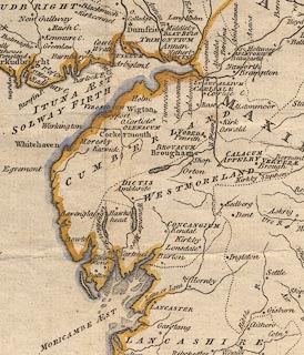 click to enlarge click to enlargePEN1Cm.jpg "DICTIS / Ambleside" circle; buildings, village, etc item:- private collection : 66 Image © see bottom of page |
||||||||||||||||||||||||||||
|
|
|||||||||||||||||||||||||||||
| evidence:- | descriptive text:- West 1778 (11th edn 1821) placename:- Amboglana placename:- Dictis |
||||||||||||||||||||||||||||
| source data:- | Guide book, A Guide to the Lakes, by Thomas West, published by
William Pennington, Kendal, Cumbria once Westmorland, and in
London, 1778 to 1821. goto source Page 71, footnote:- "On the banks of Windermere-water, have been lately built many elegant villas; ... These objects, as works of art, most of which are done in styles suitable to their situation, give an air of consequence to the country, and, with the surrounding natural beauties, have lately made this neighbourhood, and particularly about Ambleside, a place of the greatest celebrity." "..." goto sourcePage 75:- "AMBLESIDE [1]." "..." "[1] (Amboglana, Notit. Imper. Dictis. Horsley).- Though the author has not mentioned the circumstance, it is supposed that the natural beauties of this part of the country are equal in variety and perfection to any to be seen in the tour, and that the lover of landscape in viewing many an undescribed scene, would be highly gratified and delighted. But it is judged best not to descend into particulars. Let the admirer of rural nature please himself in their discovery as well as examination." "Also, if the tourist love mountainous prospects, he may meet with one, in about a three hour's ride from this place, that will not fail to please him. It is on Low-pike, in Rydal-park, ..." goto sourceAddendum; Mr Gray's Journal, 1769 Page 212:- "..." "I now reached Ambleside, sixteen miles from Keswick, meaning to lie there; but on looking into the best bed-chamber, dark and damp as a cellar, grew delicate, ... [1] ..." "[1] By not staying a little at Ambleside, Mr. Gray lost the sight of two magnificent cascades: the one not half a mile behind the inn, the other down Rydal-crag, where Sir Michael le Fleming is now making a pathway to the top of it. ..." "(The inn at Ambleside has been greatly improved since Mr. Gray's time, and now as commodious as any in the country.)" |
||||||||||||||||||||||||||||
|
|
|||||||||||||||||||||||||||||
| evidence:- | old map:- Crosthwaite 1783-94 (Win/Ble) placename:- Ambleside |
||||||||||||||||||||||||||||
| source data:- | Map, uncoloured engraving, An Accurate Map of the Grand Lake of
Windermere, scale about 2 inches to 1 mile, by Peter
Crosthwaite, Keswick, Cumberland, 1783, version published 1819. CT9NY30S.jpg "Ambleside" circle and buildings, town item:- Armitt Library : 2008.14.102 Image © see bottom of page |
||||||||||||||||||||||||||||
|
|
|||||||||||||||||||||||||||||
| evidence:- | old map:- West 1784 map placename:- Ambleside |
||||||||||||||||||||||||||||
| source data:- | Map, hand coloured engraving, A Map of the Lakes in Cumberland,
Westmorland and Lancashire, scale about 3.5 miles to 1 inch,
engraved by Paas, 53 Holborn, London, about 1784. Ws02NY30.jpg "AMBLESIDE" item:- Armitt Library : A1221.1 Image © see bottom of page |
||||||||||||||||||||||||||||
|
|
|||||||||||||||||||||||||||||
| evidence:- | old text:- Clarke 1787 placename:- Ambleside item:- market; fair; court of pie powder; Tip Fair; apple tree; weaving; tanyard; bread, charity |
||||||||||||||||||||||||||||
| source data:- | Guide book, A Survey of the Lakes of Cumberland, Westmorland,
and Lancashire, written and published by James Clarke, Penrith,
Cumberland, and in London etc, 1787; published 1787-93. goto source Page 131:- "..." "King James the II. granted to the inhabitants of Ambleside a weekly market on Wednesday, and two fairs in the year, with a court of Pie-powder to be holden before his Steward: The profits arising from the said fairs and market shall be for the use of the poor inhabitants of the town of Ambleside. A poor salary indeed! for the market frequently begins at twelve o'clock, and ends at noon! It hath one tolerable good fair, viz. on the 29th of October, commonly called the Tip-Fair. There is on that day a good shew of long-horned heifers, and Tips, which here sell at great prices: The country meet to drink, and dance as at wakes, and the steward reads the charter." "Ambleside is a long rambling awkward town, (see plate X.) pleasantly situated amongst woods of all kinds, which thrive here remarkably; apple trees, of which there are great numbers, bear surprizingly well in this place. The trade of this town is not" goto sourcePage 132:- "very considerable, but the inhabitants are very industrious; the woman spin wool, the men (and some women) weave linseys, kerseys, and other coarse cloths. There is a tan-yard of pretty considerable account, managed lately by Mr William Holm, ..." "There are at Ambleside several donations to the poor, of money, bread, &c. that ease the estates from that burden The school-house was built and endowed by a Mr Kelsick of Ambleside, ... The chapel is a low mean building, and stands in the parish of Grassmere; ..." "..." "There was formerly a family of the name of Brathwaites here, of considerable note; for I find, in the reign of Queen Elizabeth, that Gawan Brathwaite of Ambleside, Thomas Brathwaite, &c. were inquisitors several times upon a post mortem. The last Thomas Brathwaite of Ambleside had a large collection of Roman coins, ... The Brathwaites once were owners" goto sourcePage 133:- "of Wythburn manor, Low-Wray, Brimhim park, Brathay, the Finery Heath at Cunza, &c. all which are now sold to different people." |
||||||||||||||||||||||||||||
|
|
|||||||||||||||||||||||||||||
| evidence:- | old map:- Clarke 1787 map (Windermere N) placename:- Ambleside |
||||||||||||||||||||||||||||
| source data:- | Map, A Map of the Northern Part of the Lake Winandermere and its
Environs, scale about 6.5 ins to 1 mile, by James Clarke,
engraved by Samuel John Neele, 352 Strand, published by James
Clarke, Penrith, Cumberland and in London etc, 1787. CLANY30S.jpg  CLANY30R.jpg "AMBLESIDE" item:- private collection : 10.10 Image © see bottom of page |
||||||||||||||||||||||||||||
|
|
|||||||||||||||||||||||||||||
| evidence:- | old map:- Clarke 1787 map (Ambleside to Keswick) placename:- Ambleside |
||||||||||||||||||||||||||||
| source data:- | Map, A Map of the Roads Lakes etc between Keswick and Ambleside,
scale about 2.5 ins to 1 mile, by James Clarke, engraved by S J
Neele, 352 Strand, published by James Clarke, Penrith,
Cumberland and in London etc, 1787. CL9NY30X.jpg "AMBLESIDE" item:- private collection : 10.9 Image © see bottom of page |
||||||||||||||||||||||||||||
|
|
|||||||||||||||||||||||||||||
| evidence:- | old text:- Camden 1789 (Gough Additions) placename:- Ambleside item:- knitting |
||||||||||||||||||||||||||||
| source data:- | Book, Britannia, or A Chorographical Description of the Flourishing Kingdoms of England,
Scotland, and Ireland, by William Camden, 1586, translated from the 1607 Latin edition
by Richard Gough, published London, 1789. goto source Page 155:- "..." "Ambleside is a small town, whose inhabitants knit and spin for Kendal market. It is in Windermere and Gresmere parish, and has a chapel augmented by queen Anne's bounty, and a school founded by Mr. John Kelwich 1723." |
||||||||||||||||||||||||||||
|
|
|||||||||||||||||||||||||||||
| evidence:- | old map:- Cary 1789 (edn 1805) placename:- Ambleside |
||||||||||||||||||||||||||||
| source data:- | Map, uncoloured engraving, Westmoreland, scale about 2.5 miles
to 1 inch, by John Cary, London, 1789; edition 1805. CY24NY30.jpg "AMBLESIDE" group of blocks, town plan, church, labelled in block caps; town item:- JandMN : 129 Image © see bottom of page |
||||||||||||||||||||||||||||
|
|
|||||||||||||||||||||||||||||
| evidence:- | old print with text:- Farington 1789 item:- Amboglana; roman fort, Ambleside; Numerus Nerviorum Dictentium |
||||||||||||||||||||||||||||
| source data:- | Print, uncoloured engraving, View of Ambleside, Westmorland, drawn by Joseph Farington,
engraved by T Medland, published by W Byrne, 69 Titchfield Street, London, 1789. click to enlarge click to enlargeFA0116.jpg printed, bottom, left, right and centre "Drawn by Josh. Farington, R.A. / Engraved by T. Medland. / View of AMBLESIDE. / London: Published as the Act directs, 1 Jany. 1789, by W. Byrne, No.79, Titchfield Street." Descriptive text, probably by William Cookson VIEW of AMBLESIDE. AMBLESIDE is situated on the swift Decline of a Hill, over which many high Mountains rise towards the North. In Camden's Time, various ruins of the antient Amboglana of the Romans were to be seen here. Near the Head of Windermere, and at a little Distance from the Point where this View was taken, is the Vestige of a Roman Station. It lies in a Meadow on a Level with the Lake, and, as supposed, was called the Dictis, where a Part of the Cohort of the Numerus Nerviorum Dictentium was stationed. The Extent of the Fortress, as he gives Dimensions, was one hundred and thirty-two Ells in Length and eighty in Breadth. Its Form an oblong Square with obtuse Angles. It is placed near the Meeting of all the Roads from Penrth, Keswick, Ravenglass, Furness and Kendal, which it commanded, and was accessible only on one Side. Roman Bricks, Urns, and other earthen Vessels, Coins, Mill-Stones or Quern-Stones, as he calls them, were frequently found here. The natural Beauties of this Part of the Country are of a very superior Order. It would scarcely be partial to say that a greater variety of romantic and picturesque Scenery is to be found in the Neighbourhood of Ambleside, than can be met with in any other Part of this interesting Country within the same Compass. item:- Armitt Library : A6669.16 Image © see bottom of page |
||||||||||||||||||||||||||||
|
|
|||||||||||||||||||||||||||||
| evidence:- | old map:- Aikin 1790 (Wmd) placename:- Ambleside |
||||||||||||||||||||||||||||
| source data:- | Map, uncoloured engraving, Westmoreland ie Westmorland, scale
about 8.5 miles to 1 inch, by John Aikin, London, 1790. click to enlarge click to enlargeAIK2.jpg "Ambleside" circle; town item:- JandMN : 51 Image © see bottom of page |
||||||||||||||||||||||||||||
|
|
|||||||||||||||||||||||||||||
| evidence:- | old map:- Bailey 1797 placename:- Ambleside |
||||||||||||||||||||||||||||
| source data:- | Map, soil etc, uncoloured engraving, Westmoreland, scale about
12 miles to 1 inch, by J Bailey, engraved by Neele, Strand,
published by Messrs Robinson, Paternoster Row and G Nicol, Pall
Mall, London, 1797. click to enlarge click to enlargeBY05.jpg "Ambleside" group of blocks; town item:- Armitt Library : A680.3 Image © see bottom of page |
||||||||||||||||||||||||||||
|
|
|||||||||||||||||||||||||||||
| evidence:- | road book:- Cary 1798 (2nd edn 1802) placename:- Ambleside |
||||||||||||||||||||||||||||
| source data:- | Road book, itineraries, Cary's New Itinerary, by John Cary, 181
Strand, London, 2nd edn 1802. goto source click to enlarge click to enlargeC38317.jpg page 317-318 "Ambleside" market town item:- JandMN : 228.1 Image © see bottom of page |
||||||||||||||||||||||||||||
|
|
|||||||||||||||||||||||||||||
| evidence:- | old map:- Cooke 1802 placename:- Ambleside |
||||||||||||||||||||||||||||
| source data:- | Map, Westmoreland ie Westmorland, scale about 12 miles to 1
inch, by George Cooke, 1802, published by Sherwood, Jones and
Co, Paternoster Road, London, 1824. click to enlarge click to enlargeGRA1Wd.jpg "Ambleside / 281" blocks, upright lowercase text; town, distance from London item:- Hampshire Museums : FA2000.62.4 Image © see bottom of page |
||||||||||||||||||||||||||||
|
|
|||||||||||||||||||||||||||||
| evidence:- | old map:- Cooke 1802 placename:- Ambleside |
||||||||||||||||||||||||||||
| source data:- | Map, The Lakes, Westmorland and Cumberland, scale about 8.5
miles to 1 inch, engravedby Neele and Son, published by
Sherwood, Jones and Co, Paternoster Road, London, 1824. click to enlarge click to enlargeGRA1Lk.jpg "Ambleside" blocks, upright lowercase text; town item:- Hampshire Museums : FA2000.62.5 Image © see bottom of page |
||||||||||||||||||||||||||||
|
|
|||||||||||||||||||||||||||||
| evidence:- | old map:- Luffman 1803 placename:- Ambleside |
||||||||||||||||||||||||||||
| source data:- | Map, hand coloured engraving, Westmoreland ie Westmorland, scale
about 37 miles to 1 inch, by John Luffman, 28 Little Bell Alley,
Coleman Street, London, 1803-06. click to enlarge click to enlargeLUF4.jpg "Ambleside" circle; town item:- Dove Cottage : 2007.38.46 Image © see bottom of page |
||||||||||||||||||||||||||||
|
|
|||||||||||||||||||||||||||||
| evidence:- | old text:- Gents Mag item:- roman fort; museum |
||||||||||||||||||||||||||||
| source data:- | Magazine, The Gentleman's Magazine or Monthly Intelligencer or
Historical Chronicle, published by Edward Cave under the
pseudonym Sylvanus Urban, and by other publishers, London,
monthly from 1731 to 1922. goto source Gentleman's Magazine 1805 p.920 "... Ambleside is a little straggling town, shutting up the pass to the vales of Ulswater and Keswick, and indebted for much of its interest to its situation. This is celebrated by the Antiquaries as the well-selected station of a Roman encampment, the site of which presented a natural barrier to the incursions of an enemy. Curiosity has not been deficient in exploring, nor has industry failed to accumulate, the rich relics of military valour; for here the very guides are Philosophers, and a town is poor indeed that cannot boast a Museum!" |
||||||||||||||||||||||||||||
|
|
|||||||||||||||||||||||||||||
| evidence:- | old map:- Laurie and Whittle 1806 placename:- Ambleside |
||||||||||||||||||||||||||||
| source data:- | Road map, Completion of the Roads to the Lakes, scale about 10
miles to 1 inch, by Nathaniel Coltman? 1806, published by Robert
H Laurie, 53 Fleet Street, London, 1834. click to enlarge click to enlargeLw18.jpg "Ambleside 278½" market town; distance from London; travellers supplied with post horses or carriages item:- private collection : 18.18 Image © see bottom of page |
||||||||||||||||||||||||||||
|
|
|||||||||||||||||||||||||||||
| evidence:- | old text:- Capper 1808 placename:- Ambleside item:- population; market; woollens |
||||||||||||||||||||||||||||
| source data:- | Gazetteer, A Topographical Dictionary of the United Kingdom,
compiled by Benjamin Pitts Capper, published by Richard
Phillips, Bridge Street, Blackfriars, London, 1808; published
1808-29. goto source "..." "AMBLESIDE, a market town in the parish of Grassmere and Windermere, Kendal ward, Westmoreland, 13 miles from Kendal, and 274 from London; contains 118 houses and 538 inhabitants. It stands at the upper end of the celebrated lake of Windermere, a branch of which passes through the town. ... The town itself was formerly a city, built by the Romans after the reduction of the Brigantes. Horsley says it was called Dictus. Here is a considerable manufactory for woollen cloth, which is sent from hence to Kendal. Below the town is a waterfall, the town standing on the steep decline of a hill. The market is on Wednesday. - Burn's History of Westmoreland, and Guide to the Lakes." "..." |
||||||||||||||||||||||||||||
|
|
|||||||||||||||||||||||||||||
| evidence:- | old map:- Cooper 1808 placename:- Ambleside |
||||||||||||||||||||||||||||
| source data:- | Map, hand coloured engraving, Westmoreland ie Westmorland, scale
about 9 miles to 1 inch, by H Cooper, 1808, published by R
Phillips, Bridge Street, Blackfriars, London, 1808. click to enlarge click to enlargeCOP4.jpg "Ambleside" circle with two side bars; town item:- Dove Cottage : 2007.38.53 Image © see bottom of page |
||||||||||||||||||||||||||||
|
|
|||||||||||||||||||||||||||||
| evidence:- | old text:- Green 1810 placename:- Ambleside |
||||||||||||||||||||||||||||
| source data:- | Set of prints, soft ground etchings, Sixty Studies from Nature,
by William Green, Ambleside, Westmorland, drawn 1808-10,
published 1810. goto source page 7:- "..." "Ambleside and Keswick are the places principally from which the English lakes, and the mountains and vallies lying around them, are visited." "..." goto sourcepage 8:- "[the] beauties of Ambleside are numerous and highly interesting, as all will see who shall ascend to Skelgill; or visit Troutbeck, by the public road from Ambleside or Low Wood; Windermere; the vales of Great and Little Langdale; the various accesses to Loughrigg Fell, and tracing the lines upon that fell best calculated for the exhibition of its various panoramic scenes; the road from Rothay Bridge to Grasmere church, keeping the river and lakes on the right hand; Stock Gill; Scandale Beck; Rydal: the water-falls and park at Rydal; Sweden Bridge by Scandale lane, returning on the opposite side of the stream, and over the bridge at Nookend to Ambleside; Wansfell Pike; Fairfield; and various other charming places in which this district so luxuriantly abounds." "..." page 9:- "'till Ambleside and Keswick shall be more equally and generally known, no popular decision can with propriety be given in favour of either the one or the other place. The writer, not only for visual gratification, but for study, prefers Ambleside, after having with great attention examined both districts; and under the influence of this feeling, he settled himself at Ambleside." "..." |
||||||||||||||||||||||||||||
|
|
|||||||||||||||||||||||||||||
| evidence:- | old text:- Green 1810 placename:- Ambleside |
||||||||||||||||||||||||||||
| source data:- | Set of prints, soft ground etchings, Sixty Studies from Nature,
by William Green, Ambleside, Westmorland, drawn 1808-10,
published 1810. goto source page 13:- "[from the lake] ... Ambleside in a line with Scandale fell, exhibits various detached, and pleasantly planted houses, several of them built by Robert Partridge, Esq. and one of them, Covey Cottage, is his residence. Near the Kendal road and about two hundred yards from the head of the lake, stands a good house, the property of William Newton, Esq. who resides there; and nearer the lake, the comfortable habitation of that respectable yeoman, Mr. Thomas Jackson." |
||||||||||||||||||||||||||||
|
|
|||||||||||||||||||||||||||||
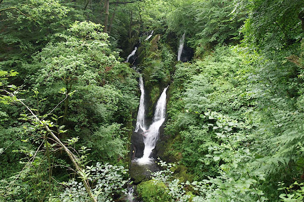
| evidence:- | old text:- Green 1810 item:- mill |
||||||||||||||||||||||||||||
| source data:- | Set of prints, soft ground etchings, Sixty Studies from Nature,
by William Green, Ambleside, Westmorland, drawn 1808-10,
published 1810. goto source page 20:- "..." "The Mills in Ambleside are four, namely, a corn mill, a bark mill, a woollen factory, and a turnery of wood and ivory; they are all upon Stock Gill." "..." |
||||||||||||||||||||||||||||
|
|
|||||||||||||||||||||||||||||
| evidence:- | old map:- Wallis 1810 (Wmd) placename:- Ambleside |
||||||||||||||||||||||||||||
| source data:- | Road map, Westmoreland, scale about 19 miles to 1 inch, by James
Wallis, 77 Berwick Street, Soho, 1810, published by W Lewis,
Finch Lane, London, 1835? click to enlarge click to enlargeWAL5.jpg "Ambleside / 281" town; distance from London item:- JandMN : 63 Image © see bottom of page |
||||||||||||||||||||||||||||
|
|
|||||||||||||||||||||||||||||
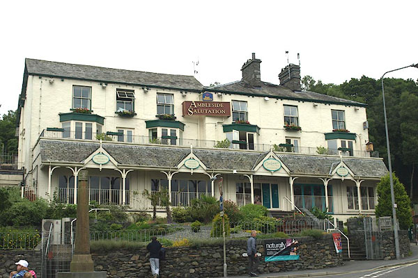
| evidence:- | descriptive text:- Wallis 1810 placename:- Ambleside |
||||||||||||||||||||||||||||
| source data:- | Map, Westmoreland, scale about 19 miles to 1 inch, and
Cumberland, scale about 16 miles to 1 inch, by James Wallis, 77
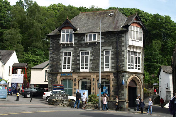
Berwick Street, Soho, London, 1810; published 1810-36. "PRINCIPAL INNS, RECOMMENDED TO TRAVELLERS AND FAMILIES." "Ambleside: The Salutation." "..." "PRINCIPAL FAIRS." "Ambleside: Wednesday after Whit-Sunday, horned cattle; October 29, horned cattle and sheep." |
||||||||||||||||||||||||||||
|
|
|||||||||||||||||||||||||||||
| evidence:- | old print:- Wilkinson 1810 (plate 11) placename:- Ambleside item:- gallery; horse; thatch |
||||||||||||||||||||||||||||
| source data:- | Print, uncoloured soft ground etching, Cottages at Ambleside, Westmorland, by Joseph
Wilkinson, engraved by William Frederick Wells, published by R Ackermann, Repository
of Arts, 101 Strand, London, 1810.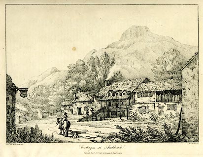 click to enlarge click to enlargeWKN111.jpg Plate 11 in Select Views in Cumberland, Westmoreland, and Lancashire. printed at bottom left, right, centre:- "Revd. Jos. Wilkenson delt. / W. F. Wells sct. / Cottages at Ambleside. / Publish'd Novr. 1. 1810. by R. Ackermann. 101. Strand. London." item:- Fell and Rock Climbing Club : MN4.11 Image © see bottom of page |
||||||||||||||||||||||||||||
|
|
|||||||||||||||||||||||||||||
| evidence:- | old text:- Green 1814 placename:- Ambleside |
||||||||||||||||||||||||||||
| source data:- | Set of prints, soft ground etchings, Sixty Small Prints, with
text, A Description of a Series of Sixty Small Prints, by
William Green, Ambleside, Westmorland, 1814. goto source page 3:- "AMBLESIDE and Keswick are the principal places from which the English lakes, and mountains and vallies lying around them, are visited." "Keswick is generally first seen by tourists from Ireland, Scotland, and the north and east of England; and Ambleside by those from the south." "..." goto sourcepage 6:- "..." "Ambleside is not a mile north of the head of Windermere." "Ambleside is 16 miles from Keswick, 40 from Whitehaven, 10 from Ulls Water, 25 from Penrith, 14 from Kendal, 6 from Bowness, 5 from Hawkshead, 8 from Coniston Waterhead, and 21 miles from Ulverstone." |
||||||||||||||||||||||||||||
|
|
|||||||||||||||||||||||||||||
| evidence:- | old map:- Otley 1818 placename:- Ambleside |
||||||||||||||||||||||||||||
| source data:- | Map, uncoloured engraving, The District of the Lakes,
Cumberland, Westmorland, and Lancashire, scale about 4 miles to
1 inch, by Jonathan Otley, 1818, engraved by J and G Menzies,
Edinburgh, Scotland, published by Jonathan Otley, Keswick,
Cumberland, et al, 1833. OT02NY30.jpg "AMBLESIDE" item:- JandMN : 48.1 Image © see bottom of page |
||||||||||||||||||||||||||||
|
|
|||||||||||||||||||||||||||||
| evidence:- | old map:- Hall 1820 (Wmd) placename:- Ambleside |
||||||||||||||||||||||||||||
| source data:- | Map, hand coloured engraving, Westmoreland ie Westmorland, scale
about 14.5 miles to 1 inch, by Sidney Hall, London, 1820,
published by Samuel Leigh, 18 Strand, London, 1820-31. click to enlarge click to enlargeHA18.jpg "Ambleside / 278" circle, upright lowercase text; town; distance from London item:- Armitt Library : 2008.14.58 Image © see bottom of page |
||||||||||||||||||||||||||||
|
|
|||||||||||||||||||||||||||||
| evidence:- | old print:- Fielding and Walton 1821 (plate 15) placename:- Ambleside |
||||||||||||||||||||||||||||
| source data:- | Print, coloured aquatint, Ambleside, Westmorland, drawn by Theodore H A Fielding,
published by R Ackermann, 101 Strand, London, 1821.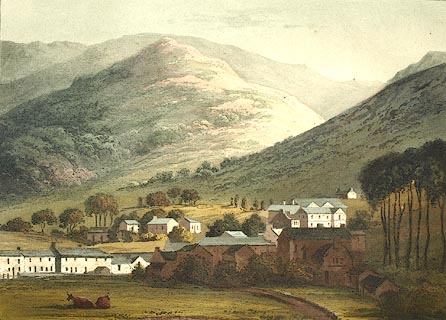 click to enlarge click to enlargeFW0115.jpg Tipped in opposite p.76 in A Picturesque Tour of the English Lakes. item:- Dove Cottage : 1993.R566.15 Image © see bottom of page |
||||||||||||||||||||||||||||
|
|
|||||||||||||||||||||||||||||
| evidence:- | descriptive text:- Otley 1823 (5th edn 1834) item:- population, Ambleside |
||||||||||||||||||||||||||||
| source data:- | Guide book, A Concise Description of the English Lakes, the
mountains in their vicinity, and the roads by which they may be
visited, with remarks on the mineralogy and geology of the
district, by Jonathan Otley, published by the author, Keswick,
Cumberland now Cumbria, by J Richardson, London, and by Arthur
Foster, Kirkby Lonsdale, Cumbria, 1823; published 1823-49,
latterly as the Descriptive Guide to the English Lakes. goto source Page 102:- "AMBLESIDE" "Is an ancient chartered town; with a population of 1095, but its market is little more than nominal. It is irregularly built upon a rising ground, commanding good prospects of the adjacent scenery. Post Chaises are kept at the Salutation and Commercial Inns, and there are two other Public Houses that accommodate travellers; besides several houses fitted up as private lodgings. Boats upon the Lake of Windermere are also provided by the Inns." goto sourcePage 105:- "A variety of shorter excursions may be made from Ambleside; a walk of seven hundred yards from the inn, to the waterfall of Stock Gill, will not be neglected; and one of a mile and a half may be taken to the falls of Rydal. A ramble round the lakes of Rydal and Grasmere - round, or over Loughrigg Fell - a more elevated walk to Wansfell Pike - or the still more lofty circuit of Fairfield, on a favourable opportunity - will not fail to please such as delight in extensive prospects. Those who have not already seen Coniston, may take an excursion thither: and Ullswater may also be visited from hence, by the steep carriage road over Kirkstone. Some who travel on horseback might choose a ride over the mountains Wrynose and Hardknot, through the vale of Eskdale to the Strands in Nether Wasdale, about 24 miles; and next day by Wast Water, Styhead, and Borrowdale, to Keswick 20 miles." |
||||||||||||||||||||||||||||
|
|
|||||||||||||||||||||||||||||
| evidence:- | old map:- Greenwood 1824 (Wmd) placename:- Ambleside |
||||||||||||||||||||||||||||
| source data:- | Map, hand coloured engraving, Map of the County of Westmorland,
scale about 1 inch to 1 mile, by C and J Greenwood, published by
George Pringle jnr, 70 Queen Street, Cheapside, London, 1824. grw5ambl.jpg "AMBLESIDE" street map; labelled in block caps for a market town. item:- Armitt Library : A1827 Image © see bottom of page |
||||||||||||||||||||||||||||
|
|
|||||||||||||||||||||||||||||
| evidence:- | old text:- Gents Mag item:- roman finds |
||||||||||||||||||||||||||||
| source data:- | Magazine, The Gentleman's Magazine or Monthly Intelligencer or
Historical Chronicle, published by Edward Cave under the
pseudonym Sylvanus Urban, and by other publishers, London,
monthly from 1731 to 1922. goto source Gentleman's Magazine 1825 part 1 p.514 From the Compendium of County History:- "At AMBLESIDE have been found innumerable Roman antiquities. Part of a Roman Bridge still remains." |
||||||||||||||||||||||||||||
|
|
|||||||||||||||||||||||||||||
| evidence:- | old drawing:- Flower 1830s placename:- Ambleside |
||||||||||||||||||||||||||||
| source data:- | Drawing, pencil, Cottages at Ambleside, Westmorland, by John Flower, 1834.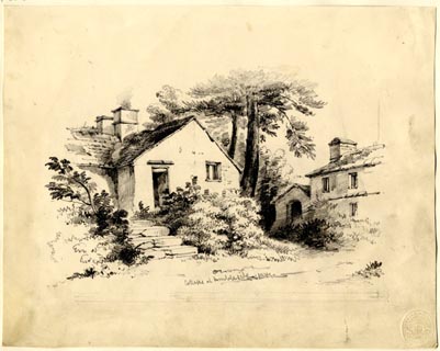 click to enlarge click to enlargePR1865.jpg ms, lower centre "Cottages at Ambleside. 1834." item:- Armitt Library : 1959.66.8 Image © see bottom of page |
||||||||||||||||||||||||||||
|
|
|||||||||||||||||||||||||||||
| evidence:- | old drawing:- Flower 1830s placename:- Ambleside |
||||||||||||||||||||||||||||
| source data:- | Drawing, pencil, Ambleside, Smithy Brow from North Road, Westmorland, by John Flower,
1830s?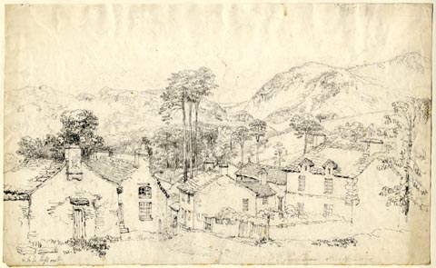 click to enlarge click to enlargePR1857.jpg ms, lower right "Ambleside" item:- Armitt Library : 1959.100 Image © see bottom of page |
||||||||||||||||||||||||||||
|
|
|||||||||||||||||||||||||||||
| evidence:- | old drawing:- Flower 1830s item:- Mill Cottage |
||||||||||||||||||||||||||||
| source data:- | Drawing, pencil, Cottage at Ambleside, Westmorland, by John Flower, 1830s?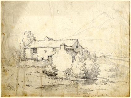 click to enlarge click to enlargePR1856.jpg ms, lower right "Cottage at Ambleside" item:- Armitt Library : 1959.98 Image © see bottom of page |
||||||||||||||||||||||||||||
|
|
|||||||||||||||||||||||||||||
| evidence:- | old drawing:- Flower 1830s placename:- Ambleside |
||||||||||||||||||||||||||||
| source data:- | Drawing, pencil, Ambleside, Westmorland, by John Flower, 1830s?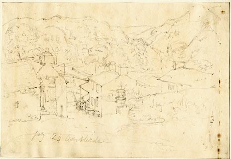 click to enlarge click to enlargePR1866.jpg ms, lower left "July 24 Ambleside" item:- Armitt Library : 1959.66.9 Image © see bottom of page |
||||||||||||||||||||||||||||
|
|
|||||||||||||||||||||||||||||
| evidence:- | descriptive text:- Ford 1839 (3rd edn 1843) placename:- Ambleside item:- population, Ambleside; market day |
||||||||||||||||||||||||||||
| source data:- | Guide book, A Description of Scenery in the Lake District, by
Rev William Ford, published by Charles Thurnam, Carlisle, by W
Edwards, 12 Ave Maria Lane, Charles Tilt, Fleet Street, William
Smith, 113 Fleet Street, London, by Currie and Bowman,
Newcastle, by Bancks and Co, Manchester, by Oliver and Boyd,
Edinburgh, and by Sinclair, Dumfries, 1839. goto source Page 32:- "..." "AMBLESIDE," "A small market-town, romantically situated in the vale of Brathay, and half-encircled by a range of stately mountains. It is a mile north of the head of Windermere, and is built in pleasing irregularity on the side of a hill, commanding prospects of the vale, the parks of Rydal, Brathay, and Windermere, amongst which the various outlets and approaches wind interestingly, detaining the tourist at every step by new combinations and unexpected beauties. Excellent fare can be had at the Salutation, Commercial, and White Lion inns, and in lodgings. From its central station, the town is frequently made the head-quarters of tourists for a considerable time, as within the compass of seven miles are the following lakes;- Windermere, Esthwaite Water, Elter Water, Coniston, Rydal Water, Grasmere, and Ulles Water. It was formerly the site of a Roman station; ruined wall and traces of fortifications are discernible, and armour and coins have been found. Most of the houses have been rebuilt or altered; the old market-house, also, which was supported on pillars and galleried round, shared the same fate in 1796, so that the town now" goto sourcePage 33:- "wears a modern appearance, and although deprived of many of those delightful studies which enamoured the artist Green, possesses more of internal comfort. The chapel, standing at the north end of the town, on an elevated station, was rebuilt in 1822, by a rate; it had been made parochial in 1675, by the Bishop of Chester. The town also reaps the benefit of a well-endowed grammar-school, founded by John Kelswick in 1721." "Such is the suitable position of Ambleside, that several short walks and excursions may be taken; and these again can be agreeably varied by others of greater distance, and requiring longer time." goto sourcePage 161:- "..." "AMBLESIDE is a small market-town in the vale of the Rothay, romantically built on the side of a hill, commanding prospects of the vale, the parks of Rydal and Brathay, and Windermere. Excellent quarters may be found at the Salutation, the Commercial, and White Lion inns; and from its central situation, the town is generally made the head-quarters of tourists for a considerable time, as many very interesting excursions may be made from it. Population, 1095; market-day, Wednesday." goto sourcePage 161:- "..." "VIII. AMBLESIDE EXCURSIONS." "PLEASANT walks and excursions will serve to engage the tourist for several days at Ambleside." "Stockgill Force must not be overlooked. Scandale Beck and Sweden Bridge are delightful evening walks. Wansfell and Skelgill afford prospects from a moderate elevation, which may be accomplished without incurring much fatigue." goto sourcePage 162:- "Loughrigg Fell and Tarn are not to be surpassed, the former in its command of Windermere, Rydal, and Grasmere waters - the latter for the quiet, pastoral character of the scenery, which it presents to the eye that delights in simple, unadorned nature." "A more extended excursion generally performed from Ambleside, is that into Langdale, ..." goto sourcePage 163:- "... bring him again to Ambleside, after a circuit of nineteen miles, viz.:"
|
||||||||||||||||||||||||||||
|
|
|||||||||||||||||||||||||||||
| evidence:- | old map:- Ford 1839 map placename:- Ambleside |
||||||||||||||||||||||||||||
| source data:- | Map, uncoloured engraving, Map of the Lake District of
Cumberland, Westmoreland and Lancashire, scale about 3.5 miles
to 1 inch, published by Charles Thurnam, Carlisle, and by R
Groombridge, 5 Paternoster Row, London, 3rd edn 1843. FD02NY30.jpg "AMBLESIDE" item:- JandMN : 100.1 Image © see bottom of page |
||||||||||||||||||||||||||||
|
|
|||||||||||||||||||||||||||||
| evidence:- | old drawing:- Aspland 1840s-60s placename:- Ambleside |
||||||||||||||||||||||||||||
| source data:- | Drawing, pencil, Ambleside, Westmorland, by Theophilus Lindsey Aspland, about 1845
or 1846.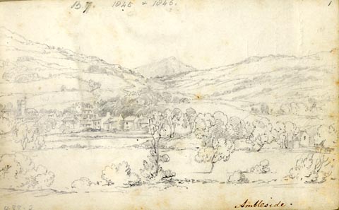 click to enlarge click to enlargeAS0202.jpg "Ambleside." and page number "B7. 1845 & 1846. / 1" item:- Armitt Library : 1958.488.2 Image © see bottom of page |
||||||||||||||||||||||||||||
|
|
|||||||||||||||||||||||||||||
| evidence:- | old drawing:- Aspland 1840s-60s placename:- Ambleside |
||||||||||||||||||||||||||||
| source data:- | Drawing, pencil, Ambleside, Westmorland, by Theophilus Lindsey Aspland, 27 August
1845.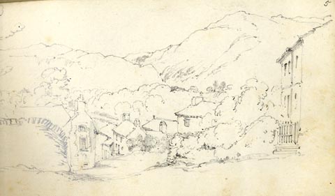 click to enlarge click to enlargeAS0297.jpg "Ambleside / Aug 27 / 45" page number "5" item:- Armitt Library : 1958.488.97 Image © see bottom of page |
||||||||||||||||||||||||||||
|
|
|||||||||||||||||||||||||||||
| evidence:- | old drawing:- Aspland 1840s-60s placename:- Ambleside |
||||||||||||||||||||||||||||
| source data:- | Drawing, pencil, Ambleside, Westmorland, by Theophilus Lindsey Aspland, about 10 July
1846.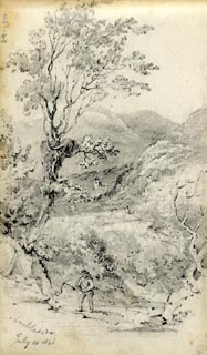 click to enlarge click to enlargeAS0245.jpg "Ambleside / July 10 1846" page number "41" item:- Armitt Library : 1958.488.45 Image © see bottom of page |
||||||||||||||||||||||||||||
|
|
|||||||||||||||||||||||||||||
| evidence:- | old drawing:- Aspland 1840s-60s |
||||||||||||||||||||||||||||
| source data:- | Drawing, pencil, Ambleside? Westmorland, by Theophilus Lindsey Aspland, 1849.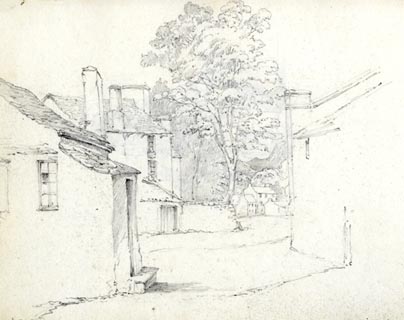 click to enlarge click to enlargeAS0115.jpg item:- Armitt Library : 1958.487.15 Image © see bottom of page |
||||||||||||||||||||||||||||
|
|
|||||||||||||||||||||||||||||
| evidence:- | old drawing:- Aspland 1840s-60s placename:- Ambleside |
||||||||||||||||||||||||||||
| source data:- | Drawing, pencil, Ambleside, Westmorland, by Theophilus Lindsey Aspland, 7 August 1849.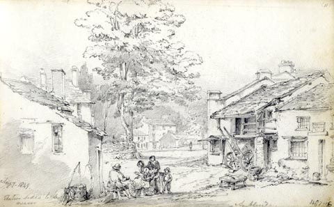 click to enlarge click to enlargeAS0116.jpg "Aug 7. 1849. / The two sides to be nearer" "Ambleside" item:- Armitt Library : 1958.487.16 Image © see bottom of page |
||||||||||||||||||||||||||||
|
|
|||||||||||||||||||||||||||||
| evidence:- | old map:- Garnett 1850s-60s H placename:- Ambleside |
||||||||||||||||||||||||||||
| source data:- | Map of the English Lakes, in Cumberland, Westmorland and
Lancashire, scale about 3.5 miles to 1 inch, published by John
Garnett, Windermere, Westmorland, 1850s-60s. GAR2NY30.jpg "AMBLESIDE" blocks, settlement, and two crosses, the old and new churches item:- JandMN : 82.1 Image © see bottom of page |
||||||||||||||||||||||||||||
|
|
|||||||||||||||||||||||||||||
 Martineau Directory 1855 Martineau Directory 1855 |
|||||||||||||||||||||||||||||
|
|
|||||||||||||||||||||||||||||
| evidence:- | old text:- Martineau 1855 item:- bath; market cross |
||||||||||||||||||||||||||||
| source data:- | Guide book, A Complete Guide to the English Lakes, by Harriet
Martineau, published by John Garnett, Windermere, Westmorland,
and by Whittaker and Co, London, 1855; published 1855-76. goto source Page 42:- "The descent to all the Ambleside inns is steep,- past the old church, and through a narrow street, and into the space dignified with the name of the market-place, and actually exhibiting an ancient market-cross. Half-a-dozen of the few shops of the town are in or about the market-place, and the Salutation and Commercial Inns and the White Lion, the three principal inns, are all conspicuous in it. ..." "..." goto sourcePage 44:- "... The traveller can hardly be wrong in his choice of an inn, as all three are comfortable and well served. At present there are no baths in the place;- a singular deficiency where there is so much of company on the one hand and of water on the other. The inconvenience is, however, in the way of being remedied; and it is to be hoped that another season will not arrive without a provision of this needful refreshment for the dusty and tired traveller,- to say nothing of the residents, who must desire it for purposes of health as well as enjoyment." |
||||||||||||||||||||||||||||
|
|
|||||||||||||||||||||||||||||
| evidence:- | old print:- Nelson 1859 placename:- Ambleside |
||||||||||||||||||||||||||||
| source data:- | Print, Nelson print, Ambleside, Westmorland, published by T Nelson and Sons, London
etc, 1859. click to enlarge click to enlargeNS0501.jpg printed, bottom "AMBLESIDE." item:- Armitt Library : 2003.13.1 Image © see bottom of page |
||||||||||||||||||||||||||||
|
|
|||||||||||||||||||||||||||||
| evidence:- | perhaps old photograph:- Payn 1867 item:- fishing |
||||||||||||||||||||||||||||
| source data:- | Photograph, sepia, Beck Fishing, probably near Ambleside, Westmorland, by Garnett
and Sproat, published by J Garnett, Windermere, Westmorland, 1867.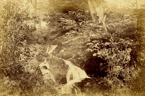 click to enlarge click to enlargePN0314.jpg Tipped in opposite p.29 of The Lakes in Sunshine, text by James Payn. printed at bottom:- "BECK FISHING." item:- Fell and Rock Climbing Club : 184.14 Image © see bottom of page |
||||||||||||||||||||||||||||
|
|
|||||||||||||||||||||||||||||
| evidence:- | old print:- Payn 1867 placename:- Ambleside |
||||||||||||||||||||||||||||
| source data:- | Print, uncoloured engraving, Windermere Lake and Ambleside, from Claife, Lancashire,
by T L Aspland, published by J Garnett, Windermere, Westmorland, 1867.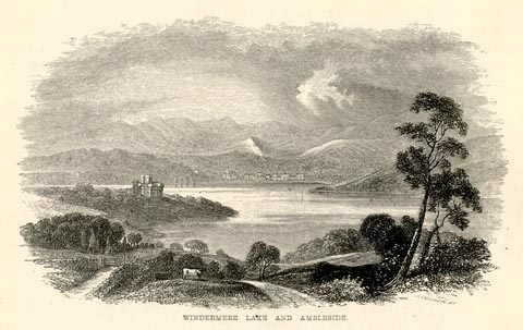 click to enlarge click to enlargePN0327.jpg On p.54 of The Lakes in Sunshine, text by James Payn. printed at bottom:- "WINDERMERE LAKE AND AMBLESIDE." item:- Fell and Rock Climbing Club : 184.27 Image © see bottom of page |
||||||||||||||||||||||||||||
|
|
|||||||||||||||||||||||||||||
| evidence:- | old map:- Prior 1874 map 1 placename:- Ambleside |
||||||||||||||||||||||||||||
| source data:- | Map, uncoloured engraving or lithograph? Winander Mere, scale
about 2.5 miles to 1 inch, published by John Garnett,
Windermere, Westmorland, 1874.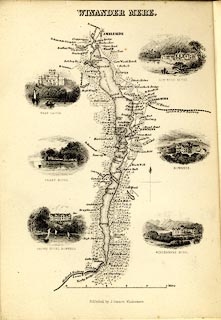 click to enlarge click to enlargePI03M1.jpg "AMBLESIDE" block/s; building/s item:- private collection : 133.1 Image © see bottom of page |
||||||||||||||||||||||||||||
|
|
|||||||||||||||||||||||||||||
| evidence:- | old itinerary:- Tinsley 1877 (Roads/Cum) placename:- Ambleside |
||||||||||||||||||||||||||||
| source data:- | Itinerary, route 7, London to Whitehaven via the Lake Districts, including from Settle,
Lancashire; through Kirkby Lonsdale, Kendal, Ambleside, Westmorland; then Keswick,
Cockermouth to Whitehaven, Cumberland, published by Tinsley Bros, 8 Catherine Street,
Strand, London, 1877.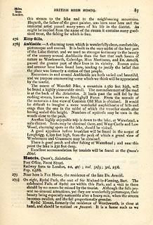 click to enlarge click to enlargeTLY187.jpg pp.71-91 in British High Roads, North and North Eastern Routes; pp.84-91. printed at p.71:- "... / ROUTE VII. - LONDON to WHTEHAVEN via THE LAKE / DISTRICTS. (See Maps 65 to 80.) / Hitchin (as per Route I.) 34, Shefford 41, Bedford 50, Higham-Ferrers, / 64¾, Kettering 74½, Rockingham 83¼, Uppingham 88¾, Oakham, / 94¾, Melton Mowbray 104¾, Nottingham 123¼, Rotherham 159¼, / Barnsley 171¾, Huddersfield 188¾, Halifax 196¾, Keighley 208¾, / Skipton 218¾, Settle 234¾, Kirkby Lonsdale 252½, Kendal 264½, / Ambleside 278½, Keswick 293½, Cockermouth 305½, Whitehaven / 319½. / ..." item:- private collection : 270.2 Image © see bottom of page |
||||||||||||||||||||||||||||
|
|
|||||||||||||||||||||||||||||
| evidence:- | old strip map:- Tinsley 1877 (Roads/Cum) placename:- Ambleside |
||||||||||||||||||||||||||||
| source data:- | Strip map, road map, part of London to Whitehaven, including from before Kirkby Lonsdale
through Kendal, Windermere to beyond Ambleside, Westmorland, published by Tinsley
Bros, 8 Catherine Street, Strand, London, 1877.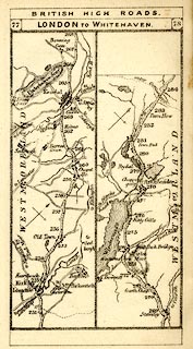 click to enlarge click to enlargeTLY1M4.jpg Map pp.77-78 in British High Roads, North and North Eastern Routes. printed at top:- "BRITISH HIGH ROADS / 77 LONDON TO WHITEHAVEN. 78" item:- private collection : 270.6 Image © see bottom of page |
||||||||||||||||||||||||||||
|
|
|||||||||||||||||||||||||||||
| Herbert Bell photographs 1890s-1900s |
|||||||||||||||||||||||||||||
|
|
|||||||||||||||||||||||||||||
| evidence:- | town plan:- placename:- Ambleside |
||||||||||||||||||||||||||||
| source data:- | Town plan, ms drawing, Plan of Ambleside, scale about 24 inches to 1 mile, by Alexander
Cameron, 1906.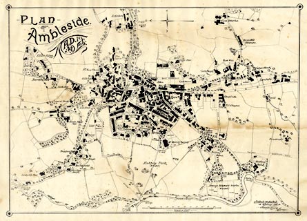 click to enlarge click to enlargeM102.jpg ms, upper left "PLAN / OF / Ambleside / A.D. 19- / AC 06." ms, lower right "Ambleside, Westmorland, / January, 1906. / Alexander Cameron, / Surveyor." item:- Armitt Library : 2001.148 Image © see bottom of page |
||||||||||||||||||||||||||||
|
|
|||||||||||||||||||||||||||||
| evidence:- | text:- Mason 1907 (edn 1930) item:- coach; Ullswater coach; Coniston coach; Windermere coach; Keswick coach; horn |
||||||||||||||||||||||||||||
| source data:- | Text book, The Ambleside Geography Books bk.III, The Counties of
England, by Charlotte M Mason, published by Kegan Paul, Trench,
Trubner and Co, Broadway House, 68-74 Carter Lane, and the
Parents' Educational Union Office, 26 Victoria Street, London,
edn 1930. MSN1P016.txt Page 16:- "..." "The market-place of ... Ambleside is a merry scene on a bright morning, when the coaches are about to start. There they are: Ullswater coach, Coniston coach, Windermere coach, Keswick coach - each with its four fine horses. The gay passengers crowd round, everybody mounts to the top, ladies and all - happy they who get the front seats - and, with a merry blast of the horn, off goes the coach." "..." "By the way, what a pleasant village, or rather town, Ambleside is,- built of the dark blue-grey rock of the slate mountains, and standing in an open valley with towering mountains round it. ..." |
||||||||||||||||||||||||||||
|
|
|||||||||||||||||||||||||||||
| evidence:- | old map:- Postlethwaite 1877 (3rd edn 1913) placename:- Ambleside |
||||||||||||||||||||||||||||
| source data:- | Map, uncoloured engraving, Map of the Lake District Mining Field, Westmorland, Cumberland,
Lancashire, scale about 5 miles to 1 inch, by John Postlethwaite, published by W H
Moss and Sons, 13 Lowther Street, Whitehaven, Cumberland, 1877 edn 1913. PST2NY30.jpg "AMBLESIDE" dots, roads item:- JandMN : 162.2 Image © see bottom of page |
||||||||||||||||||||||||||||
|
|
|||||||||||||||||||||||||||||
| evidence:- | descriptive text:- Burrow 1920s placename:- Ambleside |
||||||||||||||||||||||||||||
| source data:- | Road book, strip maps with parts in Westmorland, Cumberland etc,
irregular scales about 1.5 miles to 1 inch, by E J Burrow and
Co, Cheltenham, Gloucestershire, 1920s. "... The road runs close beside the lake [Windermere] to its northern end at Ambleside, ... Ambleside is surrounded by grand mountain scenery. The town has some quaint corners down its side streets, although wearing for the most part an essentially modern appearance. ..." |
||||||||||||||||||||||||||||
|
|
|||||||||||||||||||||||||||||
| evidence:- | old map:- Burrow 1920s |
||||||||||||||||||||||||||||
| source data:- | Road book, On the Road, Dunlop Pictorial Road Plans, volume V,
strip maps with parts in Westmorland, Cumberland etc, irregular
scale about 1.5 miles to 1 inch, by E J Burrow and Co,
Cheltenham, Gloucestershire, 1920s. EJB3Vg37.jpg item:- private collection : 17 Image © see bottom of page |
||||||||||||||||||||||||||||
|
|
|||||||||||||||||||||||||||||
| evidence:- | old photograph:- Photochrom 1930s placename:- Ambleside |
||||||||||||||||||||||||||||
| source data:- | Photograph, black and white halftone print, Ambleside, Westmorland, published by Photochrom
Co, Tunbridge Wells, Kent, 1930s? click to enlarge click to enlargePCH114.jpg printed, "Ambleside. / ..." item:- JandMN : 1015.14 Image © see bottom of page |
||||||||||||||||||||||||||||
|
|
|||||||||||||||||||||||||||||
| evidence:- | market notes:- item:- market |
||||||||||||||||||||||||||||
| source data:- | Owen: 1792: New Book of FairsMillward, Roy &Robinson, Adrian: 1970: Lake District, The: Eyre and Spottiswoode (London)Bowen, Emanuel &Kitchin, Thomas: 1760: New Map of the Counties of Cumberland and Westmoreland | ||||||||||||||||||||||||||||
|
|
|||||||||||||||||||||||||||||
| hearsay:- |
There were three earthquake events centred in the Ambleside area, 12 September 1988,
probably all on one fault, but not accurately located. It was felt over an area about
3000 sqKm with a maximum intentity 5 EMS, 'strong' on the European Macroseismic Scale.
This is felt by most people indoors, and few outdoors; buildings tremble. hanging
objects swing, china and glass clatter, doors and windows swing, and so on. There
were a few cracks in ceilings, and dust falling from beams! The events were noticed
in Ambleside, Coniston, Hawkshead, and Windermere. |
||||||||||||||||||||||||||||
|
|
|||||||||||||||||||||||||||||
| hearsay:- |
Rushbearing still takes place every year on the 'Saturday within the Octave of St
Anne's Day' which is 26 July. |
||||||||||||||||||||||||||||
|
|
|||||||||||||||||||||||||||||
| story:- |
The daughter of Rowland Hill told that:- |
||||||||||||||||||||||||||||
| "To the post office of, at that time, tiny Ambleside, came one day a well-to-do man
to buy a stamp to put on the letter he was about to post. 'Is this new reform going
to last?' he asked the postmaster. 'Certainly,' was the reply; 'it is quite established.'
Oh, well, then,' said the man, resolved to give the thing generous support, 'give
me three stamps!' ..." |
|||||||||||||||||||||||||||||
|
|
|||||||||||||||||||||||||||||
| hearsay:- |
A toffee known as 'Ambleside clag 'em' used to be made by Mary Dugdale, Mama Dugdale,
living in a cottage in Church Street. |
||||||||||||||||||||||||||||
|
|
|||||||||||||||||||||||||||||
| Post Office maps 1770-1909 |
|||||||||||||||||||||||||||||
|
|
|||||||||||||||||||||||||||||
| Ambleside, Population |
|||||||||||||||||||||||||||||
| Figures from Census returns. |
|||||||||||||||||||||||||||||
|
|||||||||||||||||||||||||||||
|
|
|||||||||||||||||||||||||||||
| evidence:- | old drawing:- TT 1850s |
||||||||||||||||||||||||||||
| source data:- | Drawing, pencil, Ambleside, Westmorland, looking across North Row, by TT, about 1850? click to enlarge click to enlargePR1804.jpg ms, lower left, centre "T.T. / Ambleside Westmorland" item:- Armitt Library : 2011.64 Image © see bottom of page |
||||||||||||||||||||||||||||
|
|
|||||||||||||||||||||||||||||
| evidence:- | old drawing:- DHL 1834 placename:- Ambleside |
||||||||||||||||||||||||||||
| source data:- | Drawing, pencil and wash colour, At Ambleside, Westmorland, by DHL, 1834. click to enlarge click to enlargePR1846.jpg ms, rev "at Ambleside Sept 23 1834 DHL" item:- Armitt Library : 1959.35.1 Image © see bottom of page |
||||||||||||||||||||||||||||
|
|
|||||||||||||||||||||||||||||
| evidence:- | old drawing:- DHL 1834 placename:- Ambleside |
||||||||||||||||||||||||||||
| source data:- | Drawing, pencil and wash colour, At Ambleside, Westmorland, by DHL, 1834. click to enlarge click to enlargePR1845.jpg ms, rev "at Ambleside Sept 23 1834 DHL" item:- Armitt Library : 1959.35.2 Image © see bottom of page |
||||||||||||||||||||||||||||
|
|
|||||||||||||||||||||||||||||
| evidence:- | old drawing:- anonymous 1811 |
||||||||||||||||||||||||||||
| source data:- | Drawing, pencil, View of Part of Windermere from Ambleside Church, Westmorland, 1811. click to enlarge click to enlargePR1808.jpg ms, pencil, lower right "11. July 1811 / View of Part of Windermere from Ambleside [Church]" item:- Armitt Library : 1959.142 Image © see bottom of page |
||||||||||||||||||||||||||||
|
|
|||||||||||||||||||||||||||||
| evidence:- | old painting:- Ibbetson 1780-1830 placename:- Ambleside |
||||||||||||||||||||||||||||
| source data:- | Painting, watercolour, Ambleside looking up Smithy Brow, Westmorland, by Julius Caesar
Ibbetson, late 18th - early 19th century.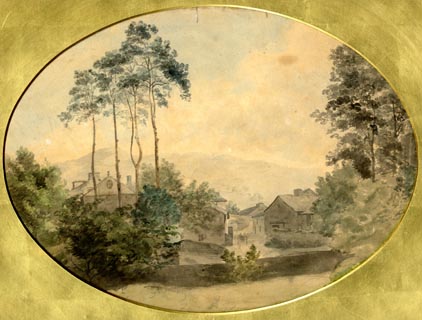 click to enlarge click to enlargePR1805.jpg ms, lower left of centre "Ibbetson" item:- Armitt Library : 1959.77 Image © see bottom of page |
||||||||||||||||||||||||||||
|
|
|||||||||||||||||||||||||||||
| evidence:- | old painting:- Green 1790s-1820s |
||||||||||||||||||||||||||||
| source data:- | Painting, watercolour, Ambleside, Westmorland, by William Green? early 19th century.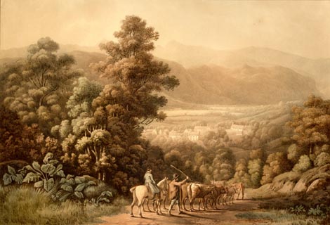 click to enlarge click to enlargePR1904.jpg item:- Armitt Library : 2001.152 Image © see bottom of page |
||||||||||||||||||||||||||||
|
|
|||||||||||||||||||||||||||||
| evidence:- | old print:- Matthew 1866 placename:- Ambleside |
||||||||||||||||||||||||||||
| source data:- | Print, engraving, Ambleside from Loughrigg Fell, Westmorland, drawn by R Howe, engraved
by J Saddler, published by J Richardson, Highgate, Kendal, Westmorland, 1866.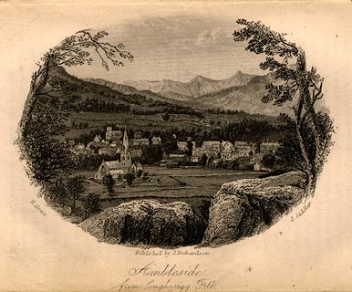 click to enlarge click to enlargeMW1E08.jpg Tipped in opposite p.62 of The English Lakes, Peaks and Passes, from Kendal to Keswick, by George King Matthew. printed at lower left, right, centre:- "R. Howe. / J. Saddler. / Published by J. Richardson, Kendal. / Ambleside from Lough-rigg Fell" item:- Armitt Library : A1168.8 Image © see bottom of page |
||||||||||||||||||||||||||||
|
|
|||||||||||||||||||||||||||||
| evidence:- | old print:- Payn 1860s-70s placename:- Ambleside |
||||||||||||||||||||||||||||
| source data:- | Print, uncoloured woodcut, Ambleside, Westmorland, published by John Garnett, Windermere,
Westmorland, and by Simpkin, Marshall and Co, London, 1860s-70s?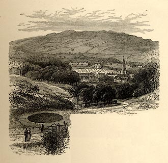 click to enlarge click to enlargePN0105.jpg On p.19 of England's Lakeland, a Tour Therein, by James Payn. item:- Armitt Library : A1183.5 Image © see bottom of page |
||||||||||||||||||||||||||||
|
|
|||||||||||||||||||||||||||||
| evidence:- | old print:- Sylvan 1847 placename:- Ambleside |
||||||||||||||||||||||||||||
| source data:- | Print, engraving, Entrance to Ambleside, Westmorland, published by John Johnstone,
Paternoster Row, London, et al, 1847.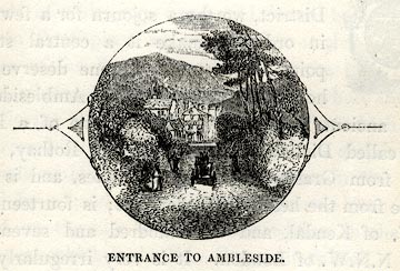 click to enlarge click to enlargeSYL110.jpg On p.43 of Sylvan's Pictorial Guide to the English Lakes. printed at bottom:- "ENTRANCE TO AMBLESIDE." item:- Armitt Library : A1201.10 Image © see bottom of page |
||||||||||||||||||||||||||||
|
|
|||||||||||||||||||||||||||||
| evidence:- | old print:- Sylvan 1847 placename:- Ambleside |
||||||||||||||||||||||||||||
| source data:- | Print, engraving, Ambleside, Seen from the Rydal Road, Westmorland, published by John
Johnstone, Paternoster Row, London, et al, 1847. click to enlarge click to enlargeSYL111.jpg On p.44 of Sylvan's Pictorial Guide to the English Lakes. printed at bottom:- "AMBLESIDE. / (SEEN FROM THE RYDAL ROAD)." item:- Armitt Library : A1201.11 Image © see bottom of page |
||||||||||||||||||||||||||||
|
|
|||||||||||||||||||||||||||||
| evidence:- | old print:- Sylvan 1847 placename:- Ambleside |
||||||||||||||||||||||||||||
| source data:- | Print, engraving, Ambleside from High Wray, Lancashire and Westmorland, published
by John Johnstone, Paternoster Row, London, et al, 1847.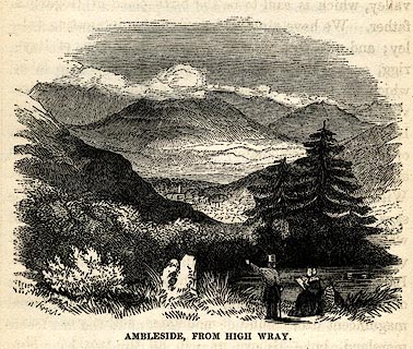 click to enlarge click to enlargeSYL120.jpg On p.64 of Sylvan's Pictorial Guide to the English Lakes. printed at bottom:- "AMBLESIDE FROM HIGH WRAY." item:- Armitt Library : A1201.20 Image © see bottom of page |
||||||||||||||||||||||||||||
|
|
|||||||||||||||||||||||||||||
| evidence:- | old advertisement:- Atkinson 1847 (5th edn 1850) item:- coach; Helvellyn, The; Skiddaw, The |
||||||||||||||||||||||||||||
| source data:- | Advertisement for coaches, The Helvellyn and The Skiddaw, running between Ambleside
and Patterdale, Westmorland, and Penrith, Cumberland, 1850.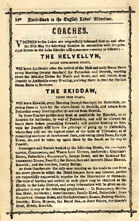 click to enlarge click to enlargeAK2A12.jpg At the end of a Handbook to the English Lakes, 5th edn. item:- Armitt Library : A1144.21 Image © see bottom of page |
||||||||||||||||||||||||||||
|
|
|||||||||||||||||||||||||||||
| evidence:- | old print:- Rose 1832-35 |
||||||||||||||||||||||||||||
| source data:- | Print, engraving, Windermere, Esthwaite Water and Ambleside from Rydal Park, by George
Pickering, engraved by J Engleheart, 1835.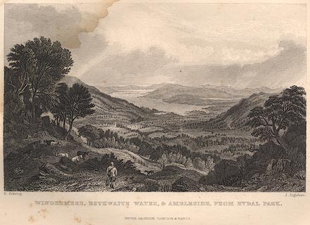 click to enlarge click to enlargeR349.jpg item:- JandMN : 66.47 Image © see bottom of page |
||||||||||||||||||||||||||||
|
|
|||||||||||||||||||||||||||||
| evidence:- | old print:- Rose 1832-35 |
||||||||||||||||||||||||||||
| source data:- | Print, engraving, Ambleside, Westmorland, by George Pickering, engraved by J Engleheart,
1835.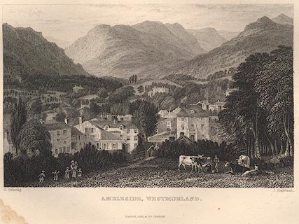 click to enlarge click to enlargeR350.jpg item:- JandMN : 66.14 Image © see bottom of page |
||||||||||||||||||||||||||||
|
|
|||||||||||||||||||||||||||||
| evidence:- | old print with text:- Farington 1789 (plate 16) |
||||||||||||||||||||||||||||
| source data:- | Print, engraving, View of Ambleside, Lakes, Cumbria, painted by Joseph Farington,
engraved by T Medland, published by W Byrne, 69 Titchfield Street, London, 1789.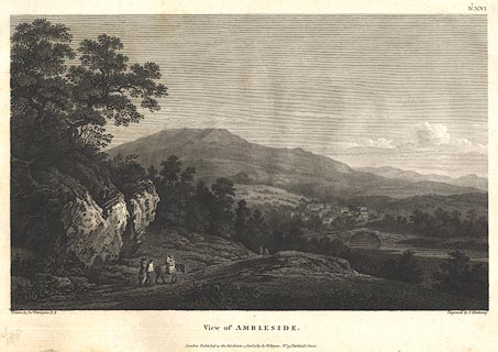 click to enlarge click to enlargeBMZ13.jpg Presumably Rothay Bridge in the foreground, Scandale Fell in the background? Plate 16 from Views of the Lakes, &c, in Cumberland and Westmorland, published 1789; with descriptive text:- "VIEW of AMBLESIDE." "AMBLESIDE is situated on the swift Decline of a Hill, over which many high Mountains rise towards the North. In Camden's Time, various ruins of the antient Amboglana of the Romans were to be seen here. Near the Head of Windermere, and at a little Distance from the Point where this View was taken, is the vestige of a Roman Station. It lies in a Meadow on a Level with the Lake, and, as supposed, was called the Dictis, where a Part of the Cohort of the Numerous Dictentium was stationed. The Extent of the Fortress, as he gives Dimensions, was one hundred and thirty-two Ells in Length and eighty in Breadth. Its Form an oblong Square with obtuse Angles. It is placed near the Meeting of all the Roads from Penrith, Keswick, Ravenglass, Furness and Kendal, which it commanded, and was accessible only on one Side. Roman Bricks, Urns, and other earthen Vessels, Coins, Mill-Stones or Quern-Stones, as he calls them, were frequently found here. The natural Beauties of this Part of the Country are of a very superior Order. It would scarcely be partial to say that a greater Variety of romantic and picturesque Scenery is to be found in the Neighbourhood of Ambleside, than can be met with in any other Part of this interesting Country within the same Compass." item:- Dove Cottage : Lowther.14 Image © see bottom of page |
||||||||||||||||||||||||||||
|
|
|||||||||||||||||||||||||||||
| evidence:- | old print:- Middiman 1784-92 (pl.17) item:- road |
||||||||||||||||||||||||||||
| source data:- | Print, engraving, View near Ambleside, Westmorland, drawn by F Wheatly with figures
by J Heath, engraved by Samuel Middiman, about 1785.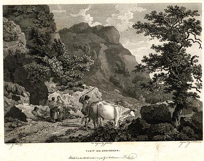 click to enlarge click to enlargePR0505.jpg A mountain path, travellers resting and talking, cattle, etc. Plate 17 from Select Views in Great Britain, engraved by Samuel Middiman, published by Samuel Middiman, 3 Grafton Street, Tottenham Court Road, London, 1784-92. printed at bottom:- "Drawn by F. Wheatly. The Figures by J. Heath. Engraved by S. Middiman. / VIEW near AMBLESIDE. / Published as the Act directs, Decr. 12, 1785, by S. Middiman, London." item:- Dove Cottage : 2008.107.454 Image © see bottom of page |
||||||||||||||||||||||||||||
|
|
|||||||||||||||||||||||||||||
| evidence:- | old drawing:- placename:- Ambleside |
||||||||||||||||||||||||||||
| source data:- | Drawing, ink, Ambleside, from Fox How, Westmorland, by Jane Arnold, no date.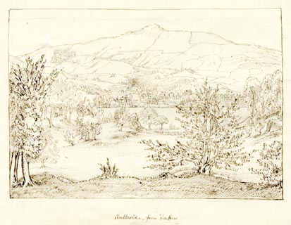 click to enlarge click to enlargePR1875.jpg "Ambleside, from Fox How" item:- Armitt Library : 1958.3774.4 Image © see bottom of page |
||||||||||||||||||||||||||||
|
|
|||||||||||||||||||||||||||||
| William Green prints 1809-1820s |
|||||||||||||||||||||||||||||
|
|
|||||||||||||||||||||||||||||
| evidence:- | old drawing:- placename:- Ambleside |
||||||||||||||||||||||||||||
| source data:- | Drawing, Ambleside from Crow How, Westmorland, by William Havell, 1800s-10s.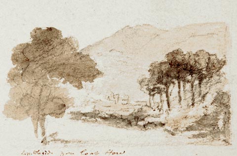 click to enlarge click to enlargePR1390.jpg Two clumps of trees frame the view of distant hills. One of a set of twenty views of the Lake District executed by the artist on one sheet of paper. at bottom:- "Ambleside from Crow How" item:- Tullie House Museum : 2009.89.34 Image © Tullie House Museum |
||||||||||||||||||||||||||||
|
|
|||||||||||||||||||||||||||||
| evidence:- | old drawing:- placename:- Ambleside |
||||||||||||||||||||||||||||
| source data:- | Drawing, Ambleside from Crow How, Westmorland, by William Havell, 1800s-10s.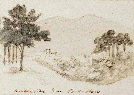 click to enlarge click to enlargePR1393.jpg View of Ambleside from Crow How. Town in centre, framed by trees on either side with hills in background. One of a set of twenty views of the lake district executed by the artist on one sheet of paper. at bottom:- "Ambleside from Crow How" item:- Tullie House Museum : 2009.89.37 Image © Tullie House Museum |
||||||||||||||||||||||||||||
|
|
|||||||||||||||||||||||||||||
| evidence:- | old drawing:- placename:- Ambleside |
||||||||||||||||||||||||||||
| source data:- | Drawing, Ambleside from the Butts, Westmorland, by William Havell, 1800s-10s. click to enlarge click to enlargePR1395.jpg View of Ambleside in wooded setting with hills in background. One of a set of twenty views of the lake district executed by the artist on one sheet of paper. at bottom:- "Ambleside from the Butts" item:- Tullie House Museum : 2009.89.39 Image © Tullie House Museum |
||||||||||||||||||||||||||||
|
|
|||||||||||||||||||||||||||||
| evidence:- | old drawing:- placename:- Ambleside |
||||||||||||||||||||||||||||
| source data:- | Drawing, Ambleside from the Gale, Westmorland, by William Havell, 1800s-10s.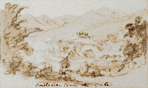 click to enlarge click to enlargePR1396.jpg View of Ambleside from above in wooded setting with hills in background. One of a set of twenty views of the lake district executed by the artist on one sheet of paper. at bottom:- "Ambleside from the Gale" item:- Tullie House Museum : 2009.89.40 Image © Tullie House Museum |
||||||||||||||||||||||||||||
|
|
|||||||||||||||||||||||||||||
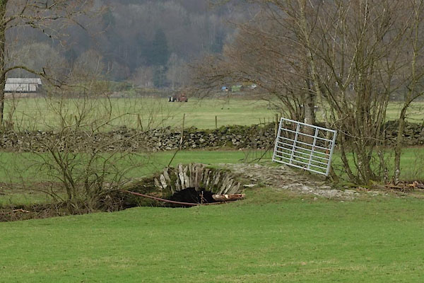
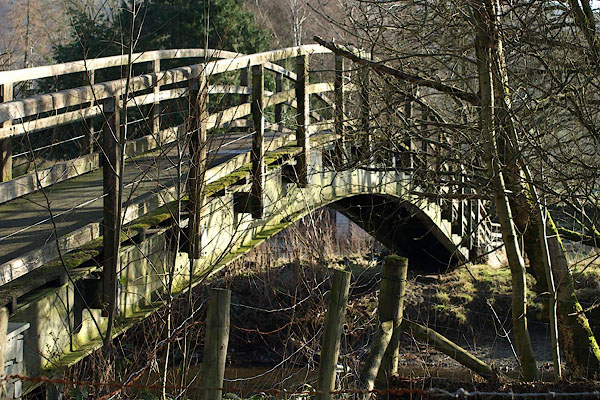
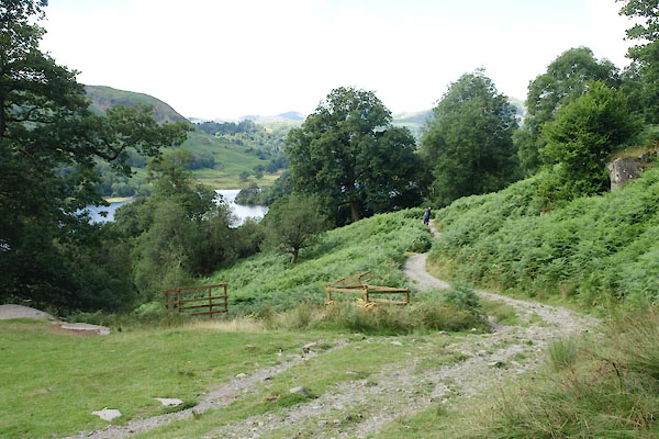
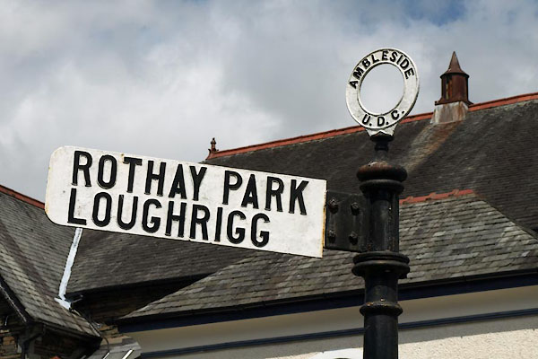
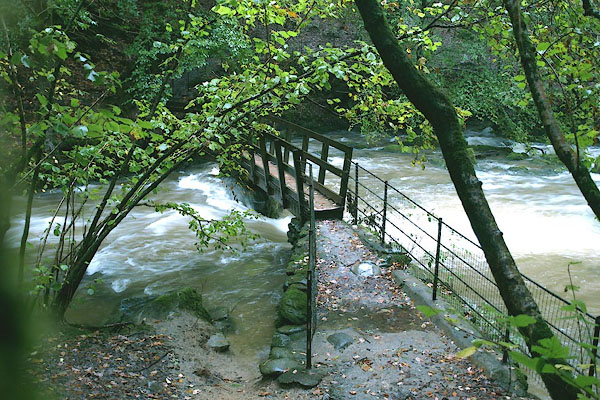
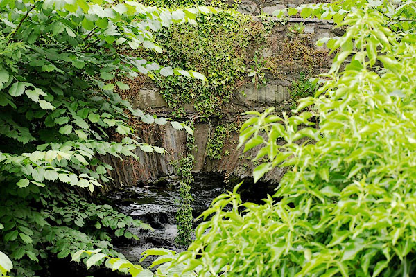
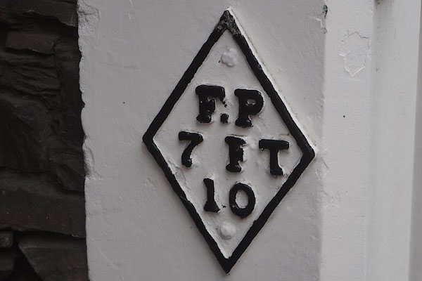
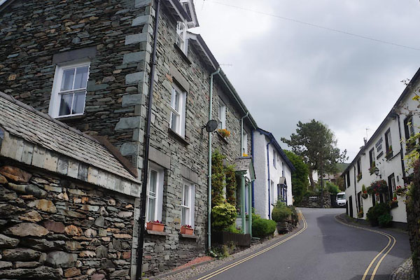
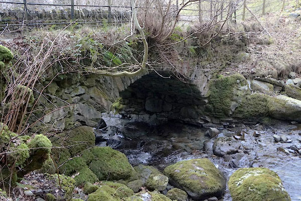
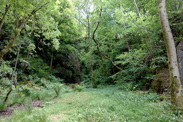
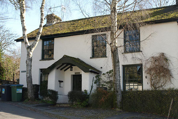
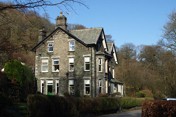
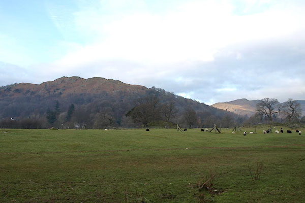
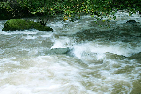
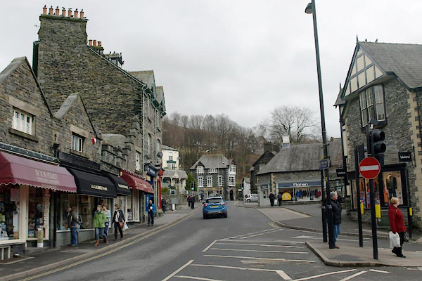
 CDZ75.jpg (taken 22.9.2015)  Click to enlarge BZT98.jpg (taken 30.1.2014)  BQV87.jpg View up the Stock Gill from the lower bridge. (taken 20.6.2009) 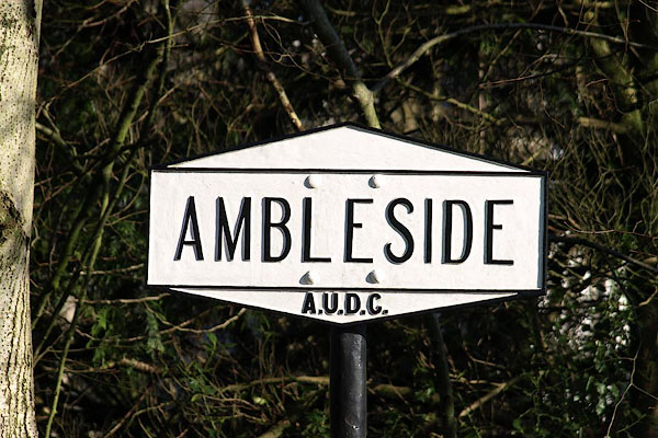 BOR05.jpg Signpost. Ambleside Urban District Council (taken 15.2.2008) 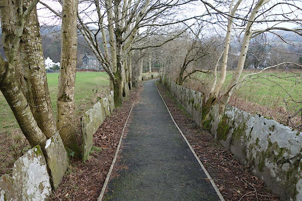 BZU05.jpg Footpath. (taken 30.1.2014) |
|||||||||||||||||||||||||||||
|
|
|||||||||||||||||||||||||||||
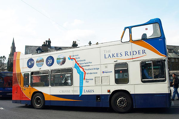 BPB71.jpg Open top bus calling at Ambleside bus stance. (taken 21.4.2008) 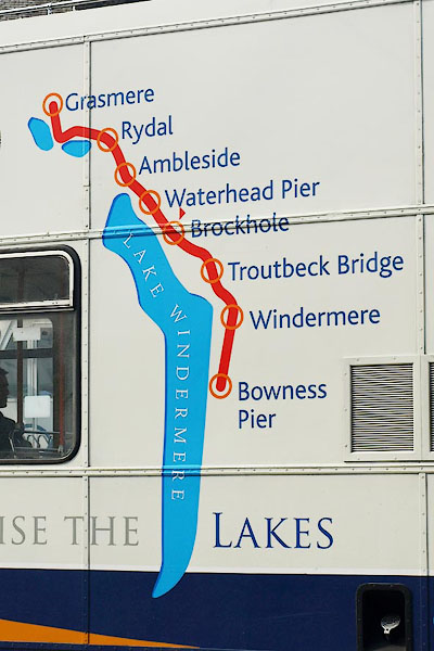 BPB72.jpg Map on the side of a bus. (taken 21.4.2008) |
|||||||||||||||||||||||||||||
|
|
|||||||||||||||||||||||||||||
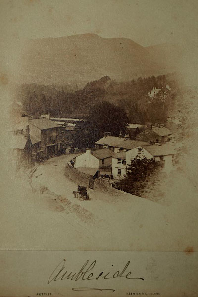 BXV75.jpg (taken 14.2.2013) 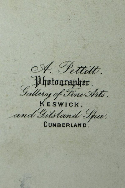 BXV76.jpg "A. Pettitt, / Photographer. / Gallery of Fine Arts, / KESWICK / and Gilsland Spa, / CUMBERLAND." (taken 14.2.2013) |
|||||||||||||||||||||||||||||
|
|
|||||||||||||||||||||||||||||
| date:- | 1650 |
||||||||||||||||||||||||||||
| period:- | 17th century, late | ||||||||||||||||||||||||||||
| item:- | charter; market charter |
||||||||||||||||||||||||||||
| Market charter granted 1650, Wednesday market. |
|||||||||||||||||||||||||||||
|
|
|||||||||||||||||||||||||||||
| places:- |
|
||||||||||||||||||||||||||||
|
|||||||||||||||||||||||||||||
|
|||||||||||||||||||||||||||||
|
|||||||||||||||||||||||||||||
|
|||||||||||||||||||||||||||||
|
|||||||||||||||||||||||||||||
|
|||||||||||||||||||||||||||||
|
|||||||||||||||||||||||||||||
|
|||||||||||||||||||||||||||||
|
|||||||||||||||||||||||||||||
|
|||||||||||||||||||||||||||||
|
|||||||||||||||||||||||||||||
|
|||||||||||||||||||||||||||||
|
|||||||||||||||||||||||||||||
|
|||||||||||||||||||||||||||||
|
|||||||||||||||||||||||||||||
|
|||||||||||||||||||||||||||||
|
|||||||||||||||||||||||||||||
|
|||||||||||||||||||||||||||||
|
|||||||||||||||||||||||||||||
|
|||||||||||||||||||||||||||||
|
|||||||||||||||||||||||||||||
|
|||||||||||||||||||||||||||||
|
|||||||||||||||||||||||||||||
|
|||||||||||||||||||||||||||||
|
|||||||||||||||||||||||||||||
|
|||||||||||||||||||||||||||||
|
|||||||||||||||||||||||||||||
|
|||||||||||||||||||||||||||||
|
|||||||||||||||||||||||||||||
|
|||||||||||||||||||||||||||||
|
|||||||||||||||||||||||||||||
|
|||||||||||||||||||||||||||||
|
|||||||||||||||||||||||||||||
|
|||||||||||||||||||||||||||||
|
|||||||||||||||||||||||||||||
|
|||||||||||||||||||||||||||||
|
|||||||||||||||||||||||||||||
|
|||||||||||||||||||||||||||||
|
|||||||||||||||||||||||||||||
|
|||||||||||||||||||||||||||||
|
|||||||||||||||||||||||||||||
|
|||||||||||||||||||||||||||||
|
|||||||||||||||||||||||||||||
|
|||||||||||||||||||||||||||||
|
|||||||||||||||||||||||||||||
|
|||||||||||||||||||||||||||||
|
|||||||||||||||||||||||||||||
|
|||||||||||||||||||||||||||||
|
|||||||||||||||||||||||||||||
|
|||||||||||||||||||||||||||||
|
|||||||||||||||||||||||||||||
|
|||||||||||||||||||||||||||||
|
|||||||||||||||||||||||||||||
|
|||||||||||||||||||||||||||||
|
|||||||||||||||||||||||||||||
|
|||||||||||||||||||||||||||||
|
|||||||||||||||||||||||||||||
|
|||||||||||||||||||||||||||||
|
|||||||||||||||||||||||||||||
|
|||||||||||||||||||||||||||||
|
|||||||||||||||||||||||||||||
|
|||||||||||||||||||||||||||||
|
|||||||||||||||||||||||||||||
|
|||||||||||||||||||||||||||||
|
|||||||||||||||||||||||||||||
|
|||||||||||||||||||||||||||||
|
|||||||||||||||||||||||||||||
|
|||||||||||||||||||||||||||||
|
|||||||||||||||||||||||||||||
|
|||||||||||||||||||||||||||||
|
|||||||||||||||||||||||||||||
|
|||||||||||||||||||||||||||||
|
|||||||||||||||||||||||||||||
|
|||||||||||||||||||||||||||||
|
|||||||||||||||||||||||||||||
|
|||||||||||||||||||||||||||||
|
|||||||||||||||||||||||||||||
|
|||||||||||||||||||||||||||||
|
|||||||||||||||||||||||||||||
|
|||||||||||||||||||||||||||||
|
|||||||||||||||||||||||||||||
|
|||||||||||||||||||||||||||||
|
|||||||||||||||||||||||||||||
|
|||||||||||||||||||||||||||||
|
|||||||||||||||||||||||||||||
|
|||||||||||||||||||||||||||||
|
|||||||||||||||||||||||||||||
|
|||||||||||||||||||||||||||||
|
|||||||||||||||||||||||||||||
|
|||||||||||||||||||||||||||||
|
|||||||||||||||||||||||||||||
|
|||||||||||||||||||||||||||||
|
|||||||||||||||||||||||||||||
|
|||||||||||||||||||||||||||||
|
|||||||||||||||||||||||||||||
|
|||||||||||||||||||||||||||||
|
|||||||||||||||||||||||||||||
|
|||||||||||||||||||||||||||||
|
|||||||||||||||||||||||||||||
|
|||||||||||||||||||||||||||||
|
|||||||||||||||||||||||||||||
|
|||||||||||||||||||||||||||||
|
|||||||||||||||||||||||||||||
|
|||||||||||||||||||||||||||||
|
|||||||||||||||||||||||||||||
|
|||||||||||||||||||||||||||||
|
|||||||||||||||||||||||||||||
|
|||||||||||||||||||||||||||||
|
|||||||||||||||||||||||||||||
|
|||||||||||||||||||||||||||||
|
|||||||||||||||||||||||||||||
|
|||||||||||||||||||||||||||||
|
|||||||||||||||||||||||||||||
|
|||||||||||||||||||||||||||||
|
|||||||||||||||||||||||||||||
|
|||||||||||||||||||||||||||||
|
|||||||||||||||||||||||||||||
|
|||||||||||||||||||||||||||||
|
|||||||||||||||||||||||||||||
|
|||||||||||||||||||||||||||||
|
|||||||||||||||||||||||||||||
|
|||||||||||||||||||||||||||||
|
|||||||||||||||||||||||||||||
|
|||||||||||||||||||||||||||||
|
|||||||||||||||||||||||||||||
|
|||||||||||||||||||||||||||||
|
|||||||||||||||||||||||||||||
|
|||||||||||||||||||||||||||||
|
|||||||||||||||||||||||||||||
|
|||||||||||||||||||||||||||||
|
|||||||||||||||||||||||||||||
|
|||||||||||||||||||||||||||||
|
|||||||||||||||||||||||||||||
|
|||||||||||||||||||||||||||||
|
|||||||||||||||||||||||||||||
|
|||||||||||||||||||||||||||||
|
|||||||||||||||||||||||||||||
|
|||||||||||||||||||||||||||||
|
|||||||||||||||||||||||||||||
|
|||||||||||||||||||||||||||||
|
|||||||||||||||||||||||||||||
|
|||||||||||||||||||||||||||||
|
|||||||||||||||||||||||||||||
|
|||||||||||||||||||||||||||||
|
|||||||||||||||||||||||||||||
|
|||||||||||||||||||||||||||||
|
|||||||||||||||||||||||||||||
|
|||||||||||||||||||||||||||||
|
|||||||||||||||||||||||||||||
|
|||||||||||||||||||||||||||||
|
|||||||||||||||||||||||||||||
|
|||||||||||||||||||||||||||||
|
|||||||||||||||||||||||||||||
|
|||||||||||||||||||||||||||||
|
|||||||||||||||||||||||||||||
|
|||||||||||||||||||||||||||||
|
|||||||||||||||||||||||||||||
|
|||||||||||||||||||||||||||||
|
|||||||||||||||||||||||||||||
|
|||||||||||||||||||||||||||||
|
|||||||||||||||||||||||||||||
|
|||||||||||||||||||||||||||||
|
|||||||||||||||||||||||||||||
|
|||||||||||||||||||||||||||||
|
|||||||||||||||||||||||||||||
|
|||||||||||||||||||||||||||||
|
|||||||||||||||||||||||||||||
|
|||||||||||||||||||||||||||||
|
|||||||||||||||||||||||||||||
|
|||||||||||||||||||||||||||||
|
|||||||||||||||||||||||||||||
|
|||||||||||||||||||||||||||||
|
|||||||||||||||||||||||||||||
|
|||||||||||||||||||||||||||||
|
|||||||||||||||||||||||||||||
|
|||||||||||||||||||||||||||||
|
|||||||||||||||||||||||||||||
|
|||||||||||||||||||||||||||||
|
|||||||||||||||||||||||||||||
|
|||||||||||||||||||||||||||||
|
|||||||||||||||||||||||||||||
|
|||||||||||||||||||||||||||||
|
|||||||||||||||||||||||||||||
|
|||||||||||||||||||||||||||||
|
|||||||||||||||||||||||||||||
|
|||||||||||||||||||||||||||||
|
|||||||||||||||||||||||||||||
|
|||||||||||||||||||||||||||||
|
|||||||||||||||||||||||||||||
|
|||||||||||||||||||||||||||||
|
|||||||||||||||||||||||||||||
|
|||||||||||||||||||||||||||||
|
|||||||||||||||||||||||||||||
|
|||||||||||||||||||||||||||||
|
|||||||||||||||||||||||||||||
|
|||||||||||||||||||||||||||||
|
|||||||||||||||||||||||||||||
|
|||||||||||||||||||||||||||||
|
|||||||||||||||||||||||||||||
|
|||||||||||||||||||||||||||||
|
|||||||||||||||||||||||||||||
|
|||||||||||||||||||||||||||||
|
|||||||||||||||||||||||||||||
|
|||||||||||||||||||||||||||||
|
|||||||||||||||||||||||||||||
|
|||||||||||||||||||||||||||||
|
|||||||||||||||||||||||||||||
|
|||||||||||||||||||||||||||||
|
|||||||||||||||||||||||||||||
|
|||||||||||||||||||||||||||||
|
|||||||||||||||||||||||||||||
|
|||||||||||||||||||||||||||||
|
|||||||||||||||||||||||||||||
|
|||||||||||||||||||||||||||||
|
|||||||||||||||||||||||||||||
|
|||||||||||||||||||||||||||||
|
|||||||||||||||||||||||||||||
|
|||||||||||||||||||||||||||||
|
|||||||||||||||||||||||||||||
|
|||||||||||||||||||||||||||||
|
|||||||||||||||||||||||||||||
|
|||||||||||||||||||||||||||||
|
|||||||||||||||||||||||||||||
|
|||||||||||||||||||||||||||||
|
|||||||||||||||||||||||||||||
|
|||||||||||||||||||||||||||||
|
|||||||||||||||||||||||||||||
|
|||||||||||||||||||||||||||||
|
|||||||||||||||||||||||||||||
|
|||||||||||||||||||||||||||||
|
|||||||||||||||||||||||||||||
|
|||||||||||||||||||||||||||||
|
|||||||||||||||||||||||||||||
|
|||||||||||||||||||||||||||||
|
|||||||||||||||||||||||||||||
|
|||||||||||||||||||||||||||||
|
|||||||||||||||||||||||||||||
|
|||||||||||||||||||||||||||||
|
|||||||||||||||||||||||||||||
|
|||||||||||||||||||||||||||||
|
|||||||||||||||||||||||||||||
|
|||||||||||||||||||||||||||||
|
|||||||||||||||||||||||||||||
|
|||||||||||||||||||||||||||||
|
|||||||||||||||||||||||||||||
|
|||||||||||||||||||||||||||||
|
|||||||||||||||||||||||||||||
|
|||||||||||||||||||||||||||||
|
|||||||||||||||||||||||||||||
|
|||||||||||||||||||||||||||||
|
|||||||||||||||||||||||||||||
|
|||||||||||||||||||||||||||||
|
|||||||||||||||||||||||||||||
Lakes Guides menu.