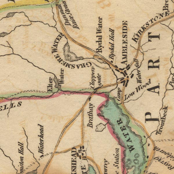
 West 1784 map NY30


|

|
|
|
gazetteer links places may or may not be labelled on the map |
||

|
-- Ambleside -- "AMBLESIDE" |
|
|
|
-- Blelham Tarn |
|
|
|
-- Brathay, River |
|
|
|
-- Clappersgate |
|
|
|
-- Elter Water |
|
|
|
-- Grasmere -- "GRASMERE WATER" |
|
|
|
-- Great Langdale Beck |
|
|
|
-- Kirkstone Pass -- "KIRKSTONE" |
|
|
|
-- Low Wood Hotel |
|
|
|
-- Old Brathay |
|
|
|
-- Galava -- "Camp" |
|
|
|
-- Rothay, River |
|
|
|
-- Rydal Hall |
|
|
|
-- Rydal Water |
|
|
|
-- Stock Ghyll |
|
|
|
-- Stockghyll Force -- "Water fall" |
|
|
|
-- Windermere lake -- "WINDERMERE WATER" |
|
|
civil parishes The area roughly includes parts of parishes:- Claife Lakes Windermere Skelwith Coniston Patterdale |
||
|
|
||
|
|
Lakes Guides menu. | |