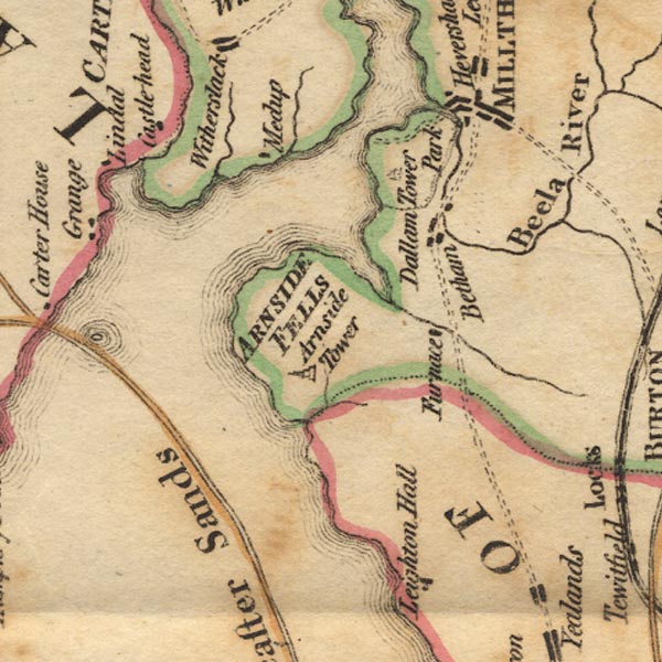
 West 1784 map SD47


|

|
|
|
gazetteer links places may or may not be labelled on the map |
||

|
-- Arnside Fell -- "ARNSIDE FELLS" |
|
|
|
-- Arnside Tower |
|
|
|
-- Beetham |
|
|
|
-- Bela, River |
|
|
|
-- Castle Head |
|
|
|
-- Dallam Tower -- "Dallam Tower" --
"Park" |
|
|
|
-- Kent Estuary |
|
|
|
-- Lancaster Sands |
|
|
|
-- Leighton Beck |
|
|
|
-- Leighton Ironworks (?) -- "Furnace" |
|
|
|
-- Meathop |
|
|
|
-- Skeggleswater Dike |
|
|
|
-- Winster, River |
|
|
civil parishes The area roughly includes parts of parishes:- Broughton East Lower Allithwaite Lower Holker Upper Allithwaite Beetham Arnside Grange-over-Sands Meathop and Ulpha |
||
|
|
||
|
|
Lakes Guides menu. | |