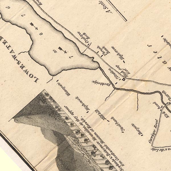
 Crosthwaite 1783-94, tetrad NY12F

|

|
|
|
gazetteer links
|
||

|
-- "Bargate" -- Bargate
|
|
|
|
-- Crabtree Beck
|
|
|
|
-- "Crabtree Beck" -- Crabtreebeck
|
|
|
|
-- Dub Beck
|
|
|
|
-- "High Cross" -- High Cross
|
|
|
|
-- "High Nook" -- High Nook Farm
|
|
|
|
-- "High Gap Yeat" -- Highgap Yeat (?)
|
|
|
|
-- "Lowes Water lake" -- Loweswater
|
|
|
|
-- "Stockbridge" -- Maggie's Bridge
|
|
|
|
-- "Mill Hill" -- Mill Hill
|
|
|
|
-- Cockermouth to Whitehaven
|
|
|
|
-- station, Highgap Yeat
|
|
|
|
-- "Steal Bank" -- Steelbank
|
|
|
|
-- "Thrush Bank" -- Thrushbank
|
|
|
|
-- "Watergate" -- Watergate Farm
|
|
|
civil parishes The area roughly includes parts of parishes:- Loweswater |
||
|
|
||
|
|
Lakes Guides menu. | |