Old Cumbria Gazetteer
 |
 |
|
||
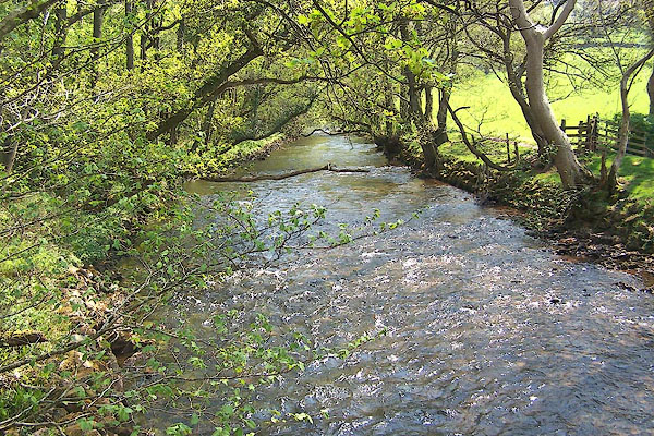
| Irt, River | ||||
| runs into:- |  Irish Sea Irish Sea |
|||
|
|
||||
| civil parish:- | Irton with Santon (formerly Cumberland) | |||
| civil parish:- | Drigg and Carleton (formerly Cumberland) | |||
| county:- | Cumbria | |||
| locality type:- | river | |||
| locality type:- | boundary | |||
| locality type:- | parish boundary | |||
| 1Km square:- | NY1002 (etc) | |||
| 10Km square:- | NY10 | |||
| 10Km square:- | SD09 | |||
|
|
||||
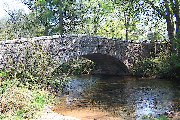
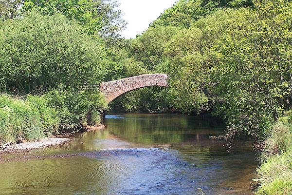
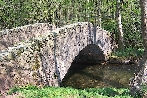
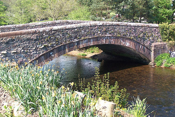
 BMB70.jpg At Lund Bridge. (taken 11.5.2006) 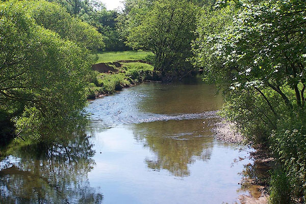 BNT99.jpg At Holme Bridge. (taken 5.6.2007) |
||||
|
|
||||
| evidence:- | possibly old map:- Lloyd 1573 |
|||
| source data:- | Map, hand coloured copper plate engraving, Angliae Regni,
Kingdom of England, with Wales, scale about 24 miles to 1 inch, authored by Humphrey
Lloyd, Denbigh, Clwyd, drawn and engraved
by Abraham Ortelius, Netherlands, 1573.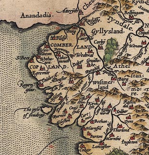 click to enlarge click to enlargeLld1Cm.jpg item:- Hampshire Museums : FA1998.69 Image © see bottom of page |
|||
|
|
||||
| evidence:- | old map:- Saxton 1579 |
|||
| source data:- | Map, hand coloured engraving, Westmorlandiae et Cumberlandiae Comitatus ie Westmorland
and Cumberland, scale about 5 miles to 1 inch, by Christopher Saxton, London, engraved
by Augustinus Ryther, 1576, published 1579-1645.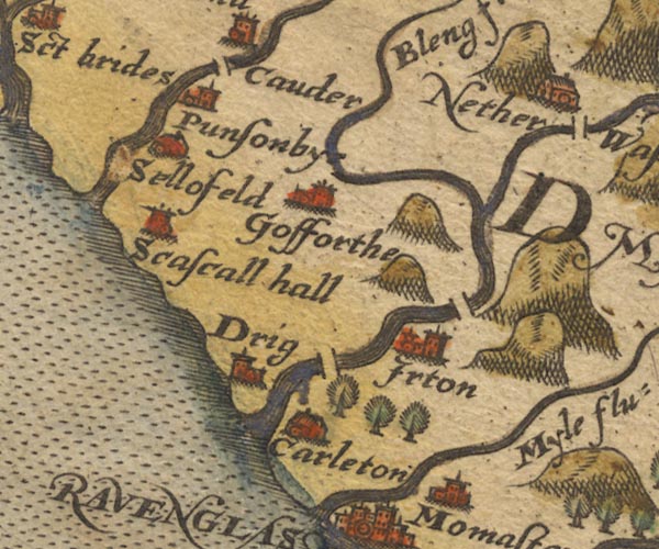 Sax9NY00.jpg 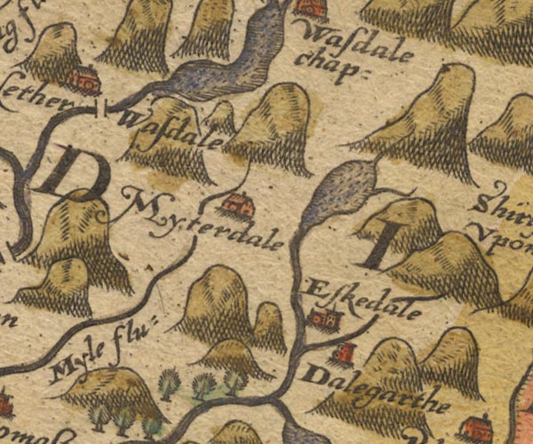 Sax9NY10.jpg from Wastwater item:- private collection : 2 Image © see bottom of page |
|||
|
|
||||
| evidence:- | old map:- Mercator 1595 (edn?) placename:- |
|||
| source data:- | Map, hand coloured engraving, Northumbria, Cumberlandia, et
Dunelmensis Episcopatus, ie Northumberland, Cumberland and
Durham etc, scale about 6.5 miles to 1 inch, by Gerard Mercator,
Duisberg, Germany, about 1595. MER8CumE.jpg "" double line with stream lines; river, running into the sea N of Ravenglass item:- JandMN : 169 Image © see bottom of page |
|||
|
|
||||
| evidence:- | descriptive text:- Keer 1605 (edn 1620) item:- pearl; mussel |
|||
| source data:- | Map, Westmorlandia et Comberlandia, ie Westmorland and
Cumberland now Cumbria, scale about 16 miles to 1 inch, probably
by Pieter van den Keere, or Peter Keer, about 1605, published
about 1605 to 1676. goto source first page:- "... the Rivers seed a kinde of Muskle that bringeth forth Pearle, where in the mouth of the Irt, as they lie gaping and sucking in dew, the Country people gather and sell to the Lapidaries, to their owne little, and the buyers great gaine. ..." |
|||
|
|
||||
| evidence:- | old map:- Speed 1611 (Cmd) |
|||
| source data:- | Map, hand coloured engraving, Cumberland and the Ancient Citie
Carlile Described, scale about 4 miles to 1 inch, by John Speed,
1610, published by J Sudbury and George Humble, Popes Head
Alley, London, 1611-12. SP11SD09.jpg double line with stream lines, runs into the sea item:- private collection : 16 Image © see bottom of page |
|||
|
|
||||
| evidence:- | poem:- Drayton 1612/1622 text placename:- Irt item:- pearls |
|||
| source data:- | Poem, Poly Olbion, by Michael Drayton, published by published by
John Marriott, John Grismand and Thomas Dewe, and others?
London, part 1 1612, part 2 1622. goto source page 163:- "... In Ravenglasse, ... Comes Irt, of all the rest, though small, the richest Girle, Her costly bosome strew'd with precious Orient Pearle, Bred in her shining Shels, which to the deaw doth yawne, Which deaw they sucking in, conceave that lusty Spawne," goto sourcepage 164:- "Of which when they grow great, and to their fulnesse swell, They cast, which those at hand there gathering, dearly sell." |
|||
|
|
||||
| evidence:- | old map:- Drayton 1612/1622 placename:- Irt Flu. |
|||
| source data:- | Map, hand coloured engraving, Cumberlande and Westmorlande, by
Michael Drayton, probably engraved by William Hole, scale about
4 or 5 miles to 1 inch, published by John Mariott, John
Grismand, and Thomas Dewe, London, 1622.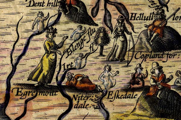 DRY519.jpg "Irt fl" River, naiad. item:- JandMN : 168 Image © see bottom of page |
|||
|
|
||||
| evidence:- | old map:- Jansson 1646 |
|||
| source data:- | Map, hand coloured engraving, Cumbria and Westmoria, ie
Cumberland and Westmorland, scale about 3.5 miles to 1 inch, by
John Jansson, Amsterdam, Netherlands, 1646.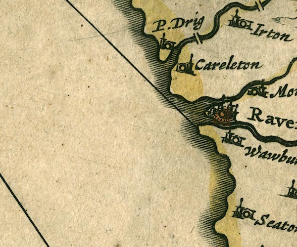 JAN3SD09.jpg  JAN3NY10.jpg Double wiggly line tapering to single. item:- JandMN : 88 Image © see bottom of page |
|||
|
|
||||
| evidence:- | old map:- Sanson 1679 |
|||
| source data:- | Map, hand coloured engraving, Ancien Royaume de Northumberland
aujourdhuy Provinces de Nort, ie the Ancient Kingdom of
Northumberland or the Northern Provinces, scale about 9.5 miles
to 1 inch, by Nicholas Sanson, Paris, France, 1679. click to enlarge click to enlargeSAN2Cm.jpg tapering wiggly line; river item:- Dove Cottage : 2007.38.15 Image © see bottom of page |
|||
|
|
||||
| evidence:- | old map:- Seller 1694 (Cmd) |
|||
| source data:- | Map, uncoloured engraving, Cumberland, scale about 12 miles to 1
inch, by John Seller, 1694. click to enlarge click to enlargeSEL9.jpg tapering wiggly line; river item:- Dove Cottage : 2007.38.89 Image © see bottom of page |
|||
|
|
||||
| evidence:- | old map:- Morden 1695 (Cmd) placename:- Irt River |
|||
| source data:- | Map, uncoloured engraving, Cumberland, scale about 4 miles to 1
inch, by Robert Morden, 1695, published by Abel Swale, the
Unicorn, St Paul's Churchyard, Awnsham, and John Churchill, the
Black Swan, Paternoster Row, London, 1695-1715. MD12NY10.jpg from Wastwater 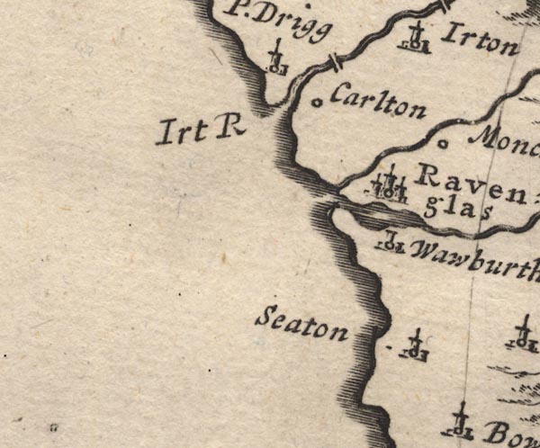 MD12SD09.jpg "Irt R" River mouth. item:- JandMN : 90 Image © see bottom of page |
|||
|
|
||||
| evidence:- | descriptive text:- Defoe 1724-26 placename:- Ire, River item:- pearl |
|||
| source data:- | Tour through England and Wales, by Daniel Defoe, published in
parts, London, 1724-26. "I enquired much for the pearl fishery here, which Mr. Cambden speaks of, as a thing well known about Ravenglass and the River Ire, which was made a kind of bubble lately: But the country people, not even the fishermen, could give us no account of any such thing; nor indeed is there any great quantity of the shell-fish to be found here (now) in which the pearl are found, I mean the large oyster or muscle. What might be in former times, I know not." |
|||
|
|
||||
| evidence:- | old map:- Badeslade 1742 placename:- |
|||
| source data:- | Map, uncoloured engraving, A Map of Cumberland North from
London, scale about 11 miles to 1 inch, with descriptive text,
by Thomas Badeslade, London, engraved and published by William
Henry Toms, Union Court, Holborn, London, 1742. click to enlarge click to enlargeBD10.jpg "" tapering wiggly line, from Wast water to coast at Drigg item:- JandMN : 115 Image © see bottom of page |
|||
|
|
||||
| evidence:- | descriptive text:- Simpson 1746 placename:- Irt Brook item:- pearl; mussel; sand pearl |
|||
| source data:- | Atlas, three volumes of maps and descriptive text published as
'The Agreeable Historian, or the Compleat English Traveller
...', by Samuel Simpson, 1746. goto source "... The chief Commodities [of Cumberland] are ... Pearls, &c. ... As to the Pearls, they are found at the Mouth of the little Brook Irt, somewhat to the N. of Ravenglass, in a sort of Shell Fish, or Muscles, which the Country People used to gather up at low Water: They are of all Colours; those that are not bright and shining, commonly call'd Sand-Pearl, are as useful in Physick, as the finest, tho' not so beautiful. There has been a Patent not long since granted to some Gentlemen and others for Pearl Fishing here, but it is uncertain whether it will turn to any Account." |
|||
|
|
||||
| evidence:- | old map:- Bowen and Kitchin 1760 placename:- Irt River |
|||
| source data:- | Map, hand coloured engraving, A New Map of the Counties of
Cumberland and Westmoreland Divided into their Respective Wards,
scale about 4 miles to 1 inch, by Emanuel Bowen and Thomas
Kitchin et al, published by T Bowles, Robert Sayer, and John
Bowles, London, 1760. BO18SD09.jpg "Irt R." wiggly line and river mouth, into the sea item:- Armitt Library : 2008.14.10 Image © see bottom of page |
|||
|
|
||||
| evidence:- | old map:- Donald 1774 (Cmd) placename:- Irt River |
|||
| source data:- | Map, hand coloured engraving, 3x2 sheets, The County of Cumberland, scale about 1
inch to 1 mile, by Thomas Donald, engraved and published by Joseph Hodskinson, 29
Arundel Street, Strand, London, 1774. D4NY10SW.jpg "Irt River"  D4SD09NE.jpg D4SD09NE.jpg single or double wiggly line; a river into the sea; estuary item:- Carlisle Library : Map 2 Images © Carlisle Library |
|||
|
|
||||
| evidence:- | old text:- Mackenzie 1776 placename:- Ort, River |
|||
| source data:- | Charts, and sailing directions, Nautical Descriptions of the
West Coast of Great Britain, Bristol Channel to Cape Wrath, by
Murdoch Mackenzie, published London, 1776. goto source Page 19:- "RAVINGLAS Harbour." "Ravinglas is a dry Harbour in Cumberland, where three rivulets, Esk, Mite, and Ort, unite. ..." |
|||
|
|
||||
| evidence:- | old map:- West 1784 map placename:- Irt River |
|||
| source data:- | Map, hand coloured engraving, A Map of the Lakes in Cumberland,
Westmorland and Lancashire, scale about 3.5 miles to 1 inch,
engraved by Paas, 53 Holborn, London, about 1784.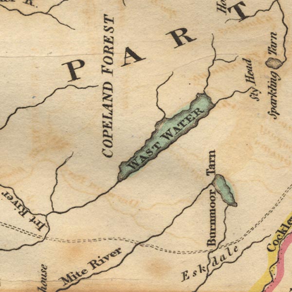 Ws02NY10.jpg 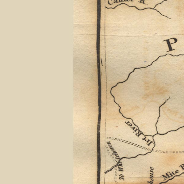 Ws02NY00.jpg 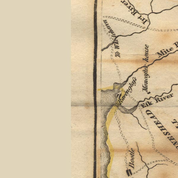 Ws02SD09.jpg item:- Armitt Library : A1221.1 Image © see bottom of page |
|||
|
|
||||
| evidence:- | old text:- Camden 1789 placename:- Irt, River item:- pearls |
|||
| source data:- | Book, Britannia, or A Chorographical Description of the Flourishing Kingdoms of England,
Scotland, and Ireland, by William Camden, 1586, translated from the 1607 Latin edition
by Richard Gough, published London, 1789. goto source Page 169:- "..." "... the little river Irt runs into the sea, in which the shell-fish having by a kind of irregular motion taken in the dew, which they are extremely fond of, are impregnated, and produce pearls, or, to use the poet's phrase, baccae concheae, shell-berries, which the inhabitants, when the tide is out, search for, and our jewellers buy of the poor for a trifle, and sell again at a very great price. Of these and the like Marbodeus seems to speak in that line;" "Gignit &insignes antiqua Britannia baccas. Old Britain also famous berries yields." |
|||
|
|
||||
| evidence:- | old text:- Camden 1789 (Gough Additions) placename:- Irt, River item:- pearls; sand pearl; mussels |
|||
| source data:- | Book, Britannia, or A Chorographical Description of the Flourishing Kingdoms of England,
Scotland, and Ireland, by William Camden, 1586, translated from the 1607 Latin edition
by Richard Gough, published London, 1789. goto source Page 180:- "..." "... the Irt ... Muscle pearls are found in this and other rivers hereabouts as also in Wales. A patent was granted to certain gentlemen for pearl fishing here, but they are not very plentiful, and may be had cheaper from the straits of Magellan, where sir John Narborough and sir Richard Hawkins tell us they abound in every muscle. Tacitus describes the British pearls as of bad colour, subfuscae ac liventes; but this is not their general character. Bede gives a juster account of them when he says they are of all colours. Those that are not bright and shining, and such are met with in the Irt, &c. are usually called Sand pearl, which are as useful in physic as the finest. Dr. Lister says he has found sixteen of these in one muscle, but that they are all only senescentium musculorum vitia. The poor people gather them at low water, and sell them to the jewellers, and it is said Mr. Patrickson of How in this county got as many as sold for 800l." |
|||
|
|
||||
| evidence:- | old map:- Skrine 1801 placename:- Irt River |
|||
| source data:- | Map, uncoloured engraving, rivers in Cumberland, Westmorland,
Lancashire and Cheshire, scale about 23 miles to 1 inch, by
Henry Skrine, published by P Elmsly, London, 1801.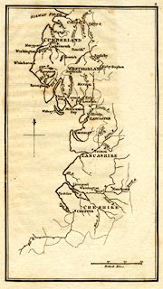 click to enlarge click to enlargeM076.jpg "Irt R." river item:- JandMN : 421 Image © see bottom of page |
|||
|
|
||||
| evidence:- | old map:- Cooke 1802 |
|||
| source data:- | Map, Cumberland, scale about 15.5 miles to 1 inch, by George
Cooke, 1802, bound in Gray's New Book of Roads, 1824, published
by Sherwood, Jones and Co, Paternoster Road, London, 1824. click to enlarge click to enlargeGRA1Cd.jpg tapering wiggly line; river item:- Hampshire Museums : FA2000.62.2 Image © see bottom of page |
|||
|
|
||||
| evidence:- | old map:- Cooke 1802 placename:- Irt River |
|||
| source data:- | Map, The Lakes, Westmorland and Cumberland, scale about 8.5
miles to 1 inch, engravedby Neele and Son, published by
Sherwood, Jones and Co, Paternoster Road, London, 1824. click to enlarge click to enlargeGRA1Lk.jpg "Irt R." tapering wiggly line; river item:- Hampshire Museums : FA2000.62.5 Image © see bottom of page |
|||
|
|
||||
| evidence:- | old map:- Laurie and Whittle 1806 placename:- Irt River |
|||
| source data:- | Road map, Completion of the Roads to the Lakes, scale about 10
miles to 1 inch, by Nathaniel Coltman? 1806, published by Robert
H Laurie, 53 Fleet Street, London, 1834. click to enlarge click to enlargeLw18.jpg "Irt River" river item:- private collection : 18.18 Image © see bottom of page |
|||
|
|
||||
| evidence:- | old map:- Cooper 1808 placename:- Irt River |
|||
| source data:- | Map, uncoloured engraving, Cumberland, scale about 10.5 miles to
1 inch, drawn and engraved by Cooper, published by R Phillips,
Bridge Street, Blackfriars, London, 1808. click to enlarge click to enlargeCOP3.jpg "Irt R." tapering wiggly line; river item:- JandMN : 86 Image © see bottom of page |
|||
|
|
||||
| evidence:- | old map:- Otley 1818 placename:- Irt River |
|||
| source data:- | Map, uncoloured engraving, The District of the Lakes,
Cumberland, Westmorland, and Lancashire, scale about 4 miles to
1 inch, by Jonathan Otley, 1818, engraved by J and G Menzies,
Edinburgh, Scotland, published by Jonathan Otley, Keswick,
Cumberland, et al, 1833.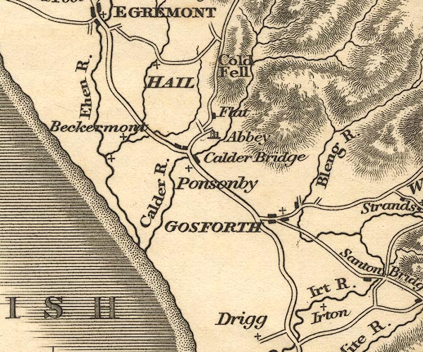 OT02NY00.jpg "Irt R." item:- JandMN : 48.1 Image © see bottom of page |
|||
|
|
||||
| evidence:- | old map:- Hall 1820 (Cmd) |
|||
| source data:- | Map, hand coloured engraving, Cumberland, scale about 21 miles
to 1 inch, engraved by Sidney Hall, published by S Leigh, 18
Strand, London, 1820-31. click to enlarge click to enlargeHA14.jpg tapering wiggly line; river item:- JandMN : 91 Image © see bottom of page |
|||
|
|
||||
| evidence:- | descriptive text:- Otley 1823 (5th edn 1834) |
|||
| source data:- | Guide book, A Concise Description of the English Lakes, the
mountains in their vicinity, and the roads by which they may be
visited, with remarks on the mineralogy and geology of the
district, by Jonathan Otley, published by the author, Keswick,
Cumberland now Cumbria, by J Richardson, London, and by Arthur
Foster, Kirkby Lonsdale, Cumbria, 1823; published 1823-49,
latterly as the Descriptive Guide to the English Lakes. goto source Page 41:- "The Esk, ... enters the sea at Ravenglass; where the Irt from Wasdale, and the Mite from Miterdale, join it upon the sands. ... The Bleng, passing Gosforth, falls into the Irt above Santon Bridge." |
|||
|
|
||||
| evidence:- | old map:- Ford 1839 map placename:- Irt River |
|||
| source data:- | Map, uncoloured engraving, Map of the Lake District of
Cumberland, Westmoreland and Lancashire, scale about 3.5 miles
to 1 inch, published by Charles Thurnam, Carlisle, and by R
Groombridge, 5 Paternoster Row, London, 3rd edn 1843.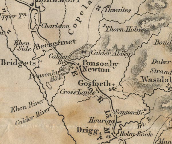 FD02NY00.jpg "Irt R." 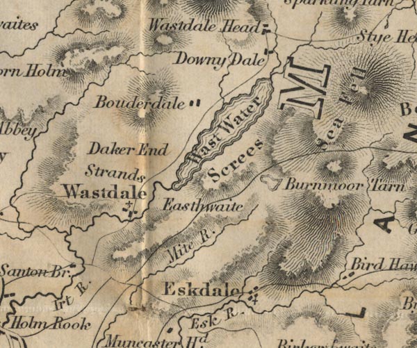 FD02NY10.jpg from Wastwater item:- JandMN : 100.1 Image © see bottom of page |
|||
|
|
||||
| evidence:- | old map:- Garnett 1850s-60s H placename:- Irt, River |
|||
| source data:- | Map of the English Lakes, in Cumberland, Westmorland and
Lancashire, scale about 3.5 miles to 1 inch, published by John
Garnett, Windermere, Westmorland, 1850s-60s.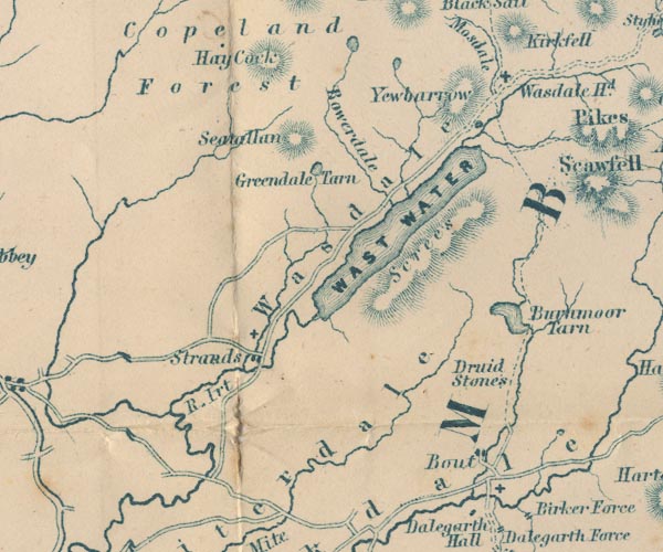 GAR2NY10.jpg "R. Irt" wiggly line, river 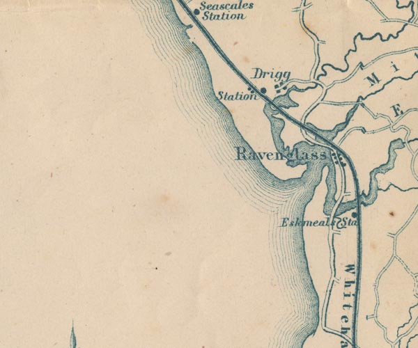 GAR2SD09.jpg item:- JandMN : 82.1 Image © see bottom of page |
|||
|
|
||||
| evidence:- | old map:- Postlethwaite 1877 (3rd edn 1913) placename:- Irt, River |
|||
| source data:- | Map, uncoloured engraving, Map of the Lake District Mining Field, Westmorland, Cumberland,
Lancashire, scale about 5 miles to 1 inch, by John Postlethwaite, published by W H
Moss and Sons, 13 Lowther Street, Whitehaven, Cumberland, 1877 edn 1913. PST2SD09.jpg "River Irt" wiggly line, running into Ravenglass harbour item:- JandMN : 162.2 Image © see bottom of page |
|||
|
|
||||
| evidence:- | old text:- Admiralty 1933 placename:- Irt, River |
|||
| source data:- | goto source Page 385:- "..." "The Irt, Mite, and Esk streams [at Ravenglass Harbour] have their sources near Scafell Pikes in Cumberland, the first from Wast water, 13 miles from Ravenglass; the second near Birnmoor tarn, 8 miles; and the third near Angel tarn, 18 miles." |
|||
|
|
||||
| hearsay:- |
The river once provided black oval pearls from the river mussel, Margaritifera margaritifera.
The Romans knew of them. The Company of Pearl Fishers, chartered 1692, paid villagers
to search for them. |
|||
|
|
||||
| places:- |
|
|||
|
||||
|
||||
|
||||
|
||||
|
||||
|
||||
|
||||
|
||||
|
||||
|
||||
|
||||
|
||||
|
||||
|
||||
Lakes Guides menu.