 Old Cumbria Gazetteer
 |
 |
|
| Lowther | ||
| civil parish:- | Lowther (formerly Westmorland) | |
| county:- | Cumbria | |
| locality type:- | buildings | |
| coordinates:- | NY53632363 (etc) | |
| 1Km square:- | NY5323 | |
| 10Km square:- | NY52 | |
|
|
||
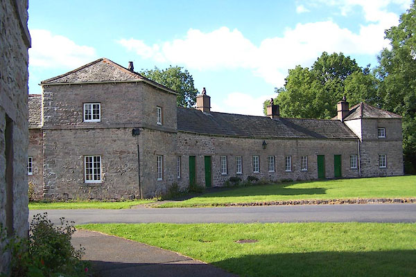 BJT80.jpg (taken 22.8.2005) 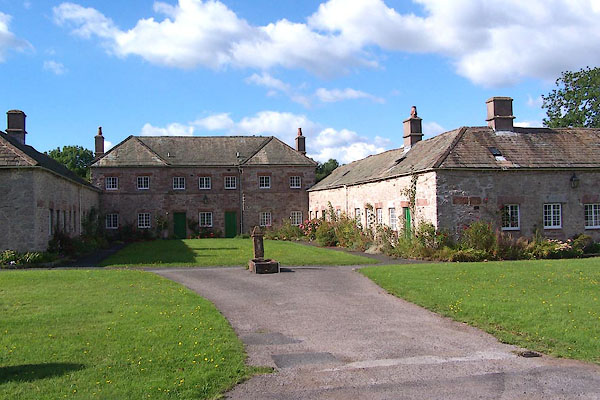 BJT81.jpg (taken 22.8.2005) |
||
|
|
||
| evidence:- | old map:- OS County Series (Wmd 8 5) placename:- Lowther |
|
| source data:- | Maps, County Series maps of Great Britain, scales 6 and 25
inches to 1 mile, published by the Ordnance Survey, Southampton,
Hampshire, from about 1863 to 1948. |
|
|
|
||
| evidence:- | old map:- Saxton 1579 placename:- Lowther |
|
| source data:- | Map, hand coloured engraving, Westmorlandiae et Cumberlandiae Comitatus ie Westmorland
and Cumberland, scale about 5 miles to 1 inch, by Christopher Saxton, London, engraved
by Augustinus Ryther, 1576, published 1579-1645.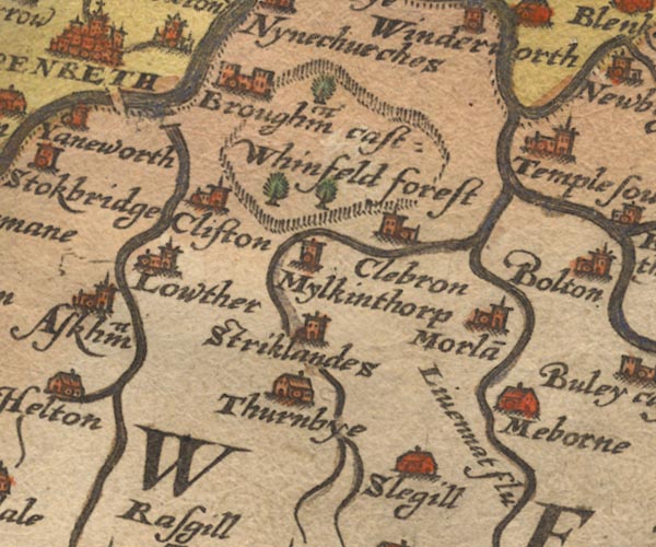 Sax9NY52.jpg Church, symbol for a parish or village, with a parish church. "Lowther" item:- private collection : 2 Image © see bottom of page |
|
|
|
||
| evidence:- | old map:- Speed 1611 (Wmd) placename:- Lowther |
|
| source data:- | Map, hand coloured engraving, The Countie Westmorland and
Kendale the Cheif Towne, scale about 2.5 miles to 1 inch, by
John Speed, 1610, published by George Humble, Popes Head Alley,
London, 1611-12.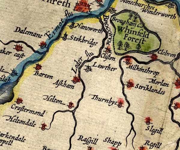 SP14NY52.jpg "Lowther" circle, building and tower item:- Armitt Library : 2008.14.5 Image © see bottom of page |
|
|
|
||
| evidence:- | old map:- Jansson 1646 placename:- Lowther |
|
| source data:- | Map, hand coloured engraving, Cumbria and Westmoria, ie
Cumberland and Westmorland, scale about 3.5 miles to 1 inch, by
John Jansson, Amsterdam, Netherlands, 1646.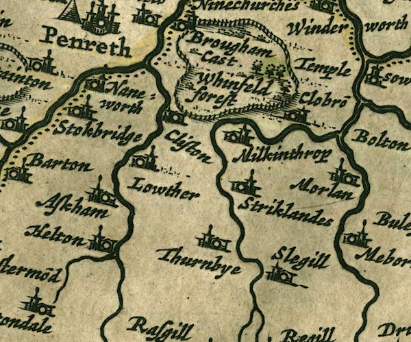 JAN3NY52.jpg "Lowther" Buildings and tower. item:- JandMN : 88 Image © see bottom of page |
|
|
|
||
| evidence:- | probably old map:- Seller 1694 (Wmd) placename:- Lowther |
|
| source data:- | Map, hand coloured engraving, Westmorland, scale about 8 miles
to 1 inch, by John Seller, 1694. click to enlarge click to enlargeSEL7.jpg "Lowther" no symbol item:- Dove Cottage : 2007.38.87 Image © see bottom of page |
|
|
|
||
| evidence:- | old map:- Morden 1695 (Cmd) placename:- Lowther |
|
| source data:- | Map, uncoloured engraving, Cumberland, scale about 4 miles to 1
inch, by Robert Morden, 1695, published by Abel Swale, the
Unicorn, St Paul's Churchyard, Awnsham, and John Churchill, the
Black Swan, Paternoster Row, London, 1695-1715.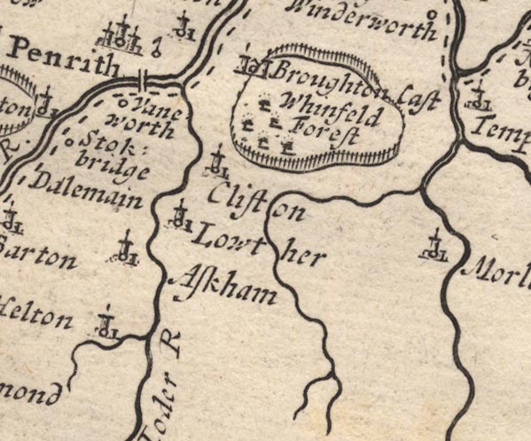 MD12NY52.jpg "Lowther" Circle, building and tower. item:- JandMN : 90 Image © see bottom of page |
|
|
|
||
| evidence:- | old map:- Morden 1695 (Wmd) placename:- Lowther |
|
| source data:- | Map, hand coloured engraving, Westmorland, scale about 2.5 miles to 1 inch, by Robert
Morden, published by Abel Swale, the Unicorn, St Paul's Churchyard, Awnsham, and John
Churchill, the Black Swan, Paternoster Row, London, 1695.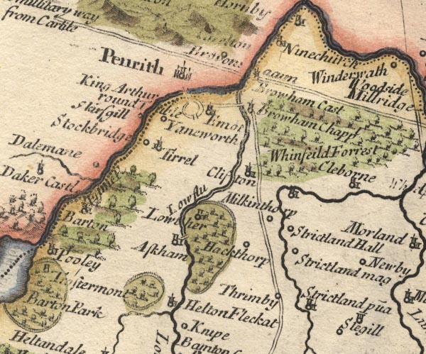 MD10NY52.jpg "Lowther" Circle, building and tower. item:- JandMN : 24 Image © see bottom of page |
|
|
|
||
| evidence:- | old map:- Bowen and Kitchin 1760 placename:- Lowther |
|
| source data:- | Map, hand coloured engraving, A New Map of the Counties of
Cumberland and Westmoreland Divided into their Respective Wards,
scale about 4 miles to 1 inch, by Emanuel Bowen and Thomas
Kitchin et al, published by T Bowles, Robert Sayer, and John
Bowles, London, 1760.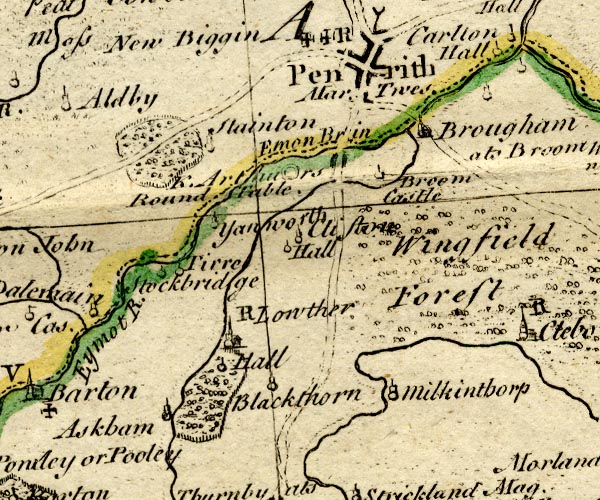 BO18NY42.jpg "Lowther / R" circle, building and tower, rectory item:- Armitt Library : 2008.14.10 Image © see bottom of page |
|
|
|
||
| evidence:- | old map:- Jefferys 1770 (Wmd) placename:- New Village |
|
| source data:- | Map, 4 sheets, The County of Westmoreland, scale 1 inch to 1
mile, surveyed 1768, and engraved and published by Thomas
Jefferys, London, 1770.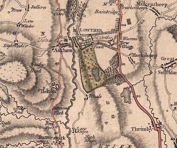 J5NY52SW.jpg "New Village" blocks, labelled in upright lowercase text; settlement; town?, includes parts never built item:- National Library of Scotland : EME.s.47 Image © National Library of Scotland |
|
|
|
||
| evidence:- | old map:- West 1784 map placename:- New Village |
|
| source data:- | Map, hand coloured engraving, A Map of the Lakes in Cumberland,
Westmorland and Lancashire, scale about 3.5 miles to 1 inch,
engraved by Paas, 53 Holborn, London, about 1784.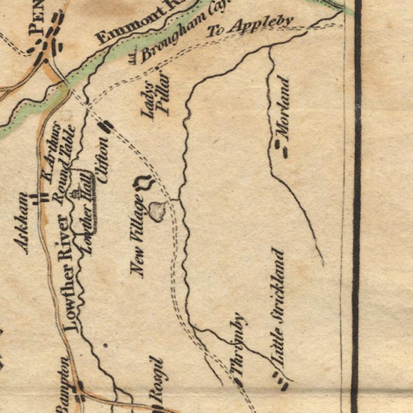 Ws02NY52.jpg Drawn as two semicircles of buildings. item:- Armitt Library : A1221.1 Image © see bottom of page |
|
|
|
||
| evidence:- | old text:- Camden 1789 placename:- Loder |
|
| source data:- | Book, Britannia, or A Chorographical Description of the Flourishing Kingdoms of England,
Scotland, and Ireland, by William Camden, 1586, translated from the 1607 Latin edition
by Richard Gough, published London, 1789. goto source goto sourcePage 149:- "[On the] Loder is also a place of the same name, which, like Strickland in its neighbourhood, gave name to families of antient renown." |
|
|
|
||
| evidence:- | old text:- Camden 1789 (Gough Additions) item:- placename, Lowther |
|
| source data:- | Book, Britannia, or A Chorographical Description of the Flourishing Kingdoms of England,
Scotland, and Ireland, by William Camden, 1586, translated from the 1607 Latin edition
by Richard Gough, published London, 1789. goto source Page 161:- "..." "Olaus Wormius consulted by Spelman finds Loder or Lother a common name among the antient kings of Denmark, and derives it from Loth and Er, q.d. fortunate honor. The name of Lothair is also frequent among the German emperors. Perhaps however both the name and seat of Lowther here, as Lauder in Scotland, are to be derived from the neighbouring river, which in British signifies clear water, Gladdwr. ..." "... The family have figured here for many generations from the time of Henry II. Sir John Lowther, who was keeper of the privy seal and one of the lords justices during the absence of William III. 1699, was advanced 1696 to the dignity of baron Lowther viscount Lonsdale, which became extinct in his grandson. The first viscount built here 1685 a handsome house (which was burnt down 1720), and rebuilt and furnished the church. Christopher, another branch of this family, was created a baronet 11 Charles I. which honour ended in his grandson James, who died immensely rich 1755, and in the title of baronet and the estate was succeeded by James Lowther, a descendant from one common ancestor, and created earl of Lonsdale 1784." |
|
|
|
||
| evidence:- | old map:- Cary 1789 (edn 1805) placename:- New Village |
|
| source data:- | Map, uncoloured engraving, Westmoreland, scale about 2.5 miles
to 1 inch, by John Cary, London, 1789; edition 1805.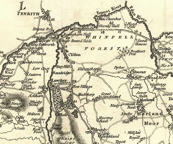 CY24NY52.jpg "New Village" block/s, labelled in italic lowercase; house, or hamlet item:- JandMN : 129 Image © see bottom of page |
|
|
|
||
| evidence:- | probably old map:- Laurie and Whittle 1806 placename:- New Village |
|
| source data:- | Road map, Completion of the Roads to the Lakes, scale about 10
miles to 1 inch, by Nathaniel Coltman? 1806, published by Robert
H Laurie, 53 Fleet Street, London, 1834. click to enlarge click to enlargeLw18.jpg "New Village 283¼" village or other place; distance from London item:- private collection : 18.18 Image © see bottom of page |
|
|
|
||
| evidence:- | old map:- Cooper 1808 placename:- Lowther |
|
| source data:- | Map, hand coloured engraving, Westmoreland ie Westmorland, scale
about 9 miles to 1 inch, by H Cooper, 1808, published by R
Phillips, Bridge Street, Blackfriars, London, 1808. click to enlarge click to enlargeCOP4.jpg "Lowther" circle; village or hamlet item:- Dove Cottage : 2007.38.53 Image © see bottom of page |
|
|
|
||
| evidence:- | old map:- Otley 1818 placename:- Lowther |
|
| source data:- | Map, uncoloured engraving, The District of the Lakes,
Cumberland, Westmorland, and Lancashire, scale about 4 miles to
1 inch, by Jonathan Otley, 1818, engraved by J and G Menzies,
Edinburgh, Scotland, published by Jonathan Otley, Keswick,
Cumberland, et al, 1833. OT02NY52.jpg "LOWTHER" item:- JandMN : 48.1 Image © see bottom of page |
|
|
|
||
| evidence:- | perhaps old map:- Hall 1820 (Wmd) placename:- Newtown |
|
| source data:- | Map, hand coloured engraving, Westmoreland ie Westmorland, scale
about 14.5 miles to 1 inch, by Sidney Hall, London, 1820,
published by Samuel Leigh, 18 Strand, London, 1820-31. click to enlarge click to enlargeHA18.jpg "Newtown" circle, italic lowercase text; settlement; marked on the main road Lowther village and Newtown seem to be muddled on this map item:- Armitt Library : 2008.14.58 Image © see bottom of page |
|
|
|
||
| evidence:- | descriptive text:- Otley 1823 (5th edn 1834) item:- geology |
|
| source data:- | Guide book, A Concise Description of the English Lakes, the
mountains in their vicinity, and the roads by which they may be
visited, with remarks on the mineralogy and geology of the
district, by Jonathan Otley, published by the author, Keswick,
Cumberland now Cumbria, by J Richardson, London, and by Arthur
Foster, Kirkby Lonsdale, Cumbria, 1823; published 1823-49,
latterly as the Descriptive Guide to the English Lakes. goto source Page 161:- "A superincumbent bed of limestone, by some called the mountain, by others the upper transition limestone, mantles round these mountains, in a position unconformable to the strata of the slaty and other rocks upon which it reposes. It bassets out near ... Dacre, Lowther and Shap; ..." |
|
|
|
||
| evidence:- | old text:- Gents Mag |
|
| source data:- | Magazine, The Gentleman's Magazine or Monthly Intelligencer or
Historical Chronicle, published by Edward Cave under the
pseudonym Sylvanus Urban, and by other publishers, London,
monthly from 1731 to 1922. goto source Gentleman's Magazine 1825 part 1 p.514 From the Compendium of County History:- "[Smith] John, a divine, particularly versed in Septentrional literature and in antiquities, Lowther, 1659." |
|
|
|
||
| evidence:- | old map:- Ford 1839 map placename:- Lowther |
|
| source data:- | Map, uncoloured engraving, Map of the Lake District of
Cumberland, Westmoreland and Lancashire, scale about 3.5 miles
to 1 inch, published by Charles Thurnam, Carlisle, and by R
Groombridge, 5 Paternoster Row, London, 3rd edn 1843.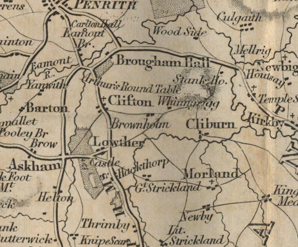 FD02NY52.jpg "Lowther" item:- JandMN : 100.1 Image © see bottom of page |
|
|
|
||
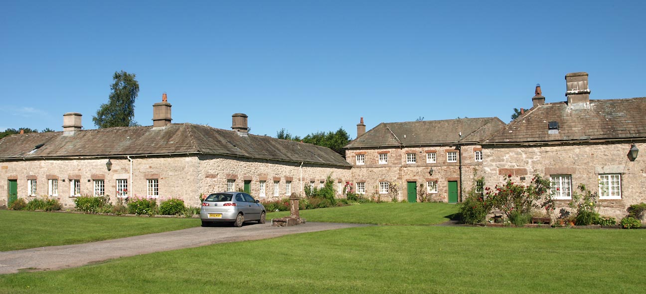
| evidence:- | database:- Listed Buildings 2010 placename:- Lowther Village |
|
| source data:- | courtesy of English Heritage "/ 40513 / LOWTHER VILLAGE / LOWTHER / EDEN / CUMBRIA / II[star] / 74357 / NY5355723650" |
|
| source data:- | courtesy of English Heritage "12 houses. 1766-73 by Robert Adam, as estate houses for Sir James Lowther, part of a model village which was never completed. Mixed sandstone rubble walls with string courses and eaves cornices. Hipped graduated greenslate roofs with banded cement-rendered chimney stacks. Built in open courtyard plan with "palace" facades on 3 sides of a square. Closing the courtyard at one end is a 2-storey, 7-bay house. The longer sides have similar central houses, at either side of which are 2-storey, 3-bay houses flanked by single-storey, 2-bay wings, all joined in a continuous row. Each central house has recessed 3-bay centre and flanking gabled wings. Central plank doors in plain openings with sandstone lintels; wings have off-centre doors. Regularly-spaced C20 casement windows with glazing bars, in plain reveals with red sandstone lintels and sills. Originally divided into 16 houses but altered with HBC grant in 1965. See Ancient Monuments Society's Transactions, 14, pp.57-73, R.W. Brunskill, Lowther Village and Robert Adam." |
|
|
|
||
| evidence:- | database:- Listed Buildings 2010 |
|
| source data:- | courtesy of English Heritage "/ 28-33 / LOWTHER VILLAGE / LOWTHER / EDEN / CUMBRIA / II[star] / 74361 / NY5362023682" |
|
|
|
||
| evidence:- | database:- Listed Buildings 2010 |
|
| source data:- | courtesy of English Heritage "/ 28-33 / LOWTHER VILLAGE / LOWTHER / EDEN / CUMBRIA / II[star] / 74360 / NY5360823677" |
|
|
|
||
| evidence:- | database:- Listed Buildings 2010 |
|
| source data:- | courtesy of English Heritage "/ 17-27 / LOWTHER VILLAGE / LOWTHER / EDEN / CUMBRIA / II[star] / 74358 / NY5360323646" |
|
|
|
||
 Click to enlarge BXA74.jpg (taken 10.8.2012) 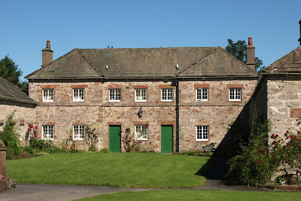 BXA75.jpg (taken 10.8.2012) 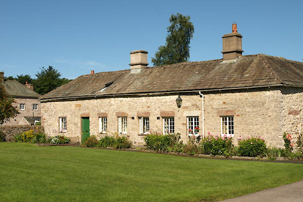 BXA76.jpg (taken 10.8.2012) 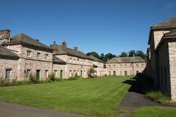 BXA77.jpg (taken 10.8.2012) 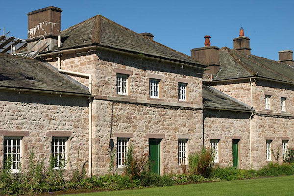 BXA78.jpg (taken 10.8.2012) 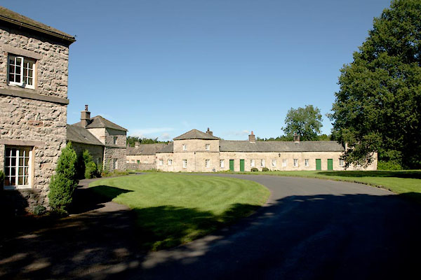 BXA79.jpg (taken 10.8.2012) 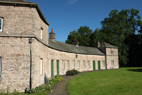 BXA80.jpg (taken 10.8.2012) 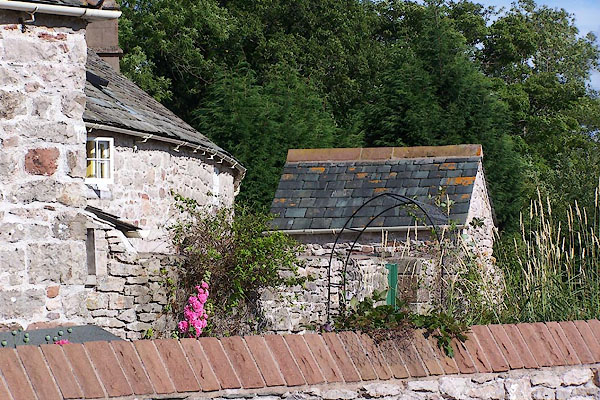 BJT82.jpg (taken 22.8.2005) |
||
|
|
||
| hearsay:- |
The 'new' village was built 1773. It was inspired by a sketch of a model village drawn
by Robert Adam for Sir James Lowther. |
|
|
|
||
| reference:- |
Lowther |
|
| Adams, Douglas & Lloyd, John: 1990: Deeper Meaning of Life, The: Pan Books &Faber
and Faber |
||
|
|
||
Lakes Guides menu.