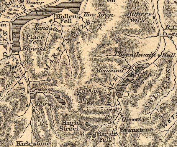
 Otley 1818 NY41


|

|
|
|
gazetteer links places may or may not be labelled on the map |
||

|
-- Angle Tarn |
|
|
|
-- Blea Water |
|
|
|
-- Brothers Water |
|
|
|
-- Hallin Fell |
|
|
|
-- Hartsop |
|
|
|
-- Hawes Water |
|
|
|
-- Hayeswater |
|
|
|
-- High Street |
|
|
|
-- Holy Trinity Church |
|
|
|
-- Howtown |
|
|
|
-- Kidsty Pike |
|
|
|
-- Mardale -- "MARDALE" |
|
|
|
-- Martindale -- "MARTINDALE" |
|
|
|
-- Measand |
|
|
|
-- Naddle Forest |
|
|
|
-- Place Fell |
|
|
|
-- Sandwick |
|
|
civil parishes The area roughly includes parts of parishes:- Kentmere Shap Rural Longsleddale Patterdale Martindale Lakes Bampton Barton Matterdale |
||
|
|
||
|
|
Lakes Guides menu. | |