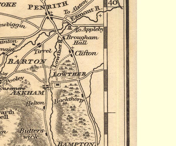
 Otley 1818 NY52


|

|
|
|
gazetteer links places may or may not be labelled on the map |
||

|
-- Askham -- "ASKHAM" |
|
|
|
-- Brougham Castle |
|
|
|
-- Brougham Hall |
|
|
|
-- Clifton |
|
|
|
-- Eamont Bridge bridge |
|
|
|
-- Eamont, River -- "Eamont R." |
|
|
|
-- Hackthorpe |
|
|
|
-- Helton |
|
|
|
-- Lowther Bridge |
|
|
|
-- Lowther Castle |
|
|
|
-- Lowther -- "LOWTHER" |
|
|
|
-- Lowther, River -- "Lowther R." |
|
|
|
-- St Ninian's Church |
|
|
|
-- Tirril |
|
|
civil parishes The area roughly includes parts of parishes:- Penrith Dacre Askham Barton Sockbridge and Tirril Langwathby Sleagill Little Strickland Culgaith Newby Thrimby Lowther Great Strickland Cliburn Morland Bampton Clifton Yanwath and Eamont Bridge Brougham |
||
|
|
||
|
|
Lakes Guides menu. | |