 Old Cumbria Gazetteer
 |
 |
|
|||||||||||||||||||||||||||||||||||||||||||||||||||||||||||||||||||||||||||||||||||||||||||||||||||||||||||||||||||||||||||||||||||||||
| Longsleddale | |||||||||||||||||||||||||||||||||||||||||||||||||||||||||||||||||||||||||||||||||||||||||||||||||||||||||||||||||||||||||||||||||||||||||
| civil parish:- | Longsleddale (formerly Westmorland) | ||||||||||||||||||||||||||||||||||||||||||||||||||||||||||||||||||||||||||||||||||||||||||||||||||||||||||||||||||||||||||||||||||||||||
| county:- | Cumbria | ||||||||||||||||||||||||||||||||||||||||||||||||||||||||||||||||||||||||||||||||||||||||||||||||||||||||||||||||||||||||||||||||||||||||
| locality type:- | locality | ||||||||||||||||||||||||||||||||||||||||||||||||||||||||||||||||||||||||||||||||||||||||||||||||||||||||||||||||||||||||||||||||||||||||
| locality type:- | valley | ||||||||||||||||||||||||||||||||||||||||||||||||||||||||||||||||||||||||||||||||||||||||||||||||||||||||||||||||||||||||||||||||||||||||
| locality type:- | selected place (secondary) | ||||||||||||||||||||||||||||||||||||||||||||||||||||||||||||||||||||||||||||||||||||||||||||||||||||||||||||||||||||||||||||||||||||||||
| coordinates:- | NY50080289 (etc) | ||||||||||||||||||||||||||||||||||||||||||||||||||||||||||||||||||||||||||||||||||||||||||||||||||||||||||||||||||||||||||||||||||||||||
| 1Km square:- | NY5002 | ||||||||||||||||||||||||||||||||||||||||||||||||||||||||||||||||||||||||||||||||||||||||||||||||||||||||||||||||||||||||||||||||||||||||
| 10Km square:- | NY40 | ||||||||||||||||||||||||||||||||||||||||||||||||||||||||||||||||||||||||||||||||||||||||||||||||||||||||||||||||||||||||||||||||||||||||
| 10Km square:- | NY50 | ||||||||||||||||||||||||||||||||||||||||||||||||||||||||||||||||||||||||||||||||||||||||||||||||||||||||||||||||||||||||||||||||||||||||
| 10Km square:- | SD59 | ||||||||||||||||||||||||||||||||||||||||||||||||||||||||||||||||||||||||||||||||||||||||||||||||||||||||||||||||||||||||||||||||||||||||
| SummaryText:- | There is no nucleated settlement in the parish; the plot point is at the church. | ||||||||||||||||||||||||||||||||||||||||||||||||||||||||||||||||||||||||||||||||||||||||||||||||||||||||||||||||||||||||||||||||||||||||
|
|
|||||||||||||||||||||||||||||||||||||||||||||||||||||||||||||||||||||||||||||||||||||||||||||||||||||||||||||||||||||||||||||||||||||||||
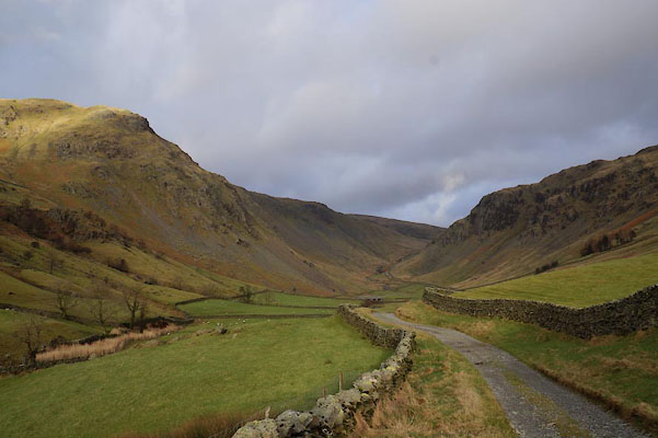
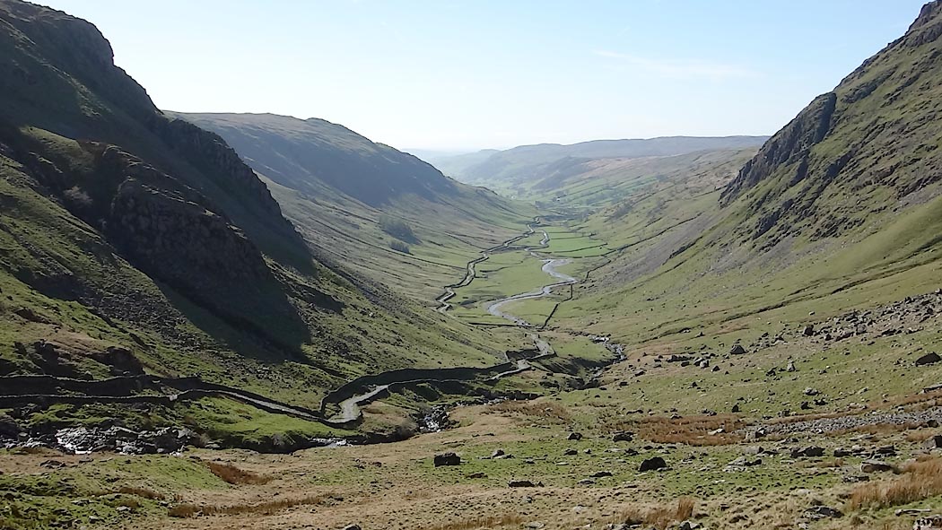 Click to enlarge CAK25.jpg (taken 19.4.2014) 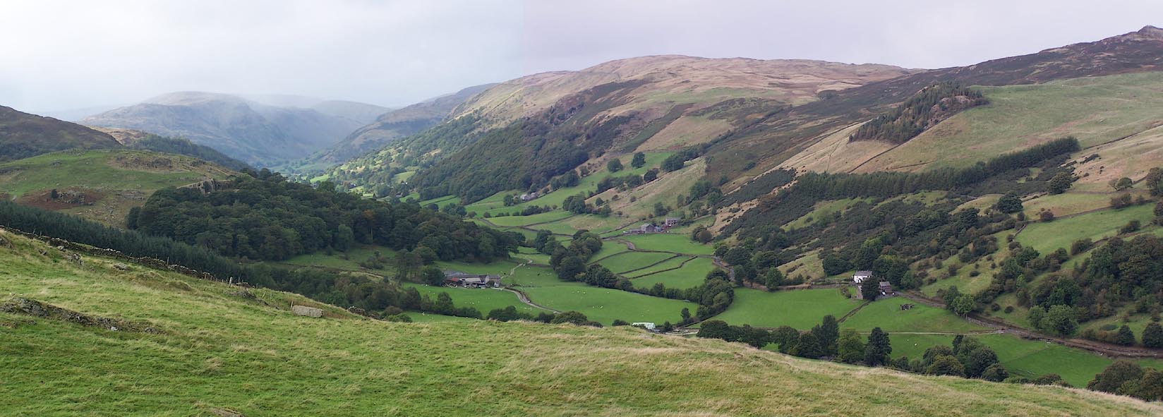 Click to enlarge BJX02.jpg (taken 1.10.2005) |
|||||||||||||||||||||||||||||||||||||||||||||||||||||||||||||||||||||||||||||||||||||||||||||||||||||||||||||||||||||||||||||||||||||||||
|
|
|||||||||||||||||||||||||||||||||||||||||||||||||||||||||||||||||||||||||||||||||||||||||||||||||||||||||||||||||||||||||||||||||||||||||
| evidence:- | old map:- OS County Series (Wmd 27 2) placename:- Long Sleddale |
||||||||||||||||||||||||||||||||||||||||||||||||||||||||||||||||||||||||||||||||||||||||||||||||||||||||||||||||||||||||||||||||||||||||
| source data:- | Maps, County Series maps of Great Britain, scales 6 and 25
inches to 1 mile, published by the Ordnance Survey, Southampton,
Hampshire, from about 1863 to 1948. |
||||||||||||||||||||||||||||||||||||||||||||||||||||||||||||||||||||||||||||||||||||||||||||||||||||||||||||||||||||||||||||||||||||||||
|
|
|||||||||||||||||||||||||||||||||||||||||||||||||||||||||||||||||||||||||||||||||||||||||||||||||||||||||||||||||||||||||||||||||||||||||
| evidence:- | old map:- Saxton 1579 placename:- Sleddale |
||||||||||||||||||||||||||||||||||||||||||||||||||||||||||||||||||||||||||||||||||||||||||||||||||||||||||||||||||||||||||||||||||||||||
| source data:- | Map, hand coloured engraving, Westmorlandiae et Cumberlandiae Comitatus ie Westmorland
and Cumberland, scale about 5 miles to 1 inch, by Christopher Saxton, London, engraved
by Augustinus Ryther, 1576, published 1579-1645.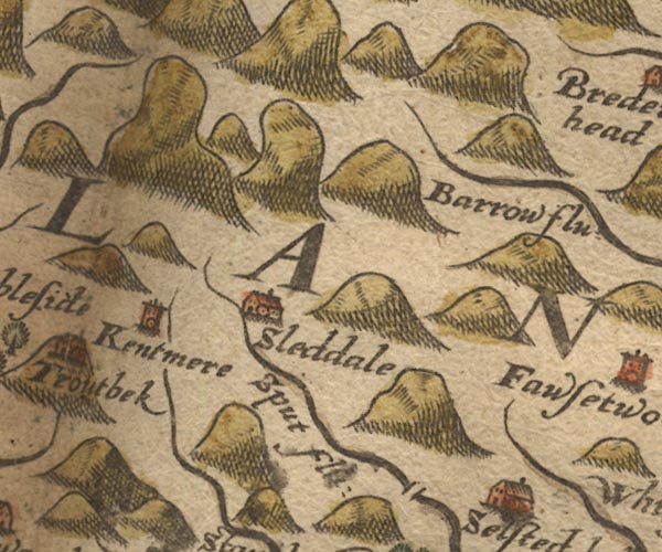 Sax9NY40.jpg Building, symbol for a hamlet, which may or may not have a nucleus. "Sleddale" item:- private collection : 2 Image © see bottom of page |
||||||||||||||||||||||||||||||||||||||||||||||||||||||||||||||||||||||||||||||||||||||||||||||||||||||||||||||||||||||||||||||||||||||||
|
|
|||||||||||||||||||||||||||||||||||||||||||||||||||||||||||||||||||||||||||||||||||||||||||||||||||||||||||||||||||||||||||||||||||||||||
| evidence:- | old map:- Mercator 1595 (edn?) placename:- Sleddale Chapelry |
||||||||||||||||||||||||||||||||||||||||||||||||||||||||||||||||||||||||||||||||||||||||||||||||||||||||||||||||||||||||||||||||||||||||
| source data:- | Map, hand coloured engraving, Westmorlandia, Lancastria, Cestria
etc, ie Westmorland, Lancashire, Cheshire etc, scale about 10.5
miles to 1 inch, by Gerard Mercator, Duisberg, Germany, 1595,
edition 1613-16. MER5WmdA.jpg "Sleddale chap." circle item:- Armitt Library : 2008.14.3 Image © see bottom of page |
||||||||||||||||||||||||||||||||||||||||||||||||||||||||||||||||||||||||||||||||||||||||||||||||||||||||||||||||||||||||||||||||||||||||
|
|
|||||||||||||||||||||||||||||||||||||||||||||||||||||||||||||||||||||||||||||||||||||||||||||||||||||||||||||||||||||||||||||||||||||||||
| evidence:- | old map:- Speed 1611 (Wmd) placename:- Sleddale |
||||||||||||||||||||||||||||||||||||||||||||||||||||||||||||||||||||||||||||||||||||||||||||||||||||||||||||||||||||||||||||||||||||||||
| source data:- | Map, hand coloured engraving, The Countie Westmorland and
Kendale the Cheif Towne, scale about 2.5 miles to 1 inch, by
John Speed, 1610, published by George Humble, Popes Head Alley,
London, 1611-12.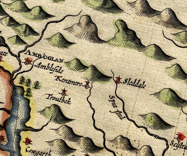 SP14NY40.jpg "Sleddale" circle, tower item:- Armitt Library : 2008.14.5 Image © see bottom of page |
||||||||||||||||||||||||||||||||||||||||||||||||||||||||||||||||||||||||||||||||||||||||||||||||||||||||||||||||||||||||||||||||||||||||
|
|
|||||||||||||||||||||||||||||||||||||||||||||||||||||||||||||||||||||||||||||||||||||||||||||||||||||||||||||||||||||||||||||||||||||||||
| evidence:- | old map:- Seller 1694 (Wmd) placename:- Sleddale |
||||||||||||||||||||||||||||||||||||||||||||||||||||||||||||||||||||||||||||||||||||||||||||||||||||||||||||||||||||||||||||||||||||||||
| source data:- | Map, hand coloured engraving, Westmorland, scale about 8 miles
to 1 inch, by John Seller, 1694. click to enlarge click to enlargeSEL7.jpg "Sleddale" circle, italic lowercase text; settlement or house item:- Dove Cottage : 2007.38.87 Image © see bottom of page |
||||||||||||||||||||||||||||||||||||||||||||||||||||||||||||||||||||||||||||||||||||||||||||||||||||||||||||||||||||||||||||||||||||||||
|
|
|||||||||||||||||||||||||||||||||||||||||||||||||||||||||||||||||||||||||||||||||||||||||||||||||||||||||||||||||||||||||||||||||||||||||
| evidence:- | old map:- Morden 1695 (Wmd) placename:- Lang Sledale |
||||||||||||||||||||||||||||||||||||||||||||||||||||||||||||||||||||||||||||||||||||||||||||||||||||||||||||||||||||||||||||||||||||||||
| source data:- | Map, hand coloured engraving, Westmorland, scale about 2.5 miles to 1 inch, by Robert
Morden, published by Abel Swale, the Unicorn, St Paul's Churchyard, Awnsham, and John
Churchill, the Black Swan, Paternoster Row, London, 1695. MD10NY40.jpg "Lang Sledale" Circle, marked high up the valley. item:- JandMN : 24 Image © see bottom of page |
||||||||||||||||||||||||||||||||||||||||||||||||||||||||||||||||||||||||||||||||||||||||||||||||||||||||||||||||||||||||||||||||||||||||
|
|
|||||||||||||||||||||||||||||||||||||||||||||||||||||||||||||||||||||||||||||||||||||||||||||||||||||||||||||||||||||||||||||||||||||||||
| evidence:- | old map:- Bowen and Kitchin 1760 placename:- Sleddale |
||||||||||||||||||||||||||||||||||||||||||||||||||||||||||||||||||||||||||||||||||||||||||||||||||||||||||||||||||||||||||||||||||||||||
| source data:- | Map, hand coloured engraving, A New Map of the Counties of
Cumberland and Westmoreland Divided into their Respective Wards,
scale about 4 miles to 1 inch, by Emanuel Bowen and Thomas
Kitchin et al, published by T Bowles, Robert Sayer, and John
Bowles, London, 1760. BO18NY30.jpg "Sleddale" circle, tower item:- Armitt Library : 2008.14.10 Image © see bottom of page |
||||||||||||||||||||||||||||||||||||||||||||||||||||||||||||||||||||||||||||||||||||||||||||||||||||||||||||||||||||||||||||||||||||||||
|
|
|||||||||||||||||||||||||||||||||||||||||||||||||||||||||||||||||||||||||||||||||||||||||||||||||||||||||||||||||||||||||||||||||||||||||
| evidence:- | old map:- Jefferys 1770 (Wmd) placename:- Long Sleddale |
||||||||||||||||||||||||||||||||||||||||||||||||||||||||||||||||||||||||||||||||||||||||||||||||||||||||||||||||||||||||||||||||||||||||
| source data:- | Map, 4 sheets, The County of Westmoreland, scale 1 inch to 1
mile, surveyed 1768, and engraved and published by Thomas
Jefferys, London, 1770. J5NY40NE.jpg  J5NY40SE.jpg 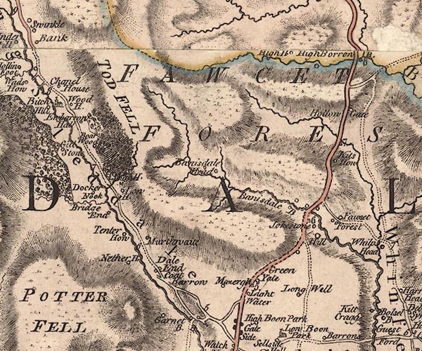 J5NY50SW.jpg "Long Sleddale" hill hachuring; valley, locality item:- National Library of Scotland : EME.s.47 Images © National Library of Scotland |
||||||||||||||||||||||||||||||||||||||||||||||||||||||||||||||||||||||||||||||||||||||||||||||||||||||||||||||||||||||||||||||||||||||||
|
|
|||||||||||||||||||||||||||||||||||||||||||||||||||||||||||||||||||||||||||||||||||||||||||||||||||||||||||||||||||||||||||||||||||||||||
| evidence:- | old text:- Pennant 1773 placename:- Long Sladale item:- slate |
||||||||||||||||||||||||||||||||||||||||||||||||||||||||||||||||||||||||||||||||||||||||||||||||||||||||||||||||||||||||||||||||||||||||
| source data:- | Book, A Tour from Downing to Alston Moor, 1773, by Thomas
Pennant, published by Edward Harding, 98 Pall Mall, London, 1801. goto source goto sourcePennant's Tour 1773, page 121 "... A little beyond I began to ascend the mountains: on the left is the narrow deep valley of Long Sladale, celebrated for the quantity of fine blue slates quarried out of its neighbourhood. At a distance soars Kentmere-fell: for a long space the road lies in the midst of black and dreary mountains. ..." |
||||||||||||||||||||||||||||||||||||||||||||||||||||||||||||||||||||||||||||||||||||||||||||||||||||||||||||||||||||||||||||||||||||||||
|
|
|||||||||||||||||||||||||||||||||||||||||||||||||||||||||||||||||||||||||||||||||||||||||||||||||||||||||||||||||||||||||||||||||||||||||
| evidence:- | descriptive text:- Nicolson and Burn 1777 placename:- Long Sleddale item:- fulling mill; mill |
||||||||||||||||||||||||||||||||||||||||||||||||||||||||||||||||||||||||||||||||||||||||||||||||||||||||||||||||||||||||||||||||||||||||
| source data:- | Book, History and Antiquities of the Counties of Westmorland and
Cumberland, 2 volumes, by Joseph Nicolson and Richard Burn,
published by W Strahan and T Cadell, Strand, London, 1777. pp.133-134 "LONG SLEDDALE, like the rest, belonged to the ancient barons of Kendale. They granted in fee divers tenements there to several persons, and finally granted the manor to the Thornburghs of Hamsfel and Selside, who sold the same to Bellingham, who sold to Colonel James Grahame, from whom the same hath descended to the present earl of Suffolk and Berkshire." "In the reign of king Henry the third, William de Lancastre, baron of Kendal, enfeoffed Rowland de Renegill of 29 acres of arable land in Sleddale, and pasture there to the value of 100s. He also enfeoffed Robert de Leyburne (to whom also he gave Skelsmergh) of three acres and a half in Sleddale for meadow ground, and pasture there also." "Among the Escheats in the 3 Cha. 1. it is found, that William de Thornbeburghe esquire held 20 messuages or tenements with two fulling mills in Sleddale of the late marquis of Northamtpon, and then of then king; as of his castle of Kendal, in socage, by fealty and the rent of 6d a year for all services; and that the same were of the clear yearly value of 12l 4s 4d." "The tenements have been from time to time all or most of them enfranchised." "Here is no manor house, for the lords of the manor, so far as we have found, never resided at this place. When the Thornburghs had the manor, the tenants attended the court at Selside Hall." "The most considerable house in the dale was Ubery-hall, ..." "The chapel stands about the middle of the dale, ..." |
||||||||||||||||||||||||||||||||||||||||||||||||||||||||||||||||||||||||||||||||||||||||||||||||||||||||||||||||||||||||||||||||||||||||
|
|
|||||||||||||||||||||||||||||||||||||||||||||||||||||||||||||||||||||||||||||||||||||||||||||||||||||||||||||||||||||||||||||||||||||||||
| evidence:- | descriptive text:- West 1778 (11th edn 1821) placename:- Long Sleddale |
||||||||||||||||||||||||||||||||||||||||||||||||||||||||||||||||||||||||||||||||||||||||||||||||||||||||||||||||||||||||||||||||||||||||
| source data:- | Guide book, A Guide to the Lakes, by Thomas West, published by
William Pennington, Kendal, Cumbria once Westmorland, and in
London, 1778 to 1821. goto source Page 166:- "... in the course of your descent [from Gatescarth], you will presently be accompanied by a cataract on the right. The road traverses the mountain as on the other side, but is much better made, and wider, on account of the slate taken from the sides of these mountains and carried to Kendal, &c. The water-falls on the right are extremely curious. You enter Long-Sleddale between two shattered rocky mountains. That on the left, Crowbarrow, is not less terrible to look up at, when under it, than any rock in Barrowside or Borrowdale, and it has covered a much larger space with ruins. Here is every possible variety of water falls and cataracts; the most remarkable of which is on the left. Over a most tremendous wall of rock, a mountain torrent, in one broken sheet, leaps headlong one hundred yards and more. The whole vale is narrow; the hills rise swift on each hand; their brows are wooded; their feet covered with grass, or cultivated, and their summits broken. The road along the vale is tolerable, and joins the great road at Watch-gate, about four miles from Kendal." |
||||||||||||||||||||||||||||||||||||||||||||||||||||||||||||||||||||||||||||||||||||||||||||||||||||||||||||||||||||||||||||||||||||||||
|
|
|||||||||||||||||||||||||||||||||||||||||||||||||||||||||||||||||||||||||||||||||||||||||||||||||||||||||||||||||||||||||||||||||||||||||
| evidence:- | old map:- West 1784 map placename:- Long Sleddale |
||||||||||||||||||||||||||||||||||||||||||||||||||||||||||||||||||||||||||||||||||||||||||||||||||||||||||||||||||||||||||||||||||||||||
| source data:- | Map, hand coloured engraving, A Map of the Lakes in Cumberland,
Westmorland and Lancashire, scale about 3.5 miles to 1 inch,
engraved by Paas, 53 Holborn, London, about 1784.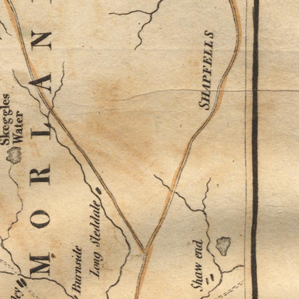 Ws02NY50.jpg Marked by a block for a village or hamlet. item:- Armitt Library : A1221.1 Image © see bottom of page |
||||||||||||||||||||||||||||||||||||||||||||||||||||||||||||||||||||||||||||||||||||||||||||||||||||||||||||||||||||||||||||||||||||||||
|
|
|||||||||||||||||||||||||||||||||||||||||||||||||||||||||||||||||||||||||||||||||||||||||||||||||||||||||||||||||||||||||||||||||||||||||
| evidence:- | old text:- Housman 1800 placename:- Long Sleddale |
||||||||||||||||||||||||||||||||||||||||||||||||||||||||||||||||||||||||||||||||||||||||||||||||||||||||||||||||||||||||||||||||||||||||
| source data:- | Guide book, Descriptive Tour, and Guide to the Lakes, Caves, Mountains ..., by John
Housman, published by F Jollie, Carlisle, Cumberland and C Law, Ave Maria Lane, London,
1800; published
1800-21. page 69:- "..." "We now leave Kendal, and proceed towards the lake Haws-water, either by way of Shap, or Long-Sleddale. ... The latter is a more direct road, of about 16 miles:" Page 70:- "... but the passage is very difficult, as it is necessary to pursue a dim serpentine path over a high mountain, impassable in any sort of carriage, and not easily traversed on horseback. This road, however, was represented to us as so romantically curious that we were induced to direct our course by that route." "..." "CONTINUING the Shap and Penrith road for about four miles and a half, we turn off to the left, and pursue a bye-road to Long-Sleddale, which is a long, narrow, and deep vale, inclosed with high ridges of rocky mountains. ... A large brook intersects a strip of meadow ground which" Page 71:- "runs along the bottom of this vale. The fields on each side rise in irregular swells, till the rocky declivity of the mountains precludes all cultivation; where brushwood and coppice commence, and often climb almost to the top, sometimes finding support even on the craggy precipices. The surrounding mountains continue to ascend with increasing grandeur. The dale then contracts a little, and towards its head the rocks become eminently conspicuous; ..." Page 72:- "..." "The mountains now begin to unite their bases, and the road gradually ascends; ..." "The road now contracts into a rugged path, and winds curiously half way up the side of a steep mountain, whence a more easy ascent is had to its summit. It then descends, in a like serpentine manner, down to the vale of Mardale. Notwithstanding the difficulty of this road, the stranger enjoys the satisfaction of being assured that he cannot possibly deviate from the right path. - When we traversed this Alpine pass, the broken scattered clouds were hurried along before a brisk wind, just touching the tops of the mountains, while the sun shone bright through among them. The dark coloured and well defined shadows of these dense vapours, sweeping rapidly over the heathy surface in a variety of figures, like immense carpets, occasioned a very singular appearance in this elevated region." |
||||||||||||||||||||||||||||||||||||||||||||||||||||||||||||||||||||||||||||||||||||||||||||||||||||||||||||||||||||||||||||||||||||||||
|
|
|||||||||||||||||||||||||||||||||||||||||||||||||||||||||||||||||||||||||||||||||||||||||||||||||||||||||||||||||||||||||||||||||||||||||
| evidence:- | old map:- Cooke 1802 placename:- Long Sleddale |
||||||||||||||||||||||||||||||||||||||||||||||||||||||||||||||||||||||||||||||||||||||||||||||||||||||||||||||||||||||||||||||||||||||||
| source data:- | Map, The Lakes, Westmorland and Cumberland, scale about 8.5
miles to 1 inch, engravedby Neele and Son, published by
Sherwood, Jones and Co, Paternoster Road, London, 1824. click to enlarge click to enlargeGRA1Lk.jpg "Long Sleddale" locality item:- Hampshire Museums : FA2000.62.5 Image © see bottom of page |
||||||||||||||||||||||||||||||||||||||||||||||||||||||||||||||||||||||||||||||||||||||||||||||||||||||||||||||||||||||||||||||||||||||||
|
|
|||||||||||||||||||||||||||||||||||||||||||||||||||||||||||||||||||||||||||||||||||||||||||||||||||||||||||||||||||||||||||||||||||||||||
| evidence:- | old text:- Capper 1808 placename:- Longsleddale item:- population |
||||||||||||||||||||||||||||||||||||||||||||||||||||||||||||||||||||||||||||||||||||||||||||||||||||||||||||||||||||||||||||||||||||||||
| source data:- | Gazetteer, A Topographical Dictionary of the United Kingdom,
compiled by Benjamin Pitts Capper, published by Richard
Phillips, Bridge Street, Blackfriars, London, 1808; published
1808-29. goto source "..." "LONGSLEDDALE, a township and curacy in the parish and ward of Kendal, Westmoreland, 6 miles from Kendal, and 266 from London; containing 36 houses and 187 inhabitants." "..." |
||||||||||||||||||||||||||||||||||||||||||||||||||||||||||||||||||||||||||||||||||||||||||||||||||||||||||||||||||||||||||||||||||||||||
|
|
|||||||||||||||||||||||||||||||||||||||||||||||||||||||||||||||||||||||||||||||||||||||||||||||||||||||||||||||||||||||||||||||||||||||||
| evidence:- | possibly old text:- Capper 1808 |
||||||||||||||||||||||||||||||||||||||||||||||||||||||||||||||||||||||||||||||||||||||||||||||||||||||||||||||||||||||||||||||||||||||||
| source data:- | Gazetteer, A Topographical Dictionary of the United Kingdom,
compiled by Benjamin Pitts Capper, published by Richard
Phillips, Bridge Street, Blackfriars, London, 1808; published
1808-29. goto source "..." "HAWES WATER, a beautiful lake, 5 miles distant of Kendal, ... On the road from Penrith to Kendal is a fine cataract, and the little vale contracts into a glen strewn with the ruins of mouldered mountains. ..." |
||||||||||||||||||||||||||||||||||||||||||||||||||||||||||||||||||||||||||||||||||||||||||||||||||||||||||||||||||||||||||||||||||||||||
|
|
|||||||||||||||||||||||||||||||||||||||||||||||||||||||||||||||||||||||||||||||||||||||||||||||||||||||||||||||||||||||||||||||||||||||||
| evidence:- | old map:- Cooper 1808 placename:- Longsleddale |
||||||||||||||||||||||||||||||||||||||||||||||||||||||||||||||||||||||||||||||||||||||||||||||||||||||||||||||||||||||||||||||||||||||||
| source data:- | Map, hand coloured engraving, Westmoreland ie Westmorland, scale
about 9 miles to 1 inch, by H Cooper, 1808, published by R
Phillips, Bridge Street, Blackfriars, London, 1808. click to enlarge click to enlargeCOP4.jpg "Longsleddale" circle; village or hamlet; and hill hachuring; valley item:- Dove Cottage : 2007.38.53 Image © see bottom of page |
||||||||||||||||||||||||||||||||||||||||||||||||||||||||||||||||||||||||||||||||||||||||||||||||||||||||||||||||||||||||||||||||||||||||
|
|
|||||||||||||||||||||||||||||||||||||||||||||||||||||||||||||||||||||||||||||||||||||||||||||||||||||||||||||||||||||||||||||||||||||||||
| evidence:- | old map:- Otley 1818 placename:- Longsleddale |
||||||||||||||||||||||||||||||||||||||||||||||||||||||||||||||||||||||||||||||||||||||||||||||||||||||||||||||||||||||||||||||||||||||||
| source data:- | Map, uncoloured engraving, The District of the Lakes,
Cumberland, Westmorland, and Lancashire, scale about 4 miles to
1 inch, by Jonathan Otley, 1818, engraved by J and G Menzies,
Edinburgh, Scotland, published by Jonathan Otley, Keswick,
Cumberland, et al, 1833. OT02NY40.jpg  OT02NY50.jpg "LONGSLEDDALE" item:- JandMN : 48.1 Image © see bottom of page |
||||||||||||||||||||||||||||||||||||||||||||||||||||||||||||||||||||||||||||||||||||||||||||||||||||||||||||||||||||||||||||||||||||||||
|
|
|||||||||||||||||||||||||||||||||||||||||||||||||||||||||||||||||||||||||||||||||||||||||||||||||||||||||||||||||||||||||||||||||||||||||
| evidence:- | descriptive text:- Otley 1823 (5th edn 1834) placename:- Long Sleddale item:- geology |
||||||||||||||||||||||||||||||||||||||||||||||||||||||||||||||||||||||||||||||||||||||||||||||||||||||||||||||||||||||||||||||||||||||||
| source data:- | Guide book, A Concise Description of the English Lakes, the
mountains in their vicinity, and the roads by which they may be
visited, with remarks on the mineralogy and geology of the
district, by Jonathan Otley, published by the author, Keswick,
Cumberland now Cumbria, by J Richardson, London, and by Arthur
Foster, Kirkby Lonsdale, Cumbria, 1823; published 1823-49,
latterly as the Descriptive Guide to the English Lakes. goto source Page 114:- "There are various mountain passes by which Hawes Water may be approached by pedestrians; and a way on horseback through Long Sleddale, has been described with a high degree of colouring in some former publications. In planning an excursion, several things are to be taken into consideration; as, what kind of conveyance the roads will admit of, how that conveyance is to be supplied, and at what places refreshment may be obtained. Long Sleddale is a valley possessing all the requisites of meadows, woods, mountains, rocks, and waterfalls; but they are deficient in that harmony of composition which renders some of the more northern vallies so attractive to the tourist." "..." goto sourcePage 116:- "Those who wish to penetrate the hidden recesses of the mountains may go the whole length of the lake, ... Mardale Green; from whence they may either return the same way, or pass over the mountains to Long Sleddale or to Kentmere." goto sourcePage 158:- "The THIRD division - forming only inferior elevations - commences with a bed of dark-blue or blackish transition limestone, containing here and there a few shells and madrepores, and alternating with a slaty rock of the same colour; the different layers of each being in some places several feet, in others only a few inches in thickness. This limestone crosses the river Duddon near Broughton; passing Broughton Mills it runs in a north-east direction through Torver, by the foot of the Old Man mountain, and appears near Low Yewdale and Yew Tree. Here it makes a considerable slip to the eastward, after which it ranges past the Tarns upon the hills above Borwick Ground; and stretching through Skelwith, it crosses the head of Windermere near Low Wood Inn. Then passing above Dovenest and Skelgill, it traverses the vales of Troutbeck, Kentmere, and Long Sleddale;" |
||||||||||||||||||||||||||||||||||||||||||||||||||||||||||||||||||||||||||||||||||||||||||||||||||||||||||||||||||||||||||||||||||||||||
|
|
|||||||||||||||||||||||||||||||||||||||||||||||||||||||||||||||||||||||||||||||||||||||||||||||||||||||||||||||||||||||||||||||||||||||||
| evidence:- | directory:- Parson and White 1829 |
||||||||||||||||||||||||||||||||||||||||||||||||||||||||||||||||||||||||||||||||||||||||||||||||||||||||||||||||||||||||||||||||||||||||
| source data:- | Book, History, Directory, and Gazetteer, of the Counties of
Cumberland and Westmorland, with that Part of the Lake District
in Lancashire, forming the Lordships of Furness and Cartmel, by
William Parson and William White, published by W White and Co,
44 Hunslet Lane, Leeds, Yorkshire, 1829. Transcription for Longsleddale from Parson and White's directory, Westmorland, 1829. page 652:- "LONG-SLEDDALE township and chapelry, is a mountainous and picturesque district, 6 miles in length and 3 miles in breadth, extending southward from the lofty Harter Fell to Potter Fell, within 5 miles N. of Kendal, and intersected by the Sprint rivulet, which runs through the deep vale, parallel with the road by which tourists from Kendal approach the sublime mountain scenery round Hawes-water. Verdant fields rise from each side of the rivulet in irregular swells, till the rocky declivities of the mountains preclude all cultivation, except brush-wood and coppices, which climb up the steep banks, and in some places find support even in the craggy precipices, which here present their lofty and rugged fronts with much grandeur, having, in may places, beautiful cascades spouting and tumbling from their summits, and sometimes broken by gusts of wind into clouds of spangled moisture. At Rangle-Gill, near the head of the dale, are extensive quarries of the finest blue slate. The Chapel stands near the centre of the dale, in which the houses are all scattered, except at the north end where there is a hamlet, called Little London. It was re-built and had a burial-ground consecrated in 1712. It has been several time augmented, viz. in 1713 with £80, given by the heir and four daughters of Henry Holme, and in 1746, 1773, and 1775, with three lots of £200 each, from Queen Anne's bounty, and a subscription of £200, making altogether £880, laid out in the purchase of land in Long-Sleddale, Selside, and Lambrigg, now let for about £50 a year. The Hon. F. G. Howard, of Levens Hall, is lord of the manor, and allows the master of the Chapel School £15 per annum for teaching poor children. Most of the estates are enfranchised. The principal mansion in the dale was Ubery, or Ubarrow-Hall, now occupied by a farmer, and having an acient tower, with walls two yards thick. The Rev. Henry Greenwood is the incumbent, and the land-owners are the patrons of the curacy." |
||||||||||||||||||||||||||||||||||||||||||||||||||||||||||||||||||||||||||||||||||||||||||||||||||||||||||||||||||||||||||||||||||||||||
| source data:- | page 672:- "LONG SLEDDALE." "Marked 1, reside at Little London; 2, on the East side; and 3, on the West side the Sprint Beck." "2 Greenwood, Rev. Edward, Incumbent, Woodhouse" "1 Holden, Joseph, tailor" "Sinkinson, Wilson &Walker, slate quarry proprietors, Rangle gill" "Wilkinson Lancelot, school master, Swinklehill" "FARMERS." "Thus *are Yeomen." "1 Adamson Thomas, Low house" "3 Dixon John, Hollin root" "3 Douthwaite Wm. Dale end" "3 Elleray Christopher, Docker nook" "1*Hanson James" "1*Hanson John" "1 Hoggarth George" "3 Horsfall James, Hill" "2*Hudson Thos. Hill sole" "FARMERS." "3 Hudson Thos. Wadshaw" "2 Kellett Wm. Ubarrow hall" "2 Kellett Thos. Mourthwaite" "2*Mattinson James, Sadgill" "2 Mattinson John, Beech hill" "3 Mattinson Michael, Tomshow" "3 Park John, Bridge end" "3 Robinson George, Tenter how" "2 Shepherd Richard, High Swinkle bank" "2*Sinkinson Robert, High house" "3 Thompson William, Well foot" "2 Walker Edward, Swinklebank" "2 Walker George, Middle Swinklebank" Notice Thomas Adamson, Low house marked as Little London ? Little London is now Stockdale |
||||||||||||||||||||||||||||||||||||||||||||||||||||||||||||||||||||||||||||||||||||||||||||||||||||||||||||||||||||||||||||||||||||||||
| source data:- | The directory data has been tabulated: names formatted in a standard way; role terms
controlled; place data with controlled terms for site name, plus a second keyword
giving the place in the old directory; other place data, standardised; date added
in each row.
|
||||||||||||||||||||||||||||||||||||||||||||||||||||||||||||||||||||||||||||||||||||||||||||||||||||||||||||||||||||||||||||||||||||||||
|
|
|||||||||||||||||||||||||||||||||||||||||||||||||||||||||||||||||||||||||||||||||||||||||||||||||||||||||||||||||||||||||||||||||||||||||
| evidence:- | descriptive text:- Rose 1832-35 placename:- Long Sleddale |
||||||||||||||||||||||||||||||||||||||||||||||||||||||||||||||||||||||||||||||||||||||||||||||||||||||||||||||||||||||||||||||||||||||||
| source data:- | Set of prints, 3 volumes, Westmorland, Cumberland, Durham and
Northumberland Illustrated; from drawings by Thomas Allom,
George Pickering, and H Gastineau, described by Thomas Rose,
published by H Fisher, R Fisher, and P Jackson, Newgate Street,
London, 1832-35. Descriptive text with the plate of Long Sleddale Slate Quarry, includes:- "Long Sleddale township and chapelry extends over a mountainous and picturesque district, six miles in length by three miles in breadth, and reaches southward from the lofty Harter Fell to Potter Fell, within a few miles north of Kendal. This vale is intersected by the Sprint rivulet, which runs parallel with the road by which tourists from Kendal approach the sublime mountain scenery around Hawes Water. On each side of the rivulet verdant fields rise in irregular swells, till the rocky decivities of the mountains preclude all cultivation except brushwood and coppices, which climb the steep banks, and in some places find support even in the craggy precipices, which here present their lofty and rugged fronts with much grandeur, having, in many places, beautiful cascades spouting and tumbling from their summits, and sometimes broken by gusts of wind into clouds of spray." |
||||||||||||||||||||||||||||||||||||||||||||||||||||||||||||||||||||||||||||||||||||||||||||||||||||||||||||||||||||||||||||||||||||||||
|
|
|||||||||||||||||||||||||||||||||||||||||||||||||||||||||||||||||||||||||||||||||||||||||||||||||||||||||||||||||||||||||||||||||||||||||
| evidence:- | descriptive text:- Ford 1839 (3rd edn 1843) placename:- Long Sleddale |
||||||||||||||||||||||||||||||||||||||||||||||||||||||||||||||||||||||||||||||||||||||||||||||||||||||||||||||||||||||||||||||||||||||||
| source data:- | Guide book, A Description of Scenery in the Lake District, by
Rev William Ford, published by Charles Thurnam, Carlisle, by W
Edwards, 12 Ave Maria Lane, Charles Tilt, Fleet Street, William
Smith, 113 Fleet Street, London, by Currie and Bowman,
Newcastle, by Bancks and Co, Manchester, by Oliver and Boyd,
Edinburgh, and by Sinclair, Dumfries, 1839. goto source Page 140:- "..." "LONG SLEDDALE." "Another path leads upwards by a mountain stream from Chapel Hill, between Harter Fell and Shap Fells, then down by Sadgill into Long Sleddale, and thence to Kendal, from which place Hawes Water is frequently visited by this route. The valley is, on the average, half-a-mile in width, and is intersected by the Sprint rivulet, which runs parallel to the road. From the bottom, which is covered with a mixture of arable and meadow ground, hanging woods and rising pastures ascend the sloping sides, terminating in sheep walks on the mountains. It is divided into small estates, having the farm-steads at the foot of rising grounds almost every quarter of a mile. On an eminence, midway, stands the chapel, and near it the school. The most interesting mansion in the dale is Yewbarrow Hall, having an ancient tower, whose walls are several feet thick." goto sourcePage 160:- "... The return from Chapelhill [Mardale] must be up the hill, having the stream from Small Water on the right, till a small stream is seen flowing down into Long Sleddale, which extends hence about six miles. The chapel stands near the centre of the dale, which is watered by the Sprint." |
||||||||||||||||||||||||||||||||||||||||||||||||||||||||||||||||||||||||||||||||||||||||||||||||||||||||||||||||||||||||||||||||||||||||
|
|
|||||||||||||||||||||||||||||||||||||||||||||||||||||||||||||||||||||||||||||||||||||||||||||||||||||||||||||||||||||||||||||||||||||||||
| evidence:- | old map:- Ford 1839 map placename:- Long Sleddale |
||||||||||||||||||||||||||||||||||||||||||||||||||||||||||||||||||||||||||||||||||||||||||||||||||||||||||||||||||||||||||||||||||||||||
| source data:- | Map, uncoloured engraving, Map of the Lake District of
Cumberland, Westmoreland and Lancashire, scale about 3.5 miles
to 1 inch, published by Charles Thurnam, Carlisle, and by R
Groombridge, 5 Paternoster Row, London, 3rd edn 1843.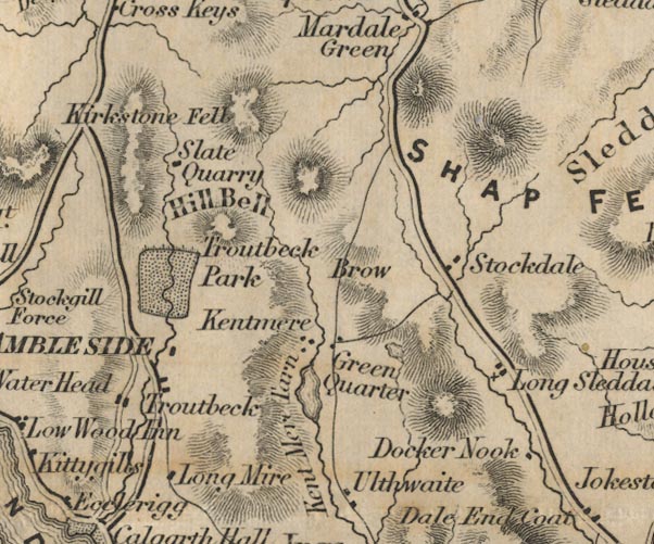 FD02NY40.jpg "Long Sleddale" item:- JandMN : 100.1 Image © see bottom of page |
||||||||||||||||||||||||||||||||||||||||||||||||||||||||||||||||||||||||||||||||||||||||||||||||||||||||||||||||||||||||||||||||||||||||
|
|
|||||||||||||||||||||||||||||||||||||||||||||||||||||||||||||||||||||||||||||||||||||||||||||||||||||||||||||||||||||||||||||||||||||||||
| evidence:- | old map:- Garnett 1850s-60s H placename:- Long Sleddale |
||||||||||||||||||||||||||||||||||||||||||||||||||||||||||||||||||||||||||||||||||||||||||||||||||||||||||||||||||||||||||||||||||||||||
| source data:- | Map of the English Lakes, in Cumberland, Westmorland and
Lancashire, scale about 3.5 miles to 1 inch, published by John
Garnett, Windermere, Westmorland, 1850s-60s.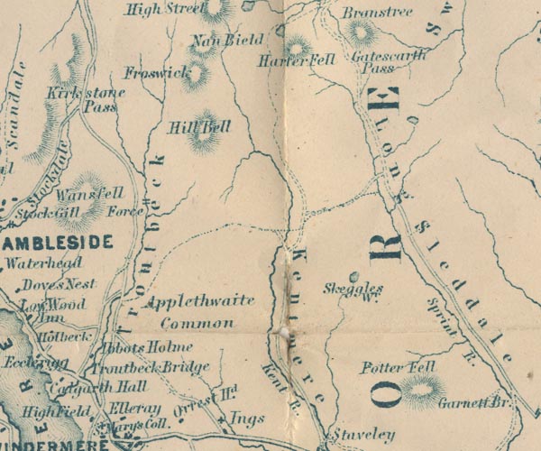 GAR2NY40.jpg "Long Sleddale" river valley item:- JandMN : 82.1 Image © see bottom of page |
||||||||||||||||||||||||||||||||||||||||||||||||||||||||||||||||||||||||||||||||||||||||||||||||||||||||||||||||||||||||||||||||||||||||
|
|
|||||||||||||||||||||||||||||||||||||||||||||||||||||||||||||||||||||||||||||||||||||||||||||||||||||||||||||||||||||||||||||||||||||||||
| evidence:- | old text:- Martineau 1855 |
||||||||||||||||||||||||||||||||||||||||||||||||||||||||||||||||||||||||||||||||||||||||||||||||||||||||||||||||||||||||||||||||||||||||
| source data:- | Guide book, A Complete Guide to the English Lakes, by Harriet
Martineau, published by John Garnett, Windermere, Westmorland,
and by Whittaker and Co, London, 1855; published 1855-76. goto source Page 174:- "[from Mardale] The traveller must either go back the way he came, or climb out of the dale at the head, whence three tracks branch off from the top of the pass of Nanbield. One of these tracks turns to the left before reaching Small Water, and goes down into Long Sleddale,- to follow which we know of no sufficient inducement, unless it be that the way is practicable for a horse,- which the others are not. ..." |
||||||||||||||||||||||||||||||||||||||||||||||||||||||||||||||||||||||||||||||||||||||||||||||||||||||||||||||||||||||||||||||||||||||||
|
|
|||||||||||||||||||||||||||||||||||||||||||||||||||||||||||||||||||||||||||||||||||||||||||||||||||||||||||||||||||||||||||||||||||||||||
| evidence:- | descriptive text:- Whellan 1860 placename:- Long Sleddale |
||||||||||||||||||||||||||||||||||||||||||||||||||||||||||||||||||||||||||||||||||||||||||||||||||||||||||||||||||||||||||||||||||||||||
| source data:- | Book, History and Topography of the Counties of Cumberland and
Westmoreland, by William Whellan, published by W Whellan and Co,
Pontefract, Yorkshire, 1860 "LONG SLEDDALE CHAPELRY" "THIS chapelry embraces a wild and picturesque district, about three miles in breadth, and extending from five to eleven miles north of Kendal. It is intersected by the Sprint rivulet, which runs through a deep vale parallel with the road, till it unites with the Kent about half a mile below Burneside Hall." "The rateable value of this township is L1,150. The population in 1801 was 187; in 1811, 172; in 1821, 185; in 1831, 199; in 1841, 173; and in 1851, 170. Agriculture is the only employment." "Long Sleddale belonged to the ancient barons of Kendal, who granted 'in fee divers tenements there to several person,' and finally granted the manor to the Thornburghs of Hamsfel and Selside, who sold it to the Bellinghams, from whom it was purchased by Colonel James Grahame, and is now held by the Hon. Mrs. Howard. The tenements have been from time to time, all or most of them, enfranchised. There does not appear to have been a manor-house here, the lords never being resident. When the Thornburghs held the manor, the tenants attended the court at Selside Hall. Ubery, or Yewbarrow Hall, was the most considerable house in the vale, and seems to have been the residence of a family bearing the name of Layburne; it is now a farm-house. The landowners are the Hon. Mrs. Howard, Richard Wilkinson, Esq.; Messrs. Henry and George Fothergill, Alexander W. Lodge, Rev. Robert Walker, Thomas Walker, Michael and John Mattinson, Robert Mattinson, and others." "..." "Long Sleddale chapel stands near the centre of the vale. ..." "There is no parsonage." "In 1853 the Rev. Miles Walker, brother of the present incumbent, gave L300, on condition that the inhabitants of the township would raise a similar sum, and devote it to the education of the poor of the chapelry. The inhabitants subscribed L250, to which the master and fellows of Trinity College, Cambridge, added L50, thus making up the amount required, which was invested in the Three-per-cent Consols, and now produces about L21 per annum. The Hon. Mrs. Howard also subscribes L10 a year for the education of poor children. A new schoolhouse is much needed." |
||||||||||||||||||||||||||||||||||||||||||||||||||||||||||||||||||||||||||||||||||||||||||||||||||||||||||||||||||||||||||||||||||||||||
|
|
|||||||||||||||||||||||||||||||||||||||||||||||||||||||||||||||||||||||||||||||||||||||||||||||||||||||||||||||||||||||||||||||||||||||||
| evidence:- | old text:- Prior 1865 placename:- Long Sleddale |
||||||||||||||||||||||||||||||||||||||||||||||||||||||||||||||||||||||||||||||||||||||||||||||||||||||||||||||||||||||||||||||||||||||||
| source data:- | Guide book, Ascents and Passes in the Lake District of England,
by Herman Prior, published by John Garnett, Windermere,
Westmorland, and by Simpkin, Marshall and Co, London, 1865. Page 7:- "... Long Sleddale ... although smaller than Kentmere, has a strikingly picturesque and secluded character. ..." |
||||||||||||||||||||||||||||||||||||||||||||||||||||||||||||||||||||||||||||||||||||||||||||||||||||||||||||||||||||||||||||||||||||||||
|
|
|||||||||||||||||||||||||||||||||||||||||||||||||||||||||||||||||||||||||||||||||||||||||||||||||||||||||||||||||||||||||||||||||||||||||
| evidence:- | old print:- Watson 1894 |
||||||||||||||||||||||||||||||||||||||||||||||||||||||||||||||||||||||||||||||||||||||||||||||||||||||||||||||||||||||||||||||||||||||||
| source data:- | View of upper Longsleddale including Sadgill, Goat Scar and Buckbarrow, in The Annals
of a Quiet Valley, by A Country Parson edited by John Watson, published by J M Dent
and Co, London, 1894.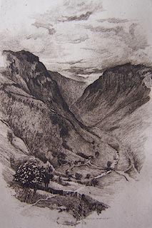 click to enlarge click to enlargeWT1E01.jpg "BERTHA NEWCOMBE" item:- Kendal Library : 5 Image © see bottom of page |
||||||||||||||||||||||||||||||||||||||||||||||||||||||||||||||||||||||||||||||||||||||||||||||||||||||||||||||||||||||||||||||||||||||||
|
|
|||||||||||||||||||||||||||||||||||||||||||||||||||||||||||||||||||||||||||||||||||||||||||||||||||||||||||||||||||||||||||||||||||||||||
 Gents Mag 1902 Legend Gents Mag 1902 Legend |
|||||||||||||||||||||||||||||||||||||||||||||||||||||||||||||||||||||||||||||||||||||||||||||||||||||||||||||||||||||||||||||||||||||||||
|
|
|||||||||||||||||||||||||||||||||||||||||||||||||||||||||||||||||||||||||||||||||||||||||||||||||||||||||||||||||||||||||||||||||||||||||
| evidence:- | descriptive text:- Wilson 1912 item:- tree; hawthorn; sycamore; flower; bluebell; gorse; broom; population, Longsleddale |
||||||||||||||||||||||||||||||||||||||||||||||||||||||||||||||||||||||||||||||||||||||||||||||||||||||||||||||||||||||||||||||||||||||||
| source data:- | Guide book, Longsleddale, by F M Wilson, published by T Wilson,
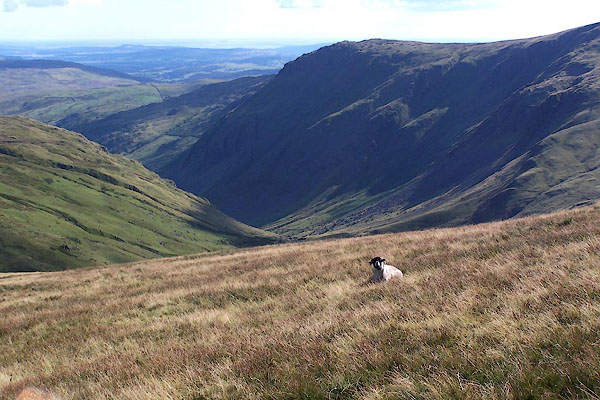
Kendal, Westmorland, 1912. WILSON1.txt "LONGSLEDDALE is the first of the grand and romantic valleys of Westmorland encountered on entering Lakeland via Kendal. This beautiful part of the country was seldom visited in times past, no doubt owing to the fact that no conveyance of any sort ran to such an out-of-the-way place. However visitors from a distance seem to have found out its beauty at last, and it is thought worth while running conveyances once a week to this lovely valley, only nine miles from Kendal, which is said to be the scene of Mrs. Humphrey Ward's 'Robert Ellesmere.' In it Mrs. Ward describes it as a valley through which runs a beautiful river, supplied by becks running down the hill sides, through which a narrow road buried with masses of 'May' runs in a line of white through the greenness of the pasture. This in June, the leafy month of the year, when Longsleddale looks at its best." "...." "As we go along, the countrysides passed through are thoroughly typical of Westmorland's most characteristic beauties: quaint farmsteadings, half-hid in their sycamore groves; hedgerows, aglow with wild flowers; lovely vistas of verdant pastures and wild moorland; with ever, beyond all, lines of mountain blue and grey, seamed with precipices and scored with gorges of a hundred streams. The wild blue hyacinths carpet the woods so that not a green blade is to be seen, and the yellow of the gorse and the broom make a bright patch of colour on the landscape." "The scenery throughout the dale is probably unsurpassed by any in the county, and it has the additional charm of being perfectly natural and free from any artificial effects. The mountains rise grandly on either side of the valley, and from among the rocks, cascades dash down and swell the river Sprint below, on its way to join the Kent. The broken sides of the mountains in rainy weather" "(and it is often raining here) are white with streams pouring from precipice to precipice, in long lines of foam." "...." "Some of the farm houses and cottages in Longsleddale are very picturesque, and deserve the attention of artists. Between Sadgill and the Slate Quarries the rocky barriers and the huge fragments of stone which have tumbled from them furnish a grand spectacle. Travellers passing through Longsleddale to Hawes Water may like to view them. There is a fine walk over Nanbeil Pass into Kentmere." "Towards the head of the valley the dale grows more narrow, rocky, and abrupt, till you think you can penetrate no further. As we leave the church, it assumes a wild, loneley" "and most solemn aspect, dividing Longsleddale from Mardale, with the grim and ghastly 'Goat Scar' on the left and the bold masses of 'Tarn Crags' on the right. " "..." "The dale is said to have received its name from the family of Sleddall, which claims to be descended from Sledda, the Saxon King. In this quiet dale, there is not much to break in upon the monotony of life, and the greatest interest is taken in strangers who visit the place. The population of the place in 1901 was 144." |
||||||||||||||||||||||||||||||||||||||||||||||||||||||||||||||||||||||||||||||||||||||||||||||||||||||||||||||||||||||||||||||||||||||||
|
|
|||||||||||||||||||||||||||||||||||||||||||||||||||||||||||||||||||||||||||||||||||||||||||||||||||||||||||||||||||||||||||||||||||||||||
| evidence:- | old map:- Burrow 1920s |
||||||||||||||||||||||||||||||||||||||||||||||||||||||||||||||||||||||||||||||||||||||||||||||||||||||||||||||||||||||||||||||||||||||||
| source data:- | Road book, On the Road, Dunlop Pictorial Road Plans, volume V,
strip maps with parts in Westmorland, Cumberland etc, irregular
scale about 1.5 miles to 1 inch, by E J Burrow and Co,
Cheltenham, Gloucestershire, 1920s. EJB3Vg11.jpg item:- private collection : 17 Image © see bottom of page |
||||||||||||||||||||||||||||||||||||||||||||||||||||||||||||||||||||||||||||||||||||||||||||||||||||||||||||||||||||||||||||||||||||||||
|
|
|||||||||||||||||||||||||||||||||||||||||||||||||||||||||||||||||||||||||||||||||||||||||||||||||||||||||||||||||||||||||||||||||||||||||
| evidence:- | records:- Curwen 1926 item:- book; Synopsis of British Plants |
||||||||||||||||||||||||||||||||||||||||||||||||||||||||||||||||||||||||||||||||||||||||||||||||||||||||||||||||||||||||||||||||||||||||
| source data:- | Records Relating to the Barony of Kendale, supplementary vol.3,
edited by John F Curwen, published by Titus Wilson and Son,
Kendal, Westmorland, 1926. CURWEN01.txt "1751 July 15 : Died in his 55th year John Wilson, author of The Synopsis of British Plants, and the first writer that attempted a systematic arrangement of our indigenous plants in the English Language. He was born in Longsleddale and became a shoemaker, but a severe asthma prevented him from following this trade and assisted him to cultivate his favourite science. His first volume was published in 1744, but he did not live long enough to finish the second volume. K. Notes and Queries, n. 581." |
||||||||||||||||||||||||||||||||||||||||||||||||||||||||||||||||||||||||||||||||||||||||||||||||||||||||||||||||||||||||||||||||||||||||
|
|
|||||||||||||||||||||||||||||||||||||||||||||||||||||||||||||||||||||||||||||||||||||||||||||||||||||||||||||||||||||||||||||||||||||||||
| evidence:- | textbook:- EPNS Westmorland 1967 placename:- Sleddal placename:- Sledale placename:- Sleddall placename:- Sleddisdale placename:- Langsleidall placename:- Longsleddell placename:- Langsleydale placename:- Long Sleddle |
||||||||||||||||||||||||||||||||||||||||||||||||||||||||||||||||||||||||||||||||||||||||||||||||||||||||||||||||||||||||||||||||||||||||
| source data:- | Book, The Place Names of Westmorland, two volumes, by A H Smith,
published for the English Place Name Society by Cambridge
University Press, Cambridgeshire, 1967 |
||||||||||||||||||||||||||||||||||||||||||||||||||||||||||||||||||||||||||||||||||||||||||||||||||||||||||||||||||||||||||||||||||||||||
|
|
|||||||||||||||||||||||||||||||||||||||||||||||||||||||||||||||||||||||||||||||||||||||||||||||||||||||||||||||||||||||||||||||||||||||||
| evidence:- | text:- Ffinch 1983 placename:- Long Whindale placename:- Long Sleddale |
||||||||||||||||||||||||||||||||||||||||||||||||||||||||||||||||||||||||||||||||||||||||||||||||||||||||||||||||||||||||||||||||||||||||
| source data:- | Book, Kendal and the Kent Valley, by Michael Ffinch, published
by Robert Hale, London, 1983. |
||||||||||||||||||||||||||||||||||||||||||||||||||||||||||||||||||||||||||||||||||||||||||||||||||||||||||||||||||||||||||||||||||||||||
|
|
|||||||||||||||||||||||||||||||||||||||||||||||||||||||||||||||||||||||||||||||||||||||||||||||||||||||||||||||||||||||||||||||||||||||||
| jigsaw |
|||||||||||||||||||||||||||||||||||||||||||||||||||||||||||||||||||||||||||||||||||||||||||||||||||||||||||||||||||||||||||||||||||||||||
|
|
|||||||||||||||||||||||||||||||||||||||||||||||||||||||||||||||||||||||||||||||||||||||||||||||||||||||||||||||||||||||||||||||||||||||||
| :- |
"The sheep in Longsleddale are tough, The swaddles, and also the rough; In the cold and the rain The ewes don't complain, But the tups, they have had quite enough." |
||||||||||||||||||||||||||||||||||||||||||||||||||||||||||||||||||||||||||||||||||||||||||||||||||||||||||||||||||||||||||||||||||||||||
|
|
|||||||||||||||||||||||||||||||||||||||||||||||||||||||||||||||||||||||||||||||||||||||||||||||||||||||||||||||||||||||||||||||||||||||||
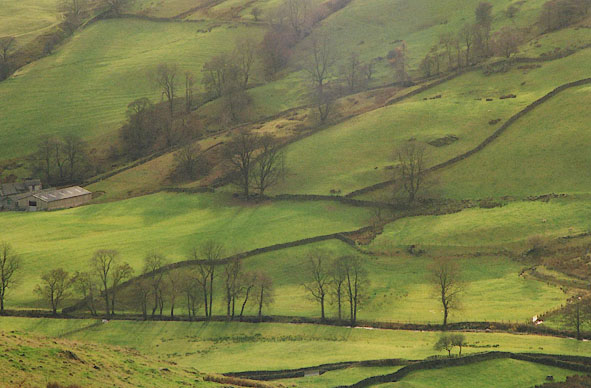 BHU26.jpg Trees, fields and stone walls. Between Low Sadgill and Tills Hole. (taken 11.2003) 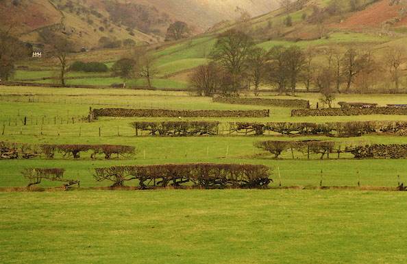 BIH23.jpg Bare hedges, fields below Hill, Longsleddale. (taken 24.1.2004) 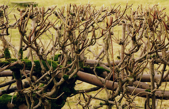 BIH27.jpg Bare hedge branches. (taken 24.1.2004) 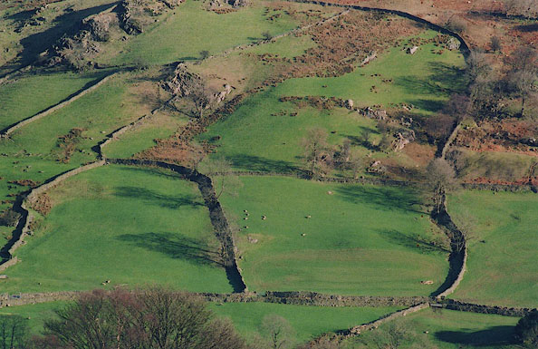 BIK12.jpg Fields, stone walls, trees, shadows. (taken 15.2.2004) |
|||||||||||||||||||||||||||||||||||||||||||||||||||||||||||||||||||||||||||||||||||||||||||||||||||||||||||||||||||||||||||||||||||||||||
|
|
|||||||||||||||||||||||||||||||||||||||||||||||||||||||||||||||||||||||||||||||||||||||||||||||||||||||||||||||||||||||||||||||||||||||||
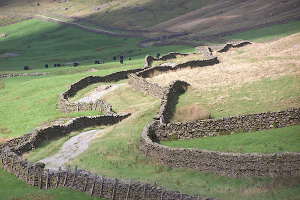
 BZS96.jpg (taken 28.12.2013) 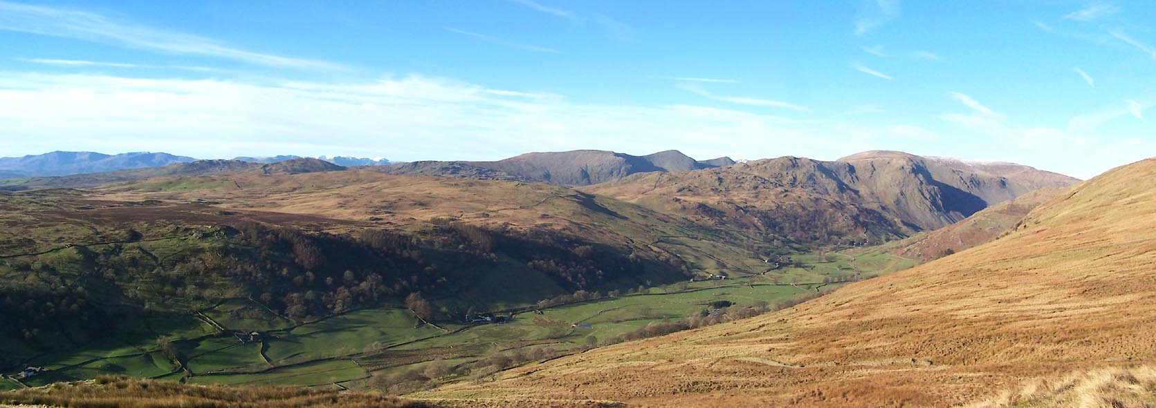 Click to enlarge BXS53.jpg (taken 29.11.2012) 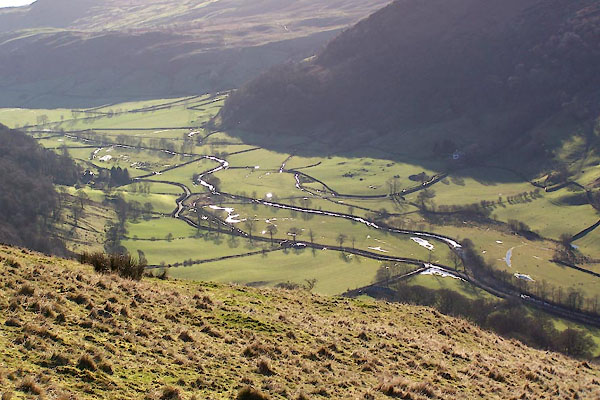 BXS57.jpg (taken 29.11.2012) 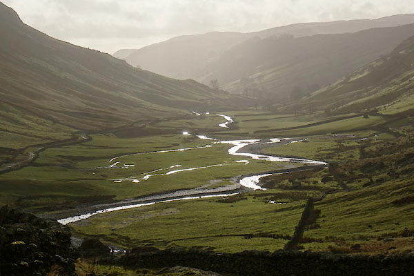 BZS99.jpg (taken 28.12.2013)  CBC31.jpg S of Docker Nook; note the low meadows, improved fields, and unimproved fell. (taken 11.7.2014) 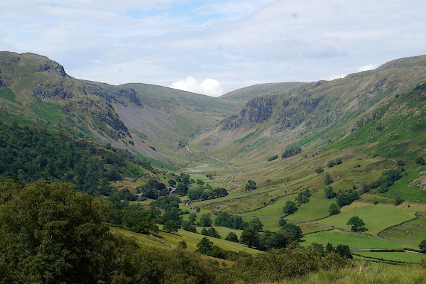 CBC51.jpg Upper valley. (taken 11.7.2014) 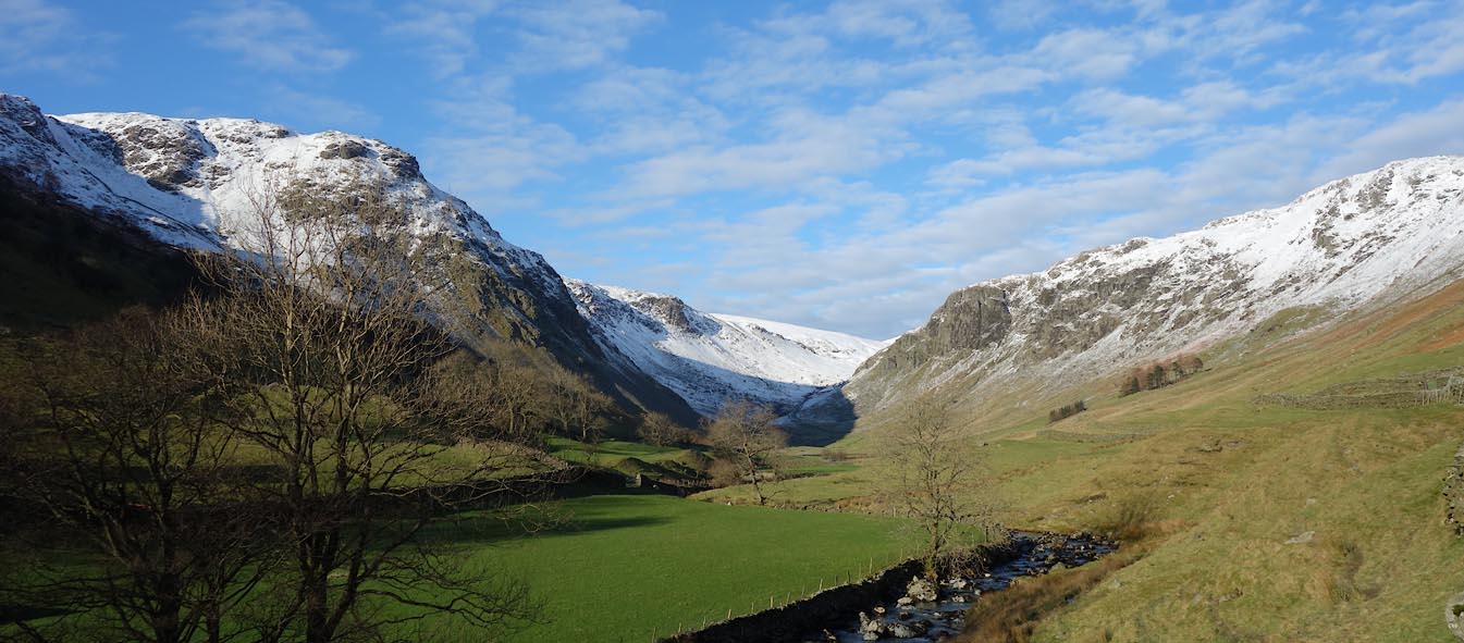 Click to enlarge CEM47.jpg Upper valley, snow. (taken 25.1.2016)  CEK97.jpg Six inches of rain so far, and still pouring. (taken 5.12.2015) 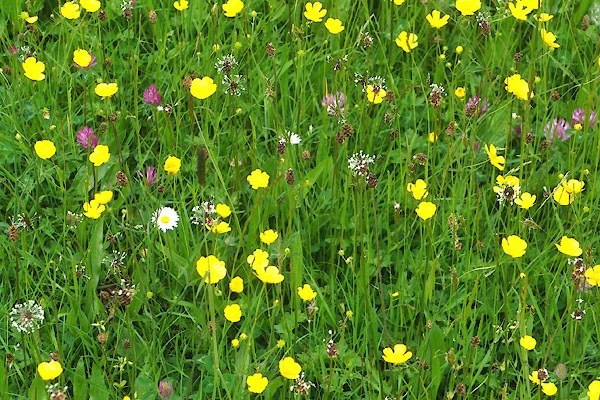 CFB87.jpg Meadow. (taken 7.6.2016) |
|||||||||||||||||||||||||||||||||||||||||||||||||||||||||||||||||||||||||||||||||||||||||||||||||||||||||||||||||||||||||||||||||||||||||
|
|
|||||||||||||||||||||||||||||||||||||||||||||||||||||||||||||||||||||||||||||||||||||||||||||||||||||||||||||||||||||||||||||||||||||||||
 BJT40.jpg (taken 20.8.2005) 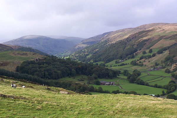 BJX01.jpg (taken 1.10.2005)  BIG22.jpg Stone walls and fields. (taken 4.12.2003) 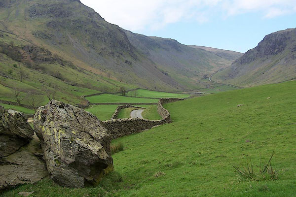 BNK09.jpg Dale head. (taken 2004) 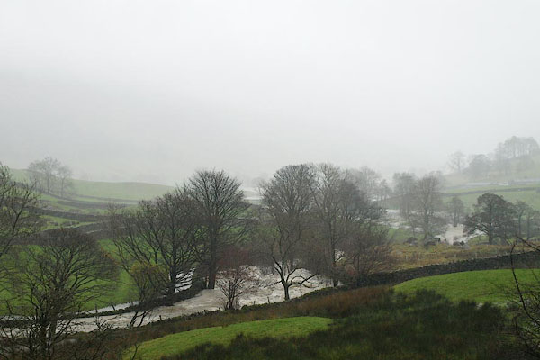 BRW95.jpg The river Sprint in spate. (taken 19.11.2009) 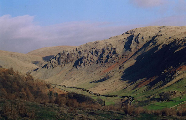 BIK13.jpg The drove road from Sadgill to Gatescarth, from Cocklaw Fell:- (taken 15.2.2004)  BIH07.jpg Shadow of Goat Scar in Longsleddale, from:- (taken 29.12.2003) 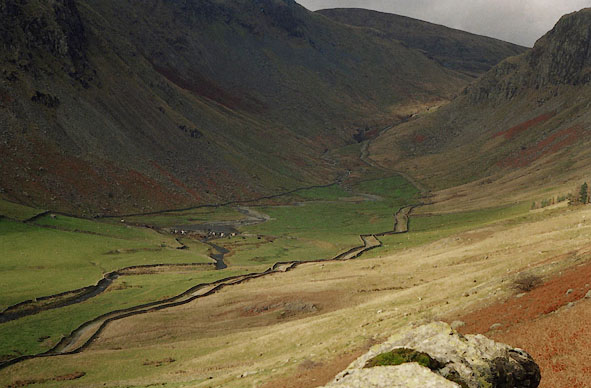 BHU24.jpg The drove road from Sadgill to Gatescarth, from Great Howe, (taken 11.2003) 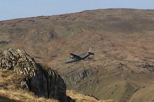 BNO60.jpg Hercules aircraft. (taken 12.4.2007) |
|||||||||||||||||||||||||||||||||||||||||||||||||||||||||||||||||||||||||||||||||||||||||||||||||||||||||||||||||||||||||||||||||||||||||
|
|
|||||||||||||||||||||||||||||||||||||||||||||||||||||||||||||||||||||||||||||||||||||||||||||||||||||||||||||||||||||||||||||||||||||||||
| clouds |
|||||||||||||||||||||||||||||||||||||||||||||||||||||||||||||||||||||||||||||||||||||||||||||||||||||||||||||||||||||||||||||||||||||||||
|
|
|||||||||||||||||||||||||||||||||||||||||||||||||||||||||||||||||||||||||||||||||||||||||||||||||||||||||||||||||||||||||||||||||||||||||
| :- |
Longsleddale, Population |
||||||||||||||||||||||||||||||||||||||||||||||||||||||||||||||||||||||||||||||||||||||||||||||||||||||||||||||||||||||||||||||||||||||||
| Figures from Census returns. |
|||||||||||||||||||||||||||||||||||||||||||||||||||||||||||||||||||||||||||||||||||||||||||||||||||||||||||||||||||||||||||||||||||||||||
|
|||||||||||||||||||||||||||||||||||||||||||||||||||||||||||||||||||||||||||||||||||||||||||||||||||||||||||||||||||||||||||||||||||||||||
|
|
|||||||||||||||||||||||||||||||||||||||||||||||||||||||||||||||||||||||||||||||||||||||||||||||||||||||||||||||||||||||||||||||||||||||||
| evidence:- | old newspaper:- Z8900719.txt item:- botany; wizard; botanist |
||||||||||||||||||||||||||||||||||||||||||||||||||||||||||||||||||||||||||||||||||||||||||||||||||||||||||||||||||||||||||||||||||||||||
| source data:- | Z8900719.txt Westmorland Gazette Transcription from the Westmorland Gazette 19 July 1890 page 2:- "... Lickbarrow studied plants and collected herbs, and such conduct would stamp him as a wizard. A botanist in this dale [Longsleddale] in the year 1702, without Lickbarrow's power of either imparting fear or inspiring affection, met with such disapprobation of his conduct that he was made wretched and driven from the district. This is not surprising when it is remembered that many trees and plants were supposed to have an influence on the powers of darkness. ..." |
||||||||||||||||||||||||||||||||||||||||||||||||||||||||||||||||||||||||||||||||||||||||||||||||||||||||||||||||||||||||||||||||||||||||
|
|
|||||||||||||||||||||||||||||||||||||||||||||||||||||||||||||||||||||||||||||||||||||||||||||||||||||||||||||||||||||||||||||||||||||||||
| evidence:- | old newspaper:- Z8900705.txt placename:- Longsleddale item:- flowers; gorse; broom; hawthorn; bluebell; butterfly orchid; orchid; globe flower; lichens; royal fern; geology; botany; placename, Longsleddale; Sleddale Family; Sleddow; fox; fox hunting; raven; eagle; echoes |
||||||||||||||||||||||||||||||||||||||||||||||||||||||||||||||||||||||||||||||||||||||||||||||||||||||||||||||||||||||||||||||||||||||||
| source data:- | Z8900705.txt Westmorland Gazette Transcription from the Westmorland Gazette 5 July 1890 page 6:- "VALLEYS OF WESTMORLAND. VIII. LONGSLEDDALE" "..." "The valley to-day, as early in the century, when its charms were described by Wordsworth, "has the advantage of being thoroughly free from the intrusion of art." All around the little church, and along both sides of the river, the land is well cultivated. The richly-adorned lanes, narrow and tortuous, gemmed with many variegated wild flowers and many species of lichens, the sparkling and dashing Sprint, on its way to join the Kent, the bleating of sheep, and the lowing of cattle, indicate many of the most attractive beauties and mode of rural life in our fertile dales. The contrast, as the pedestrian moves onwards and upwards, is particularly graphic, and in this respect has indeed charms which are all its own. The dale, as we leave the church, assumes a wild, a lonely, and most solemn aspect, in this respect resembling in many features the great Highland passes of Argyleshire and Perthshire. Longsleddale terminates with the "grim and ghastly" Goat Scar on the left, and the bold mass of Tarn Crag on the right. The pathway up to the elevated plateau of Gatescarth is very tortuous and very rugged, but, when once reached, the panorama on a clear day is indescribably grand. ... Like most of our valleys, Longsleddale presents many attractions to the geologist, being particularly rich in fossils of the lower silurian formation. The valley, and more particularly the upper reaches of it, is also the happy hunting ground of the botanist, and particularly of those who make a special study of lichens." "The dale is said to have received its name from the family of Sleddale, which claims to be etymologically descended from Sledda, the Saxon king. Another and more probable derivation is the Saxon word Slaed, a valley, to which dale has been added, a duplication not uncommon in place names. We do not find any traces of any family of Sleddall etymologically descended, whatever that may mean, or otherwise descended, from Sledda the Saxon King. The second is certainly more probable, but is not quite satisfactory. A third interpretation is the vale of the sleds or sledges, referring to the custom of using these articles for the conveyance of peat, wood, &c., from the hill sides down the valley. The fourth is that we find in the word the root of the Danish word slet, which means the open level plain. But we think the most probable derivation is from the Norse word Sleddow, which means the channel between the scars, and this would aptly suit the description of the upper part of the dale. Above Sadgill, we have a narrow channel or pass, bounded on one side by Goat Scar and on the other by Gard Ends. Thus Sleddale becomes the dale of the pass between the scars; ..." "... Mrs. Humphrey Ward says of "Whindale," which we make out to be Longsleddale, "during the greater part the valley is tame and colourless." This we cannot understand, even to Mrs. Ward's shewing, for we follow her description as that of a valley, through which runs a beautiful river, supplied by becks rolling down the hillsides, through which a narrow road, buried with masses of white heckberyy or birdcherry, runs an arrowy line of white, through the greenness of the sloping pastures. This is in June, the leafy month of the year, the month when Longsleddale looks its very best. Let us sit in this field and enjoy the view. Around is the yellow bloom of the gorse and broom; rising above us are the white and pink flowers of the hawthorn; to our left is a small wood carpeted with wild hyacinths so that not a green blade is to be seen; a little above us, let the secret be kept, is a bed of the royal fern; occasionally we come upon the butterfly orchid, and globe flowers grow in rich profusion. ... Many amusing anecdotes are to be told about the Incumbents of Longsleddale, but we shall only notice them so far as to remark that the peculiarity of these and similar anecdotes is that they are found to do duty for many different parishes. One may hear similar tales in Cornwall. ..." "... The immortal Burke says with pathos and sublimity, - "But the age of chivalry is gone; that of sophisters, economists, and calculators has succeeded, and the glory of Europe is extinguished for ever." In some measure we may parody his words for this dale, and say that the age of yeomanry has gone; that of tenant farmers has succeeded. But we do not add the glory is extinguished for ever. For some of the farmers work hard, live sparingly, and do well for the country. Still, we cannot resist the conviction that the magic of property turns sand to gold, and the yeomanry were the glory of our county. The statesmen of Westmorland and Cumberland were sturdy, heroic, and independent men; and from this stock have arisen some our greatest merchants, literary and professional men. And in a dale like Longsleddale the presence of sturdy and sensible statesmen was likely to exercise an elevating influence. There is here a small population, and yet the grave-stone of an Oxford man tells of high aspiration; as well also as the grave-stone of one of the inccumbents who was by blood connected with the dale, and was fit to instruct a nobleman's son. These were the men who were true supporters of Church and state. They built the original chapel, and imposed upon their farms a chapel salary, which can be traced to the year 1727, ... We believe the life of those statesmen in Longsleddale was wholesome and peaceful; and we do not find traces that the houses in which they lived were the miserable hovels sometimes described. They must have been roomy, at least, if it be true that the "chimney place was one into which a cart might have been driven, being 12ft. or more in diameter and open in front." ..." "In these quiet dales there is not much to break in upon the monotony of life, and the greatest excitement which our dalesmen experience is when the dogs are prowling on the hillsides, and the hunters are watching in the road below. It is indeed wonderful with what patience they watch all through the cold, wet, dreary day. Notwithstanding hunter's zeal the foxes are getting rather too numerous. They can hide in the holes under Buckbarrow where the dogs cannot reach them. The beautiful woods on the hill sides also form a comparatively safe hiding place, for they can pass through thick set briers and thorns, and over craggy heights with a freedom from harm which the dogs cannot equal. The dalesmen feel this, and precious as is the sport of fox hunting still more precious is the farmer's live stock; and we have lain on the hill beside the farmers, gun in hand, and ready cocked, waiting for the fox to come forth from her hiding place, which was in a hole in the hill side, so steep and rocky that the hardy mountain climber could not venture to approach, while the mother was watching her cubs. After patient watching for three days and as many nights the yellow bushy tail is visible, the gun is levelled, the trigger is drawn, the hill sides echo again and again with the sound of the discharged gun, and the cubs in the home are orphaned. Then comes the arduous task of ropes, and sticks, and climbing, the den is entered, the whole family are extracted, and sold for sporting purposes to districts where foxes are not so numerous. The lambs are not often touched. The foxes appear to prefer rabbits, hares, birds, and poultry. The poultry are fairly safe if the henhouse is built near the human dwelling and not too near a wood." "In ancient times we fancy wild animals lived in these dales, which were then more thickly covered with woods. They must have been, for we have seen immense beams of oak stretching from the floor to the roof of a lofty barn; these were the true remaining limbs of some gigantic king of the Longsleddale forest. Goat Scar and Buckbarrow, at the head of the dale, still speak of a race of animals extinct in these parts. It is not so very long since the eagle built her eyrie in our mountain heights; and only a few years ago the last of the large vulture tribe was shot somewhere about Grey Crag. Smaller birds of prey still float through the pure air. The ravens do not confine themselves to Raven's Crag, neither do they, like Poe's raven, sit above anybody's chamber door, and with dismal croaking quoth the hopeless expression "Never-more." It is not the raven but the dreary screech of the owl, making night hideous, which tends to induce the horrors so fearfully indicated in Poe's poem. If the owl makes night hideous, and the cuckoo, by long continuance, makes day monotonous, linnet, lark, thrush, blackbird, and garden warbler make day cheery, and beguile the tedious pathway of the traveller with their merry songs. In the early summer morning the woods on the hill-sides form a concert-hall, where the foliage fashions richest drapery, the blue heavens above a glorious canopy, the hyacinths, the foxglove, the wild violet, the wild geranium, and the butterfly orchid, form a carpet of richest pattern, and singers give forth their strains of music without stint." "..." |
||||||||||||||||||||||||||||||||||||||||||||||||||||||||||||||||||||||||||||||||||||||||||||||||||||||||||||||||||||||||||||||||||||||||
|
|
|||||||||||||||||||||||||||||||||||||||||||||||||||||||||||||||||||||||||||||||||||||||||||||||||||||||||||||||||||||||||||||||||||||||||
| flood 17490822 |
|||||||||||||||||||||||||||||||||||||||||||||||||||||||||||||||||||||||||||||||||||||||||||||||||||||||||||||||||||||||||||||||||||||||||
|
|
|||||||||||||||||||||||||||||||||||||||||||||||||||||||||||||||||||||||||||||||||||||||||||||||||||||||||||||||||||||||||||||||||||||||||
| flood 18880000 |
|||||||||||||||||||||||||||||||||||||||||||||||||||||||||||||||||||||||||||||||||||||||||||||||||||||||||||||||||||||||||||||||||||||||||
|
|
|||||||||||||||||||||||||||||||||||||||||||||||||||||||||||||||||||||||||||||||||||||||||||||||||||||||||||||||||||||||||||||||||||||||||
| flood 18981101 |
|||||||||||||||||||||||||||||||||||||||||||||||||||||||||||||||||||||||||||||||||||||||||||||||||||||||||||||||||||||||||||||||||||||||||
|
|
|||||||||||||||||||||||||||||||||||||||||||||||||||||||||||||||||||||||||||||||||||||||||||||||||||||||||||||||||||||||||||||||||||||||||
| flood 19261006 |
|||||||||||||||||||||||||||||||||||||||||||||||||||||||||||||||||||||||||||||||||||||||||||||||||||||||||||||||||||||||||||||||||||||||||
|
|
|||||||||||||||||||||||||||||||||||||||||||||||||||||||||||||||||||||||||||||||||||||||||||||||||||||||||||||||||||||||||||||||||||||||||
| flood 20120628 |
|||||||||||||||||||||||||||||||||||||||||||||||||||||||||||||||||||||||||||||||||||||||||||||||||||||||||||||||||||||||||||||||||||||||||
|
|
|||||||||||||||||||||||||||||||||||||||||||||||||||||||||||||||||||||||||||||||||||||||||||||||||||||||||||||||||||||||||||||||||||||||||
| storm 1670s |
|||||||||||||||||||||||||||||||||||||||||||||||||||||||||||||||||||||||||||||||||||||||||||||||||||||||||||||||||||||||||||||||||||||||||
|
|
|||||||||||||||||||||||||||||||||||||||||||||||||||||||||||||||||||||||||||||||||||||||||||||||||||||||||||||||||||||||||||||||||||||||||
| walk 20180324 |
|||||||||||||||||||||||||||||||||||||||||||||||||||||||||||||||||||||||||||||||||||||||||||||||||||||||||||||||||||||||||||||||||||||||||
|
|
|||||||||||||||||||||||||||||||||||||||||||||||||||||||||||||||||||||||||||||||||||||||||||||||||||||||||||||||||||||||||||||||||||||||||
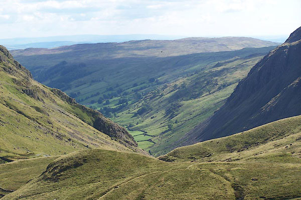 BJT20.jpg (taken 20.8.2005) 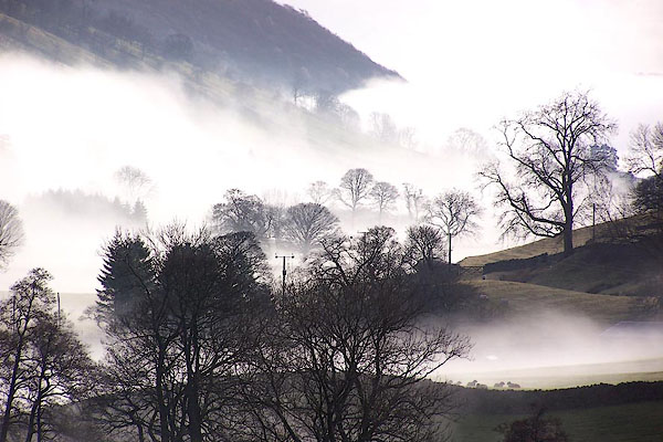 BLN09.jpg Mist. (taken 3.1.2006)  BIQ06.jpg (taken 22.4.2004)  BLW18.jpg (taken 20.4.2006)  BTU92.jpg (taken 5.12.2010)  Click to enlarge BQR81.jpg (taken 31.5.2009)  BQY13.jpg Sheep in the shade, near Kilnstones. (taken 29.6.2009)  BRC03.jpg (taken 19.7.2009)  BSM33.jpg View, towards Cappelbarrow. (taken 11.4.2010)  BTO68.jpg Tree, near Toms How (taken 26.9.2010) 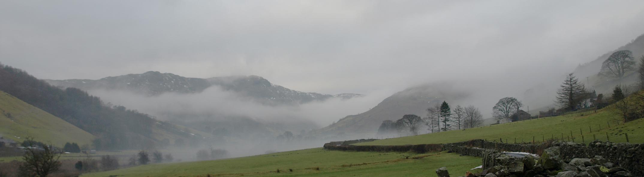 Click to enlarge BTW25.jpg Mist. (taken 31.12.2010) 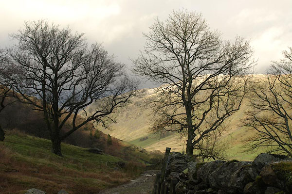 BVT69.jpg N from Stile End path. (taken 3.1.2012) |
|||||||||||||||||||||||||||||||||||||||||||||||||||||||||||||||||||||||||||||||||||||||||||||||||||||||||||||||||||||||||||||||||||||||||
|
|
|||||||||||||||||||||||||||||||||||||||||||||||||||||||||||||||||||||||||||||||||||||||||||||||||||||||||||||||||||||||||||||||||||||||||
 BMV05.jpg Stone walls. (taken 8.10.2006) |
|||||||||||||||||||||||||||||||||||||||||||||||||||||||||||||||||||||||||||||||||||||||||||||||||||||||||||||||||||||||||||||||||||||||||
|
|
|||||||||||||||||||||||||||||||||||||||||||||||||||||||||||||||||||||||||||||||||||||||||||||||||||||||||||||||||||||||||||||||||||||||||
| hearsay:- |
The brock, called a badger since the 18th century, was classified as vermin by statutes
of Henry VIII and of Elizabeth I. Parish records for Kendal, 1668-73 list 73 payments
for badger heads at 1/- each, mostly from Longsleddale. |
||||||||||||||||||||||||||||||||||||||||||||||||||||||||||||||||||||||||||||||||||||||||||||||||||||||||||||||||||||||||||||||||||||||||
|
|
|||||||||||||||||||||||||||||||||||||||||||||||||||||||||||||||||||||||||||||||||||||||||||||||||||||||||||||||||||||||||||||||||||||||||
| hearsay:- |
John Wilson was born, in humble circumstances, in Longsleddale. He became a botanist,
and wrote a Synopsis of British Plants in Mr. Ray's Method, published 1744. This is
the first systematic list of british plants in English. He died 1751, at Kendal. |
||||||||||||||||||||||||||||||||||||||||||||||||||||||||||||||||||||||||||||||||||||||||||||||||||||||||||||||||||||||||||||||||||||||||
|
|
|||||||||||||||||||||||||||||||||||||||||||||||||||||||||||||||||||||||||||||||||||||||||||||||||||||||||||||||||||||||||||||||||||||||||
| hearsay:- |
Longsleddale is said to be the model for Long Whindale in |
||||||||||||||||||||||||||||||||||||||||||||||||||||||||||||||||||||||||||||||||||||||||||||||||||||||||||||||||||||||||||||||||||||||||
| Ward, Humphrey, Mrs: 1888: Robert Elsmere |
|||||||||||||||||||||||||||||||||||||||||||||||||||||||||||||||||||||||||||||||||||||||||||||||||||||||||||||||||||||||||||||||||||||||||
| Chapter 1:- |
|||||||||||||||||||||||||||||||||||||||||||||||||||||||||||||||||||||||||||||||||||||||||||||||||||||||||||||||||||||||||||||||||||||||||
| "It was a brilliant afternoon towards the end of May. The spring had been unusually
cold and late, and it was evident from the general aspect of the lonely Westmoreland
valley of Long Whindale that warmth and sunshine had only just penetrated to its bare
green recesses, where a few scattered trees were fast rushing into their full summer
dress, while at their feet, and along the bank of the stream, the flowers of March
and April still lingered, as though they found it impossible to believe that their
rough brother, the east wind, had at last deserted them. The narrow road, which was
the only link between the farmhouses sheltered by the crags at the head of the valley
and those far-away regions of town and civilisation suggested by the smoke wreaths
of Whinborough on the southern horizon, was lined with masses of the white heckberry
or bird-cherry, and ran, an arrowy line of white, through the greenness of the sloping
pastures. The sides of some of the little becks running down into the main river and
many of the plantations round the arms were gay with the same tree, so that the farmhouses,
gray-roofed and gray-walled, standing in the hollows of the fells, seemed here and
there to have been robbed of all their natural austerity of aspect, and to be masquerading
in a dainty garb of white and green imposed upon them by the caprice of the spring." |
|||||||||||||||||||||||||||||||||||||||||||||||||||||||||||||||||||||||||||||||||||||||||||||||||||||||||||||||||||||||||||||||||||||||||
| "During the greater part of its course the valley of Long Whindale is tame and featureless.
The hills at the lower part are low and rounded, and the sheep and cattle pasture
over slopes unbroken either by wood or rock. The fields are bare and close shaven
by the flocks which feed on them; the walls run either perpendicularly in many places
up the fells or horizontally along them, so that, save for the wooded course of the
tumbling river and the bush-grown hedges of the road, the whole valley looks like
a green map divided by regular lines of grayish black. But as the walker penetrates
farther, beyond a certain bend which the stream makes half way from the head of the
dale, the hills grow steeper, the breadth between them contracts, the enclosure lines
are broken and deflected by rocks and patches of plantation, and the few farms stand
more boldly and conspicuously forward, each on its spur of land, looking up to or
away from the great masses of frowning crag which close in the head of the valley,
and which from the moment they come into sight give it dignity and a wild beauty." |
|||||||||||||||||||||||||||||||||||||||||||||||||||||||||||||||||||||||||||||||||||||||||||||||||||||||||||||||||||||||||||||||||||||||||
|
|
|||||||||||||||||||||||||||||||||||||||||||||||||||||||||||||||||||||||||||||||||||||||||||||||||||||||||||||||||||||||||||||||||||||||||
| hearsay:- |
Many of the incidents in Greendale, of the Postman Pat stories are said to have been
inspired by the valley of Longsleddale. |
||||||||||||||||||||||||||||||||||||||||||||||||||||||||||||||||||||||||||||||||||||||||||||||||||||||||||||||||||||||||||||||||||||||||
| The Postman Pat stories were conceived after teacher John Cunliffe called in at Beast
Bank Post Office, Kendal, in the 1970s. John Cunliffe called in and chatted to the
post master, Jim, at that time, for background ideas. The post office closed 19 June
2003. |
|||||||||||||||||||||||||||||||||||||||||||||||||||||||||||||||||||||||||||||||||||||||||||||||||||||||||||||||||||||||||||||||||||||||||
|
|
|||||||||||||||||||||||||||||||||||||||||||||||||||||||||||||||||||||||||||||||||||||||||||||||||||||||||||||||||||||||||||||||||||||||||
| hearsay:- |
At the head of the valley:- |
||||||||||||||||||||||||||||||||||||||||||||||||||||||||||||||||||||||||||||||||||||||||||||||||||||||||||||||||||||||||||||||||||||||||
| "... A year or more ago [before 1931] this neighbourhood was visited by a tremendous
cloudburst, which not only changed the aspect of this end of the valley but wrought
great havoc lower down. It was estimated that during a storm of five or six hours
15,000 or 20,000 tons of rock, some of it in boulders weighing a couple of tons, were
dislodged and brought down the hill sides. ..." |
|||||||||||||||||||||||||||||||||||||||||||||||||||||||||||||||||||||||||||||||||||||||||||||||||||||||||||||||||||||||||||||||||||||||||
| Barber, John B &Atkinson, George: 1931: Lakeland Passes |
|||||||||||||||||||||||||||||||||||||||||||||||||||||||||||||||||||||||||||||||||||||||||||||||||||||||||||||||||||||||||||||||||||||||||
|
|
|||||||||||||||||||||||||||||||||||||||||||||||||||||||||||||||||||||||||||||||||||||||||||||||||||||||||||||||||||||||||||||||||||||||||
| personal | |||||||||||||||||||||||||||||||||||||||||||||||||||||||||||||||||||||||||||||||||||||||||||||||||||||||||||||||||||||||||||||||||||||||||
| person:- | botanist; author : Wilson, John |
||||||||||||||||||||||||||||||||||||||||||||||||||||||||||||||||||||||||||||||||||||||||||||||||||||||||||||||||||||||||||||||||||||||||
| place:- | birthplace | ||||||||||||||||||||||||||||||||||||||||||||||||||||||||||||||||||||||||||||||||||||||||||||||||||||||||||||||||||||||||||||||||||||||||
| date:- | 1697 to 1698 |
||||||||||||||||||||||||||||||||||||||||||||||||||||||||||||||||||||||||||||||||||||||||||||||||||||||||||||||||||||||||||||||||||||||||
|
|
|||||||||||||||||||||||||||||||||||||||||||||||||||||||||||||||||||||||||||||||||||||||||||||||||||||||||||||||||||||||||||||||||||||||||
Lakes Guides menu.