Old Cumbria Gazetteer
 |
 |
|
||
| Appleby | ||||
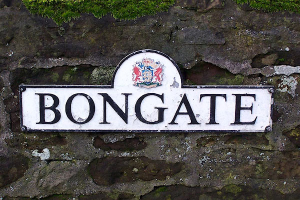
| Appleby-in-Westmorland | ||||
| civil parish:- | Appleby-in-Westmorland (formerly Westmorland) | |||
| county:- | Cumbria | |||
| locality type:- | locality | |||
| locality type:- | buildings | |||
| locality type:- | market town | |||
| locality type:- | selected place | |||
| coordinates:- | NY68342038 (etc) | |||
| 1Km square:- | NY6820 | |||
| 10Km square:- | NY62 | |||
| latitude; longitude:- | 2d 29.4 W; 54d 34.6m N | |||
|
|
||||
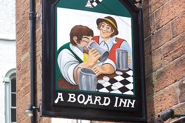
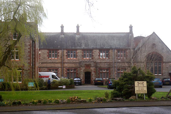
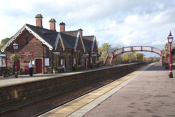
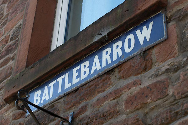
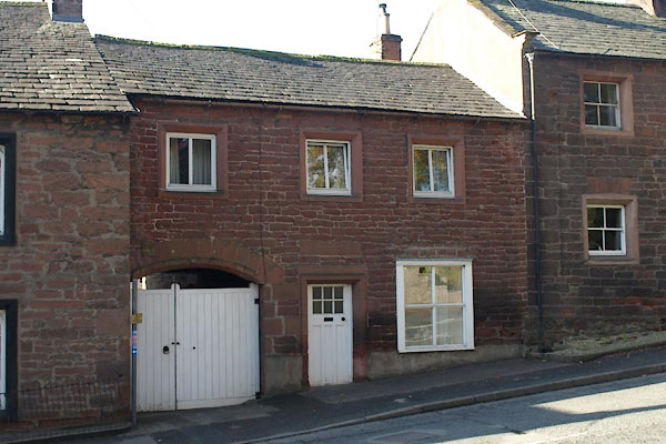
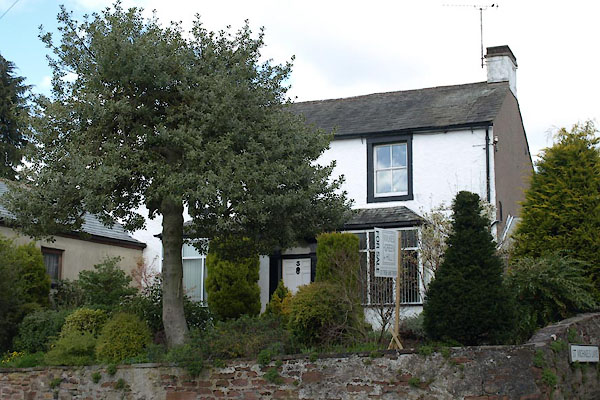
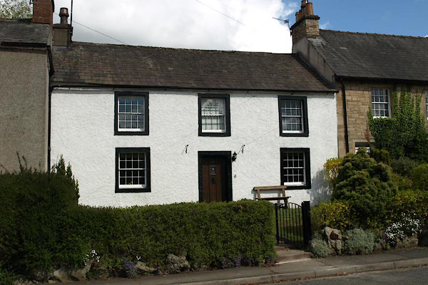
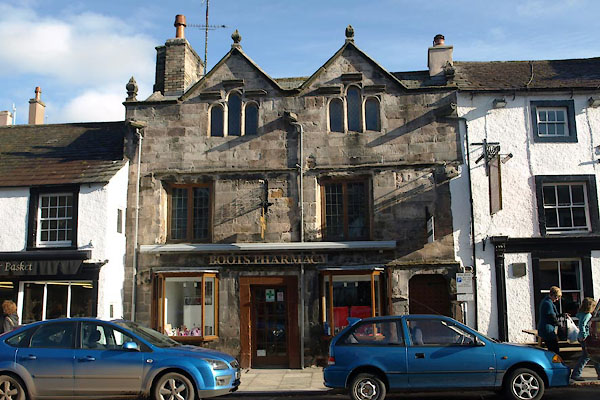
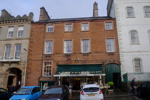
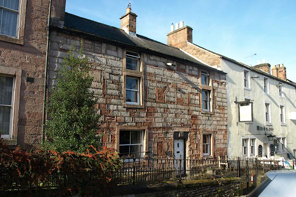
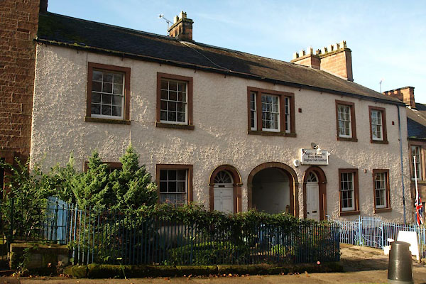
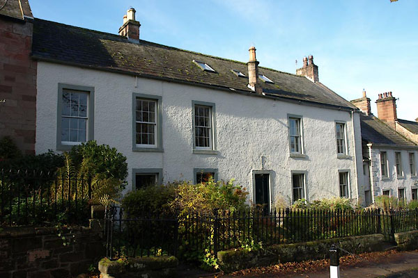
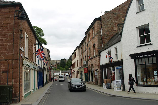
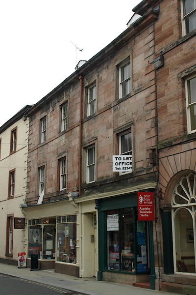
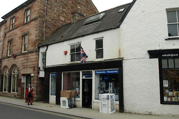
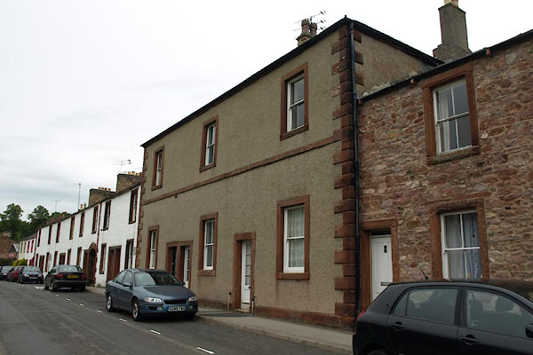
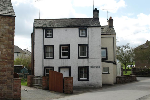
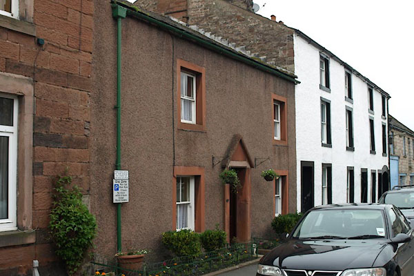
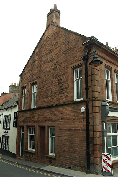
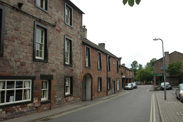
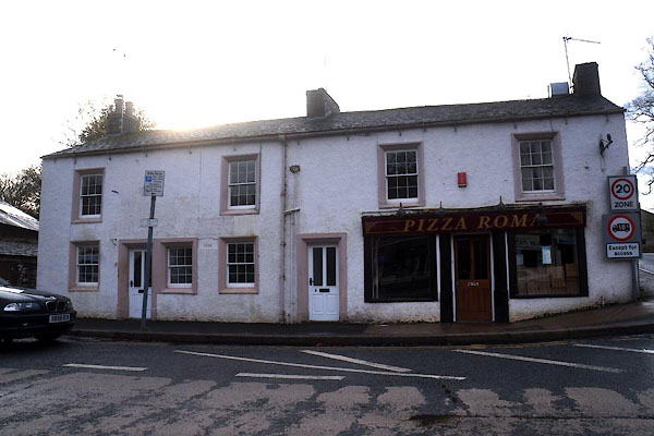
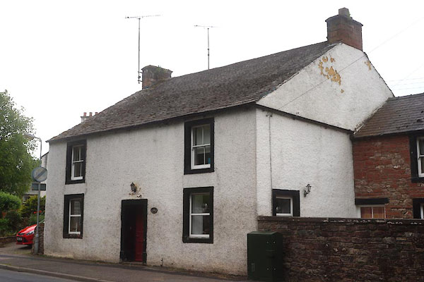
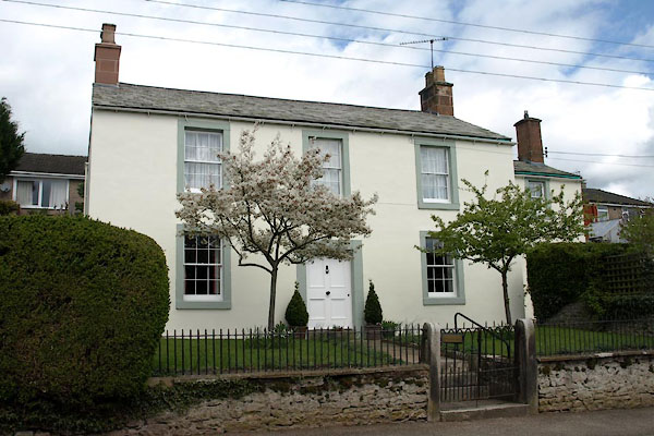
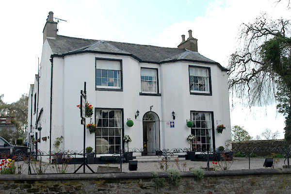
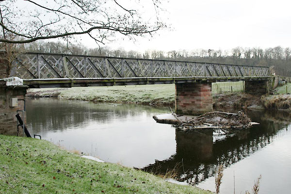
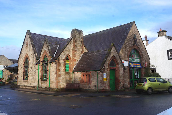
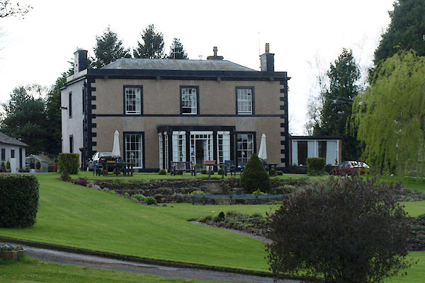
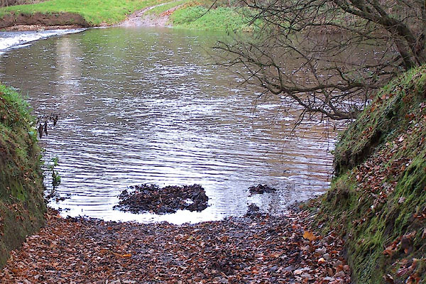
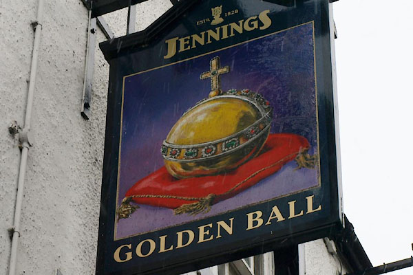
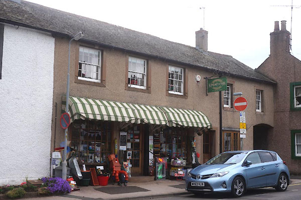
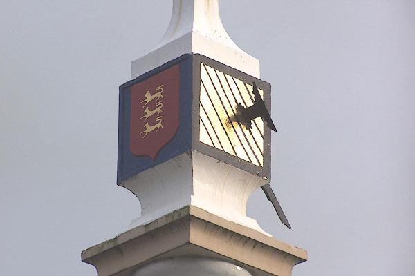
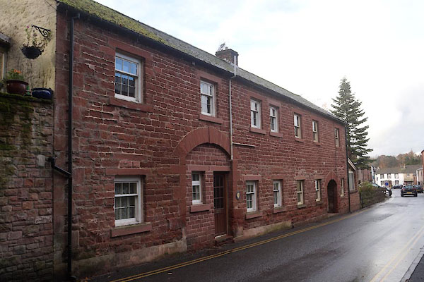
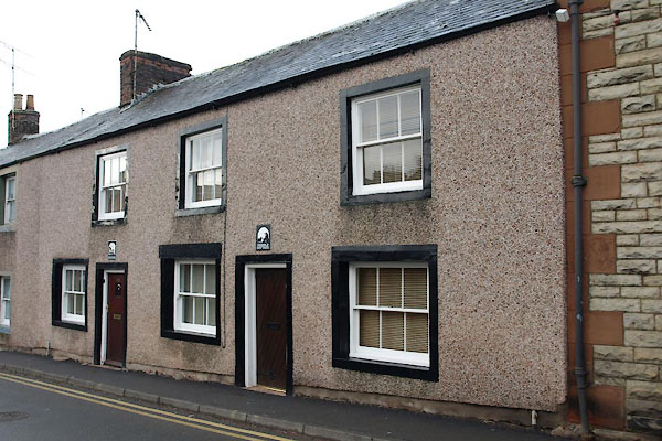
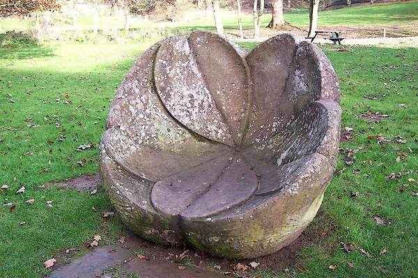
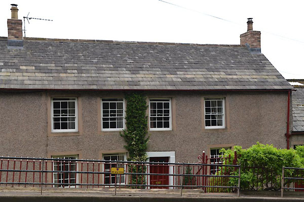
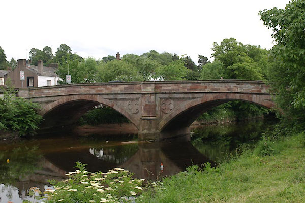
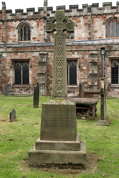
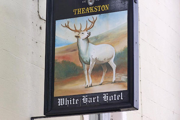
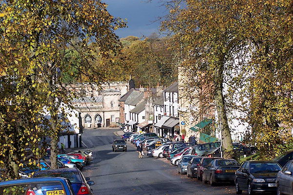
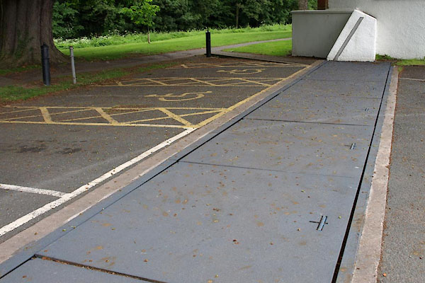
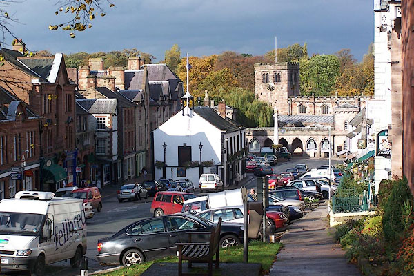 BJY59.jpg (taken 28.10.2005) |
||||
|
|
||||
| evidence:- | old map:- OS County Series (Wmd 15 3) placename:- Appleby |
|||
| source data:- | Maps, County Series maps of Great Britain, scales 6 and 25
inches to 1 mile, published by the Ordnance Survey, Southampton,
Hampshire, from about 1863 to 1948. OS County Series (Wmd 9 15) |
|||
|
|
||||
| evidence:- | old map:- Gough 1350s-60s placename:- Appelbee |
|||
| source data:- | Map, colour photozincograph copy, reduced size facsimile, Gough
Map of Britain, scale about 28.5 miles to 1 inch, published by
the Ordnance Survey, Southampton, Hampshire, 1875. click to enlarge click to enlargeGgh1Cm.jpg item:- JandMN : 33 Image © see bottom of page |
|||
|
|
||||
| evidence:- | old map:- Gough 1350s-60s placename:- Appelbee |
|||
| source data:- | Map, lithograph facsimile, Gough Map of Britain, 20 miles to 1
inch? published by the Ordnance Survey, Southampton, Hampshire,
1935. click to enlarge click to enlargeGgh2Cm.jpg item:- JandMN : 34 Image © see bottom of page |
|||
|
|
||||
| evidence:- | old map:- Lloyd 1573 placename:- Apelbya |
|||
| source data:- | Map, hand coloured copper plate engraving, Angliae Regni,
Kingdom of England, with Wales, scale about 24 miles to 1 inch, authored by Humphrey
Lloyd, Denbigh, Clwyd, drawn and engraved
by Abraham Ortelius, Netherlands, 1573.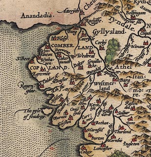 click to enlarge click to enlargeLld1Cm.jpg "Apelbya" item:- Hampshire Museums : FA1998.69 Image © see bottom of page |
|||
|
|
||||
| evidence:- | old map:- Saxton 1579 placename:- Applebye |
|||
| source data:- | Map, hand coloured engraving, Westmorlandiae et Cumberlandiae Comitatus ie Westmorland
and Cumberland, scale about 5 miles to 1 inch, by Christopher Saxton, London, engraved
by Augustinus Ryther, 1576, published 1579-1645. Sax9NY62.jpg Buildings and towers, symbol for a town. "APPLEBYE" item:- private collection : 2 Image © see bottom of page |
|||
|
|
||||
| evidence:- | old map:- Mercator 1595 (edn?) placename:- Applebye |
|||
| source data:- | Map, hand coloured engraving, Westmorlandia, Lancastria, Cestria
etc, ie Westmorland, Lancashire, Cheshire etc, scale about 10.5
miles to 1 inch, by Gerard Mercator, Duisberg, Germany, 1595,
edition 1613-16. MER5WmdA.jpg "Applebye" circle, building/s, tower, tinted red item:- Armitt Library : 2008.14.3 Image © see bottom of page |
|||
|
|
||||
| evidence:- | old map:- Keer 1605 placename:- Applebye |
|||
| source data:- | Map, hand coloured engraving, Westmorland and Cumberland, scale
about 16 miles to 1 inch, probably by Pieter van den Keere, or
Peter Keer, about 1605 edition perhaps 1676. click to enlarge click to enlargeKER8.jpg "Applebye" dot, two circle, tower, tinted red; town item:- Dove Cottage : 2007.38.110 Image © see bottom of page |
|||
|
|
||||
| evidence:- | descriptive text:- Keer 1605 (edn 1620) placename:- Aballaba placename:- Apleby |
|||
| source data:- | Map, Westmorlandia et Comberlandia, ie Westmorland and
Cumberland now Cumbria, scale about 16 miles to 1 inch, probably
by Pieter van den Keere, or Peter Keer, about 1605, published
about 1605 to 1676. goto source goto sourcesecond page "(8) Places of memorable note for Antiquitie are ... and Aballaba, which we contractly call Apleby. ... In [which] the Aureli-" goto sourcethird page "[Aureli]an Maures kept a station in the time of the Romanes, and their high streete is yet apparently to be seene by the ridges thereof which lead by Apelby to a place called Brovonacum, mentioned in the Booke of Provinciall notices. The antique pieces of Romane Coyne otherwhiles digd up hereabouts, and some Inscriptions not long since found, shew of what continuance they have beene: although Time, which devoureth all things, hath so fed upon their carkasses many ages together, as it hath almost consumed both houses and Inhabitants. For Apelby now is bare both of people and buildings; and were it not for the antiquitie that makes it the more esteemable, in whose Castle the Assises are commonly kept, in would be little better in account then a village. ... These two places [Brough and Appleby] William of Newborough called Princely Holds, and writeth that William King of Scots a little before he himselfe was taken prisoner at Alnewicke, surprized them on a sodaine, but King John recovered them after, and liberally bestowed them upon Robert Vipont, for his many worthy services." |
|||
|
|
||||
| evidence:- | old map:- Speed 1611 (Cum/EW) placename:- Appleby |
|||
| source data:- | Map, hand coloured engraving, Kingdome of Great Britaine and
Ireland, scale about 36 miles to 1 inch, by John Speed, about
1610-11, published by Thomas Bassett, Fleet Street and Richard
Chiswell, St Paul's Churchyard, London, 1676? click to enlarge click to enlargeSPD6Cm.jpg "Appleby" dot, circle, and tower item:- private collection : 85 Image © see bottom of page |
|||
|
|
||||
| evidence:- | old map:- Speed 1611 (Wmd) placename:- Appleby placename:- Abballaba |
|||
| source data:- | Map, hand coloured engraving, The Countie Westmorland and
Kendale the Cheif Towne, scale about 2.5 miles to 1 inch, by
John Speed, 1610, published by George Humble, Popes Head Alley,
London, 1611-12. SP14NY62.jpg "Appleby / ABBALLABA" circle, buildings and towers item:- Armitt Library : 2008.14.5 Image © see bottom of page |
|||
|
|
||||
| evidence:- | old map:- Drayton 1612/1622 placename:- Appleby |
|||
| source data:- | Map, hand coloured engraving, Cumberlande and Westmorlande, by
Michael Drayton, probably engraved by William Hole, scale about
4 or 5 miles to 1 inch, published by John Mariott, John
Grismand, and Thomas Dewe, London, 1622.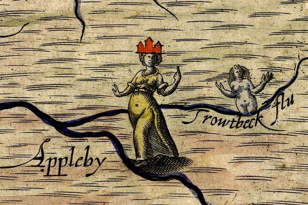 DRY512.jpg "Appleby" Lady with a 'town' headress. item:- JandMN : 168 Image © see bottom of page |
|||
|
|
||||
| evidence:- | table of distances:- Simons 1635 placename:- Appleby |
|||
| source data:- | Table of distances, uncoloured engraving, Westmerland ie
Westmorland, with a thumbnail map, scale about 42 miles to 1
inch, by Mathew Simons, published in A Direction for the English
Traviller, 1635.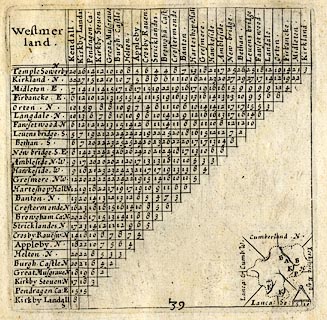 click to enlarge click to enlargeSIM3.jpg "Appleby N" upright text, a larger place; and tabulated distances; A on thumbnail map item:- private collection : 50.39 Image © see bottom of page |
|||
|
|
||||
| evidence:- | old text:- Brathwaite 1638 placename:- Appleby |
|||
| source data:- | Poem, Drunken Barbaby's Four Journeys to the North of England,
by Richard Brathwaite, 1638, published 1716-1818 at least. goto source Page 119:- "..." "Horse Fairs." "..." "Tra-montane Fairs." "..." "Thence to Native Appleby mount I," "Th'ancient Seat of all that County." "..." goto sourcePage 4:- "... I conclude his Name was Barnaby Harrington. ... He further says, ... he at last arrived at Appleby in Westmorland, where he was born, and where, if I mistake not, there are some Remains of the Family still living, That he was a Graduate in Queen's College, Oxon, is plain, but I have not had an Opportunity of knowing what Degrees he took. ..." Unreliable deductions by the publisher, William Williamson, 1762. |
|||
|
|
||||
| evidence:- | old map:- Jenner 1643 placename:- Applebye |
|||
| source data:- | Table of distances, with map, hand coloured engraving,
Westmerland ie Westmorland, scale about 16 miles to 1 inch,
engraved by Jacob van Langeren, published by Thomas Jenner,
Cornhill, London, 1643.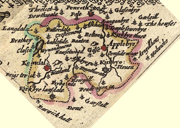 JEN3Sq.jpg "Applebye" dot, double circle, buildings, red tint item:- private collection : 52.Wmd Image © see bottom of page |
|||
|
|
||||
| evidence:- | old map:- Jansson 1646 placename:- Appleby |
|||
| source data:- | Map, hand coloured engraving, Cumbria and Westmoria, ie
Cumberland and Westmorland, scale about 3.5 miles to 1 inch, by
John Jansson, Amsterdam, Netherlands, 1646.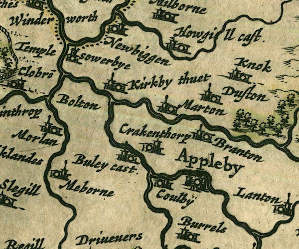 JAN3NY62.jpg "Appleby" Buildings and towers, suggestion of a wall, notice ?fence palings; upright lowercase text; market town. item:- JandMN : 88 Image © see bottom of page |
|||
|
|
||||
| evidence:- | hearth tax returns:- Hearth Tax 1670 placename:- Appulbye Towne |
|||
| source data:- | Records, hearth tax returns, exchequer duplicates, Westmorland,
1670. "Appulbye Towne" |
|||
|
|
||||
| evidence:- | old map:- Ogilby 1675 (plate 38) placename:- Applebey |
|||
| source data:- | Road strip map, hand coloured engraving, continuation of the
Road from London to Carlisle, scale about 1 inch to 1 mile, by
John Ogilby, London, 1675.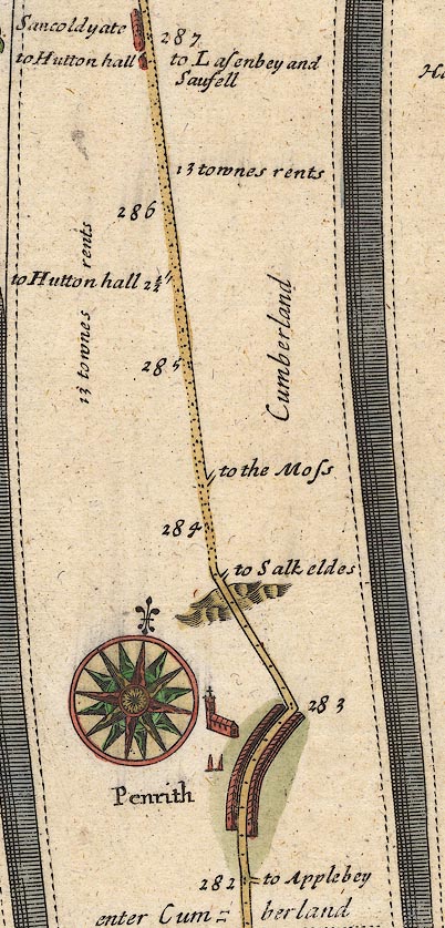 OG38m282.jpg In mile 282, Cumberland. Turning right:- "to Applebey" item:- JandMN : 21 Image © see bottom of page |
|||
| source data:- | Road strip map, hand coloured engraving, continuation of the
Road from London to Carlisle, scale about 1 inch to 1 mile, by
John Ogilby, London, 1675.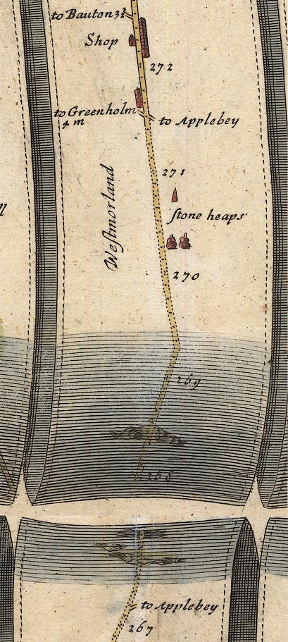 OG38m267.jpg In mile 267, Westmorland. Turning right:- "to Applebey" In mile 271, Westmorland. Turning right:- "to Applebey" item:- JandMN : 21 Image © see bottom of page |
|||
| source data:- | Road strip map, hand coloured engraving, continuation of the
Road from London to Carlisle, scale about 1 inch to 1 mile, by
John Ogilby, London, 1675.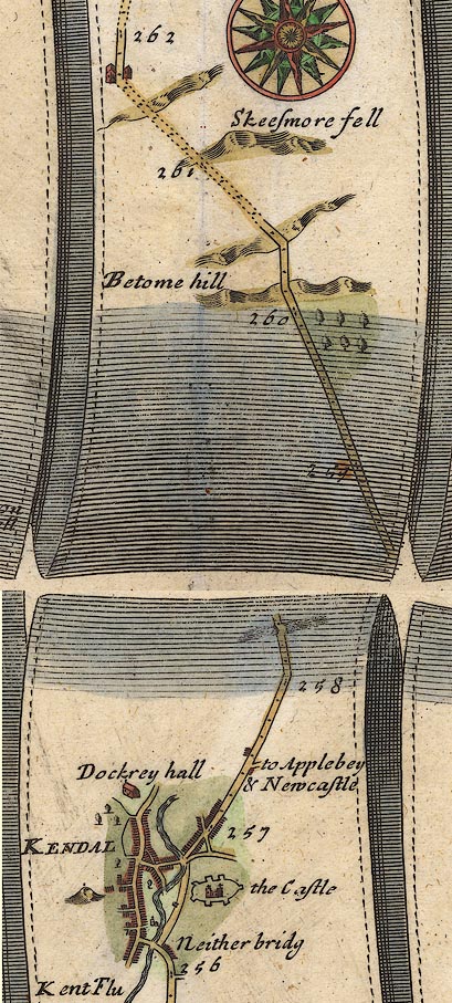 OG38m257.jpg In mile 257, Westmoreland. Turning right:- "to Applebey &Newcastle" Houses drawn at the junction. item:- JandMN : 21 Image © see bottom of page |
|||
|
|
||||
| evidence:- | old map:- Sanson 1679 placename:- Appleby |
|||
| source data:- | Map, hand coloured engraving, Ancien Royaume de Northumberland
aujourdhuy Provinces de Nort, ie the Ancient Kingdom of
Northumberland or the Northern Provinces, scale about 9.5 miles
to 1 inch, by Nicholas Sanson, Paris, France, 1679. click to enlarge click to enlargeSAN2Cm.jpg "Appleby" circle, buildings and towers; town item:- Dove Cottage : 2007.38.15 Image © see bottom of page |
|||
|
|
||||
| evidence:- | old map:- Seller 1694 (Wmd) placename:- Appleby |
|||
| source data:- | Map, hand coloured engraving, Westmorland, scale about 8 miles
to 1 inch, by John Seller, 1694. click to enlarge click to enlargeSEL7.jpg "Appleby" circle, upright lowercase text; town, large item:- Dove Cottage : 2007.38.87 Image © see bottom of page |
|||
|
|
||||
| evidence:- | old map:- Morden 1695 (EW) placename:- Appleby |
|||
| source data:- | Map, hand coloured engraving, England, including Wales, scale
about 27 miles to 1 inch, by Robert Morden, published by Abel
Swale Awnsham and John Churchil, London, about 1695. click to enlarge click to enlargeMRD3Cm.jpg "Appleby" circle, buildings and tower; county town item:- JandMN : 339 Image © see bottom of page |
|||
|
|
||||
| evidence:- | old map:- Morden 1695 (Cmd) placename:- Appleby |
|||
| source data:- | Map, uncoloured engraving, Cumberland, scale about 4 miles to 1
inch, by Robert Morden, 1695, published by Abel Swale, the
Unicorn, St Paul's Churchyard, Awnsham, and John Churchill, the
Black Swan, Paternoster Row, London, 1695-1715. MD12NY62.jpg "Appleby" Circle, buildings, towers. item:- JandMN : 90 Image © see bottom of page |
|||
|
|
||||
| evidence:- | old map:- Morden 1695 (Wmd) placename:- Apalby placename:- Aballaba |
|||
| source data:- | Map, hand coloured engraving, Westmorland, scale about 2.5 miles to 1 inch, by Robert
Morden, published by Abel Swale, the Unicorn, St Paul's Churchyard, Awnsham, and John
Churchill, the Black Swan, Paternoster Row, London, 1695.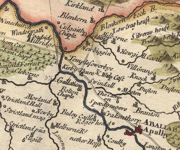 MD10NY62.jpg "Apalby / ABALLABA" Circle, buildings, towers on the road north of the river, and circle, building and tower south of the river. item:- JandMN : 24 Image © see bottom of page |
|||
|
|
||||
| evidence:- | descriptive text:- Fiennes 1698 placename:- Appleby |
|||
| source data:- | Travel book, manuscript record of Journeys through England
including parts of the Lake District, by Celia Fiennes, 1698. "Kendall is the biggest town and much in the heart of Westmoreland but Appleby 10 mile off is the shire town where the session and assizes are held ..." |
|||
|
|
||||
| evidence:- | descriptive text:- Defoe 1724-26 placename:- Appleby |
|||
| source data:- | Tour through England and Wales, by Daniel Defoe, published in
parts, London, 1724-26. "The upper, or northern part of the county [Westmorland], has two manufacturing towns, called Kirkby Stephen, and Appleby; the last is the capital of the county, yet neither of them offer any thing considerable to our observation, ..." "..." "In this vale [Eden], and on the bank of this river, stands Appleby, once a flourishing city, now a scattering, decayed, and half-demolished town, the fatal effects of the antient inroads of the Scots, when this being a frontier county, those invasions were frequent, and who several times were masters of this town, and at length burnt it to the ground, which blow it has not yet recovered." |
|||
|
|
||||
| evidence:- | old map:- Badeslade 1742 placename:- Appleby |
|||
| source data:- | Maps, Westmorland North from London, scale about 10 miles to 1
inch, and Cumberland North from London, scale about 11 miles to
1 inch, with descriptive text, by Thomas Badeslade, London,
engraved and published by William Henry Toms, Union Court,
Holborn, London, 1742; published 1742-49. "Appleby the County Town, sends 2 Members [to Parliament], Market Saturday, Fair May 30." |
|||
|
|
||||
| evidence:- | old map:- Badeslade 1742 placename:- Appleby |
|||
| source data:- | Map, uncoloured engraving, A Map of Westmorland North from
London, scale about 10 miles to 1 inch, with descriptive text,
by Thomas Badeslade, London, engraved and published by William
Henry Toms, Union Court, Holborn, London, 1742. click to enlarge click to enlargeBD12.jpg "Appleby" circle, tower/s, upright lowercase text; town, and two stars item:- Dove Cottage : 2007.38.62 Image © see bottom of page |
|||
|
|
||||
| evidence:- | old map:- Simpson 1746 map (Wmd) placename:- Appleby |
|||
| source data:- | Map, uncoloured engraving, Westmorland, scale about 8 miles to 1
inch, printed by R Walker, Fleet Lane, London, 1746.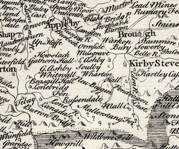 SMP2NYQ.jpg "Appleby" Building and towers; labelled as a town.. item:- Dove Cottage : 2007.38.59 Image © see bottom of page |
|||
|
|
||||
| evidence:- | descriptive text:- Simpson 1746 placename:- Appleby placename:- Aballaba item:- charter |
|||
| source data:- | Atlas, three volumes of maps and descriptive text published as
'The Agreeable Historian, or the Compleat English Traveller
...', by Samuel Simpson, 1746. goto source Page 1021:- "..." "... It [Westmoreland] sends only four Members to Parliament, viz. two for the County and two for" "Appleby, which claims the first Place both on account of its Antiquity, and because 'tis a County Town, where the yearly Assizes are held, tho' 'tis neither very rich nor beautiful; but the Situation of it in the midst of pleasant Fields, and on the Banks of the River Eden, which almost encompasses it, is very agreeable. The Name is a Corruption of the Aballaba mentioned in the Notitia. In the [Romans]" goto sourcePage 1022:- "Romans Time it was the Station of the Mauri Aureliani, a Band of Soldiers, so called because they were sent hither by the Emperor Aurelian. King Henry I. gave it Privileges equal to York that city's Charter being granted, as 'tis said, in the Forenoon, and this in the Afternoon of the same Day. It has the same Privileges still, its Charter having been confirmed by King Henry II. and also by King Henry III. (in whose Time there was an Exchequer here) and by the succeeding Kings of England. In the Reign of King Edward I. it had a Mayor and two Provosts, who sign'd the publick Acts of the Town together with the Mayor, tho' at present they only attend the Mayor with two Halberds. Brompton makes mention of Applebyshire, and 'tis supposed that it had once Sheriffs of its own, as most Cities had; or else that Westmoreland was called the County of Appleby or Applebyshire. In the 22d of Henry II. it was set on Fire by the Scots, as it was again in the 12th of Richard II. In 1598 it was also a great Sufferer by a Pestilence, and so depopulated, as appears from an Inscription placed in the Garden belonging to the School-house, describing those Calamities, which it has never yet recovered, that the Market was removed to Gilshaughlin, four or five Miles from the Town. William King of Scots took this Town, and the Burgh under Stanemore by Suprize, a little before himself was taken at Alnwick; but they were afterward recovered by King John, who gave the Castle and Barony of this Town and the Burgh to John de Vipont, whose Family and that of the Cliffords have been Lords of this County, and flourished at this Place for above 500 Years. Its Market is on Saturdays, and Fairs on Whit monday, May 30, and June 10." "The Assizes are held here in the Town-hall, but the Goal for Malefactors, which was formerly in the Castle, is now at the End of the Bridge. Here is the best Corn-market in all these northern Parts; but the chief Beauty of the Town consists in one broad Street, which runs with an easy Ascent from North and South; at the Head whereof is the Castle, almost surrounded with the River, and with Trenches, where the River comes not. At the Lower-end of the Town are the Church, and a School built by Robert Langton and Miles Spencer, Doctors of [Law,]" goto sourcePage 1023:- "Law, and much improved and augmented by Dr. Smith, late Bishop of Carlisle, and other Benefactors: But the greatest Benefactress to this Town was the Lady Anne, Daughter and Heiress of George Lord Clifford, who in 1651 founded, and afterwards endowed an Hospital here, for a Governess, and twelve other Widows, commonly called, the Mother and twelve Sisters, settled Lands on the Top to the Value of 8 l. a Year to keep up the Repairs of the Church, School-house, Town-hall, and Bridge; rebuilt a good Part of the Church in which she lies interr'd, and wholly rebuilt the Church at Bongate, which is a Part of this Town." "The Town is governed by a Mayor, Recorder, twelve Aldermen, a Common-council, and Serjeants at Mace. It stands on the Roman military Way, which crosses this County from Rear-Cross on Stainmore in the East, to the River Eden, a little below Penrith in the West." |
|||
|
|
||||
| evidence:- | descriptive text:- Bickham 1753-54 |
|||
| source data:- | Maps, A Map of Westmorland, 1753, and A Map of Cumberland, 1754,
by George Bickham, James Street, Bunhill Fields, London;
published 1750s-96. Print, engraving, imaginary scene and a coat of arms:- "The Arms of the Town of Appleby." Three lions passant guardant. "..." "[Appleby] is esteemed the County Town, but is now of little Note except for its Antiquity." |
|||
|
|
||||
| evidence:- | old map:- Bickham 1753-54 (Wmd) placename:- Appleby |
|||
| source data:- | Map, uncoloured engraving, perspective view, A Map of
Westmorland, North from London, by George Bickham, James Street,
Bunhill Fields, London, 1753.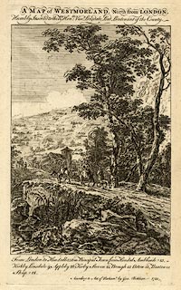 click to enlarge click to enlargeBCK3.jpg "Appleby" view (sort of) item:- Armitt Library : 2008.14.71 Image © see bottom of page |
|||
|
|
||||
| evidence:- | old map:- Hill 1754 placename:- Correction House placename:- Jail |
|||
| source data:- | Town plan, A Plan of Appleby in Westmorland, scale about 32 ins
to 1 mile, engraved by Nathaniel Hill, 1754.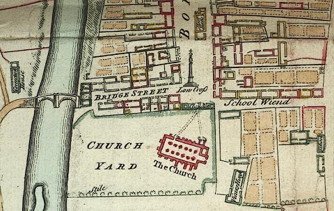 click to enlarge click to enlargeM010P2.jpg item:- Carlisle Library : Map 211 Image © Carlisle Library |
|||
|
|
||||
| evidence:- | old map:- Bowen and Kitchin 1760 placename:- Appleby |
|||
| source data:- | Map, hand coloured engraving, A New Map of the Counties of
Cumberland and Westmoreland Divided into their Respective Wards,
scale about 4 miles to 1 inch, by Emanuel Bowen and Thomas
Kitchin et al, published by T Bowles, Robert Sayer, and John
Bowles, London, 1760.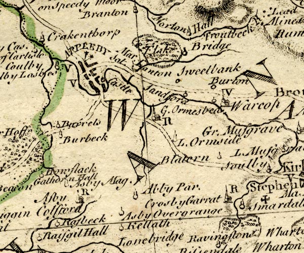 BO18NY61.jpg "APPLEBY Mar. Sat. / V" blocks, on roads, street plan, vicarage, county town, market, two stars for members of Parliament item:- Armitt Library : 2008.14.10 Image © see bottom of page |
|||
|
|
||||
| evidence:- | old map:- Jefferys 1770 (Wmd) placename:- Appleby placename:- Aballaba |
|||
| source data:- | Map, 4 sheets, The County of Westmoreland, scale 1 inch to 1
mile, surveyed 1768, and engraved and published by Thomas
Jefferys, London, 1770.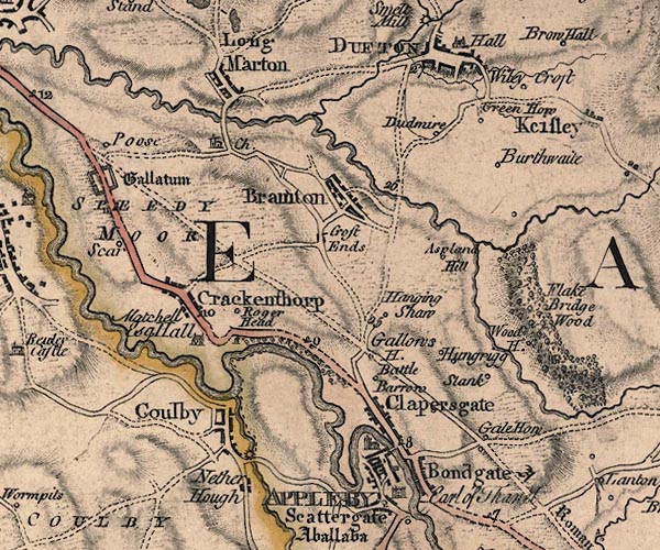 J5NY62SE.jpg "APPLEBY" blocks on a street plan, labelled in block caps; settlement, market town? 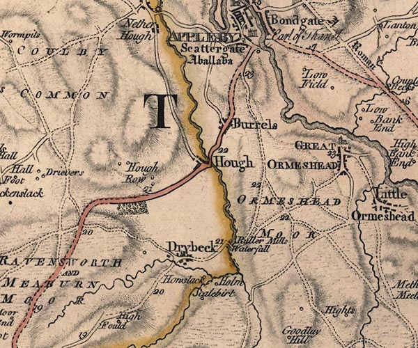 J5NY61NE.jpg "Aballaba" antiquity; roman fort item:- National Library of Scotland : EME.s.47 Images © National Library of Scotland |
|||
|
|
||||
| evidence:- | old map:- Jefferys 1770 placename:- Appleby placename:- Aballaba |
|||
| source data:- | Map, 4 sheets, The County of Westmoreland, scale 1 inch to 1
mile, surveyed 1768, and engraved and published by Thomas
Jefferys, London, 1770.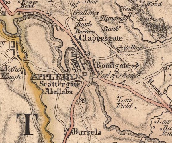 JEF5Appl.jpg "APPLEBY / Aballaba" blocks on a street plan, church, bridge, castle, named suburbs, Scattergate, Bondgate, Clappersgate item:- National Library of Scotland : EME.s.47 Image © National Library of Scotland |
|||
|
|
||||
| evidence:- | old text:- Pennant 1773 item:- fire, Appleby; local authority, Appleby |
|||
| source data:- | Book, A Tour from Downing to Alston Moor, 1773, by Thomas
Pennant, published by Edward Harding, 98 Pall Mall, London, 1801. goto source Pennant's Tour 1773, page 139 "I entered the small town of Appleby, consisting of a single street irregularly built on the steep slope of a hill: on the summit is the castle. ..." goto sourcePennant's Tour 1773, page 140 "... The town, and probably the castle, had suffered many misfortunes from the inroads of the Scots. ... In 1388 the town underwent a stroke which it never recovered, having been totally burnt and wasted by those cruel invaders; so that, on requisition made in the reigns of Henry VIII. and of Philip and Mary, it was" goto sourcePennant's Tour 1773, page 141 "found wholly unable to pay the usual rent of twenty marks to the Crown, which was reduced in future to 26s. 8d. ..." "Appleby had been a place of great extent and importance. At one period it seemed to have been put on a level with the city of York, for Henry I. bestowed on it equal privileges: York had its charter bestowed on it in the morning, and Appleby in the afternoon of the same day. Henry III. gave another charter, in which all things were like York. In the reign of Edward I. it had a Mayor, and two provosts," goto sourcePennant's Tour 1773, page 142 "who signed the public acts with the mayor, but at present are degraded into two attendants, who follow that magistrate with halberds. The borough sends two Members to Parliament, a privilege first obtained in the time of Edward I." "The town had formerly been of vast extent; for Burrals, i.e. borough-walls, shew its limits on that side, now a mile from the inhabited remains. Bondgate, Dungate, and Scattergate, mark its former entrances at places at present very distant. That a Roman station had been at or near this town, is very certain; and most probably at the Burrals, which might preserve that name through the pre-eminence of antiquity. The Learned differ whether Abbalaba or Galacum was the proper appellation: some contest, from similarity of sound, that it must have been the first. Mr. Horsley, by the more certain rule of observing the distances in Antonine's Itinerary, proves it to have been the latter. It stands on the Roman road, and some antiquities have been found in its neighbourhood. ..." |
|||
|
|
||||
| evidence:- | old map:- Pennant 1777 placename:- Calacum placename:- Appelby |
|||
| source data:- | Map, hand coloured engraving, A Map of Scotland, Hebrides and
Part of England, drawn for Thomas Pennant, engraved by J Bayly,
published by Benjamin White, London, 1777. click to enlarge click to enlargePEN1Cm.jpg "CALACUM / APPELBY" circle with side bars and spike; town item:- private collection : 66 Image © see bottom of page |
|||
|
|
||||
| evidence:- | descriptive text:- West 1778 (11th edn 1821) placename:- Apulby placename:- Galacum |
|||
| source data:- | Guide book, A Guide to the Lakes, by Thomas West, published by
William Pennington, Kendal, Cumbria once Westmorland, and in
London, 1778 to 1821. goto source Addendum; Mr Gray's Journal, 1769 Page 200:- "... On the ascent of the hill above Appleby, the thick hanging woods, and the long reaches of the Eden, clear, rapid and full as ever, winding below, with views of the castle and town, gave much employment to the mirror [1];" "[1] Mr. Gray carried usually with him on these tours a plano-convex mirror, of about four inches diameter, on a black foil, and bound up like a pocket-book. A glass of this sort is perhaps the best and most convenient substitute for a camera obscura, of anything that has hitherto been invented, and may be had of any optician." goto sourceTour to the Caves in the West Riding of Yorkshire, late 18th century Page 243:- "..." "... Bremetonacae [Overborough] is placed ... twenty-seven Roman (or twenty-four English) miles south of Galacum, which some antiquaries conceive to be Apulby, though others with more probability think it was Brough: the distances correspond, besides the additional argument of their being nearly in the same direction, whether we conceive Galacum to be Apulby or Brough. The Roman road is easily traced from Ribchester ... to Overborough; afterwards the Roman road goes through Casterton and Middleton, and, as some think, by Borrow-bridge and Orton, to Apulby. Others, and perhaps from better reasons, are of opinion, the road went by Sedbergh, or Sedburgh, over Blewcaster, along Ravenstonedale-street, and through Kirkby-Stephen, to Brough or Burgh." |
|||
|
|
||||
| evidence:- | old text:- Camden 1789 placename:- Apelby placename:- Aballaba |
|||
| source data:- | Book, Britannia, or A Chorographical Description of the Flourishing Kingdoms of England,
Scotland, and Ireland, by William Camden, 1586, translated from the 1607 Latin edition
by Richard Gough, published London, 1789. goto source Page 148:- "... ABALLABA, mentioned in the Notitia, which still retains its name with so little variation as to discover itself most clearly, and remove every doubt. For we call it by shortness from Aballaba Apelby. This place is considered only for antiquity and situation, as in the Roman times it was a station of Aurelian Moors, situate in a very pleasant country, and almost surrounded by the river Eden, but so thin of inhabitants, and meanly built, that were it not that for its antiquity it deserves to be accounted the principal town in the county, and to have the assizes held in its castle, which is the county gaol, it would be little better than a village. For all its beauty consists in one broad street running up a gentle hill from south to north. On the top of the hill is the castle, almost entirely surrounded by the river. At the bottom the church, and a school founded by Robert Langton and Milo Spencer, Doctors of Law, the head master whereof is the very learned Reginald Bainbrigge, who kindly copied for me several antient inscriptions in these parts, and removed several into his garden here. William of Newburgh, not without reason, calls this place and Burgh royal fortresses, when he relates the surprize of them by William king of Scots, a little before he was taken prisoner at Alnwick. King John generously gave them to John de Vipont for his services in re-taking them." |
|||
|
|
||||
| evidence:- | old text:- Camden 1789 (Gough Additions) placename:- Appleby placename:- Galacum |
|||
| source data:- | Book, Britannia, or A Chorographical Description of the Flourishing Kingdoms of England,
Scotland, and Ireland, by William Camden, 1586, translated from the 1607 Latin edition
by Richard Gough, published London, 1789. goto source Page 157:- "..." ""Appleby is the shire town, but it is now but a poor village having a ruinous castle wherein the prisoners are kept."" "Mr. Horsley removes Aballaba to Water-cross on the Wall; the station being placed per lineam valli. It occurs also on lord Hertford's Roman cup, under the name of Avallava, as it is also spelt in Ravennas. Appleby being thus out of the wall, yet from the antiquities found there, and the Roman road a station, he determines it to be GALACUM of the Itinerary, which ever since Mr. Camden's time has been placed at Kirby Thor or Whellop castle." "It is now the best corn market in the county. and has three fairs, makes a neat compact appearance at a distance; the principal street broad, with a good inn fronting the market-cross, which stands aukwardly in the middle of the street. ..." "..." "... The assizes are now held in the town-hall, and the gaol is at the end of the bridge." goto sourcePage 158:- "..." "Appleby has several evidences of its antient splendour. Henry I. gave it privileges equal to York, that city's charter being granted as is pretended in the forenoon and this in the afternoon of the same day. Henry II. granted them another charter of like immunities, as did Henry III. in whose time here was an Exchequer. These privileges were in all points like those of York, and confirmed by succeeding kings. When it was first governed by a mayor does not appear; but here was one in the reign of Edward I. with two provosts, who seem to have been formerly equal to sheriffs or bailiffs, and signed the public acts of the town with the mayor, though now they only attend him with halberds. Bromton mentions Aplebyschire, which seems to imply that it had then sheriffs of its own as most cities had, though now we call them bailiffs. For 2 Edward I. in a confirmation charter to Shap abbey we find this subscription: Teste Thoma filio Johannis tunc vicecomite de Apelby. The Scotch wars by degrees reduced this town. It was burnt 22 Henry II. and again 11 Richard II. when of 2200 burgages by due computation of the fee-farm rents, these remained not above 1/10th as appears by inquisitions in the town chest. Since that time it never recovered itself, but lay dismembered like so many separate villages which could not be known except by records to have belonged to the same body. For though Burgh gate is spoken of as the principal street, yet Bon gate, Battle burgh, Dongate, Scattergate, are all members of it, and that it was antiently of greater extent appears from the Burrals near a mile from it, which word being a corruption of Burrow walls may prove its having been walled about, because the town walls of Bath are called Burrals, and ruins of buildings have been dug up two or three miles from the present town. The condition and misfortunes of this place are recited in the inscription before-mentioned in the school-house garden." "The Viponts and Cliffords (ancestors on the mother's side to the earls of Thanet) have been lords of the country, and flourished at this place for above 400 years. Here was a house of White Friars founded 1281, and near it an hospital of St. Nicholas." |
|||
|
|
||||
| evidence:- | old map:- Cary 1789 (edn 1805) placename:- Appleby |
|||
| source data:- | Map, uncoloured engraving, Westmoreland, scale about 2.5 miles
to 1 inch, by John Cary, London, 1789; edition 1805. CY24NY62.jpg "APPLEBY" group of blocks, labelled in block caps, town plan, two stars for members of parliament; borough town. item:- JandMN : 129 Image © see bottom of page |
|||
|
|
||||
| evidence:- | old map:- Aikin 1790 (Wmd) placename:- Appleby |
|||
| source data:- | Map, uncoloured engraving, Westmoreland ie Westmorland, scale
about 8.5 miles to 1 inch, by John Aikin, London, 1790. click to enlarge click to enlargeAIK2.jpg "Appleby" circle with side bars and spike; county town item:- JandMN : 51 Image © see bottom of page |
|||
|
|
||||
| evidence:- | old text:- Gents Mag placename:- Applebie |
|||
| source data:- | Magazine, The Gentleman's Magazine or Monthly Intelligencer or
Historical Chronicle, published by Edward Cave under the
pseudonym Sylvanus Urban, and by other publishers, London,
monthly from 1731 to 1922. goto source Gentleman's Magazine 1792 p.224  click to enlarge click to enlargeG792E02.jpg |
|||
|
|
||||
| evidence:- | old map:- Bailey 1797 placename:- Appleby |
|||
| source data:- | Map, soil etc, uncoloured engraving, Westmoreland, scale about
12 miles to 1 inch, by J Bailey, engraved by Neele, Strand,
published by Messrs Robinson, Paternoster Row and G Nicol, Pall
Mall, London, 1797. click to enlarge click to enlargeBY05.jpg "Appleby" group of blocks; town item:- Armitt Library : A680.3 Image © see bottom of page |
|||
|
|
||||
| evidence:- | road book:- Cary 1798 (2nd edn 1802) placename:- Appleby |
|||
| source data:- | Road book, itineraries, Cary's New Itinerary, by John Cary, 181
Strand, London, 2nd edn 1802. goto source click to enlarge click to enlargeC38281.jpg page 281-282 "Appleby - King's Head / At Appleby on r. a T.R. to Kendal." market town, post office goto source click to enlarge click to enlargeC38285.jpg page 285-286 "INNS. ... Appleby, Crown. ..." goto source click to enlarge click to enlargeC38315.jpg page 315-316 "Appleby / INN. Appleby, Crown." market town, post office item:- JandMN : 228.1 Image © see bottom of page |
|||
|
|
||||
| evidence:- | old map:- Cooke 1802 placename:- Appleby |
|||
| source data:- | Map, Westmoreland ie Westmorland, scale about 12 miles to 1
inch, by George Cooke, 1802, published by Sherwood, Jones and
Co, Paternoster Road, London, 1824. click to enlarge click to enlargeGRA1Wd.jpg "APPLEBY / 267" blocks, upright lowercase text; town, and two stars, distance from London item:- Hampshire Museums : FA2000.62.4 Image © see bottom of page |
|||
|
|
||||
| evidence:- | old map:- Luffman 1803 placename:- Appleby |
|||
| source data:- | Map, hand coloured engraving, Westmoreland ie Westmorland, scale
about 37 miles to 1 inch, by John Luffman, 28 Little Bell Alley,
Coleman Street, London, 1803-06. click to enlarge click to enlargeLUF4.jpg "Appleby" double circle; county town item:- Dove Cottage : 2007.38.46 Image © see bottom of page |
|||
|
|
||||
| evidence:- | old map:- Laurie and Whittle 1806 placename:- Appleby |
|||
| source data:- | Road map, Continuation of the Roads to Glasgow and Edinburgh,
scale about 10 miles to 1 inch, by Nathaniel Coltman? 1806,
published by Robert H Laurie, 53 Fleet Street, London, 1834. click to enlarge click to enlargeLw21.jpg "Appleby 269¾" market town; distance from London; travellers supplied with post horses or carriages item:- private collection : 18.21 Image © see bottom of page |
|||
|
|
||||
| evidence:- | old text:- Capper 1808 placename:- Appleby placename:- Aballaba item:- population; market; fair; fire; assizes; plague |
|||
| source data:- | Gazetteer, A Topographical Dictionary of the United Kingdom,
compiled by Benjamin Pitts Capper, published by Richard
Phillips, Bridge Street, Blackfriars, London, 1808; published
1808-29. goto source "..." "APPLEBY, a borough and market town in East Ward, Westmoreland, 10 miles from Penrith, 20 from Carlisle, and 266 from London; contains 120 houses and 711 inhabitants, exclusive of Bongate, a separate parish, but part of the town. It is almost encompassed by the river Eden. It was a Roman station, called Aballaba, and had a military way crossing the country here. The assizes are held in the town-hall, and the judges lodge in the castle, an ancient building at the end of the principal street. It is governed by a mayor, aldermen, and common council; besides its church, an old building which stands at the end of the town, there is another in Bongate. It has a gaol, town-hall, free-school, charity-school, and an hospital for a governess and twelve widows, commonly called the mother and twelve sisters; but here is no manufactory. The market, on Saturday, is the best supplied with corn in this part of the kingdom. This town was taken by suprise by William, king of Scotland, but recovered by king John; and Henry II. granted it privileges equal to the city of York; in the reigns of Henry II. and Richard II. it was set on fire by the Scots, and in 1598 it suffered greatly by pestilence; since which time, it has never recovered its original extent. It is a vicarage, value 9l. 5s. 2d. Patron, the dean and chapter of Carlisle." "..." |
|||
|
|
||||
| evidence:- | old map:- Cooper 1808 placename:- Appleby |
|||
| source data:- | Map, hand coloured engraving, Westmoreland ie Westmorland, scale
about 9 miles to 1 inch, by H Cooper, 1808, published by R
Phillips, Bridge Street, Blackfriars, London, 1808. click to enlarge click to enlargeCOP4.jpg "Appleby" double circle, and two dots on spikes for MPs; county town item:- Dove Cottage : 2007.38.53 Image © see bottom of page |
|||
|
|
||||
| evidence:- | old map:- Wallis 1810 (Wmd) placename:- Appleby |
|||
| source data:- | Road map, Westmoreland, scale about 19 miles to 1 inch, by James
Wallis, 77 Berwick Street, Soho, 1810, published by W Lewis,
Finch Lane, London, 1835? click to enlarge click to enlargeWAL5.jpg "Appleby / 267" town; distance from London; two asterisks for members of parliament item:- JandMN : 63 Image © see bottom of page |
|||
|
|
||||
| evidence:- | descriptive text:- Wallis 1810 placename:- Appleby |
|||
| source data:- | Map, Westmoreland, scale about 19 miles to 1 inch, and
Cumberland, scale about 16 miles to 1 inch, by James Wallis, 77
Berwick Street, Soho, London, 1810; published 1810-36. "PRINCIPAL INNS, RECOMMENDED TO TRAVELLERS AND FAMILIES." "Appleby: Crown, King's Head, Crown and Mitre." "..." "PRINCIPAL FAIRS." "Appleby: Whitsun-eve, horned cattle; Whit-Monday, linen cloth and merchandise; June 10, cattle and sheep; August 10, horses, sheep, and linen cloth." |
|||
|
|
||||
| evidence:- | old map:- Hall 1820 (Wmd) placename:- Appleby |
|||
| source data:- | Map, hand coloured engraving, Westmoreland ie Westmorland, scale
about 14.5 miles to 1 inch, by Sidney Hall, London, 1820,
published by Samuel Leigh, 18 Strand, London, 1820-31. click to enlarge click to enlargeHA18.jpg "APPLEBY / 270" circle, block caps; county town; distance from London; two stars for MPs item:- Armitt Library : 2008.14.58 Image © see bottom of page |
|||
|
|
||||
| evidence:- | old map:- Perrot 1823 placename:- Appleby |
|||
| source data:- | Map, hand coloured engraving, Cumberland and Westmoreland ie
Westmorland, scale about 38 miles to 1 inch, by Aristide Michel
Perrot, engraved by Migneret, 1823, published by Etienne Ledoux,
9 Rue Guenegaud, Paris, France, 1824-48. click to enlarge click to enlargePER2.jpg "Appleby" double circle; county town item:- Dove Cottage : 2007.38.45 Image © see bottom of page |
|||
|
|
||||
| evidence:- | old map:- Greenwood 1824 (Wmd) placename:- Appleby |
|||
| source data:- | Map, hand coloured engraving, Map of the County of Westmorland,
scale about 1 inch to 1 mile, by C and J Greenwood, published by
George Pringle jnr, 70 Queen Street, Cheapside, London, 1824. grw5appl.jpg "APPLEBY" street map; labelled in block caps for a market town; 2 stars for 2 members sent to Parliament. item:- Armitt Library : A1827 Image © see bottom of page |
|||
|
|
||||
| evidence:- | old map:- Greenwood 1834 ((Wmd)) |
|||
| source data:- | Map, hand coloured engraving, Map of the County of Westmorland,
scale about 3 miles to 1 inch, by C and J Greenwood, 1822-23,
engraved by J and C Walker, 1830, published by Greenwood and Co,
13 Regent Street, Pall Mall, London, 1830-34.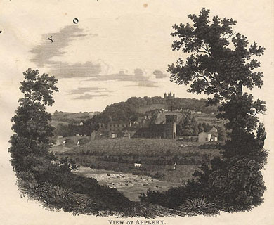 click to enlarge click to enlargeGrw4Vgn1.jpg Vignette scene from Greenwood's map, 1830-34. item:- private collection : 12 Image © see bottom of page |
|||
|
|
||||
| evidence:- | old map:- Greenwood 1824 placename:- Appleby |
|||
| source data:- | Map, hand coloured engraving, Map of the County of Westmorland,
scale about 1 inch to 1 mile, by C and J Greenwood, published by
George Pringle jnr, 70 Queen Street, Cheapside, London, 1824.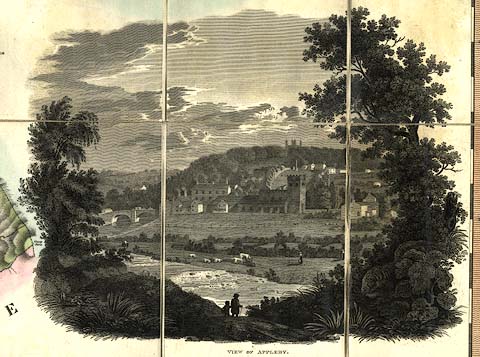 click to enlarge click to enlargeGRW5V1.jpg "VIEW OF APPLEBY" Vignette on a Map of the County of Westmorland item:- Armitt Library : A1827 Image © see bottom of page |
|||
|
|
||||
| evidence:- | old text:- Gents Mag item:- fire, Appleby |
|||
| source data:- | Magazine, The Gentleman's Magazine or Monthly Intelligencer or
Historical Chronicle, published by Edward Cave under the
pseudonym Sylvanus Urban, and by other publishers, London,
monthly from 1731 to 1922. goto source Gentleman's Magazine 1825 part 1 p.414 From the Compendium of County History:- "1176. King William of Scotland surprised Appleby castle, and utterly destroyed the town. In this inroad he sacked Brough Castle." "1388. The Scots by a second conflagration destroyed the town of Appleby." |
|||
|
|
||||
| evidence:- | old text:- Gents Mag placename:- Appleby item:- plague |
|||
| source data:- | Magazine, The Gentleman's Magazine or Monthly Intelligencer or
Historical Chronicle, published by Edward Cave under the
pseudonym Sylvanus Urban, and by other publishers, London,
monthly from 1731 to 1922. goto source Gentleman's Magazine 1825 part 1 p.514 From the Compendium of County History:- "Viteripont, Thomas de, Bishop of Carlisle, 1255, Appleby." "..." "At APPLEBY, in 1598, the plague raged. - The castle was the residence of the Clifford family, ... The School has produced a number of eminent characters in Church and State. ..." |
|||
|
|
||||
| evidence:- | old map:- Cobbett 1832 placename:- Appleby |
|||
| source data:- | Map, uncoloured engraving, Westmoreland ie Westmorland, scale
about 7 miles to 1 inch, by William Cobbett, 11 Bolt Court,
Fleet Street, London, 1832. click to enlarge click to enlargeCOB4.jpg "Appleby" dot and circle; town item:- JandMN : 116 Image © see bottom of page |
|||
|
|
||||
| evidence:- | old map:- Ford 1839 map placename:- Appleby |
|||
| source data:- | Map, uncoloured engraving, Map of the Lake District of
Cumberland, Westmoreland and Lancashire, scale about 3.5 miles
to 1 inch, published by Charles Thurnam, Carlisle, and by R
Groombridge, 5 Paternoster Row, London, 3rd edn 1843. FD02NY61.jpg "APPLEBY" item:- JandMN : 100.1 Image © see bottom of page |
|||
|
|
||||
| evidence:- | old map:- Garnett 1850s-60s H placename:- Appleby |
|||
| source data:- | Map of the English Lakes, in Cumberland, Westmorland and
Lancashire, scale about 3.5 miles to 1 inch, published by John
Garnett, Windermere, Westmorland, 1850s-60s. GAR2NY62.jpg "APPLEBY" blocks, settlement item:- JandMN : 82.1 Image © see bottom of page |
|||
|
|
||||
| evidence:- | old text:- Gents Mag item:- token |
|||
| source data:- | Magazine, The Gentleman's Magazine or Monthly Intelligencer or
Historical Chronicle, published by Edward Cave under the
pseudonym Sylvanus Urban, and by other publishers, London,
monthly from 1731 to 1922. goto source Gentleman's Magazine 1853 part 1 p.493 "..." "The remaining Westmerland tokens described by Mr. Brockett are -" "Two for Appleby, 1. the halfpenny" goto sourceGentleman's Magazine 1853 part 1 p.494 "of Christopher Birkbecke (the King's head); and 2. the farthing of Edward Guy, rev. "I SERVE FOR CHANGE." Both these are dated 1666." |
|||
|
|
||||
| evidence:- | old text:- Gents Mag item:- Kendal Mercury; token; Allhallows Lane, Kendal |
|||
| source data:- | Magazine, The Gentleman's Magazine or Monthly Intelligencer or
Historical Chronicle, published by Edward Cave under the
pseudonym Sylvanus Urban, and by other publishers, London,
monthly from 1731 to 1922. goto source Gentleman's Magazine 1863 part 1 p.571 "APPLEBY TOKEN." "WE copy the following from the "Kendal Mercury" of March 28, 1863, conceiving it of interest, as tending to settle a question of numismatics upon which different opinions have been entertained." ""In taking down the old dwellings on the south side of Allhallows'-lane, Kendal, consequent on the widening of that street, the workmen turned up a small brass token of the seventeenth century, issued at Appleby, in Westmoreland, in the year 1669." ""Mr. Brockett, in his 'Tradesmen's Tokens (of the seventeenth century) issued in the counties of Cumberland and Westmoreland,' 1853, and republished in the GENTLEMAN'S MAGAZINE for May of that year, has omitted any notice of this specimen; it is however engraved and described in the latter publication for March, 1792, p.209, without, we believe, being assigned to any county. In Mr. Boyne's elaborate work, 'Tokens issued in the Seventeenth Century in England, Wales, and Ireland,' 1858, and also in Mr. North's 'Leicestershire Tokens.' 1857, it is given, but in both dubiously appropriated to Appleby in Leicestershire." ""We think, however, there can be no question that we are right in claiming this token for our Appleby, from the fact of its occasional - though it must be admitted rare - occurence in this part of the country, and also that William Smith (doubtless the issuer of the token now under consideration) was Mayor of Appleby, in this county, in the years 1667 and 1673." ""If any of our Appleby correspondents could identify the pigeon chosen for his obverse by the William Smith of the token as having any reference or allusion to the trade or occupation of their Mayor of that name, it might further tend to confirm our assumption, and finally decide the question of this token's parentage." ""The token just discovered is of brass, of the farthing size, and is in excellent preservation. It contains on the" ""Obverse - WILLIAM SMITH* = A pigeon pecking." ""Reverse - IN-APPLEBYE-1669* = .*. / W S. / .*." "And is now in the possession of John Hudson, Esq., of Larch How." ""We believe this to be the first time the above token has been accurately delineated, as in all the descriptions we have met with the name of the town is spelled APPLEBIE, instead of APPLEBYE." "Kendal, March 25, 1863." ""K.K."" |
|||
|
|
||||
| evidence:- | old itinerary:- Tinsley 1877 (Roads/Cum) placename:- Appleby |
|||
| source data:- | Itinerary, route 3, London to Edinburgh and Glasgow via Boroughbridge and Carlisle,
including from Bowes, Durham; through Brough, Appleby, Westmorland; then Penrith,
Carlisle, Longtown, Cumberland; and into Scotland, published by Tinsley Bros, 8 Catherine
Street, Strand, London, 1877.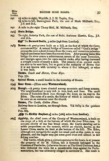 click to enlarge click to enlargeTLY137.jpg pp.36-49 in British High Roads, North and North Eastern Routes; pp.37-39. printed at p.36:- "... / ROUTE III. - LONDON to EDINBURGH and GLASGOW via / BOROUGHBRIDGE and CARLISLE (See Maps 31 to 42.) / Boroughbridge 206 (as per Route I.), Leeming 221½, Catterick 228, Greta Bridge 242½, Bowes 248½, Brough 261½, Appleby 269¾, / Penrith 283½, Carlisle 301½, Longtown 310¼, Langholm 321¾, / Hawick 349½, Selkirk 356, Middleton 379½, Edinburgh 392½. / ..."  click to enlarge click to enlargeTLY138.jpg item:- private collection : 270.1 Image © see bottom of page |
|||
|
|
||||
| evidence:- | old strip map:- Tinsley 1877 (Roads/Cum) placename:- Appleby |
|||
| source data:- | Strip map, road map, part of London to Edinburgh via Boroughbridge and Carlisle, including
from Appleby, Westmorland through Penrith to Carlisle, Cumberland, published by Tinsley
Bros, 8 Catherine Street, Strand, London, 1877.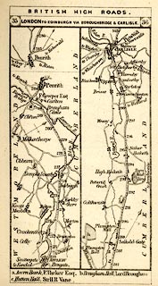 click to enlarge click to enlargeTLY1M2.jpg Map pp.35-36 in British High Roads, North and North Eastern Routes. printed at top:- "BRITISH HIGH ROADS. / 35 LONDON TO EDINBURGH, VIA BOROUGHBRIDGE &CARLISLE. 36" item:- private collection : 270.4 Image © see bottom of page |
|||
|
|
||||
| evidence:- | old itinerary:- Johnson 1908 (Roads/Cum) placename:- Appleby |
|||
| source data:- | Itinerary, Route 41. reverse in Roads Made Easy by Picture and Pen, Glasgow to Doncaster,
through Appleby, by Claude Johnson, edited by Lord Montagu, published by The Car Illustrated,
168 Piccadilly, London, 1908.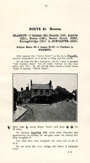 click to enlarge click to enlargeJS5083.jpg pp.83-84 in the road book, Roads Made Easy by Picture and Pen, vol.3. printed at beginning, p.83:- "ROUTE 41. Reverse. / GLASGOW via Carlisle (95), Penrith (113), Appleby (125½), Bowes (146¾), Scotch Corner (162¾), Boroughbridge (191¾), to DONCASTER (235¼)." 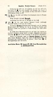 click to enlarge click to enlargeJS5084.jpg item:- private collection : 268.11 Image © see bottom of page |
|||
|
|
||||
| evidence:- | old map:- Postlethwaite 1877 (3rd edn 1913) |
|||
| source data:- | Map, uncoloured engraving, Map of the Lake District Mining Field, Westmorland, Cumberland,
Lancashire, scale about 5 miles to 1 inch, by John Postlethwaite, published by W H
Moss and Sons, 13 Lowther Street, Whitehaven, Cumberland, 1877 edn 1913.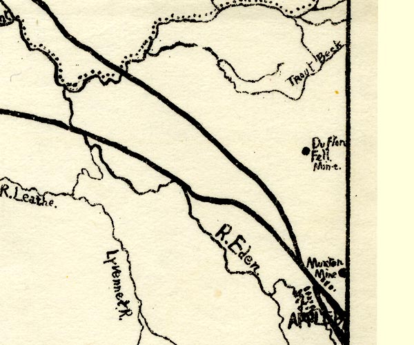 PST2NY62.jpg "APPL[EB ]" dots, railways item:- JandMN : 162.2 Image © see bottom of page |
|||
|
|
||||
| evidence:- | town plan:- Historical Monuments 1936 placename:- Appleby item:- |
|||
| source data:- | Town plan, uncoloured lithograph, Appleby Map Showing Castle Earthworks and Town,
Westmorland, scale about 1 to 5000, published by Royal Commission on Historical Monuments
England, London, 1936.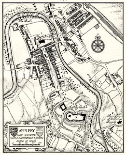 click to enlarge click to enlargeHMW009.jpg On p.13 of the Inventory of the Historical Monuments in Westmorland. printed, lower left "APPLEBY / MAP SHOWING / CASTLE EARTHWORKS &TOWN" item:- Armitt Library : A745.9 Image © see bottom of page |
|||
|
|
||||
| evidence:- | old map:- County Associations 1950 placename:- Appleby |
|||
| source data:- | Town plan, uncoloured lithograph, Appleby, Westmorland, scale about 4 inches to 1
mile, published by The County Associations, Bourdon Street, Berkeley Square, London,
1950.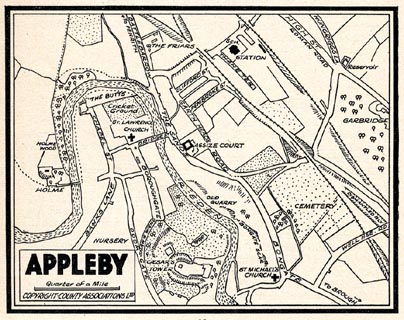 click to enlarge click to enlargeWMD1M6.jpg Town plan, uncoloured lithograph, Appleby, Westmorland, scale about 4 inches to 1 mile, published in The Westmorland Official County Guide by The County Associations, Bourdon Street, Berkeley Square, London, 1950. item:- JandMN : 1000.6 Image © see bottom of page |
|||
|
|
||||
| evidence:- | market notes:- placename:- Appleby item:- market |
|||
| source data:- | www.history.ac.uk/cmh/gaz/gazweb2.htmPalmer's Index No.93:: Public Record OfficeOwen: 1792: New Book of FairsBowen, Emanuel &Kitchin, Thomas: 1760: New Map of the Counties of Cumberland and Westmoreland | |||
|
|
||||
| evidence:- | old map:- Horsley 1732 placename:- Galacum placename:- Appleby |
|||
| source data:- | Map, uncoloured engraving, Britannia Antiqua, roman Britain,
scale about 50 miles to 1 inch, by John Horsley, perhaps 1732,
edition published about 1869?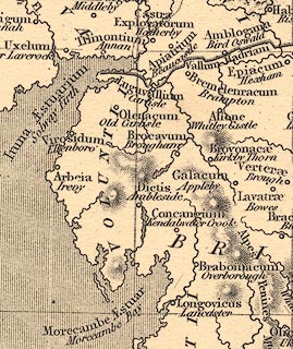 click to enlarge click to enlargeHOR1Cm.jpg "Galacum / Appleby" item:- JandMN : 429 Image © see bottom of page |
|||
|
|
||||
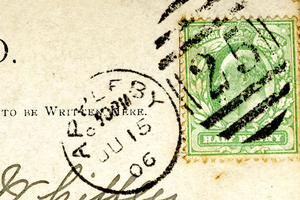 CCS52.jpg Postmark:- "APPLEBY / 10PM / JU 15 / 06" Stamp - Edward VII, halfpenny, green 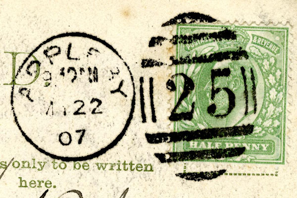 CCS59.jpg Postmark:- "APPL[EB]Y / 9 [ ]M / [ ] 22 / 07" Stamp - Edward VII, halfpenny, green |
||||
|
|
||||
 Post Office maps 1770-1909 Post Office maps 1770-1909 |
||||
|
|
||||
| evidence:- | old print:- Sayer 1847 placename:- Appleby |
|||
| source data:- | Frontispiece to vol.2 of Sayer's History of Westmorland, drawn by Thomas Gilks.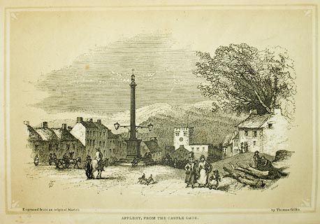 click to enlarge click to enlargeSY01E2.jpg "APPLEBY, FROM THE CASTLE GATE." item:- Armitt Library : A1390.3 Image © see bottom of page |
|||
|
|
||||
| evidence:- | old print:- Rose 1832-35 (vol.1 no.57) placename:- Appleby |
|||
| source data:- | Print, uncoloured engraving, Appleby, Westmorland, drawn by Thomas Allom, engraved
by M J Starling, published by Peter Jackson, London and Paris, 1830s.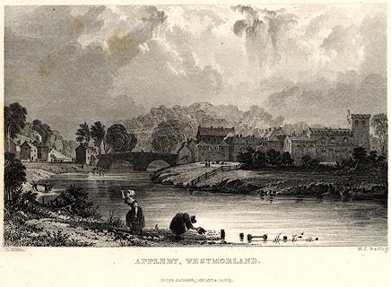 click to enlarge click to enlargePR0021.jpg vol.1 pl.57 in the set of prints, Westmorland, Cumberland, Durham and Northumberland Illustrated, originally. In the foreground water is being fetched from the River Eden. printed at bottom left, right, centre:- "T. Allom. / M. J. Starling. / APPLEBY, WESTMORLAND. / PETER JACKSON, LONDON &PARIS." item:- Dove Cottage : 2008.107.21 Image © see bottom of page |
|||
|
|
||||
| evidence:- | old print:- Rose 1832-35 |
|||
| source data:- | Print, engraving, Highcup-Gill, Appleby in the Distance, by Thomas Allom, engraved
by S Lacey, 1833.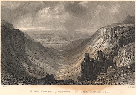 click to enlarge click to enlargeR219.jpg "Highcup-Gill, Appleby in the Distance" item:- JandMN : 96.10 Image © see bottom of page |
|||
|
|
||||
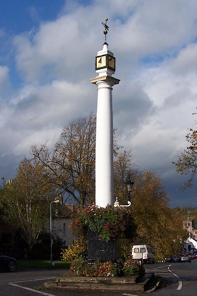 BJY52.jpg The pillar at the top of Boroughgate. (taken 28.10.2005) 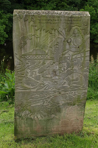 BUS66.jpg Memorial panel by the Eden. (taken 23.2.2007) 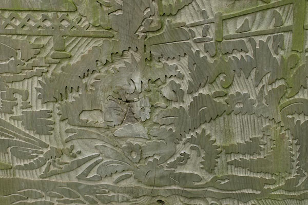 BUS67.jpg Memorial panel by the Eden. (taken 23.2.2007) 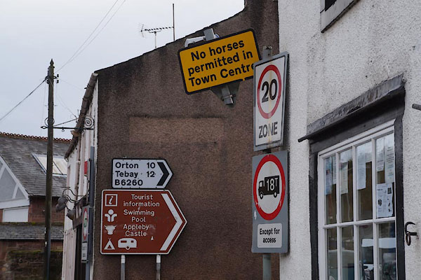 CCB46.jpg Roadsigns by Eden Bridge ... no horses. (taken 7.11.2014) |
||||
|
|
||||
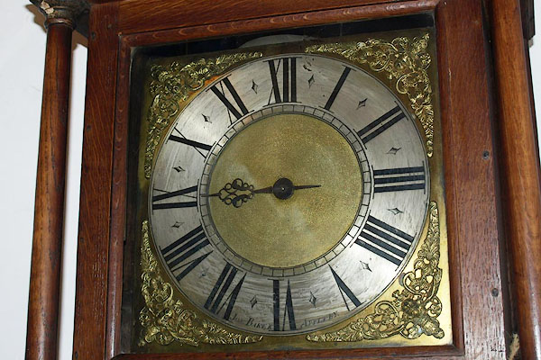 BPB33.jpg Brass dial of a longcase clock by:- "Jos. BAKER APPLEBY" Joseph Baker, clockmaker, Appleby (taken 18.4.2008) courtesy of Market Place Antiques, Kirkby Stephen |
||||
|
|
||||
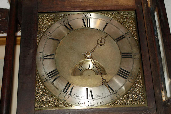 BPB34.jpg Brass dial of a longcase clock by:- "Joseph Baker APPLEBY" Joseph Baker, clockmaker, Appleby (taken 18.4.2008) courtesy of Market Place Antiques, Kirkby Stephen |
||||
|
|
||||
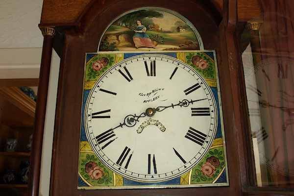 BQQ29.jpg Painted dial of a longcase clock by:- "George Wilson / APPPLEBY" George Wilson, clockmaker, Bridge Street, Appleby (taken 29.5.2009) courtesy of Mary Southwood |
||||
|
|
||||
| hearsay:- |
There is said to be a sycamore tree here, under which John Wesley preached. |
|||
|
|
||||
| hearsay:- |
The main street, Boroughgate, was planted with lime trees in the 1870s. |
|||
|
|
||||
| hearsay:- |
The famous horse fair is held on the second Tuesday and Wednesday in June. It had
a charter granted by James II. |
|||
|
|
||||
| hearsay:- |
John Robinson was an alderman here, and later MP for Appleby. He was called Jack,
as:- |
|||
| "Afore you can say Jack Robinson" |
||||
|
|
||||
| date:- | 1179 |
|||
| period:- | 12th century? | |||
| item:- | charter; market charter |
|||
| Market charter granted 1179? |
||||
|
|
||||
| places:- |
|
|||
|
||||
|
||||
|
||||
|
||||
|
||||
|
||||
|
||||
|
||||
|
||||
|
||||
|
||||
|
||||
|
||||
|
||||
|
||||
|
||||
|
||||
|
||||
|
||||
|
||||
|
||||
|
||||
|
||||
|
||||
|
||||
|
||||
|
||||
|
||||
|
||||
|
||||
|
||||
|
||||
|
||||
|
||||
|
||||
|
||||
|
||||
|
||||
|
||||
|
||||
|
||||
|
||||
|
||||
|
||||
|
||||
|
||||
|
||||
|
||||
|
||||
|
||||
|
||||
|
||||
|
||||
|
||||
|
||||
|
||||
|
||||
|
||||
|
||||
|
||||
|
||||
|
||||
|
||||
|
||||
|
||||
|
||||
|
||||
|
||||
|
||||
|
||||
|
||||
|
||||
|
||||
|
||||
|
||||
|
||||
|
||||
|
||||
|
||||
|
||||
|
||||
|
||||
|
||||
|
||||
|
||||
|
||||
|
||||
|
||||
|
||||
|
||||
|
||||
|
||||
|
||||
|
||||
|
||||
|
||||
|
||||
|
||||
|
||||
|
||||
|
||||
|
||||
|
||||
|
||||
|
||||
|
||||
|
||||
|
||||
|
||||
|
||||
|
||||
|
||||
|
||||
|
||||
|
||||
|
||||
|
||||
|
||||
|
||||
|
||||
|
||||
|
||||
|
||||
|
||||
|
||||
|
||||
|
||||
|
||||
|
||||
|
||||
|
||||
|
||||
|
||||
|
||||
|
||||
|
||||
|
||||
|
||||
|
||||
|
||||
|
||||
|
||||
|
||||
|
||||
|
||||
|
||||
|
||||
|
||||
|
||||
|
||||
|
||||
|
||||
|
||||
|
||||
|
||||
|
||||
|
||||
|
||||
|
||||
|
||||
|
||||
|
||||
|
||||
|
||||
|
||||
|
||||
|
||||
|
||||
|
||||
|
||||
|
||||
|
||||
|
||||
|
||||
|
||||
|
||||
|
||||
|
||||
|
||||
|
||||
|
||||
|
||||
|
||||
|
||||
|
||||
|
||||
|
||||
|
||||
|
||||
|
||||
|
||||
|
||||
|
||||
|
||||
|
||||
|
||||
|
||||
|
||||
|
||||
|
||||
|
||||
|
||||
|
||||
|
||||
|
||||
|
||||
|
||||
|
||||
|
||||
|
||||
|
||||
|
||||
|
||||
|
||||
|
||||
|
||||
|
||||
|
||||
|
||||
|
||||
|
||||
|
||||
|
||||
|
||||
|
||||
|
||||
|
||||
|
||||
|
||||
Lakes Guides menu.