Old Cumbria Gazetteer
 |
 |
|
||
| Kendal | ||||
| civil parish:- | Kendal (formerly Westmorland) | |||
| county:- | Cumbria | |||
| locality type:- | locality | |||
| locality type:- | buildings | |||
| locality type:- | market town | |||
| locality type:- | selected place | |||
| locality type:- | twinned town | |||
| coordinates:- | SD51479261 (etc) | |||
| 1Km square:- | SD5192 | |||
| 10Km square:- | SD59 | |||
| latitude; longitude:- | 2d 44.8m W, 54d 19.5m N | |||
|
|
||||
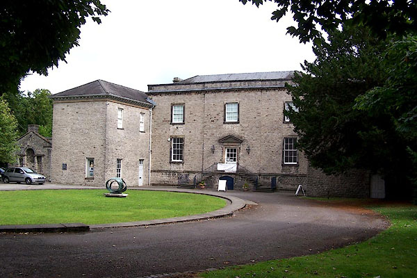
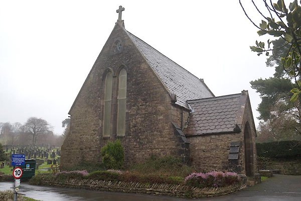
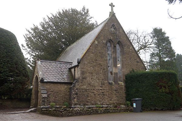
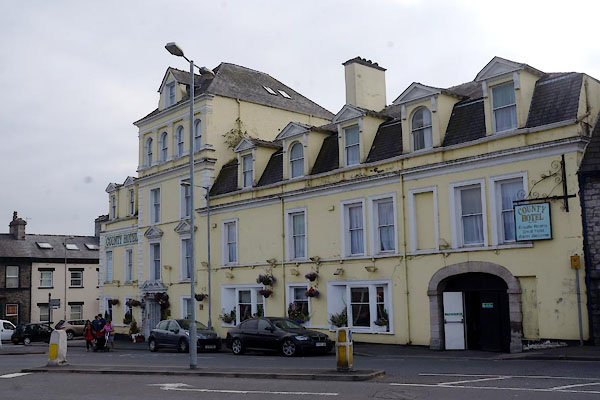
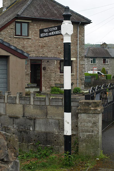
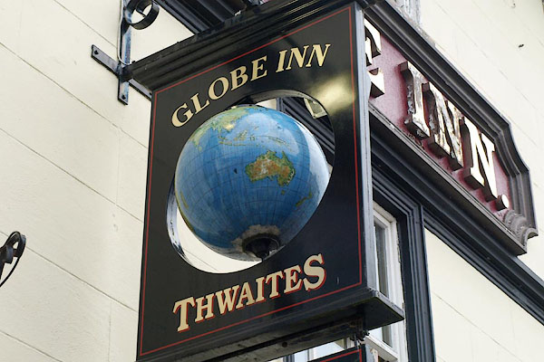
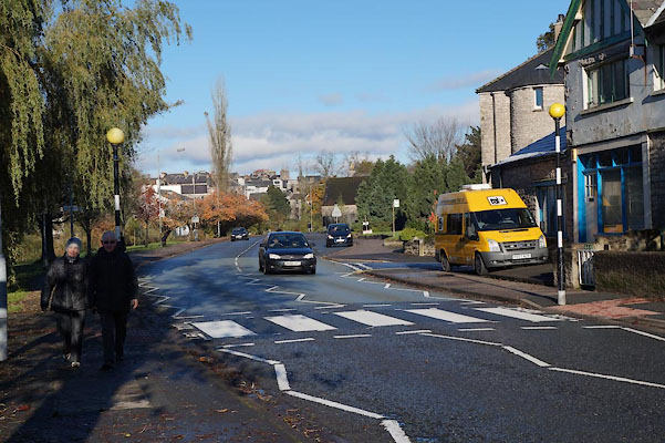
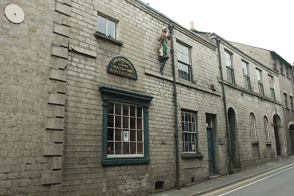
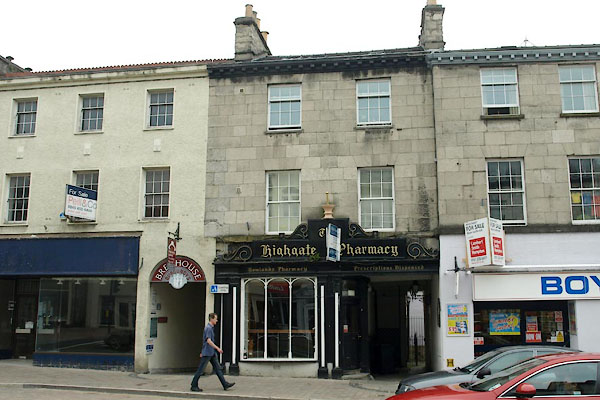
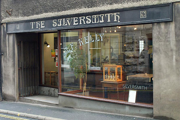
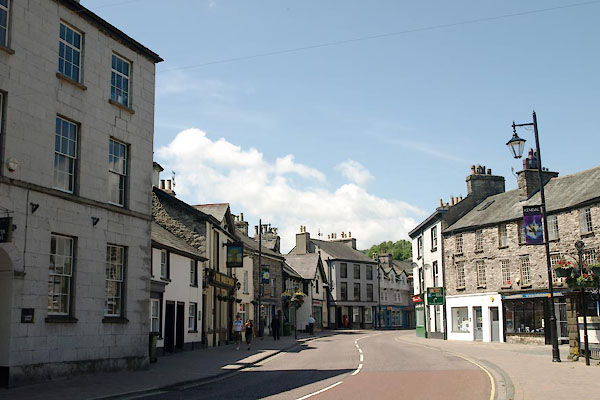
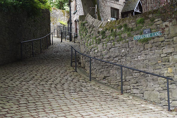
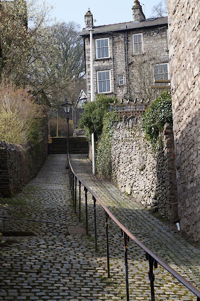
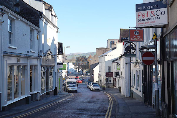
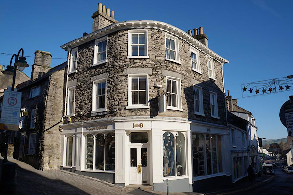
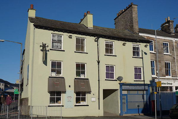
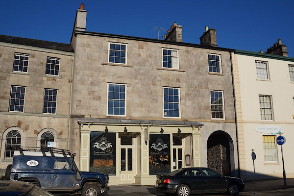
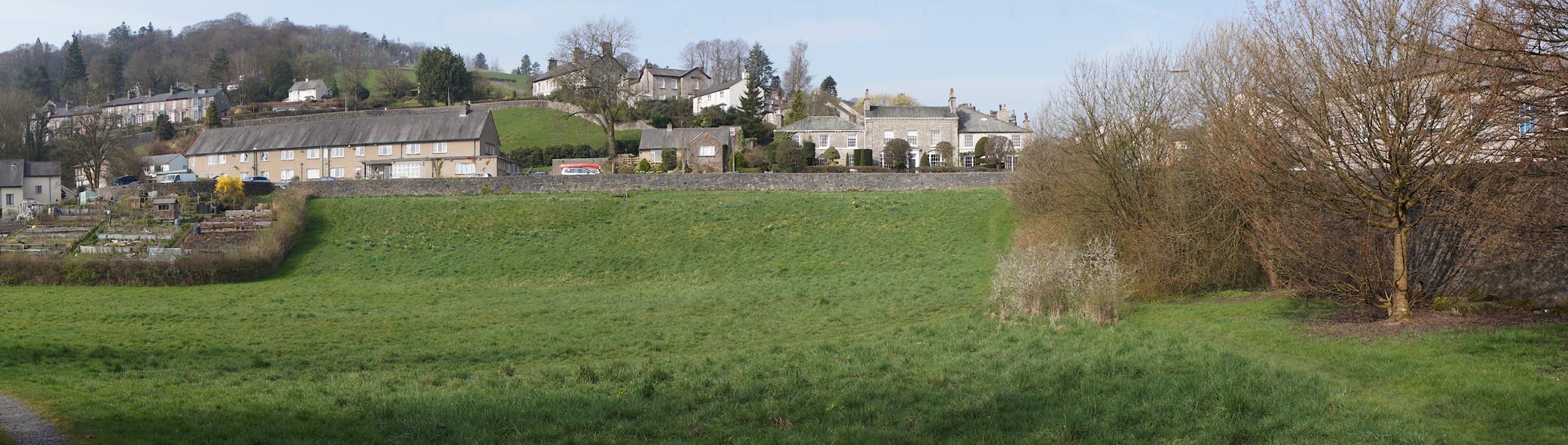
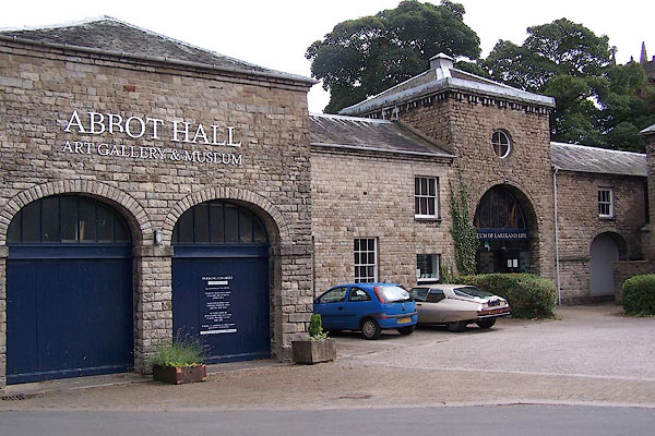
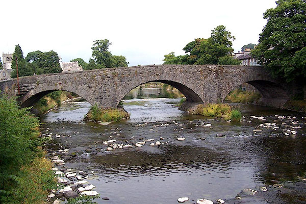
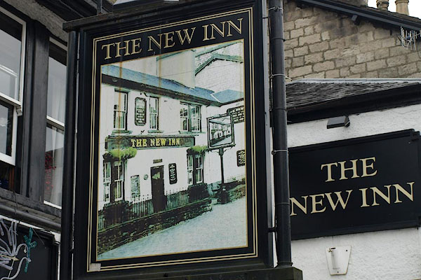
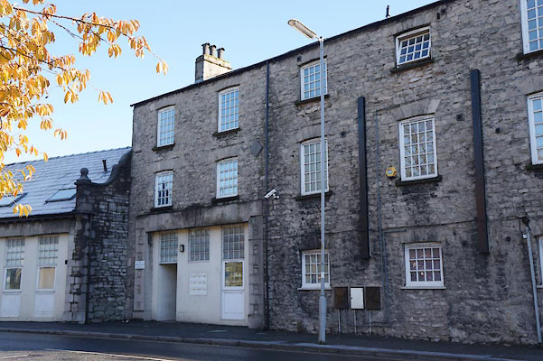
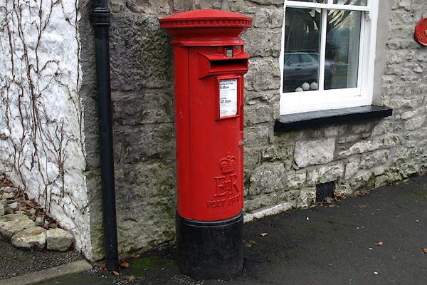
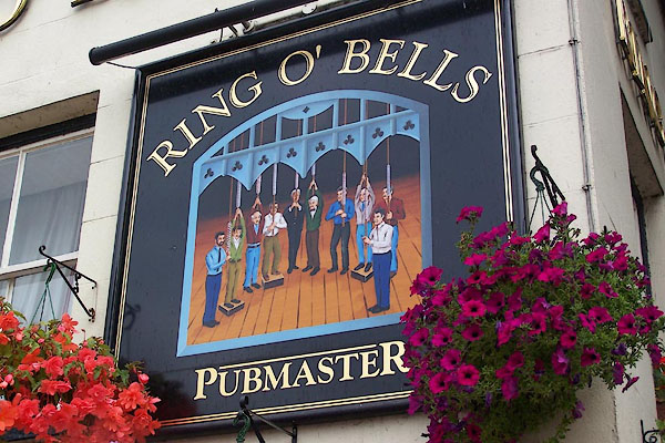
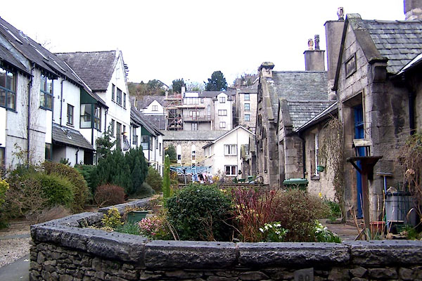
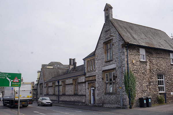
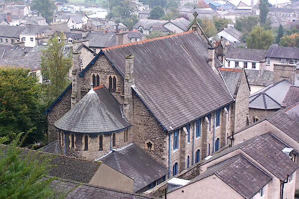
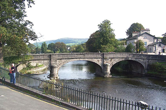
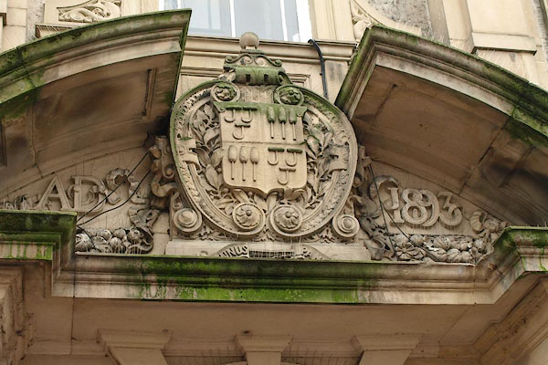
 BJS48.jpg Highgate, town hall, etc, from south. (taken 14.8.2005) 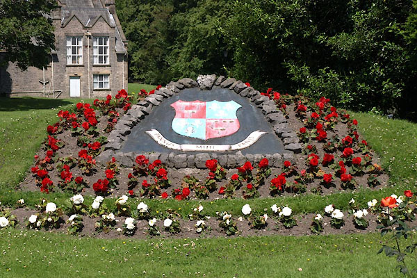 BUW72.jpg Civic flowers, coat of arms. (taken 3.7.2011) 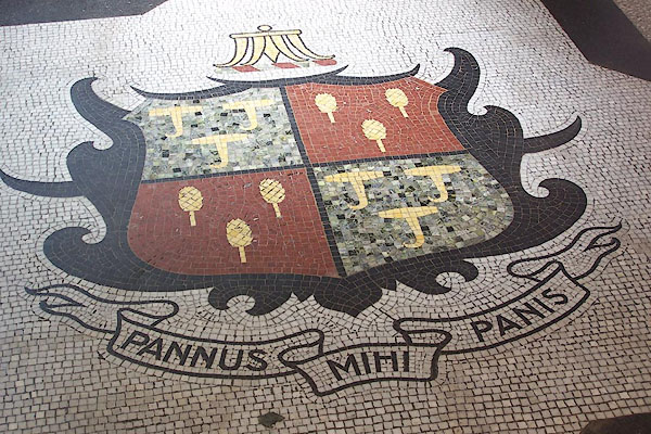 BJS49.jpg (taken 14.8.2005) |
||||
|
|
||||
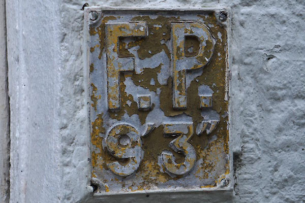
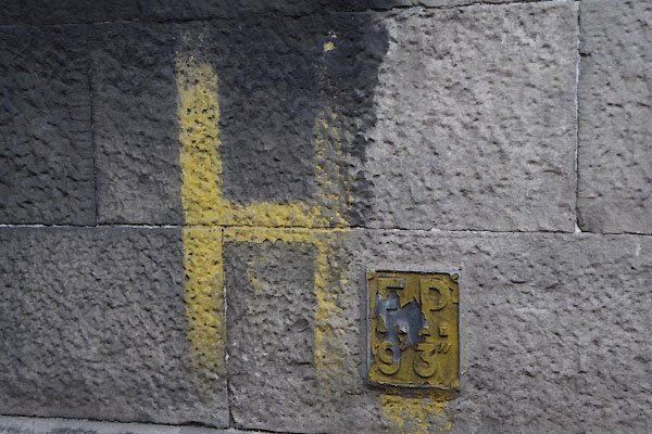
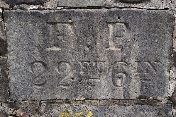
| evidence:- | old map:- OS County Series (Wmd 38 4) placename:- Kendal |
|||
| source data:- | Maps, County Series maps of Great Britain, scales 6 and 25
inches to 1 mile, published by the Ordnance Survey, Southampton,
Hampshire, from about 1863 to 1948. OS County Series (Wmd 38 8) |
|||
|
|
||||
| evidence:- | old map:- Gough 1350s-60s placename:- Kirkebie Kendale |
|||
| source data:- | Map, colour photozincograph copy, reduced size facsimile, Gough
Map of Britain, scale about 28.5 miles to 1 inch, published by
the Ordnance Survey, Southampton, Hampshire, 1875.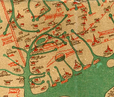 click to enlarge click to enlargeGgh1Cm.jpg item:- JandMN : 33 Image © see bottom of page |
|||
|
|
||||
| evidence:- | old map:- Gough 1350s-60s placename:- Kirkebie Kendale |
|||
| source data:- | Map, lithograph facsimile, Gough Map of Britain, 20 miles to 1
inch? published by the Ordnance Survey, Southampton, Hampshire,
1935.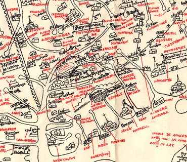 click to enlarge click to enlargeGgh2Cm.jpg item:- JandMN : 34 Image © see bottom of page |
|||
|
|
||||
| evidence:- | descriptive text:- Myddylton 1544 placename:- Kendale |
|||
| source data:- | Book, Cronycle of Yeres, including an early table of highways,
published by Wyllyam Myddylton, at the sign of the George, Fleet
Street, London, 1544. "And also the wayes leadynge to the / most notable places: and the dy- / staunce betwyxte the / same / Anno. 1544" "Here foloweth the waye fro~ Coker / mouth to lancastre, and so to London. / From Cokermouth to Kyswike. vi myle. / from Kyswike to Grosener. viii. myle. / from Grosener to Kendale. xiiii. myle. / from Kendale to Burton. vii. myle. / from Burton to Lancastre. viii. myle. / ..." |
|||
|
|
||||
| evidence:- | old map:- Lloyd 1573 placename:- Kirckbye |
|||
| source data:- | Map, hand coloured copper plate engraving, Angliae Regni,
Kingdom of England, with Wales, scale about 24 miles to 1 inch, authored by Humphrey
Lloyd, Denbigh, Clwyd, drawn and engraved
by Abraham Ortelius, Netherlands, 1573.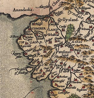 click to enlarge click to enlargeLld1Cm.jpg "Kirckbye" item:- Hampshire Museums : FA1998.69 Image © see bottom of page |
|||
|
|
||||
| evidence:- | old map:- Saxton 1579 placename:- Kendal |
|||
| source data:- | Map, hand coloured engraving, Westmorlandiae et Cumberlandiae Comitatus ie Westmorland
and Cumberland, scale about 5 miles to 1 inch, by Christopher Saxton, London, engraved
by Augustinus Ryther, 1576, published 1579-1645.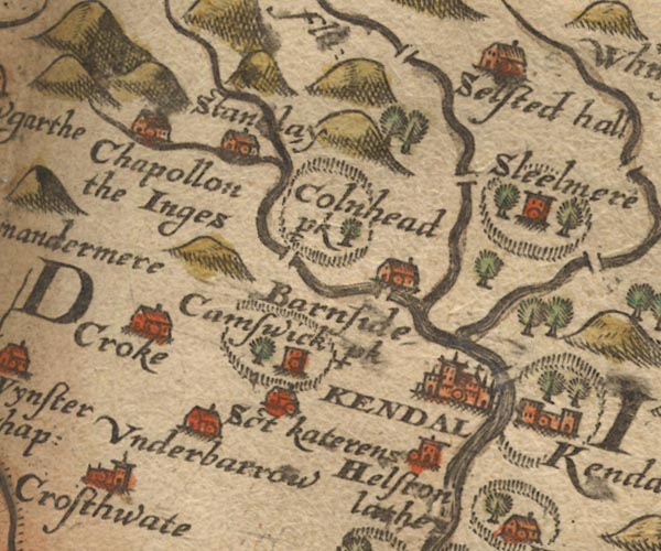 Sax9SD49.jpg Buildings and towers, symbol for a town. "KENDAL" item:- private collection : 2 Image © see bottom of page |
|||
|
|
||||
| evidence:- | old map:- Mercator 1595 (edn?) placename:- Kendall |
|||
| source data:- | Map, hand coloured engraving, Westmorlandia, Lancastria, Cestria
etc, ie Westmorland, Lancashire, Cheshire etc, scale about 10.5
miles to 1 inch, by Gerard Mercator, Duisberg, Germany, 1595,
edition 1613-16. MER5WmdA.jpg "Kendall" circle, building/s, tower, tinted red item:- Armitt Library : 2008.14.3 Image © see bottom of page |
|||
|
|
||||
| evidence:- | old map:- Unknown 1600s placename:- Kirkby Kendall |
|||
| source data:- | Town plan, uncoloured lithograph copy, Plan of Kirkby Kendall ie
Kendal, Westmorland, scale about 10 inches to 1 mile, perhaps
from a coloured original of the late 17th century.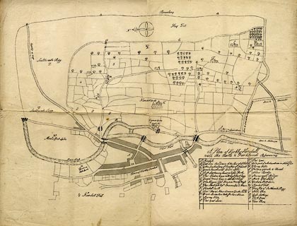 click to enlarge click to enlargeUN11.jpg "Kirkby Kendall" item:- JandMN : 136 Image © see bottom of page |
|||
|
|
||||
| evidence:- | old map:- Keer 1605 placename:- Kendall |
|||
| source data:- | Map, hand coloured engraving, Westmorland and Cumberland, scale
about 16 miles to 1 inch, probably by Pieter van den Keere, or
Peter Keer, about 1605 edition perhaps 1676. click to enlarge click to enlargeKER8.jpg "Kendall" dot, two circle, tower, tinted red; town item:- Dove Cottage : 2007.38.110 Image © see bottom of page |
|||
|
|
||||
| evidence:- | descriptive text:- Keer 1605 (edn 1620) placename:- Kandale placename:- Kendale placename:- Kirkeby Kendale item:- cloth; weaving; latitude; longitude; Kendal, lat and long |
|||
| source data:- | Map, Westmorlandia et Comberlandia, ie Westmorland and
Cumberland now Cumbria, scale about 16 miles to 1 inch, probably
by Pieter van den Keere, or Peter Keer, about 1605, published
about 1605 to 1676. goto source goto sourcesecond page "... the principall profit that the people of this Province [Westmorland] raise unto themselves, is by cloathing." "(7) The chiefest place of which is Kandale or Kendale, called also Kirkeby Kendale, standing on the banke of the River Can. This Towne is of great trade and resort, and for the diligent and industrious practice of making cloath so excels the rest, that in regard thereof it carrieth a supereminent name above them, and hath great vent &traffique for her wollen cloaths through all the parts of England. It challengeth not much glorie for Antiquitie; onely this is accounteth a great credit, that it hath dignified three Earles with the title thereof, as John Duke of Bedford, whom Henry the Fist (sic) (being his brother) advanced to that honour, John, Duke of Sommerset, and John de Foix, whom King Henry the sixt preferred to that dignitie for his honourable and trusty services done in the French warres. It is a place of very civill and orderly government, the which is mannaged by an Alderman, chosen every year out of his twelve Brethren, who are all distinguished and notified from the rest by wearing of purple garments. The Alderman and his Senior Brother are alwayes Justices of Peace and Quorum. There are in it a Towne-Clerke, a Recorder, two Sergeants at Mace, and two Chamberlaines. By Mathematicall observation the site of this Towne is in the degree of Longitude 17.30 scruples, from the first West point, and the Pole elevated in Latitude to the degree 55. and 15 minutes" |
|||
|
|
||||
| evidence:- | old map:- Speed 1611 (Cum/EW) placename:- Kendal |
|||
| source data:- | Map, hand coloured engraving, Kingdome of Great Britaine and
Ireland, scale about 36 miles to 1 inch, by John Speed, about
1610-11, published by Thomas Bassett, Fleet Street and Richard
Chiswell, St Paul's Churchyard, London, 1676?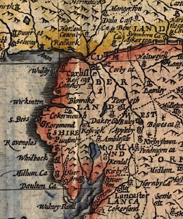 click to enlarge click to enlargeSPD6Cm.jpg "Kendal" dot, circle, and tower item:- private collection : 85 Image © see bottom of page |
|||
|
|
||||
| evidence:- | old map:- Speed 1611 (Wmd) placename:- Kendale |
|||
| source data:- | Map, hand coloured engraving, The Countie Westmorland and
Kendale the Cheif Towne, scale about 2.5 miles to 1 inch, by
John Speed, 1610, published by George Humble, Popes Head Alley,
London, 1611-12.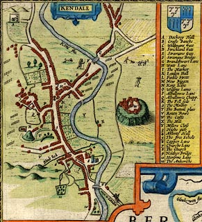 click to enlarge click to enlargeSP14Mk.jpg "KENDALE" item:- Armitt Library : 2008.14.5 Image © see bottom of page |
|||
|
|
||||
| evidence:- | old map:- Speed 1611 (Wmd) placename:- Kendall |
|||
| source data:- | Map, hand coloured engraving, The Countie Westmorland and
Kendale the Cheif Towne, scale about 2.5 miles to 1 inch, by
John Speed, 1610, published by George Humble, Popes Head Alley,
London, 1611-12.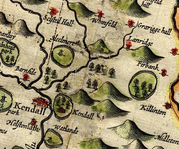 SP14SD59.jpg "Kendall" circle, buildings and towers item:- Armitt Library : 2008.14.5 Image © see bottom of page |
|||
|
|
||||
| evidence:- | poem:- Drayton 1612/1622 text placename:- Kendale item:- cloth; placename, Kendal |
|||
| source data:- | Poem, Poly Olbion, by Michael Drayton, published by published by
John Marriott, John Grismand and Thomas Dewe, and others?
London, part 1 1612, part 2 1622. goto source page 161:- "... Where Can first creeping forth, her feet hath scarcely found, But gives that Dale her name, where Kendale towne doth stand, For making of our Cloth scarce match'd in all the land." |
|||
|
|
||||
| evidence:- | old map:- Drayton 1612/1622 placename:- Kendall |
|||
| source data:- | Map, hand coloured engraving, Cumberlande and Westmorlande, by
Michael Drayton, probably engraved by William Hole, scale about
4 or 5 miles to 1 inch, published by John Mariott, John
Grismand, and Thomas Dewe, London, 1622.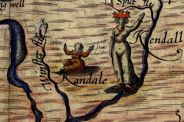 DRY523.jpg "Kendall" Lady with 'town' hedaress. item:- JandMN : 168 Image © see bottom of page |
|||
|
|
||||
| evidence:- | table of distances:- Simons 1635 |
|||
| source data:- | Table of distances, uncoloured engraving, Westmerland ie
Westmorland, with a thumbnail map, scale about 42 miles to 1
inch, by Mathew Simons, published in A Direction for the English
Traviller, 1635.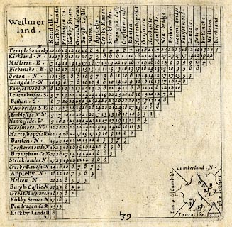 click to enlarge click to enlargeSIM3.jpg K on thumbnail map item:- private collection : 50.39 Image © see bottom of page |
|||
|
|
||||
| evidence:- | table of distances:- Simons 1635 placename:- Kendale |
|||
| source data:- | Table of distances, uncoloured engraving, Lancashire, with a
thumbnail map, by Mathew Simons, published in A Direction for
the English Traviller, 1635.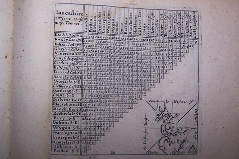 click to enlarge click to enlargeSIM522.jpg "Kendale Westm. N" and tabulated distances item:- private collection : 50.22 Image © see bottom of page |
|||
|
|
||||
| evidence:- | old text:- Brathwaite 1638 placename:- Kendall |
|||
| source data:- | Poem, Drunken Barbaby's Four Journeys to the North of England,
by Richard Brathwaite, 1638, published 1716-1818 at least. goto source Page 29:- "..." "Thence to Kirkland, thence to Kendall," "I did that which Men call Spend-all:" goto sourcePage 31:- "" "Night and Day with Sociates many," "I drank Ale both thick and clammy." "'Shroud thy Head, Boy, stretch thy Hand too" "'Hand has done what Head can't stand to.'" "..." goto sourcePage 107:- "..." "Thence to Kendall, pure her State is," "Prudent too her Magistrate is;" "In whose Charter to them granted," "Nothing but a Mayor wanted:" "Here it likes me to be dwelling," "Bousing, loving; Stories telling." "..." goto sourcePage 129:- "..." "Now to Kendall for Cloth-making," "Sight, site, Alderman awaking;" "Beauteous Damsels, modest Mothers," "And her four and twenty Brothers;" "Ever in her Honour spreading," "Where I had my Native Breeding." "[footnote] A Town so highly renown'd for her commodius Cloathing, and industrious Trading, as her Name is become famus in that kind. Camb. in Brit." goto sourcePage 131:- "Where I'll tell you (while none mind us)" "We throw th' House quite out at Windows;" "Nought makes them or me ought sorry," "They dance lively with John Dory:" "Holy Brethren with their Poet" "Sing, nor care they much who know it." |
|||
|
|
||||
| evidence:- | old map:- Jenner 1643 placename:- Kendal |
|||
| source data:- | Table of distances, with map, hand coloured engraving,
Westmerland ie Westmorland, scale about 16 miles to 1 inch,
engraved by Jacob van Langeren, published by Thomas Jenner,
Cornhill, London, 1643.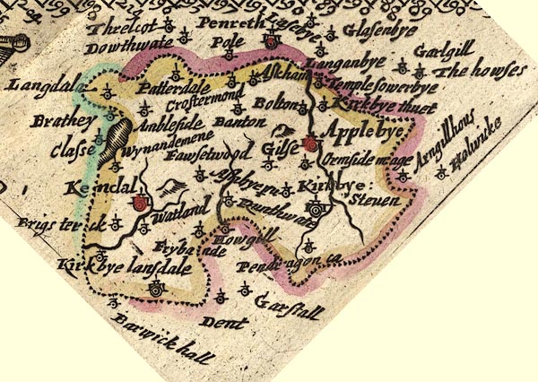 JEN3Sq.jpg "Kendal" dot, double circle, buildings, red tint item:- private collection : 52.Wmd Image © see bottom of page |
|||
|
|
||||
| evidence:- | old map:- Jansson 1646 placename:- Kendall |
|||
| source data:- | Map, hand coloured engraving, Cumbria and Westmoria, ie
Cumberland and Westmorland, scale about 3.5 miles to 1 inch, by
John Jansson, Amsterdam, Netherlands, 1646.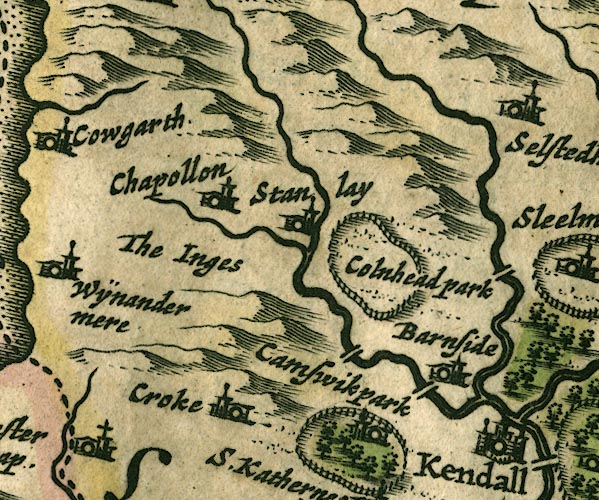 JAN3SD49.jpg "Kendall" Buildings and towers, suggestion of a wall, notice ?fence palings; upright lowercase text; market town. item:- JandMN : 88 Image © see bottom of page |
|||
|
|
||||
| evidence:- | hearth tax returns:- Hearth Tax 1675 placename:- Kendal parish |
|||
| source data:- | Records, hearth tax survey returns, Westmorland, 1674/75. "Kendal parish" |
|||
|
|
||||
| evidence:- | hearth tax returns:- Hearth Tax 1675 placename:- Nethergraveship |
|||
| source data:- | Records, hearth tax survey returns, Westmorland, 1674/75. "Nethergraveship" |
|||
|
|
||||
| evidence:- | old road book:- Ogilby 1675 (edn 1698) placename:- Kendal |
|||
| source data:- | OB16p018.txt page 18; describing plate 38 "The Continuation of the Road from / LONDON to CARLISLE in Cumberland." "... to Kendal at 256'1 extending 1 M. on the Road." "Kendal, a fair, large Town, pleasantly seated on Can or Kent flv. is of no great Antiquity, but noted for its Manufactures of Cotton, Druggets, Hats, Stockings, &c. It has a large Church with 12 Chappels of Ease, and on the East of the River, formerly stood a Castle, of which the ruinous Walls now only remain: 'Tis govern'd by a Mayor, 12 Mayor-Peers or Aldermen, 12 Common-Council-Men, a Recorder, &c. Near the Ch. is a fair Free-School well-endow'd, with Exhibitions to Queen's-College in Oxford: Here, is kept a great Mt. on Saturd. with 2 Fairs, viz. on April 25. Octob. 28. and between those Terms, a great Beast-Market every Fortnight." item:- private collection : 367 Image © see bottom of page |
|||
|
|
||||
| evidence:- | old map:- Ogilby 1675 (plate 96) placename:- Kendal |
|||
| source data:- | Road strip map, hand coloured engraving, the Road from Kendal to
Cockermouth, and the Road from Egremond to Carlisle, scale about
1 inch to 1 mile, by John Ogilby, London, 1675. OG96m000.jpg In mile 0, Westmoreland. "Kendal" town plan, castle, river; Ogilby's route leaves at the end of Stricklandgate. item:- JandMN : 22 Image © see bottom of page |
|||
|
|
||||
| evidence:- | old map:- Ogilby 1675 (plate 38) placename:- Kendal |
|||
| source data:- | Road strip map, hand coloured engraving, continuation of the
Road from London to Carlisle, scale about 1 inch to 1 mile, by
John Ogilby, London, 1675.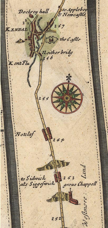 OG38m252.jpg In mile 256, Westmoreland. "KENDAL" town plan; Ogilby's route apparently goes round, not through the town, and keeps east of the river. item:- JandMN : 21 Image © see bottom of page |
|||
|
|
||||
| evidence:- | old map:- Berry 1679 placename:- Kendal |
|||
| source data:- | Road map, diagram, The Grand Roads of England, engraved by John
Rich, made and published by William Berry, at the Sign of the
Globe, London, 1679. "Kendal" market Saturday |
|||
|
|
||||
| evidence:- | old map:- Sanson 1679 placename:- Kendall |
|||
| source data:- | Map, hand coloured engraving, Ancien Royaume de Northumberland
aujourdhuy Provinces de Nort, ie the Ancient Kingdom of
Northumberland or the Northern Provinces, scale about 9.5 miles
to 1 inch, by Nicholas Sanson, Paris, France, 1679. click to enlarge click to enlargeSAN2Cm.jpg "KENDALL" circle, buildings and towers; town item:- Dove Cottage : 2007.38.15 Image © see bottom of page |
|||
|
|
||||
| evidence:- | old map:- Seller 1694 (Wmd) placename:- Kendall |
|||
| source data:- | Map, hand coloured engraving, Westmorland, scale about 8 miles
to 1 inch, by John Seller, 1694. click to enlarge click to enlargeSEL7.jpg "Kendall" circle, upright lowercase text; town item:- Dove Cottage : 2007.38.87 Image © see bottom of page |
|||
|
|
||||
| evidence:- | old map:- Morden 1695 (EW) placename:- Kendal |
|||
| source data:- | Map, hand coloured engraving, England, including Wales, scale
about 27 miles to 1 inch, by Robert Morden, published by Abel
Swale Awnsham and John Churchil, London, about 1695. click to enlarge click to enlargeMRD3Cm.jpg "Kendal" circle, tower; town, perhaps county town item:- JandMN : 339 Image © see bottom of page |
|||
|
|
||||
| evidence:- | old map:- Morden 1695 (Wmd) placename:- Kendall |
|||
| source data:- | Map, hand coloured engraving, Westmorland, scale about 2.5 miles to 1 inch, by Robert
Morden, published by Abel Swale, the Unicorn, St Paul's Churchyard, Awnsham, and John
Churchill, the Black Swan, Paternoster Row, London, 1695. MD10SD59.jpg "Kendall" Circle, buildings, towers. item:- JandMN : 24 Image © see bottom of page |
|||
|
|
||||
| evidence:- | descriptive text:- Fiennes 1698 placename:- Kendall item:- char; potted char; Kendal green; cloth; leather; tanning; market |
|||
| source data:- | Travel book, manuscript record of Journeys through England
including parts of the Lake District, by Celia Fiennes, 1698. "Kendall is a town built all of stone, one very broad streete in which is the market Crosse; its a goode tradeing town mostly famed for the cottons; Kendall Cotton is used for blanckets and the Scotts use them for their plodds and there is much made here and also linsiwoolseys and a great deale of leather tann'd here and all sorts of commodityes twice a week is the market furnished with all sorts of things." "The River Can which gives name to the town is pretty large but full of rocks and stones that makes shelves and falls in the water, ... there are great falls of water partly naturall and added to by putting more stones in manner of wyers at which they catch salmon ... the roareing of the water at these places sometymes does foretell wet weather, they do observe when the water roares most in the fall on the northside it will be faire, if on the southside of the town it will be wet; some of them are falls as high as a house ... there are 3 or 4 good houses in the town, the rest are like good traders houses very neate and tight, the streets are all pitch'd which is extreame easy to be repair'd for the whole country is like one entire rock or pitching almost all the roads." "At the Kings Arms one Mrs. Rowlandson she does pott up the charr fish the best of any in the country, I was curious to have some and so bespoke some of her [potted char], ... abundance of horses I see all about Kendall streetes with their burdens." "This Kendall is the biggest town and much in the heart of Westmoreland but Appleby 10 mile off is the shire town where the session and assizes are held ..." |
|||
|
|
||||
| evidence:- | old map:- Ogilby 1699 map (edn 1712) placename:- Kendal |
|||
| source data:- | Road map, uncoloured engraving, a New Mapp of the Roads of England, by John Ogilby,
published by William Bray, Exeter Court, Strand, London, 1712. "Kendal"  click to enlarge click to enlargeOGY7Cm.jpg item:- private collection : 263.1 Image © see bottom of page |
|||
|
|
||||
| evidence:- | old text:- Ogilby 1699 (edn 1712) placename:- Kendal item:- market |
|||
| source data:- | Road book, itineraries and map, The Traveller's Guide, by John
Ogilby, published by Abel Swall, Tim Child, White Hart, and R
Knaplock, the Angel and Crown, St Paul's Churchyard, London,
1699. OGY7p072.txt page 72 Distances from London "... and to Kendal at 256'1 extending 1M. on the Road." "Kendal, a fair, large T. pleasantly seated on Can or Kent flv. is of no great Antiquity, but noted for its Manufactures of Cotton, Druggets, Hats, Stockings, &c. It has a large Ch. with 12 Chaps. of Ease, and on the E. of the Riv. formerly stood a Castle, of which the ruinous Walls now only remain: 'Tis govern'd by a Mayor, 12 Mayor-Peers or Aldermen, 12 Common-Council-Men, a Recorder, &c. Near the Ch. is a Free-School well-endowed, with Exhibitions to Queen's-College in Oxford: Here, is kept a great Mt. on Saturd. with 2 Fairs, viz. on April 25. Octob. 28. and between those Terms, a great Beast-Mt. every Fortnight." |
|||
|
|
||||
| evidence:- | old map, descriptive text:- Bowen 1720 (plate 93) placename:- Kendal item:- placename, Kendal; woollens; fair; charter; market; cattle |
|||
| source data:- | Strip maps, uncoloured engravings, road maps, The Road from
London to Carlisle, scale about 2 miles to 1 inch, with sections
in Lancashire and Westmorland, published by Emanuel Bowen, St
Katherines, London, 1720.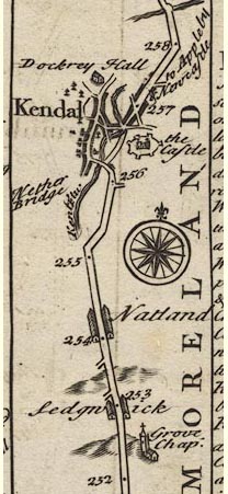 B093m252.jpg "Kendal at 257 So called from its scituation on Kan or Kant Flu. Is a large Town, well built & populous, driving a Considerable Trade in the Woollen Manufacture. It had formerly a strong Castle, the Walls of which are partly yet standing, & has now a large Church & about 12 Chappels of ease. It was made a Corporation by Q. Eliz. 18[ ]. Regni & afterwards by K. James 1st. [22] Regni, consisting of a Mayor, 12 Ald~, 12 Com~on Councilmen, a Recorder, &c. Here is a good Freeschool well endowed with Exhibitions to Queens Coll. Oxon. Mt. Sat. Fairs Au. 25th. & Oct. 28. &between the said Fairs a great Mt. for Cattle once a Fortnight." item:- Dove Cottage : 2007.38.100 Image © see bottom of page |
|||
|
|
||||
| evidence:- | old map:- Bowen 1720 (plate 260) placename:- Kendal |
|||
| source data:- | Road strip map, uncoloured engraving, pl.260, The Road from
Kendal to Cockermouth, scale about 2 miles to 1 inch, with
sections in Westmorland and Cumberland, published by Emanuel
Bowen, St Katherines, London, 1720. B260m25.jpg An alternative engraving of the descriptive text appears on this plate. item:- private collection : 1.260 Image © see bottom of page |
|||
|
|
||||
| evidence:- | old map:- Millward and Dickinson 1737 placename:- Kendal |
|||
| source data:- | Road map, photocopy, diagram, A New and Correct Map of Roads of
England, probably published by T Millward and B Dickinson, Inigo
Jones's Head, Fleet Street, London, 1737. "Kendal / 256" miles fom London  click to enlarge click to enlargeMWD1Cm.jpg item:- private collection : 264 Image © see bottom of page |
|||
|
|
||||
| evidence:- | old print:- Buck 1739 |
|||
| source data:- | Print, uncoloured engraving, The East View of Kendal Castle, in the County of Westmorland,
drawn and engraved by Samuel and Nathaniel Buck, published 1739.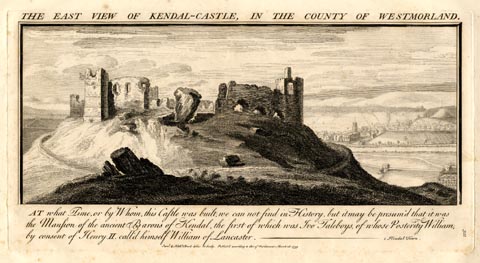 click to enlarge click to enlargeBU0222.jpg printed, top "THE EAST VIEW OF KENDAL-CASTLE, IN THE COUNTY OF WESTMORLAND." item:- Armitt Library : 1959.67.22 Image © see bottom of page |
|||
|
|
||||
| evidence:- | old map:- Badeslade 1742 placename:- Kirby in Kendale |
|||
| source data:- | Maps, Westmorland North from London, scale about 10 miles to 1
inch, and Cumberland North from London, scale about 11 miles to
1 inch, with descriptive text, by Thomas Badeslade, London,
engraved and published by William Henry Toms, Union Court,
Holborn, London, 1742; published 1742-49. "Kirby in Kendale is the largest Town in the County, Market Saturday, Fairs Monday before Lady-day, and Trinity Monday." "..." "... The S. part of the County [Westmorland] is divided into 2 by the Can or Ken, which gives name to Kendale ..." |
|||
|
|
||||
| evidence:- | old map:- Badeslade 1742 placename:- Kendall |
|||
| source data:- | Map, uncoloured engraving, A Map of Westmorland North from
London, scale about 10 miles to 1 inch, with descriptive text,
by Thomas Badeslade, London, engraved and published by William
Henry Toms, Union Court, Holborn, London, 1742. click to enlarge click to enlargeBD12.jpg "Kendall / 203 m" circle, tower/s, upright lowercase text; town, distance from London item:- Dove Cottage : 2007.38.62 Image © see bottom of page |
|||
|
|
||||
| evidence:- | old text:- Gents Mag item:- rebellion, 1745; 1745 Rebellion |
|||
| source data:- | Magazine, The Gentleman's Magazine or Monthly Intelligencer or
Historical Chronicle, published by Edward Cave under the
pseudonym Sylvanus Urban, and by other publishers, London,
monthly from 1731 to 1922. goto source Gentleman's Magazine 1745 p.624 "From the London Gazette extraordinary. Whitehall, Dec. 18 [1745]." "... The person call'd duke of Perth, with about 150 horse, left the rebel army upon the 11th at Lancaster, and took the road towards Carlisle, giving out, that he was going to fetch a reinforcement. Notice thereof has been sent to all the towns through which he was to pass, and it was hoped the country people would intercept him. ..." "Accordingly, as other letters add, the people fell upon this party at Kendal, took 3 men and 2 women, and some horses, but three of the town were killed. This was on the 14th at noon. ..." |
|||
|
|
||||
| evidence:- | old text:- Gents Mag 1745 item:- rebellion, 1745; 1745 Rebellion; beacon |
|||
| source data:- | goto source Gentleman's Magazine 1745 p.625 "... Dec. 14 [1745]. ... About ten this morning the van-guard of the rebels, consisting of 110 men, equip'd and accoutred like Hussars, entred Kendal on horseback, with a chaise, in which was a person in woman's dress, rode up the town quietly, and turned thro' the fish-market down to the bridge leading to Penrith; but as they were pursuing their route thro' the town, without stopping, and were almost got out of it, a gun was fired out of a house, and one of the rebels kill'd; whereupon the town's people closed in, and took two more prisoners. The rest of them gallop'd on towards the bridge, where a halt was made on a sudden, and a few muskets discharg'd at the people, and an ostler and shoemaker thereby kill'd upon the spot. They then made a general volley, but without doing any more mischief, and after that pursued their way as fast as they could towards Shap. Their horses seem's very much harassed and jaded." "... Dec. 17. A party of rebel horse (about 100) amongst whom was the D. of Perth, so call'd, pass'd thro' Kendal on Saturday morning about ten; the country and town's people mobb'd their rear, which fir'd and kill'd two or three, and proceeded forward towards Penrith. On Sunday after dinner a party of horse came into Kendal, amongst whom was their commissary; and an hour afterwards came the rest, horse and foot, and were coming in till after dark. Their artillery, consisting of 12 or 13 small pieces, was about the middle of the corps, with several cover'd carts. The duke of Perth, so call'd, after the scuffle above mention'd at Kendal, proceeded on to Shap, and intended for Penrith; but seeing the beacons on fire, and hearing it was done to call in the country, sent a small party to the round table, which is a mile on this side of Penrith, and five from Shap to make enquiries; and finding it true, he return'd for safety to Kendal about two in the morning of the 16th. Between four and five the drums began to beat, and the men march'd out from day-break till near ten, in the same order as they enter'd, Ld George Murray being with the last company." |
|||
|
|
||||
| evidence:- | old text:- Gents Mag item:- rebeliion, 1745; 1745 Rebellion |
|||
| source data:- | Magazine, The Gentleman's Magazine or Monthly Intelligencer or
Historical Chronicle, published by Edward Cave under the
pseudonym Sylvanus Urban, and by other publishers, London,
monthly from 1731 to 1922. goto source Gentleman's Magazine 1745 p.612 "... ..." "Letters from Kendal of the 21st [Nov 1745] bring advice, that about 120 horse, belonging to the rebels, were come into that town, and that orders had been given for preparing quarters for 2000 foot, which were to be there that evening under the command of lord George Murray. Letters of the 22d from the same place say, that the rebels were arriv'd there, and that they gave out that they propos'd to be at Lancaster upon the 23d." |
|||
|
|
||||
| evidence:- | old text:- Gents Mag item:- rebellion, 1745; 1745 Rebellion |
|||
| source data:- | Magazine, The Gentleman's Magazine or Monthly Intelligencer or
Historical Chronicle, published by Edward Cave under the
pseudonym Sylvanus Urban, and by other publishers, London,
monthly from 1731 to 1922. goto source Gentleman's Magazine 1746 p.62 "Mr URBAN, Feb. 10, 1745-6." "AS the intelligence convey'd to us by your magazine is very much depended upon, and may furnish materials for a more compleat history of the present troubles, it becomes every one, to furnish you with proper incidents." "In your Mag. for December, p.624 C, in the note, and p.625 F, you have given some account of the D. of Perth's being attack'd at Kendal, and of his procedure afterwards till his joining the main body of the rebels; but as it is imperfect, I would supply its deficiencies with an exact representation of the affair." "Dec. 14. The D. of Perth with about 110 men, the vanguard of the rebels, dress'd in imitation of hussars, entred Kendal and pass'd quietly till they came to Tinkle-street, where the mob suddenly rising fell upon them, with clubs, stones, or any thing they could pick up in their hurry. The D.'s men made a short stand a little below the fish market, and fir'd several shot, by which four people received wounds of which they died. Of the rebels none were kill'd on the place, but four made prisoners, one of them Perth's servant, who rid on a good horse, and had a mail behind him, which were secured. Then the rebels push'd forward as fast as their horses could carry them near a quarter of a mile, till they came at the bridge, being pursued all the way by the enraged people, throwing stones, &c. at them. Their rear made another stand here, and seem'd as if they would return, but a townsman, having crept privately to the end of the bridge, fir'd at the foremost, who immediately let his gun and cloak fall, and could not turn his horse, but by the help of his companions he got off; ..." |
|||
|
|
||||
| evidence:- | old map:- Simpson 1746 map (Wmd) placename:- Kendall |
|||
| source data:- | Map, uncoloured engraving, Westmorland, scale about 8 miles to 1
inch, printed by R Walker, Fleet Lane, London, 1746.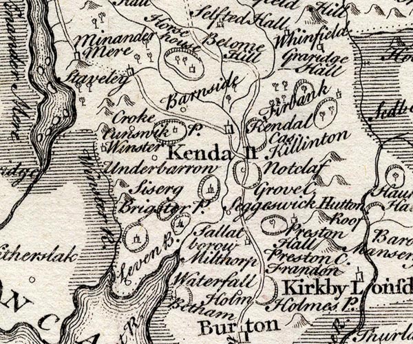 SMP2SDP.jpg "Kendall" Building; labelled as a town. item:- Dove Cottage : 2007.38.59 Image © see bottom of page |
|||
|
|
||||
| evidence:- | descriptive text:- Simpson 1746 placename:- Kendal placename:- Kirkby Candale placename:- Brovonaca placename:- Concangi item:- charter; woollens; Kendal Cloths; cottons; druggets; serges; hat; worsted; stockings; market; fair |
|||
| source data:- | Atlas, three volumes of maps and descriptive text published as
'The Agreeable Historian, or the Compleat English Traveller
...', by Samuel Simpson, 1746. goto source Page 1023:- "..." "Kendal, called also Kirkby Candale, i.e. a Church in the Valley upon the River Can, over which it has two Bridges of Stone, and one of Wood, and a Harbour for Boats. Dr. Gale thinks it to be the Brovonaca of Antoninus, and allows that it was the Station of the Romans, called Concangi; but both these Points are disputed. 'Tis much superior to Appleby in Trade, Buildings, and the Number and Wealth of the Inhabitants, and is indeed the largest Town in the County. It has two good Streets, which cross each other, and is inriched by the Industry of the Townsmen, and the Woollen Manufacture, with which they have drove a Trade throughout England ever since the Reign of Edward III. As early as Richard II. and Henry IV. special Laws were enacted on purpose for regulating Kendal Cloths. Queen Elizabeth erected it into a Corporation by the Name of Aldermen and Burgesses; and King James I. incorporated it with a Mayor, Recorder, Town-Clerk, twelve Aldermen, twenty four Burgesses, and two Attorneys, of whom the Mayor, Recorder, and two Senior Aldermen, are always Justices of the Peace. It is of Note also for the Manufacture of Cottons, Druggets, Serges, Hats, Worsted, and Yarn Stockings, &c. Its Markets are on Saturday, and the Monday before Lady day, and its Fairs are on [Trinity]" goto sourcePage 1024:- "Trinity Monday, April 25, October 28, and between them a great Beast-market every Fortnight." "There are seven trading Companies belonging to the Town, viz. Mercers, Sheermen, Cordwainers, Tanners, Glovers, Taylors, and Pewterers, who have each their Hall. The Church here is beautiful, and very large, and yet has twelve Chapels of Ease belonging to it. 'Tis supported by five Rows of handsome Pillars. Near the Church is Free-School well endowed, with Exhibitions for such Scholars as are sent hence to Queen's-College, Oxford. There's a Charity-School here for sixteen Boys and ten Girls, all cloathed and taught. At a little Distance from the wooden Bridge are the Ruins of a Castle, in which Catherine Parr, the sixth Wife of Henry VIII. was born." "This Place has had the great honour of giving Title of Baron, Earl and Duke, particularly that of Earl to Prince George of Denmark; and last of all, that of Dutchess to the late Melusina Schulenberg, who had before been created Dutchess of Munster in Ireland." |
|||
|
|
||||
| evidence:- | descriptive text:- Bickham 1753-54 |
|||
| source data:- | Maps, A Map of Westmorland, 1753, and A Map of Cumberland, 1754,
by George Bickham, James Street, Bunhill Fields, London;
published 1750s-96. "Kendal is large and populous, and has twelve Chappels of Ease to its single Church. Here are seven incorporated Companies, and a noble Free School. A little Fray happen'd here last Year between ye Rebels, in their advance Southward, and some of the Inhabitants." |
|||
|
|
||||
| evidence:- | old map:- Bickham 1753-54 (Wmd) placename:- Kendall |
|||
| source data:- | Map, uncoloured engraving, perspective view, A Map of
Westmorland, North from London, by George Bickham, James Street,
Bunhill Fields, London, 1753.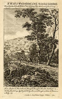 click to enlarge click to enlargeBCK3.jpg "Kendall" view (sort of) item:- Armitt Library : 2008.14.71 Image © see bottom of page |
|||
|
|
||||
| evidence:- | old map:- Bowen and Kitchin 1760 placename:- Kendal |
|||
| source data:- | Map, hand coloured engraving, A New Map of the Counties of
Cumberland and Westmoreland Divided into their Respective Wards,
scale about 4 miles to 1 inch, by Emanuel Bowen and Thomas
Kitchin et al, published by T Bowles, Robert Sayer, and John
Bowles, London, 1760.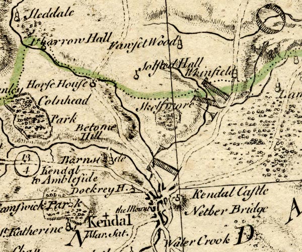 BO18SD49.jpg "Kendal Mar. Sat." blocks, on road, street plan, town, market, small plain cross for a charity school? item:- Armitt Library : 2008.14.10 Image © see bottom of page |
|||
|
|
||||
| evidence:- | old map:- Jefferys 1770 placename:- Kendal |
|||
| source data:- | Map, 4 sheets, The County of Westmoreland, scale 1 inch to 1
mile, surveyed 1768, and engraved and published by Thomas
Jefferys, London, 1770.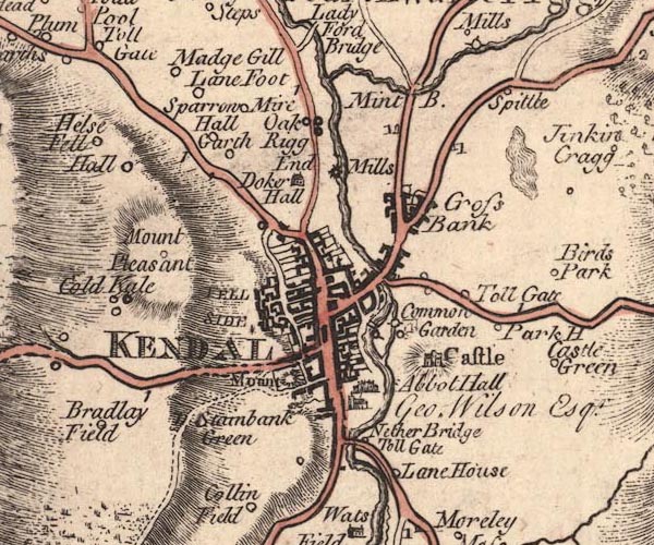 JEF5Kndl.jpg "KENDAL" blocks on a street plan, church, large houses, castle, mills, bridges, etc (the source map has a town plan of Kendal) item:- National Library of Scotland : EME.s.47 Image © National Library of Scotland |
|||
|
|
||||
| evidence:- | old map:- Jefferys 1770 placename:- Kendal |
|||
| source data:- | Map, 4 sheets, The County of Westmoreland, scale 1 inch to 1
mile, surveyed 1768, and engraved and published by Thomas
Jefferys, London, 1770.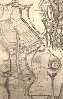 click to enlarge click to enlargeJEF5Kn.jpg item:- National Library of Scotland : EME.s.47 Image © National Library of Scotland |
|||
|
|
||||
| evidence:- | old text:- Pennant 1773 |
|||
| source data:- | Book, A Tour from Downing to Alston Moor, 1773, by Thomas
Pennant, published by Edward Harding, 98 Pall Mall, London, 1801. goto source Pennant's Tour 1773, page 120 "I am surprised that Dr. Burn should omit the mention of a native of this town [Kendal], who would have done honour to any county - Thomas Shaw, the celebrated traveller, was born here in 1693: he was son of Gabriel Shaw, shearman and dyer, a reputable and profitable business. The merit of his travels in Barbary, Egypt, and the Holy Land, are justly held in the highest estimation, and beyond the danger of being either depreciated or superseded. He became Fellow of Queen's College, Oxford, and was promoted to the Headship of Edmund-hall; and, in 1751, died in high reputation, for knowledge, probity, and pleasantry. His countenance was grotesque, but marked most strongly with jocularity and good-humour, so as to diffuse into the company the full effects of his innocent and instructive mirth. The print prefixed to his works is a faithful representation of this excellent and able character." |
|||
|
|
||||
| evidence:- | old map:- Pennant 1777 placename:- Kendal |
|||
| source data:- | Map, hand coloured engraving, A Map of Scotland, Hebrides and
Part of England, drawn for Thomas Pennant, engraved by J Bayly,
published by Benjamin White, London, 1777.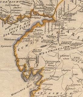 click to enlarge click to enlargePEN1Cm.jpg "CONCANGIUM / Kendal" circle; buildings, village, etc item:- private collection : 66 Image © see bottom of page |
|||
|
|
||||
| evidence:- | descriptive text:- West 1778 (11th edn 1821) placename:- Concangium item:- charter; market charter; woollens; cotton goods; weaving; stockings; silk spinning; ivory comb; comb; card; wool card |
|||
| source data:- | Guide book, A Guide to the Lakes, by Thomas West, published by
William Pennington, Kendal, Cumbria once Westmorland, and in
London, 1778 to 1821. goto source Page 177:- "KENDAL. [1]" "The approach to it from the north is pleasant. A noble river, the Kent, is discovered flowing briskly through fertile fields, and visiting the town in its whole length. It is crossed by a handsome bridge, where three great roads coincide, from Sedbergh, Kirkby-Stephen, and Penrith. The main street leading from the bridge slopes upwards to the centre of the town, and contracts itself into an inconvenient passage, [2] where it joins another principal street, which falls with a gentle declivity both ways, and is a mile in length, and of spacious breadth. Was an area for a market-place opened at the incidence of these two streets, it would be a noble improvement. The entrance from the south is by another bridge, which makes a short awkward turn into the suburbs, but after that, the street opens well, and the town has a chearful appearance. The principal inns are genteel, commodious, and plentifully served." "Here is a workhouse for the poor, which for neatness and oeconomy exceeds most of the kind in the kingdom." "[1] Concangium, Not. Imp." "[2] This passage is now widened; and a new street has been opened from near the centre of the town, to the river side, which has much improved the road through it for carriages." goto sourcePage 178:- "The objects most worthy of notice here are the manufactories. The chief of these are of Kendal cottons (a coarse woollen cloth) of linseys, toilonets, kerseymeres, callicoes, and of knit worsted stockings. Also a considerable tannery is carried on in this town. The less (sic) manufactures are, of fish hooks, of waste silk (which is received from London, and after scouring, combing, and spinning, is returned) of ivory combs, and of wool cards, in which branch considerable improvements have been made by the curious machines invented here for that purpose. There are other articles of industry well worth seeing; as the mills for scouring, fulling, and frizing cloth, for cutting and rasping dying wood, &c. But what is most to the credit of this place, is, that notwithstanding many inconveniences, which this town has laboured under, the manufactures have all along continued to flourish, and have of late years been greatly increased by the spirit and industry of the inhabitants. These manufactures are particularly noticed so early as the reign of King Richard II, and Henry IV. when special laws were enacted for the better regulation of Kendal-cloths, &c." goto sourcePage 179:- "When William the Conqueror gave the barony of Kendal to Ivo de Taillebois, the inhabitants of the town were villain-tenants of the baronial lord; but one of his successors emancipated them, and confirmed their burgages to them, by charter. Queen Elizabeth, in the 18th year of her reign, erected it into a corporation, by the name of aldermen and burgesses; and afterwards King Charles I. incorporated it with a mayor, 12 aldermen, and 20 capital burgesses." "Mr. Gray's description of this town is injurious to it; but his account of the church and castle is worth transcribing. 'Near the end of the town, stands a handsome house of Colonel Wilson's, and adjoining it, the" goto sourcePage 180:- "church, a very large Gothic fabric, with a square tower; it has no particular ornaments, but double aisles, and at the east four chapels, or choirs.' Mr. Gray's account then proceeds to the inside of the church, ..." goto sourcePage 182:- "..." "The castle he describes thus:- 'The remains of the castle are seated on a fine hill, on the side of the river opposite to the town; ...'" "..." goto sourcePage 190:- "A TABLE OF THE Height of Mountains and Lakes SEEN IN THIS TOUR, ... TAKEN FROM THE LEVEL OF THE SEA. ... by Mr. John Dalton." "Town of Kendal ... 46 [yards]" goto sourceAddendum; Mr Gray's Journal, 1769 Page 212:- "..." "I now reached Ambleside, ... meaning to lie there; but on looking into the best bed-chamber, ... grew delicate, gave up Windermere in despair, and resolved I would go on to Kendal directly, fourteen miles further ..." goto sourcePage 213:- "..." "... the dusk of the evening coming on, I entered Kendal almost in the dark, and could distinguish only a shadow of the castle on a hill, and tenter grounds spread far and wide round the town, which I mistook for houses. My inn promised sadly, having two wooden galleries, like Scotland, in front of it: it was indeed an ill-contrived house, but kept by civil, sensible people; so I stayed two nights with them, and fared and slept very comfortably." "Oct. 9. The air mild as summer, all corn off the ground, and the sky-larks singing aloud ... I went up the castle-hill: the town chiefly consists of three nearly parallel streets, almost a mile long; except these, all the other houses seem as if they had been dancing a country dance, and were out: there they stand back to back, corner to corner, some up-hill, some down, without intent or meaning. Along by their side runs a fine brisk stream, over which there are three stone bridges: the buildings (a few comfortable houses excepted) are mean, of stone, and covered with a" goto sourcePage 214:- "bad rough-cast [1]. Near the end of the town stands a handsome house of Colonel Wilson's, and adjoining to it the church, a very large gothic fabric, with a square tower, ... ... The remains of the castle are seated on a fine hill on the side of the river opposite the town; almost the whole inclosure of the walls remain, with four towers, two square and two round, but their upper parts" "[1] [The accounts of things given by hasty travellers, are generally inaccurate and often injudicious. As to the principal streets in Kendal, they are neither three in number, nor nearly parallel. They are but two. One about a mile in length, and another about half a mile. These streets contain indeed not many elegant houses; they are however on the whole as open and well-built as in most other towns. As to the bad rough-cast our author speaks of, judges of rough-cast have always supposed this country no way deficient in the materials, or in the manner of laying it on.]" goto sourcePage 215:- "or embattlements are demolished; ... There is a good view of the town and river, with a fertile open valley, though which it winds." goto sourceTour to the Caves in the West Riding of Yorkshire, late 18th century Page 244:- "..." "... Many of the smaller farmers, betwixt Kirkby-Lonsdale and Kendal, earn their bread with carrying coals, during most part of the year, from the pits at Ingleton, Black-Burton, or properly Burton-in-Lonsdale, to Kendal and the neighbouring places ..." |
|||
|
|
||||
| evidence:- | old map:- West 1784 map placename:- Kendal |
|||
| source data:- | Map, hand coloured engraving, A Map of the Lakes in Cumberland,
Westmorland and Lancashire, scale about 3.5 miles to 1 inch,
engraved by Paas, 53 Holborn, London, about 1784.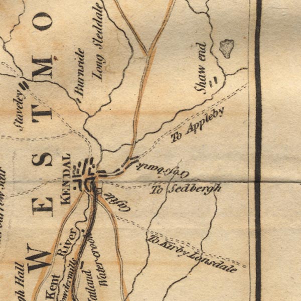 Ws02SD59.jpg "KENDAL" As well as buildings there is a castle to the east. item:- Armitt Library : A1221.1 Image © see bottom of page |
|||
|
|
||||
| evidence:- | old text:- Camden 1789 (Gough Additions) item:- fish; market |
|||
| source data:- | Book, Britannia, or A Chorographical Description of the Flourishing Kingdoms of England,
Scotland, and Ireland, by William Camden, 1586, translated from the 1607 Latin edition
by Richard Gough, published London, 1789. goto source Page 150:- "... All these bodies of water [lakes] abound with divers species of fish, as trout, eels, bass, perch, tench, roach, pike, char and divers others. The south coast is pretty well furnished with sea-fish, of which upwards of thirty different sorts have been brought to Kendal market, till by the improvement of the town and port of Lancaster the market for fish is considerably drawn that way." |
|||
|
|
||||
| evidence:- | old text:- Camden 1789 (Gough Additions) placename:- Kendale placename:- Kirby Kendale item:- stockings; woollens; Kendal cloth; market |
|||
| source data:- | Book, Britannia, or A Chorographical Description of the Flourishing Kingdoms of England,
Scotland, and Ireland, by William Camden, 1586, translated from the 1607 Latin edition
by Richard Gough, published London, 1789. goto source Page 151:- "..." ""In Westmorland is but one good market town called Kendale, otherwise, as I wene, Kirkby Kendale. It hath the name of the river called Kent, unde &Kendale, sed emporium laneis pannis celeberrimum. In the town is but one church: the circuit of the parish by the country adjacent hath many chapels and divers in the town itself. ..."" "Kendal is a large town situated in a beautiful valley prettily cultivated and watered by the river Kent. The principal street is above a mile long, rising north and south; the houses old and irregular, mostly of stone plaistered, yet the whole has an appearance of neatness and industry: the number of inhabitants" goto sourcePage 152:- "about 7,000, chiefly engaged in manufacturing of linseys, worsted stockings woven and knit, and a coarse woollen cloth called cottons, sent to Glasgow and thence to Virginia for the use of the negroes. These manufactures employ great quantities of wool from Durham and Scotland. As early as Richard II. and Henry IV. we find special laws enacted on purpose for the regulating of Kendale-clothes. Kendal has a large weekly market. Elizabeth a. r. 18 erected it into a corporation by the name of aldermen and burgesses. Charles I. incorporated it with a mayor, 12 aldermen, and 20 burgesses. This charter was surrendered to Charles II. who regranted it with a few alterations. ... The parish comprehends 24 townships or constablewicks, and was antiently larger. ... A chapel of ease was erected 1754, by the legacy of the most benevolent Dr. Stratford, commissary of the archdeaconry of Richmond, with the residue of whose property 58 small livings were augmented in this and adjoining counties, and other charities performed. ..." "Charles Stuart 3d son of James duke of York after king James II. was created duke of Kendal 1664. Prince George of Denmark was created duke of Cumberland and earl of Kendal; and Melusina Erengart Schulenburg, who had before been created duchess of Munster in Ireland, was further honoured with the title of duchess of Kendal, countess of Glassenbury, and countess of Faversham." "Kendal gave birth to Dr. Barnaby Potter bishop of Chester, Dr. Christopher Potter, provost of Queen's college, Oxford, and Dr. Thomas Shaw the traveller and principal of Edmund hall." |
|||
|
|
||||
| evidence:- | old text:- Camden 1789 placename:- Candale placename:- Kirkeby Candale placename:- Concangios item:- woollens |
|||
| source data:- | Book, Britannia, or A Chorographical Description of the Flourishing Kingdoms of England,
Scotland, and Ireland, by William Camden, 1586, translated from the 1607 Latin edition
by Richard Gough, published London, 1789. goto source Page 147:- "..." "... on whose [River Can] western banks is the populous town of Candale or Kirkeby Candale, q.d. the church in the valley on the Can, with two long streets intersecting each other, and eminent for its woollen manufacture, and the industry of its inhabitants, who carry on a great trade in woollen cloth all over England, and esteem it their highest honour that they have had barons and earls of their own. The first of these are descended from Ivo Taleboys, of whose posterity William by leave of Henry II. styled himself William of Lancaster, whose niece and heiress married Gilbert Fitz Roger Fitz Reinfrid, by whose daughters on the death of his son William, the estate passed to Peter Brus second lord of Skelton of that Christian name, and William Lindesay, from whom Ingelram lord of Coucy in France derived his descent by the mother's side as we find in the history of Forness abbey. By a daughter of this Peter Brus, sister and heir of Peter Brus the 3d, this barony came to the Rosses of Werke, and from them this honour devolved by inheritance on the Parrs, whose castle overagainst the town is now decaying with age. I find three earls, John duke of Bedford, so created by his brother king Henry V. John duke of Somerset and John de Foix of the illustrious family of Foix in France, whom Henry VI. advanced to this dignity for his faithful services in the French wars; whence it probably comes that some of this family of Foix in France are still called Candale. I know no other claim that Kendal has to antiquity. I once, indeed, imagined that it was the Roman station CONCANGIOS, but time has better informed me. ..." |
|||
|
|
||||
| evidence:- | old map:- Cary 1789 (edn 1805) placename:- Kendal |
|||
| source data:- | Map, uncoloured engraving, Westmoreland, scale about 2.5 miles
to 1 inch, by John Cary, London, 1789; edition 1805.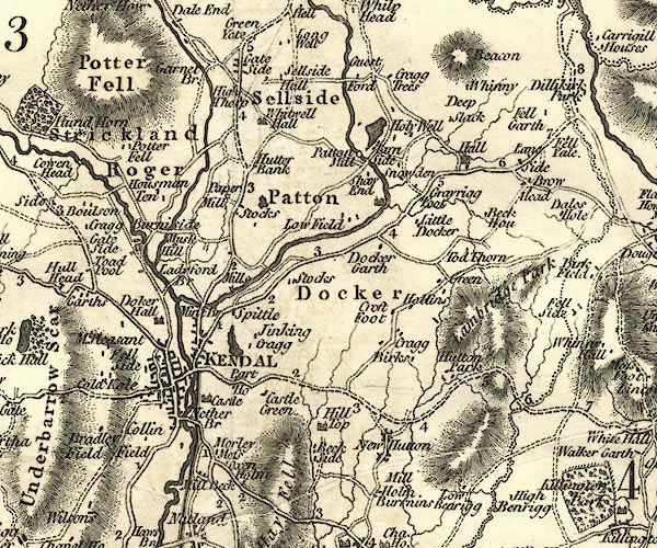 CY24SD59.jpg "KENDAL" group of blocks, labelled in block caps; town item:- JandMN : 129 Image © see bottom of page |
|||
|
|
||||
| evidence:- | old map:- Aikin 1790 (Wmd) placename:- Kendall |
|||
| source data:- | Map, uncoloured engraving, Westmoreland ie Westmorland, scale
about 8.5 miles to 1 inch, by John Aikin, London, 1790. click to enlarge click to enlargeAIK2.jpg "Kendall" circle; town item:- JandMN : 51 Image © see bottom of page |
|||
|
|
||||
| evidence:- | old text:- Gents Mag item:- weather; birds; meteorological diary |
|||
| source data:- | Magazine, The Gentleman's Magazine or Monthly Intelligencer or
Historical Chronicle, published by Edward Cave under the
pseudonym Sylvanus Urban, and by other publishers, London,
monthly from 1731 to 1922. goto source Gentleman's Magazine 1792 p.1197 "Kendal, Jan. 8." "Mr. URBAN," "PERHAPS the following remarks on the weather and natural history of a part of the country, where nothing of the kind has been before attempted, may prove acceptable to your philosophical readers, It will be necessary to add, that this year has been the wettest we have experienced since the commencement of my Journal in 1787." "JOHN GOUGH." "Abstract of a Meteorological Diary, kept at Kendal for 1792." "Explanation of the Table. - The first column contains the month; the second, the mean height ofthe barometer in inches and decimals; the third and fourth, the greatest and least heights; the fifth, the space moved through by the mercury; the sixth, the mean of the thermometer; the seventh and eighth, the mean of the hottest and coldest days; the ninth, the height of the rain in inches; the tenth, the number of wet days."  click to enlarge click to enlargeG792E01.jpg "N.B. The means in the foregoing Table are taken from three observations each day, without one ommission. The space moved through by the mercury is found by adding together the differences arising from the subtraction of the different heights of the column, in the barometer, at each successive change." "Notes for the year 1792." "February 1. The hedge-sparrow, motacilla modularis, singing." "4. Thrush, turdus musicus, singing." "12. Rooks, corvus fragilegus, building." "15. The chaffinch, fringilla coelebs, singing. The female was seen on the 25th: none were observable in January. Is the return of these birds proclaimed by the song of the male?" "March 6. Yellow wagtail, motacilla flava, singing." "18. Woodcocks, scolopax rusticula, are very abundant at present, after disappearing for a fortnight. These visitors, perhaps, are on their return from Ireland to the Continent." "24. The wheatear, motacilla oenan; the female taken on the hills." "29. The sand martin, hirundo riparia, two seen, and again on the 31st." "April 4. The redbreast, motacilla rubicula, has reired to the woods." "6. Bees busy on the gooseberry blossom." "8. The redstart, motacilla phoenicurus, seen; the same began to sing on the 25th." "11. Swallows, hirundo rustica, two seen; they were numerous on the 13th." "15. Blackcap, motacilla atracapilla, singing." "23. Phryganea bicaudata, plentiful. Few swallows seen since the 13th. The sand-martins mentioned in March have been stragglers, as they disappeared again. The cuckow, cuculus canorus, heard this day." "25. The whitethroat, motocilla sylvia, singing." "29. The shrew, sorex araneous, abroad, and a wasp, vespa vulgaris, and the stonechatter, motacilla rubicola." "30. The swift, hirundo apus." "May 14. The corncrake, rallus crex, crying in the grass. n.b. This bird breeds here in June." "15. Young sparrows, fringilla domestica, fledged." "22. The quail, tetroa coturnix, rare here." "June 4. Cockchaffer, scaraboeus melolontha, on the wing." "A little hay cut between the 16th and 27th." "August 7. The swifts have been gra-" |
|||
|
|
||||
| evidence:- | old text:- Gents Mag 1792 item:- flower |
|||
| source data:- | goto source Gentleman's Magazine 1792 p.1198 "[gra]dually disappearing since the 5th. They have remained with us 104 days this year." "13. The redbreast is returned to the town. All the song birds are silent at present, except the redbreast, about the houses; and the yellowhammer, emberiza citrinella, in the hedges. Hay-harvest nearly finished." "17. Oats reaped." "September 5. Swallows, hirundo rustica, in flocks. These birds were seen till the 24th; not after." "25. The fieldfare, turdus pilaris." "October 2. The woodcock, scolopax rusticola." "15. The harvest finished." "November. The chaffinch, fringilla coelebs. Large flocks of the females, separate from the males, seen in the hedges on the first, some as late as on the 12th." "17. The water ouzel, sturnus cinclus, singing, and fishing in the shallow parts of the river." "Progress of Vegetation, determined from the time of flowering of wild Plants." "February 26. Galanthus nivalis." "March 21. Ficaria verna, viola canina. 22. Narcissus pseudo-narcissus. 28. Mercurialis perennis." "April 4. Ribes glossularia. 6. Adoxa moschatellina, Anemone nemorosa, Oxalis acetosella. 12. plum-tree, Alchemilla vulgaris, Prunus spinosa. 15. Cherry-tree, Primuka veris, Cardamine pratensis, Leontodon taraxacum. 17. Pear-tree. 29. Geum rivale, Stellaria nemorum. 30. Erysimum alliaria." "May 6. Hyacinthus non-scriptus, Trollius Europaeus. 9. Paris quadrifolia, Orchis morio. 15. Geranium sylvaticum, Asperula odorata, Lychnis dioica. 17. Saxifraga granulata. 20. Crataegus oxycantha." "June 1. Ophrys ovata, Punguicula vulgaris. 7. Comarum paulstre, Lychnis flos-cuculi. 10 Digitalis purpurea." |
|||
|
|
||||
| evidence:- | old map:- Bailey 1797 placename:- Kendal |
|||
| source data:- | Map, soil etc, uncoloured engraving, Westmoreland, scale about
12 miles to 1 inch, by J Bailey, engraved by Neele, Strand,
published by Messrs Robinson, Paternoster Row and G Nicol, Pall
Mall, London, 1797. click to enlarge click to enlargeBY05.jpg "Kendal" group of blocks; town item:- Armitt Library : A680.3 Image © see bottom of page |
|||
|
|
||||
| evidence:- | road book:- Cary 1798 (2nd edn 1802) placename:- Kendal |
|||
| source data:- | Road book, itineraries, Cary's New Itinerary, by John Cary, 181
Strand, London, 2nd edn 1802. goto source click to enlarge click to enlargeC38267.jpg page 267-268 "Kendal - King's Arms / At Kendal, on r. T.Rs. to Sedbergh, Kirkby Stephen, and Appleby; on l. to Milthorpe, Ulverston, Winander Mere, and Ambleside." market town, post office goto source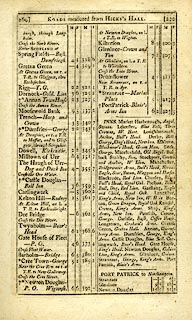 click to enlarge click to enlargeC38269.jpg page 269-270 "INNS. ... Kendal, Crown, King's Arms. ..." goto source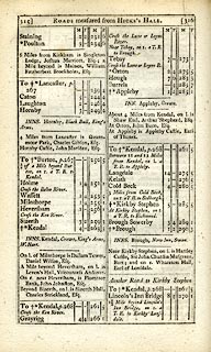 click to enlarge click to enlargeC38315.jpg page 315-316 "Kendal" market town, post town "INNS. Kendal, Crown, King's Arms, W. Hart." goto source click to enlargeC38315.jpg page 315-316 "To Kendal, p.268" goto source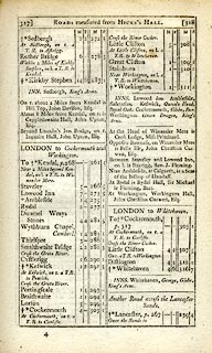 click to enlarge click to enlargeC38317.jpg page 317-318 "To Kendal, p.268" market town, post office goto source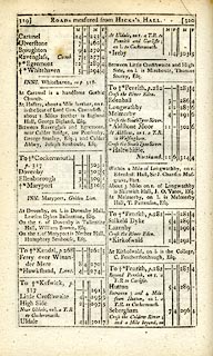 click to enlarge click to enlargeC38319.jpg page 319-320 "To Kendal, p.268" market town, post office goto source click to enlarge click to enlargeC38333.jpg page 333-334 "Kendal" market town, post office "INNS. ... Kendal, Crown, King's Arms, W. Hart." item:- JandMN : 228.1 Image © see bottom of page |
|||
|
|
||||
| evidence:- | road book:- Cary 1798 (2nd edn 1802) placename:- Kendal |
|||
| source data:- | Road book, itineraries, Cary's New Itinerary, by John Cary, 181
Strand, London, 2nd edn 1802. goto source click to enlarge click to enlargeC38653.jpg page 653-654 "INNS, Kendal, Crown, King's Arms. ..." item:- JandMN : 228.2 Image © see bottom of page |
|||
|
|
||||
| evidence:- | old map:- Housman 1800 map 2 placename:- Kendal |
|||
| source data:- | Town plan, uncoloured engraving, Plan of Kendal, scale about 6
inches to 1 mile, engraved by James Lowes, 1798 published by F
Jollie, Carlisle, Cumberland, 1800. click to enlarge click to enlargeHM08.jpg Town plan, uncoloured engraving, Plan of Kendal, scale about 6 inches to 1 mile, engraved by James Lowes, 1798 published by F Jollie, Carlisle, Cumberland, 1800. Taken from a guide book, A Descriptive Tour, and Guide to the Lakes, Caves and Mountains, by John Housman, 1800, 5th edn 1812. printed at oval cartouche, lower left:- "A / PLAN OF / KENDAL, / in the County / OF / Westmoreland. / J. Lowes Sculp 1798." printed at with scale line:- "Scale of Yards." item:- JandMN : 233.2 Image © see bottom of page |
|||
|
|
||||
| evidence:- | descriptive text:- Baker 1802 placename:- Kendal item:- charter |
|||
| source data:- | Perspective road map with sections in Lancashire, Westmorland,
and Cumberland, by J Baker, London 1802. pp.25-26:- "..." "At the approach to Kendal, where I made my sketch for the plan of that town - It deceitfully appears to be situated in a secure valley, contiguous to which, on a hill to the right, are the ruins of the castle. Another similar eminence, ornamented with an obelisk, is called Castlebow Hill. From either of these may be obtained the most complete view of the adjacent river Kent, and surrounding country, and as many deep valleys are comprehended in this prospect, the apparent situation of the town, by a comparison with them, rises to a greater eminence. It is very ancient, and still retains several British and Roman remains. Here were early planted some of our most productive manufactories, particularly those of woollen cloths, cottons, and stockings, which have since branched so widely and profitably to other pasrt of the kingdom. Queen Elizabeth erected the town into a corporation; and Charles the First confirmed and enlarged the charter. It hath a mayor, 12 aldermen, and 20 capital burgesses. It is recorded by a Latin inscription on the wall of the vestry in the church at Penrith, that 2500 people died here in 1598, of the plague. The market, inns, and principal shops of trade are on the highest ground, near half a mile from the entrance of the town; from thence to the north is another street of nearly the same length; another leads by similar distance to cross the river Kent on the eastward, and by means of this latter the post road is continued to Shap." |
|||
|
|
||||
| evidence:- | old map:- Baker 1802 placename:- Kendal |
|||
| source data:- | Perspective road maps with sections in Lancashire, Westmorland
and Cumberland, by J Baker, London 1802. Bk03Vg13.jpg "Kendal" item:- private collection : 3 Image © see bottom of page |
|||
|
|
||||
| evidence:- | old map:- Cooke 1802 placename:- Kendall |
|||
| source data:- | Map, Westmoreland ie Westmorland, scale about 12 miles to 1
inch, by George Cooke, 1802, published by Sherwood, Jones and
Co, Paternoster Road, London, 1824. click to enlarge click to enlargeGRA1Wd.jpg "Kendall / 257" blocks, upright lowercase text; town, distance from London item:- Hampshire Museums : FA2000.62.4 Image © see bottom of page |
|||
|
|
||||
| evidence:- | old map:- Cooke 1802 placename:- Kendal |
|||
| source data:- | Map, The Lakes, Westmorland and Cumberland, scale about 8.5
miles to 1 inch, engravedby Neele and Son, published by
Sherwood, Jones and Co, Paternoster Road, London, 1824. click to enlarge click to enlargeGRA1Lk.jpg "Kendal" blocks, upright lowercase text; town item:- Hampshire Museums : FA2000.62.5 Image © see bottom of page |
|||
|
|
||||
| evidence:- | old map:- Luffman 1803 placename:- Kendal |
|||
| source data:- | Map, hand coloured engraving, Westmoreland ie Westmorland, scale
about 37 miles to 1 inch, by John Luffman, 28 Little Bell Alley,
Coleman Street, London, 1803-06. click to enlarge click to enlargeLUF4.jpg "Kendal" circle; town item:- Dove Cottage : 2007.38.46 Image © see bottom of page |
|||
|
|
||||
| evidence:- | old text:- Gents Mag item:- rainfall |
|||
| source data:- | Magazine, The Gentleman's Magazine or Monthly Intelligencer or
Historical Chronicle, published by Edward Cave under the
pseudonym Sylvanus Urban, and by other publishers, London,
monthly from 1731 to 1922. goto source Gentleman's Magazine 1807 p.637  click to enlarge click to enlargeG8070637.jpg Rainfall for various places in England and Scotland, including Dalton, Lancashire and Kendal, Westmorland, January to December 1806 |
|||
|
|
||||
| evidence:- | old map:- Laurie and Whittle 1806 placename:- Kendal |
|||
| source data:- | Road map, Completion of the Roads to the Lakes, scale about 10
miles to 1 inch, by Nathaniel Coltman? 1806, published by Robert
H Laurie, 53 Fleet Street, London, 1834. click to enlarge click to enlargeLw18.jpg "Kendal 261¾" market town; distance from London item:- private collection : 18.18 Image © see bottom of page |
|||
|
|
||||
| evidence:- | old map:- Laurie and Whittle 1806 placename:- Kendal |
|||
| source data:- | Road map, Continuation of the Roads to Glasgow and Edinburgh,
scale about 10 miles to 1 inch, by Nathaniel Coltman? 1806,
published by Robert H Laurie, 53 Fleet Street, London, 1834. click to enlarge click to enlargeLw21.jpg "Kendal 264½" market town; distance from London; travellers supplied with post horses or carriages item:- private collection : 18.21 Image © see bottom of page |
|||
|
|
||||
| evidence:- | old text:- Capper 1808 placename:- Kendal placename:- Kirby in Kendal item:- population; market; fair; placename, Kendal |
|||
| source data:- | Gazetteer, A Topographical Dictionary of the United Kingdom,
compiled by Benjamin Pitts Capper, published by Richard
Phillips, Bridge Street, Blackfriars, London, 1808; published
1808-29. goto source "..." "KENDAL, a market-town and parish in Kendal ward, Westmoreland; it is 22 miles from Lancaster, and 260 fom London, and is sometimes called Kirby in Kendal, that is, a church in a valley, from its being situated in a pleasant valley on the banks of the river Ken; it contains 1394 houses and 6892 inhabitants, viz. 2950 males and 3942 females, of whom 3729 were returned as employed in various trades and manufactures, and 151 in agriculture. The manufactures of cottons, coarse woollens, lindseys, druggetts, worsted stockings, flannels, and serges, are here very considerable, and there are several small manufactories of hardware. Here are seven trading companies, each having their hall, viz. Mercers, Tanners, Glovers, Sheermen, Cordwainers, Taylors, and Pewterers. The church is a large Gothic fabric, ... North of the church is Abbot Hall, ... The Ken is crossed from the north by an ancient bridge, and the main street, leading from it, slopes towards the centre of the town, where it joins another principal street, being about one mile long, and of a spacious breadth. The entrance from the south is by another bridge, which makes a short turn into the outskirts of the town, where the street expands, and has a pleasant appearance. A new street has been built from the centre of the town towards the river, and there has lately been erected some very convenient and neat butchers' shambles. Near the church is a free school, connected with Queen's college, Oxford. Here are chapels for Quakers, Methodists, Presbyterians, and Roman Catholics. The buildings in general have a handsome appearance, being of limestone covered with blue slate. There are several charitable institutions, and the workhouse is very commodious. On the top of a high hill west of the town are the ruins of a very ancient castle, opposite to which is an artificial cone-shaped mount, called Castle Law hill. ... The river abounds with salmon and trout, over which there are three bridges, and on the banks live a number of dyers and tanners. By the inland navigation this town has communication with the rivers Mersey, Dee, Ribble, Ouse, Trent, Severn, Humber, Thames, Avon, &c. extending above 500 miles through most of the inland counties. Here are kept the sessions for the barony of Kendal. It has a new house of correction with cells underneath. It is incorporated under a mayor, 12 aldermen, and 24 capital burgesses. Several Roman stations are observable in the neighbourhood. The living is a vicarage, value 92l. 5s. in the patronage of Trinty college, Cambridge. - Burn's Westmoreland." "..." |
|||
|
|
||||
| evidence:- | old map:- Cooper 1808 placename:- Kirkby Kendal |
|||
| source data:- | Map, hand coloured engraving, Westmoreland ie Westmorland, scale
about 9 miles to 1 inch, by H Cooper, 1808, published by R
Phillips, Bridge Street, Blackfriars, London, 1808. click to enlarge click to enlargeCOP4.jpg "Kirkby Kendal" circle with two side bars; town item:- Dove Cottage : 2007.38.53 Image © see bottom of page |
|||
|
|
||||
| evidence:- | old map:- Wallis 1810 (Wmd) placename:- Kendall |
|||
| source data:- | Road map, Westmoreland, scale about 19 miles to 1 inch, by James
Wallis, 77 Berwick Street, Soho, 1810, published by W Lewis,
Finch Lane, London, 1835? click to enlarge click to enlargeWAL5.jpg "KENDALL / 257" town; distance from London item:- JandMN : 63 Image © see bottom of page |
|||
|
|
||||
| evidence:- | descriptive text:- Wallis 1810 placename:- Kendal |
|||
| source data:- | Map, Westmoreland, scale about 19 miles to 1 inch, and
Cumberland, scale about 16 miles to 1 inch, by James Wallis, 77
Berwick Street, Soho, London, 1810; published 1810-36. "PRINCIPAL INNS, RECOMMENDED TO TRAVELLERS AND FAMILIES." "Kendal: Crown, King's Arms, White Hart, besides several others, where travellers will be well accommodated, at low charges." "..." "PRINCIPAL FAIRS." "Kendal: April 27, horned cattle, sheep, and pedlary; Nov. 8, horned cattle, horses, and sheep." |
|||
|
|
||||
| evidence:- | old map:- Otley 1818 placename:- Kendal |
|||
| source data:- | Map, uncoloured engraving, The District of the Lakes,
Cumberland, Westmorland, and Lancashire, scale about 4 miles to
1 inch, by Jonathan Otley, 1818, engraved by J and G Menzies,
Edinburgh, Scotland, published by Jonathan Otley, Keswick,
Cumberland, et al, 1833. OT02SD59.jpg "KENDAL" item:- JandMN : 48.1 Image © see bottom of page |
|||
|
|
||||
| evidence:- | old map:- Hall 1820 (Wmd) placename:- Kendal |
|||
| source data:- | Map, hand coloured engraving, Westmoreland ie Westmorland, scale
about 14.5 miles to 1 inch, by Sidney Hall, London, 1820,
published by Samuel Leigh, 18 Strand, London, 1820-31. click to enlarge click to enlargeHA18.jpg "KENDAL / 262" circle, block caps; county town; distance from London item:- Armitt Library : 2008.14.58 Image © see bottom of page |
|||
|
|
||||
| evidence:- | descriptive text:- Otley 1823 (5th edn 1834) item:- woollens; waistcoat; ivory comb; marble; population, Kendal |
|||
| source data:- | Guide book, A Concise Description of the English Lakes, the
mountains in their vicinity, and the roads by which they may be
visited, with remarks on the mineralogy and geology of the
district, by Jonathan Otley, published by the author, Keswick,
Cumberland now Cumbria, by J Richardson, London, and by Arthur
Foster, Kirkby Lonsdale, Cumbria, 1823; published 1823-49,
latterly as the Descriptive Guide to the English Lakes. goto source Page 98:- "KENDAL" "Is a clean and well built town, of considerable trade, and a population of 11,301 inhabitants. It is situate at the junction of the Carlisle road by Penrith, with the Whitehaven road by Ambleside, Keswick, and Cockermouth. It is famous for the manufacture of various kinds of woollen goods and fancy waistcoats. Here is a manufactory of ivory combs; and a marble manufactory, where several varieties of the limestone of the country are worked and polished. The King's Arms and Commercial are the principal Inns." goto sourcePage 170:- "The mean annual quantity of rain at Keswick is about 68 inches; at Kendal 60 inches; at Manchester 35 inches; at London 20 inches." |
|||
|
|
||||
| evidence:- | old map:- Perrot 1823 placename:- Kendal |
|||
| source data:- | Map, hand coloured engraving, Cumberland and Westmoreland ie
Westmorland, scale about 38 miles to 1 inch, by Aristide Michel
Perrot, engraved by Migneret, 1823, published by Etienne Ledoux,
9 Rue Guenegaud, Paris, France, 1824-48. click to enlarge click to enlargePER2.jpg "Kendal" circle; town item:- Dove Cottage : 2007.38.45 Image © see bottom of page |
|||
|
|
||||
| evidence:- | old map:- Greenwood 1824 (Wmd) placename:- Kendal |
|||
| source data:- | Map, hand coloured engraving, Map of the County of Westmorland,
scale about 1 inch to 1 mile, by C and J Greenwood, published by
George Pringle jnr, 70 Queen Street, Cheapside, London, 1824.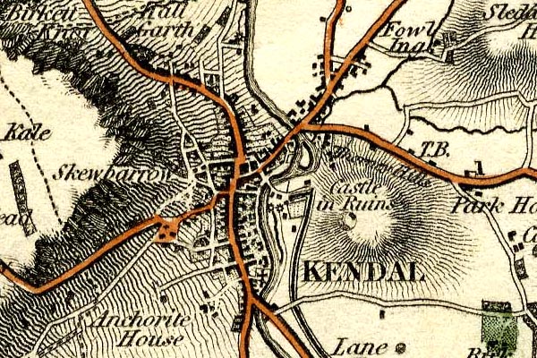 grw5kndl.jpg "KENDAL" street map; labelled in block caps for a market town; notice the canal, canal basin, and mills. item:- Armitt Library : A1827 Image © see bottom of page |
|||
|
|
||||
| evidence:- | old text:- Gents Mag |
|||
| source data:- | Magazine, The Gentleman's Magazine or Monthly Intelligencer or
Historical Chronicle, published by Edward Cave under the
pseudonym Sylvanus Urban, and by other publishers, London,
monthly from 1731 to 1922. goto source Gentleman's Magazine 1825 part 1 p.513 From the Compendium of County History:- "Askew, Anthony, eminent physician, Kendal, 1722." "..." "CHAMBERS, EPHRAIM, author of the Encyclopedia, Kendal (ob. 1740)." |
|||
|
|
||||
| evidence:- | old text:- Gents Mag 1825 |
|||
| source data:- | goto source Gentleman's Magazine 1825 part 1 p.514 From the Compendium of County History:- "Potter, Barnaby, called the Puritanical Bishop of Carlisle, Kendal, 1578 or 9." "[Potter] Christopher, nephew of above, and loyal divine, who sent his plate to the King, saying he would drink as Diogenes did, in the hollow of his hand, before the King should want. Kendal, 1591." "..." "Shaw, Dr. Thomas, author of 'Travels in Barbary and the Levant,' a work of high celebrity, Kendal, 1692." "..." "[Walker] William, lecturer on astronomy, son of above [Adam, Windermere], Kendal, 1766." "..." "Wilson, John, celebrated botanist, originally stocking knitter, Kendal (ob. about 1750)." |
|||
|
|
||||
| evidence:- | old text:- Gents Mag item:- tithes; Trinity College, Cambridge |
|||
| source data:- | Magazine, The Gentleman's Magazine or Monthly Intelligencer or
Historical Chronicle, published by Edward Cave under the
pseudonym Sylvanus Urban, and by other publishers, London,
monthly from 1731 to 1922. goto source Gentleman's Magazine 1831 part 2 p.482 "..." "The Rev. ROBERT UVEDALE, Vicar of Fotherby and Hogsthorpe, having learned from the public prints that Mr. Sadler and Mr. Hume have presented to the House of Commons petitions from Kendal, complaining of an attempt to levy Tithes in kind, begs to state he that has a M.S. in small quarto respecting Trinity College, Cambridge, which belonged to his great-grandfather, the Rev. R. Uvedale, LL.D. one of the Fellows, and which comprises copies of Charters, Statutes, and King's Letters, and Accounts of Masters, Benefactors, Estates, &c. From a passage in this book, it is evident that the holders of land in the parish of Kendal were, 300 years ago, not liable to such demands as have been lately set up by Trinity College." |
|||
|
|
||||
| evidence:- | old text:- Gents Mag item:- newspaper; Westmoreland Advertiser and Kendal Chronicle |
|||
| source data:- | Magazine, The Gentleman's Magazine or Monthly Intelligencer or
Historical Chronicle, published by Edward Cave under the
pseudonym Sylvanus Urban, and by other publishers, London,
monthly from 1731 to 1922. goto source Gentleman's Magazine 1831 part 1 p.190 "WESTMORELAND. - At Kendal, age 41, Mr. Richard Lough, printer and proprietor of the Westmoreland Advertiser and Kendal Chronicle" |
|||
|
|
||||
| evidence:- | old map:- Cobbett 1832 placename:- Kendal |
|||
| source data:- | Map, uncoloured engraving, Westmoreland ie Westmorland, scale
about 7 miles to 1 inch, by William Cobbett, 11 Bolt Court,
Fleet Street, London, 1832. click to enlarge click to enlargeCOB4.jpg "Kendal" dot and circle; town item:- JandMN : 116 Image © see bottom of page |
|||
|
|
||||
| evidence:- | descriptive text:- Ford 1839 (3rd edn 1843) placename:- Kendal |
|||
| source data:- | Guide book, A Description of Scenery in the Lake District, by
Rev William Ford, published by Charles Thurnam, Carlisle, by W
Edwards, 12 Ave Maria Lane, Charles Tilt, Fleet Street, William
Smith, 113 Fleet Street, London, by Currie and Bowman,
Newcastle, by Bancks and Co, Manchester, by Oliver and Boyd,
Edinburgh, and by Sinclair, Dumfries, 1839. goto source "..." "THE order in which the Lakes should be visited, if seen in any prescribed order at all, can be pointed out much more easily than satisfactorily. Lancaster and Kendal in the south, Carlisle and Penrith in the north, formerly offered the readiest facilities of access to this Northern Elysium; but since the improvement of steam navigation, Whitehaven and other ports have become equally suitable as starting places. One advantage, however, remains in favour of the old routes, that the direct lines are better, especially for carriages, although to the pedestrian this will not be a matter of any great importance." goto sourcePage 19:- "..." "KENDAL," "The largest town in Westmorland, seated on the west side of the river Kent, beneath a lofty scar, opposite to the ruins of the ancient castle. It is intersected by four principal streets, one of which runs north and south, forming a busy thoroughfare of one mile in length, and leading to the Lakes. The houses are built of limestone, capable of receiving a high polish, and covered with slate. The town, although very ancient, has now a modern appearance, nearly all the old houses having been" goto sourcePage 20:- "rebuilt, and many new streets erected during late years. The whiteness of the houses is greatly enlivened by the number of poplars which grow about them, the long range of hanging gardens on the west, and the sloping meads and plantations on the east, where the Kent washes the skirts of the town, and is crossed by three good bridges. The completion of the canal to Lancaster, in 1819, gave a powerful impulse to the building spirit of the inhabitants, ..." "..." goto sourcePage 21:- "..." "Kendal was governed by a corporation formerly" goto sourcePage 22:- "consisting of a mayor, recorder, alderman, and capital burgesses. By the recent Municipal act, it is divided into three wards, under the superintendence of a mayor, six aldermen, and eighteen councilmen. By the Reform bill, the town returns one member to Parliament. It was formerly noted for coarse woollen goods, called Kendal cottons, but goods of finer description are now more commonly manufactured. The river Kent affords plenty of water for its numerous mills and dye-houses. There are also very extensive marble works. As the country people for many miles around attend the markets and fairs, the town thus combines the character of a manufacturing place, with that of the centre of a rich agricultural district." "Kendal can also boast of being furnished with schools and charitable institutions, as numerously and liberally endowed as any town of equal population. Indeed, in this respect, the county of Westmorland exceeds all others, owing chiefly to the number of clever and eminent men who have distinguished themselves, and have sought to return back to their native county some portion of those benefits which they themselves derived from it." "The road leaves Kendal by a steep ascent, having the workhouse and prison on either hand. The views northward, in" goto sourcePage 153:- "..." "KENDAL is a flourishing town, being the largest in Westmorland, and is placed in a very agreeable valley, enlivened by the meanderings of the Kent. A full description of it will be found at page 19." |
|||
|
|
||||
| evidence:- | old map:- Ford 1839 map placename:- Kendal |
|||
| source data:- | Map, uncoloured engraving, Map of the Lake District of
Cumberland, Westmoreland and Lancashire, scale about 3.5 miles
to 1 inch, published by Charles Thurnam, Carlisle, and by R
Groombridge, 5 Paternoster Row, London, 3rd edn 1843.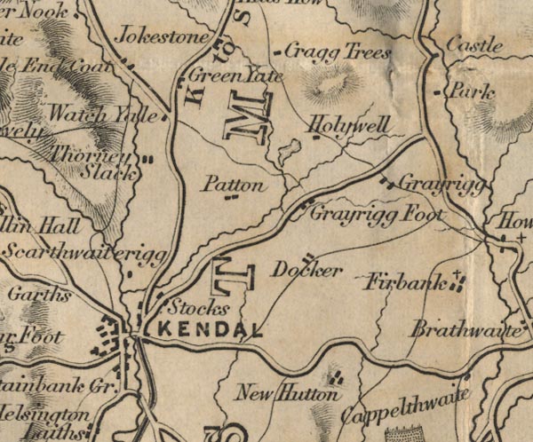 FD02SD59.jpg "KENDAL" item:- JandMN : 100.1 Image © see bottom of page |
|||
|
|
||||
| evidence:- | old map:- Garnett 1850s-60s H placename:- Kendal |
|||
| source data:- | Map of the English Lakes, in Cumberland, Westmorland and
Lancashire, scale about 3.5 miles to 1 inch, published by John
Garnett, Windermere, Westmorland, 1850s-60s.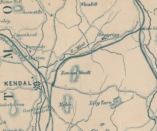 GAR2SD59.jpg "KENDAL" blocks, settlement, on a minimal street plan item:- JandMN : 82.1 Image © see bottom of page |
|||
|
|
||||
| evidence:- | old text:- Gents Mag item:- woollens |
|||
| source data:- | Magazine, The Gentleman's Magazine or Monthly Intelligencer or
Historical Chronicle, published by Edward Cave under the
pseudonym Sylvanus Urban, and by other publishers, London,
monthly from 1731 to 1922. goto source Gentleman's Magazine 1853 part 1 p.613 "MR. URBAN, - You are entitled to many thanks for the interesting paper in your last Magazine on the"Ancient Commerce of Westmerland," including the history of the woollen manufactures of Kendal, yclept Kendal cottons; and, as the whole subject is capable of much further illustration, I now offer to your notice a few observations. I engage with the greater alacrity in an endeavour to elucidate the early history of Kendal cottons becauseI am just now gleaning fresh materials for a new edition of my "Annals of Kendal."" "The two points of interest more immediatley called in question are, first, Whether the woollen manufactures were introduced into Kendal so early as Edward III.? and how John Kemp is idenitifed therewith? 2ndly. As to the "milk-white cloth" worn by the Kendal bow-men at Flodden Field, and the derivation thence of "White Hall."" "Firstly, You ask on what authority John Kemp is declared to be one of the founders of the woollen manufactures; and by implication you inquire how I claim John Kemp for Kendal when the Pictorial History of England, and some other authorities, omit the mention of Kendal altogether?" "In regard of John Kemp nothing more can be required than the proofs I here forward you in the copy of the "Letter of Protection" granted by King Edward III. to Johnn Kemp, as translated from Rymer's Foedera, vol.ii. p.823." "A.D. 1331, 5 Edw. III." "On behalf of John Kempe, of Flanders, cloth weaver, concerning the exercise of his craft." "The king to all bailiffs, &c. whom it may concern, greeting. Know ye that whereas John Kempe of Flanders, weaver of woollen cloths, hath come to dwell within our kingdom of England for the purpose" |
|||
|
|
||||
| evidence:- | old text:- Gents Mag 1853 |
|||
| source data:- | goto source Gentleman's Magazine 1853 part 1 p.614 "of practising his craft therein, and of instructing and informing such as might desire to learn it of him, and hath brought with him certain men and servants, and apprentices to the said trade, we have taken the same John, and his aforesaid men, servants, and apprentices, and all his goods and chattels whatsoever, under our protection, &c. (according to the tenor of similar letters as far as these words; viz.) for we promise to cause similar letters of protection to be issued to other men of the same craft, and to dyers and fullers, who wish to come from parts beyond the seas to dwell within the same our kingdom for the aforesaid object. In witness whereof, &c. these letters are to hold good during the King's pleasure. Witness the King at Lincoln, the 28th day of July." "Next, as respect John Kemps' locus in quo. I have the authority of the Encyclopaedia Londinensis for stating the John Kemp was established in Kendal. "where (says the Cyclopaedia, p.725) his descendants still remain, and the woollen trade is at present carried on." Kemp was a family name in Kendal down to the present generation. Then it is to be observed that tradition has always spoken, with the most confident tone, of John Kemp's connection with Kendal, and even in cases where history is wholly silent tradition is an acknowledged authority. For these reasons I have not hesitated to assert that the woollen manufactures were established in Kendal by John Kemp temp. Edward III. I have not said that there were not woollen manufactures in the same reign (I believe at a later date though) in York, Halifax, &c., but I challenge the annalists of these and other towns to set up a better claim to John Kemp than I have put forth in favour of Kendal. The art of weaving might be known and practised, in a small and rude way, before the 13th century, in some of the towns in England; but there could be nothing worthy to be dignified as a manufacture till this period; for Fuller, alluding to the time of Edward III. says "Englishmen were then so little instructed in the art of cloth-making, they knew no more what to do with their wool than the sheep that wear it." (Church History, book iii. p.111.)" "..." |
|||
|
|
||||
| evidence:- | old text:- Gents Mag item:- Drunken Barnaby's Journal |
|||
| source data:- | Magazine, The Gentleman's Magazine or Monthly Intelligencer or
Historical Chronicle, published by Edward Cave under the
pseudonym Sylvanus Urban, and by other publishers, London,
monthly from 1731 to 1922. goto source Gentleman's Magazine 1853 part 1 p.488 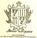 click to enlarge click to enlargeG853E07.jpg "Nunc as Kendal, propter pannum, Coetum, situm, aldermannum, Virgines pulchras, pias matres, Et viginti quatuor fratres, Vere clarum et beatum, Mihi nactum, notum, natum." "Now to Kendal, for clothmaking, Sight, site, alderman awaking; Beauteous damsels, modest mothers, And her four-and-twenty brothers; Ever in her honour spreading, Where I had my native breeding." "Drunken Barnaby's Journal." "THE ANCIENT COMMERCE OF WESTMERLAND." "AT the first view it appears strange and surprising that one of the chief woollen manfactures of England in ancient times should have been seated in the remote county of Westmerland. Yet such we are assured was the case. The cloths made at Kendal were famous as early as the 13th Ric. II.* if not before, and are the subject of continual legislative regulations during the reign of Henry IV.† Leland‡speaks of Kendal as emporium laneis pannis cele-" "*See the Rotuli Parliament. iii. p.271." " †Ibid. pp.437, 498, 541, 614, 693." "‡"In Westmerland is but one good market towne caullid Kendale, otherwise as I wene Kirkby Kendal. Yt hath the name of the ryver caullid Kent, unde et Kentdale, sed emporium laneis pannis celeberrimum." - Itinerary." |
|||
|
|
||||
| evidence:- | old text:- Gents Mag item:- woollens; Stourbridge Fair; fairs |
|||
| source data:- | Magazine, The Gentleman's Magazine or Monthly Intelligencer or
Historical Chronicle, published by Edward Cave under the
pseudonym Sylvanus Urban, and by other publishers, London,
monthly from 1731 to 1922. goto source Gentleman's Magazine 1853 part 1 p.489 "[cele]berrimum. Speed and Camden repeat the same eulogium; and Drayton re-echoes it in the lines," "--- where Kendal town doth stand, For making of our cloth scarce match in all the land." "Camden adds further that the townsmen of Kendal exercised an extensive merchandise of woollen cloths throughout all England.*" "It would, perhaps, be as little expected that the principal market of these Westmerland clothiers should have been at Cambridge; yet so it was. A fair annually held in the outskirts of that town, called Sturbridge Fair, proved so convenient as a central point of concourse for the manufacturers and retailers throughout the kingdom, that for some centuries it was the greatest fair in England, and especially for cloth.†So much was the mart indebted to this branch of trade that Fuller, in his History of Cambridge University, relates a story that Sturbridge Fair originated with the clothiers of Kendal, who first exposed there for sale some cloths which had been accidentally wetted on their journey to the South. This anecdote is scouted by a subsequent historian of Sturbridge Fair as having been invented only for the ears of silly rustics: still, if the fair itself was not originated in this way, its great repute for cloth may possibly have arisen from some such circumstance." "The staple produce of the Kendal looms was evidently of that coarse quality which was required in large quantities for the lower classes of the community. We know from various passages of old authors that it was consumed especially by foresters and countrymen, being so commonly dyed of a green colour, that the name of the place was ordinarily used to express that colour.‡Skelton, in his poem" "*We find, however, no recognition of the above facts in Mr. C. Knight's "Pictorial History of England, being a History of the People, as well as a History of the Kingdom." In a chapter on the "national industry," Vol.ii. p.192. edit.1839, it is stated that "When the woollen manfacture first began to assume importance as the great staple of the nation, it was chiefly carried on in London and the immediate neighbourhood, but it soon spread itself into the adjacent counties of Surrey, Kent, Essex, Berks, Oxford, and subsequently into Dorset, Wilts, Somerset, Gloucester, and Worcester. These were the counties which produced the best wool, and in the imperfect state of the means of communication, the manufacture naturally became located within reach of the raw material. The woollen manufacture had not yet found its way into Yorkshire, though in Devonshire, the wool of which was of an inferior description, it had existed long before the present period." The "period" intended we understand to be that of the kings of the house of Lancaster, commencing in 1399: some time before which, in 1336, the weavers of Brabant who had settled in York are mentioned (Rymer's Foedera, iv. 723). We may conclude that Anderson and Macpherson, the authorities relied upon for commercial matters by the compilers of the Pictorial History, are not very accurate in their details of the early annals of the woollen manufacture. Nor do we find on consulting Mr. Bischoff's History of Wool and the Woollen Manufactures, 1842, 8vo. that either he, or Smith in his "Memoirs of Wool," has admitted the manufactures of Kendal to their due place in the subject. There is, however, an agreeable article on Kendal and its Manufactures in No.86 of Dickens's Household Words, Nov. 15, 1851: but we apprehend not fully authenticated in the early historical details. What is the authority for setting forth John Kemp as the founder of the Kendal woollen manufacture?" " †A spacious square, formed by some of the largest booths, was occupied by woollen-drapers, tailors, and others concerned in the cloth trade; and always retained its ancient appellation of the Duddery, which is mentioned in connection with a house of lepers called the "Fratres de Sterebridge, ubi nunc domus vetus eo loco ubi nunc pars fori lanarii, Angl. the Duddery." (Leland's Collectanea, i. 444, from the Liber Bernwelensis coenobii.) Carter, who published his short account of Cambridgeshire just a hundred years ago (in 1753), after the trade of Sturbridge fair had begun to decline, says that 100,000l. worth of wool had been known to be sold in less than a week's time in the Duddery." "‡In an old poem on the battle of Flodden Field are these lines:-" "" "upon which Mr. Cornelius Nicholson, in his Annals of Kendal, 8vo. 1832, p.26, makes" |
|||
|
|
||||
| evidence:- | old text:- Gents Mag 1853 item:- Battle of Flodden Field; Kendal green; trade guilds |
|||
| source data:- | goto source Gentleman's Magazine 1853 part 1 p.490 "called the Bouge of Court, when describing the costume of Riot, tells us that-" "His cote was checkt with patches rede and blewe, of Kirkeby Kendall was his short demye, And ay he sange, "In fayth, decon thou crewe," His elbow bare, he ware his gere so nye." "It seems to be doubrful, from the commentators Warton and Dyce, what article of dress was designated by the term "demye;" but both agree that by "Kirkeby Kendall" in this passage was intended the colour green." "So too in Hall's Chronicle, where we are told that king Henry VIII. with a party of noblemen, "came sodainly in a mornyng into the queen's chamnre, all appareled in shorte cotes of Kentish Kendal (a misprint probably for Kirkby Kendal) ... like outlawes, or Robin Hodes men," the allusion is evidently to the same colour." "In later writers it is uaually termed "Kendal green," and it is frequently mentioned by our dramatists and poets, being the recognised dress of foresters." "In Anthony Munday's play of "Robin Hood, or Robert Earl of Huntington," 1601, occurs this passage," "--- all the woods Are full of outlaws that, in Kendall green, Follow'd the utlaw'd Earl of Huntington." "Falstaff was attacked at Gad's Hill by "three mis-begotten knaves in Kendal green," (1st Part of Henry IV. ii. 4); and Ben Jonson in his "Underwoods" attires Greenhood" "--- in Kendal green As in the forest colour seen." "From some lines in Hall's Satires it appears also that this was the colour worn by agricultural labourers, as blue was usually that of serving-men:" "The sturdy plowman doth the soldier see All scarf'd with pyed colours to the knee Whom Indian pillage hath made fortunate; And now he 'gins to loathe his former state, Now doth he inly scorne his Kendall greene Hall's Satires, iv. 6, p.76." "The most recent account of the Kendal manufactures is as follows:" "This town, nearly as late as the beginning of the last century, exported largely of coarse woollens to America, but the machinery in Yorkshire and Lancashire (inter alia) have nearly destroyed it (the trade). The Kendal green, superseded by the Saxon green,*was produced from a plant with a small yellow flour (sic), and producing, when boled, a beautiful yellow extract provincially known as woodas or sarrat (the genista tinctora of Linneaus), and from a blue liquor extracted from woad. These cottons (as such coarse woollen were called) have yielded to coarser things: floor-cloths, horse-cloths, linseys, and the like. The manufacture of carpets has recently become popular and flourishing. Hosiery, wool-card making, and horn-comb making, as trades, still exist to some extent. - Atkinson's Worthies of Westmoreland, 1851, vol.i. p.32." "The traders of Kendal were formerly associated in twelve free companies, which are this enumerated in an ancient "boke of recorde" belonging to the corporation of the borough:-" "1. Chapmen, Marchants, and Salters; 2. Mercers and Drapers, Linen and Woollen; 3. Shearmen, Fullers, Dyers, and Websters; 4. Taylors, Imbrodyrers, and Whilters; 5. Cordyners, Coblers, and Curryers; 6. Tanners, Sadlers, and Bridlers; 7. Innholders and Alehousekeepers and Typlers; 8. Butchers and Fishers; 9. Cardmakers and Wyerdrawers; 10. Surgeons, Scryvyners, Barners, Glovers, Skynners, ... (obliterated), and Poyntmakers; 11. Smyths, Iron and Hardwaremen, Armerers, Cutlers, Bowyers, Fletchers, Spuryers, Potters, Panners," "this note, with reference to the public room in Kendal, called the White Hall: "It seems not improbable that White Hall (originally perhaps White Cloth Hall) has taken its name from the manufacture of milk-white cloth." But this remark is founded upon a misapprehension. The old poet was not here describing a colour peculiar to the manufacture, or to the archers of Kendale. White coats with St. George's cross were worn by all the infantry of our English armies; and the White Coats of London - that is, the trained bands of the city - are as often mentioned as any others. Mr. Nicholson repeats this misconception in p.203, where he imagines that "spots might be easily, by poetic fancy, magnified into crosses red." In correction of this idea it is to be remarked that the white coats were not besprinkled with crosses, but every bowman, or soldier, exhibited only one cross back and front, displayed upon the whole of his body, as may be seen in the illuminations to the manuscripts of Froissart and other old historians." "*This change took place about the year 1770. - Nicholson's Annals of Kendal." |
|||
|
|
||||
| evidence:- | old text:- Gents Mag 1853 |
|||
| source data:- | goto source Gentleman's Magazine 1853 part 1 p.491 "Plumbers, Tynkers, Pewterers, and Metallers; 12. Carpenters, Joyners, Masons, Wallers, Slaters, Thatchers, Glassers, Paynters, Pleysterers, Dawbers, Pavers, Myllers, and Cowpers. These incorporated companies gradually became extinct, the last of them (the cordyners or Cordwainers) being "broken up" - i.e. dissolved - in 1800, in consequence of one Robert Moser refusing to recognise any legal power in the company to impose a fine upon persons, not being freemen, commencing business within the borough." "There is, in our estimation, something more than an ordinary local interest in such notices as we have now put together. Not only do the packhorses of Kendal clothiers again, in our mind's eye, tramp along the highways of Old England, but the knaves in Kendal-green again start forth from the wood-side, and the tattered hood of the same dye again barely shades the head of the labouring swain." "In Kendal itself the townsmen were prosperous in their industry, and bountiful in their charity; sometimes laying the foundation of families of landed gentry, and sometimes the more lasting structure of an almshouse or hospital. In the seventeenth century, like other traders, they felt the want of a currency of small value; and it was supplied, partly by the trading companies and partly by individuals, in the form of various tokens, of which some eight or ten varieties are known. It is by these tokens that our attention has been directed to the ancient manfactures of Kendal,*to the illustration of which they will be found to lend some further assistance."  click to enlarge click to enlargeG853E08.jpg "1. The earliest in point of date is that of "Thomas Sandes of Kendal," 1656. The obverse presents the figures of a teasel and a wool-hook; and the reverse a wool-comb." "Thomas Sandes, who was mayor of Kendal in 1647-8, made a fortune as a manufacturer of "Kendal Cottons." He resided in the front house of the Elephant yard, (now the Elephant inn, which was rebuilt about thirty years ago,) using the back premises as his warehouses. His mint, consisting of two coining presses and other instruments, was a few years ago found in making alterations to these premises. He founded, in 1670, Sandes Hospital in Kendal, endowing it with considerable property for the maintenance and relief of eight poor widows, and for the support of a school for poor children until they should be fitted for the free school of Kendal or elsewhere. The hospital premises consist of the master's house, school-house, library, and eight dwellings for the widows, with gardens and crofts. He also bequeathed a collection of books, including a valuable series of the ancient Fathers of the Church. He died, aged 75, on the 22nd Aug. 1681; and there is a handsome monument to his memory in Kendal church. It was originally erected against a pillar at the west end of the "aldermen's pew," but was moved last year (1852) in consequence of a renovation of the church, to an appropriate position immediately over the south-west entrance door, in the interior of the edifice." "2. in 1657 a farthing token was issued under the name of the Mercer's Company. On one side it bears their arms, the Virgin's head, - the arms of trading companies being the same throughout the country as they were in London. On the reverse are the arms displayed by the town (as shown more at large in the woodcut at the head of this article), quarterly of teasles and wool-hooks. Above the shield are the letters K K, for Kirkby Kendal,"  click to enlarge click to enlargeG853E09.jpg "which are placed in like manner on the" "*"The Trademen's Tokens (of the 17th century) of Cumberland and Westmoreland. By William Henry Brockett. Gateshead-upon-Tyne, 1853." 8vo. pp.14. We are indebted to Mr. Brockett for the loan of the woodcuts which illustrate this pamphlet. He had previously published, "The Tokens of Durham and Northumberland. 1851."" |
|||
|
|
||||
| evidence:- | old text:- Gents Mag 1853 item:- shears; teasels |
|||
| source data:- | goto source Gentleman's Magazine 1853 part 1 p.492 "seal of the town. The seal is of silver, circular, and one inch and a half in diameter; it has the date 1576, being the year following that of a charter granted to the town by Queen Elizabeth, and its device is a view of the town - the same as is shown on the annexed shield."  click to enlarge click to enlargeG853E10.jpg "The dies of this token, much worn, were found in 1803, among the ruins of the New Biggin, where the company of Cordwainers had their hall, and they are now in the museum of the Natural History Society in Kendal." "In 1659 two other farthing tokens were issued in Kendal by Oliver Plat and Edmond Adlington." 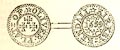 click to enlarge click to enlargeG853E11.jpg "3. Oliver Plat was a gentleman of considerable property, both in Kendal and its neighbourhood, and lived on his estate at Summer How in Skelsmergh. The Rainbow inn in Kendal belonged to him; and an oak table and an oak panel, bearing the inscription (boldly carved), "O.P. x E.P. 1638," were discovered when the house was rebuilt about twenty-five years ago. Some other articles, bearing the same initials are preserved by Mr. John Fisher, jun. of Kendal. Mr. Plat was a Roman Catholic, and hence, probably, the use of the Maltese crosses." 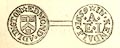 click to enlarge click to enlargeG853E12.jpg "4. Edmond Adlington displays the arms of the Dyers (as in London and elsewhere), Sable, a chevron between three bags of madder argent, corded or. Edmond Adlington was sworn as a shearman-dyer in the year 1649, and followed that business in 1655 and 1657, as evidenced in the corporation books. The family originally from Yealand in Lancashire, and carried on business there and at Kendal simultaneously. They were Quakers, and tradition says that Edmond was a man of immense bulk, weighing upwards of 24 stone, and that his wife was of little inferior weight, being upwards of 22 stone. He retired, and died, probably at his native place, at a great age. Francis Higginson, vicar of Kirkby Stephen, a pamphleteer against the early Quakers in the time of Cromwell, says that some of them stood naked upon the market cross on the market days, preaching from thence to the people; and particularly mentions the wife of one Edmond Adlington, of Kendal, who went naked through the streets there. The initial of the name of this over-zealous lady, "in virtue bold," accompanies that of her husband on the token, as we often find the case on these coins." "5. In 1666 the token here figured was issued by the company of Shearmen." 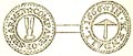 click to enlarge click to enlargeG853E13.jpg "The two implements it represents are now almost entirely disused, having been superseded by machinery, which does the work better and cheaper. The large shears were used by the croppers to cut all the long hairs off the cloth; and, unless great care and precision were applied, there was danger of cutting the cloth, so that none but experienced workmen were employed, and they earned great wages. During the Luddite riots in the West Riding of Yorkshire in 1812, many of these artisans were implicated, some of them having been thrown out of employment by the improvements in manufacture, and many by their intemperate habits. The long hairs are now removed by a spiral thread fixed on a revolving cylinder, which gives a fine even nap to the cloth. The hand teasel brush, which appears on the reverse of the token," |
|||
|
|
||||
| evidence:- | old text:- Gents Mag 1853 |
|||
| source data:- | goto source Gentleman's Magazine 1853 part 1 p.493 "was used for brushing the cloth - a brush being held in each hand. This operation is now also performed by machinery, the teasels being placed in a long, narrow iron frame, which is worked by steam-power. The vegetable teasel (Dipsacus fullonum) continues still to be used - no artificial brush having yet been found better than the natural one." "6. In the same year a token was issued conjointly by Thomas Wilson and Thomas Warde of Kirkland. Though" 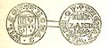 click to enlarge click to enlargeG853E14.jpg "there are other Kirklands elsewhere, the arms of the town show that the token is rightly assigned to Kirkland in Kendal, which is thus described by Nicolson and Burn:-" "Adjoining to the town of Kendal on the south is Kirkland, which is commonly reckoned part of Kendal (it now forms part of both the parliamentary and municipal borough), but it is a distinct township, separated from the town of Kendal by a little brook, which having but a small current, and as it were seeking a passage, is called Blindbeck. This place, being out of the mayor's liberty, is much resorted to by tradesmen that are not free of the corporation. Kendal church stands in Kirkland." "Whether Messrs. Wilson and Warde were partners in trade, or merely joint-issuers of the token, has not been ascertained; but instances of joint-issue by neighbours in trade are not unfrequent." "7. In 1667 James Cocke junior of Kendal issued a halfpenny token, ex-"  click to enlarge click to enlargeG853E15.jpg "hibiting a rebus upon his name.*This Mr. Cocke was sworn a member of the Mercer's Company in 1655, and became mayor of Kendal in 1681. His residence was in the Park; and a house which stood on the site of that now occupied by Mr. Hudson, druggist, in Butcher's Row, belonged to the family, and before it was rebuilt in 1812, had the figure of a cock in stained glass in one of its windows." "8. Richard Rowlandson of Grayrig in Kendal parish issued a Halfpenny in 1669. The device is described by Mr. Brockett as "a pair of scales on a pedestal," but the pedestal looks exceedingly like a shovel." "Richard Rowlandson was a fellmonger and woolstapler, and lived on"  click to enlarge click to enlargeG853E16.jpg "his own estate at Lambert Ash, Grayrig, where he carried on his business. Grayrig is at a few miles distance from Kirkby Kendal; but Rowlandson had a branch establishment in the town, and others at Kirkby Stephen and Kirkby Lonsdale. It is related that he walked to London and back on business three times, and that he was there in the time of the Great Plague of 1665." "This was probably the last Token coined for Kendal, as the tokens struck by towns, trading companies, and individual tradesmen, at the period in question, "for necessary change," range for about 24 years, that is, from 1648 to 1672, and were checked as early as 1669. In that year the citizens of Norwich had a pardon granted them for all transgressions, and in particular for their coinage of halfpence and farthings, by which they had forfeited their charter, all coinage being declared to be the king's prerogative.†In 1672 all such currency was "cried down" by royal proclamation." "..." "*The obverse is nearly identical with that of the token of John Cocke of Leeds, the reverse of which is inscribed "William Balley, 1666, a half peny." Snelling, fig.12." " †Blomefield's History of Norfolk, vol.ii. p.290." |
|||
|
|
||||
| evidence:- | old itinerary:- Tinsley 1877 (Roads/Cum) placename:- Kendal |
|||
| source data:- | Itinerary, route 7, London to Whitehaven via the Lake Districts, including from Settle,
Lancashire; through Kirkby Lonsdale, Kendal, Ambleside, Westmorland; then Keswick,
Cockermouth to Whitehaven, Cumberland, published by Tinsley Bros, 8 Catherine Street,
Strand, London, 1877.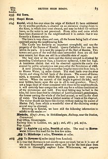 click to enlarge click to enlargeTLY185.jpg pp.71-91 in British High Roads, North and North Eastern Routes; pp.84-91. printed at p.71:- "... / ROUTE VII. - LONDON to WHTEHAVEN via THE LAKE / DISTRICTS. (See Maps 65 to 80.) / Hitchin (as per Route I.) 34, Shefford 41, Bedford 50, Higham-Ferrers, / 64¾, Kettering 74½, Rockingham 83¼, Uppingham 88¾, Oakham, / 94¾, Melton Mowbray 104¾, Nottingham 123¼, Rotherham 159¼, / Barnsley 171¾, Huddersfield 188¾, Halifax 196¾, Keighley 208¾, / Skipton 218¾, Settle 234¾, Kirkby Lonsdale 252½, Kendal 264½, / Ambleside 278½, Keswick 293½, Cockermouth 305½, Whitehaven / 319½. / ..." item:- private collection : 270.2 Image © see bottom of page |
|||
|
|
||||
| evidence:- | old strip map:- Tinsley 1877 (Roads/Cum) placename:- Kendal |
|||
| source data:- | Strip map, road map, part of London to Whitehaven, including from before Kirkby Lonsdale
through Kendal, Windermere to beyond Ambleside, Westmorland, published by Tinsley
Bros, 8 Catherine Street, Strand, London, 1877.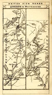 click to enlarge click to enlargeTLY1M4.jpg Map pp.77-78 in British High Roads, North and North Eastern Routes. printed at top:- "BRITISH HIGH ROADS / 77 LONDON TO WHITEHAVEN. 78" item:- private collection : 270.6 Image © see bottom of page |
|||
|
|
||||
| evidence:- | old text:- Harper 1907 placename:- Kendal placename:- Kirkby Kendal placename:- Kirkby Kent Dale item:- placename, Kendal |
|||
| source data:- | Guidebook, The Manchester and Glasgow Road, by Charles G Harper,
published by Chapman and Hall Ltd, London, 1907. HP01p101.txt Page 101:- "..." "AND so into Kendal, across the river." "Kendal, originally Kirkby Kendal, i.e. Kirkby Kent-Dale, is indeed very much among the waters, for here the river Kent, reinforced by tributary streams pouring down from the misty fells, foams down in weirs, and is crossed, in highway and byway, by no fewer than three bridges. There is good fishing for the "gentle" angler in these waters. Though why "gentle" and where the gentleness is more than I can comprehend. For sport, the angler baits his cruel line and, if sport be good, he, himself, an exemplar of "nature, red in tooth and claw," hooks, with his fiendish barb, some unfortunate trout or grayling in the gills." "The streets in Kendal are mostly "gates," as Stramongate and Stricklandgate, and were once picturesque, in the stern way of these northern latitudes; but Kendal, in these days a highly prosperous agricultural town, and in a favourable position at the gate of the Lake Country, is being greatly rebuilt, and looks, to those who hurry by, little removed from the common run of provincial towns. Motor-tourists to and from the Lakes do not deign to halt at Kendal, and he who does may notice, any day of summer and autumn, a veritable procession of cars hurrying to and from those resorts and regarding Kendal as an unwelcome incident, containing inhabitants and dogs, which are to be run over only at risk to car and purse." "..." HP01p104.txt Page 104:- "..." "The people of Kendal were turbulent folk in the old days, and varied the humdrum existence of woollen manufacture and the printing of cottons by rioting: keeping up their reputation in this sort until the early years of the nineteenth century, when the first Parliamentary election was excuse sufficient for an outbreak. The making and the dyeing of the once famous "Kendal green" cloth is a thing of the past, and peace is now characteristic of Kendal, but the reputation of the neighbourhood for incisive wit remains, in the ancient story of the horseman who asked a countryman the time o' day. "Twelve o'clock," said the man, looking at that rural chronometer, the sky." ""Twelve!" exclaimed the traveller. "I thought it was more."" ""Did y'ever know it to be moor nor twelve?" rejoined the man, turning away." "The traveller, struck with this unusual rustic facility for repartee, sent his servant after him, to know if he would like a situation as a jester." ""Here, fellow," said the servant, "my master wants to know if you would like a place as a fool."" "The reply was disheartening: "Does he want two on 'em, then, or are you going to leave?"" "The turbulent people of Kendal no doubt acquired their character from the old-time circumstance of the place, ever subject to incursions of Scottish raiders. Sturdy independence, and a readiness to hold their own, thus become traits in these men of the dales and fells. Something of the ancient" HP01p105.txt Page 105:- "trials of Kendal town may yet be seen, behind the modern smug face of shops in the older streets, where houses and cottages are built around courtyards approached only by narrow alleys easily to be defended in case of attack." "..." |
|||
|
|
||||
| evidence:- | old itinerary:- Johnson 1908 (Roads/Cum) placename:- Kendal |
|||
| source data:- | Itinerary, Route 37 in Roads Made Easy by Picture and Pen, Preston to Glasgow, by
Claude Johnson, edited by Lord Montagu, published by The Car Illustrated, 168 Piccadilly,
London, 1908.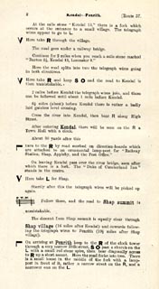 click to enlarge click to enlargeJS5002.jpg pp.1-10 in the road book, Roads Made Easy by Picture and Pen, vol.3. printed at beginning, p.1:- "ROUTE 37. / PRESTON via Lancaster (21½), Kendal (42½), Shap (58½), Penrith (69), Carlisle (87), Lockerbie (111½), Beattock (125¾), Abington (144½), Hamilton (170½) to GLASGOW (182). / (The Land's End to John o' Groats Route.)" item:- private collection : 268.2 Image © see bottom of page |
|||
|
|
||||
| evidence:- | old itinerary:- Johnson 1908 (Roads/Cum) placename:- Kendal |
|||
| source data:- | Itinerary, Route 37 reverse in Roads Made Easy by Picture and Pen, Glasgow to Preston,
by Claude Johnson, edited by Lord Montagu, published by The Car Illustrated, 168 Piccadilly,
London, 1908.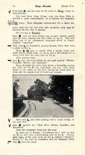 click to enlarge click to enlargeJS5018.jpg pp.11-21 in the road book, Roads Made Easy by Picture and Pen, vol.3. printed at beginning, p.11:- "ROUTE 37. Reverse / GLASGOW via Hamilton (11½), Abington (37½), Beattock (56¼), Lockerbie (70½), Carlisle (95), Penrith (113), Shap (123½), Kendal (139½), Lancaster (160½) to PRESTON (182)." item:- private collection : 268.3 Image © see bottom of page |
|||
|
|
||||
| evidence:- | old itinerary:- Johnson 1908 (Roads/Cum) placename:- Kendal |
|||
| source data:- | Itinerary, Route 39 reverse in Roads Made Easy by Picture and Pen, Glasgow to Doncaster,
through Skipton, by Claude Johnson, edited by Lord Montagu, published by The Car Illustrated,
168 Piccadilly, London, 1908.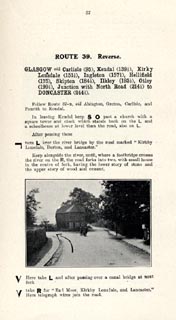 click to enlarge click to enlargeJS5057.jpg pp.57-65 in the road book, Roads Made Easy by Picture and Pen, vol.3. printed at beginning, p.57:- "ROUTE 39. Reverse. / GLASGOW via Carlisle (95), Kendal (139½), Kirkby Lonsdale (151½), Ingleton (157¼), Hellifield (175), Skipton (184½), Ilkley (193½), Otley (199½), Junction with North Road (214½) to DONCASTER (244 1/34)." item:- private collection : 268.7 Image © see bottom of page |
|||
|
|
||||
| evidence:- | old itinerary:- Johnson 1908 (Roads/Cum) placename:- Kendal |
|||
| source data:- | Itinerary, Route 42 in Roads Made Easy by Picture and Pen, Kendal to Carlisle, through
The Lakes, by Claude Johnson, edited by Lord Montagu, published by The Car Illustrated,
168 Piccadilly, London, 1908.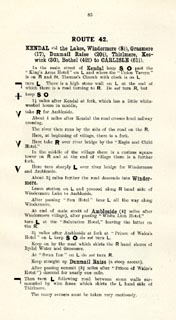 click to enlarge click to enlargeJS5085.jpg pp.85-88 in the road book, Roads Made Easy by Picture and Pen, vol.3. printed at beginning, p.85:- "ROUTE 42. / KENDAL via the Lakes, Windermere (8¼), Grasmere (17), Dunmail Raise (20¼), Thirlmere, Keswick (30), Bothel (42¾), to CARLISLE (61¼)." item:- private collection : 268.12 Image © see bottom of page |
|||
|
|
||||
| evidence:- | old map:- Burrow 1920s |
|||
| source data:- | Road book, On the Road, Dunlop Pictorial Road Plans, volume V,
strip maps with parts in Westmorland, Cumberland etc, irregular
scale about 1.5 miles to 1 inch, by E J Burrow and Co,
Cheltenham, Gloucestershire, 1920s.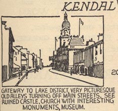 EJB3Vg09.jpg "... The gateway to the Lake District from the south is Kendal, marked as we approach it by the ruins of Kendal Castle crowning a hill to the right. Kendal is an interesting old town with memories of Border warfare. Of its ancient houses the most curious is one in Wildman Street called the 'Castle Dairy.' This is typical of what most houses in Kendal were formerly like - built with an eye on the need for defence. Its walls are of great thickness and the house is provided with hiding places. The church is notable chiefly for its monuments, including one to a seventeenth-century vicar with a quaint rhyming inscription." item:- private collection : 17 Image © see bottom of page |
|||
|
|
||||
| evidence:- | town plan:- Historical Monuments 1936 |
|||
| source data:- | Town plan, uncoloured lithograph, Kendal Plan Showing the Position of Monuments, Kendal,
Westmorland, scale about 1 to 6800, about 9 inches to 1 mile, published by Royal Commission
on Historical Monuments England, London, 1936.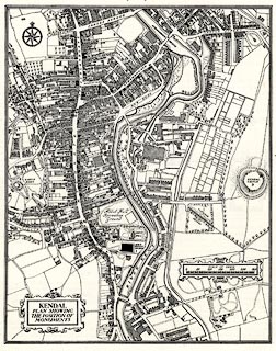 click to enlarge click to enlargeHMW080.jpg On p.126 of the Inventory of the Historical Monuments in Westmorland. printed, lower left "KENDAL / PLAN SHOWING / THE POSITION OF / MONUMENTS" item:- Armitt Library : A745.80 Image © see bottom of page |
|||
|
|
||||
| evidence:- | old map:- County Associations 1950 placename:- Kendal |
|||
| source data:- | Town plan, uncoloured lithograph, Kendal, Westmorland, scale about 6.5 inches to 1
mile, published by The County Associations, Bourdon Street, Berkeley Square, London,
1950.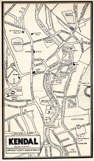 click to enlarge click to enlargeWMD1M2.jpg Town plan, uncoloured lithograph, Kendal, Westmorland, scale about 6.5 inches to 1 mile, published in The Westmorland Official County Guide by The County Associations, Bourdon Street, Berkeley Square, London, 1950. item:- JandMN : 1000.2 Image © see bottom of page |
|||
|
|
||||
| evidence:- | market notes:- placename:- Kirkeby in Kendale placename:- Kirkby in Kendal item:- market |
|||
| source data:- | www.history.ac.uk/cmh/gaz/gazweb2.htmPalmer's Index No.93:: Public Record OfficeOwen: 1792: New Book of Fairs: 1889: Market Rights and Tolls: HM GovernmentBowen, Emanuel &Kitchin, Thomas: 1760: New Map of the Counties of Cumberland and Westmoreland | |||
|
|
||||
| records of Kirkby Kendal | ||||
|
|
||||
| MN photo:- |
A miscellany of stoneware jars used by Kendal tradesmen:- |
|||
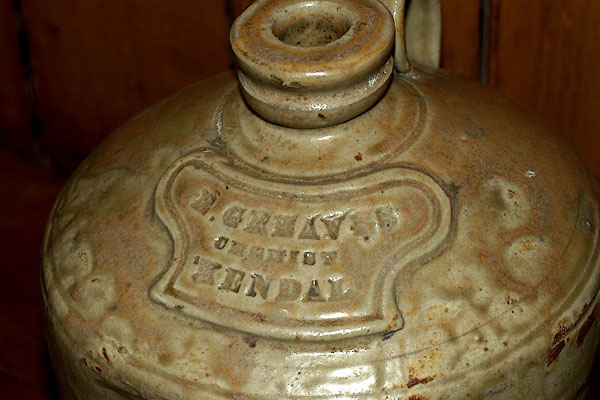 BRH01.jpg "[E] GRAVES / CHEMIST / KENDAL" (taken 13.8.2009) courtesy of the antique shop in Sedbergh. 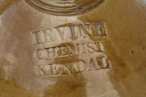 BRH02.jpg "IRVINE / CHEMIST / KENDAL" (taken 13.8.2009) courtesy of the antique shop in Sedbergh. 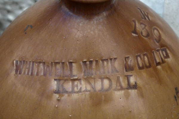 BRH03.jpg "WHITWELL MARK &CO LTD / KENDAL" (taken 13.8.2009) courtesy of the antique shop in Sedbergh. 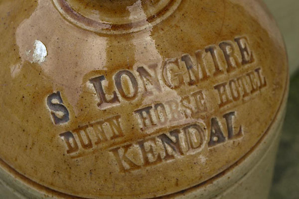 BRH04.jpg "S LONGMIRE / DUNN HORSE HOTEL / KENDAL" (taken 13.8.2009) courtesy of the antique shop in Sedbergh. 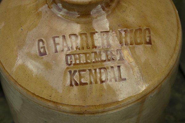 BRH05.jpg "G FARRER HIGG / CHEMIST / KENDAL" (taken 13.8.2009) courtesy of the antique shop in Sedbergh. 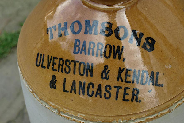 BRH06.jpg "THOMSONS / BARROW, / ULVERSTON & KENDAL / &LANCASTER." (taken 13.8.2009) courtesy of the antique shop in Sedbergh. 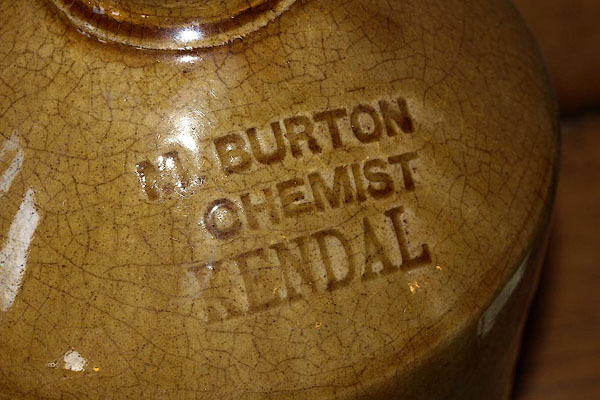 BRH07.jpg "M BURTON / CHEMIST / KENDAL" (taken 13.8.2009) courtesy of the antique shop in Sedbergh. 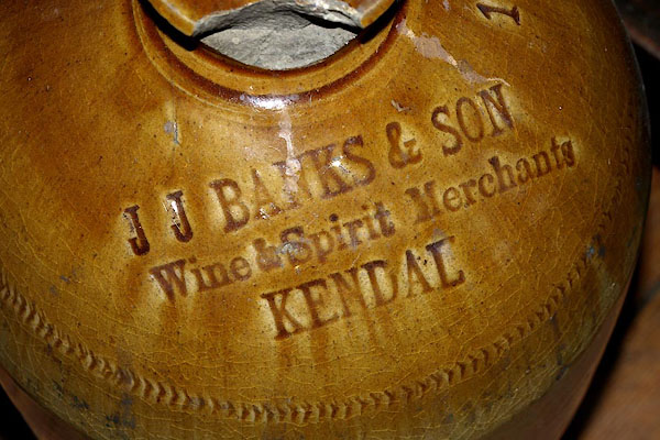 BRH08.jpg "J J BANKS & SON / Wine &Spirit Merchants / KENDAL" (taken 13.8.2009) courtesy of the antique shop in Sedbergh. |
||||
|
|
||||
| hearsay:- |
It is said that Kendal Mint Cake was invented by accident; Joseph Wiper made a mistake
boiling sugar in his sweet shop, 1868. Some was taken to Antarctica by Sir Ernest
Shackleton. In 1953, Sir Edmund Hillary and Tenzing on Everest:- |
|||
| "... sat on the snow and looked at the country far below us ... we nibbled Kendal Mint
Cake ..." |
||||
|
|
||||
| hearsay:- |
Kendal Green was cloth dyed yellow using dyer's greenweed, Genista tinctoria, the
dyed again probably with woad, Isatis tinctoria, or, later, indigo. |
|||
| Henry IV part 1, Falstaff:- |
||||
| "... three misbegotten rogues in Kendal green ..." |
||||
|
|
||||
| hearsay:- |
Archers from Kendal, Kendal Bowmen, did well at the Battle of Flodden, 1513. Their
uniform was green, Kendal Green, and buff, with arrow buttons. |
|||
|
|
||||
| hearsay:- |
Kendal Parish Records include records of payments of a bounty on polecats in the 18th
century; 51 in 1702, 173 in 1794, and similar numbers in the years between. The polecat
was known as the foul mart. |
|||
|
|
||||
| hearsay:- |
In Stricklandgate there is a black boar shop sign, at Black Hall, formerly a brush
works. The sign is a fake, the original is in the Museum of Lakeland Life. |
|||
|
|
||||
| map:- |
'Organ factory' labelled at SD51799228. |
|||
| 'The Calling Stone' labelled at SD51489263 outside the town hall. |
||||
|
|
||||
| fiction:- |
Called Whinborough in |
|||
| Ward, Humphrey, Mrs: 1888: Robert Elsmere |
||||
|
|
||||
 Post Office maps Post Office maps |
||||
|
|
||||
| evidence:- | old print:- Pearson 1900s placename:- Kendal |
|||
| source data:- | Print, halftone photograph, A Side Street in Kendal, Westmorland, published by C Arthur
Pearson, Henrietta Street, London, 1900s.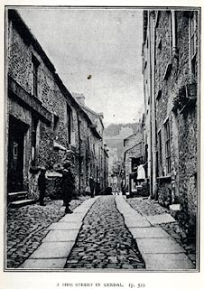 click to enlarge click to enlargePS1E23.jpg On p.51 of Pearson's Gossipy Guide to the English Lakes and Neighbouring Districts. printed at bottom:- "A SIDE STREET IN KENDAL. (p.52)." item:- Armitt Library : A1188.30 Image © see bottom of page |
|||
|
|
||||
| evidence:- | old print:- Sylvan 1847 placename:- Kendal |
|||
| source data:- | Print, engraving, Kendal, Westmorland, published by John Johnstone, Paternoster Row,
London, et al, 1847.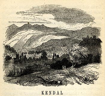 click to enlarge click to enlargeSYL104.jpg On p.18 of Sylvan's Pictorial Guide to the English Lakes. item:- Armitt Library : A1201.4 Image © see bottom of page |
|||
|
|
||||
| evidence:- | old print:- Sayer 1847 placename:- Kendal |
|||
| source data:- | Frontispiece to vol.1 of Sayer's History of Westmorland, drawn by Thomas Gilks.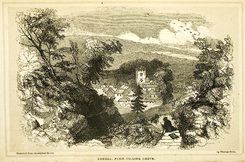 click to enlarge click to enlargeSY01E1.jpg "KENDAL, FROM GILLING GROVE." item:- Armitt Library : A1390.2 Image © see bottom of page |
|||
|
|
||||
| evidence:- | old print:- Rose 1832-35 |
|||
| source data:- | Print, engraving, Kendal, from Green Bank, by Thomas Allom, engraved by S Bradshaw,
1834.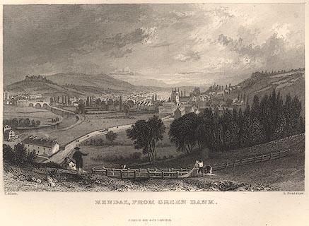 click to enlarge click to enlargeR264.jpg item:- JandMN : 66.33 Image © see bottom of page |
|||
|
|
||||
| evidence:- | old print:- Rose 1832-35 |
|||
| source data:- | Print, engraving, Kendal, from the Castle, by Thomas Allom, engraved by W le Petit,
1830s.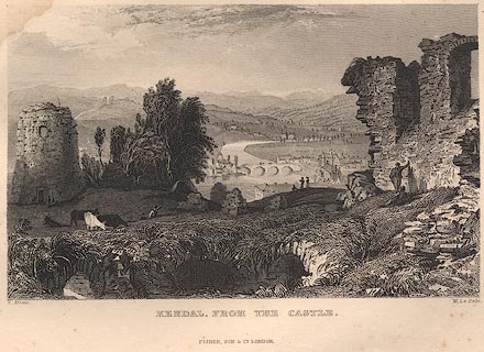 click to enlarge click to enlargeR2E41.jpg item:- JandMN : 66.26 Image © see bottom of page |
|||
|
|
||||
| evidence:- | old print:- item:- government |
|||
| source data:- | Print, uncoloured engraving, charter seal, Kendal, of Charles I, published by Hudson
and Nicholson, Kendal, Westmorland, 1832.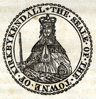 click to enlarge click to enlargePR0740.jpg On p.147 of The Annals of Kendal by Cornelius Nicholson. item:- private collection : 125.13 Image © see bottom of page |
|||
|
|
||||
| evidence:- | old print:- item:- government |
|||
| source data:- | Print, uncoloured engraving, corporation seal, Kendal, published by Hudson and Nicholson,
Kendal, Westmorland, 1832.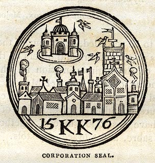 click to enlarge click to enlargePR0739.jpg On p.144 of The Annals of Kendal by Cornelius Nicholson. item:- private collection : 125.12 Image © see bottom of page |
|||
|
|
||||
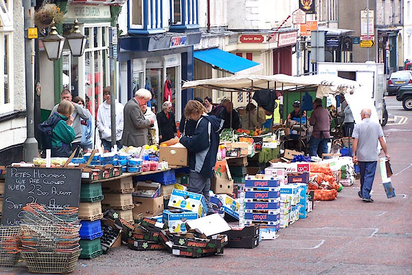 BMN21.jpg Fruit and veg market in Finkle Street. (taken 16.8.2006) 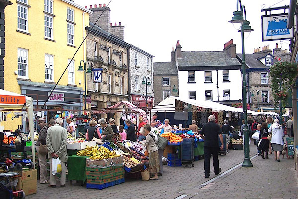 BMN25.jpg Wednesday market in Market place. (taken 16.8.2006) 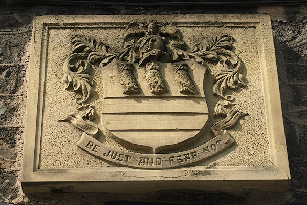 BPM92.jpg Coat of arms on building. (taken 24.7.2008) 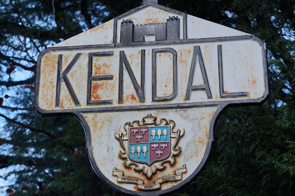 BZR96.jpg Sign, (taken 29.11.2013) |
||||
|
|
||||
| person:- | : Richard I |
|||
| date:- | 1189 |
|||
| period:- | 12th century | |||
| item:- | charter; market charter |
|||
| Market charter granted by Richard I, 1189, Saturday market and 3 fairs per annum.
Borough charter, 1575. |
||||
|
|
||||
| twinned with:- | Rinteln, Germany |
|||
|
|
||||
| twinned with:- | Killarney, Ireland |
|||
|
|
||||
| places:- |
|
|||
|
||||
|
||||
|
||||
|
||||
|
||||
|
||||
|
||||
|
||||
|
||||
|
||||
|
||||
|
||||
|
||||
|
||||
|
||||
|
||||
|
||||
|
||||
|
||||
|
||||
|
||||
|
||||
|
||||
|
||||
|
||||
|
||||
|
||||
|
||||
|
||||
|
||||
|
||||
|
||||
|
||||
|
||||
|
||||
|
||||
|
||||
|
||||
|
||||
|
||||
|
||||
|
||||
|
||||
|
||||
|
||||
|
||||
|
||||
|
||||
|
||||
|
||||
|
||||
|
||||
|
||||
|
||||
|
||||
|
||||
|
||||
|
||||
|
||||
|
||||
|
||||
|
||||
|
||||
|
||||
|
||||
|
||||
|
||||
|
||||
|
||||
|
||||
|
||||
|
||||
|
||||
|
||||
|
||||
|
||||
|
||||
|
||||
|
||||
|
||||
|
||||
|
||||
|
||||
|
||||
|
||||
|
||||
|
||||
|
||||
|
||||
|
||||
|
||||
|
||||
|
||||
|
||||
|
||||
|
||||
|
||||
|
||||
|
||||
|
||||
|
||||
|
||||
|
||||
|
||||
|
||||
|
||||
|
||||
|
||||
|
||||
|
||||
|
||||
|
||||
|
||||
|
||||
|
||||
|
||||
|
||||
|
||||
|
||||
|
||||
|
||||
|
||||
|
||||
|
||||
|
||||
|
||||
|
||||
|
||||
|
||||
|
||||
|
||||
|
||||
|
||||
|
||||
|
||||
|
||||
|
||||
|
||||
|
||||
|
||||
|
||||
|
||||
|
||||
|
||||
|
||||
|
||||
|
||||
|
||||
|
||||
|
||||
|
||||
|
||||
|
||||
|
||||
|
||||
|
||||
|
||||
|
||||
|
||||
|
||||
|
||||
|
||||
|
||||
|
||||
|
||||
|
||||
|
||||
|
||||
|
||||
|
||||
|
||||
|
||||
|
||||
|
||||
|
||||
|
||||
|
||||
|
||||
|
||||
|
||||
|
||||
|
||||
|
||||
|
||||
|
||||
|
||||
|
||||
|
||||
|
||||
|
||||
|
||||
|
||||
|
||||
|
||||
|
||||
|
||||
|
||||
|
||||
|
||||
|
||||
|
||||
|
||||
|
||||
|
||||
|
||||
|
||||
|
||||
|
||||
|
||||
|
||||
|
||||
|
||||
|
||||
|
||||
|
||||
|
||||
|
||||
|
||||
|
||||
|
||||
|
||||
|
||||
|
||||
|
||||
|
||||
|
||||
|
||||
|
||||
|
||||
|
||||
|
||||
|
||||
|
||||
|
||||
|
||||
|
||||
|
||||
|
||||
|
||||
|
||||
|
||||
|
||||
|
||||
|
||||
|
||||
|
||||
|
||||
|
||||
|
||||
|
||||
|
||||
|
||||
|
||||
|
||||
|
||||
|
||||
|
||||
|
||||
|
||||
|
||||
|
||||
|
||||
|
||||
|
||||
|
||||
|
||||
|
||||
|
||||
|
||||
|
||||
|
||||
|
||||
|
||||
|
||||
|
||||
|
||||
|
||||
|
||||
|
||||
|
||||
|
||||
|
||||
|
||||
|
||||
|
||||
|
||||
|
||||
|
||||
|
||||
|
||||
|
||||
|
||||
|
||||
|
||||
|
||||
|
||||
|
||||
|
||||
|
||||
|
||||
|
||||
|
||||
|
||||
|
||||
|
||||
|
||||
|
||||
|
||||
|
||||
|
||||
|
||||
|
||||
|
||||
|
||||
|
||||
|
||||
|
||||
|
||||
|
||||
|
||||
|
||||
|
||||
|
||||
|
||||
|
||||
|
||||
|
||||
|
||||
|
||||
|
||||
|
||||
|
||||
|
||||
|
||||
|
||||
|
||||
|
||||
|
||||
|
||||
|
||||
|
||||
|
||||
|
||||
|
||||
|
||||
|
||||
|
||||
|
||||
|
||||
|
||||
|
||||
|
||||
|
||||
|
||||
|
||||
|
||||
|
||||
|
||||
|
||||
|
||||
|
||||
|
||||
|
||||
|
||||
|
||||
|
||||
|
||||
|
||||
|
||||
|
||||
|
||||
|
||||
|
||||
|
||||
|
||||
|
||||
|
||||
|
||||
|
||||
|
||||
|
||||
|
||||
|
||||
|
||||
|
||||
|
||||
|
||||
|
||||
|
||||
|
||||
|
||||
|
||||
|
||||
|
||||
|
||||
|
||||
|
||||
|
||||
|
||||
|
||||
|
||||
|
||||
|
||||
|
||||
|
||||
|
||||
|
||||
|
||||
|
||||
|
||||
|
||||
|
||||
|
||||
|
||||
|
||||
|
||||
|
||||
|
||||
|
||||
|
||||
|
||||
|
||||
|
||||
|
||||
|
||||
|
||||
|
||||
|
||||
|
||||
|
||||
|
||||
|
||||
|
||||
|
||||
|
||||
|
||||
|
||||
|
||||
|
||||
|
||||
|
||||
|
||||
|
||||
|
||||
|
||||
|
||||
|
||||
|
||||
|
||||
|
||||
|
||||
|
||||
|
||||
|
||||
|
||||
|
||||
|
||||
|
||||
|
||||
|
||||
|
||||
|
||||
|
||||
|
||||
|
||||
|
||||
|
||||
|
||||
|
||||
|
||||
|
||||
|
||||
|
||||
|
||||
|
||||
|
||||
|
||||
|
||||
Lakes Guides menu.