Old Cumbria Gazetteer
 |
 |
|
||
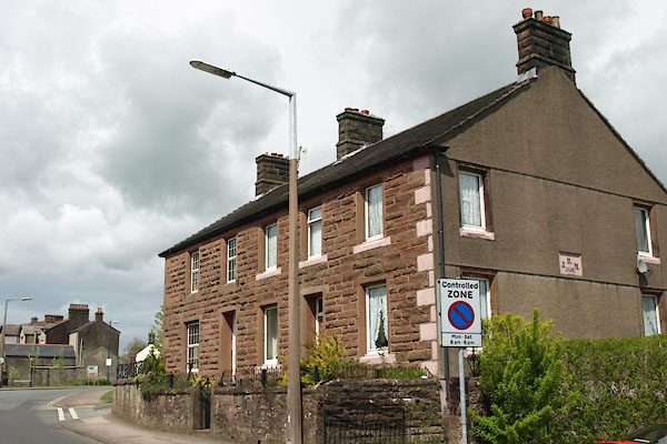
| Egremont | ||||
| civil parish:- | Egremont (formerly Cumberland) | |||
| county:- | Cumbria | |||
| locality type:- | locality | |||
| locality type:- | buildings | |||
| locality type:- | market town | |||
| locality type:- | selected place | |||
| coordinates:- | NY01041062 (etc) | |||
| 1Km square:- | NY0110 | |||
| 10Km square:- | NY01 | |||
| latitude; longitude:- | 3d 31.6m W; 54d 28.9m N | |||
|
|
||||
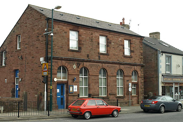
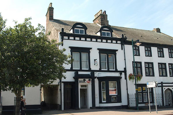
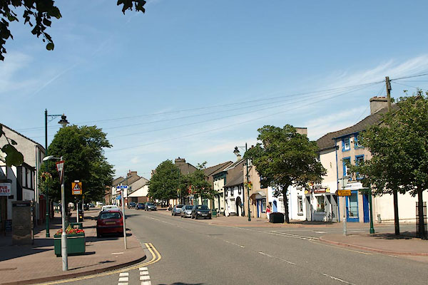
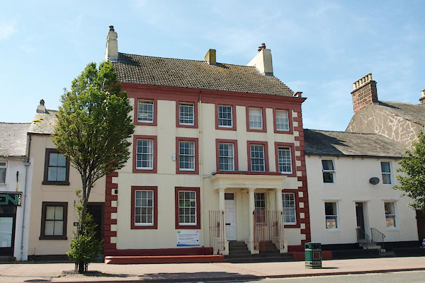
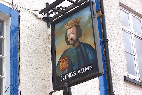
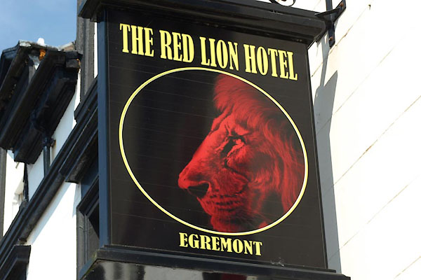
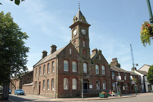
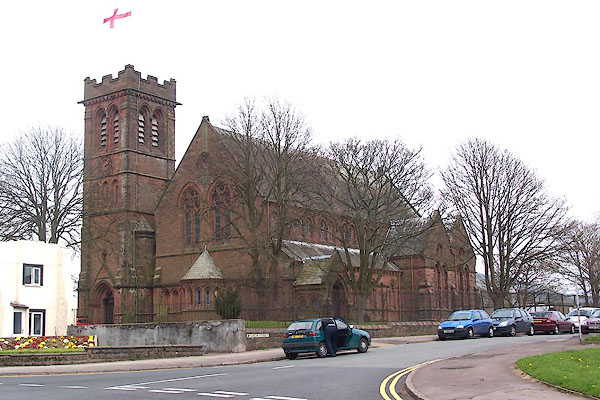
 BLY72.jpg (taken 24.4.2006) 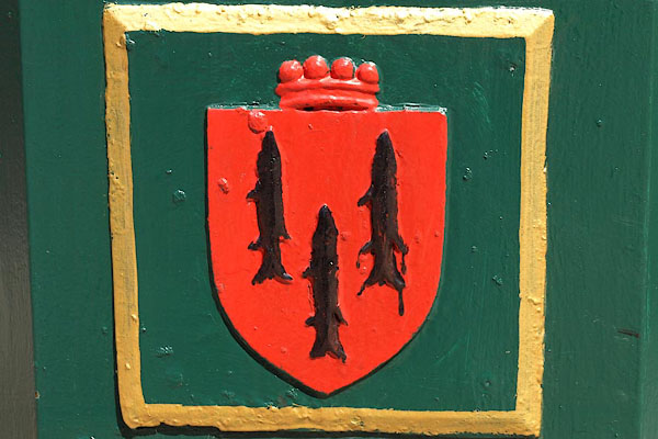 BQN71.jpg The town's coat of arms, on a litter bin. The blazon:- gules three lucies hauriant sable (taken 11.5.2009) |
||||
|
|
||||
| evidence:- | old map:- OS County Series (Cmd 72 8) placename:- Egremont |
|||
| source data:- | Maps, County Series maps of Great Britain, scales 6 and 25
inches to 1 mile, published by the Ordnance Survey, Southampton,
Hampshire, from about 1863 to 1948. OS County Series (Cmd 72 7) |
|||
|
|
||||
| evidence:- | old map:- Lloyd 1573 placename:- Egremot |
|||
| source data:- | Map, hand coloured copper plate engraving, Angliae Regni,
Kingdom of England, with Wales, scale about 24 miles to 1 inch, authored by Humphrey
Lloyd, Denbigh, Clwyd, drawn and engraved
by Abraham Ortelius, Netherlands, 1573.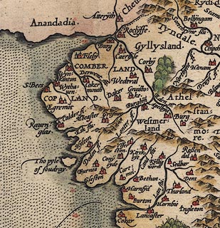 click to enlarge click to enlargeLld1Cm.jpg "Egremot" item:- Hampshire Museums : FA1998.69 Image © see bottom of page |
|||
|
|
||||
| evidence:- | old map:- Saxton 1579 placename:- Egremond |
|||
| source data:- | Map, hand coloured engraving, Westmorlandiae et Cumberlandiae Comitatus ie Westmorland
and Cumberland, scale about 5 miles to 1 inch, by Christopher Saxton, London, engraved
by Augustinus Ryther, 1576, published 1579-1645.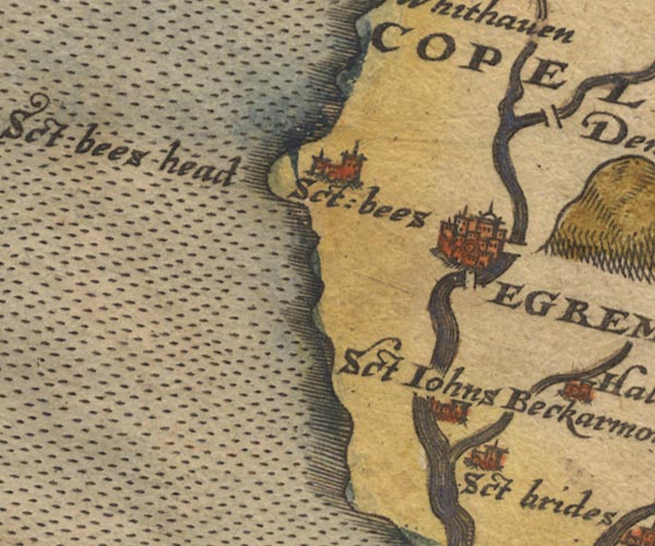 Sax9NX91.jpg Buildings and towers, symbol for a town. "EGREMOND" item:- private collection : 2 Image © see bottom of page |
|||
|
|
||||
| evidence:- | old map:- Mercator 1595 (edn?) placename:- Egremond |
|||
| source data:- | Map, hand coloured engraving, Northumbria, Cumberlandia, et
Dunelmensis Episcopatus, ie Northumberland, Cumberland and
Durham etc, scale about 6.5 miles to 1 inch, by Gerard Mercator,
Duisberg, Germany, about 1595. MER8CumE.jpg "Egremond" circle, building/s, tower, tinted red item:- JandMN : 169 Image © see bottom of page |
|||
|
|
||||
| evidence:- | old map:- Keer 1605 placename:- Egremond |
|||
| source data:- | Map, hand coloured engraving, Westmorland and Cumberland, scale
about 16 miles to 1 inch, probably by Pieter van den Keere, or
Peter Keer, about 1605 edition perhaps 1676. click to enlarge click to enlargeKER8.jpg "Egremond" dot, two circle, tower, tinted red; town item:- Dove Cottage : 2007.38.110 Image © see bottom of page |
|||
|
|
||||
| evidence:- | old map:- Speed 1611 (Cum/EW) placename:- Egremond |
|||
| source data:- | Map, hand coloured engraving, Kingdome of Great Britaine and
Ireland, scale about 36 miles to 1 inch, by John Speed, about
1610-11, published by Thomas Bassett, Fleet Street and Richard
Chiswell, St Paul's Churchyard, London, 1676? click to enlarge click to enlargeSPD6Cm.jpg "Egremond" dot, circle, and tower item:- private collection : 85 Image © see bottom of page |
|||
|
|
||||
| evidence:- | old map:- Speed 1611 (Cmd) placename:- Egremond |
|||
| source data:- | Map, hand coloured engraving, Cumberland and the Ancient Citie
Carlile Described, scale about 4 miles to 1 inch, by John Speed,
1610, published by J Sudbury and George Humble, Popes Head
Alley, London, 1611-12. SP11NY01.jpg "Egremond" circle, buildings, towers item:- private collection : 16 Image © see bottom of page |
|||
|
|
||||
| evidence:- | poem:- Drayton 1612/1622 text placename:- Egremound |
|||
| source data:- | Poem, Poly Olbion, by Michael Drayton, published by published by
John Marriott, John Grismand and Thomas Dewe, and others?
London, part 1 1612, part 2 1622. goto source goto sourcepage 164:- "... Egremound, ..." |
|||
|
|
||||
| evidence:- | old map:- Drayton 1612/1622 placename:- Egremont |
|||
| source data:- | Map, hand coloured engraving, Cumberlande and Westmorlande, by
Michael Drayton, probably engraved by William Hole, scale about
4 or 5 miles to 1 inch, published by John Mariott, John
Grismand, and Thomas Dewe, London, 1622. DRY519.jpg "Egremont" Lady with 'town' headress. item:- JandMN : 168 Image © see bottom of page |
|||
|
|
||||
| evidence:- | table of distances:- Simons 1635 placename:- Egremonde |
|||
| source data:- | Table of distances, uncoloured engraving, Cumberland, with a
thumbnail map, scale about 41 miles to 1 inch, by Mathew Simons,
published in A Direction for the English Traviller, 1635.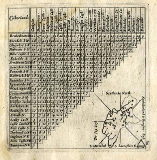 click to enlarge click to enlargeSIM4.jpg "Egremo~de S.W." and tabulated distances item:- private collection : 50.11 Image © see bottom of page |
|||
|
|
||||
| evidence:- | old map:- Jenner 1643 placename:- Edgermond |
|||
| source data:- | Tables of distances with a maps, Westmerland, scale about 16
miles to 1 inch, and Cumberland, scale about 21 miles to 1 inch,
published by Thomas Jenner, London, 1643; published 1643-80.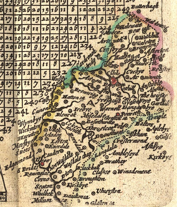 JEN4Sq.jpg "Edgermond" circle |
|||
|
|
||||
| evidence:- | old map:- Jansson 1646 placename:- Egremond |
|||
| source data:- | Map, hand coloured engraving, Cumbria and Westmoria, ie
Cumberland and Westmorland, scale about 3.5 miles to 1 inch, by
John Jansson, Amsterdam, Netherlands, 1646.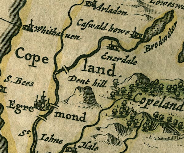 JAN3NY01.jpg "Egremond" Buildings and towers, suggestion of a wall, notice ?fence palings; upright lowercase text; market town. item:- JandMN : 88 Image © see bottom of page |
|||
|
|
||||
| evidence:- | old road book:- Ogilby 1675 (edn 1698) placename:- Egrimond |
|||
| source data:- | page 45; describing plate 96 "The Road from" "... And from Egrimond to CARLISLE." "... Egrimond, the Initial Borough-Town near the Sea, having the advantage of a strong castle, and of a good Market on Saturd. ..." item:- private collection : 367 Image © see bottom of page |
|||
|
|
||||
| evidence:- | old map:- Ogilby 1675 (plate 96) placename:- Egremond |
|||
| source data:- | Road strip map, hand coloured engraving, the Road from Kendal to
Cockermouth, and the Road from Egremond to Carlisle, scale about
1 inch to 1 mile, by John Ogilby, London, 1675.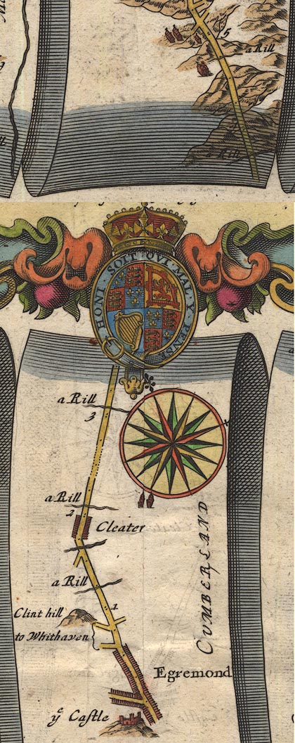 OG96Bm00.jpg In mile 0, Cumberland. "Egremond" two streets with houses each side, and a castle. item:- JandMN : 22 Image © see bottom of page |
|||
|
|
||||
| evidence:- | old map:- Sanson 1679 placename:- Egremond |
|||
| source data:- | Map, hand coloured engraving, Ancien Royaume de Northumberland
aujourdhuy Provinces de Nort, ie the Ancient Kingdom of
Northumberland or the Northern Provinces, scale about 9.5 miles
to 1 inch, by Nicholas Sanson, Paris, France, 1679. click to enlarge click to enlargeSAN2Cm.jpg "Egremond" circle, building and tower, flag; town? item:- Dove Cottage : 2007.38.15 Image © see bottom of page |
|||
|
|
||||
| evidence:- | old map:- Seller 1694 (Cmd) placename:- Egremond |
|||
| source data:- | Map, uncoloured engraving, Cumberland, scale about 12 miles to 1
inch, by John Seller, 1694. click to enlarge click to enlargeSEL9.jpg "Egremond" circle, upright lowercase text; town item:- Dove Cottage : 2007.38.89 Image © see bottom of page |
|||
|
|
||||
| evidence:- | old map:- Morden 1695 (EW) placename:- Egremond |
|||
| source data:- | Map, hand coloured engraving, England, including Wales, scale
about 27 miles to 1 inch, by Robert Morden, published by Abel
Swale Awnsham and John Churchil, London, about 1695.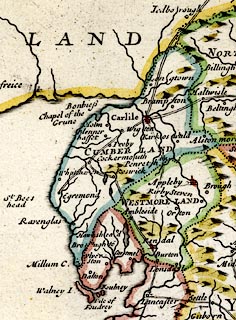 click to enlarge click to enlargeMRD3Cm.jpg "Egremond" circle; village or town item:- JandMN : 339 Image © see bottom of page |
|||
|
|
||||
| evidence:- | old map:- Morden 1695 (Cmd) placename:- Egremont |
|||
| source data:- | Map, uncoloured engraving, Cumberland, scale about 4 miles to 1
inch, by Robert Morden, 1695, published by Abel Swale, the
Unicorn, St Paul's Churchyard, Awnsham, and John Churchill, the
Black Swan, Paternoster Row, London, 1695-1715.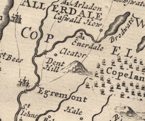 MD12NY01.jpg "Egremont" Circle, buildings, towers. item:- JandMN : 90 Image © see bottom of page |
|||
|
|
||||
| evidence:- | old text:- Ogilby 1699 (edn 1712) placename:- Egrimond |
|||
| source data:- | Road book, itineraries and map, The Traveller's Guide, by John
Ogilby, published by Abel Swall, Tim Child, White Hart, and R
Knaplock, the Angel and Crown, St Paul's Churchyard, London,
1699. OGY7p179.txt page 179 "In the Road to Carlisle." "FROM Egrimond, the initial Borough-Town near the Sea, having the advantage of a strong Castle, and of a good Market on Saturd. ..." |
|||
|
|
||||
| evidence:- | old map, descriptive text:- Bowen 1720 (plate 261) placename:- Egremond |
|||
| source data:- | Road strip map, uncoloured engraving, pl.261, the end of the
road from Kendal to Cockermouth and the road from Egremont to
Carlisle, scale about 2 miles to 1 inch, published by Emanuel
Bowen, St Katherines, London, 1720.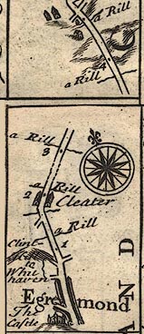 B261m00.jpg "Egremond Is noted for its stately Castle, ye Ancient Seat of ye Ld. Copeland. This Borough as well as Cockermouth was represented in Par. 23d. Ed. 1st. but never since as we can find. Mt. on Sat." item:- Dove Cottage : Lowther.36 Image © see bottom of page |
|||
|
|
||||
| evidence:- | old map:- Badeslade 1742 placename:- Egremont |
|||
| source data:- | Maps, Westmorland North from London, scale about 10 miles to 1
inch, and Cumberland North from London, scale about 11 miles to
1 inch, with descriptive text, by Thomas Badeslade, London,
engraved and published by William Henry Toms, Union Court,
Holborn, London, 1742; published 1742-49. "Egremont Market Saturday." |
|||
|
|
||||
| evidence:- | old map:- Badeslade 1742 placename:- Egermont |
|||
| source data:- | Map, uncoloured engraving, A Map of Cumberland North from
London, scale about 11 miles to 1 inch, with descriptive text,
by Thomas Badeslade, London, engraved and published by William
Henry Toms, Union Court, Holborn, London, 1742. click to enlarge click to enlargeBD10.jpg "Egermont" circle, tower/s, upright lowercase text; town item:- JandMN : 115 Image © see bottom of page |
|||
|
|
||||
| evidence:- | descriptive text:- Simpson 1746 placename:- Egremont |
|||
| source data:- | Atlas, three volumes of maps and descriptive text published as
'The Agreeable Historian, or the Compleat English Traveller
...', by Samuel Simpson, 1746. goto source "The principal Towns in Cumberland, are, ... Egremond, ..." goto source"..." "Egremont is a small Market Town, standing on the Banks of a little River, over which there are two Bridges near it; It is famous for its Castle, ... Sir Thomas Piercy was created Baron of Egremont, and tho' he left no Issue, the Barony remain'd in the Family of the Piercy's, Earls of Northumberland. It was a Borough Town, having formerly the Privilege of electing Members of Parliament, but hath now lost it, for what Reason doth not appear. Its Market is on Saturdays; and it is 222 Miles computed and 287 measured from London." |
|||
|
|
||||
| evidence:- | old map:- Bickham 1753-54 (Cmd) placename:- Egermont |
|||
| source data:- | Map, uncoloured engraving, perspective map, Map of Cumberland
North from London, by George Bickham, James Street, Bunhill
Fields, London, 1753, published by F Jollie and Sons, Carlisle,
Cumberland, 1811. click to enlarge click to enlargeJL05.jpg "Egermont" view (sort of) item:- Carlisle Library : 4.2 Image © Carlisle Library |
|||
|
|
||||
| evidence:- | old map:- Bowen and Kitchin 1760 placename:- Egremont |
|||
| source data:- | Map, hand coloured engraving, A New Map of the Counties of
Cumberland and Westmoreland Divided into their Respective Wards,
scale about 4 miles to 1 inch, by Emanuel Bowen and Thomas
Kitchin et al, published by T Bowles, Robert Sayer, and John
Bowles, London, 1760.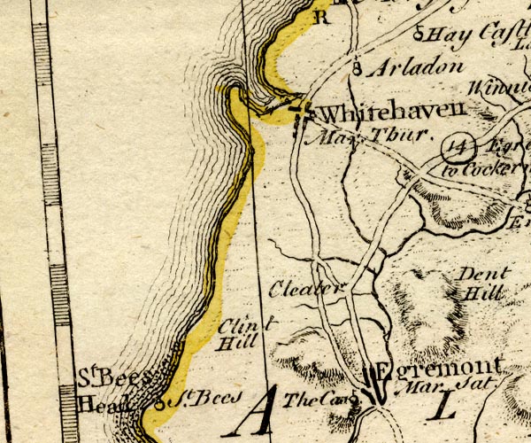 BO18NX91.jpg "Egremont Mar. Sat." blocks, street plan, town, market item:- Armitt Library : 2008.14.10 Image © see bottom of page |
|||
|
|
||||
| evidence:- | old map:- Donald 1774 (Cmd) placename:- Egremont |
|||
| source data:- | Map, hand coloured engraving, 3x2 sheets, The County of Cumberland, scale about 1
inch to 1 mile, by Thomas Donald, engraved and published by Joseph Hodskinson, 29
Arundel Street, Strand, London, 1774.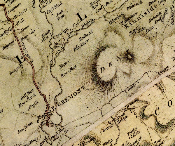 D4NY01SW.jpg "EGREMONT" blocks, perhaps a church, labelled in block caps; a town with a street plan item:- Carlisle Library : Map 2 Image © Carlisle Library |
|||
|
|
||||
| evidence:- | old map:- Donald 1774 (Cmd) placename:- Egremont |
|||
| source data:- | Map, hand coloured engraving, 3x2 sheets, The County of Cumberland, scale about 1
inch to 1 mile, by Thomas Donald, engraved and published by Joseph Hodskinson, 29
Arundel Street, Strand, London, 1774.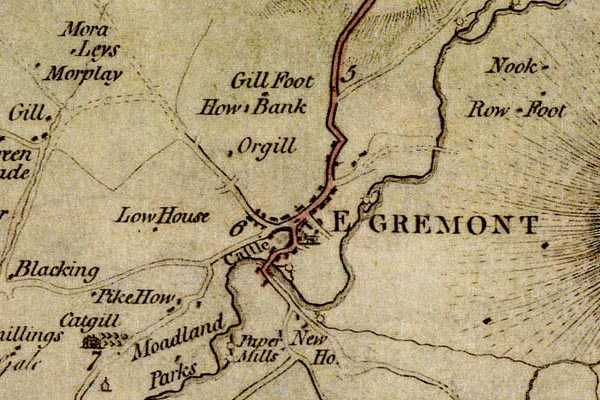 DN04Egrm.jpg "EGREMONT" Labelled in block caps for a market town; street map. item:- Carlisle Library : Map 2 Image © Carlisle Library |
|||
|
|
||||
| evidence:- | old map:- Donald 1774 (Cmd) placename:- Egremont |
|||
| source data:- | Map, hand coloured engraving, 3x2 sheets, The County of Cumberland, scale about 1
inch to 1 mile, by Thomas Donald, engraved and published by Joseph Hodskinson, 29
Arundel Street, Strand, London, 1774. D4NY01SW.jpg "EGREMONT" blocks, perhaps a church, labelled in block caps; a town with a street plan item:- Carlisle Library : Map 2 Image © Carlisle Library |
|||
|
|
||||
| evidence:- | old map:- Donald 1774 (Cmd) placename:- Egremont |
|||
| source data:- | Map, hand coloured engraving, 3x2 sheets, The County of Cumberland, scale about 1
inch to 1 mile, by Thomas Donald, engraved and published by Joseph Hodskinson, 29
Arundel Street, Strand, London, 1774. DN04Egrm.jpg "EGREMONT" Labelled in block caps for a market town; street map. item:- Carlisle Library : Map 2 Image © Carlisle Library |
|||
|
|
||||
| evidence:- | old map:- Pennant 1777 placename:- Egremont |
|||
| source data:- | Map, hand coloured engraving, A Map of Scotland, Hebrides and
Part of England, drawn for Thomas Pennant, engraved by J Bayly,
published by Benjamin White, London, 1777. click to enlarge click to enlargePEN1Cm.jpg "Egremont" circle; buildings, village, etc item:- private collection : 66 Image © see bottom of page |
|||
|
|
||||
| evidence:- | old text:- Camden 1789 (Gough Additions) placename:- Egremont item:- market |
|||
| source data:- | Book, Britannia, or A Chorographical Description of the Flourishing Kingdoms of England,
Scotland, and Ireland, by William Camden, 1586, translated from the 1607 Latin edition
by Richard Gough, published London, 1789. goto source Page 180:- "..." "... market town of Egremont." "... The town of Egremont once sent members to Parliament." |
|||
|
|
||||
| evidence:- | old map:- Aikin 1790 (Cmd) placename:- Egremont |
|||
| source data:- | Map, uncoloured engraving, Cumberland, by John Aikin, London,
1790. click to enlarge click to enlargeAIK3.jpg "Egremont" circle; town item:- JandMN : 145 Image © see bottom of page |
|||
|
|
||||
| evidence:- | old map:- Bailey 1797 placename:- Egremont |
|||
| source data:- | Map, soil etc, uncoloured engraving, Cumberland, scale about 21
miles to 1 inch, by J Bailey, engraved by Neele, Strand,
published by Messrs Robinson, Paternoster Row and G Nicol, Pall
Mall, London, 1797. click to enlarge click to enlargeBY04.jpg "Egremont" group of blocks; town item:- Armitt Library : A680.2 Image © see bottom of page |
|||
|
|
||||
| evidence:- | road book:- Cary 1798 (2nd edn 1802) placename:- Egremont |
|||
| source data:- | Road book, itineraries, Cary's New Itinerary, by John Cary, 181
Strand, London, 2nd edn 1802. goto source click to enlarge click to enlargeC38319.jpg page 319-320 "Egremont" market town, post office item:- JandMN : 228.1 Image © see bottom of page |
|||
|
|
||||
| evidence:- | old map:- Cooke 1802 placename:- Egremont |
|||
| source data:- | Map, Cumberland, scale about 15.5 miles to 1 inch, by George
Cooke, 1802, bound in Gray's New Book of Roads, 1824, published
by Sherwood, Jones and Co, Paternoster Road, London, 1824. click to enlarge click to enlargeGRA1Cd.jpg "Egremont / 299" blocks, upright lowercase text; town, distance from London item:- Hampshire Museums : FA2000.62.2 Image © see bottom of page |
|||
|
|
||||
| evidence:- | old map:- Cooke 1802 placename:- Egremont |
|||
| source data:- | Map, The Lakes, Westmorland and Cumberland, scale about 8.5
miles to 1 inch, engravedby Neele and Son, published by
Sherwood, Jones and Co, Paternoster Road, London, 1824. click to enlarge click to enlargeGRA1Lk.jpg "Egremont" blocks, italic lowercase text, village, hamlet, locality item:- Hampshire Museums : FA2000.62.5 Image © see bottom of page |
|||
|
|
||||
| evidence:- | old map:- Laurie and Whittle 1806 placename:- Egremont |
|||
| source data:- | Road map, Completion of the Roads to the Lakes, scale about 10
miles to 1 inch, by Nathaniel Coltman? 1806, published by Robert
H Laurie, 53 Fleet Street, London, 1834. click to enlarge click to enlargeLw18.jpg "Egremont 292¾" market town; distance from London item:- private collection : 18.18 Image © see bottom of page |
|||
|
|
||||
| evidence:- | old text:- Capper 1808 placename:- Egremont item:- population; market; fair; piazza |
|||
| source data:- | Gazetteer, A Topographical Dictionary of the United Kingdom,
compiled by Benjamin Pitts Capper, published by Richard
Phillips, Bridge Street, Blackfriars, London, 1808; published
1808-29. goto source "..." "EGREMONT, a market-town, and formerly a borough in the ward of Allerdale above Derwent, Cumberland, on a small river which falls into the Irish Sea near the promontory of St. Bees, 5 miles from Whitehaven, and 289½ from London; containing 319 houses and 1515 inhabitants, of whom 523 were returned as being employed in various trades, &c. The buildings in general are ancient, and many of the houses have piazzas in front. On a remarkable eminence are the ruins of a castle, ... The market, on Saturdays, is well supplied with barley and oats. The fair is on the 19th September. Horseman's Tour." "..." |
|||
|
|
||||
| evidence:- | old map:- Cooper 1808 placename:- Egremont |
|||
| source data:- | Map, uncoloured engraving, Cumberland, scale about 10.5 miles to
1 inch, drawn and engraved by Cooper, published by R Phillips,
Bridge Street, Blackfriars, London, 1808. click to enlarge click to enlargeCOP3.jpg "Egremont" circle with two side bars; town item:- JandMN : 86 Image © see bottom of page |
|||
|
|
||||
| evidence:- | old map:- Wallis 1810 (Cmd) placename:- Egremont |
|||
| source data:- | Road map, hand coloured engraving, Cumberland, scale about 16
miles to 1 inch, by James Wallis, 77 Berwick Stree, Soho,
London, 1810. click to enlarge click to enlargeWL13.jpg "Egremont / 299" town; distance from London item:- Dove Cottage : 2009.81.10 Image © see bottom of page |
|||
|
|
||||
| evidence:- | old text:- Green 1814 placename:- Egermont |
|||
| source data:- | Set of prints, soft ground etchings, Sixty Small Prints, with
text, A Description of a Series of Sixty Small Prints, by
William Green, Ambleside, Westmorland, 1814. goto source page 24:- "..." "From Nether Wastdale pass through Gosforth to Calder Bridge, Egermont, Lampleugh, and by Scale Hill to Keswick ..." |
|||
|
|
||||
| evidence:- | old map:- Otley 1818 placename:- Egremont |
|||
| source data:- | Map, uncoloured engraving, The District of the Lakes,
Cumberland, Westmorland, and Lancashire, scale about 4 miles to
1 inch, by Jonathan Otley, 1818, engraved by J and G Menzies,
Edinburgh, Scotland, published by Jonathan Otley, Keswick,
Cumberland, et al, 1833. OT02NY01.jpg "EGREMONT" item:- JandMN : 48.1 Image © see bottom of page |
|||
|
|
||||
| evidence:- | old text:- Gents Mag placename:- Egremond |
|||
| source data:- | Magazine, The Gentleman's Magazine or Monthly Intelligencer or
Historical Chronicle, published by Edward Cave under the
pseudonym Sylvanus Urban, and by other publishers, London,
monthly from 1731 to 1922. goto source Gentleman's Magazine 1816 part 2 p.600 Biographical note from the Compendium of County History:- "Benn, William, nonconformist divine and author, Egremond, 1600." "..." "Egremont, William, schoolman, Egremont (flourished 1390)." |
|||
|
|
||||
| evidence:- | old map:- Hall 1820 (Cmd) placename:- Egremont |
|||
| source data:- | Map, hand coloured engraving, Cumberland, scale about 21 miles
to 1 inch, engraved by Sidney Hall, published by S Leigh, 18
Strand, London, 1820-31. click to enlarge click to enlargeHA14.jpg "Egremont / 293" circle, upright lowercase text; town; distance from London item:- JandMN : 91 Image © see bottom of page |
|||
|
|
||||
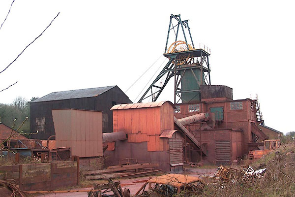
| evidence:- | descriptive text:- Otley 1823 (5th edn 1834) item:- geology; iron ore |
|||
| source data:- | Guide book, A Concise Description of the English Lakes, the
mountains in their vicinity, and the roads by which they may be
visited, with remarks on the mineralogy and geology of the
district, by Jonathan Otley, published by the author, Keswick,
Cumberland now Cumbria, by J Richardson, London, and by Arthur
Foster, Kirkby Lonsdale, Cumbria, 1823; published 1823-49,
latterly as the Descriptive Guide to the English Lakes. goto source Page 161:- "A superincumbent bed of limestone, by some called the mountain, by others the upper transition limestone, mantles round these mountains, in a position unconformable to the strata of the slaty and other rocks upon which it reposes. It bassets out near Egremont, Lamplugh, Pardshaw, ..." goto sourcePage 162:- "... The principal mineral production of this limestone, is iron ore, which is raised in great quantities near Dalton, and also near Egremont. ..." |
|||
|
|
||||
| evidence:- | old map:- Perrot 1823 placename:- Egremont |
|||
| source data:- | Map, hand coloured engraving, Cumberland and Westmoreland ie
Westmorland, scale about 38 miles to 1 inch, by Aristide Michel
Perrot, engraved by Migneret, 1823, published by Etienne Ledoux,
9 Rue Guenegaud, Paris, France, 1824-48. click to enlarge click to enlargePER2.jpg "Egremont" circle; town item:- Dove Cottage : 2007.38.45 Image © see bottom of page |
|||
|
|
||||
| evidence:- | old map:- Greenwood 1824 placename:- Egremont |
|||
| source data:- | Map, engraving, Map of the County of Cumberland, scale about 1
inch to 1 mile, etc, by Christopher and John Greenwood,
published by George Pringle jnr, 70 Queen Street, Cheapside,
London, 1823.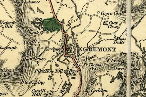 gw12egrm.jpg "EGREMONT" street map; labelled in block caps for a market town. item:- National Library of Scotland : EME.b.3.11 Image © National Library of Scotland |
|||
|
|
||||
| evidence:- | old map:- Cobbett 1832 placename:- Egremont |
|||
| source data:- | Map, uncoloured engraving, Cumberland, scale about 20 miles to 1
inch, by William Cobbett, 11 Bolt Court, Fleet Street, London,
1832. click to enlarge click to enlargeCOB5.jpg "Egremont" dot and circle; town item:- JandMN : 117 Image © see bottom of page |
|||
|
|
||||
| evidence:- | descriptive text:- Ford 1839 (3rd edn 1843) placename:- Egremont placename:- Mount of Sorrow |
|||
| source data:- | Guide book, A Description of Scenery in the Lake District, by
Rev William Ford, published by Charles Thurnam, Carlisle, by W
Edwards, 12 Ave Maria Lane, Charles Tilt, Fleet Street, William
Smith, 113 Fleet Street, London, by Currie and Bowman,
Newcastle, by Bancks and Co, Manchester, by Oliver and Boyd,
Edinburgh, and by Sinclair, Dumfries, 1839. goto source Page 75:- "..." "EGREMONT," "With its ruined castle crowning the northern banks. The heights above the town conceal beneath their surface a productive iron mine. The bridge over the river, and the castle above it, form a romantic scene; indeed, the town and castle, from many points on the Ehen, displays pleasing assemblages of the picturesque. ..." goto sourcePage 76:- "... There is nothing worth notice in the town; it is small, neat, and clean; the houses adjoining the market-place have many of them rude colonnades of wood in front, under which the corn is exposed for sale during rainy weather. ... The name of Egremont signifies the 'Mount of sorrow:' but it must not be confounded with Wotobank, which is two miles from the castle." |
|||
|
|
||||
| evidence:- | old map:- Ford 1839 map placename:- Egremont |
|||
| source data:- | Map, uncoloured engraving, Map of the Lake District of
Cumberland, Westmoreland and Lancashire, scale about 3.5 miles
to 1 inch, published by Charles Thurnam, Carlisle, and by R
Groombridge, 5 Paternoster Row, London, 3rd edn 1843. FD02NY01.jpg "EGREMONT" item:- JandMN : 100.1 Image © see bottom of page |
|||
|
|
||||
| evidence:- | old map:- Garnett 1850s-60s H placename:- Egremont |
|||
| source data:- | Map of the English Lakes, in Cumberland, Westmorland and
Lancashire, scale about 3.5 miles to 1 inch, published by John
Garnett, Windermere, Westmorland, 1850s-60s.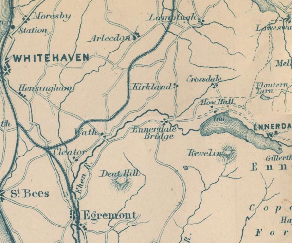 GAR2NY01.jpg "Egremont" blocks, settlement item:- JandMN : 82.1 Image © see bottom of page |
|||
|
|
||||
| evidence:- | old text:- Martineau 1855 placename:- Mount of Sorrow item:- population, Egremont |
|||
| source data:- | Guide book, A Complete Guide to the English Lakes, by Harriet
Martineau, published by John Garnett, Windermere, Westmorland,
and by Whittaker and Co, London, 1855; published 1855-76. goto source Page 124:- "... at the mouth of the vale, between it and the coast, stands Egremont, a little town of 1,500 inhabitants or so, and which certainly looks very pretty from the uplands;- and cheerful too, in spite of its Roman name,- (the Mount of Sorrow.) It is distinguished by Roman traditions. ..." |
|||
|
|
||||
| evidence:- | old print:- Bradley 1901 placename:- Egremont |
|||
| source data:- | Print, uncoloured lithograph, Egremont from a Distance, Cumberland, by Joseph Pennell,
published by Macmillan and Co, London, 1901.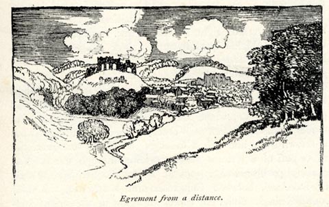 click to enlarge click to enlargeBRL137.jpg On page 171 of Highways and Byways in the Lake District, by A G Bradley. printed at bottom:- "Egremont from a Distance." item:- JandMN : 464.37 Image © see bottom of page |
|||
|
|
||||
| evidence:- | old map:- Postlethwaite 1877 (3rd edn 1913) placename:- Egremont |
|||
| source data:- | Map, uncoloured engraving, Map of the Lake District Mining Field, Westmorland, Cumberland,
Lancashire, scale about 5 miles to 1 inch, by John Postlethwaite, published by W H
Moss and Sons, 13 Lowther Street, Whitehaven, Cumberland, 1877 edn 1913. PST2Ny00.jpg "EGREMONT" dots, railway and station item:- JandMN : 162.2 Image © see bottom of page |
|||
|
|
||||
| evidence:- | market notes:- placename:- Egremunt item:- market |
|||
| source data:- | www.history.ac.uk/cmh/gaz/gazweb2.htmPalmer's Index No.93:: Public Record OfficeOwen: 1792: New Book of Fairs: 1889: Market Rights and Tolls: HM GovernmentBowen, Emanuel &Kitchin, Thomas: 1760: New Map of the Counties of Cumberland and Westmoreland | |||
|
|
||||
 Post Office maps Post Office maps |
||||
|
|
||||
| evidence:- | old print:- Rose 1832-35 (vol.3 no.52) placename:- Egremont |
|||
| source data:- | Print, uncoloured engraving, Egremont, from the Ravenglass Road, Cumberland, drawn
by G Pickering, engraved by W Taylor, published by Fisher, Son and Co, London, 1835.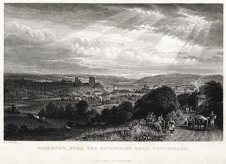 click to enlarge click to enlargePR0051.jpg vol.3 pl.51 in the set of prints, Westmorland, Cumberland, Durham and Northumberland Illustrated. printed at bottom left, right, centre:- "G. Pickering. / [W. Taylor.] / EGREMONT, FROM THE RAVENGLASS ROAD, CUMBERLAND. / FISHER, SON &CO. LONDON, 1835." item:- Dove Cottage : 2008.107.51 Image © see bottom of page |
|||
|
|
||||
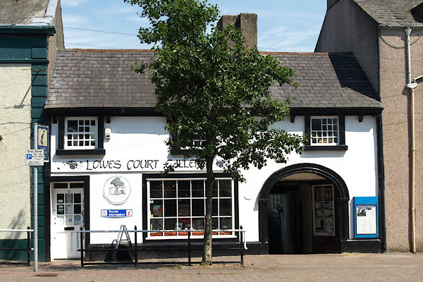
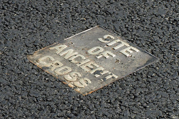
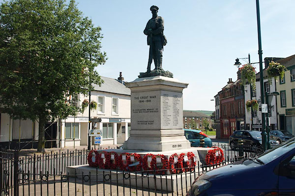
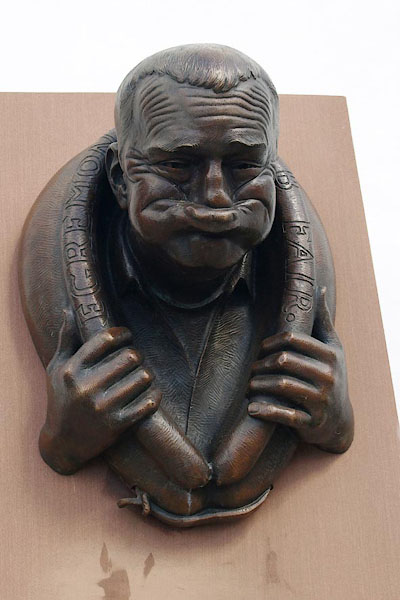 BQN72.jpg Sculpture, commemorating the world championships of 'gurning through a braffin' that takes place during "EGREMONT CRAB FAIR" (taken 11.5.2009) 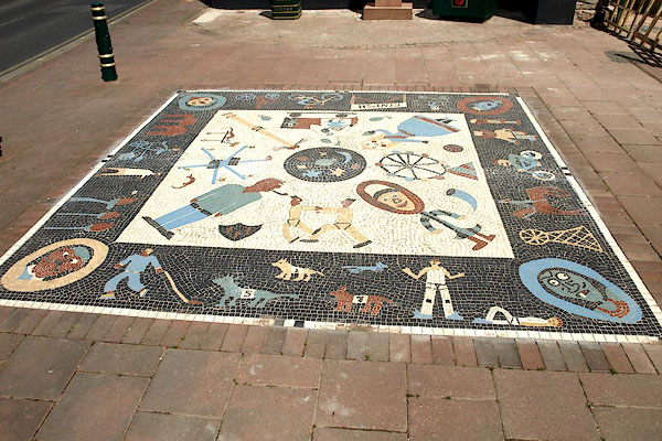 BQN73.jpg Tesselated pavement, (taken 11.5.2009) 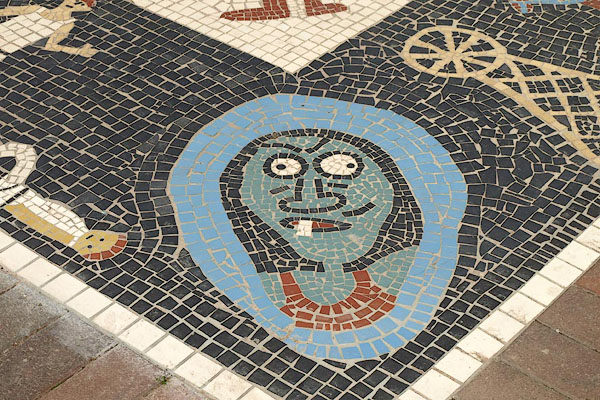 BQN74.jpg Tesselated pavement, detail 'gurning through a braffin'. (taken 11.5.2009) 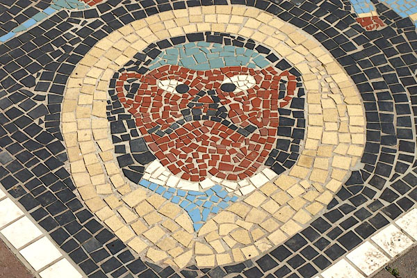 BQN75.jpg Tesselated pavement, detail 'gurning through a braffin'. (taken 11.5.2009) |
||||
|
|
||||
| personal | ||||
| person:- | politician : Davie, William Richardson |
|||
| place:- | birthplace | |||
| date:- | 22.6.1756 |
|||
| Emigrated to America when a child, with his parents. He became a lawyer, and was at
the meeting of Congress 1787 which drafted the American Consitution. |
||||
|
|
||||
| places:- |
|
|||
|
||||
|
||||
|
||||
|
||||
|
||||
|
||||
|
||||
|
||||
|
||||
|
||||
|
||||
|
||||
|
||||
|
||||
|
||||
|
||||
|
||||
|
||||
|
||||
|
||||
|
||||
|
||||
|
||||
|
||||
|
||||
|
||||
|
||||
|
||||
|
||||
|
||||
|
||||
|
||||
|
||||
|
||||
|
||||
|
||||
|
||||
|
||||
|
||||
|
||||
|
||||
|
||||
|
||||
|
||||
|
||||
|
||||
|
||||
|
||||
|
||||
|
||||
|
||||
|
||||
|
||||
|
||||
|
||||
|
||||
|
||||
|
||||
|
||||
Lakes Guides menu.